The 1913 State Highway Map of California
by Judy Aulik
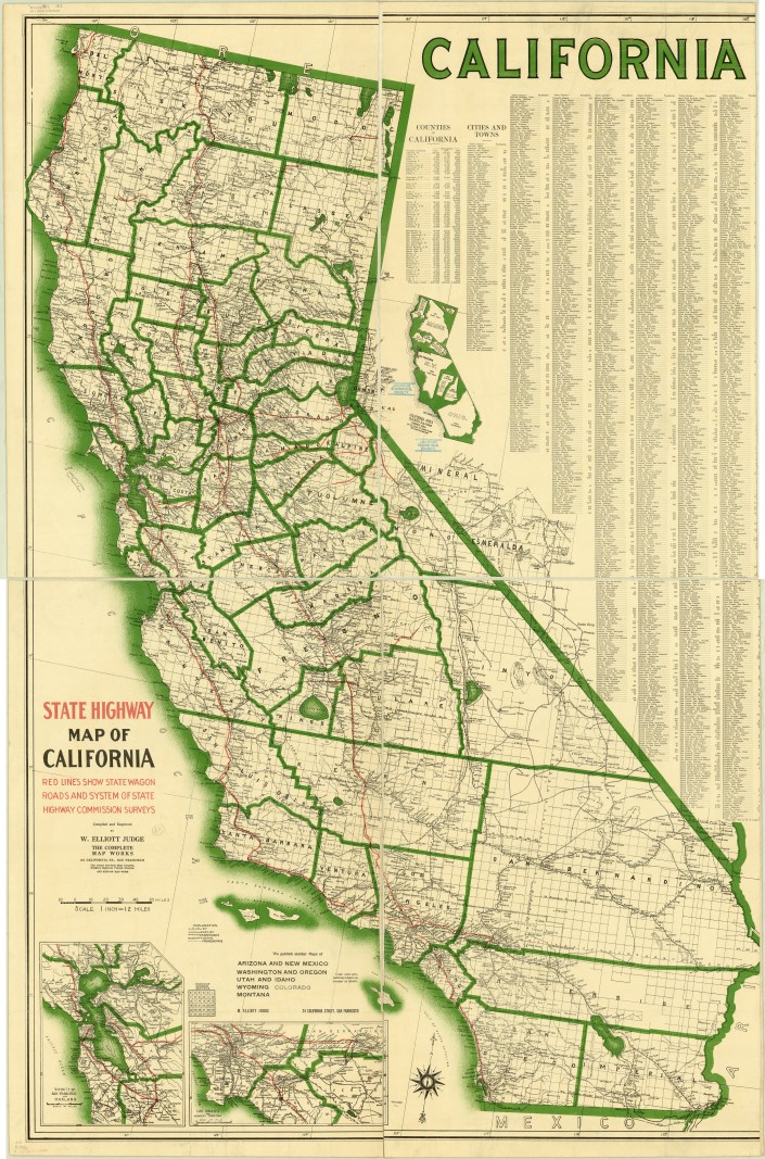
The moment I first saw this map, I knew it was something very special. California is a somewhat difficult state to map attractively because of its shape. There’s a lot of negative space to fill, and W. Elliott Judge used the expected list of cities and their population. But wait! There’s more! He added the graphic of an outline map with other states included to illustrate its size. Several eastern states’ outlines were twisted and turned to fill the space. It’s clever, and something I’ve never seen before on a road map.

At first glance, it appears to be bicolored, but then the red highways and wagon trails become evident. [1913ca-legend.jpg]  Highway scarcity is expected in a 1913 edition. Confusion, however, is generated by railroad lines not using the convention of crosshatches to represent ties (sleepers). The region around Fresno illustrates how early highways tended to parallel the major railroads of the day, which also were planned to avoid the worst of California’s mountainous terrain. The 1916 edition (not shown) is remarkably similar, except the vast amount of red ink used on highways and proposed highways is clearly identifiable.
The Complete Map Works of San Francisco, Judge’s employer, appears to have only produced California highway maps for a relatively brief period. The 1913 map appears to be one of the first. Maps drawn by Judge appear in WorldCat, with the last a 1949 Pacific North West edition co-authored with W. Campbell Judge, presumed to be his son. Another Complete Map Works’ map series is the Engineers Official Map of … , which also cover midwestern states into the 1930s.
Click here to view this map in the AGS Library Digital Map Collection: https://cdm17272.contentdm.oclc.org/digital/collection/agdm/id/14269/rec/1
