black history month
Re-discovering Seneca Village
By Brendan Dooley
It was almost two centuries ago when New York City’s first Black property owners began purchasing lots in what is now part of Central Park. Starting in 1825, Andrew Young and Epiphany Davis (both Black) and the African Methodist Episcopal Zion Church, bought the initial lots from John and Elizabeth Whitehead that would become Seneca Village (in what is now Central Park West).
The 5-acre area would become an integrated settlement of about 260 Black, Native American, Irish and German immigrant residents, with 2-3 churches, a school and more. Enter eminent domain and wealthier residents’ aspirations for a grand park to rival those of some European capitals. Central Park was an authorized entity by 1853 and land owners were starting to be meagerly compensated and evicted a few years later.
Cartographer Egbert Viele illustrated several maps of NYC, as well as Central Park in its planning stages. You can see where Seneca Village was, though it is not labeled as such. Newspapers of the time belittled residents there as “squatters” and worse in the apparent hopes of moving common will in favor of the “greater good” a park would serve. (The Seneca Village Irish in particular were said to be living in “shanties” with their “goats and hogs.”)
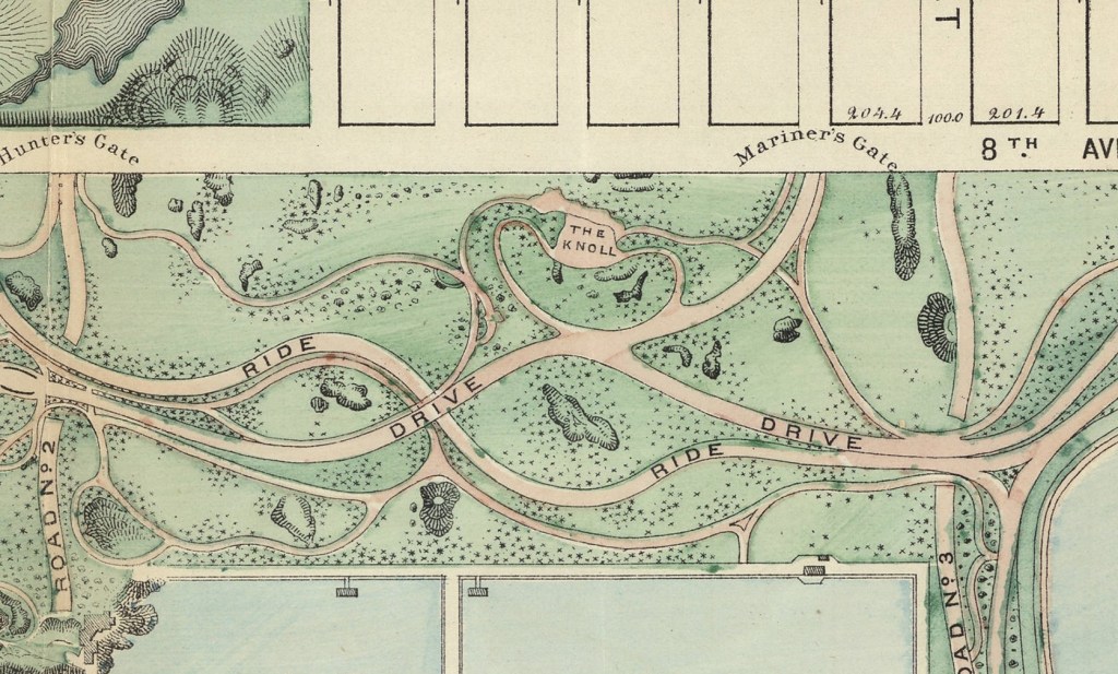
A renewed interest in the nearly lost history of Seneca Village has been ongoing since around the 1990s, including exhibits from the New York Historical Society. Some minor excavations of sites in the early 2000s located some small artifacts indicative of domestic living and foundational stonework of possibly one of the churches. You can check out some of these maps to look at more about Seneca Village, or learn more on the history and development of Central Park and NYC, in the AGSL Monday-Friday, 9 a.m. to 4:30 p.m. or anytime through our digital collections here.
Other links about Seneca Village:
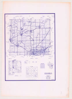
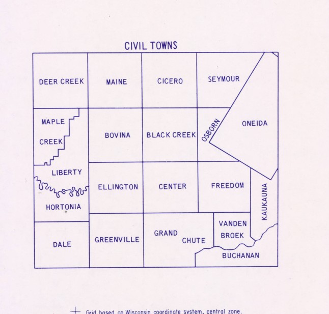
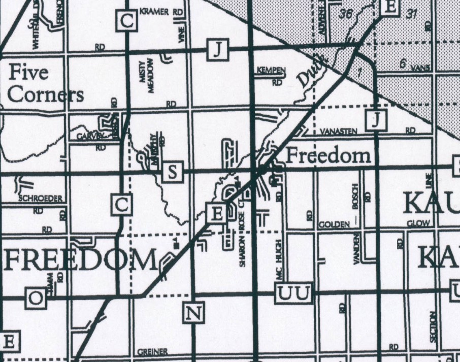
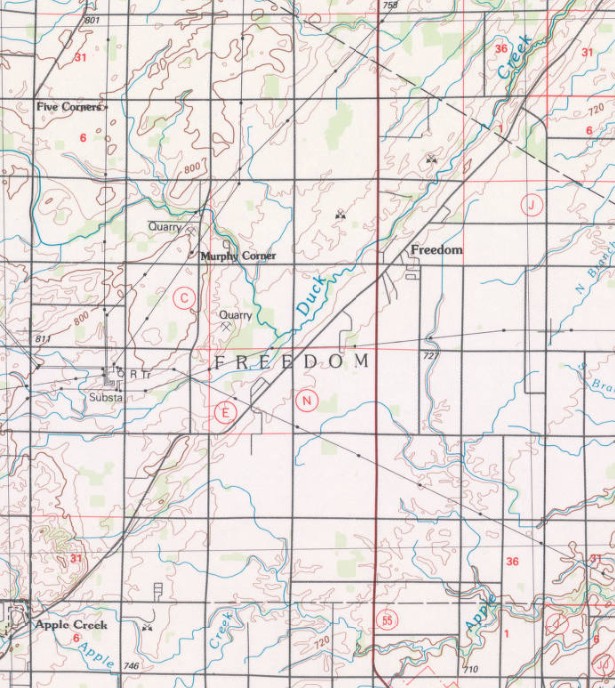
Town of Freedom, Wisconsin named in honor of Black Wisconsinite, James Andrew Jackson
by Angie Cope
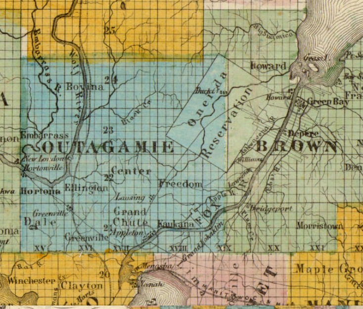
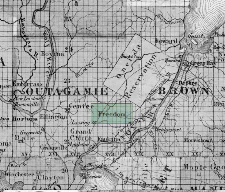
The first non-native settler in the Town of Freedom, Wisconsin was James Andrew Jackson, an Black man who escaped enslavement around the year 1850.
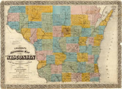
Chapman’s sectional map of Wisconsin : with the most recent surveys / published by Dyer & Pasmore ; A.S. Barnes & Co. ; L.B. Lippinccott & Co. ; sold by Matthew Wallace. 1857

Jackson was very well liked by the local people and they wanted to name the town “Jackson.” But Jackson asked that it be named Freedom instead because that’s where he found his freedom.
https://collections.lib.uwm.edu/digital/collection/agdm/id/13485/rec/15
https://collections.lib.uwm.edu/digital/collection/agdm/id/13032/rec/10
The town is small with a total area of 35.8 square miles (92.6 km2) and a population of 6,057. Freedom is at the crossroads of the Fox Valley, located halfway between Appleton and Green Bay on County E and halfway between Kaukauna and Seymour on State Highway 55 in Outagamie County.
Milwaukee Streets named after Black Wisconsinites Joshua Glover and Sherman Booth
by Angie Cope
Joshua Glover escaped enslavement from Benammi Stone Garland’s Missouri farm in 1852 and traveled by foot to Racine, Wisconsin. Because of The Fugitive Slave Act, Garland was legally able to hunt down Glover and recapture him in March 1854. Garland and his men took Glover to a jail in Milwaukee with the plan of returning Glover to Missouri.
However, the morning after Glover’s jailing, it is said that abolitionist Sherman Booth and a mob stormed the jail. Glover was freed but then spent 40 years on the run, finding safe spots along the Underground Railroad system. After decades of running, Glover found ultimate freedom in Canada, where he died.
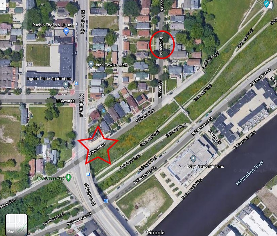
In 1857, Booth Street in Milwaukee’s Riverwest neighborhood was named after Sherman Booth.
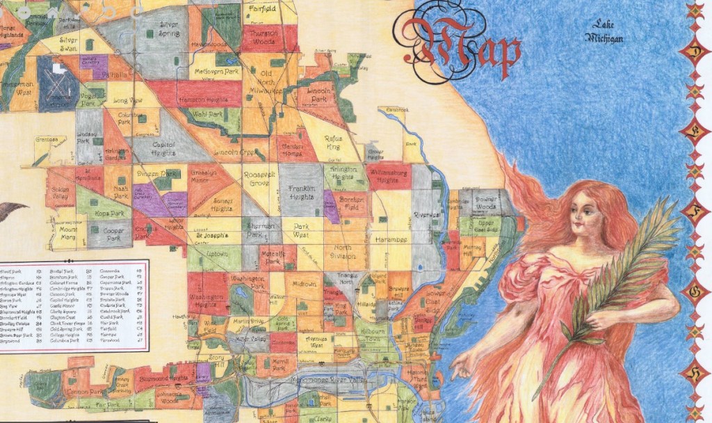
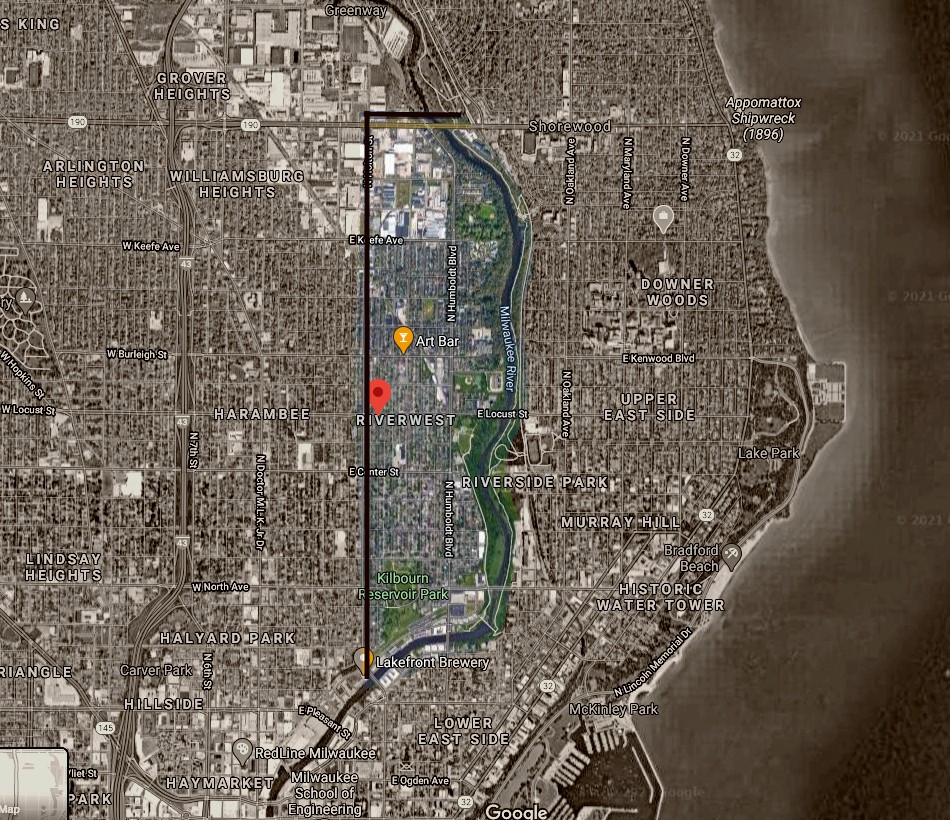
In 2016, some homeowners in the area signed a petition approving the renaming of part of Reservoir Avenue to Glover Avenue. Now there is a cross where Booth Street and Glover Avenue intersect.
View the maps in more detail
Milwaukee neighborhood map / V. Robie and Big Stick, Inc. 2002
https://collections.lib.uwm.edu/digital/collection/agdm/id/11909/rec/2
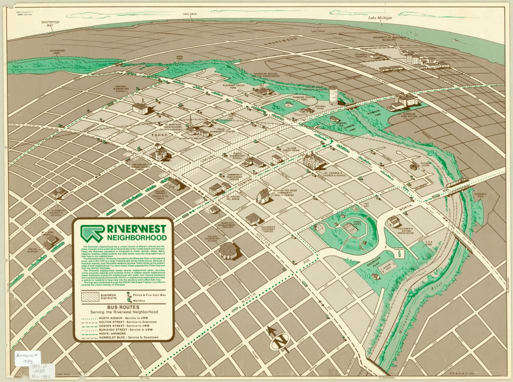
Riverwest neighborhood / Dru Maki, artist 1981
https://collections.lib.uwm.edu/digital/collection/agdm/id/5918/rec/6
