Angie’s Blog
Nixon’s Chicago Loop Parade 1972
Curtis Wright Maps recently gifted this broadside to the AGSL showing President Nixon’s re-election event scheduled for October 30, 1972.
Richard Nixon and his wife Pat planned a re-election visit to the windy city that included bands, entertainment and a parade. An inset map on this broadside shows the route for the motorcade on La Salle Street.

However, a day before the event was scheduled to take place, a morning rush hour commuter train crash killed 44 people and left 332 injured. Nixon cancelled the event and sent his Secretary of Transportation John A. Volpe to Chicago to guide relief efforts.
Survival, Storytelling, and the Reimagining of History : Marguerite de Roberval
by Angie Cope
Survival stories have long captured the human imagination, and for me, they hold a special appeal by helping me connect story telling with materials from the AGS Library. My interest in survival narratives began about fifteen years ago with Tony Horwitz’s Blue Latitudes, a modern retelling of Captain James Cook’s voyages. Horwitz sailed in a replica of Cook’s ship, the H.M. Endeavour, retracing the explorer’s journeys across the Pacific Ocean and to Australia. By pairing his contemporary experiences with Cook’s own hardships, Horwitz provided a helpful perspective on the AGSL’s holdings—most notably, Cook’s hand-drawn manuscript maps of the southeastern coast of Australia.
Recently, I have been drawn to another survival narrative, Allegra Goodman’s Isola, which is based on the astonishing true story of Marguerite de la Rocque, a French noblewoman marooned in the Gulf of Saint Lawrence in 1542. Marguerite, orphaned but heir to a fortune, was placed under the guardianship of her uncle, Jean-François de Roberval. He squandered Marguerite’s inheritance to such an extent that he could no longer maintain a home for himself and Marguerite in France. After securing funds from the king for an expedition to New France he compelled Marguerite to accompany him. During the voyage, she fell in love with his secretary. Roberval was enraged by the affair and exiled her, along with her lover and her nurse, Damienne, on a desolate island later referred to as the “Isle of Demons.” Marguerite endured more than two and a half years of isolation and privation before she was rescued and returned to France.

The trio was stranded with little more than their personal possession and they faced starvation and endured harsh winters. In less than a year Marguerite suffered the death of her lover, her nurse and a child she gave birth to on the island.
What makes Marguerite’s story particularly remarkable is the way it has been retold and reshaped across centuries. At least three versions circulated before 1600. Marguerite of Navarre, the French king’s sister, included an early version in her Heptameron, a collection of short tales modeled on Boccaccio’s Decameron. However, Marguerite de Navarre likely heard the story from the uncle’s point of view rather than that of Marguerite. Another version of the story was told by François de Belleforest. He was best known for his Histoires tragiques (1572), dramatizations of a tale’s moral and tragic dimensions, presenting Marguerite as an exiled “demoiselle” punished by fate. A later version was by André Thevet who was the cosmographer to the king and who recorded a lengthy essay in his Cosmographie universelle (1575) on Marguerite’s exile. Thevet included an illustration of the island showing Marguerite with a swaddled child resting in the shade of a palm tree. While Thevet’s account carried the authority of his office, it was riddled with inaccuracies. Each of these retellings reflected the concerns of its author—whether moral instruction, entertainment, or cosmographical authority—rather than the lived truth of Marguerite herself. The story later resurfaced in the nineteenth century, during a cultural revival of interest in exiles and castaways, further demonstrating its enduring resonance.


The book I read, Goodman’s Isola, is part of this long tradition of reinterpreting Marguerite de la Rocque’s ordeal. Goodman took what historical fragments are available and translated them into a compelling story. This retelling of a story through fiction serves as a bridge between past and present, breathing new life into obscure chronicles, restores marginalized voices, and reimagines historical experiences in ways that scholarship alone often cannot.
Just as Horwitz reframed Cook’s voyages through his modern writing, Goodman reinterprets Marguerite’s exile in a way that speaks to contemporary readers. In both cases, the past is not a fixed record but a living dialogue between archival evidence, scholarly interpretation, and narrative imagination.
Furhter readings
- Tony Horwitz, Blue Latitudes: Boldly Going Where Captain Cook Has Gone (New York: Henry Holt, 2002).
- Allegra Goodman, Isola (New York: Dial Press, 2025).
- The llegend of Marguerite de Roberval / Arthur P. Stabler (Pullman : Washington State University Pres, 1972).
- Marguerite of Navarre, The Heptameron, trans. P. A. Chilton (Harmondsworth: Penguin, 1984).
- François de Belleforest, Histoires tragiques (Paris: 1572).
- André Thevet, La cosmographie universelle de tout le monde (Paris: 1575).
This article was written with the assistance of ChatGPT
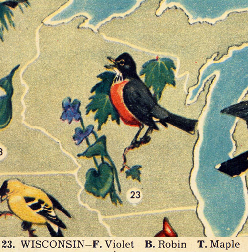
Flowers, birds and trees of the United States

This map, illustrated by Jacob Bates Abbott, is a charming map of the United States showing state birds, trees and flowers.
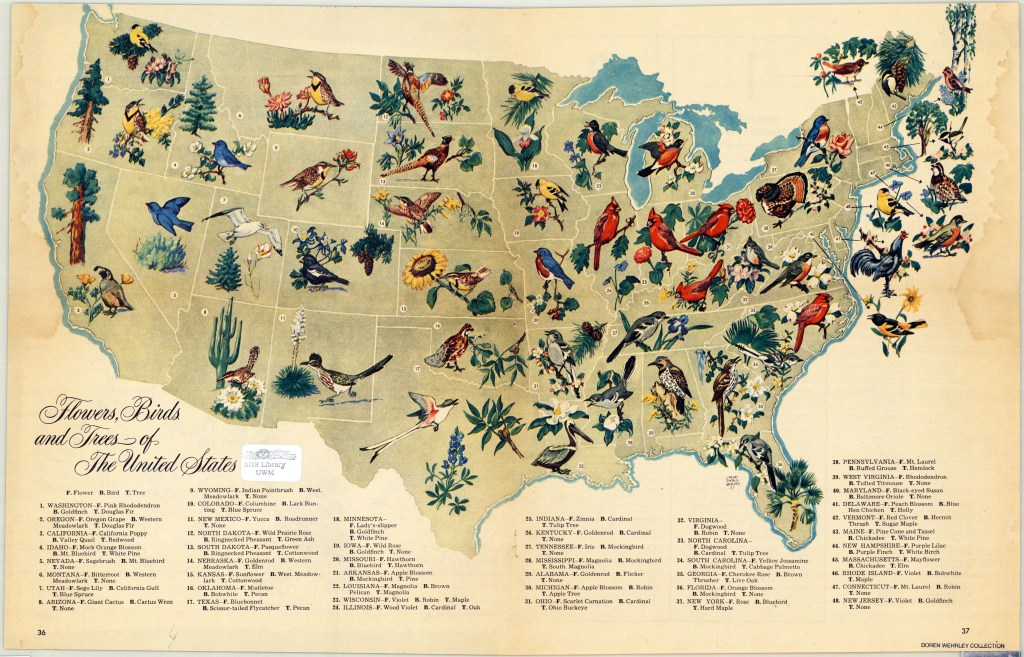
It appeared in a 1948 edition of the biweekly, general interest magazine named Look. Look magazine was published between 1937 and 1971 and was a direct competitor of Life magazine that ran from 1937 to 1972. Stanley Kubrick, Margaret Bourke-White and Normal Rockwell are among the illustrators and photographers that worked at Look magazine.
The map was presented to the AGSL as part of an extensive donation from Doren F. Wehrley, a military veteran and Milwaukee area dentist.
Click here to view this map in the AGSL Digital Map Collection.
Reading list for how to use maps in research
Recently, a faculty member in History at the University of California at Riverside asked for book recommendations that he could use for readings in an upcoming graduate seminar on “Nature, Space and Place in Historical Research.” Janet Reyes, Geospatial Information Librarian at UC Riverside, asked for suggestions via the Map Librarian discussion list, Maps-L. Here is a list of titles that were shared via that discussion that may be of interest to readers of the AGS Library Blog. These titles will teach and/or demonstrate how to focus on maps and cartography, helping students think about maps as sources, problems in their construction, how maps lie, etc., and how to bring historic maps into a GIS.
Books
Anthamatten, Peter. 2020. How to Make Maps: An Introduction to Theory and Practice of Cartography. ISBN-13: 978-1138067806, ISBN-10: 1138067806
Crampton, Jeremy. 2010. Mapping: A Critical Introduction to Cartography and GIS. ISBN-13: 978-1405121736, ISBN-10: 1405121734
Field, Kenneth. 2018. Cartography. ISBN-13: 978-1589484399, ISBN-10: 1589484398
Gurney, Alan. 2004. Compass: A Story of Exploration and Innovation. ISBN-10: 0393050734, ISBN-13: 978-0393050738
Krygier, J, and D Wood. 2016. Making Maps: A Visual Guide for Map Design for GIS. Third ed. ISBN-13: 978-1462509980, ISBN-10: 9781462509980
Monmonier, Mark. Several books to choose from. https://www.goodreads.com/author/list/6040304.Mark_Monmonier
Tyner, Judith. 2014. The World of Maps: Map Reading and Interpretation for the 21st Century. ISBN-13: 978-1462516483, ISBN-10: 1462516483
Winchester, Simon. 2021. Land: How the Hunger for Ownership Shaped the Modern World. ISBN-10: 0062938339, ISBN-13: 978-0062938336
Digital Materials
Open textbook – Mapping, Society, and Technology / Manson (2017)
World Historical Gazetteer: https://www.whgazetteer.org/teaching/
From Joseph Kerski, Esri Education Manager: Course in modern web GIS: https://community.esri.com/t5/education-blog/a-complete-first-course-in-modern-web-based-gis/ba-p/1020548
Spatial Reserves: https://spatialreserves.wordpress.com
MILWAUKEE MUNICIPAL RESEARCH CENTER MAP COLLECTION
Beginning in 2020, the American Geographical Society Library partnered with the Milwaukee Municipal Research Center (MRC) to provide online access to over 250 maps. This online map collection features maps created by city departments and includes subject areas of the city’s historic geographical boundaries and annexations, current and former aldermanic districts (known as wards prior to 1972), Census tracts, neighborhoods, land use, redevelopment planning, transportation and population. The collection has both historical maps dating back to early 1800s as well as more modern maps dating into the 2000s. The technical work was done by two UWM SOIS students, Samantha Dickson and Lillian Pachner, who uploaded the files and created ContentDM metadata.
In addition to finding these 250+ maps in the American Geographical Society Library Digital Map Collection online, all of them can be used on site at the Milwaukee Municipal Research Center (MRC), located in the basement level of the Zeidler Municipal Building, 841 N. Broadway. Their hours are 8:00 am – 4:45 pm, Monday-Friday.
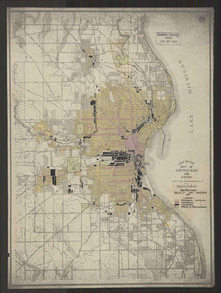
Milwaukee Wis. Annotated title: Showing Built Up Area 1919
https://collections.lib.uwm.edu/digital/collection/agdm/id/25616/rec/130
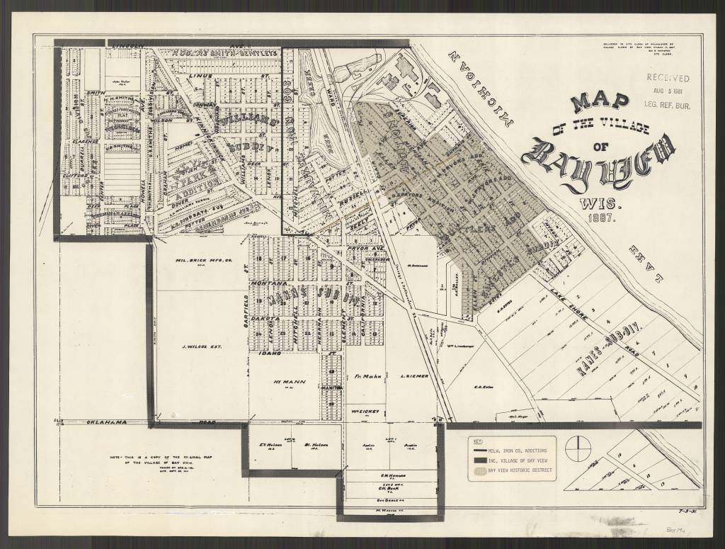
https://collections.lib.uwm.edu/digital/collection/agdm/id/25578/rec/150
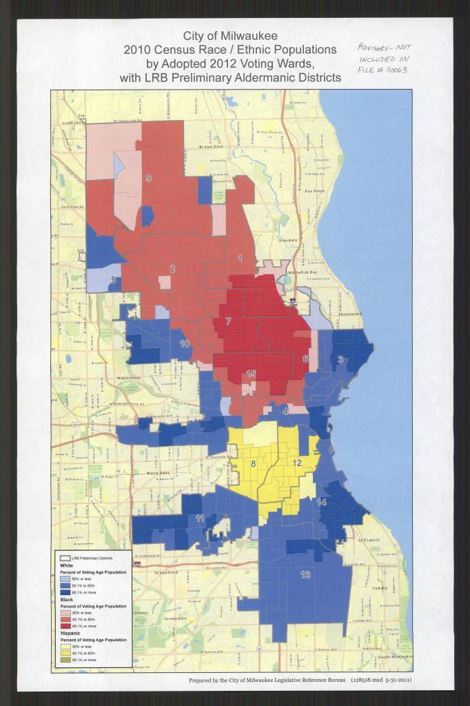
by Adopted 2012 Voting Wards, with LRB Preliminary Aldermanic Districts /
Prepared by the City of Milwaukee Legislative Reference Bureau
https://collections.lib.uwm.edu/digital/collection/agdm/id/25684/rec/135
May 30, Day of the Canary Islands
by Angie Cope
The Day of the Canary Islands (Spanish: Día de Canarias) is celebrated annually on 30 May. It is a public holiday in the Spanish autonomous community of the Canary Islands chosen as the anniversary of the first session of the Parliament of the Canary Islands, held on 30 May 1983.
At present, the Canary Islands is the only autonomous community in Spain that has two capitals: Santa Cruz de Tenerife and Las Palmas de Gran Canaria, since the Statute of Autonomy of the Canary Islands was created in 1983.
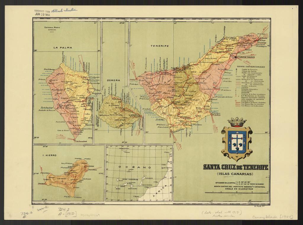
Santa Cruz de Tenerife (Islas Canarias) / by Alberto Martín, 1916
https://collections.lib.uwm.edu/digital/collection/agdm/id/15485/rec/10
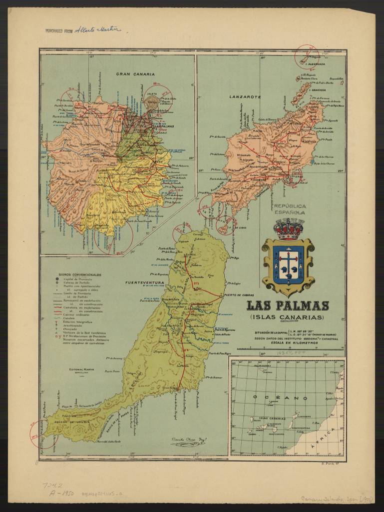
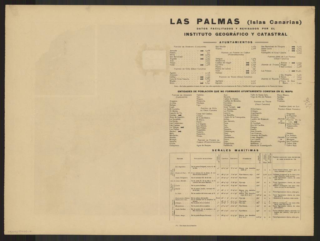
Las Palmas (Islas Canarias) / By Alberto Martin, 1922
https://collections.lib.uwm.edu/digital/collection/agdm/id/15570/rec/4
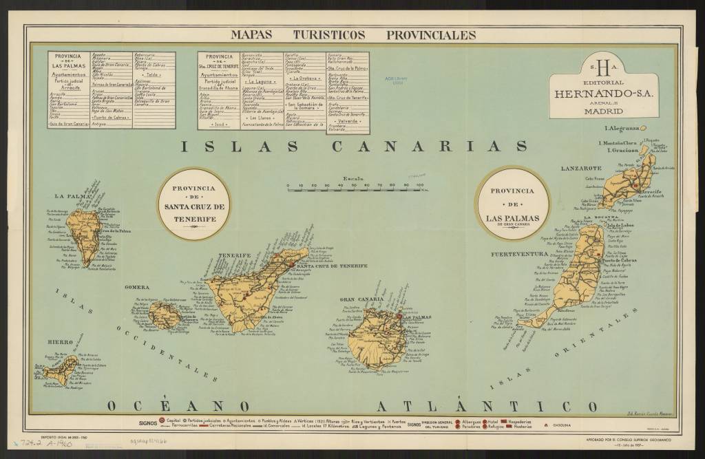
Mapas turisticos provinciales Canarias / aprobados por el Consejo Superior Geografico ; dib. Ramón Vicente Mesoner / Canarias (Islas) Mapas turísticos 1960
https://collections.lib.uwm.edu/digital/collection/agdm/id/15479/rec/5
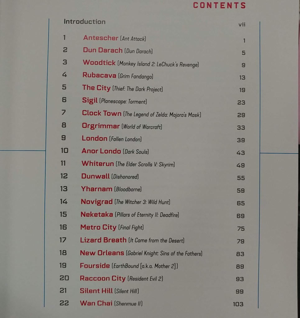
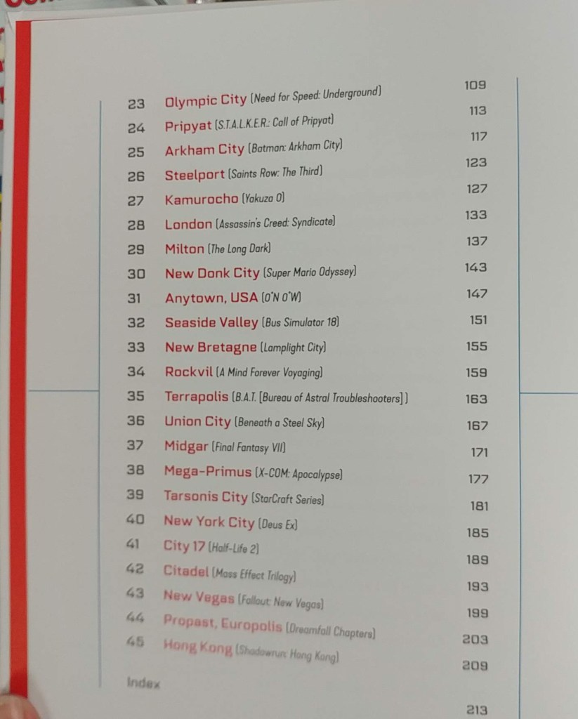
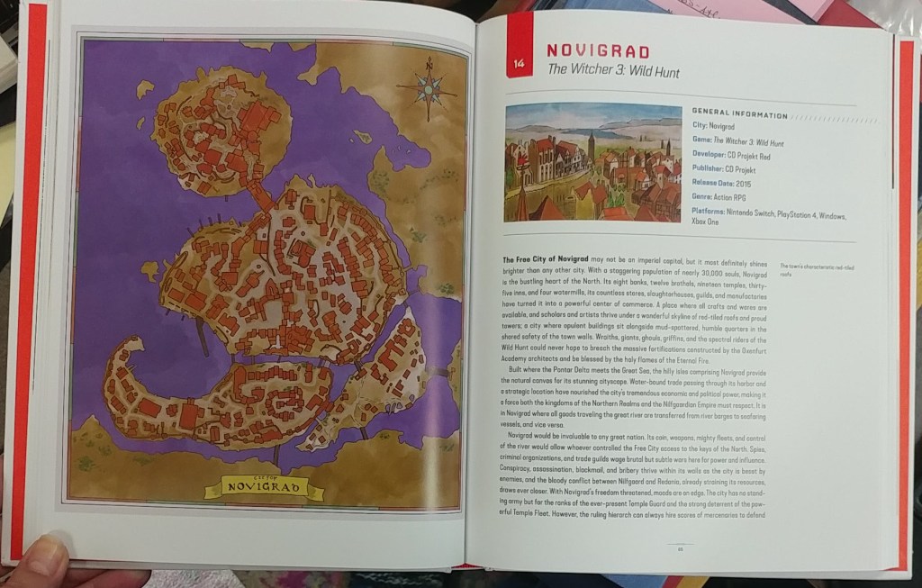
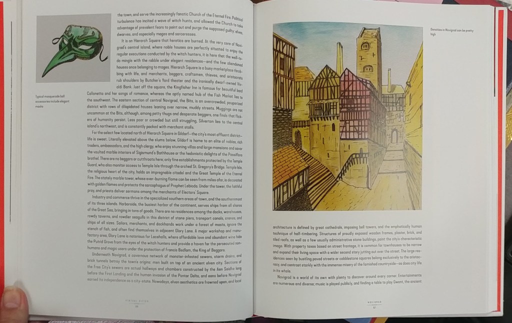
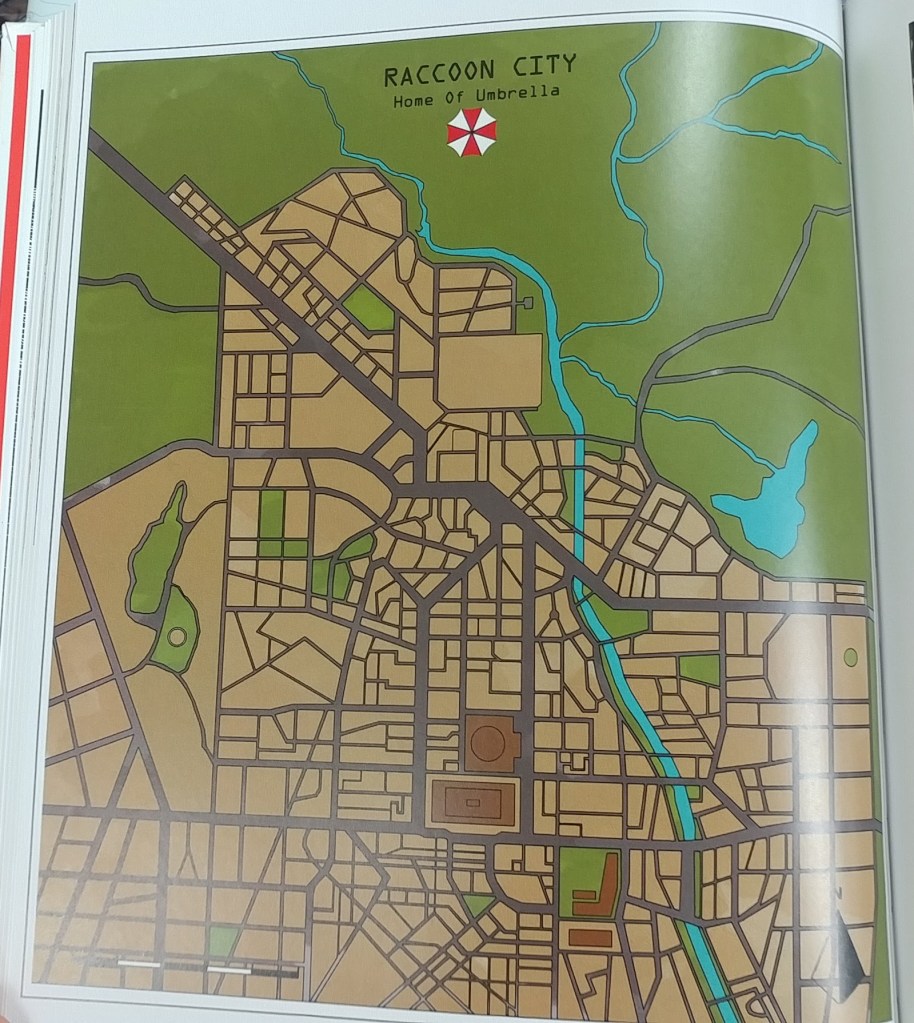
Virtual cities : an atlas of exploration of video game cities
The AGS Library added a new atlas to the collection. Virtual Cities: An Atlas & Exploration of Video Game Cities by Konstantinos Dimopoulos. 224 pages, ISBN 1682686094 by Countryman Press, 2020.
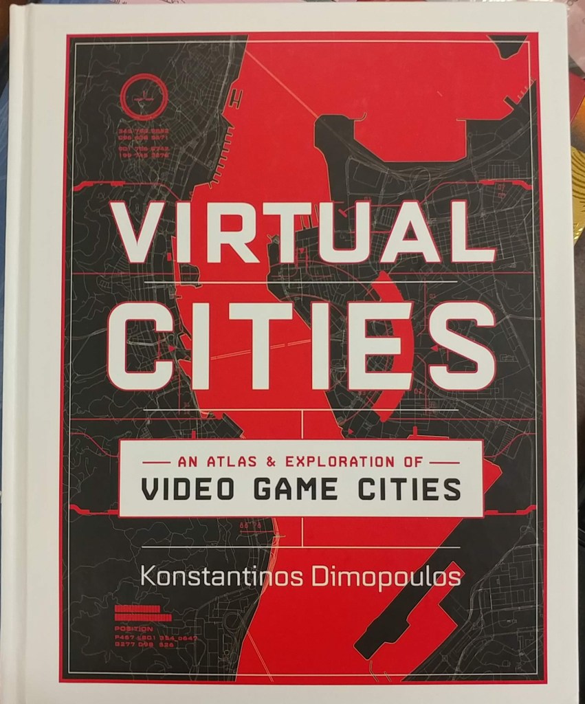
“Spanning decades of digital history, this is the ultimate travel guide and atlas of the gamer imagination. Dimopoulos invites readers to share his vision of dozens of different gaming franchises like never before: discover Dimopoulos’s Half-Life 2’s City 17, Yakuza 0’s Kamurocho, Fallout’s New Vegas, Super Mario Odyssey’s New Donk City, and many more. Each chapter of this virtual travel guide consists of deep dives into the history and lore of these cities from an in-universe perspective. Illustrated with original color ink drawings and―of course―gorgeous and detailed maps, readers can explore the nostalgic games of their youth as well as modern hits. Sidebars based on the author’s research tell behind-the-scenes anecdotes and reveal the real-world stories that inspired these iconic virtual settings. With a combination of stylish original maps, illustrations, and insightful commentary and analysis, this is a must-have for video game devotees, world-building fans, and game design experts. 100 color illustrations.” — amazon.com

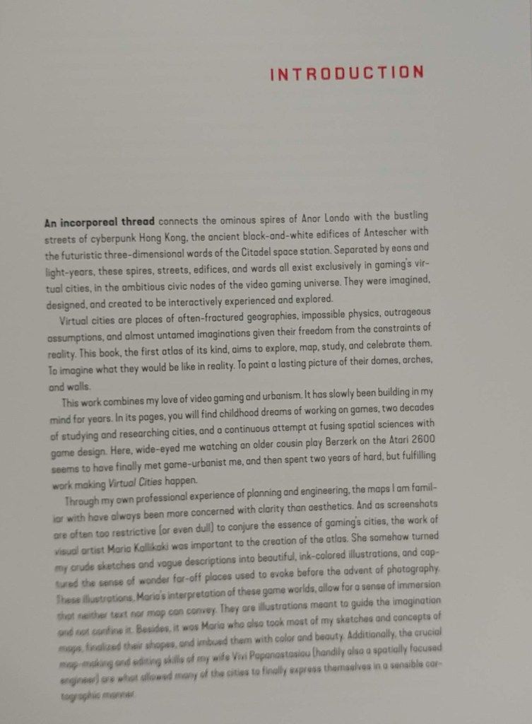

Konstantinos Dimopoulos studied urban planning and city geography for 10 years and holds a PhD. He has worked on the cities, settlements, and maps of several games including MMO Seed, The Sinking City, and more. He lives in Athens, Greece.
Wisconsin’s Tornado and Severe Weather Awareness Week is April 12-16
by Angie Cope
Modern day storm tracking relies on Doppler radar data and computer algorithms to forecast and identify dangerous weather.
In the past, The Department of Commerce produced daily weather maps … in print. Many libraries across the country have stacks of these maps.
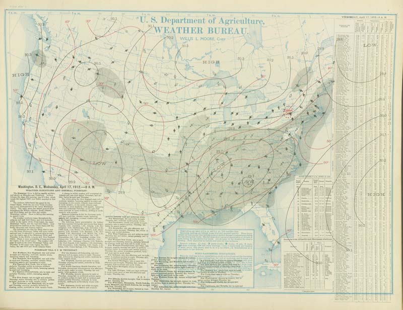
Daily weather maps continue to aid researchers but are prepared in digital format by the National Centers for Environmental Prediction, Weather Prediction Center.

The AGS Library has many weather maps, photographs and data sets. Here are a few maps from the American Geographical Society Library Digital Map Collection.
Call number: 800-c .E2C4 I-1974 1975
https://collections.lib.uwm.edu/digital/collection/agdm/id/16471
Call number: 800 I-1976
https://collections.lib.uwm.edu/digital/collection/agdm/id/24523
For more information on data or maps from the AGS Library, contact us via email at: agsl@uwm.edu
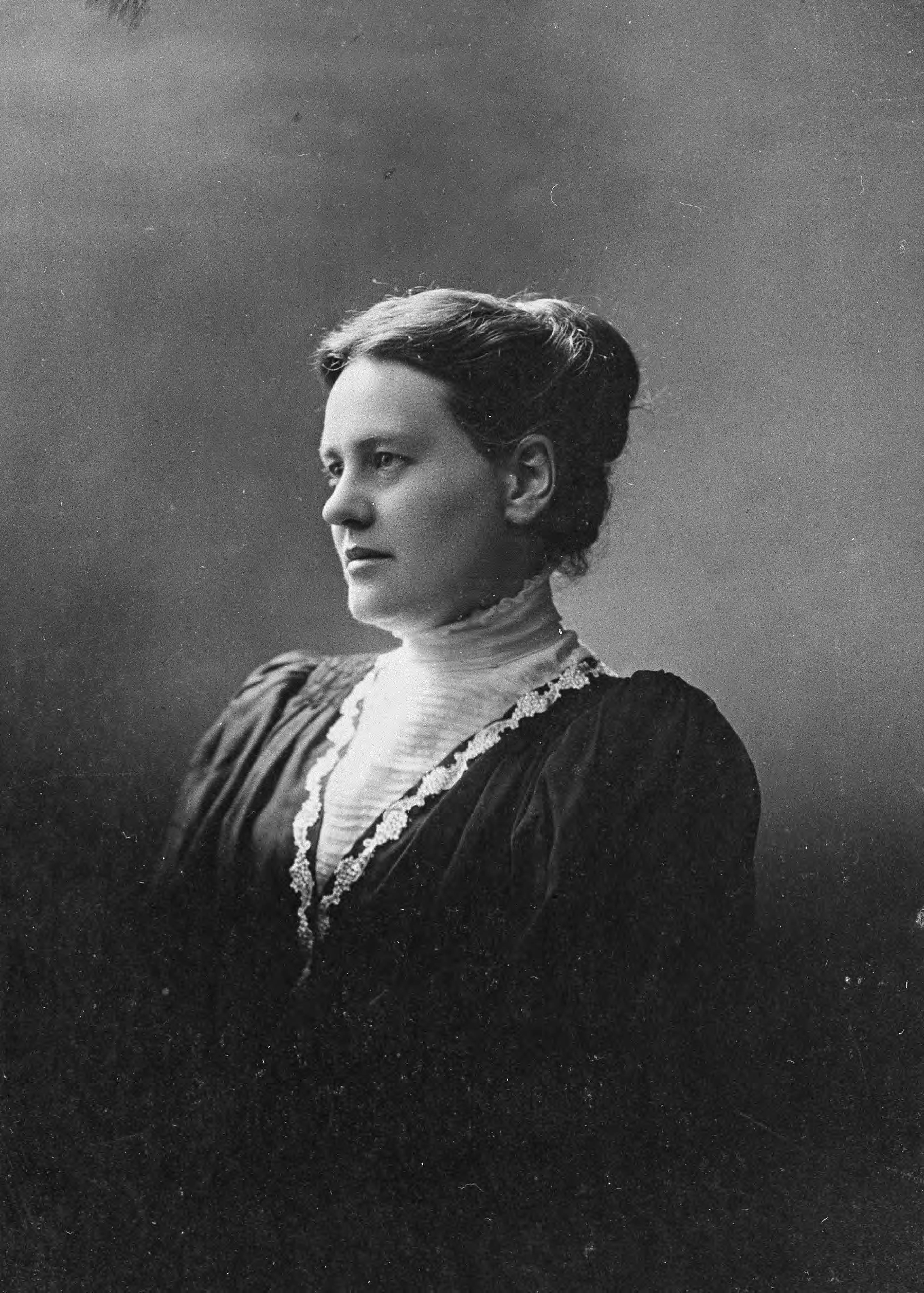
Anna Estelle Paddock 1874-1940
The AGS Library holds a small collection of documents and photos from Anna Estelle Paddock. She worked for the Young Women’s Christian Association in China. There is a collection of photographs and letters that were donated by Maurine Estelle Huang in 1981.
https://collections.lib.uwm.edu/digital/collection/agsnorth/id/2600/rec/6
https://collections.lib.uwm.edu/digital/collection/agsnorth/id/2599/rec/14
https://collections.lib.uwm.edu/digital/collection/agsnorth/id/2595/rec/2
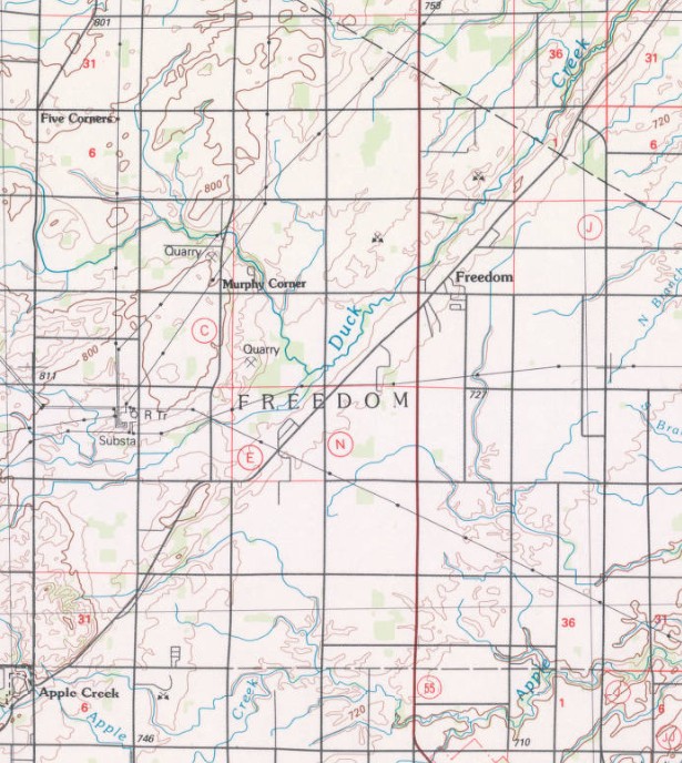
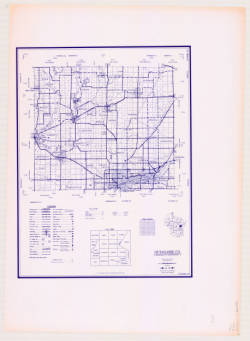
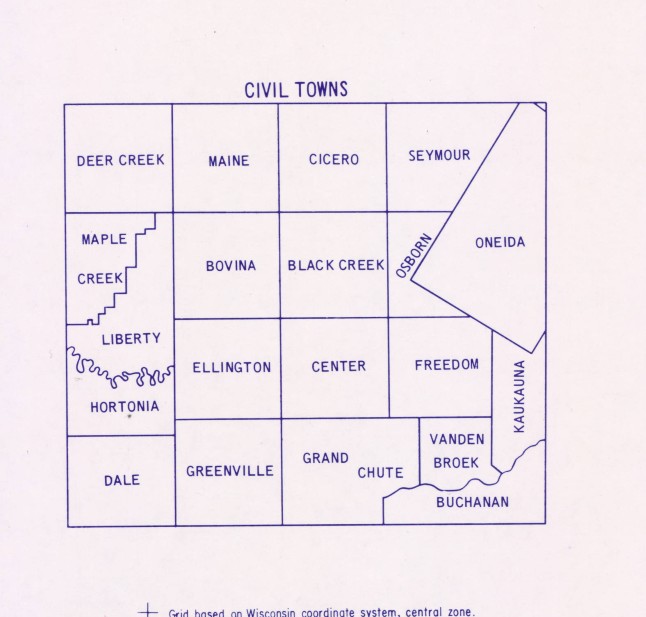
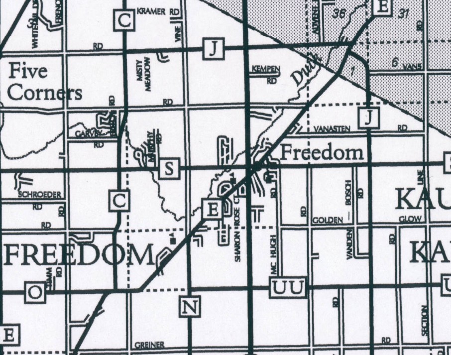
Town of Freedom, Wisconsin named in honor of Black Wisconsinite, James Andrew Jackson
by Angie Cope
The first non-native settler in the Town of Freedom, Wisconsin was James Andrew Jackson, an Black man who escaped enslavement around the year 1850.
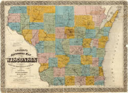
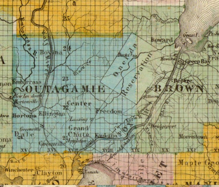
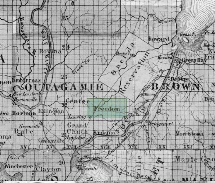
Chapman’s sectional map of Wisconsin : with the most recent surveys / published by Dyer & Pasmore ; A.S. Barnes & Co. ; L.B. Lippinccott & Co. ; sold by Matthew Wallace. 1857

Jackson was very well liked by the local people and they wanted to name the town “Jackson.” But Jackson asked that it be named Freedom instead because that’s where he found his freedom.
https://collections.lib.uwm.edu/digital/collection/agdm/id/13485/rec/15
https://collections.lib.uwm.edu/digital/collection/agdm/id/13032/rec/10
The town is small with a total area of 35.8 square miles (92.6 km2) and a population of 6,057. Freedom is at the crossroads of the Fox Valley, located halfway between Appleton and Green Bay on County E and halfway between Kaukauna and Seymour on State Highway 55 in Outagamie County.