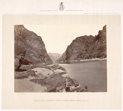
Photo Collection
Western Photograph Digital Collection featuring Timothy H. O’Sullivan
The American Geographical Society Library has an extensive collection of western photographs by the photographers of the four great western surveys: William Henry Jackson, John K. Hillers, William Bell, Timothy O’Sullivan, Eadweard J. Muybridge and Carleton E. Watkins.
The Western Photograph Digital Collection presents 250 images from the American Geographical Society Library. The images selected are those of Timothy H. O’Sullivan (1840-1882) and were taken during the Geological Exploration of the Fortieth Parallel, 1867 – 1872 and the Surveys West of the 100th Meridian Expedition, 1874 and other explorations of the early Western territories of the United States.
View the digital collection here: https://uwm.edu/lib-collections/western-photos/?fbclid=IwAR3_6YbX7Qrot_ljWp905P-mSlR7mkdrCKYI2LgoVFGNWDhWK07yq6IU9Dg
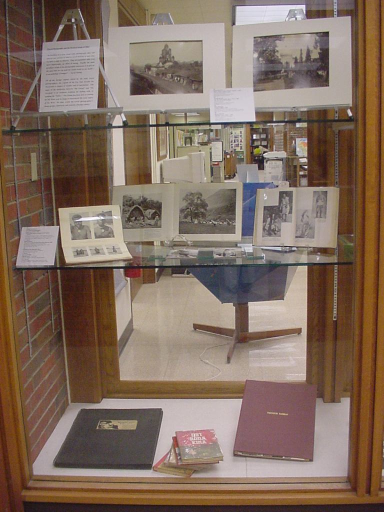
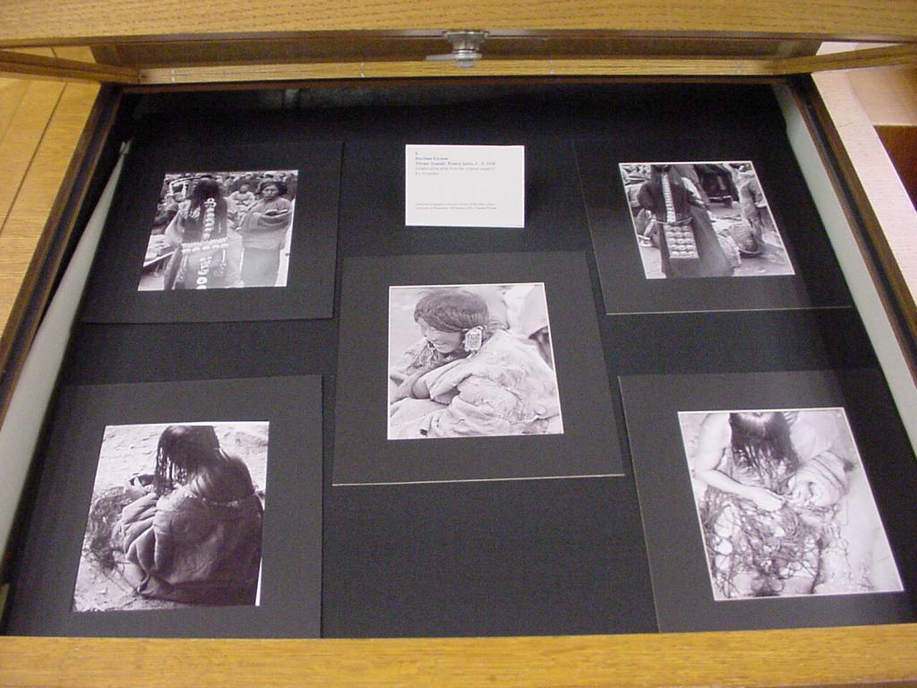
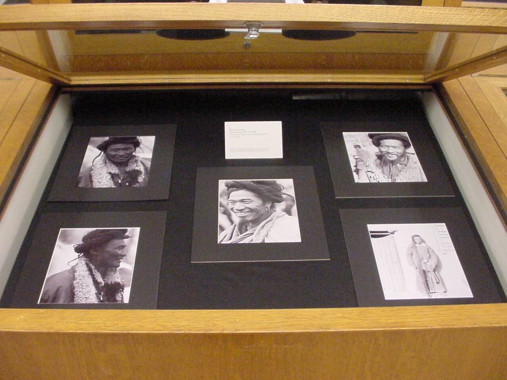
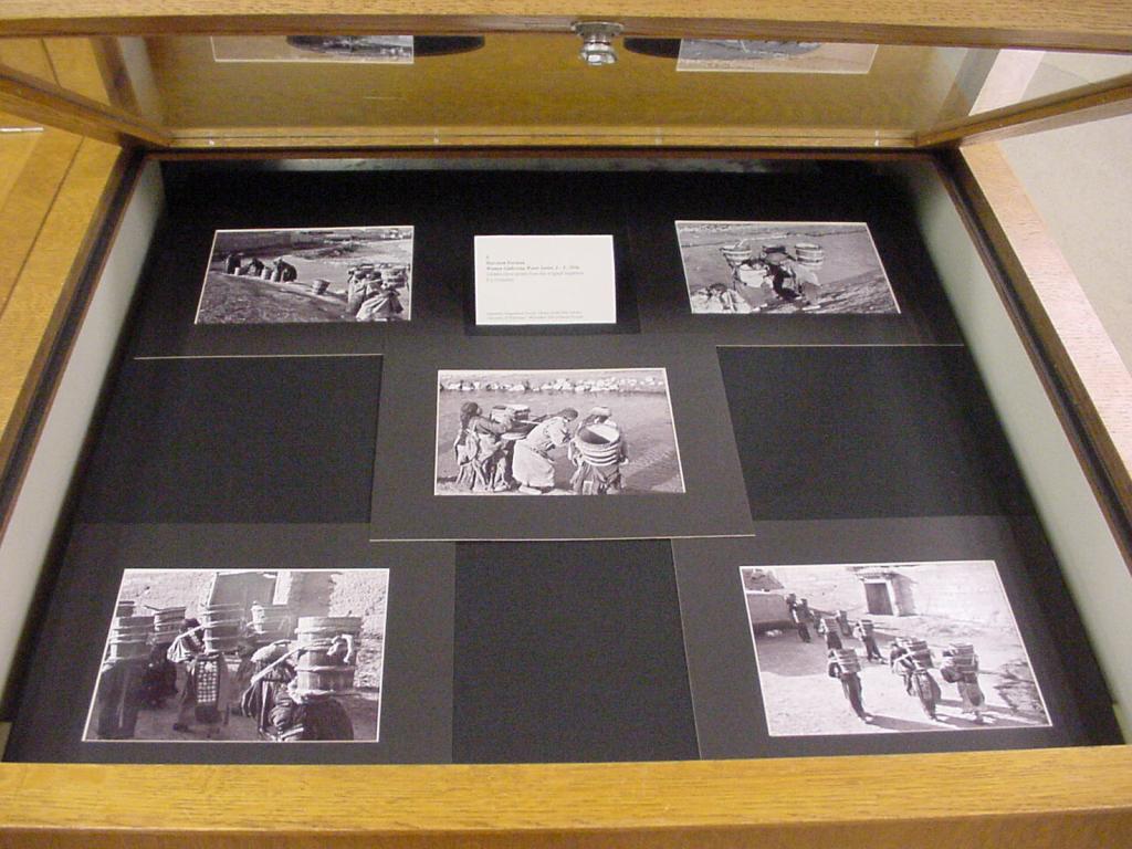
AROUND THE WORLD IN 34 YEARS – IMAGES FROM THE HARRISON FORMAN COLLECTION NOW ONLINE
Thirty-four years after the American Geographical Society Library received the Harrison Forman Collection, work to make the images in the collection accessible online was completed in May 2021. Donated by his wife Sandra Carlyle Forman in 1987, the photographic collection consists of print photographs, nitrate and safety negatives, 35 mm color slides, Ektachrome color slides, and motion picture films.
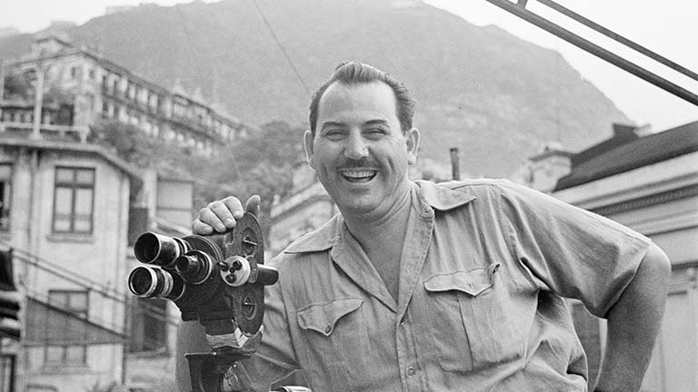
Harrison Forman (1904-1978) was a prominent photojournalist, explorer, author, and fellow of the American Geographical Society. As a foreign correspondent, Form n’s images and articles appeared in the New York Times, Times of London, Life, Look, Collier’s, Harpers, and Reader’s Digest. He was a native of Wisconsin and UW alumnus with a degree in Oriental Philosophy. Forman’s collection was a tremendous gift to the AGSL and subsequently became one of the most popular and most utilized of AGSL’s photography collections among researchers around the world.
This historically and geographically significant collection covers Forman’s travels from the late 1920s to the mid-1970s. Forman travelled the world with the eye of an anthropologist. He was fascinated by the lives, culture, economies, governments and infrastructure of each place he visited. Known in his heyday as the “Modern Day Marco Polo,” Forman was often the first Westerner to have access to the people and places he visited and seemed to always be in the right place at the right time, witnessing significant moments in history and documenting them with his photography. The content of the Forman Collection is a gold mine of historical information and beautiful photography. Forman’s images can be accessed online in the following collections on the UWM Digital Collections website:
Afghanistan: Images from the Harrison Forman Collection documents the life and culture of Afghanistan in the 1950s and 1960s.
Transportation Around the World focuses on the ways people all over the world get from point A to point B.
Cities Around the World highlights the architecture, city life, people, transportation, neighborhoods, commercial streets, and business districts of metropolitan areas.
Tibet from the AGSL Collection includes Forman’s images he took while visiting Tibet in the 1930s – one of the few Westerners to visit the region at the time.
Nazi Invasion of Poland documents the beginning of WWII through images Forman took during the Blitzkrieg in Poland.
Travel Diaries and Scrapbooks of Harrison Forman 1932 – 1973 presents 62 of Forman’s diaries he kept while in the field, spanning his professional career.
Forman’s images can also be found in the UWM Digital Collections geographically organized collections: Asia and Middle East, Africa, Europe, North and Central America, South America and Oceania.
For further information about the collection, please contact Susan Peschel, Visual Resources Librarian, American Geographical Society Library.
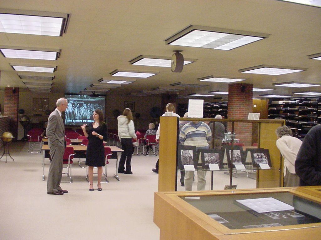
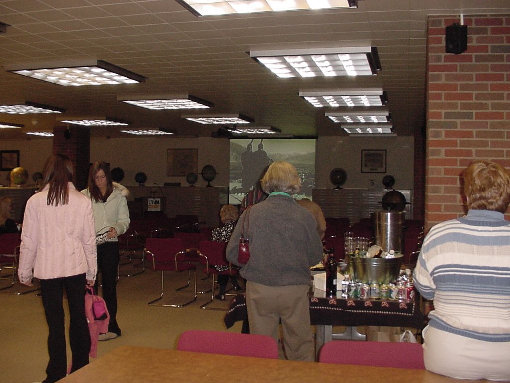
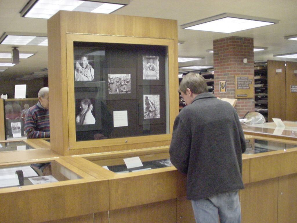
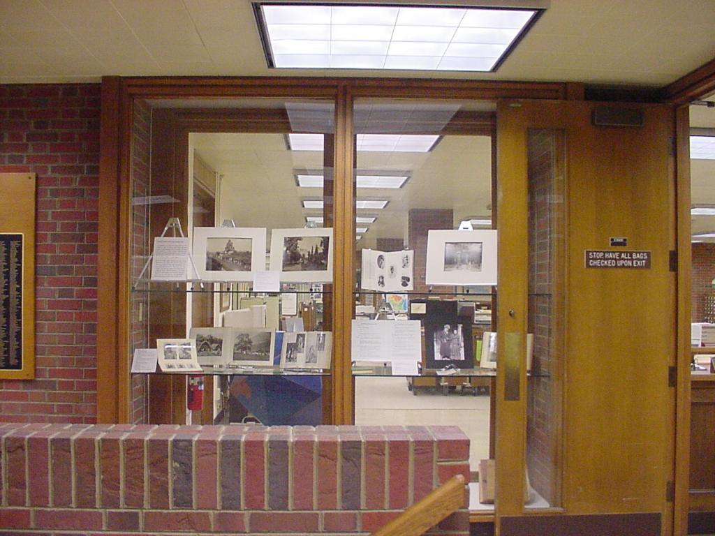
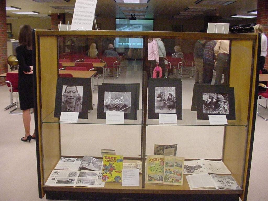
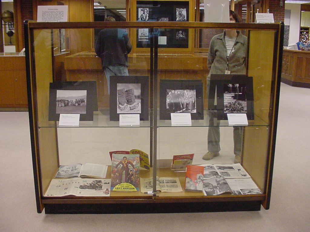
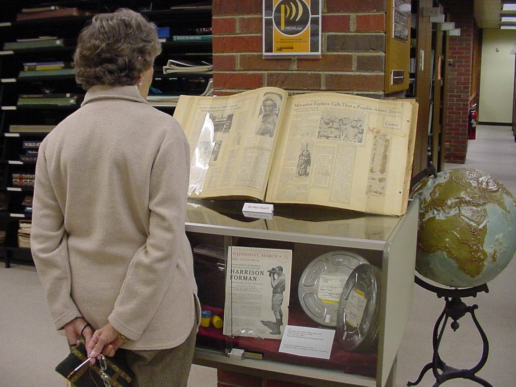
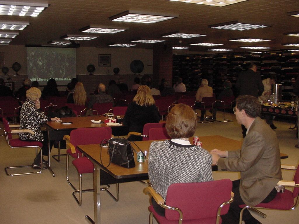
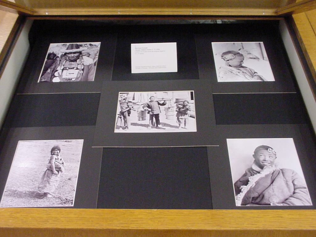
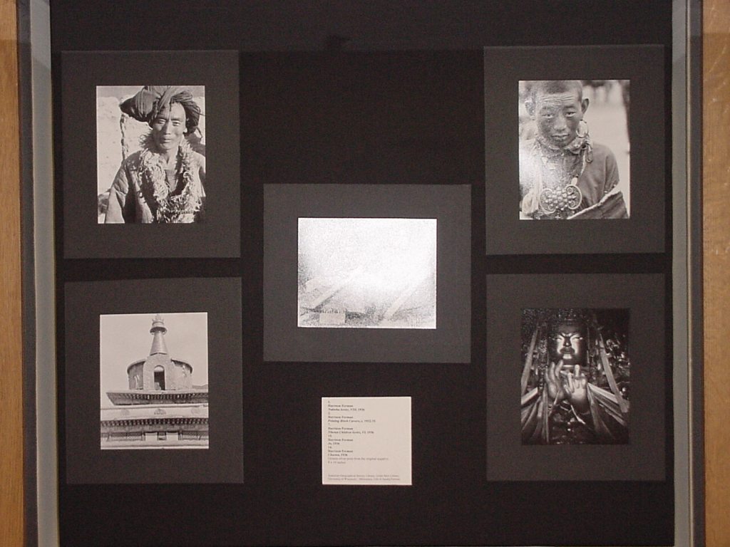
Looking back: Graduate Student Thesis Exhibition held in the AGS Library 2004
The AGS Library had the honor of providing space for a graduate student to host her senior art exhibit on the 3rd floor of the east wing of the Gold Meir Library.
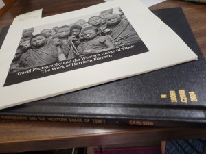
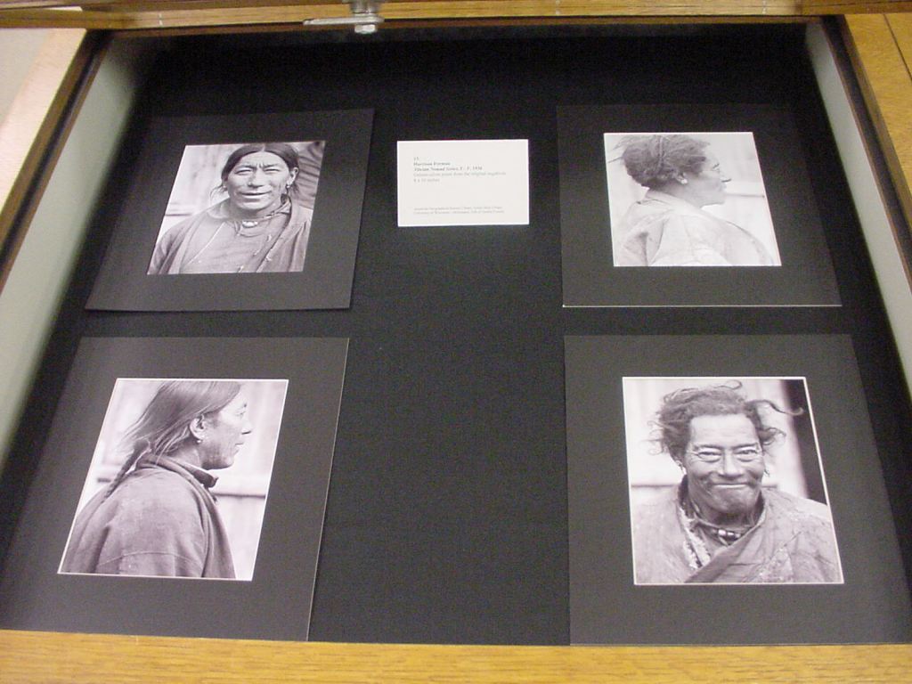
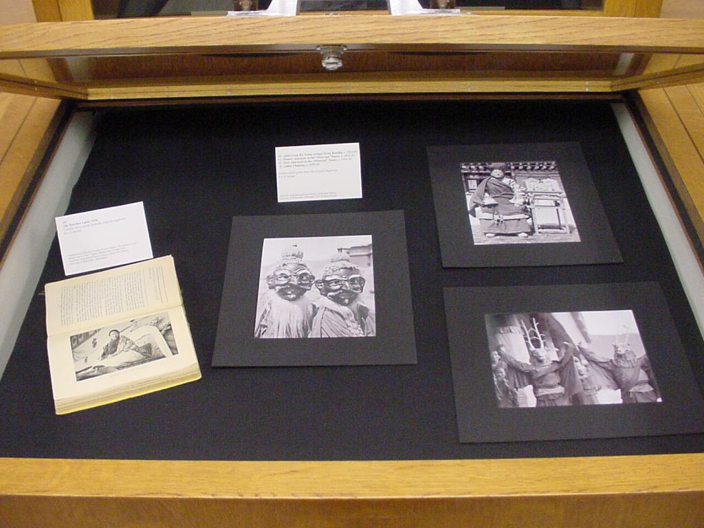
In December of 2004, UWM graduate student Beth Carlson hosted an exhibit of photographs at the AGS Library. Her exhibit, titled: “Travel Photography and the Western Image of Tibet: The Work of Harrison Forman” featured prints and negatives preserved at the AGS Library by Harrison Forman, often described by his peers as the Modern Day Marco Polo.
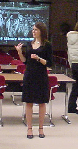
The exhibit was part of Carlson’s Masters of Arts in Art History degree at the University of Wisconsin Milwaukee. Her exhibit catalog, and thesis analyzed 40 of Forman’s 1930s travel photographs of Tibet and compared them to other images of the Far East by Western photographers. The AGS Library proved to be a lovely space to host Carlson’s exhibit that included a reception, a slide show and a brief lecture.
The exhibit included photographs, books, maps, scrapbooks, and graphic novels featuring Harrison Forman.
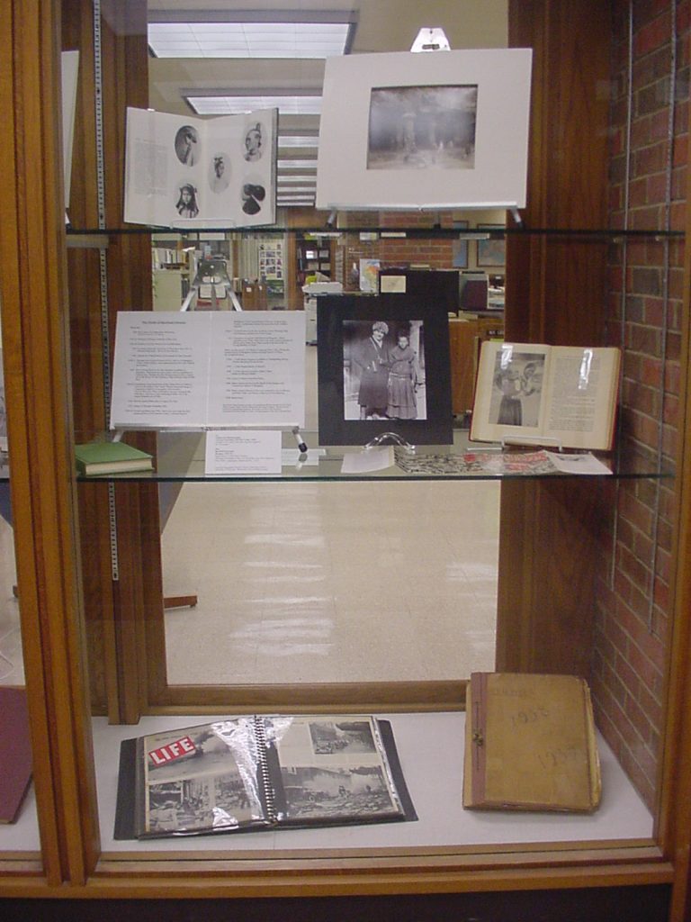
Harrison Forman was a Milwaukee native who graduated from the University of Wisconsin in 1929. He later worked as a foreign correspondent in the Far East for the New York Times, London Times and the National Broadcasting Company. Forman was an avid lecturer on international relations and became a Fellow of the American Geographical Society, Explorers Club, Circumnavigators Club and the Overseas Press. Forman died in 1978 and his photos were donated to the AGS Library by his wife, Sandra Carlyle Forman in 1987.

At the time of Beth Carlson’s senior exhibition, the AGS Library didn’t have a full time librarian dedicated the photograph collections. In 2006, Susan Peschel was promoted to the role of Visual Resources Librarian. The Forman collection has since been process and described and is available through the UWM Libraries digital collections.
Harrison Forman in the Asia Middle East Collection
While in the field, Forman maintained diaries containing information directly relevant to his photography. Those diaries are online here: Harrison Forman diaries
The inspiration for this post came up when Map Librarian, Angie Cope, met a library employee studying Art History at UWM. Angie wanted to show the student the beautiful exhibit that was held in the AGSL. However, the timing couldn’t be better to recognize this exhibit NOW because this year also represents the actual completion of organizing a collection. The entire Harrison Forman collection has been processed, scanned and put online in the UW Milwaukee digital collections! That’s amazing! You can read about it here: https://uwm.edu/lib-collections/harrison-forman/?fbclid=IwAR0-1ORMMHoowf276YPLEm5lcYyCclxFyEgLwc98wpWsrk_O6pSbz_g67DI
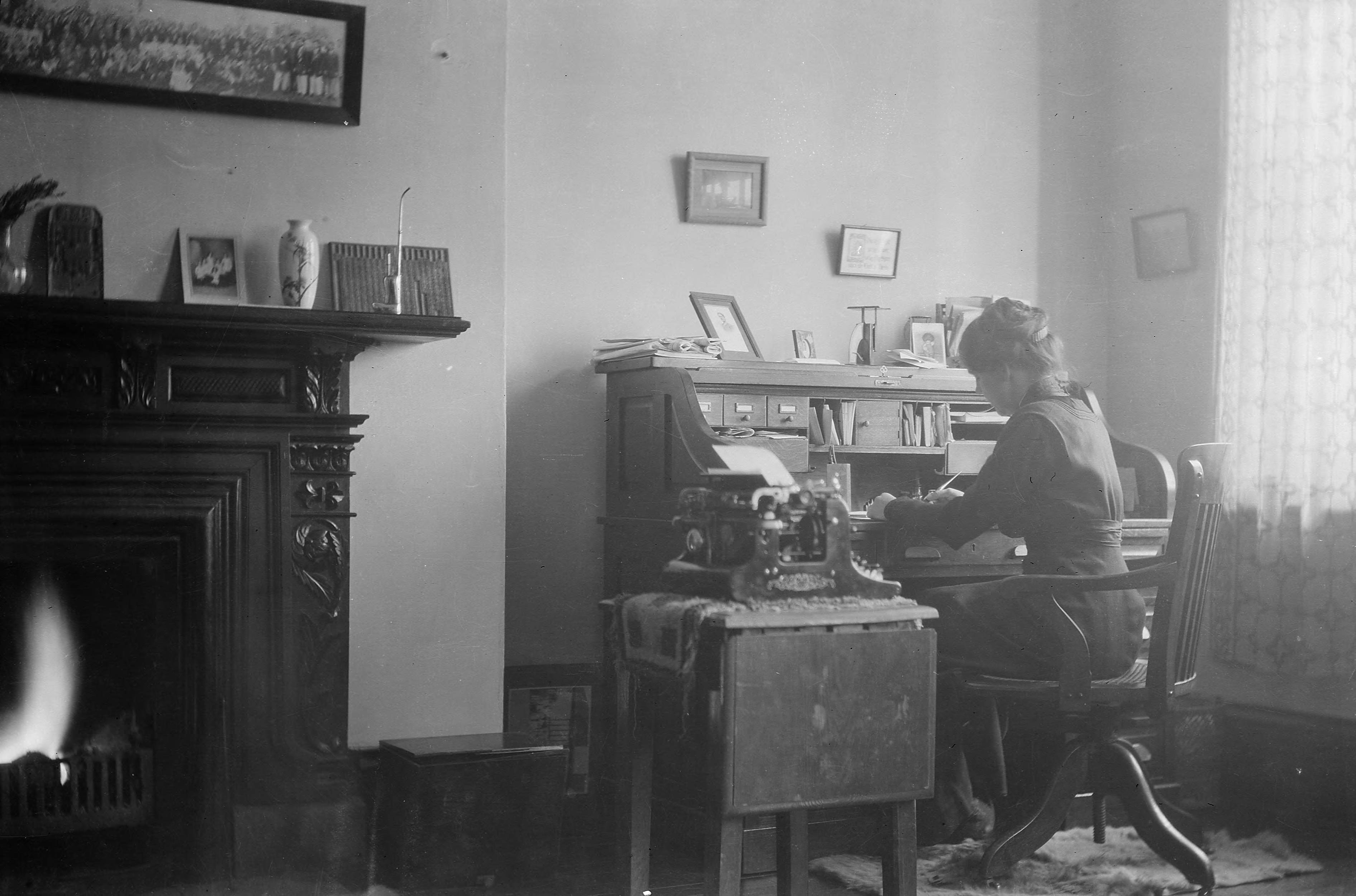
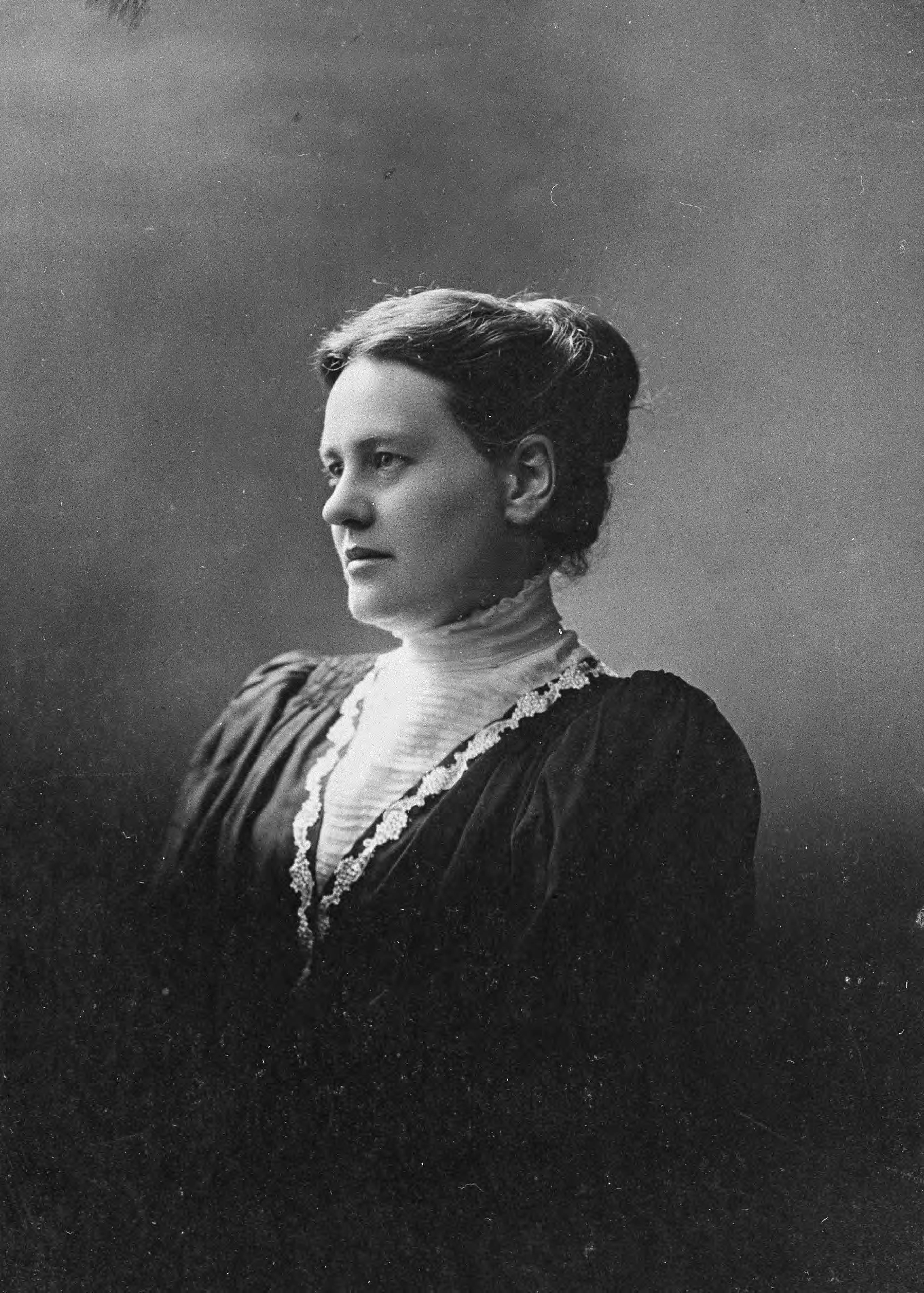
Anna Estelle Paddock 1874-1940
The AGS Library holds a small collection of documents and photos from Anna Estelle Paddock. She worked for the Young Women’s Christian Association in China. There is a collection of photographs and letters that were donated by Maurine Estelle Huang in 1981.
https://collections.lib.uwm.edu/digital/collection/agsnorth/id/2600/rec/6
https://collections.lib.uwm.edu/digital/collection/agsnorth/id/2599/rec/14
https://collections.lib.uwm.edu/digital/collection/agsnorth/id/2595/rec/2
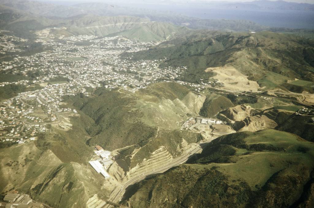
Christchurch earthquake, 10 years ago
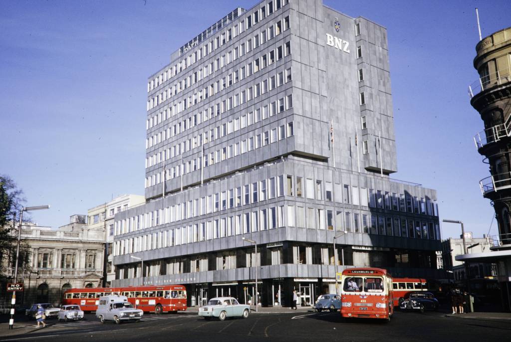
On 22 February 2011, a fatal earthquake hit Christchurch, New Zealand. One-hundred and eighty-five people were killed and the city’s CBD was destroyed. The 6.3 magnitude earthquake hit during the lunch hour and its epicenter was just 6km south of the city. Christchurch’s central city and eastern suburbs were badly affected, with damage to buildings and infrastructure already weakened by the magnitude 7.1 that had occurred less than a year earlier.
https://collections.lib.uwm.edu/digital/collection/agsoceania/id/690/rec/13
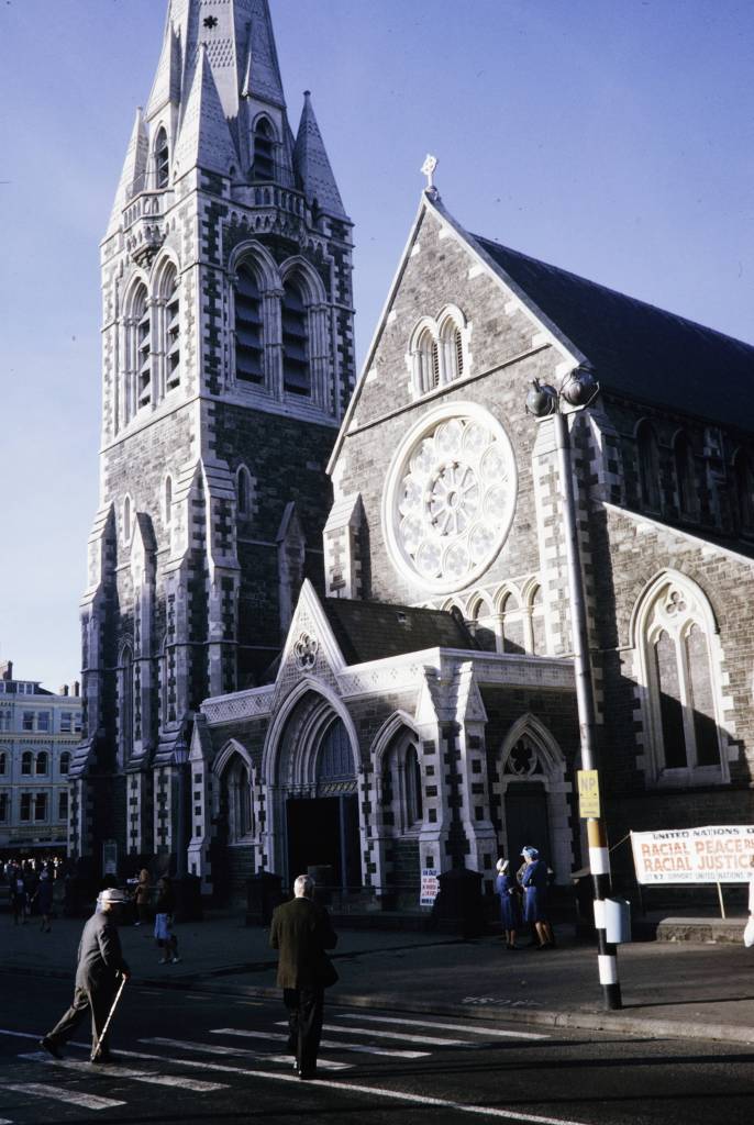
“Two story buildings in the CBD were flattened and masonry in older parts of the city crumbled onto the streets. The steeple and bell tower of Christ Church Cathedral collapsed into the square, and its whole front face and beautiful rose window – the spiritual and symbolic face of Christchurch itself – teetered, and would later collapse onto the entrance portico, opening the nave to wind and weather, and the pigeons of Cathedral Square. [Australian Geographic].”
The earthquake destroyed the Christchurch Cathedral’s spire and severely damaged the structure as a whole. The Anglican Church voted to demolish the building but various groups came together to save the building.
https://collections.lib.uwm.edu/digital/collection/agsoceania/id/825/rec/1
https://collections.lib.uwm.edu/digital/collection/agsoceania/id/708/rec/32
Demolished in 2013.
.
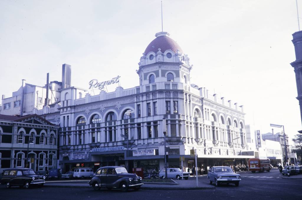
https://collections.lib.uwm.edu/digital/collection/agsoceania/id/796/rec/4 The Regent Theater opened on 16 August 1930 and had a seating capacity of 1,568. It survived a 1976 fire and major renovations in the 1980s and 1990s but succumbed to the earthquake and was demolished in July 2011.
About 10,000 houses were demolished in the suburbs. The earthquake caused soil liquefaction and rockslides in and around Christchurch, leaving many areas infeasible for rebuilding. Efforts continue in Australia to earthquake proof buildings.
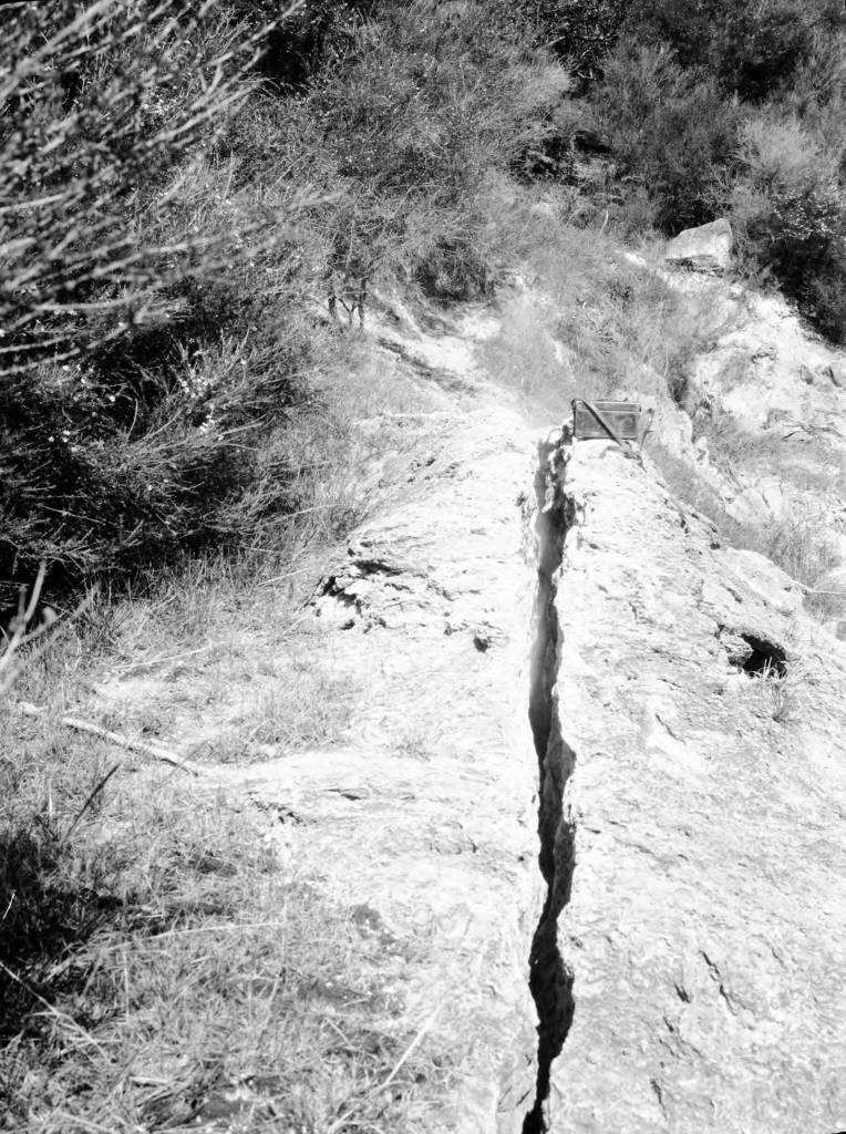
Earthquake crack 5 feet deep, 6 inches wide and 40 feet long with emerging hot spring (the crack trends South 30 degrees East) Te Puia Springs. New Zealand. (1925) from the AGSL Photocraph Collections https://collections.lib.uwm.edu/digital/collection/agsoceania/id/232/rec/1
.
First flight blazes the trail for future discovery – The Wright Brothers and Lincoln Ellsworth
by Angie Cope
| On the morning of December 17, 1903, Wilbur and Orville Wright took turns piloting and monitoring their flying machine in Kill Devil Hills, North Carolina. Orville piloted the first flight that lasted just 12 seconds and 120 feet. On the fourth and final flight of the day, Wilbur traveled 852 feet, remaining airborne for 59 seconds. That morning, the brothers became the first people to demonstrate sustained flight of a heavier-than-air machine under the complete control of the pilot. |
Orville and Wilbur Wright are credited with inventing, building, and flying the world’s first successful motor-operated airplane. Their inventions led the way for world exploration using airplanes. One notable flight was the Ellsworth Transantarctic Flight Expedition. Lincoln Ellsworth with pilot Herbert Hollick-Kenyon completed the first transantarctic flight in history. With four stops along the route, the flight covered 2200 miles with an elapsed time of approximately 20 hours.
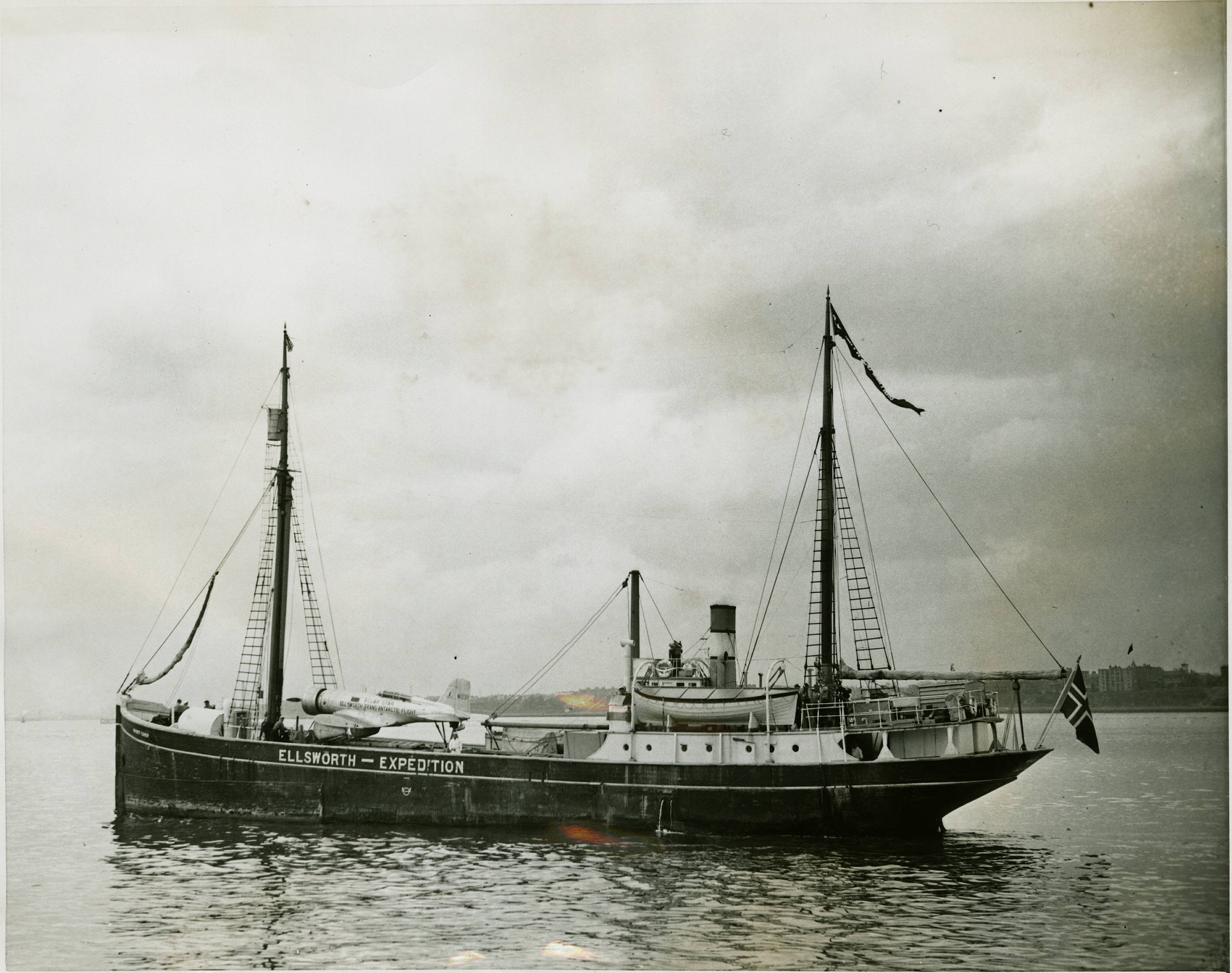
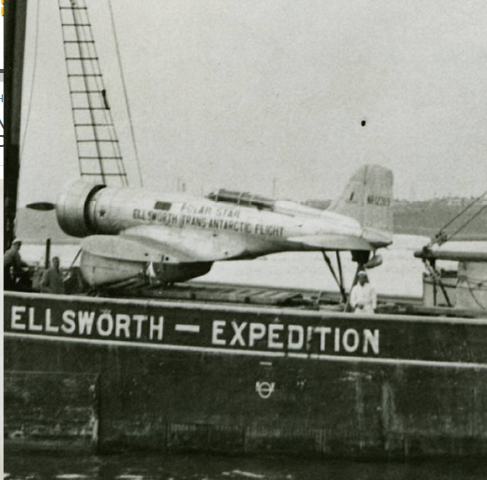
The transantarctic flight was the longest flight in Antarctic history, an accomplishment not repeated again until January 1956.
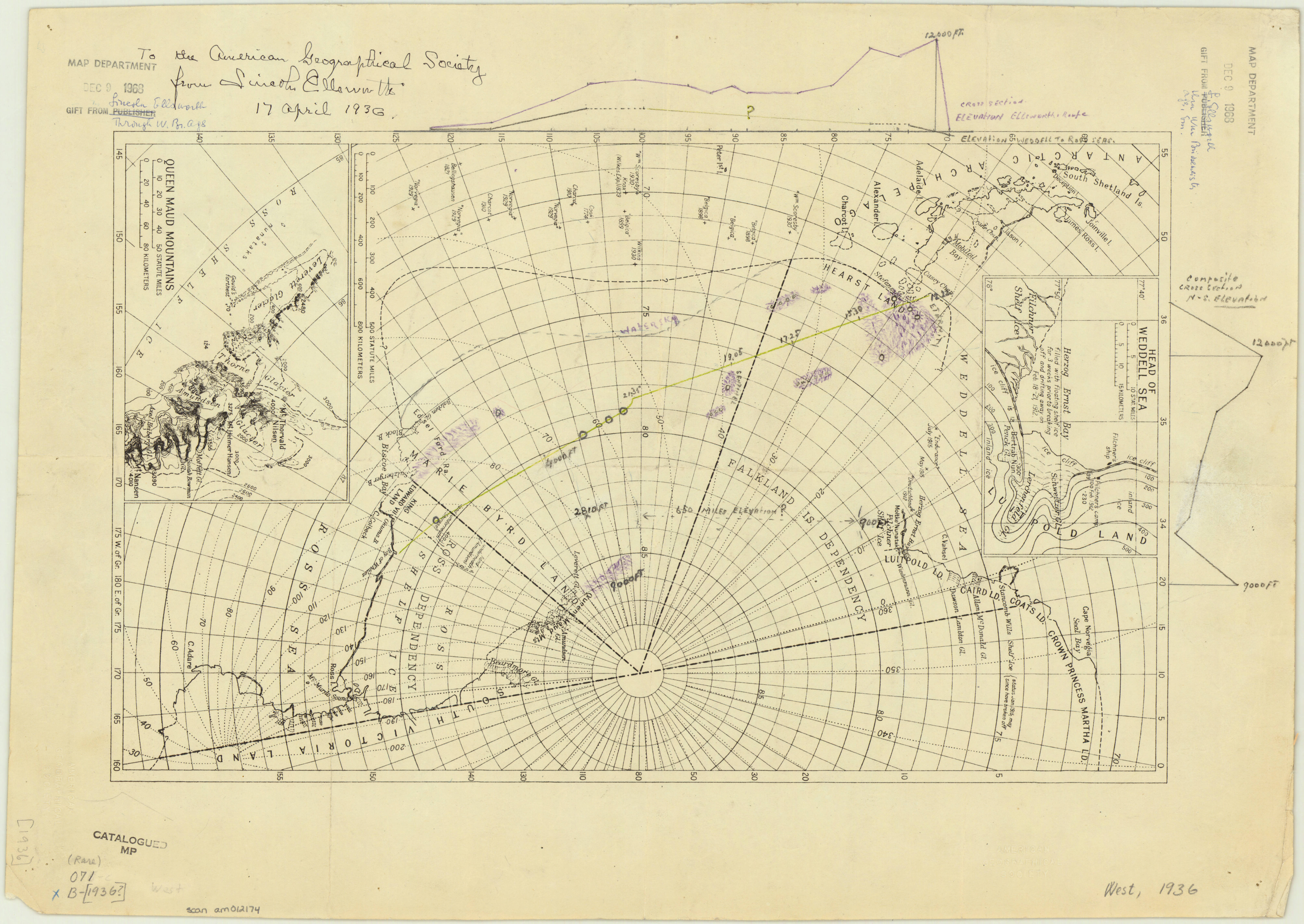
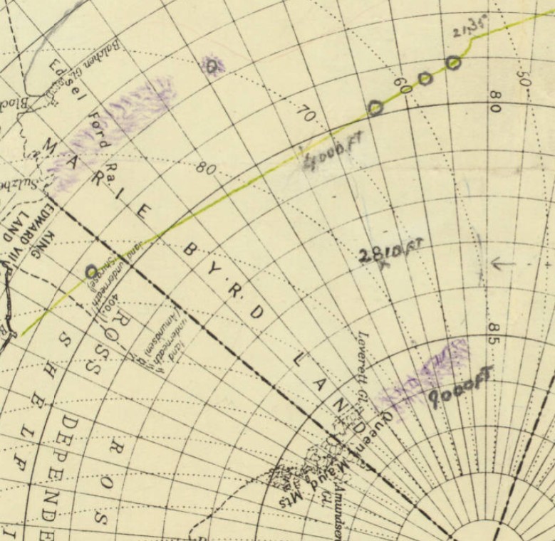
The story map of flying being a chronicle of man’s conquest of the air / designed, pictured and published by Ernest Dudley Chase of Winchester Massachusetts, 1942
1 map : color ; 65 x 47 cm, on sheet 77 x 56 cm
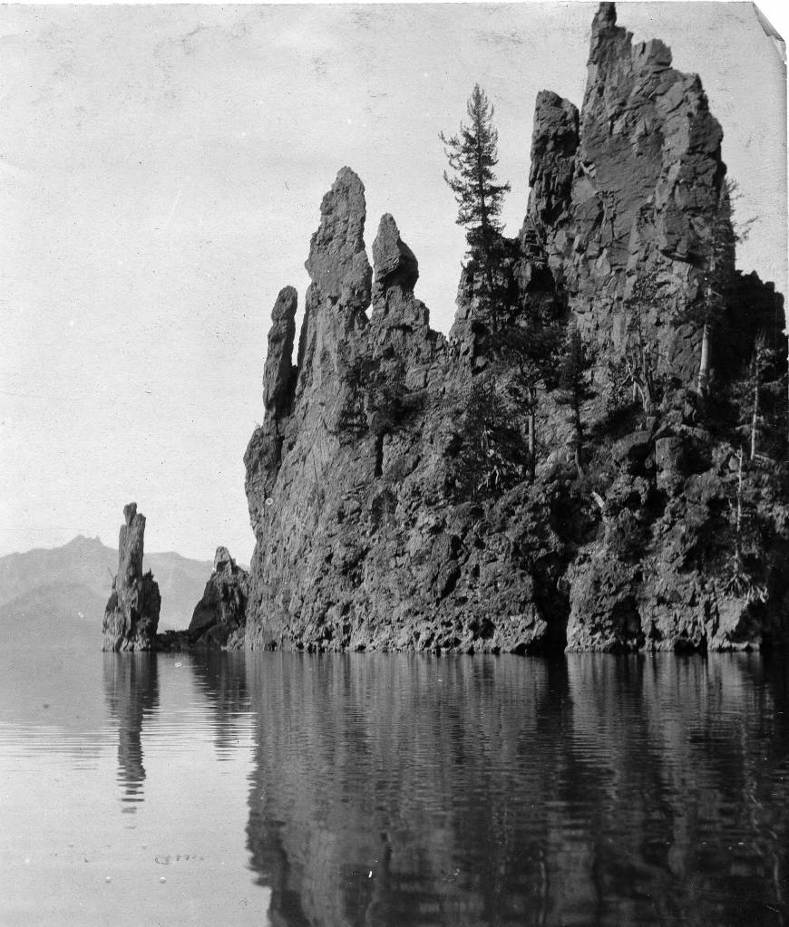
The Phantom Ship on Crater Lake
By Lauren Maddox
Photo of Phantom Ship Island from the AGS’s 1912 Transcontinental Excursion. Click the link to see this photo in our Digital Collections!
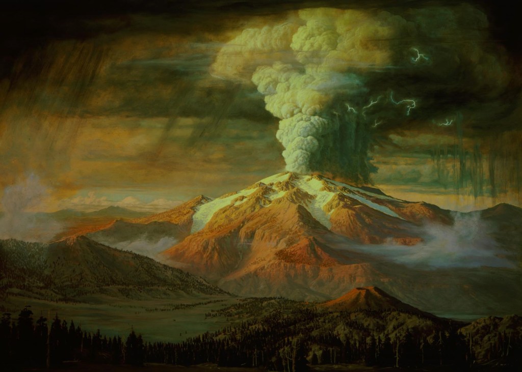
The Klamath people have lived near Mount Mazama for over 10,000 years. According to their histories, Llao, the Chief of the Below World, attacked the community living by the volcano when a human woman refused to become his lover. Skell, the Chief of the Above World, defended the Klamath people from Llao’s rage; he chased Llao back into the mountain and smashed the mountain peak over his head, collapsing Mount Mazama and forming a huge crater. The crater filled with rain water so blue, it turned the grey mountain birds bright blue, too.

Young Mountain Bluebird from Aubudon’s Field Guide. Click the link to learn more about Mountain Bluebirds!
Lalek, a 19th century Klamath leader, interpreted this oral history before white geologists even understood the volcanic nature of Mount Mazama: 7,700 years ago, Mount Mazama violently erupted and collapsed in on itself, forming a huge crater lake. The crater was fed with snow melt and rain instead of a running water source, so its waters remain clear and shockingly blue.
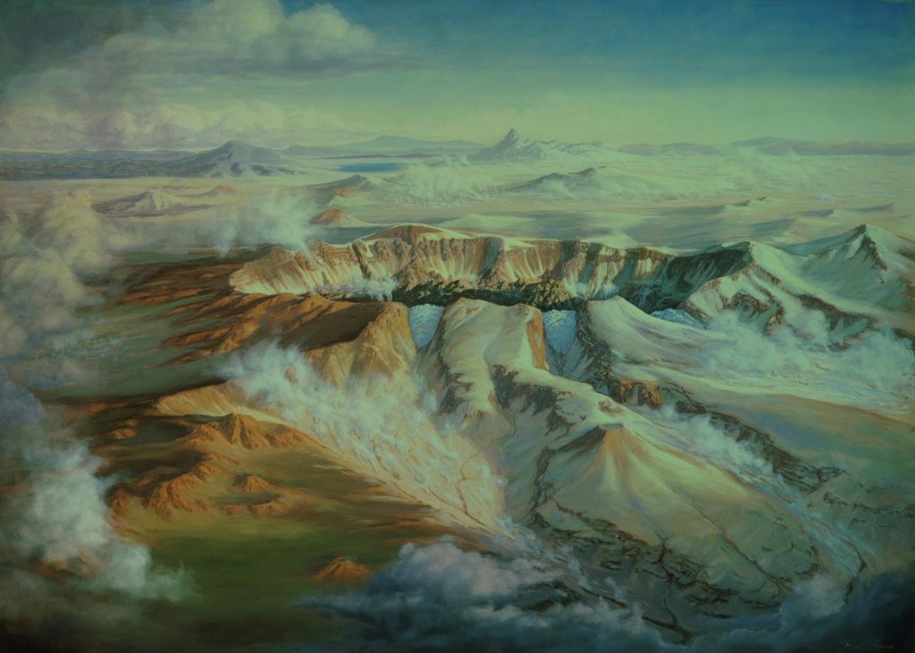
Crater Lake in Oregon is the deepest lake in the United States. It has two famous islands: Wizard Island, which is a a volcanic cinder cone formed after the massive eruption of Mount Mazama, and Phantom Ship Island. Phantom Ship Island, as its name suggest, appears to be a ship when seen from a distance. Mysteriously, when the lake is foggy, the island appears to disappear, adding to the impression that it is a phantom ship. The island is made of ancient andecite rock formations, which were shaped by the hydrothermal activity of Crater Lake.
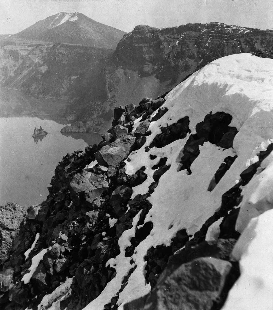
Phantom Ship Island from a distance, 1912. Click the link to see this photo in our Digital Collections!
In 1912, the American Geographical Society organized a Transcontinental Excursion to, as supposed by Geography in the Making: The American Geographical Society 1851-1951, “increase the knowledge of American geography by Europeans” and to “promote the acquaintance of European Geographers with Americans.”
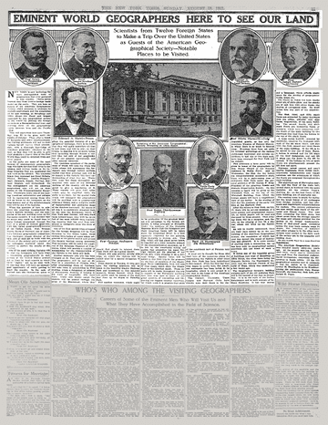
1912 Article in the New York Times. Click the link to see this article on the NY Times website! 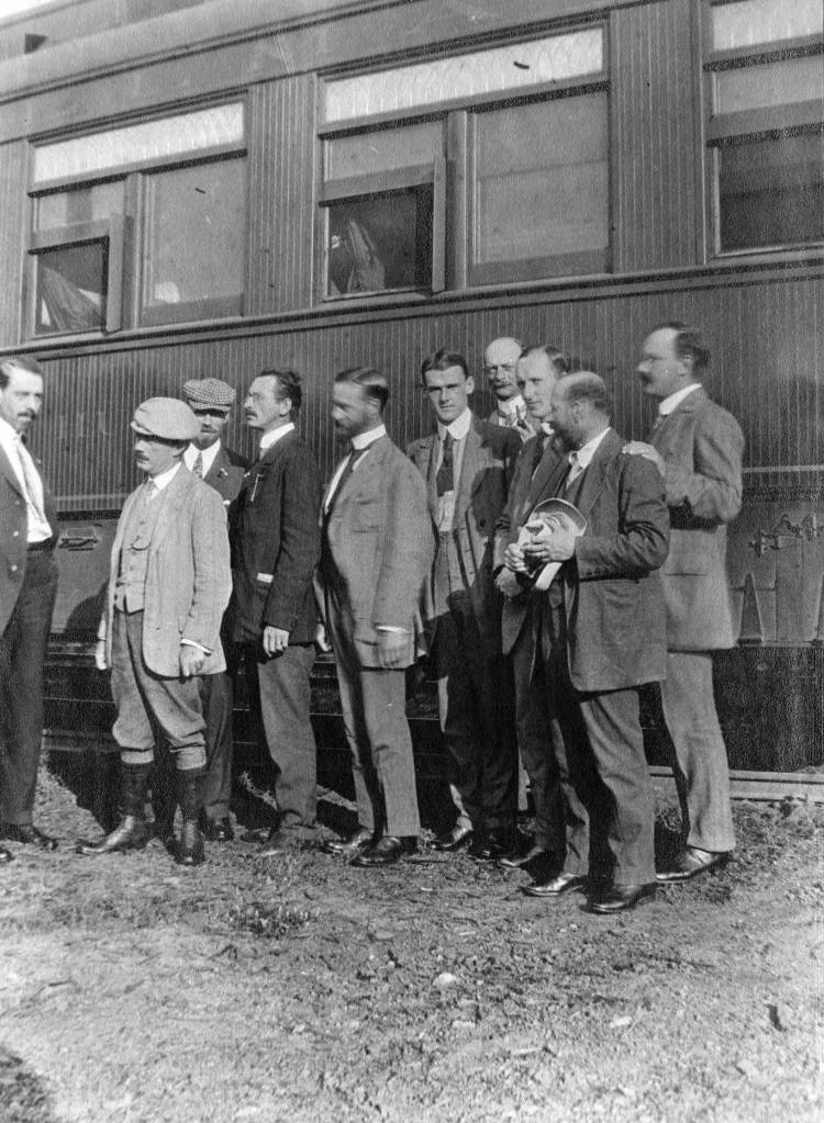
Passengers posing by AGS Transcontinental Train. Click the link to see this photo in our Digital Collections!
One of the stops on the Transcontinental Excursion’s route was Crater Lake, where several passengers took photos of Phantom Ship Lake.
Closeup of Phantom Ship Island. Click the link to see this photo in our Digital Collections! 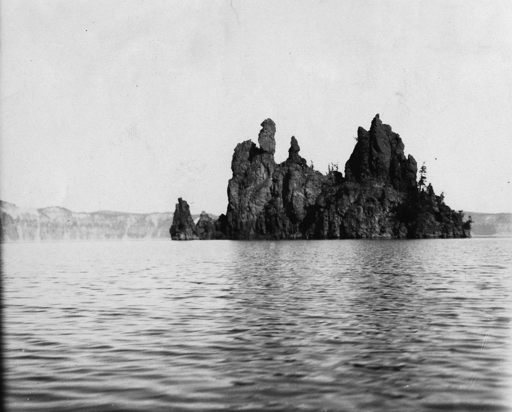
Photo of Phantom Ship Island. Click the link to see this photo in our Digital Collections!
While Phantom Ship Island may resemble a ghost ship, it is not the most mysterious phenomenon on Crater Lake. Some visitors to the park report seeing campfire on the uninhabited islands, and eerie sounds plague tourists who choose to stay in the Crater Lake Lodge. But by far, the most inexplicable occurrence on the lake.
The first account of the Old Man of the lake was written in 1902; Joseph S. Diller reported a stump floating upright in the lake. The Old Man is a more than 100 year old hemlock tree that floats, as reported, completely upright in Crater Lake. The Old Man travels by floating across the lake, sometimes over 60 miles, never upending. The Old Man is allowed to float freely now, because once, when scientists tied the Old Man to the shore to prevent him from disrupting navigation of the lake, he called a storm that didn’t subside until he was released.
Though Crater Lake has a strange and magical history, somehow Phantom Ship Island through the fog is not the most unusual sight visitors might encounter. But that doesn’t mean it isn’t eerie!
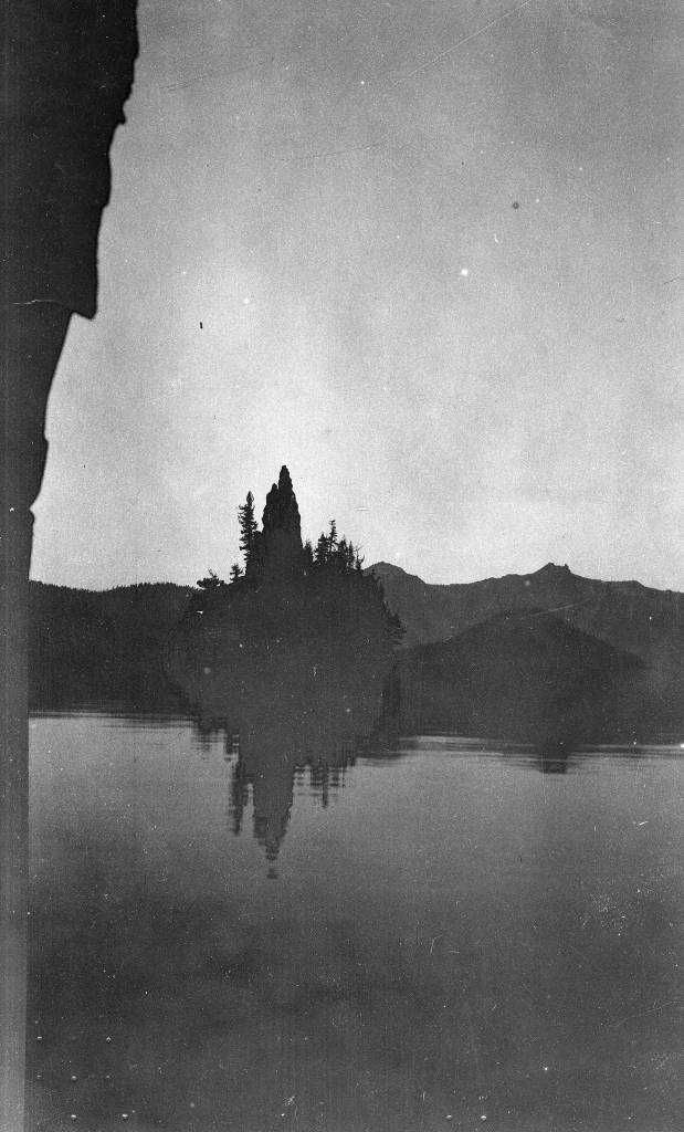
Phantom Ship Island. Click the link to see this photo in our Digital Collections!
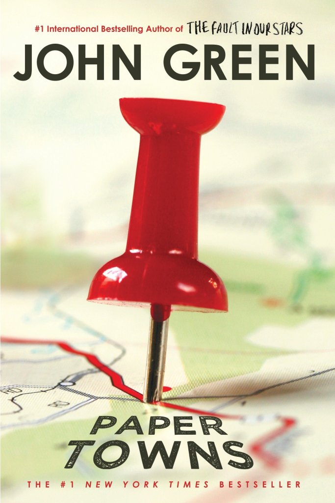
On the Road to Algoe: Revisiting the Paper Town
By Lauren Maddox
John Green’s Paper Towns posed a question that stumped many of its readers: how can spaces be simultaneously fictitious and real?
The novel was received by an excited public in 2008; the book won the Edgar Award, was Editor’s Choice for book of the year at Booklist and Voya, and was top of the list for Best Book at the Chicago and New York public libraries. In 2014 and 2015 interest in the novel and its faux-setting peaked– Paper Towns was being adapted into a film starring Nat Wolff and Cara Delevingne. Excitement for the move inspired a plethora of articles by news outlets like NPR, MNN, and Gizmodo describing the paper town that the book is centered around: Algoe, New York.
Check this book out from the UWM library! Click the link to learn more.
Algoe was unique in that it wasn’t and then was and then wasn’t a real place. Mapmakers would sometimes include fictitious entries as a way to subtly sign their work. It’s almost impossible to prove that a representation of reality has been copied, but copyright traps were a way to prove that a work had been stolen. If the copycat included the fictional place names from the original map in their version, the original mapmaker could prove that it was their intellectual property. Algoe was one of these copyright traps. It appeared to be a small hamlet in upstate New York, nestled between interstate routes. In reality, “Algoe” was just an anagram of mapmakers Otto G. Lindberg’s and Ernest Alpers’s initials.
Esso bought the map from Lindberg and Alpers and began distributing it. A few years later, Algoe appeared on another map by Randy McNally. Lindberg accused McNally of having stolen the map because, of course, Algoe wasn’t a real place. But McNally protested. His company had gotten the records of Algoe completely legally. A general store owner had seen the town name Algoe on the Esso map years earlier and decided to name his general store after it. Just like that, Algoe had become a real place. After a few years, the store shut down, and Algoe ceased to exist again. You can still find it, though, if you search for Algoe on Google Maps.
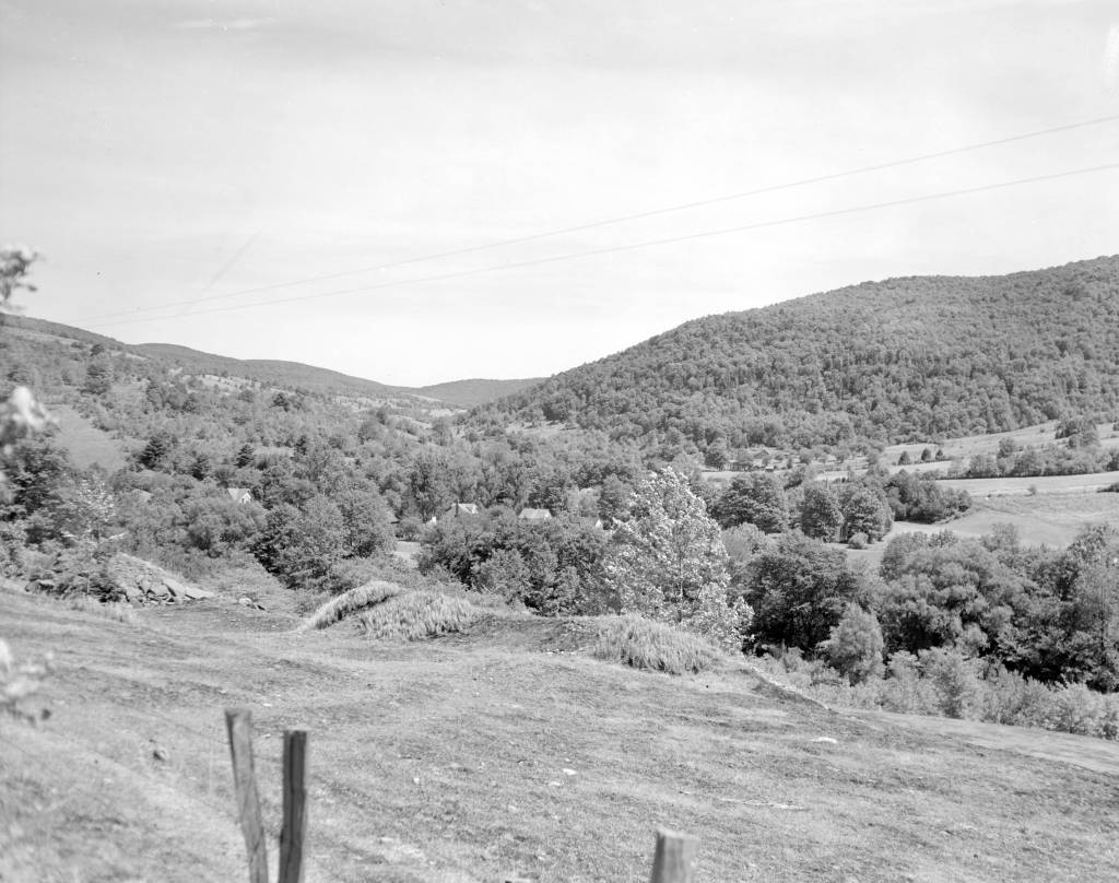
Photo of Delaware County, New York, where Algoe was supposed to be. Click this link to see this photo in our Digital Collections!
Trap streets and paper towns were just one way that a mapmaker might mark their work– the map sheets below, which are part of a survey of the Gold Coast (now Ghana), depict a hidden elephant in the elevation chart. Frank Jacobs’s “How to Hide an Elephant in a Map” tells the story of a hot, uncomfortable British surveying expedition who, upon discovering a particularly inaccessible stretch of land, decided to just doodle an elephant and call it a day.
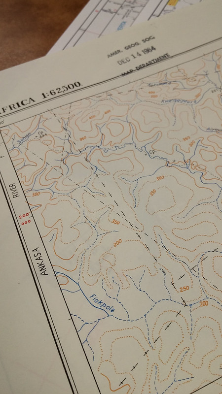
1964 Edition of the Gold Coast Survey Maps. Click the link to check out our Flickr! 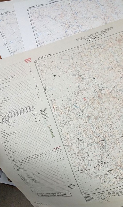
Three editions featuring the elephant. Click the link to check out out Flickr!
In this case, the hidden mark on the map wasn’t to protect intellectual property; apparently, the expedition decided to fill the blank space in their survey so that they could pack up and go home. But the result was the same– the creator’s left a unique stamp on their work that was copied in later editions over and over again. Just in the AGSL archives, there are three editions of this map sheet with the elephant from 1924, 1951, and 1964.
We expect maps to tell the truth– they appear, on the surface, to be objective representations of reality. But the truth is, they often aren’t; mapmakers and the people who finance them have an agenda. In Algoe’s case, it was a white lie designed to protect the intellectual property of mapmakers who wouldn’t otherwise be able to prove that their work had been stolen. And the tired British expedition’s elephant was a way for them to avoid traversing any deeper into an inaccessible landscape. These are the innocent lies that maps sometimes tell us– but other times, a map could be lying to us for other, more nefarious reasons.
Monmonier’s How to Lie with Maps. Click the link to see this book in our Digital Collections!
Mark Monmonier’s How to Lie with Maps outlines the many lies, harmless or not, that maps sometimes tell us. According to Monmonier, “map users…need to appreciate the perils and limitations” of maps because they are “rhetorical tools fully capable of ‘lying'” to us, accidentally and purposefully. These lies can be fairly small– a fake hamlet in upstate New York or an elephant masquerading as a hill. Algoe isn’t a threat to our perceptions of reality. However, it does remind us that maybe our maps aren’t as truthful as we like to believe.
In 1993, a series of cases against the board game company behind Trivial Pursuit ended the use of copyright traps. The courts found that, in the same way you can’t copyright a real place, you can’t copyright a lie. No one looks for these copyright traps anymore, since they aren’t functional protections against copycat map makers– which means there might be even more hidden places on our maps, waiting to be discovered.
Disney’s Darkest Day
By Lauren Maddox
July 17th is celebrated at Disneyland as the park’s official opening day. This year marks the 65th anniversary– Disney hasn’t announced any official celebration plans yet, but fans can most likely expect a birthday bash to remember. The park’s anniversary wasn’t always celebrated on July 17th, however; during Walt Disney’s life, the official date was July 18th, one day after what we consider to be the opening day now.
Walt Disney was adamant that the July 17th opening not be acknowledged as the official opening– and with good reason. July 17th, 1955 was such a disaster that Disney sometimes called it “Black Sunday.”
Expectations for the July 17th preview day were high. Disney had been planning his amusement park since at least 1948, when he sent the first memo to Dick Kelsey describing his plans for a Mickey Mouse theme-park. But the original idea pre-dated even this first draft of the park concept; Disney’s own father worked at the World’s Columbia Exposition in 1893.

Map of the Chicago World’s Fair in 1893. Click the link to see this map in our Digital Collections! 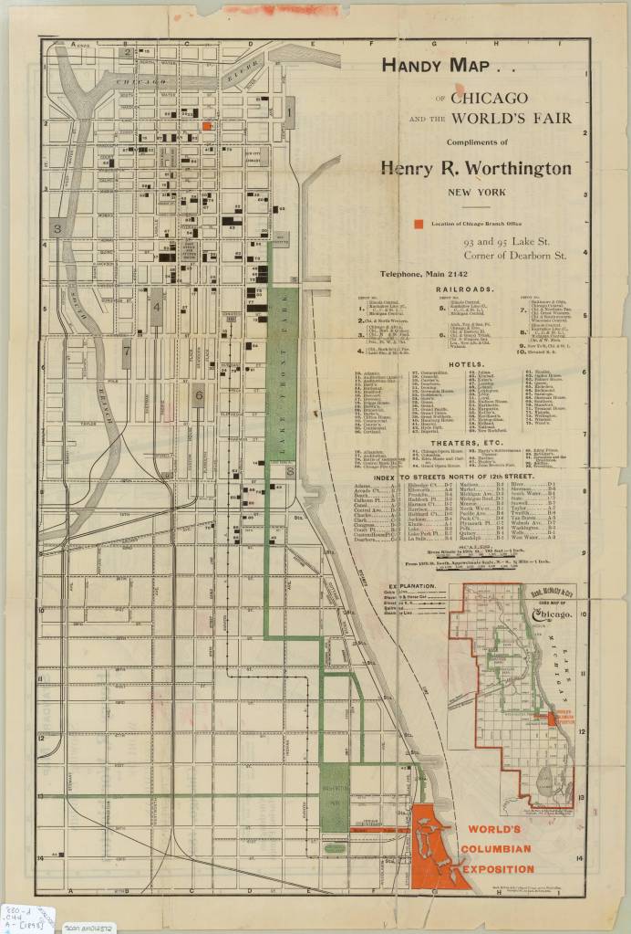
Map of the Chicago World’s Fair in 1893. Click the link to see this map in our Digital Collections!
The World’s Columbia Exposition was a Chicago’s World’s Fair held in 1893 to celebrate the 400th anniversary of Christopher Columbus’s first arrival in North America. The Fair was supposed to be a symbol of the burgeoning ideas of American exceptionalism and Chicago’s recovery from 1871 fire. The Fair was a monumental undertaking; the grounds covered more than 650 acres, and nearly 26 million visitors passed through. More important to Disney’s story than the grandiosity of the fair: the 1893 World’s Fair was the first to host a dedicated amusement park area.
His father’s memories of that Fair and its amusement rides stayed with Disney until his own fatherhood. Disney cited watching his children on a merry-go-round as the final inspiration that lead him to Disneyland.
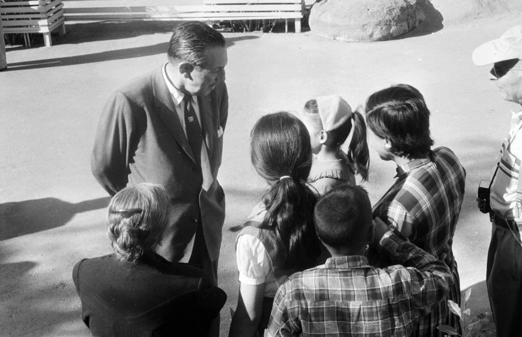
Disney talking to a group of children at Disneyland in 1957. Click the link to see this photo in our Digital Archives!
Besides his tender family memories, Disney also had a practical reason to build an amusement park. He was, after all, a businessman first. As Disney’s animation studio in Burbank gained more success, more and more fans wanted to come visit. The inside of an animation studio isn’t actually that interesting, and it would be hard to get any work done with crowds of tourists peeking in on the animators who worked there.
The original plans for Disneyland put the amusement park right next door to the Burbank studio. After realizing how much of an undertaking (and how many more acres) the amusement park was going to be, Disney moved the location to the Anaheim site.
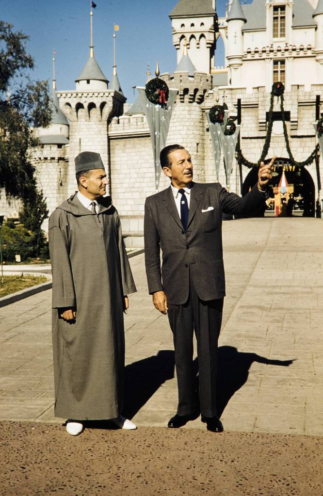
Disney entertaining King Muhammad V at Disneyland, 1957. Click the link to see this photo in our Digital Archives!
For the preview day, Disney invited a select group of 14,000 guests. This included the press as well as friends and families. This was the first thing to go wrong that day. Around twice as many guests actually showed up to the park– many had purchased counterfeit tickets to gain entry to the preview day opening, but many more simply climbed over the walls and broke into the park. Disneyland, for the day, was only prepared to serve the 14,000 intended guests; vendors ran out of food, half of the water fountains weren’t functioning because the plumbers working on the park went on strike (and offered the ultimatum “bathrooms or water fountains”). The event was sponsored by Pepsi, so many park-goers accused Disney of forcing them to buy drinks by sabotaging the water fountains. It was an unseasonably warm day for Anaheim, and the freshly poured asphalt was so soft that women’s high heels would sink into it.
Besides these critical logistical failures, the media coverage of the event was a circus. Disney himself missed the cue to read his dedication, and said, to the camera live and on air, that he’d thought he’d been given the signal to start. Bob Cummings was caught on camera flirting with the dancers and even kissing one girl. Other commentators lost their mics and had to cover for themselves while the tapes ran on.
In summary, the whole day was deeply embarrassing to Disney. He never acknowledged the July 17th preview as the opening day of Disneyland, and it was only after his death that it was adopted as the official anniversary.
Disney’s legacy lives on, for all the good and ills that entails. But perhaps his greatest contribution to the amusement park circuit, besides Disneyland itself, is the impact his choices made on amusement park cartography.
When Disney was first pitching the park idea to investors, he used maps created by Herbert Ryman to help draw the picture of the park that he was imagining and struggling to put into words. Ryman’s version of the park didn’t make it to brochures, partially because his maps were of an imaginary park that wasn’t quite the same as the real Disneyland.
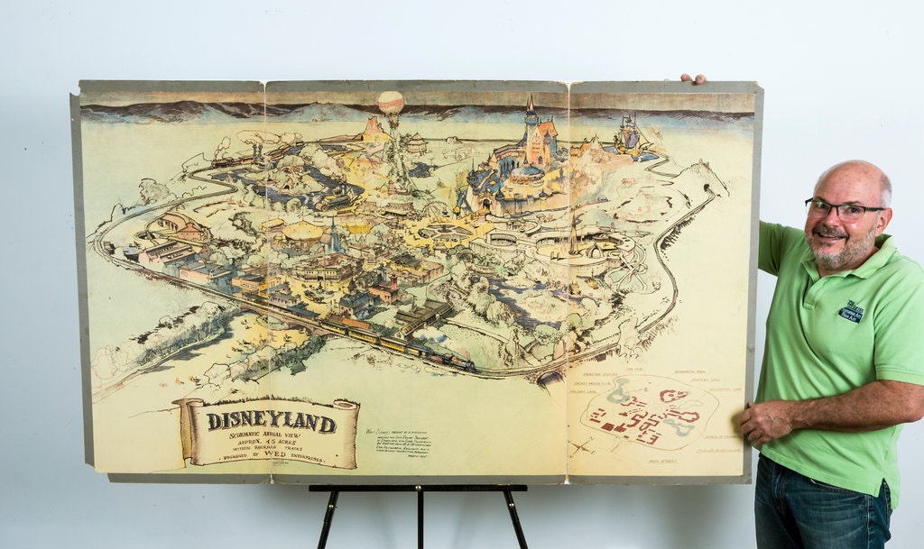
The 1953 Ryman Map of Disneyland from the New York Times. Click the link to see the rest of this article!
Due to budgeting issues, the official map of Disneyland took another three years after opening day to create. Sam McKim was the artist behind the first official park maps in 1958. The maps, at this point, still had some aspirations for parts of Disneyland not yet built, but mostly functioned as tools for park-goers to use to find their way around and as free souvenirs they could take home. Sam McKim’s maps ran, with some slight adjustments over the years, until 1964. For his contributions to the Disney brand, he was named “Map Maker to the Kingdom” and a tribute to his work can still be found at Disneyland.
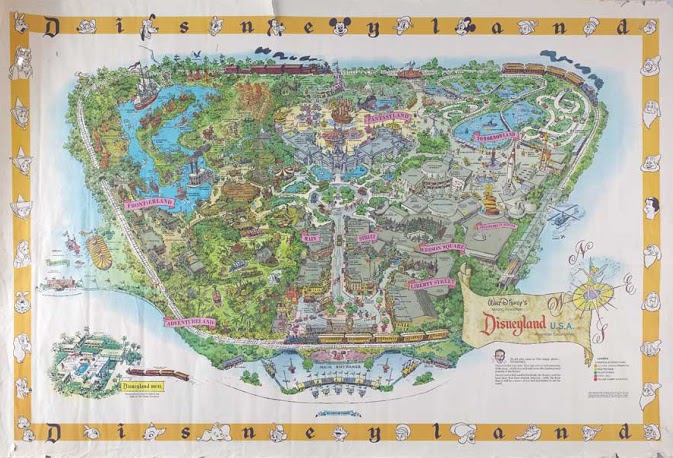
McKim’s 1958 Map of Disneyland. Click the link to see this map on Mouse Maps!
Maps as souvenirs was not a new concept; many World’s Fairs gave out artful brochure maps for visitors to remember their day at the Fair. But McKim’s willingness to push the boundaries of realistic map making in order to appeal to the imaginative and exciting nature of Disneyland revolutionized the amusement park map. After McKim, the artists behind the brochure maps became anonymous, but his impact on the work remains clear.
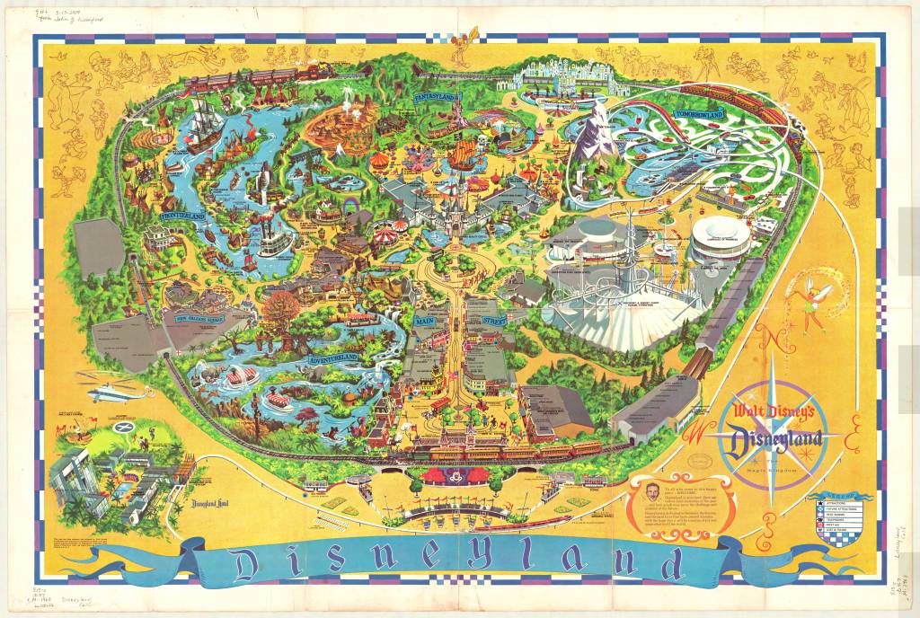
1968 Map of Disneyland. This version removed Edison Square and Liberty Park, which were not built but still included on the previous generation of maps. Click the link to see this map in our Digital Collections!
Cartography was a key tool in Disneyland’s creation. And it continues to be an important part of the Disneyland brand an experience– but more than that, the maps at Disneyland give us a way to take the park home. That first day may have been a disaster, but many, many Disney fans have experienced and loved the park since then. Happy 65th anniversary! Remember to take a map before you go–they help us find our way.
Salt of the Earth
By Lauren Maddox
Instagram has changed the way we vacation– our destinations don’t just need to look good in person. They also need to look good for the camera. This age of aesthetic vacationing has sent trendy tourists to the salt production operation in Las Coloradas, at the very tip of the Yucatan Peninsula. You’ve actually probably seen these pictures– pretty, bikini-clad women perched on flamingo pool-floaties drifting across the pink, uber-salt water of a man-made salt evaporation pond.
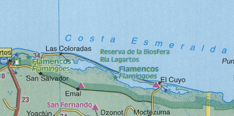
Detail of Los Coloradas 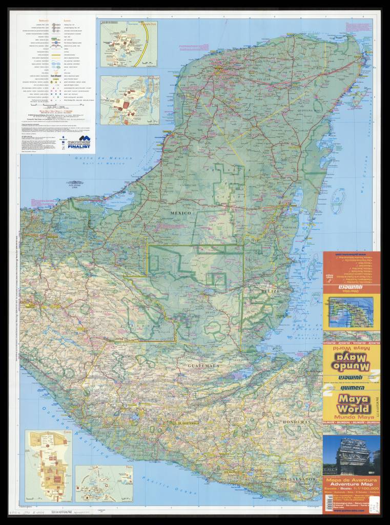
2004 Map of Yucatan. Click the link to see this map in our Digital Collections!
These places may not be as picturesque as millenial trendsetters make them out to be– in essence, the salt lakes at Los Coloradas are a step in an assembly line. They’re salt evaporation ponds designed to extract sea salt for table salt. Several different colors of salt are harvested from the lakes– though the lakes are actually pink because of the micro-organisms that thrive in highly salinated environments. But the flamingo habitat nearby still seems pretty on brand.
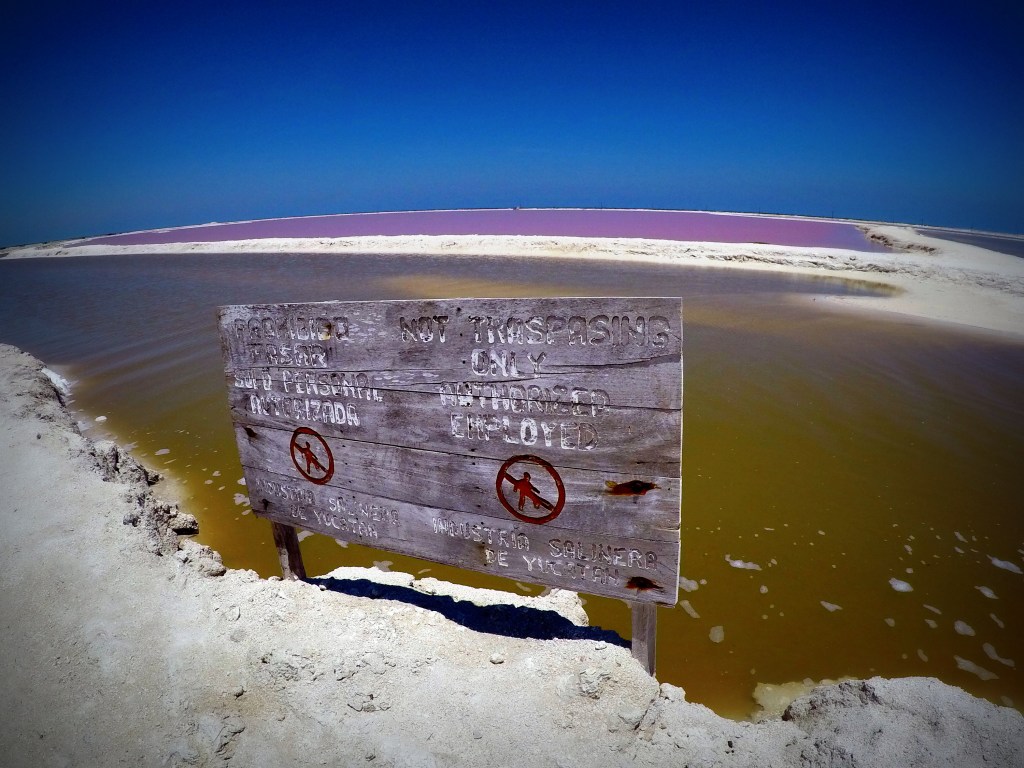
And because of the influx of tourists, the salt production plant has had to put fences around the lakes to keep people from swimming in them. You can still take a tour, but it’s not really the same without the novelty pool-floaty. The ponds aren’t dangerous to swim in, but if you had scratches, it would be a pretty unpleasant and unrefreshing dip in the pool. And this is a food production facility– people swimming in the lakes does seem like a contamination concern.
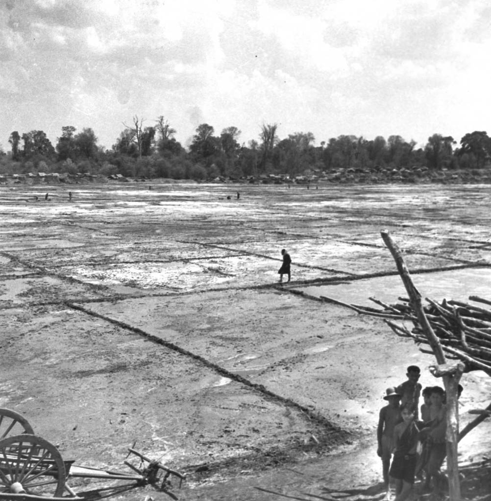
Roi Et Province in Thailand, 1940. Families turned natural brine into salt using evaporation. Click the link to see this photo in our Digital Collection!
But besides being a great photo-op, salt evaporation and collection has been a center of civilization since antiquity. The oldest known towns in Europe were centered around salt production because salt allowed for the preservation and trading of food across longer distances. The ancient roads that all lead to Rome were first used to transport salt back to the city from the empire’s many, saltier territories. Salt made other ancient empires like Egypt and China stable and prosperous, which created opportunities for technological advancement. And salt’s deep connection to the beginnings of civilization is still visible today– the word salary is derived from the Latin word for salt, English towns with names ending in -wich were named for their connection to salt production, and now Instagram influencers can pose with modern salt production facilities for the aesthetic.
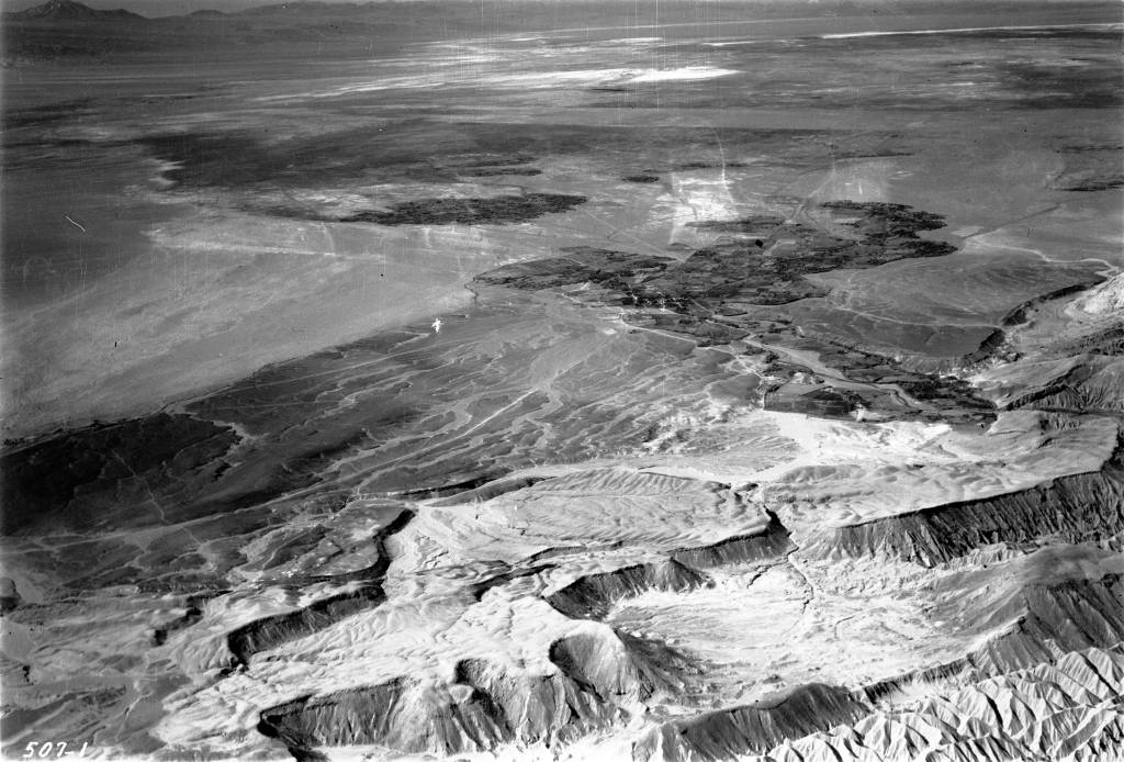
The Salar de Atacama Salt Flat in San Pedro de Atacama, Chile. From Mary Light Leader and Dr. Leaders 1937 Collection of photos. Click the link to see this photo in our Digital Collections!
Now salt is pretty cheap– most people have to worry about eating too much salt. But salt production, and the old methods of salt harvesting, are still a key global industry. And a great backdrop for your vacation pics (with the facility’s permission).
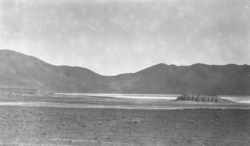
Salar del Rincon in Argentina, from Isaiah Bowman’s 1913 Expedition to the Central Andes. Click the link to see this photo in our Digital Collections!
