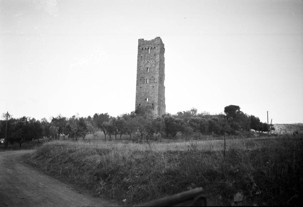
France
The Cassini Atlas
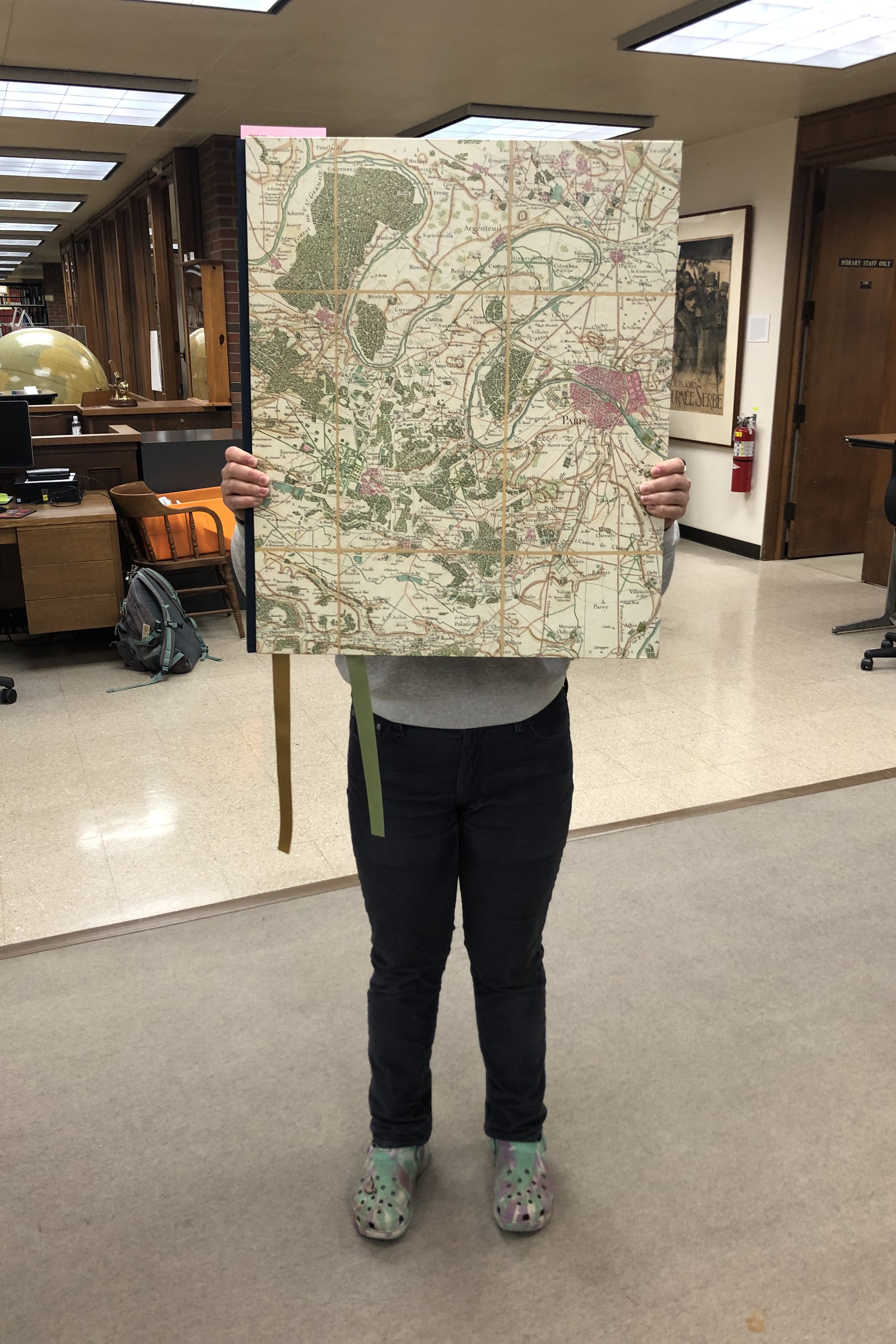
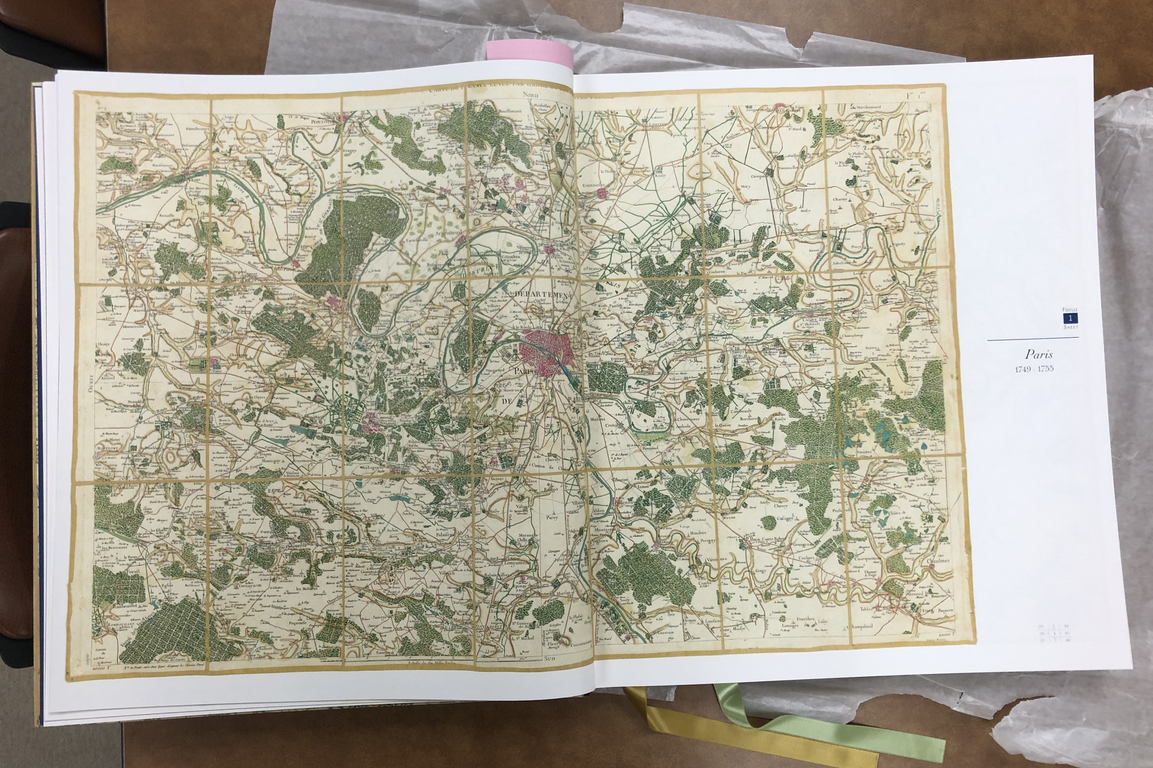
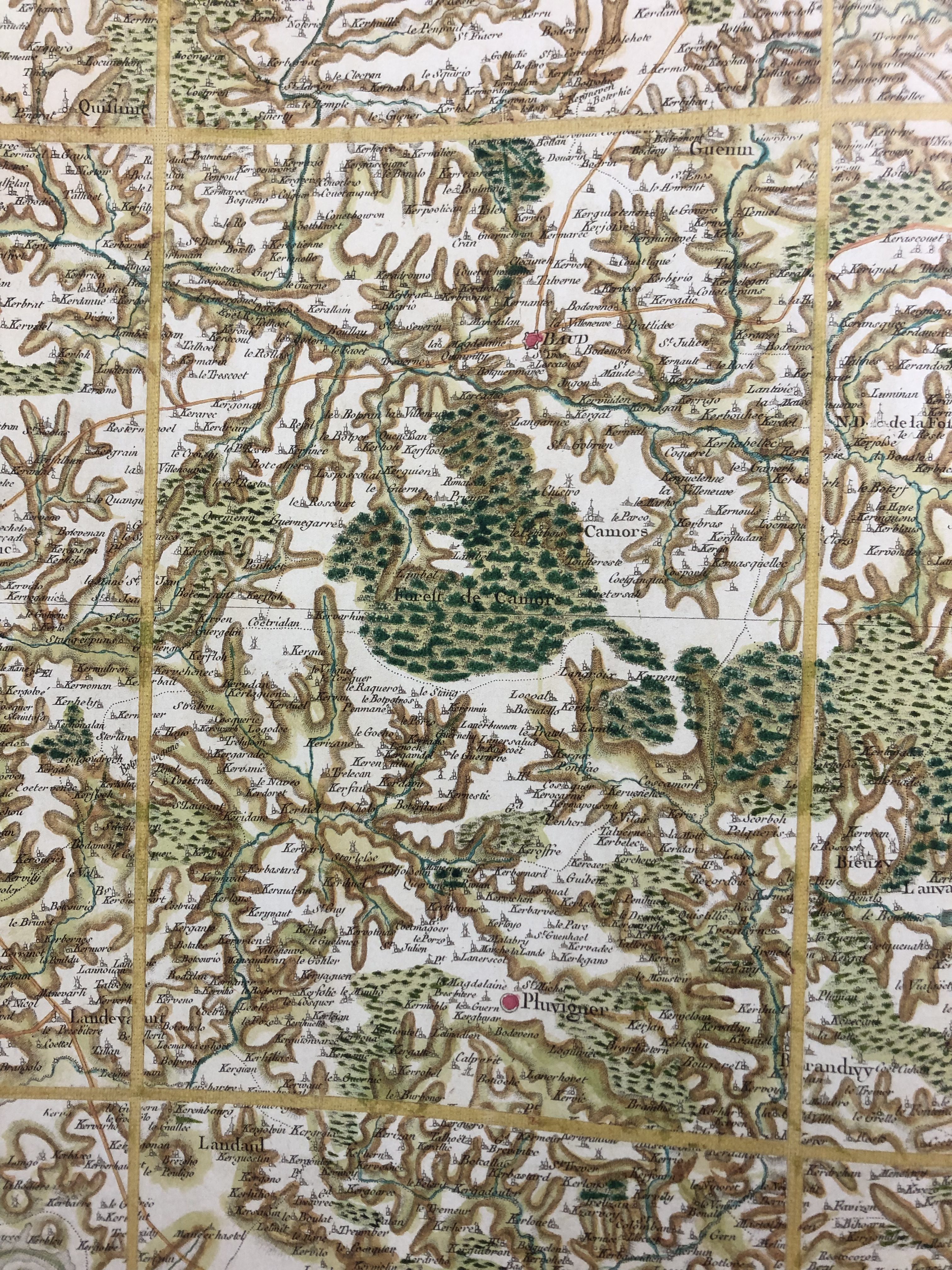
The AGSL recently added a treasure to our collections: a bound reproduction of hand-colored editions of the Cassini Map, released in a limited edition this year. This book is a massive (22.4×26.2 inches when closed!), masterful edition of one of the most influential mapping projects in Western history: the Cassini Family’s map of France.
The Cassini maps are the result of the work of four generations of astronomers, geometers, and cartographers in the Cassini Family. Cassini I, Giovanni Domencio, was an astronomer who worked for Louis XIV at the Paris Observatory. Using his knowledge of the stars and planets’ movements, he was the first to accurately measure distances on Earth using triangulation and geodetic measurements —a method we still use in mapping today! Cassini I also proposed a way to standardize longitude, a necessity for both navigation and conveying distance on maps.
Cassini I, his son, and his grandson all worked on creating a map of France using their new, scientific mapping method, and the result was the first accurate outline map of France, presented to the King in 1744. Cassini III thought that this map would be the end of their project, but Louis XV had bigger plans: he wanted the Cassinis to create detailed, topographic maps of each part of his nation.
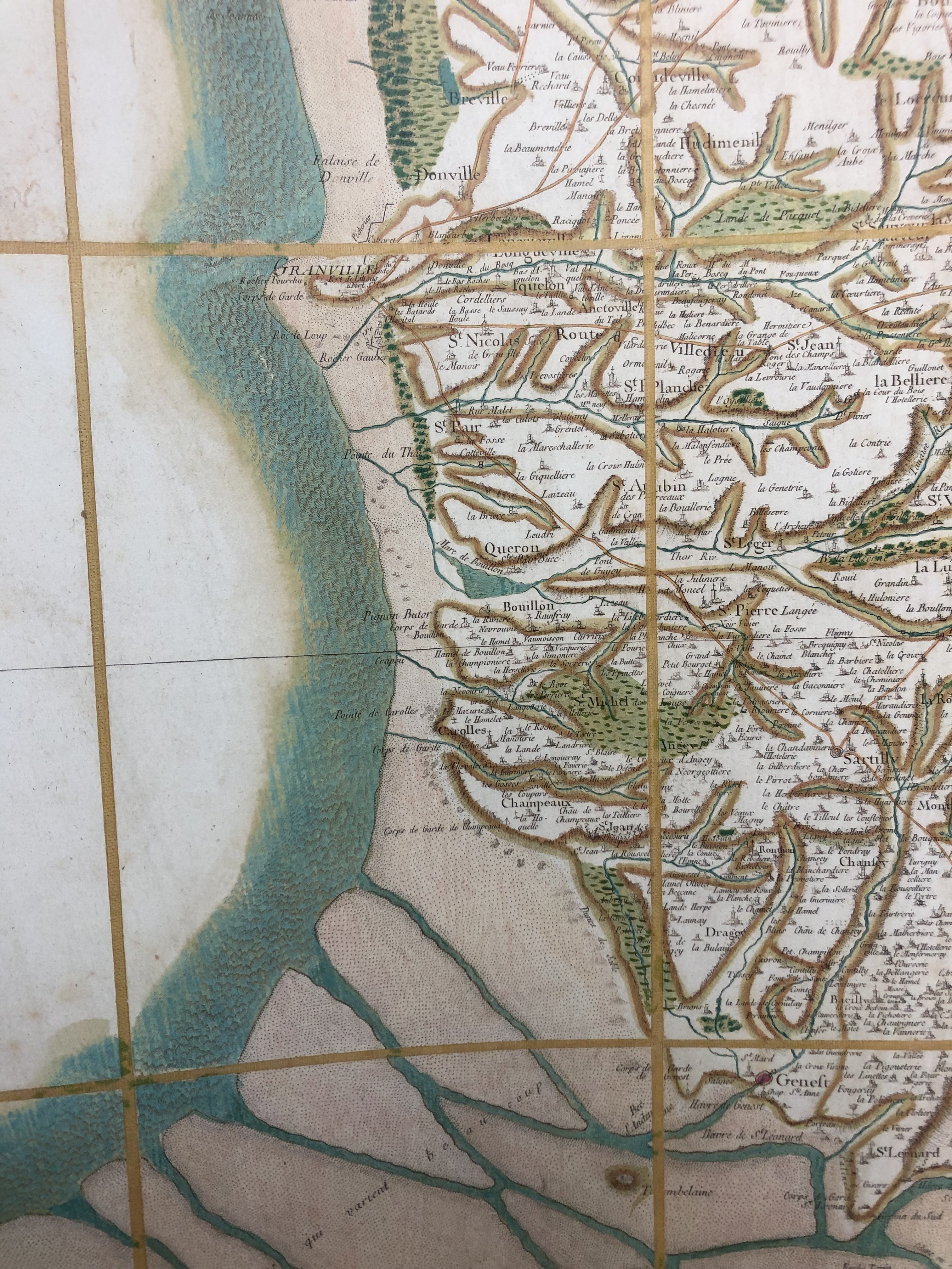
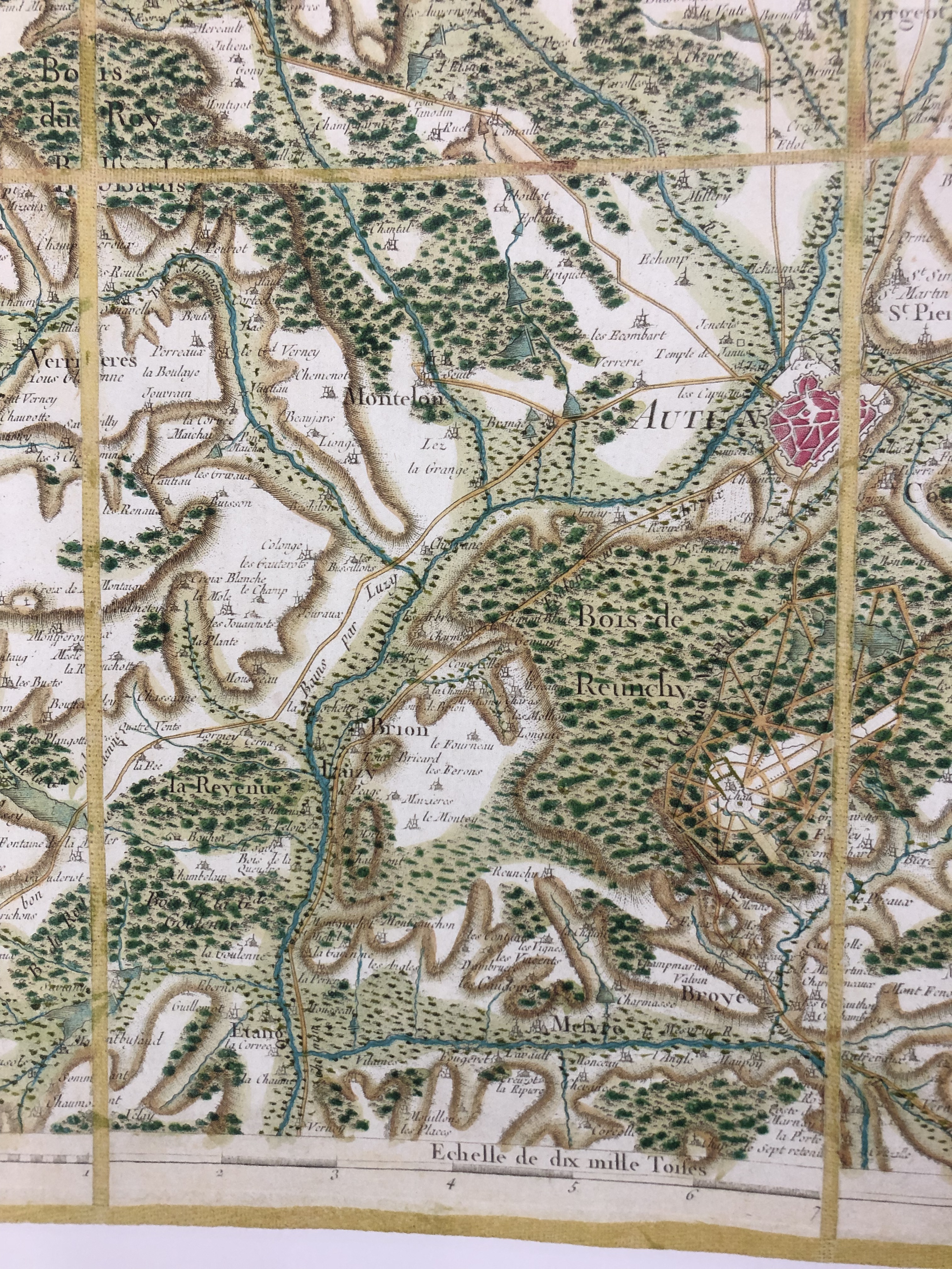
Over about 30 years, this mapping project would give us the maps bound in the atlas just added to the AGSL’s collections. Cassini III and Cassini IV (after 1784) oversaw the process with care: they had ten different teams of surveyors spread out over the country at any given time, asking them to make extensive notes on both the geodetic measurements they were making and topographic and toponymic information like physical landmarks, church locations, and place names to include in the maps. The result was 182 sheets which measured 65×95 centimeters each, covering the entirety of France.
While the maps would have been an impressive point in the history of mapping because of the size of the project and the innovation in measurements alone, they also left an important legacy in the political and social histories of mapping. The Cassinis’ massive mapping endeavor was initially made possible because France’s kings wanted accurate, comprehensive maps to help them govern, quantify, and tax the nation they ruled. To make that possible, the Cassinis not only imposed the lines of measurement on France, they also developed and standardized what historian Jerry Brotton calls a “new language of cartography” through their maps, where standardized symbols, lettering, and notations made the culturally and linguistically diverse county seem like a unified nation—and one happily overseen by a monarch (Brotton, 324).
But before the maps were completed, the French Revolution altered the course of France’s nationhood, and of the Cassinis’ project. In 1793, the National Assembly ‘nationalized’ the map, forbidding the sheets that had already been published from being sold and confiscating all the Cassinis’ engraved plates to prevent more copies being made. From this point on, the maps were seen not just as navigational tools for the public, but as a way to unify the diverse peoples living within the national lines of France so that they could more effectively be governed. It was Napoleon’s Department of War who finished printing the full series of maps in 1815, helping the infamous emperor re-shape France’s identity for himself.
If you’d like to see our stunning copy of the Cassini’s historic atlas for yourself, stop by the AGSL sometime this summer! To read more about the Cassini map, check out chapter 9 of Jerry Brotton’s A History of the World in Twelve Maps or the website of the publisher of our new atlas. Or you can schedule an appointment to view two original sheets of the Cassinis’ map using our Rare Materials Viewing Form!
All the News that’s Fit to Map
By Brendan Dooley
In order to keep troops around the world up to date on each week’s advances during World War II, the U.S. military developed Newsmaps, poster-sized weekly publications of geographically focused battle updates. This was a time, of course, before emails, Tweets and Instagram posts (let alone personal cellphones in every pocket), so for the sailor at sea or soldier in the woods, jungle or desert, posted Newsmaps (often literally attached to posts) might be the only regular news they would see.
The American Geographical Society Library collection recently added 30-plus Newsmap editions, growing its collection of them to 142.
Most of the Newsmaps featured news briefs on the front, keyed to either large maps or smaller insets and/or photos from the relevant theater of operations, and the backs often featured large instructional or propaganada-ish illustrations or large-scale maps detailing particular battle hot zones.
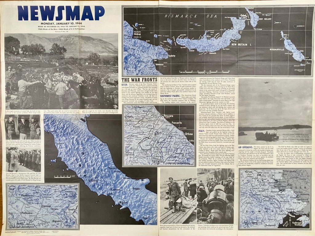
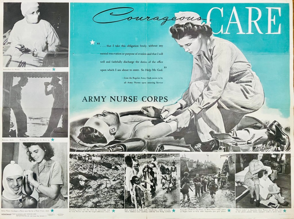

For instance, on the front of the Monday, Jan. 10, 1944, Newsmap (Vol. II, No. 38) are a collection of maps and images to go along with news briefs. The briefs that week covered the Soviet advance against Nazis in Crimea and Poland, U.S. movements against Japan on New Guinea in the Southwest Pacific, U.S. troop gains in central Italy and combined U.S. and R.A.F. bombing raids against Nazi-controlled munitions, plants and materiel in Northern Germany, Berlin and Paris (though no graphics with this last snippet). On the reverse of this Newsmap was a combined illustration and images detailing some ins and outs of the Army Nurse Corps.
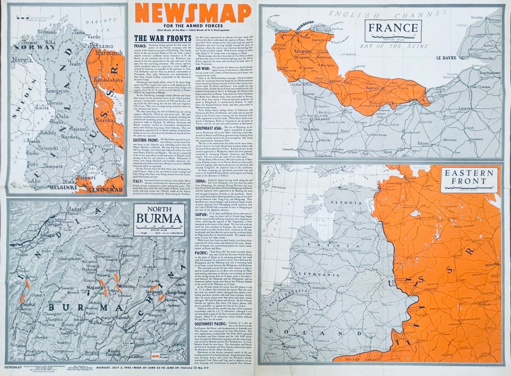
In another example six months later, the front of the Monday, July 3, 1944, Newsmap (Vol. III, No. 11F) includes briefs on the Allied seizure of the port at Cherbourg, France, Soviet advances in Finland, the Allied march north through Italy (now 120-some miles past Rome), bombing raids across Germany, Poland, Italy and Yugoslavia, Chinese and British troops taking Mogaung in Burma, U.S. Marine movements on Saipan, the new “Task Force 58” maneuvers near the Philippines and air operations in the Southwest Pacific. The back of this edition (Vol. III, No. 11B) detailed the importance of Teamwork, whether by army and naval forces in combined attacks or various Allied contingents in joint planning efforts and operations.
While blue was a dominant color of the Jan. 10 Newsmap, July 3 (on the front side) uses orange to highlight interest; from week to week, Newsmaps tended to feature one main color. Of note, the Newsmaps starting within Vol. II began denoting front “F” and back “B” sides to the editions. Additionally, there were Industrial editions of the Newsmaps—sent to U.S.-based munitions plants and military factories—that were usually similar in their news and layout on the front, but did not contain B sides. (More on these Industrial editions in a future post.)
The AGSL physical collection now includes 114 military editions of the Newsmaps across Volumes 1-5 (which ran from 1942-1946), as well as 28 of the Industrial versions from Volumes 2-4. Roughly two dozen of the new military editions and 15 of the Industrial versions were added after a donation from the Milwaukee County Historical Society.
You can come up to view them Monday-Friday, 9 a.m. to 4:30 p.m. in the AGSL on the third floor of the Golda Meir Library; which is open to the public as well as UWM students. (The extent of 212 Newsmaps is also available online at the University of North Texas here.
The Harriet H. Werley Collection: American Army Nurse Serving in the Mediterranean
by Susan Dykes
Every once-in-awhile a collection comes our way that, at first, looks to be unassuming but upon further investigation turns into quite an interesting story. Last fall, the UWM Archives shared with AGSL, a small collection of photographs taken by the late Dr. Harriet H. Werley (b. 1914 – d. 2002), Distinguished Professor in the UWM College of Nursing. The photographs were included in the Harriet H. Werley Papers, a collection that “documents Harriet H. Werley’s long and distinguished nursing career…” Werley took these photographs while she was serving in the United States Army Nurse Corps (ANC), between 1941 and 1944, in the Mediterranean theater during World War II.
Among the 210 photographs, Werley captured the landscape and places of interest in Algeria, France, Italy and Morocco. Although she was in active service, her photos were primarily taken from a tourist’s perspective. She appears in only one image, at the Pitti Palace in Florence, wearing her Army nurse’s uniform and a delightful smile on her face.
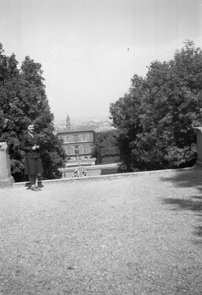
- Italy, Helen H. Werley in front of Pitti Palace in Florence http://collections.lib.uwm.edu/cdm/ref/collection/agseurope/id/6180
Others show a military parade moving through the streets of Oran, Algeria; the Sultan’s Palace in Casablanca, Morocco; ruins of the Great Mosque of Mansoura, Algeria; the Port of Oran and Fort Santa Cruz, Algeria; military nurses touring the gardens at Versailles, France; the waterfront at Cannes, France; an American military Fourth of July fair in Livorno, Italy; an American Military horse race in Pisa, Italy; and many other historic, tourist spots.
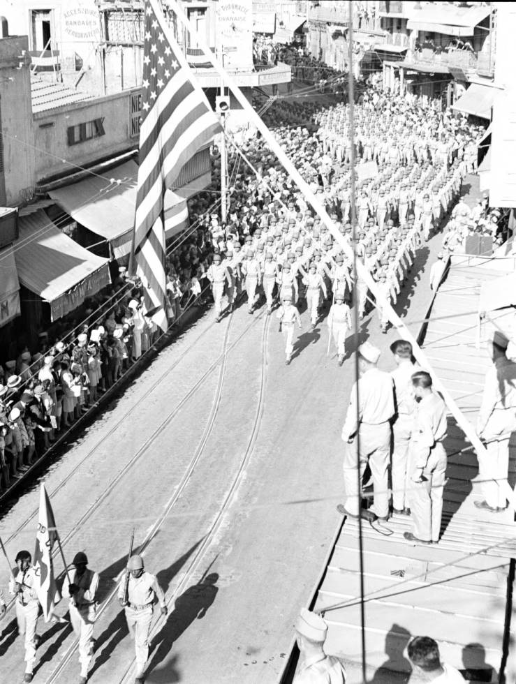
- Algeria, troops marching through Oran street in parade http://collections.lib.uwm.edu/cdm/ref/collection/agsafrica/id/6139
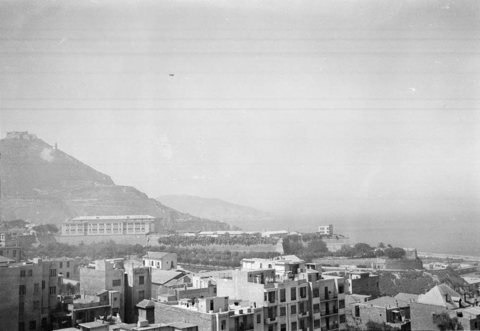
- Algeria, view of Port of Oran and Fort Santa Cruz on hill http://collections.lib.uwm.edu/cdm/ref/collection/agsafrica/id/6176
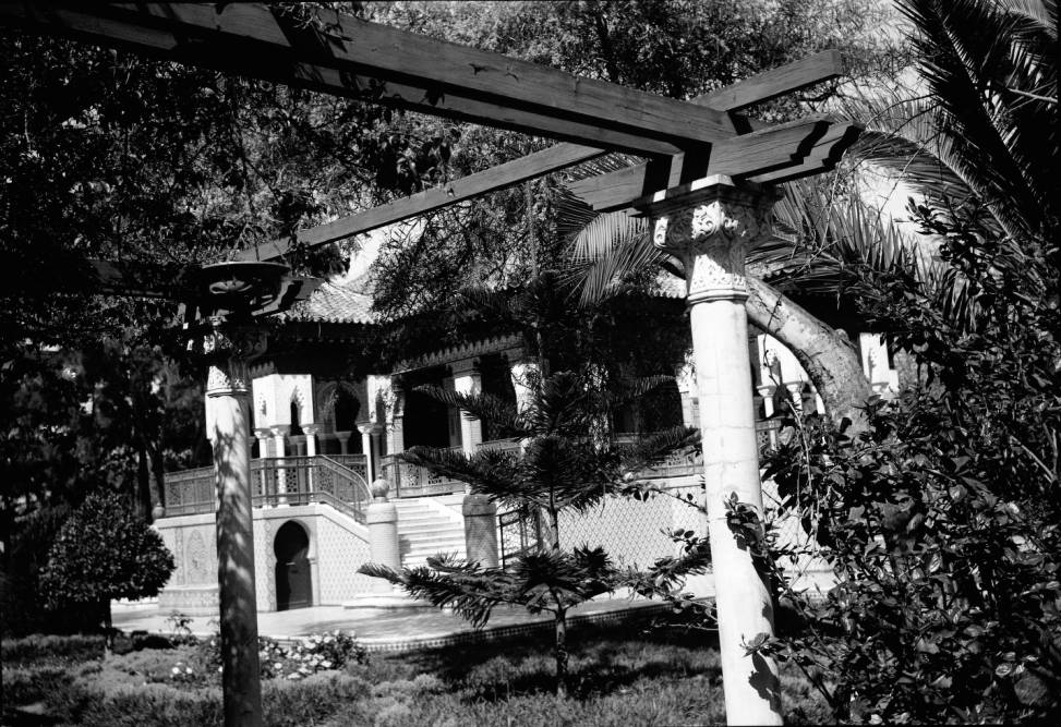
- Morocco, gardens and Sultan’s Palace in Casablanca http://collections.lib.uwm.edu/cdm/ref/collection/agsafrica/id/6146
- Algeria, ruins of Great Mosque of Mansoura in Tlemcen Province http://collections.lib.uwm.edu/cdm/ref/collection/agsafrica/id/6145
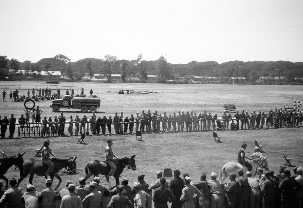
- Italy, American military at horse race in Pisa http://collections.lib.uwm.edu/cdm/ref/collection/agseurope/id/6124
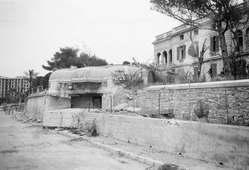
However, even Werley’s tourist eye couldn’t escape the harsh reality of the war. In one photo she captures a cross at the grave of a German soldier buried in Italy. In others she shows how life continued on as people made their way around bombed out buildings in Florence and Livorno, and the bombed out remnants of buildings and abandoned military bunkers in Cannes.
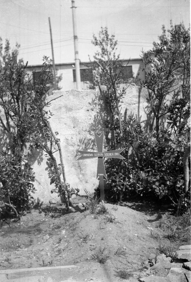
- Italy, grave of German soldier in Livorno http://collections.lib.uwm.edu/cdm/ref/collection/agseurope/id/6122
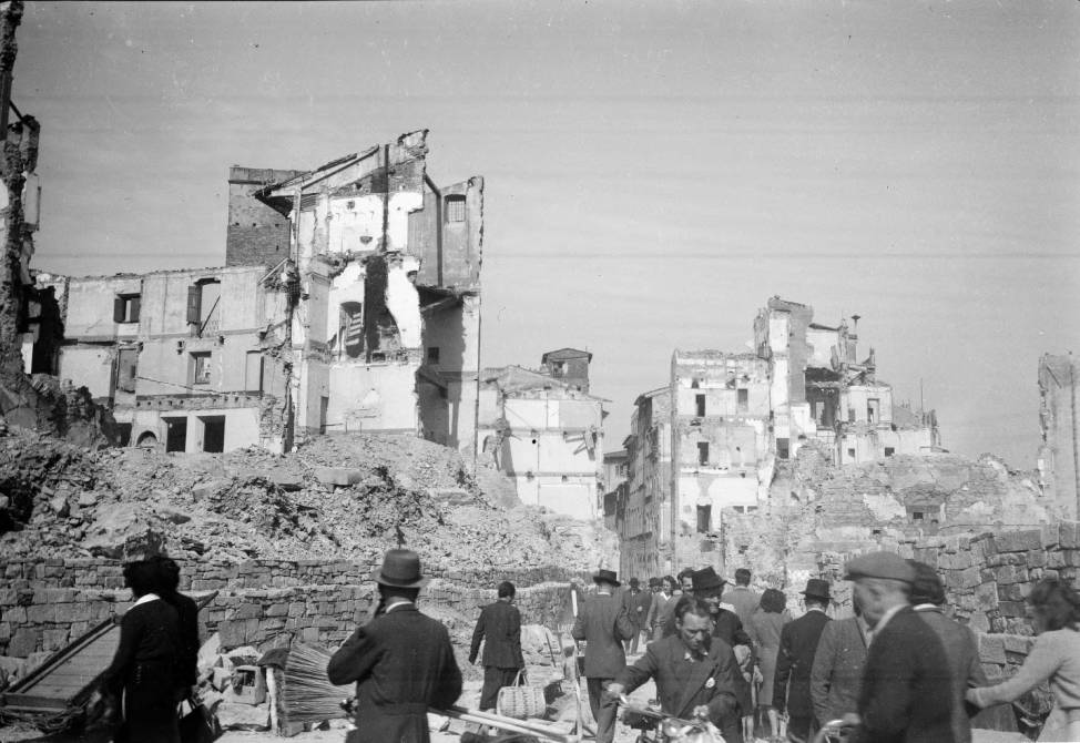
- Italy, people moving through rubble of bombed buildings in Florence http://collections.lib.uwm.edu/cdm/ref/collection/agseurope/id/6178
As a whole, the collection provides a sense of Werley’s experience, as an American nurse serving in a foreign land, documenting her travels and touching upon the overarching reason she was there.
What I find most fascinating about Harriet Werley, is her photographs not only serve to document World War II, they also represent a precursor to what will turn out to be Werley’s extraordinary career in nursing research and health care informatics. After the war, Werley worked in the Office of the Surgeon General, was assigned to the Department of Atomic Casualties Studies at the Walter Reed Army Institute of Research, and then she was appointed Chief of the Department of Nursing. She became Chief Nurse for the U.S. 8th Army Headquarters in Korea in 1962 and retired, as Lieutenant Colonel, from the Army Nurse Corps in 1964.
According to the U.S. Army Medical Department, it was at Walter Reed that she became “dismayed” at the lack of research positions and the realization that nurses were not more involved in studies. As a result she decided to concentrate her career on nursing research. After obtaining her Ph.D. in 1969, she promoted nursing research development through faculty and administrative positions at a variety of universities, including the University of Wisconsin – Milwaukee, became founding editor of Research in Nursing and Health and the Annual Review of Nursing Research, and was instrumental in the development of a Nursing Minimum Data Set (NDMS). As described in the Journal of the American Medical Informatics Association, Werley “…became the first nurse informatician even before the field had been named.” While at the University of Wisconsin – Milwaukee, she participated in IBM sponsored conferences to “identify data processing needs in health care and the potential for computer applications.”
This little, unassuming, yet historically important collection, turned out to be originated by a woman who, according to Laurie K Glass RN, PhD, FAAN, Professor Emerita and Director, Center for Nursing History, UW- Milwaukee College of Nursing, “…pioneered the use of computers and informatics in the health care arena.” We are pleased to be able to make available Harriet H. Werley’s images in the AGSL collections.
See all of Harriet H. Werley’s images in the American Geographical Society Library Digital Photo Archive:
See the finding aid for the Harriet H. Werley Papers:
http://digital.library.wisc.edu/1711.dl/wiarchives.uw-mil-uwmmss0284
Sources:
A salute to one of our own. Harriet Helen Werley. (n.d.) U. S. Army Medical Department, Office of Medical History. U.S. Army. Retrieved from http://history.amedd.army.mil/ancwebsite/articles/harrietwerley.html
Ozbolt JG. Harriet Helen Werley, PhD, RN, FAAN, FACMI: Lieutenant Colonel, U.S. Army (Ret.) October 12, 1914—October 14, 2002. Journal of the American Medical Informatics Association : JAMIA. 2003;10(2):224-225. doi:10.1197/jamia.M1276. Retrieved from https://www.ncbi.nlm.nih.gov/pmc/articles/PMC150375/
