World War II
All the News that’s Fit to Map
By Brendan Dooley
In order to keep troops around the world up to date on each week’s advances during World War II, the U.S. military developed Newsmaps, poster-sized weekly publications of geographically focused battle updates. This was a time, of course, before emails, Tweets and Instagram posts (let alone personal cellphones in every pocket), so for the sailor at sea or soldier in the woods, jungle or desert, posted Newsmaps (often literally attached to posts) might be the only regular news they would see.
The American Geographical Society Library collection recently added 30-plus Newsmap editions, growing its collection of them to 142.
Most of the Newsmaps featured news briefs on the front, keyed to either large maps or smaller insets and/or photos from the relevant theater of operations, and the backs often featured large instructional or propaganada-ish illustrations or large-scale maps detailing particular battle hot zones.
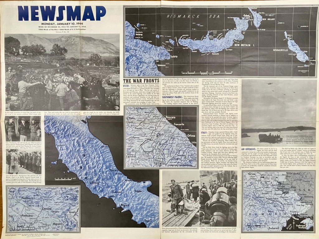
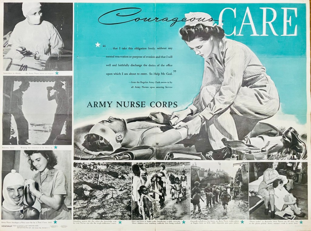

For instance, on the front of the Monday, Jan. 10, 1944, Newsmap (Vol. II, No. 38) are a collection of maps and images to go along with news briefs. The briefs that week covered the Soviet advance against Nazis in Crimea and Poland, U.S. movements against Japan on New Guinea in the Southwest Pacific, U.S. troop gains in central Italy and combined U.S. and R.A.F. bombing raids against Nazi-controlled munitions, plants and materiel in Northern Germany, Berlin and Paris (though no graphics with this last snippet). On the reverse of this Newsmap was a combined illustration and images detailing some ins and outs of the Army Nurse Corps.
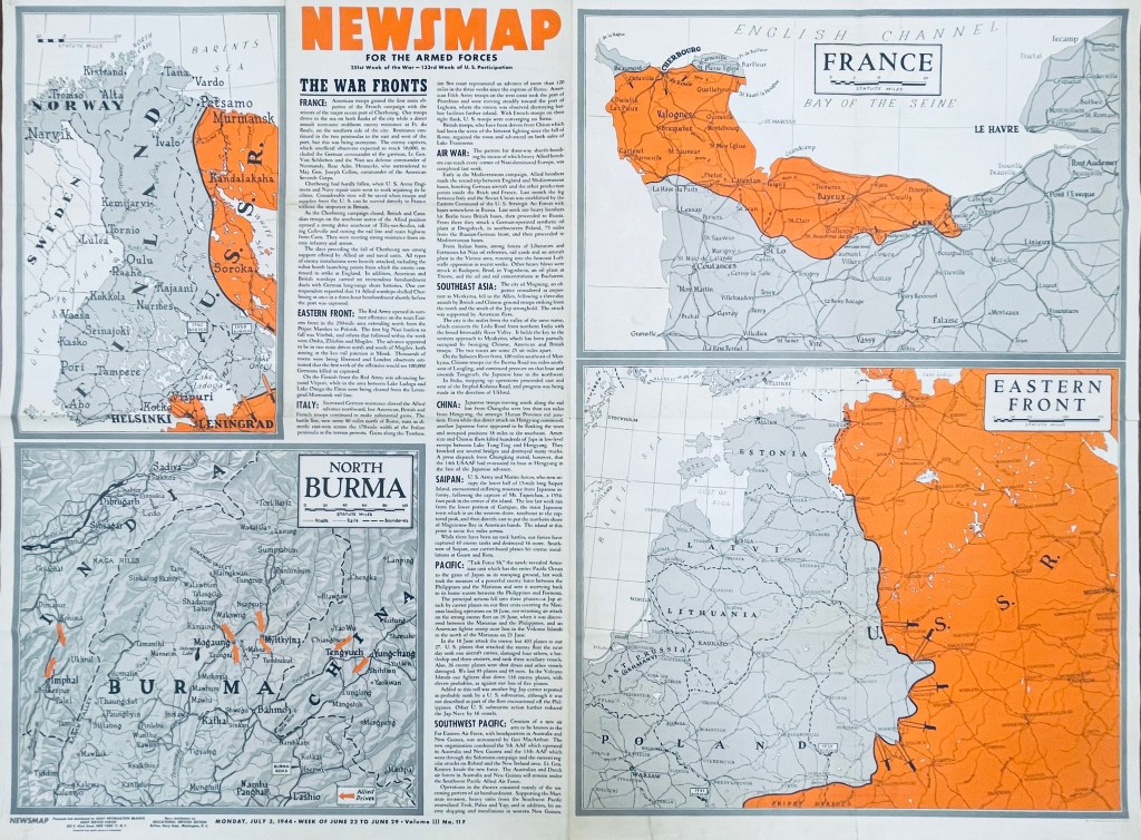
In another example six months later, the front of the Monday, July 3, 1944, Newsmap (Vol. III, No. 11F) includes briefs on the Allied seizure of the port at Cherbourg, France, Soviet advances in Finland, the Allied march north through Italy (now 120-some miles past Rome), bombing raids across Germany, Poland, Italy and Yugoslavia, Chinese and British troops taking Mogaung in Burma, U.S. Marine movements on Saipan, the new “Task Force 58” maneuvers near the Philippines and air operations in the Southwest Pacific. The back of this edition (Vol. III, No. 11B) detailed the importance of Teamwork, whether by army and naval forces in combined attacks or various Allied contingents in joint planning efforts and operations.
While blue was a dominant color of the Jan. 10 Newsmap, July 3 (on the front side) uses orange to highlight interest; from week to week, Newsmaps tended to feature one main color. Of note, the Newsmaps starting within Vol. II began denoting front “F” and back “B” sides to the editions. Additionally, there were Industrial editions of the Newsmaps—sent to U.S.-based munitions plants and military factories—that were usually similar in their news and layout on the front, but did not contain B sides. (More on these Industrial editions in a future post.)
The AGSL physical collection now includes 114 military editions of the Newsmaps across Volumes 1-5 (which ran from 1942-1946), as well as 28 of the Industrial versions from Volumes 2-4. Roughly two dozen of the new military editions and 15 of the Industrial versions were added after a donation from the Milwaukee County Historical Society.
You can come up to view them Monday-Friday, 9 a.m. to 4:30 p.m. in the AGSL on the third floor of the Golda Meir Library; which is open to the public as well as UWM students. (The extent of 212 Newsmaps is also available online at the University of North Texas here.
