AGS-New York
American Geographical Society Councilman Roosevelt and his Geographer
By Lauren Maddox
The American Geographical Society’s council has been host to some famous and interesting members– Rockefellers and Tiffanys, even. But even with a cast of fascinating characters, it’s hard to outshine Franklin D. Roosevelt.
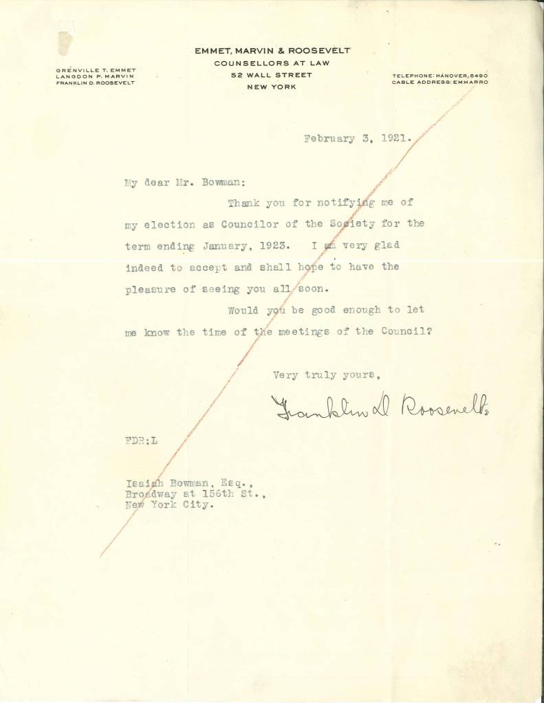
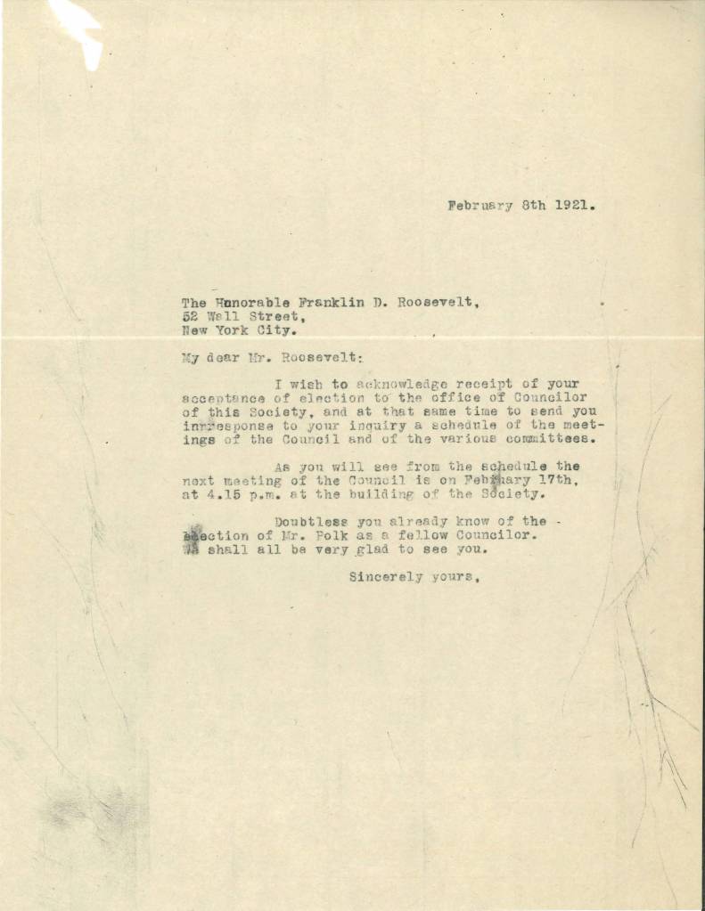
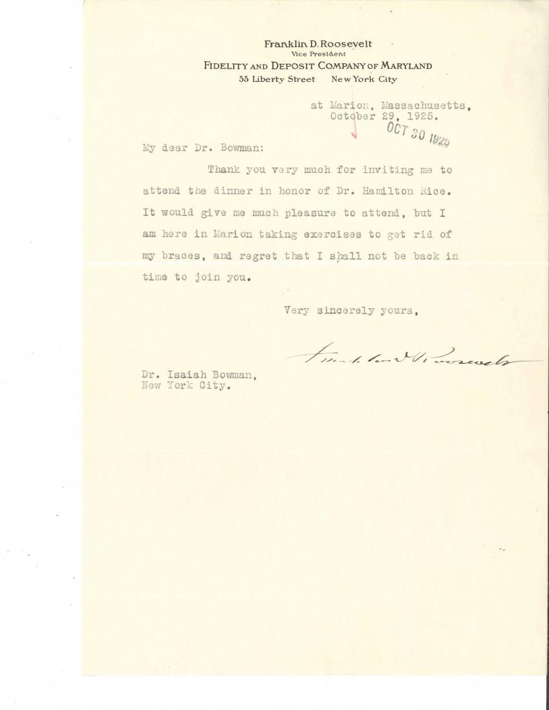
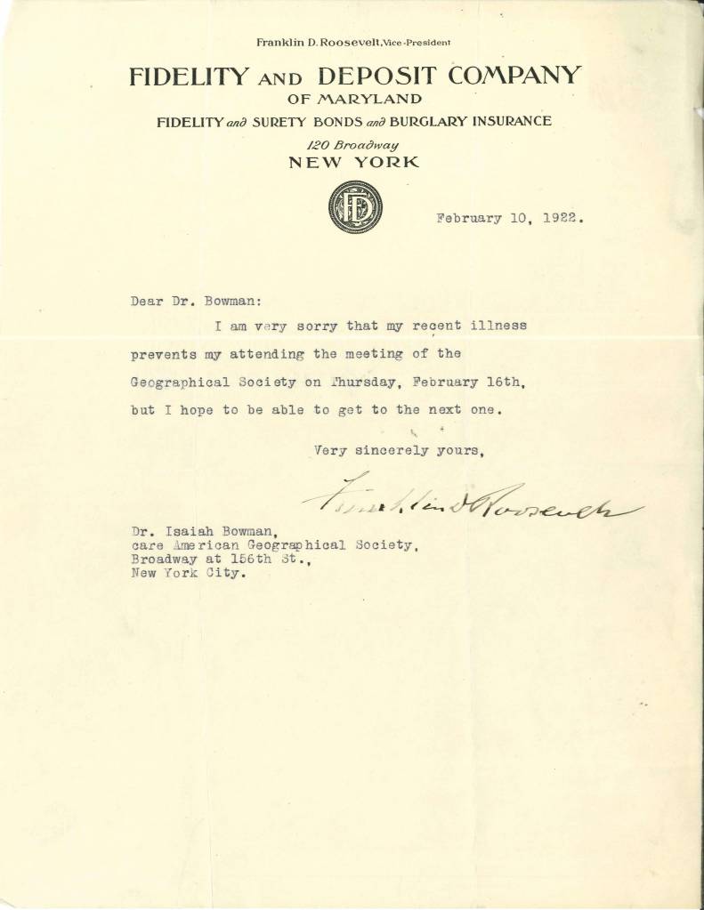
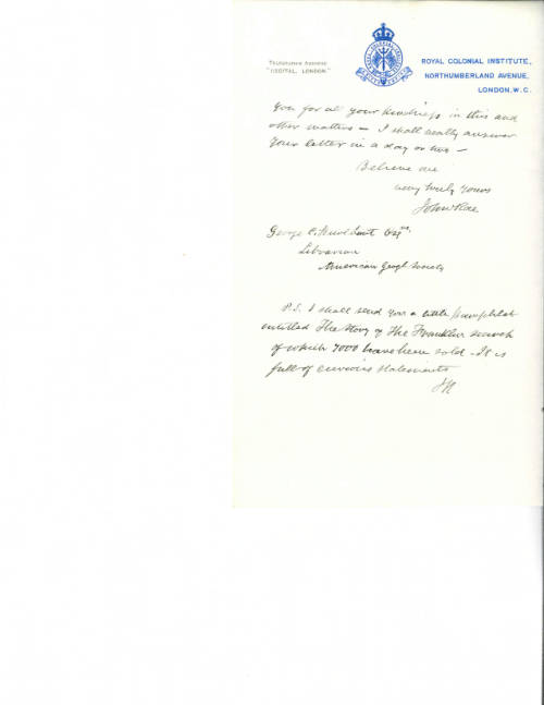
Through Roosevelt and Bowman’s letters, we can track the progression of Roosevelt’s health and his political career. Roosevelt often sent letters apologizing for his absence from AGS Council meetings, due to travel and health problems both.
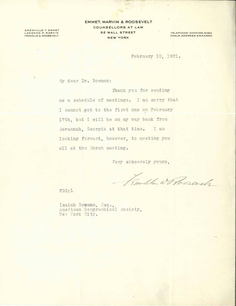
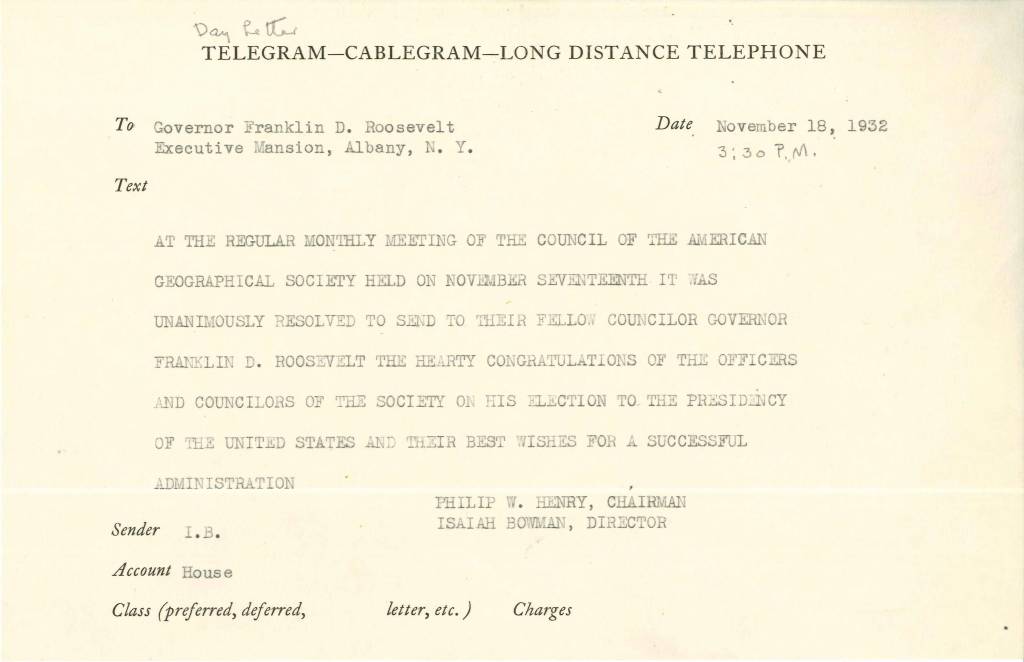
As Roosevelt’s political career progressed, his ability to attend council meetings and participate in Society work was greatly hampered. He was elected governor and then president during his tenure on the council! In 1932, he was forced to resign from his position as council member in light of his impending Presidency. Roosevelt served on the American Geographical Society’s council for more than 10 years– he was a busy man but always believed in the Society’s mission and continued to think kindly of them after his obligations to his office prevented him from participating on the council.

Roosevelt’s relationship with the AGS of New York didn’t end with his resignation from the council, however. The two men continued to correspond, and Roosevelt made Isaiah Bowman a State Department adviser during World War II.
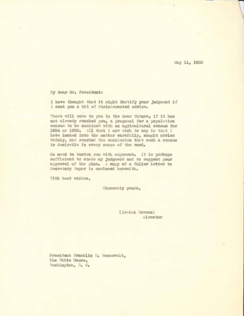
This wasn’t the first time Isaiah Bowman had gained the confidence of a President; in 1917, he offered the AGS’s resources to the government and became close to Woodrow Wilson. His insight played a key role in how territory was distributed as part of the Paris Peace Conference in 1919. It wasn’t surprising that FDR would keep Bowman and his geographical and cartographic resources in mind during World War II. As an adviser in the State Department, Bowman participated in the Dumbarton Oaks Conference and the San Francisco Conference, which established the United Nations. During this time, Bowman was still President of John Hopkins, and he established the Applied Physics Laboratory, where technologies like the Proximity Fuze were created. Bowman was a useful man for the president to rely on.
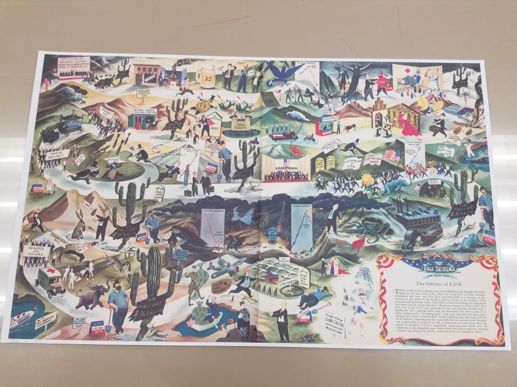
“The Odyssey of FDR” is an unflattering map of FDR’s political exploits up to 1939.
It was, however, surprising that Roosevelt enlisted Bowman to help find and establish refuge for Jewish emigrants displaced by the war. Bowman was a known antisemite who put policies into place at John Hopkins to limit the number of Jewish students admitted to the school. Neil Smith’s American Empire: Roosevelt’s Geographer and the Prelude to Globalization revealed Bowman’s prejudiced policies at John Hopkins and his treatment of Jewish students there. Unsurprisingly, Bowman’s search for refuge for Jewish emigrants lead him to five different countries, not one of which was the United States.
The collection of Roosevelt’s and Bowman’s letters in the AGSL collections help track the rise of Roosevelt to power, and the years-long relationship he maintained with the American Geographical Society and its leadership. Reading through their letters lets us watch as history unfolds before us all over again– and reminds us of the private lives that influence our public histories.
You can find more about Roosevelt and Bowman at the Archives of the American Geographical Society digital collection: https://uwm.edu/lib-collections/agsny/
The Lost Franklin Expedition and the Early Years of the AGS
By Lauren Maddox
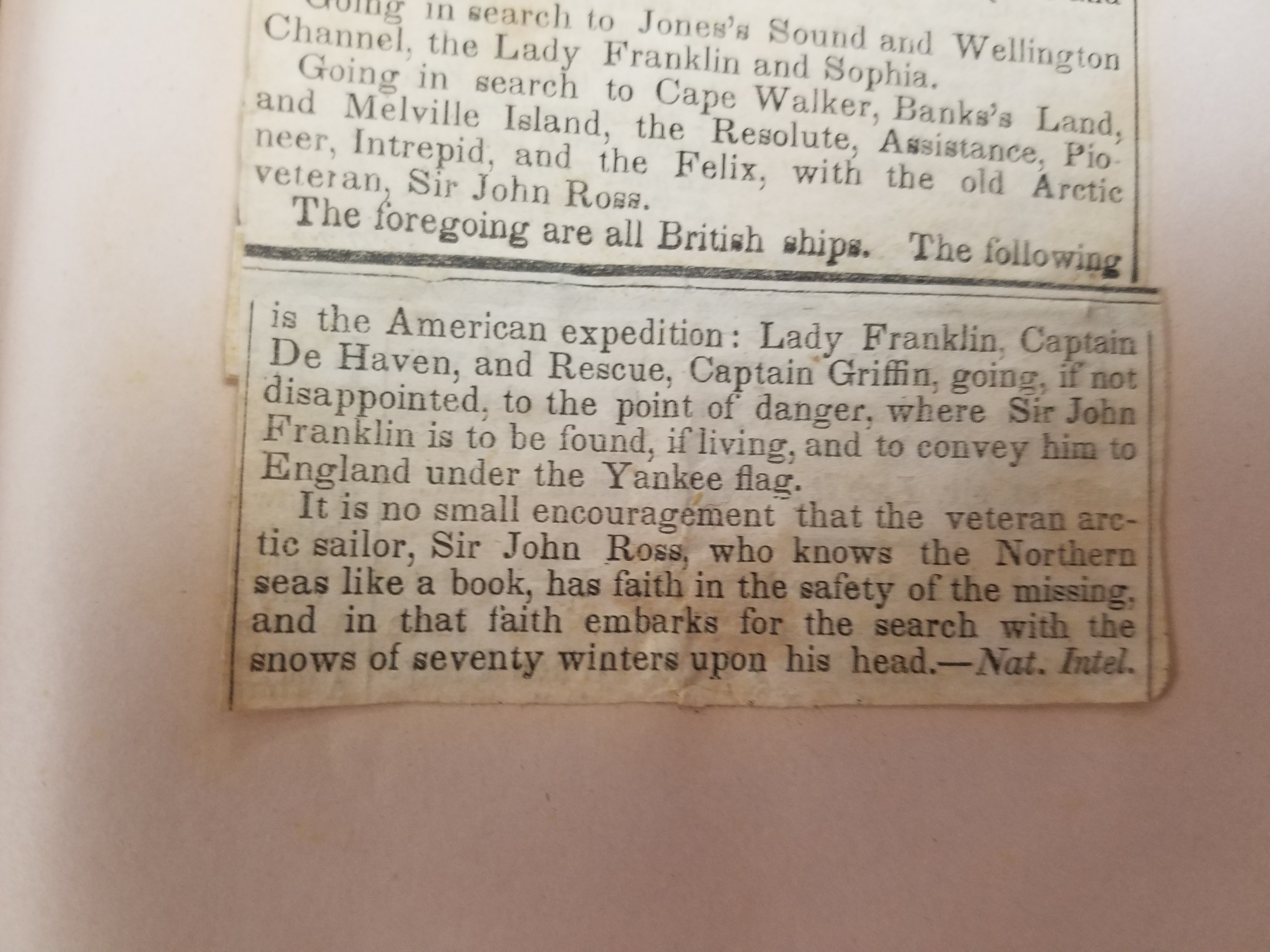
On May 19th, 1845, John Franklin, Francis Crozier, and the crews of the HMS Terror and HMS Erebus set out from Greenhithe, England on an expedition intended to explore previously unexplored areas of the Canadian Arctic and to complete the Northwest Passage. Lady Jane Franklin, with no word from Franklin and concerned for the welfare of her husband, began petitioning the British Admiralty to begin searching for the lost expedition as soon as 1847.
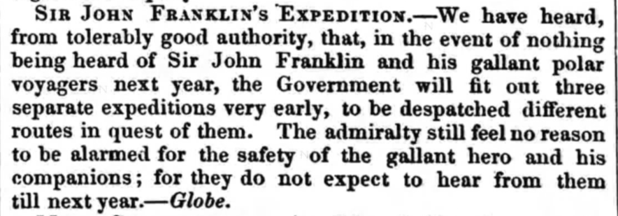
Click the link to see this excerpt From the November 13, 1847 Edition of Sheffield and Rotherham Independent
The Franklin expedition had been supplied with three years worth of canned goods to supplement the men’s hunting efforts; the British Admiralty assumed that the crew could comfortably survive another year before needing rescue. Unfortunately, the food provisioning contract had been awarded to Stephen Goldner just weeks before the Terror and Erebus set out. In his rush to fulfill the order of 8,000 cans of food, Goldner failed to check the quality of lead soldering on the tins. The food spoiled quickly, leaving the crew without proper provisions on their journey and unable to hunt once the ship was trapped in ice.
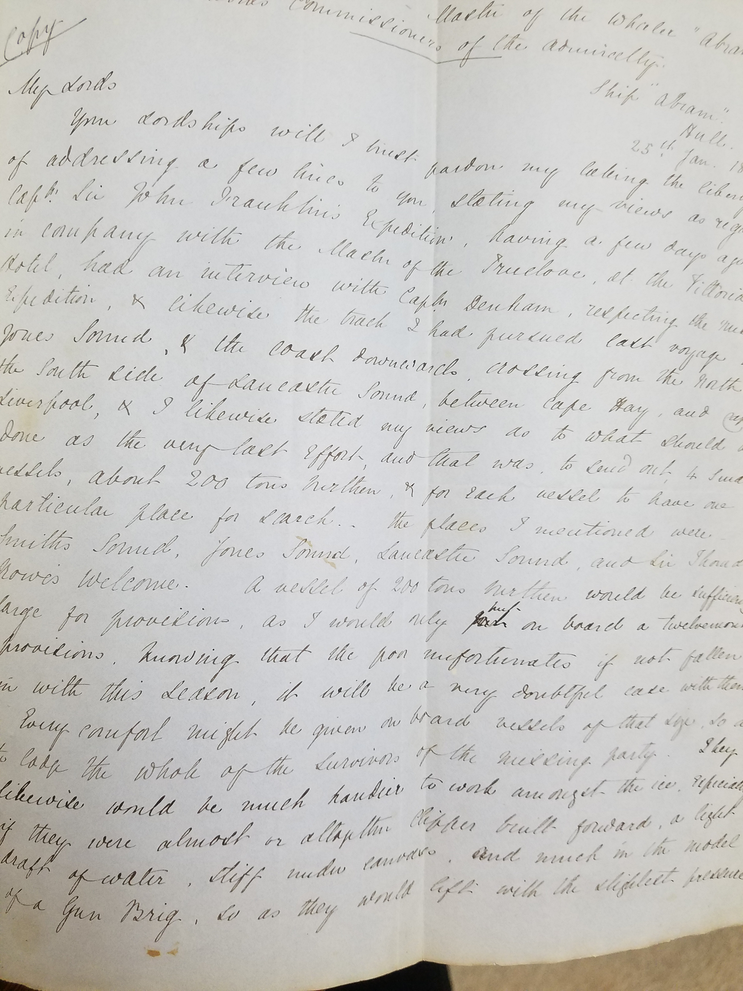
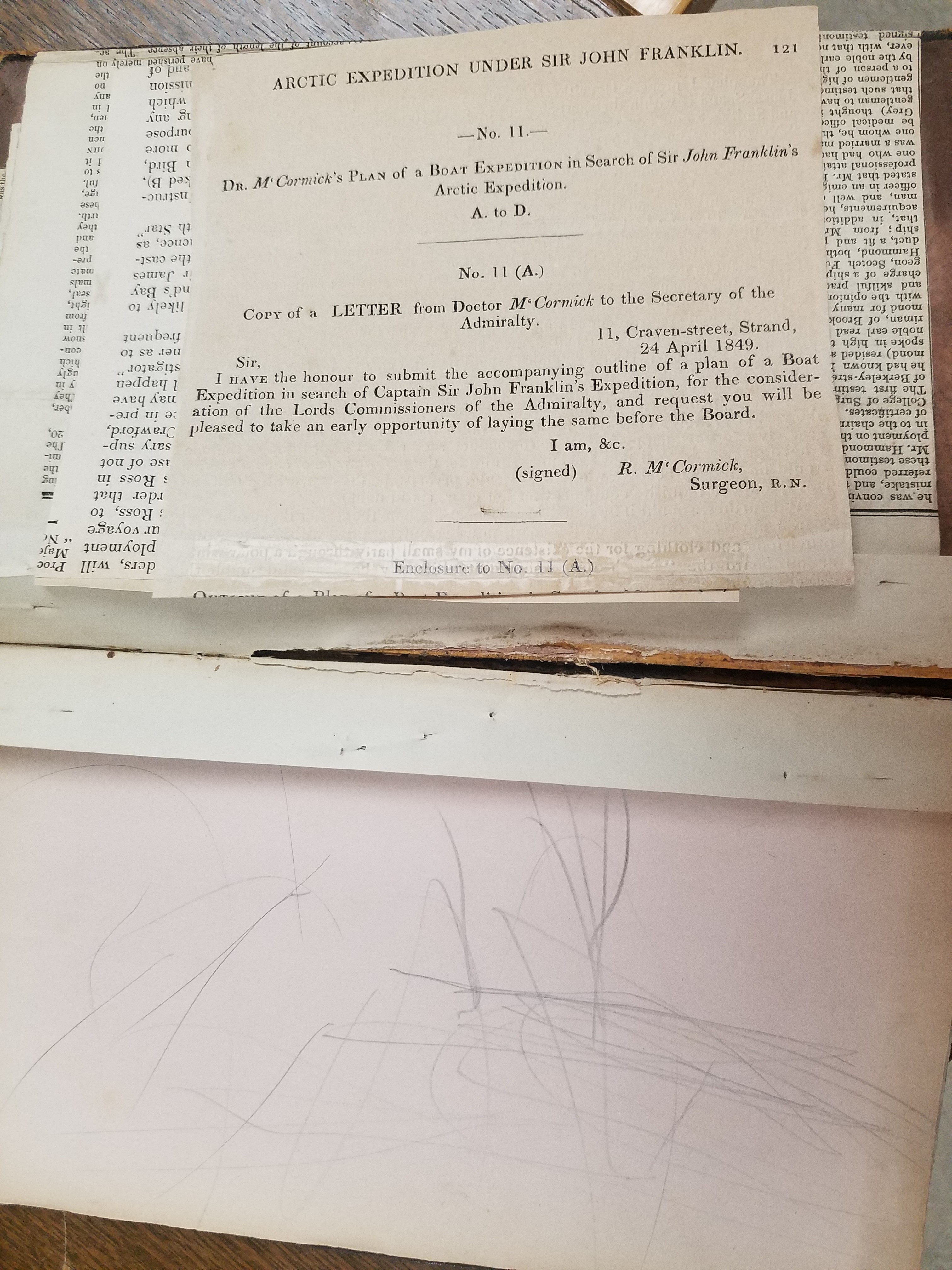
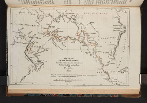
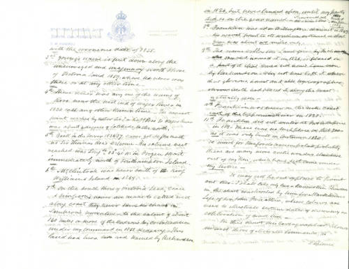
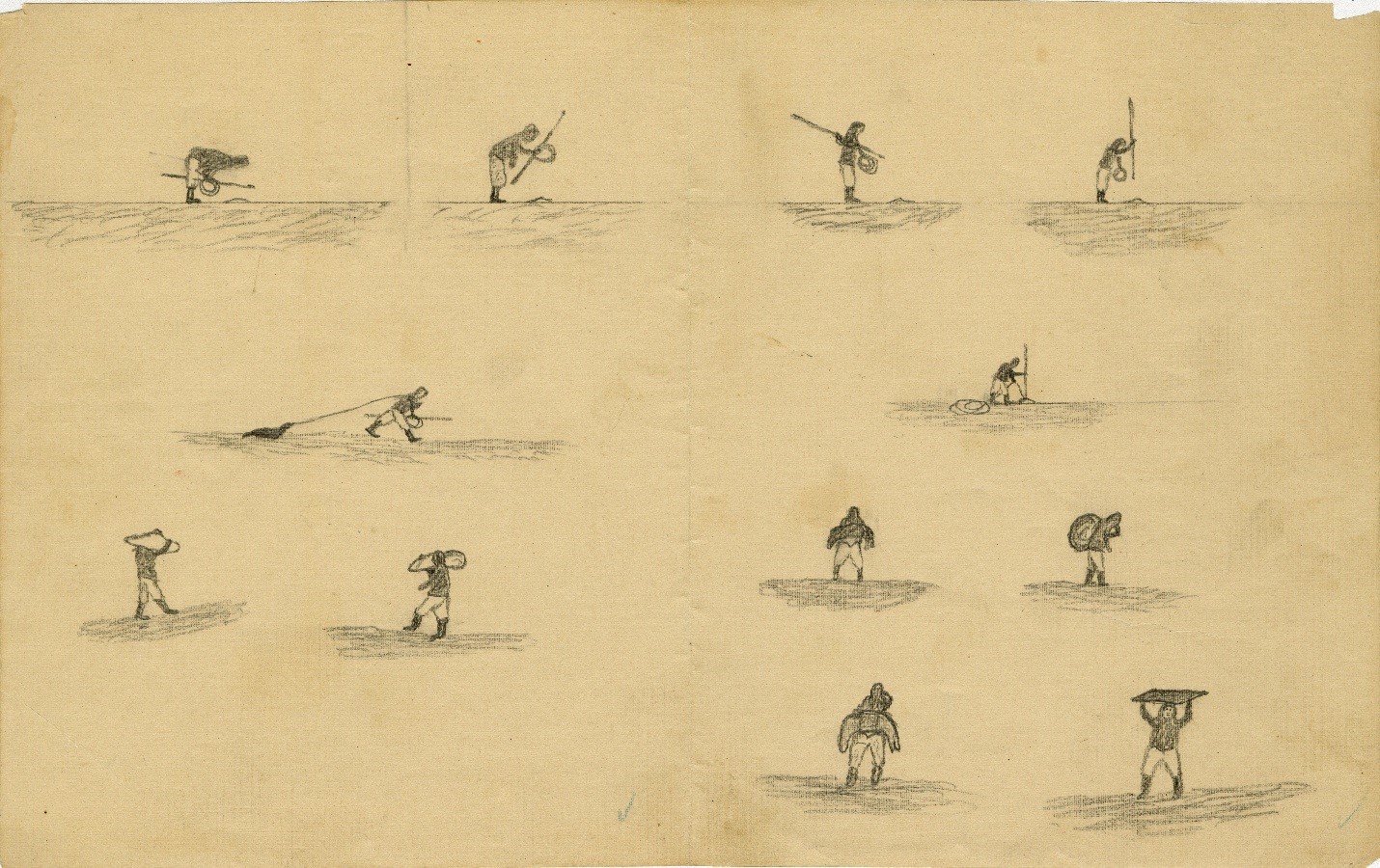
Official preparations for the rescue effort began in 1847– the Admiralty chose the three most likely routes that the Franklin expedition might have taken. The ships were likely icebound, so an overland rescue expedition would have to be arranged. Sir John Richardson, a seasoned arctic explorer who had traveled with Franklin on previous expeditions, chose a route along the Mackenzie River and the shores of Victoria Land and Wollaston Land, now Victoria Island and Wollaston Peninsula, which seemed most consistent with Franklin’s original travel plans. John Rae, another arctic explorer well-known for his prowess at safe and efficient overland travel, as well as his rapport with local indigenous peoples, was included in the rescue plans.

Click the link to see these Tracings of Dr. Rae’s Discoveries in the Arctic, 1851 from the AGS-NY Archives 
Flip Side
After travelling together overland and gathering information from locals, the men wintered in Fort Confidence; using the fort as a base of operations, Rae continued his search around the areas between the Mackenzie and Coppermine Rivers. In 1849, the two men decided that Rae would take the single boat and continue the journey on their intended route with a smaller crew of six men. Richardson returned to Liverpool on November 6, 1849. The above tracings of John Rae’s sketch maps outline his discoveries in 1851. Rae would continue charting the area and searching for signs Franklin’s lost expedition into 1854, but during this time, several other search expeditions were launched, including Henry Grinnell’s.
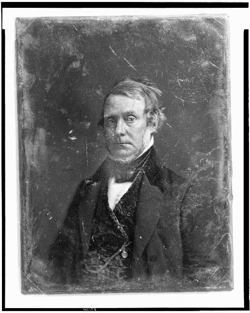
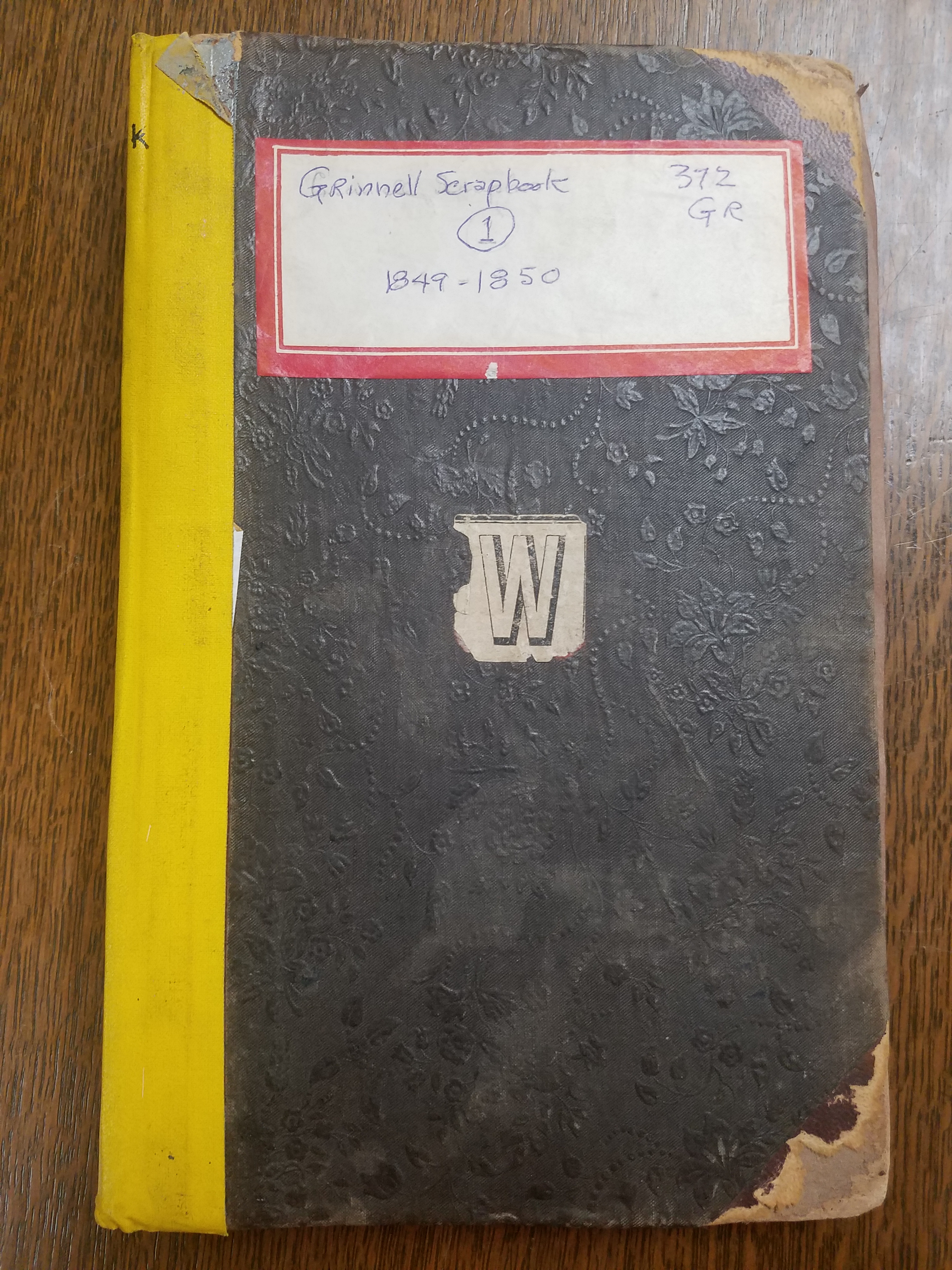
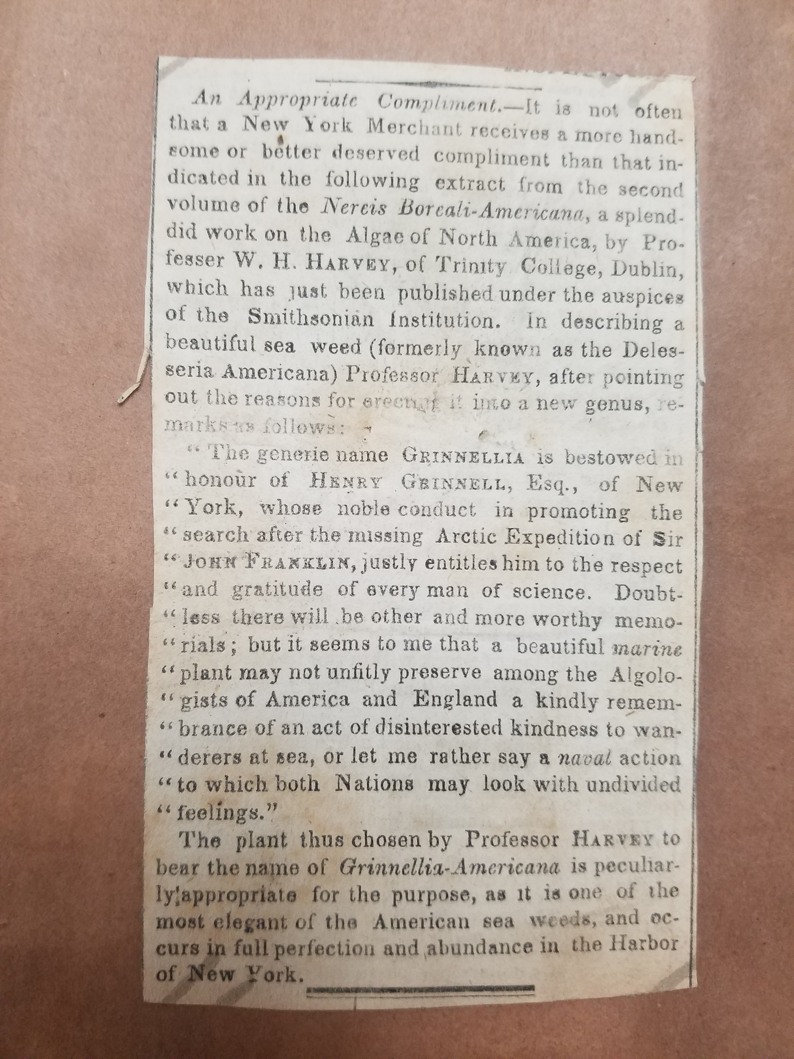
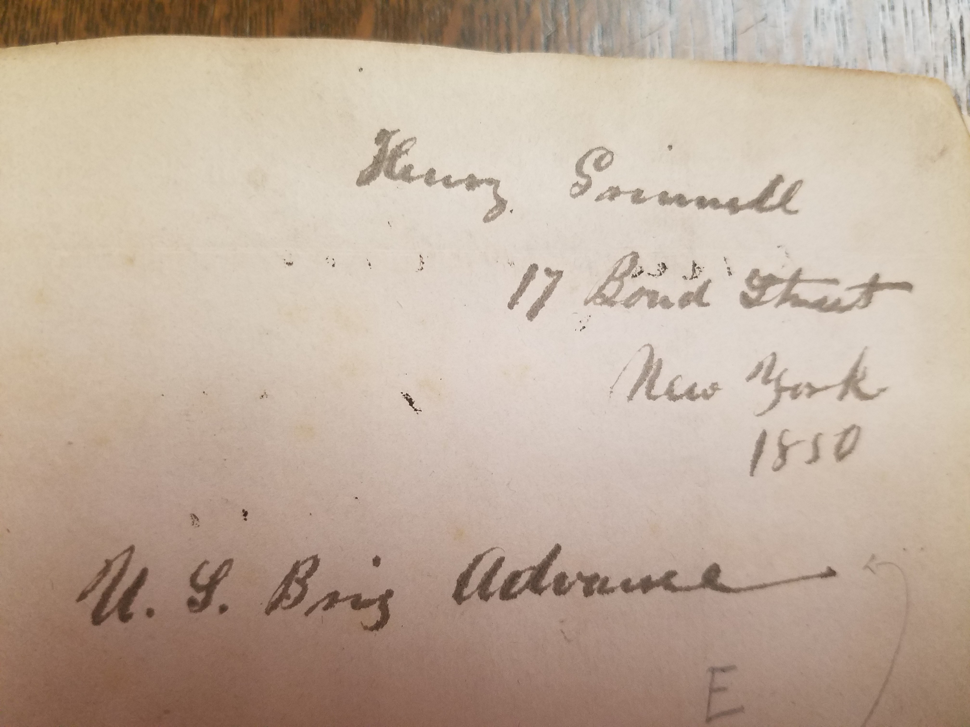
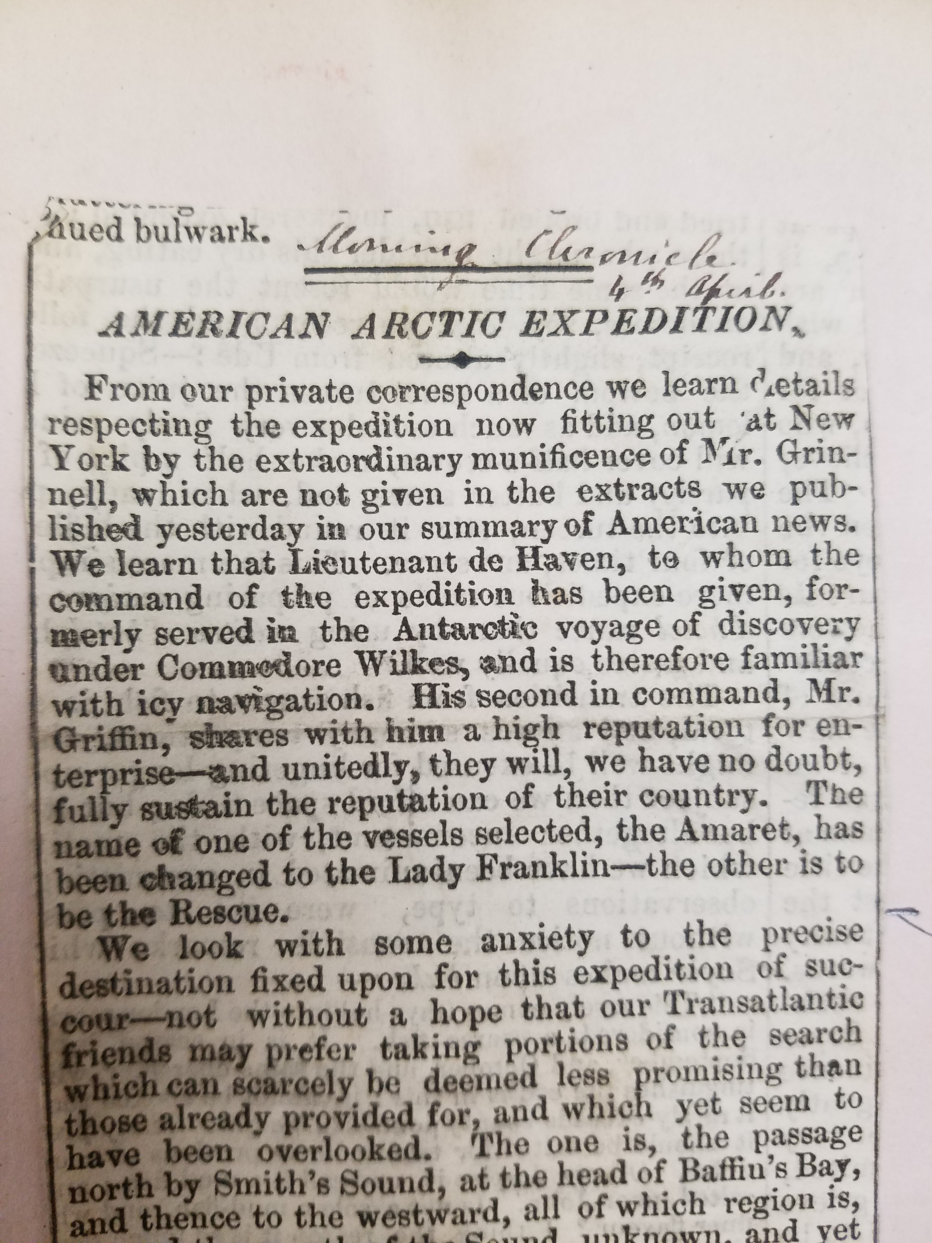
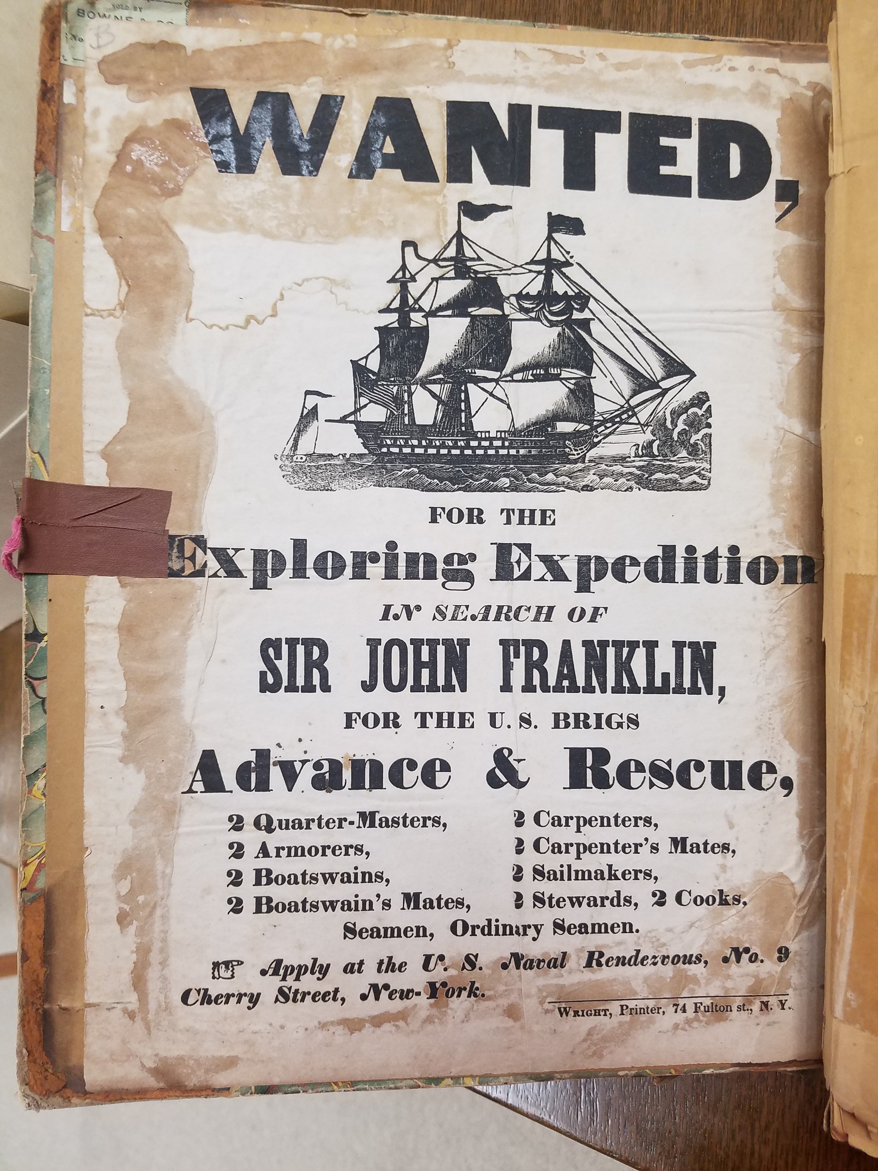
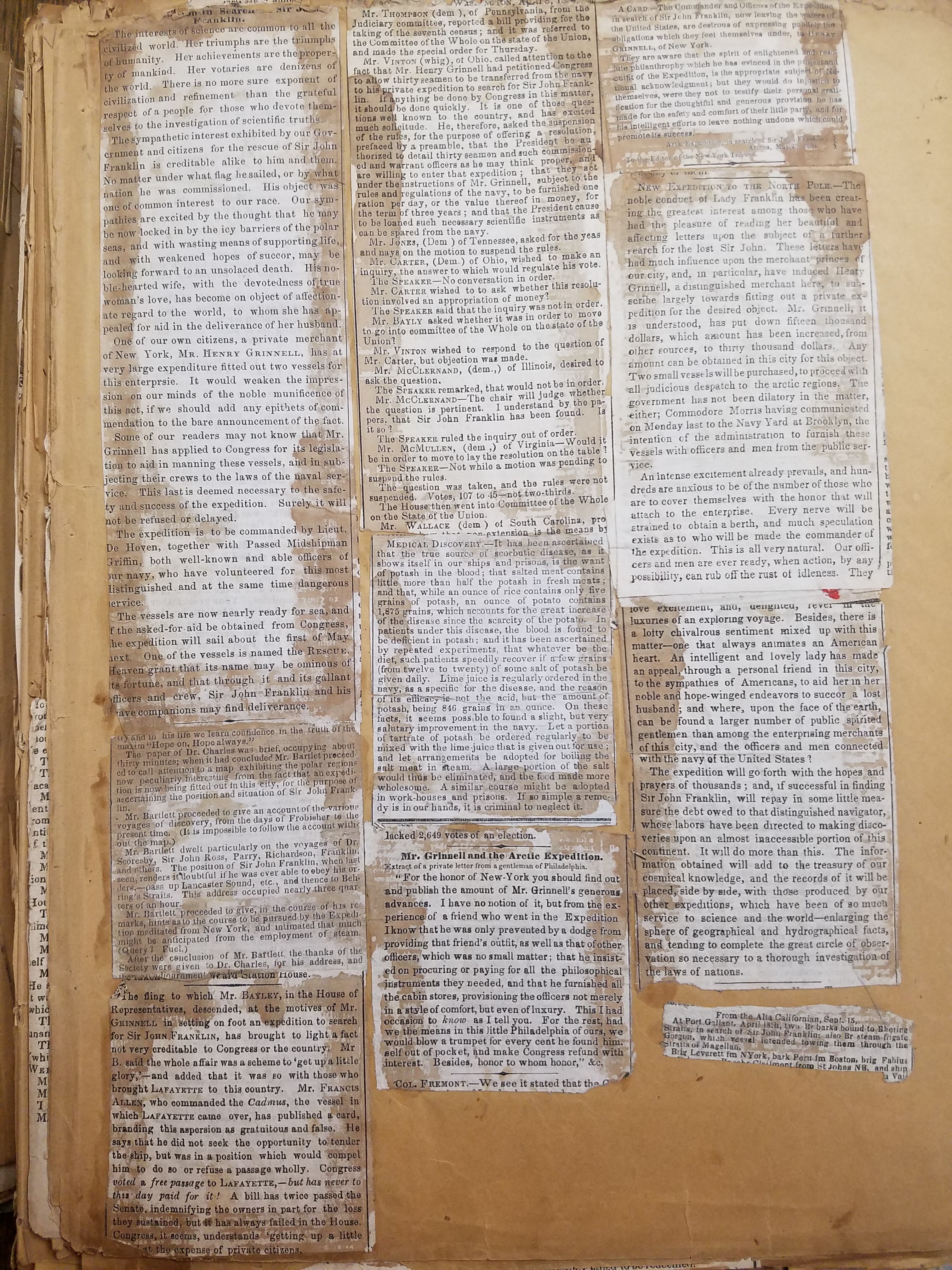
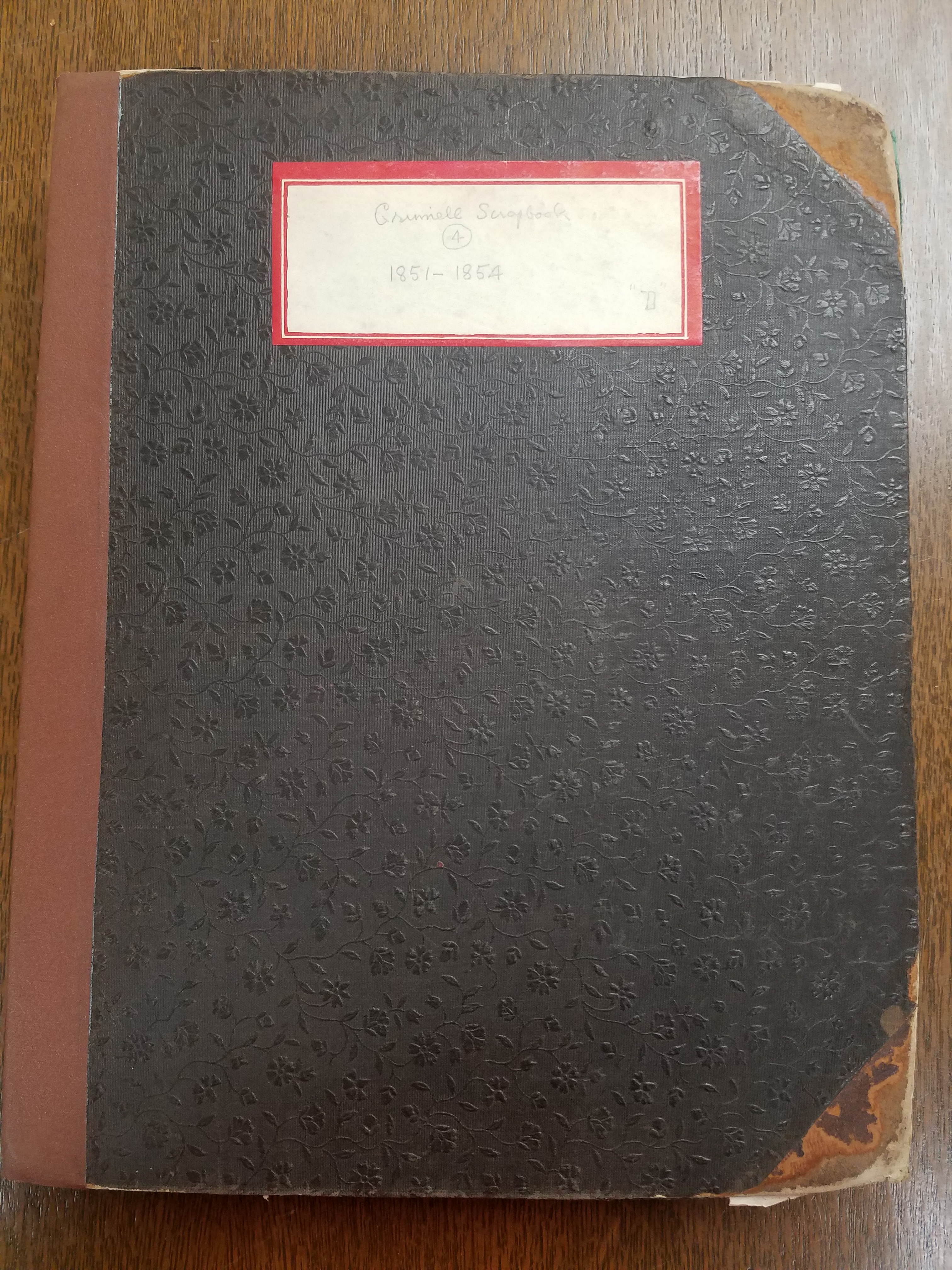
The Lost Franklin expedition would turn out to be instrumental in the foundation of the American Geographical Society. Henry Grinnell, wealthy merchant and the first elected president of the AGS, retired in 1850 to dedicate his life to philanthropy. Grinnell was a passionate follower of the search for John Franklin; in its collection, the AGSL has several scrapbooks of newspaper clippings following the story collected by Grinnell himself. The scrapbooks contain materials on previous expeditions as well as Grinnell’s own. He was particularly moved by Lady Jane Franklin’s continued appeals to American President Zachary Taylor for help finding her lost husband; when Congress hesitated to provide the aid required for a rescue expedition, Grinnell himself bought and refitted two brigs for arctic travel. He loaned these ships to the US Navy for use in an arctic exploration expedition in the hopes that John Franklin, or some trace of what happened to him, could be found.
Click the link to see Chart Exhibiting Discoveries of the First Grinnell Expedition submitted by Kane in our Digital Archives
Click to see this Unidentified Notebook, 1854 found aboard the HMS Resolute after it was abandoned in the search for Franklin in our Digital Collections
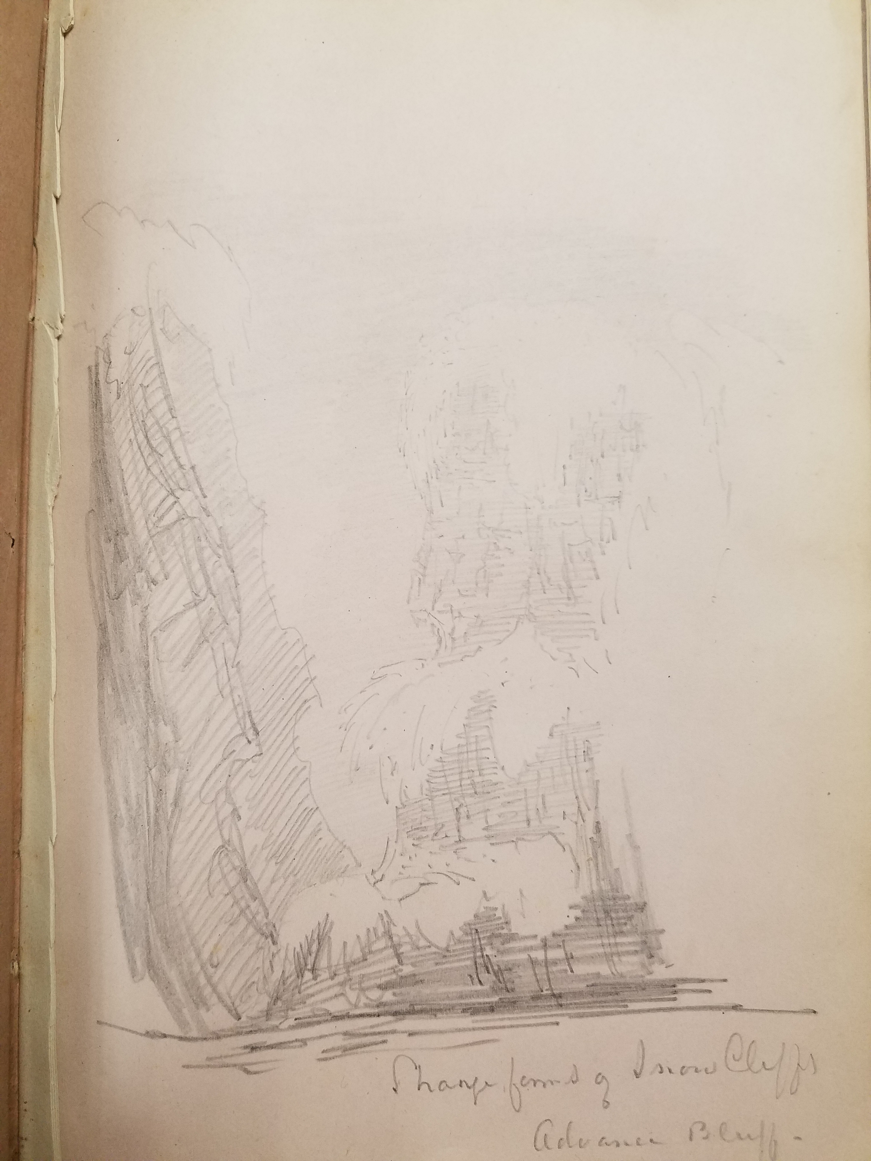
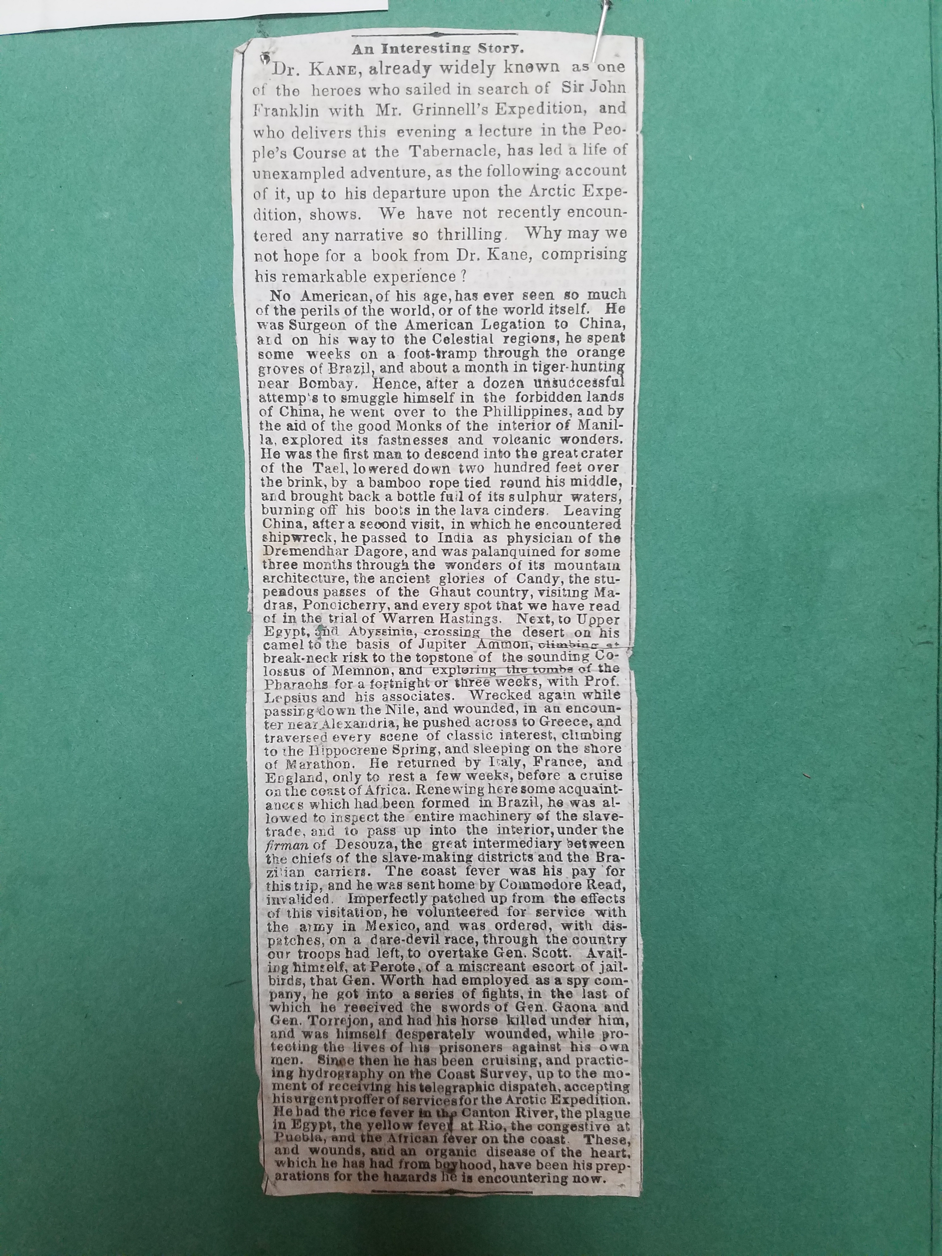
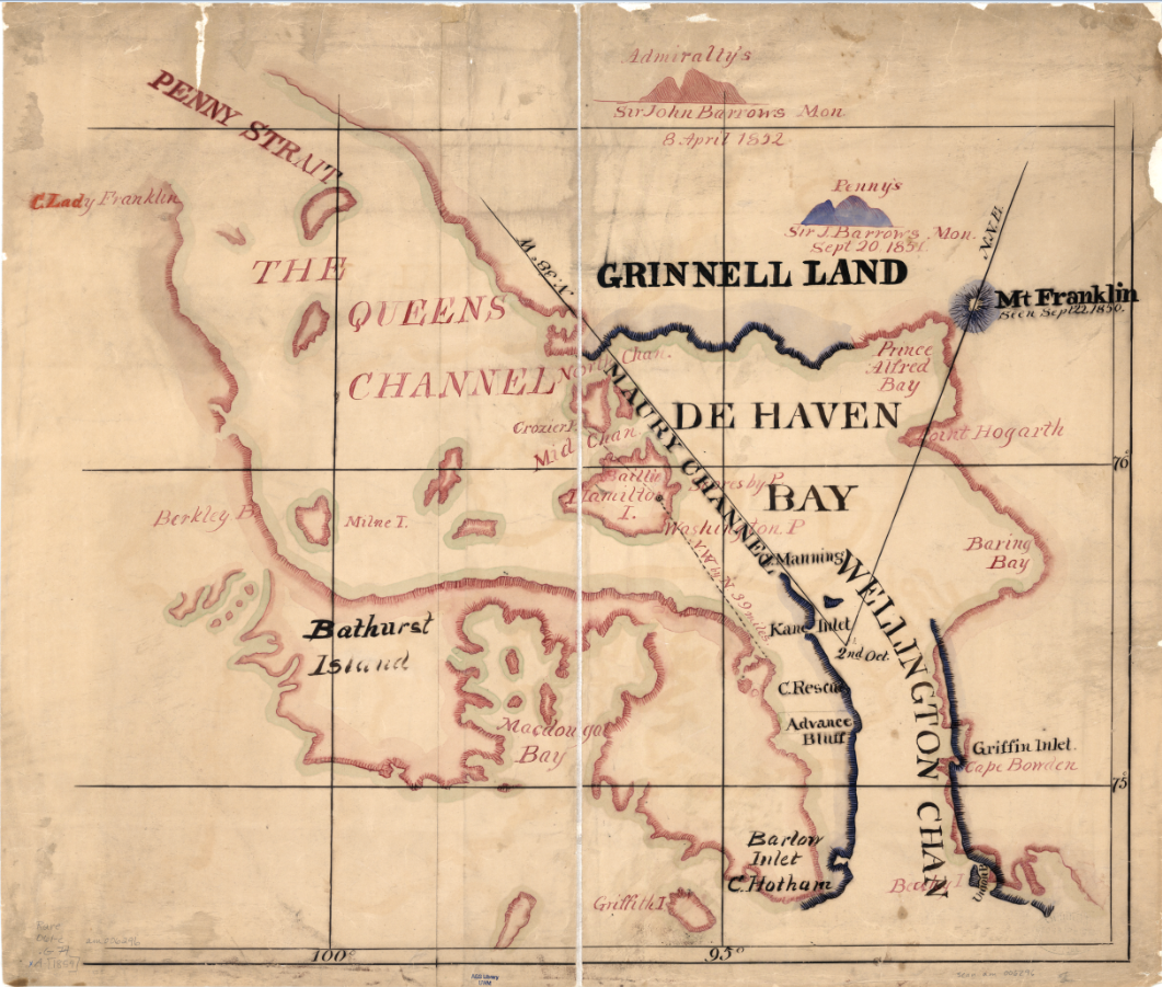
The First Grinnell expedition set out in the summer of 1850– the same year preliminary talks about founding an American geographical society began. Geography in the Making: The American Geographical Society 1851-1951 intimates in a single sentence that, though there is no “positive evidence” that Grinnell’s polar interests influence the foundation of the Society, the timing of his arctic expeditions and his election as president seem to suggest it. The expedition, lead by Edwin de Haven and including Elisha Kent Kane, set out in May and would continue their search through ice and bad weather for a year. They met with British search parties, including the first expedition on the HMS Resolute lead by, and joined forces to comb the area thoroughly– during the winter, however, the Advance and the Rescue were separated and icebound. Elisha Kane submitted a chart with a revised survey of the coast of Greenland and the party’s escape route south. This chart also shows the newly christened Grinnell Land, which De Haven named in honor of the expedition’s patron. After being forced to winter over in the ice, it was decided that the two ships should return with what news they had, though it was not very much: all the expedition had discovered about the lost Franklin party was their first camp, abandoned, and three graves on Beechy Island.
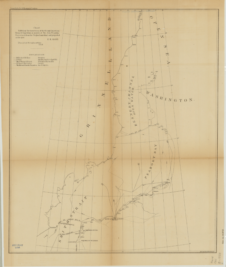
Click the link to see this Chart Exhibiting Discoveries of the Second Grinnell Expedition by Kane in our Digital Collections
Unsatisfied with the results of the first expedition, Grinnell began planning a second search for Franklin. Elisha Kane would lead the expedition north of Beechy Island where Franklin’s first camp was found and into the open summer polar sea. The search plan was approved by the American Geographical Society in New York and financially supported by Grinnell and other philanthropists. Isaac Israel Hayes, another well-known name in the AGSL archives, signed onto the expedition as surgeon. The small crew set out on the Advance on May 30th, 1853 with meager provisions and research instruments. This expedition would shed no new light of the disappearance of Franklin’s expedition, but it would go farther north than any expedition before it, setting a new record, and allow Kane to gather useful geographical, climate, and magnetic observations. The journey was harrowing and the men, trapped for two winters in the ice, running low on supplies, and afflicted with scurvy, would be forced to abandon the Advance in search of rescue. Three men were lost during the expedition and Kane’s health would continue to deteriorate. He died in 1857, just two years after the expedition returned– the same year as his account of the journey was published.
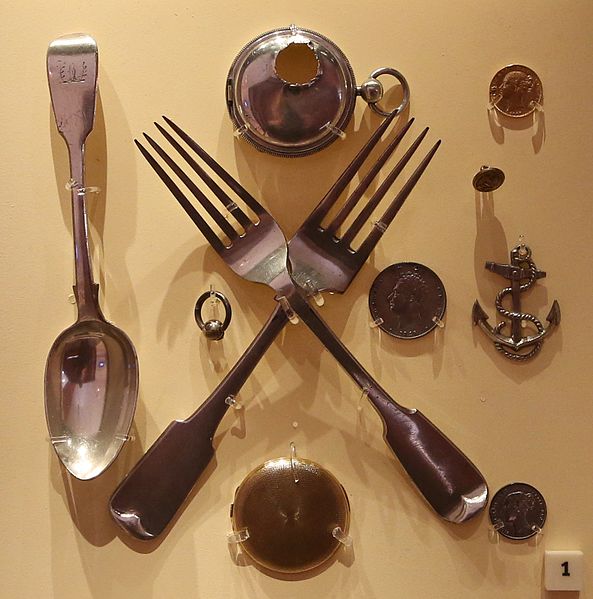
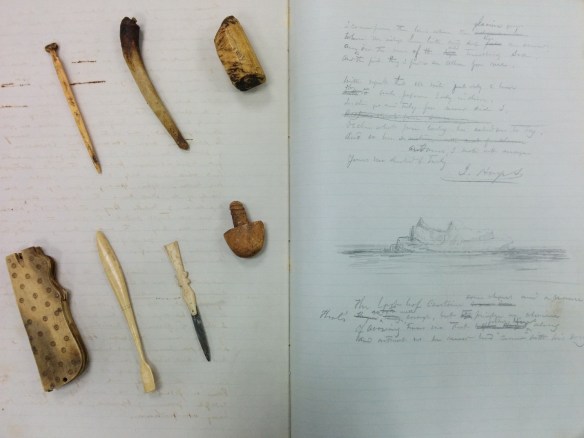
Click the link to see these Items Recovered by Rae, currently housed in the National Maritime Museum in Greenwich, London
The Grinnell Expeditions were unsuccessful in discovering the fate of the lost Franklin expedition. But during this time, John Rae’s own expedition was still on-going. In 1853, he encountered a group of Inuit who had several artifacts from Franklin’s crew in their possession. This included several pieces of monogrammed silverware, coins, and a pocket watch. Rae purchased these items from the Inuit and began interviewing locals. This was how he eventually discovered the sad fate of the Franklin expedition. While completing his survey of West Boothia, Rae heard about a group of white men who had starved four years earlier in a camp nearby. Rae continued his search until he discovered the final camp of the Franklin expedition. In his letter to the Admiralty, he described the state of the camp and the signs of cannibalism he found there. But, “any tidings, however meager and unexpectedly obtained” were better than none in Rae’s opinion.
Click the link to see “Arctic Exploration, With Information Respecting Sir John Franklin’s Missing Party.” 1855
The British Admiralty published John Rae’s letter without his knowledge before his return to England in 1854. The public was outraged by his claims; Charles Dickens maligned him in the press and his findings were mostly ignored by Lady Jane Franklin who continued her search into the 1880s. However, later expeditions would only confirm what Rae had discovered, and the British Admiralty officially presumed the entire crew of the Franklin expedition dead. Rae’s crew collected the reward, but his reputation never recovered. Other explorers who had joined in the search for Franklin were knighted, but Rae, for implying that officers of the Royal Navy would stoop to cannibalism, was mostly kept out of the picture.
Rae published several articles in the Journal of the American Geographical Society of New York after his days of Arctic exploration were behind him. He shared his discoveries and practical advice with other explorers in the spirit of the AGS’s organizational purpose: “furthering the understanding of the role of geography in our lives.” After his death in 1893, the AGS published his obituary in their journal, honoring John Rae for his 35 years as a Corresponding Member of the AGS and his important contributions to geography. The Society had this to say about Dr. John Rae: “He wrote with simplicity and force, but he was more concerned to do things worthy of record than to record them. He had the gifts of the born explorer, the habit of exact observation, courage and fertility of resource, untiring energy, activity and strength; and with these a firmness and generosity of character that won the respect and the affection of men.”
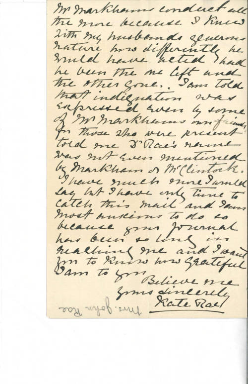
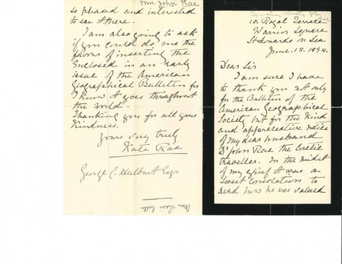
And in the AGSL archives, relics of a longstanding friendship between the Society and Rae: a collection of years of correspondence from Rae and his wife Kate to the AGS.


The young beginnings of the American Geographical Society were tied to those first Arctic expeditions to find Franklin, and this legacy of Arctic exploration continued into the 20th century. Luckily, records from these early years remain in the AGSL collection as a reminder of these tragic and exciting origins.
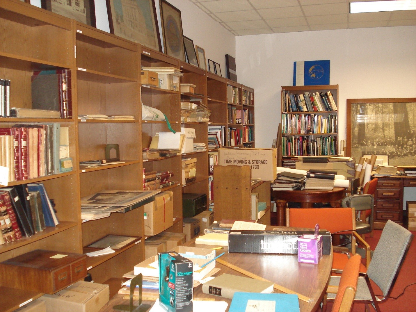
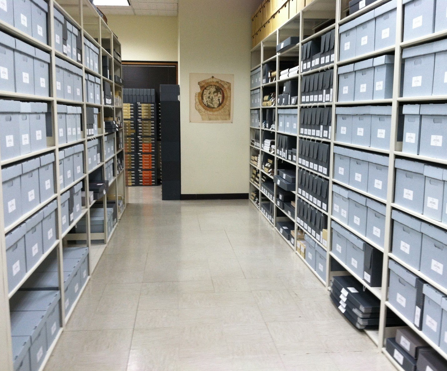
AGS of NY Archives Grant-Supported Processing Project Completed
by Bob Jaeger and Susan Peschel
A three-year project to organize and process the American Geographical Society of New York Archives, funded by a grant from the Andrew Mellon Foundation through the Council on Library and Information Resources (CLIR), has been completed.
The CLIR grant funded a full-time archivist and part-time student employees to work on the collection, which contains the records of the Society, the only organization focused on bringing together academics, business people, those who influence public policy (including leaders in local, state and federal government, state and federal government, not-for-profit organizations and the media), and the general public for the express purpose for furthering the understanding of the role of geography in our lives.
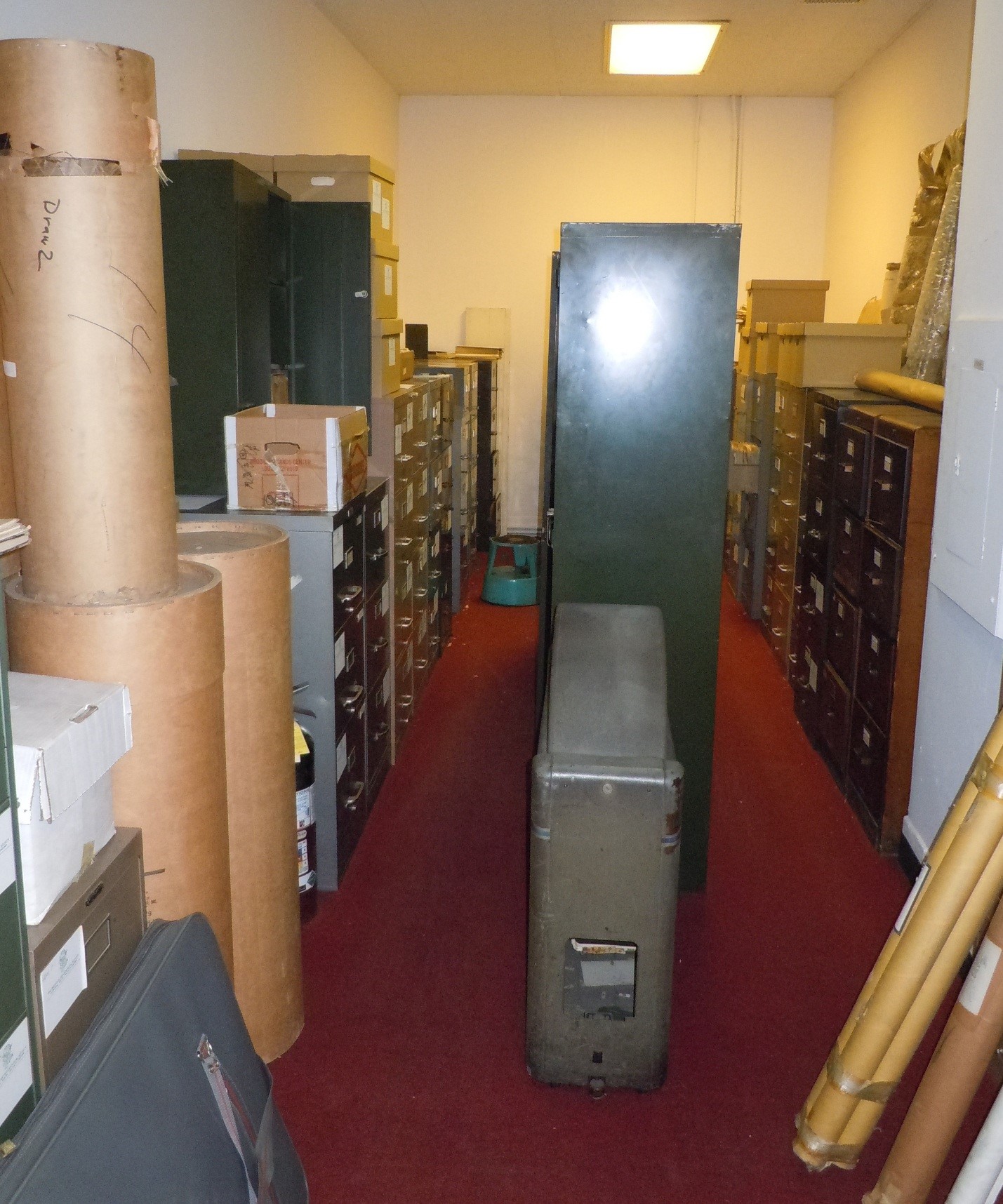
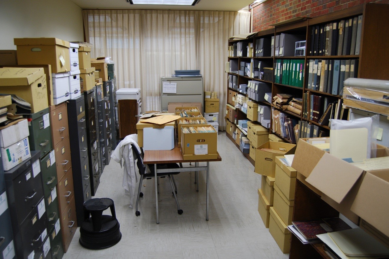
The materials date from the Society’s founding in 1851 and include approximately 350 cubic feet of material, with documents relating to well-known figures in American exploration and the larger field of geography from the mid–nineteenth century through most of the twentieth.
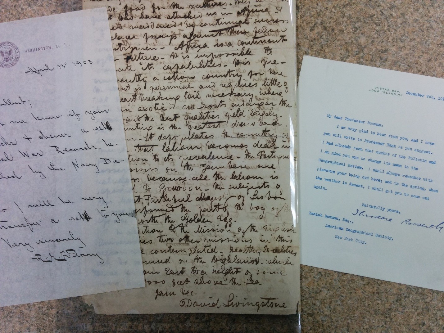
Highlights include log books, diaries, photographs, and artifacts of early Polar expeditions, such as the papers of Robert E. Peary (who served as President of the Society), the American flag carried by Capt. Charles Francis Hall on his second Polar Expedition, and correspondence with such individuals as David Livingstone, Franklin D. Roosevelt (an AGS councilor), Charles Lindbergh, and William H. Seward, to name only a few.
The collection contains correspondence, publications, reports, maps, meeting minutes, ledgers, and records on expeditions, explorers, and other geographic organizations and activities. For more information, please contact the American Geographical Society Library at 414-229-6282 or via email at agsl at uwm dot edu.
American Geographical Society Library Records, 1851-2013 (link to finding aid)
American Geographical Society New York Archives (link to digital collection)
The images selected for this digital collection focus on explorers and expeditions, particularly to the Polar Regions. Highlights include log books, diaries, photographs, and artifacts of early Polar expeditions, such as the papers of Robert E. Peary (who served as President of the Society) and Isaac Israel Hayes, sketches of Inuit life by Robert Flaherty, records from the Transcontinental Excursion of 1912, and correspondence with such individuals as David Livingstone, Franklin D. Roosevelt (a councilor), Charles Lindbergh, and Louise A. Boyd to name only a few. The collection also contains correspondence, publications, reports, maps, meeting minutes, ledgers, and records on expeditions, explorers, and other geographic organizations and activities. The digital collection is under development as more items continue to be scanned and added to the collection.
