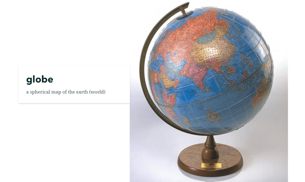
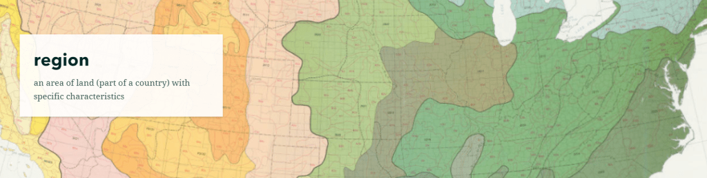
geography
Who I Am, Where I’m From
This summer the AGSL K-12 Fellowship went virtual! Our Public Services Librarian worked with four awesome teachers in the Milwaukee area as they developed curriculum for their upcoming school years. To see the projects and lesson plans, check out the AGSL’s Resources for Educators.
My name is Erin Sivek, and I am an English Language Arts (ELA), Social Studies, and English as a Second Language (ESL) teacher at the International Newcomer Center (INC) in Milwaukee Public Schools. The INC is a specialized program for middle school newcomer refugee English Learners; currently, I serve students from Central and Eastern Africa, Southeast Asia, and the Middle East. Depending on how many refugees are resettled in the US (and specifically Milwaukee) each year, my student population changes in both number and in cultural background.
The curriculum I created through the AGSL grant is titled “Who I Am, Where I’m From,” and focuses on students’ home countries, and how these places have changed over time. Because the majority of my students have spent their childhood in refugee camps or resettled in countries of asylum, they often desire learning about where they’re originally from.
In this unit, students will analyze maps of their homelands from the AGSL Digital Collections dated as recently as 2018 to as far back as 1721. Specifically, students will use three pre-selected maps that include their home countries’ region. After identifying and writing about their homeland, they will study how its name and borders have changed through the time period of these maps. Students will then perform research using online databases to learn how and why these changes occurred. During this unit, students will also acquire new academic vocabulary while gaining insight into how people in power have changed our world.
My students have been learning in a virtual setting since April, and are becoming more skilled in using the tools of this environment. I will teach this curriculum through whole and small group video classes, while also supporting students through live documents, discussion boards, and interactive videos. In culmination, students will create a final assessment piece to demonstrate understanding of their new knowledge using a digital platform. Students will meet various standards in ELA and Social Studies surrounding History, Geography, Inquiry, and Research; such as evaluating people’s relationship to places, connecting past and present, and using geographic tools to analyze the world.
Catholic education in Milwaukee
by Angie Cope
In 2015, Tom and Lisa Marcz donated a map to the AGSL on behalf of Tom’s father, Frank Marcz.
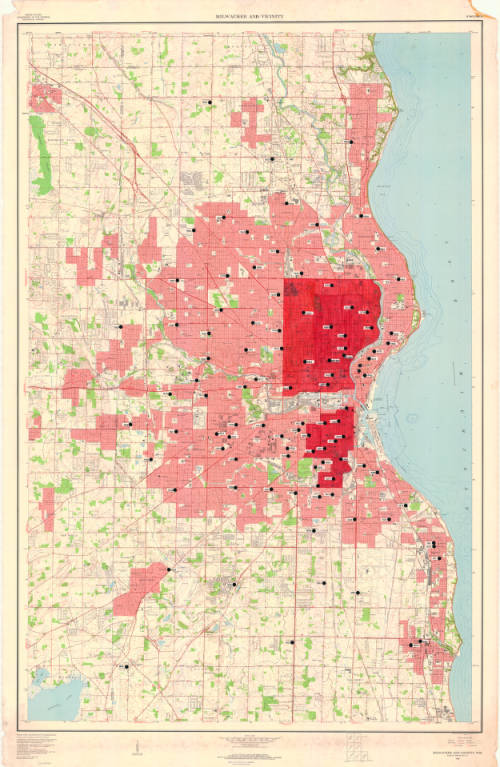
Upon further investigation, and interviews with Tom Marcz, it was discovered that the map was annotated by Sister Dolores Rausch and used as part of her 1971 PhD dissertation, “The changing status of urban Catholic parochial schools; an explanatory model illustrating demand for Catholic elementary education in Milwaukee County.” The Marcz family were long time friends with Sister Dolores.
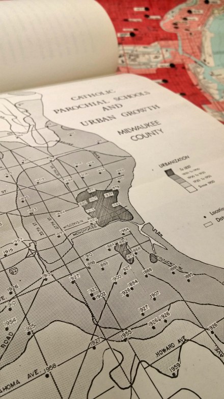
The base map is “Milwaukee and vicinity, Wisconsin : 1959” by the U.S. Geological Survey and the annotations show location of catholic schools and the date of establishment.
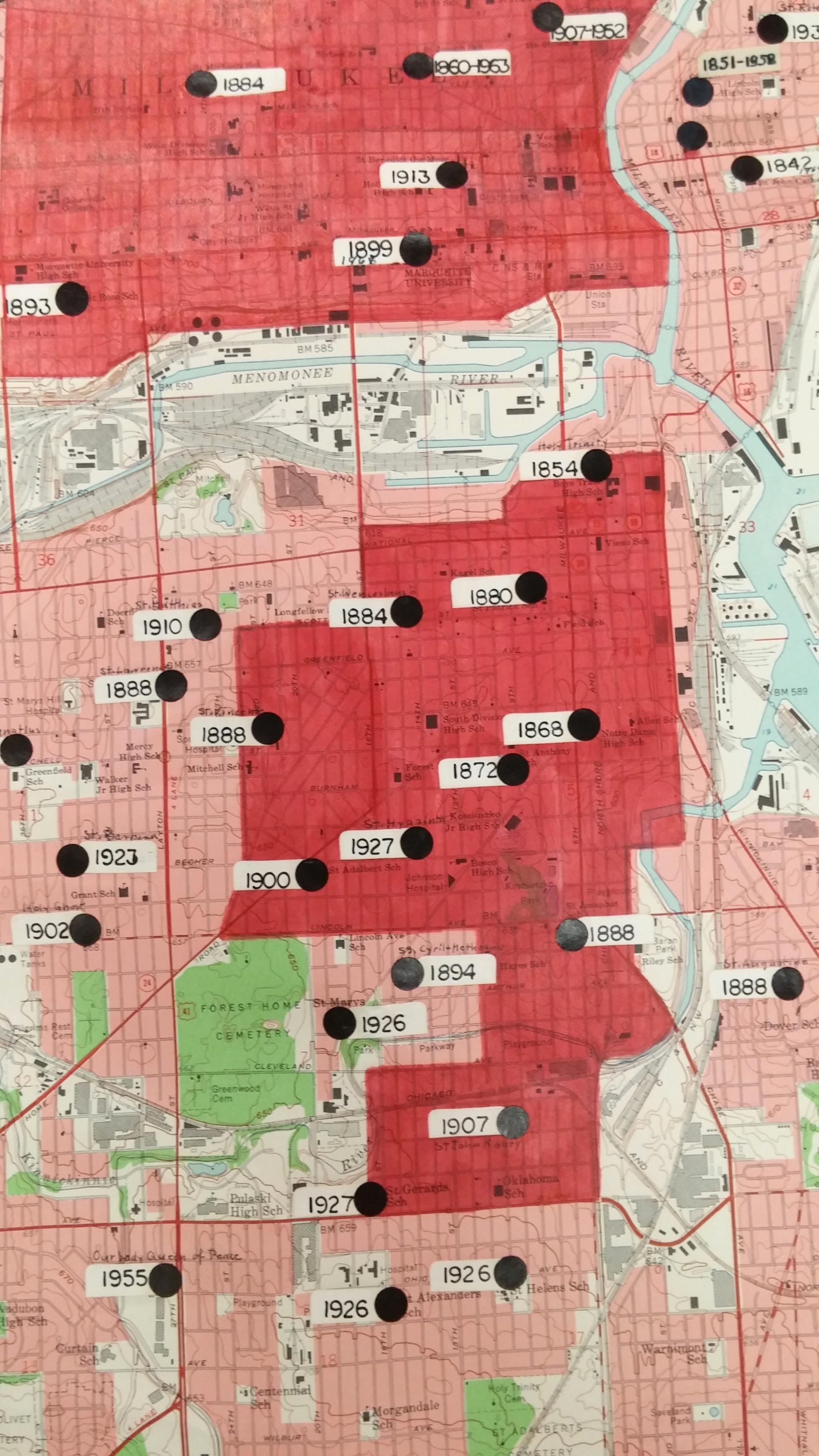
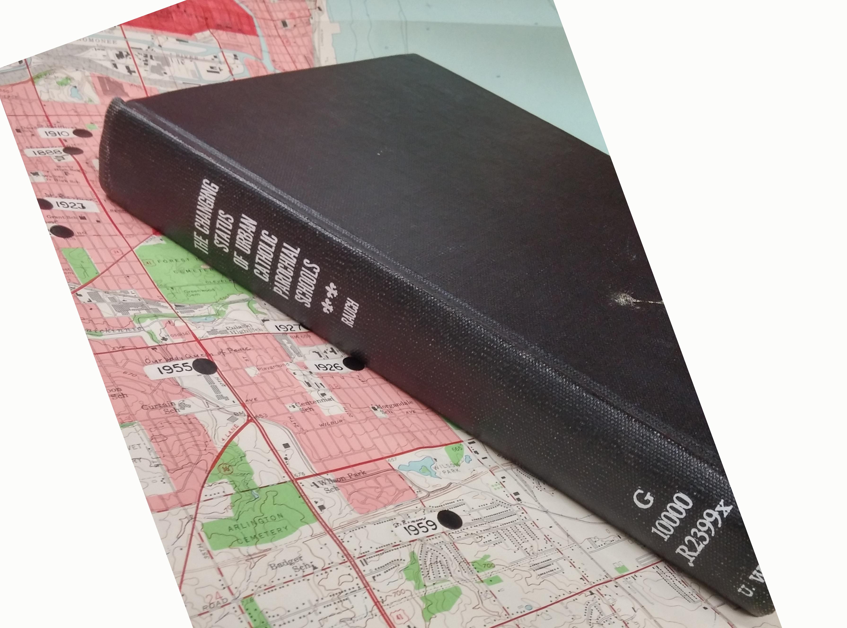
Sister Dolores was the first PhD student to graduate from the Geography Department at UW Milwaukee. The 181 page dissertation includes many maps, similar to the annotated map above.
Her dissertation is popular and has been checked out often from the UWM Libraries.
Sister Dolores Rausch (1915-2011) touched many lives and was an incredible citizen of the Milwaukee area. If you’re interested in learning more about Sister Dolores, here are some biographical resources:
Sister Dolores Rauch, compiled by Sister Victoria Wiethaler in 2003. https://atlanticmidwest.org/posts/sister-dolores-rauch
Tale of two sisters by Dr. David Snowdon. http://www.sturdyroots.org/ns_taleotsister.htm
The Harrison Forman Photo Collection
By Susan Dykes
I was recently asked what my favorite image is in the Harrison Forman Collection. Having become intimately familiar with tens of thousands of images Harrison Forman took, it was an overwhelming and almost impossible request to say the least. There are so many! Harrison Forman, photojournalist and adventurer, travelled the world from the 1930s through the 1970s. He was prolific, wielding his camera to capture major historical events, and the economies, infrastructures, politics, societies, educational systems, and cultures of the places he visited.
By far my favorite kinds of images Forman took are of the people living in many of these places, asking them to take a moment from their daily lives practicing their trades, spending time with their families, and simply enjoying life, to pose for a photo. Of the thousands of portraits and group photos he took, I found those of the Berber people living in the Atlas Mountains in Morocco among the most striking and beautiful in the collection.
My favorite image, taken in the 1960s, shows a Berber woman in the foreground, eyes closed, wearing a delicate lace veil and coin jewelry, two Berber men behind her in traditional clothing wearing turbans, and another man in the background, photo bombing the shot.
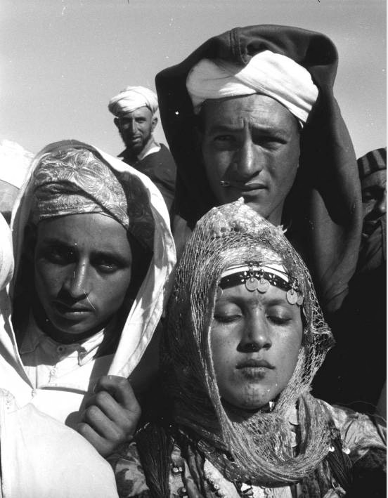
There’s something very serene about the woman. Perhaps she just blinked, but I choose to think she was soaking up the sun on her face and possibly the moment. The two men, eager to be a part of the photograph, looking directly at the camera and the man in the back with a look of wonder, curious about the activity.
Forman’s enthusiasm about documenting people and cultures outside of the Western world is evident in this photograph. He wanted to share the beauty of people in places unfamiliar to us at the time of his work, which in an historical context, makes a much richer scholarly endeavor today.
While this image is in black and white, as well as the other images of the Berbers in the UWM Libraries Digital Collections online, the Harrison Forman Collection includes over 50,000 color slides that have yet to be digitized, some of which Forman took of the Berber people. It is our hope that we will be able to obtain the funding to digitize the slides in the near future and make them accessible online, in all their full color glory!
In the meantime, check out the rest of Forman’s images of the Berber people in Morocco:
http://collections.lib.uwm.edu/cdm/search/searchterm/forman%20berber/mode/all/order/nosort/page/2
And, explore images of the other people around the world Forman photographed:
http://collections.lib.uwm.edu/cdm/search/searchterm/forman%20people/order/nosort
If you have questions about the Harrison Forman Collection, or would like to know more about the color slides, please contact Susan Peschel at the American Geographical Society Library.
