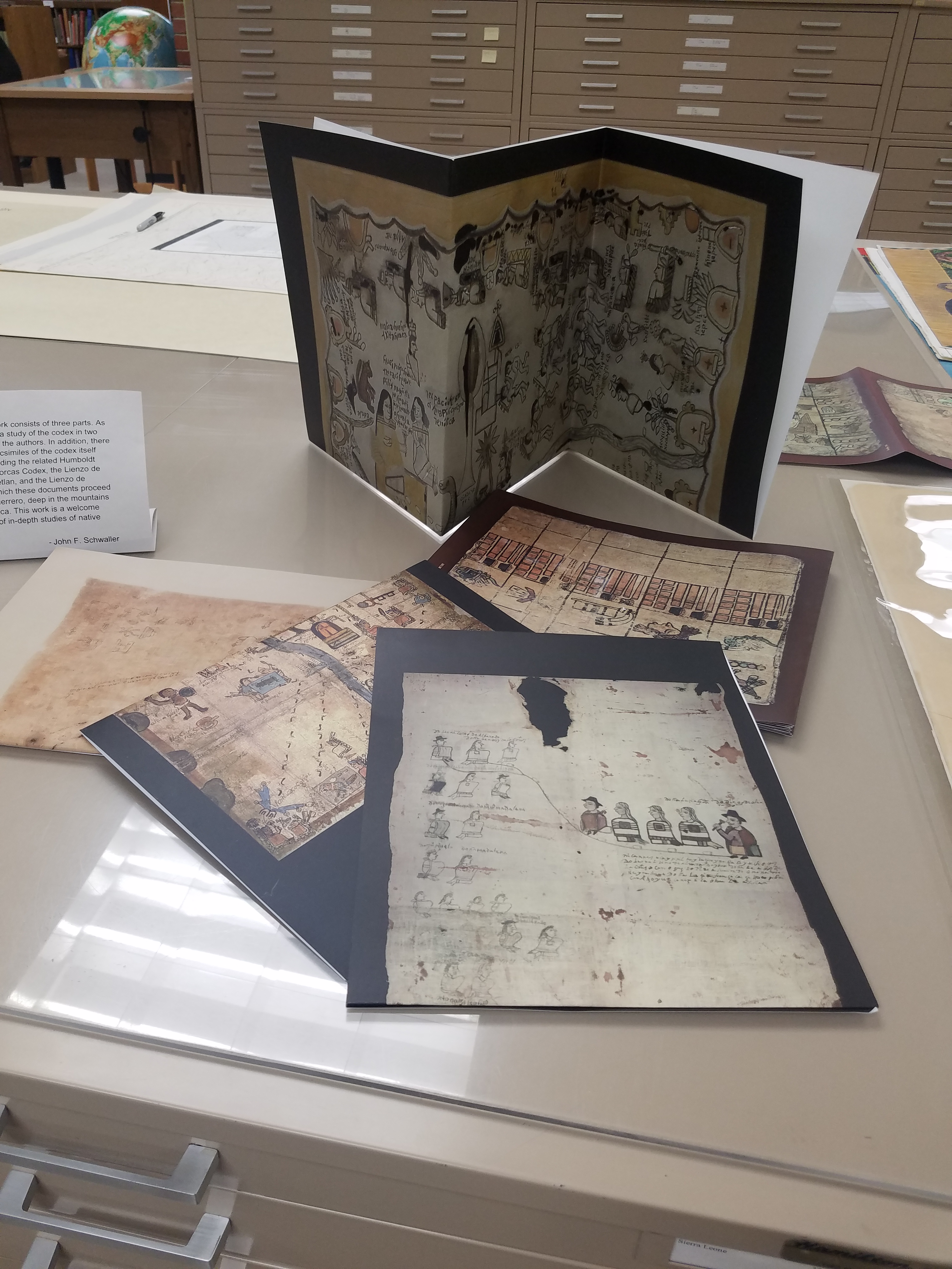
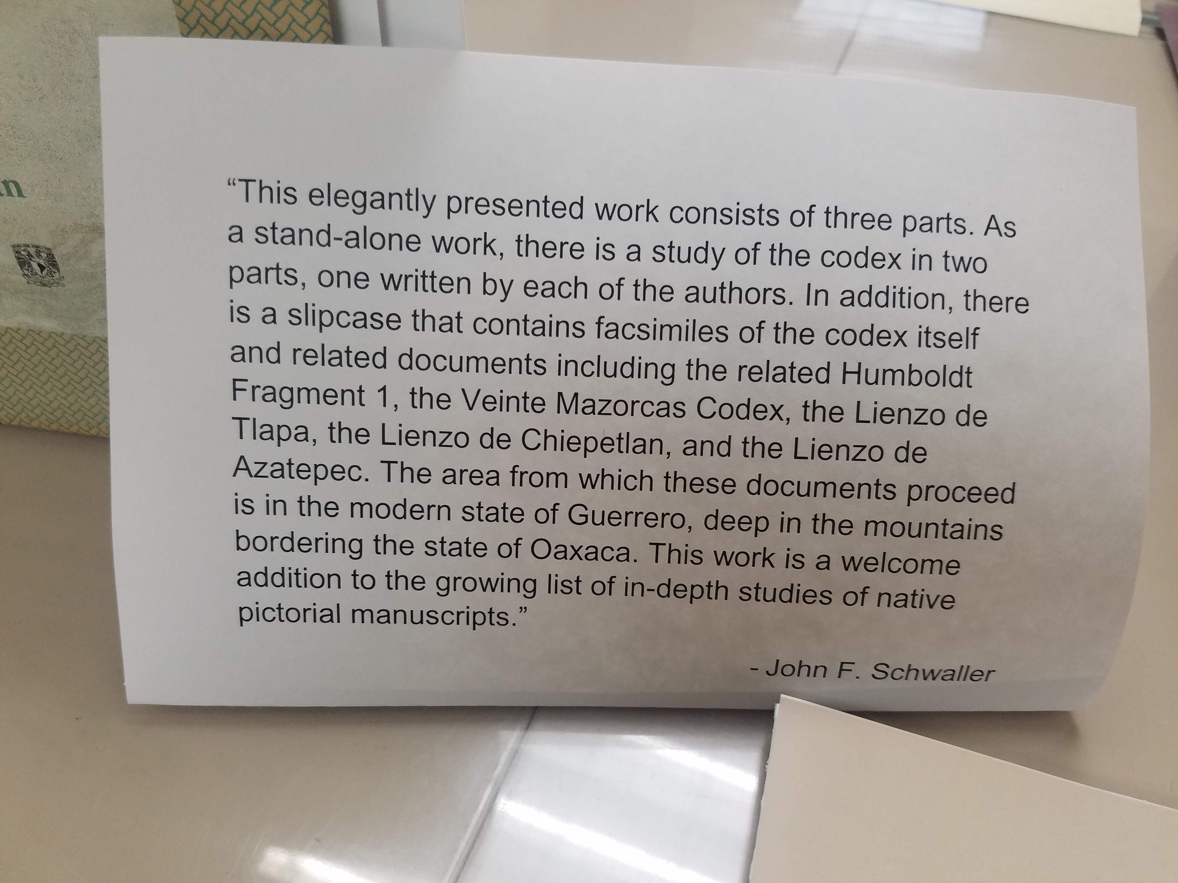
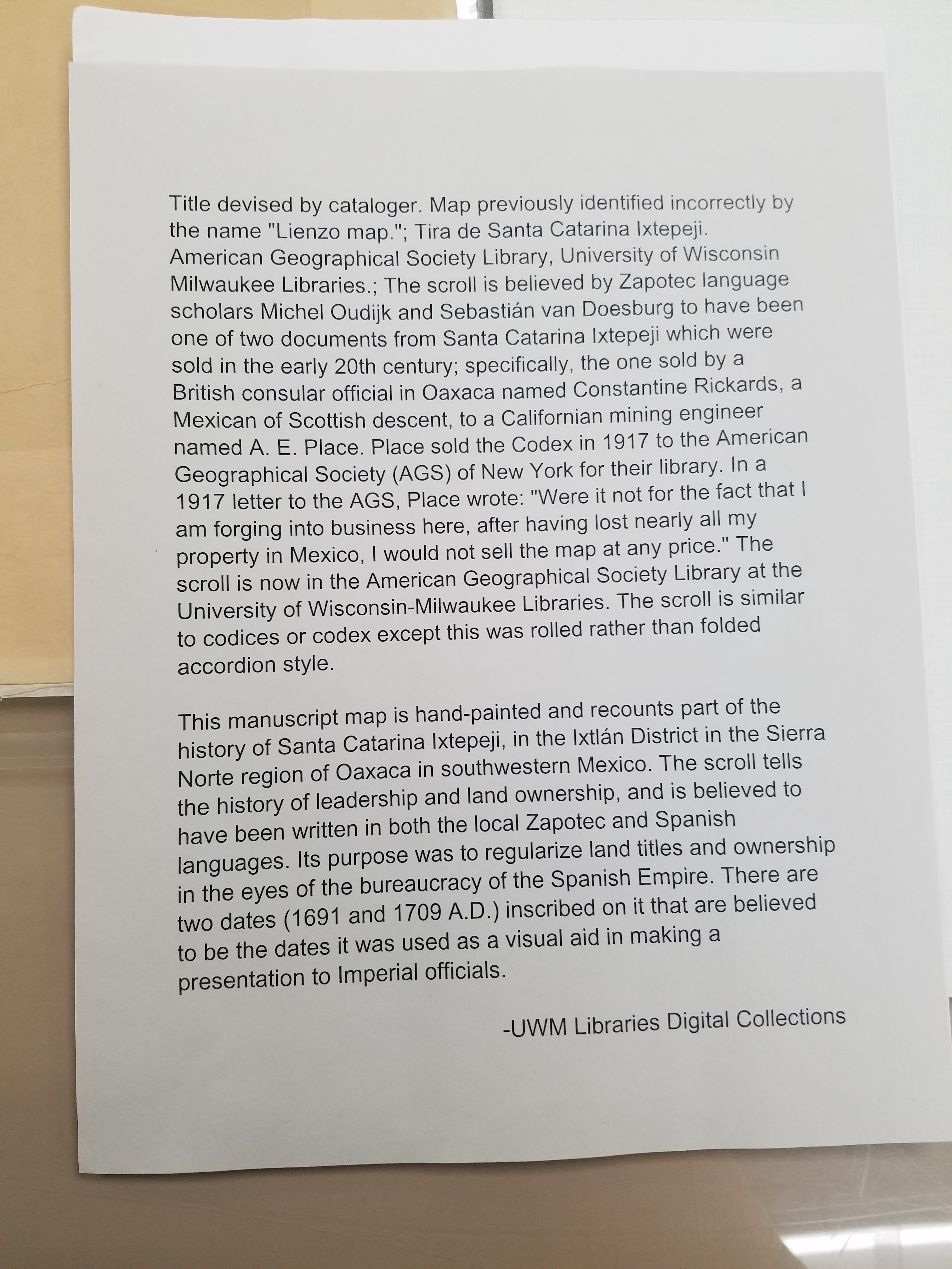
Manuscript maps
In Case You Missed Us: The National Hispanic Heritage Month Pop-Up Exhibit
By Lauren Maddox
Last month, I wrote about our then-upcoming Pop-Up Exhibit in celebration of National Hispanic Heritage Month. The exhibit was a collaborative project in conjunction with the UWM Archives to showcase some of our collections and honor this very special month. As we move into October, we will be putting up another exciting exhibit (stay tuned for more on that later!), but in case you missed this pop-up, here are some of the digital versions of pieces we featured in the exhibit:
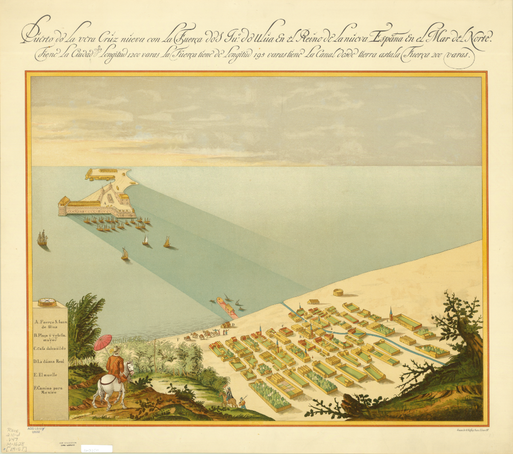
Map of San Juan Ulua Island in 1628. 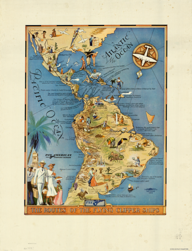
“The Routes of the Flying Clipper Ships,” 1930s. Click the links to see these maps in our Digital Collections! 
Map of San Juan Ulua Island in 1628. 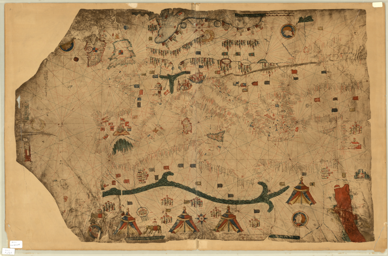
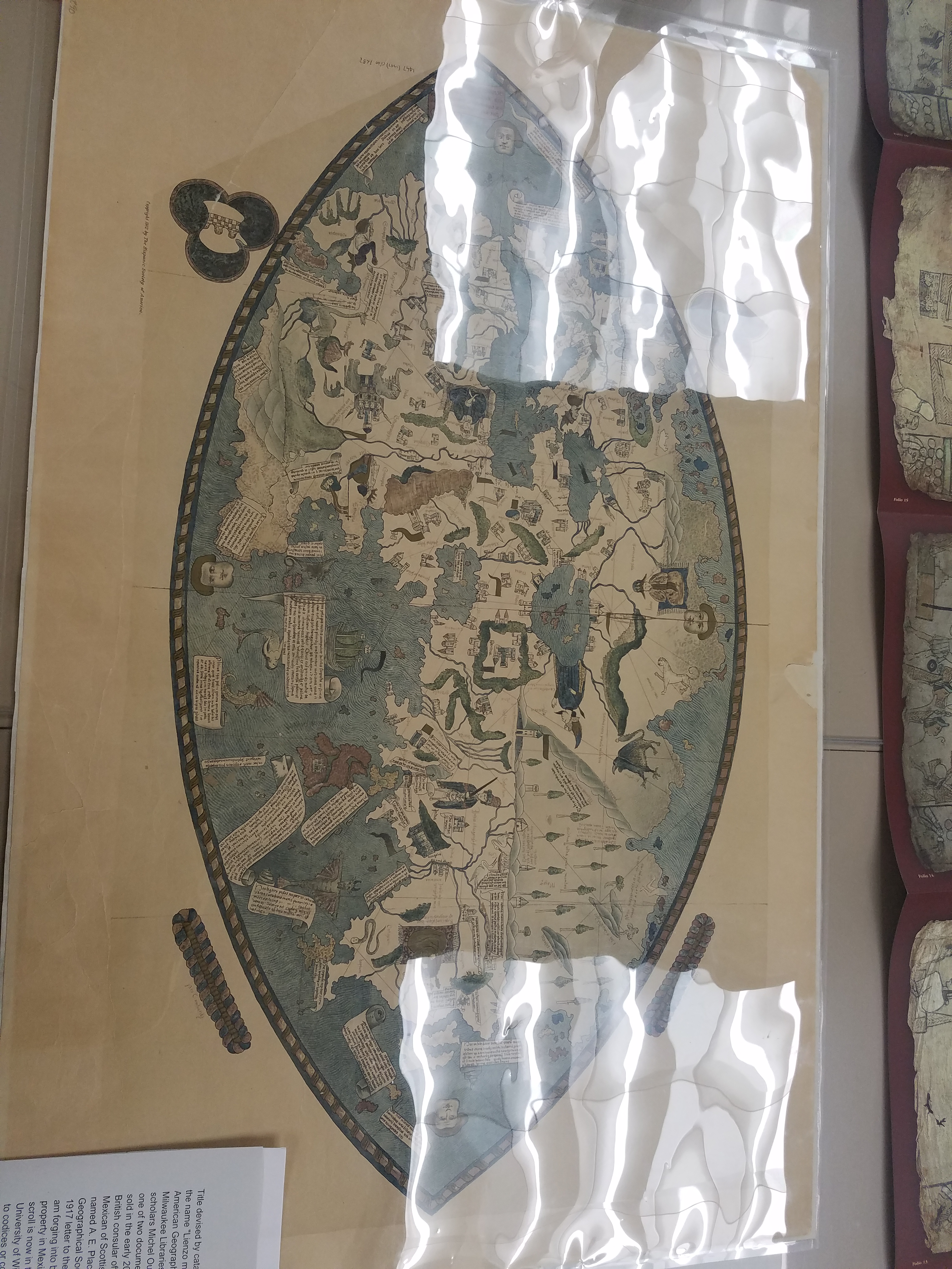
Fascimile of 1468 World Map, previously owned by the Hispanic Society of America.
And some photos of the exhibit live and in-person:
Stay tuned for more updates about future exhibits!
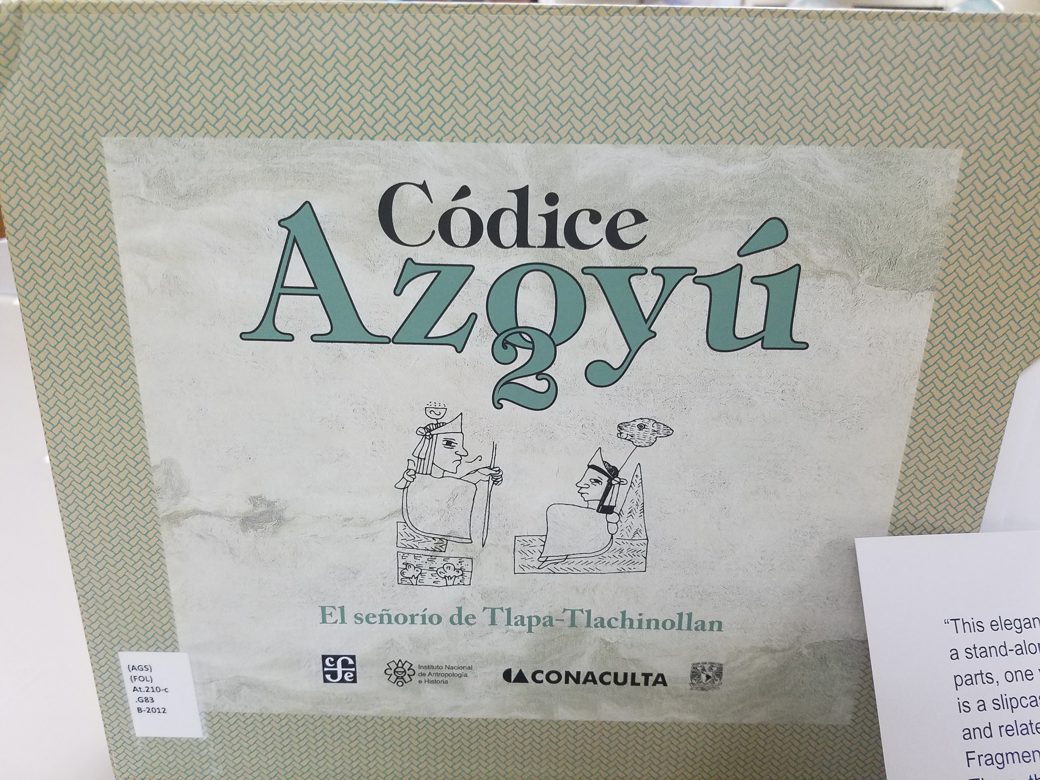
Catholic education in Milwaukee
by Angie Cope
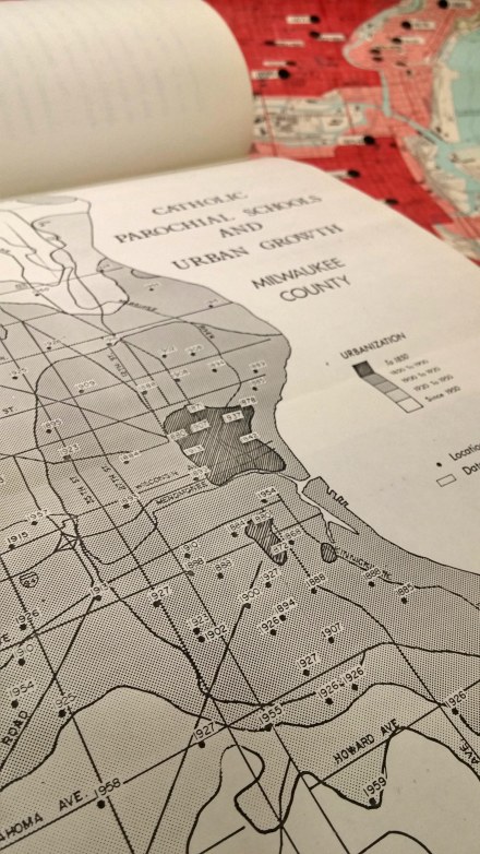
In 2015, Tom and Lisa Marcz donated a map to the AGSL on behalf of Tom’s father, Frank Marcz.
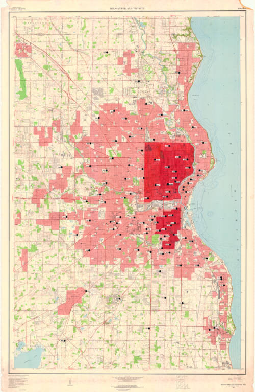
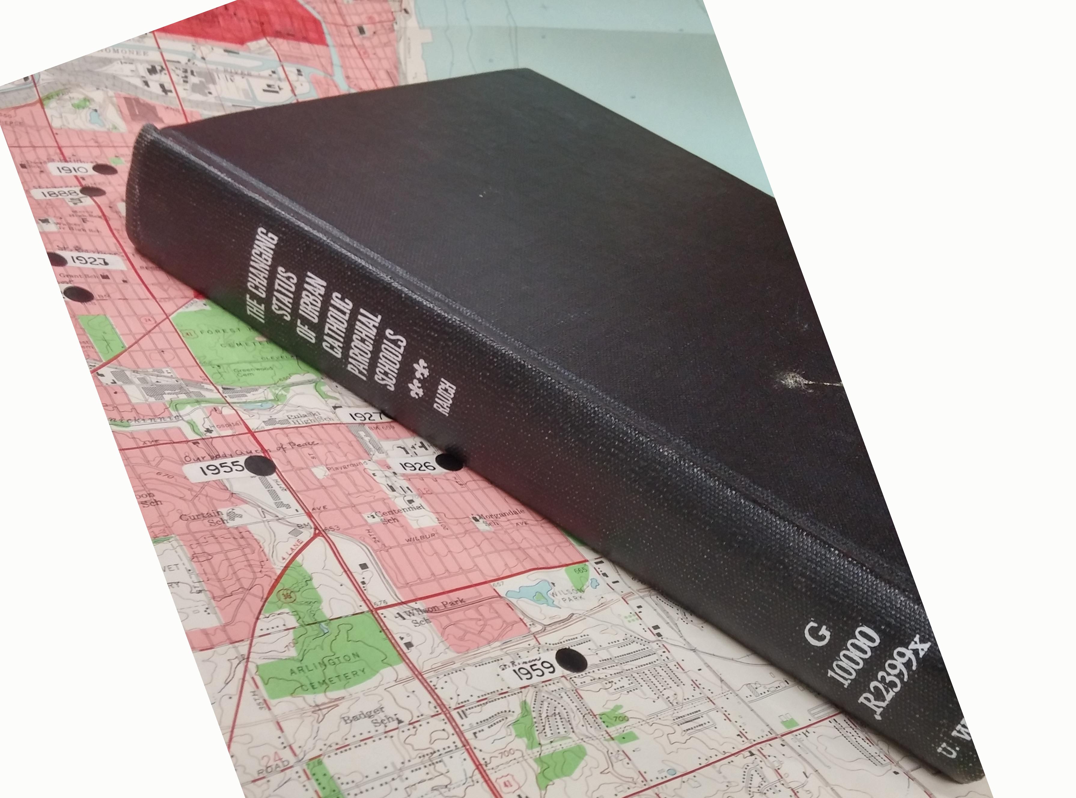
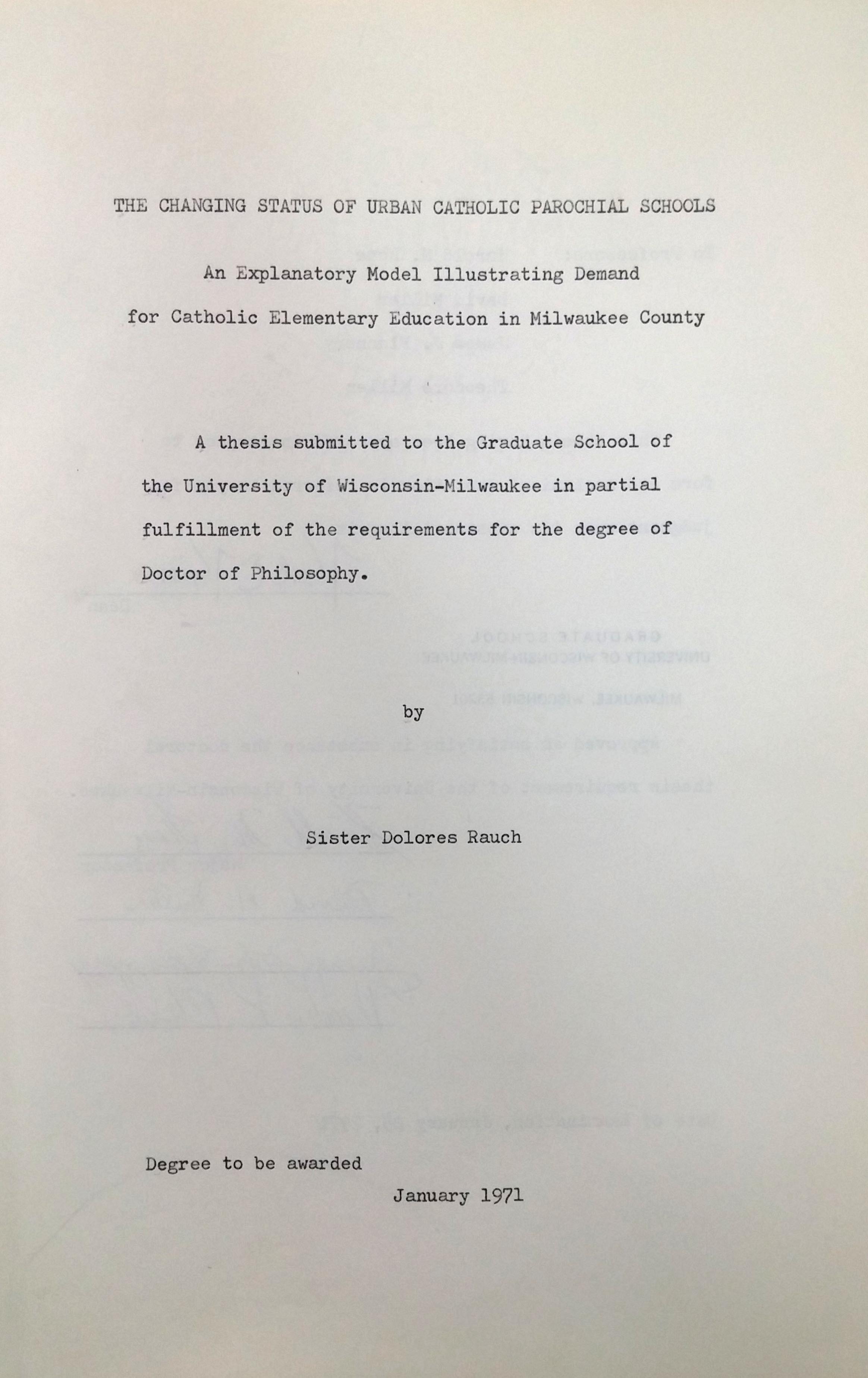
Upon further investigation, and interviews with Tom Marcz, it was discovered that the map was annotated by Sister Dolores Rausch and used as part of her 1971 PhD dissertation, “The changing status of urban Catholic parochial schools; an explanatory model illustrating demand for Catholic elementary education in Milwaukee County.” The Marcz family were long time friends with Sister Dolores.
The base map is “Milwaukee and vicinity, Wisconsin : 1959” by the U.S. Geological Survey and the annotations show location of catholic schools and the date of establishment.
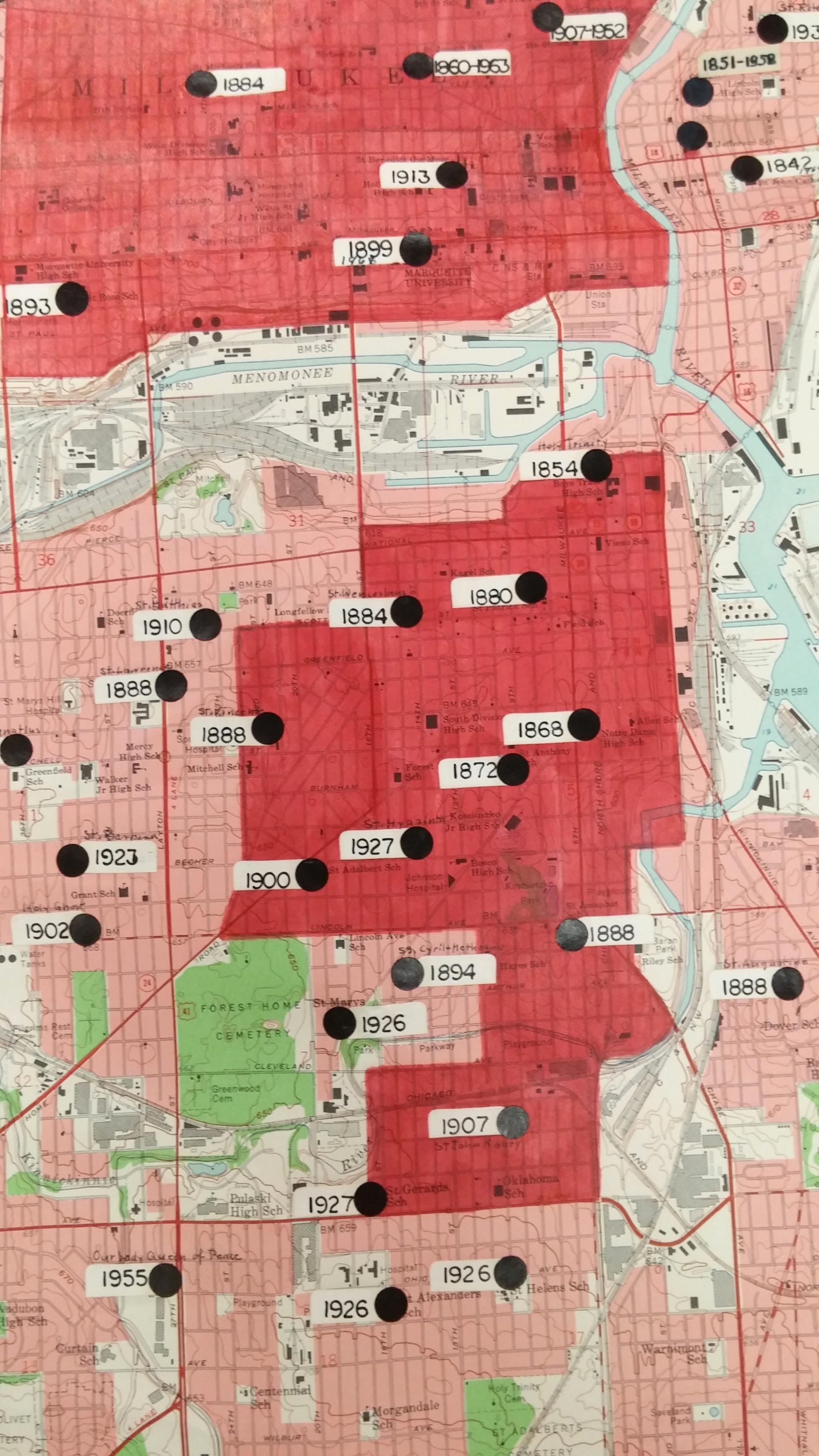
Sister Dolores was the first PhD student to graduate from the Geography Department at UW Milwaukee. The 181 page dissertation includes many maps, similar to the annotated map above.
Her dissertation is popular and has been checked out often from the UWM Libraries.
Sister Dolores Rausch (1915-2011) touched many lives and was an incredible citizen of the Milwaukee area. If you’re interested in learning more about Sister Dolores, here are some biographical resources:
Sister Dolores Rauch, compiled by Sister Victoria Wiethaler in 2003. https://atlanticmidwest.org/posts/sister-dolores-rauch
Tale of two sisters by Dr. David Snowdon. http://www.sturdyroots.org/ns_taleotsister.htm
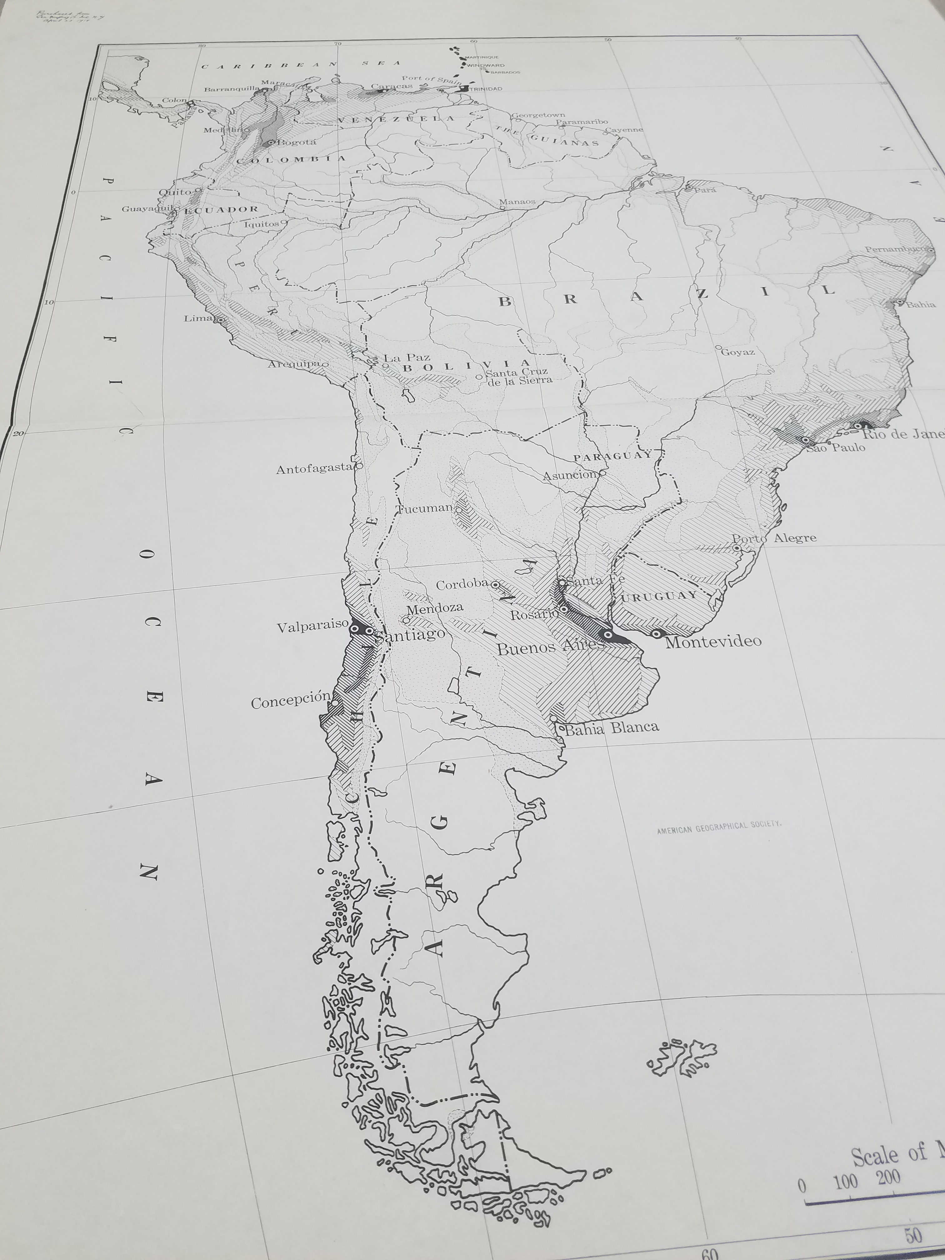
Manuscript maps by Adolph N. Krug, an American missionary in Cameroon in the early 20th Century
by Angie Cope
The AGS Library has 3 manuscript maps drawn by Adolph N. Krug, an American missionary in Cameroon in the early 20th Century.
Krug was born in 1873 in Germany and immigrated to the United States at the age of 15. He studied at Amherst College, graduating in 1903. That same year, he married Miss Evelyn E. Saul and they both left for Cameroon under the appointment of the Board of Foreign Missions of the Presbyterian Church of the USA.
Krug traveled the country, opening schools and churches and mapping the trails. It was his mapping efforts that led to his membership as a fellow in both the the Royal Geographical Society and the American Geographical Society.
Toward the end of his career, Krug was in charge of the village school in Foulassi. In 1941 he and his wife returned to the states to address Krug’s health condition. Krug died of heart failure in 1942. Mrs. Krug returned to Cameroon where she lived until her death in 1951. Their four children became missionaries in Asia and Africa.
Two of the manuscript maps held at the AGSL depict the trails, missionary sites, rivers and locations where Krug set up schools and churches. One of these is a “photostat” made by the American Geographical Society of Krug’s manuscript map. It is unknown where the original is located – perhaps at the Royal Geographical Society.
The third manuscript map is Krug’s manuscript reproduction of Dr. Marcel Chambon’s map showing the French medical survey of Cameroon. Chambon was a colleague of Dr. Eugene Jamot and the two of them working together were instrumental in trying to combat the African sleeping sickness
In addition to his mission work, Krug was interested in the life of the indigenous peoples, especially their folklore. The Journal of American Folklore published a number of “Bulu Tales” collected by Krug over his 39 years in Africa.


Click on any image above to open a larger view.
Map 1
Part of district of Ebolowa with outposts of Sangemalima and Ako’o Afem / drawn by A.N. Krug, M.A., cyclometer measures and compass direction. [Photostat/photocopy]
Adolph N Krug ; American Geographical Society of New York.
Foulassi, Cameroun : Adolph N. Krug New York, New York : American Geographical Society of New York ; 1911
Map 2
District subdivision, Sangmelima, Cameroun.
Adolph N Krug
1927?
Map 3
French medical survey of sleeping sickness in Sangmelima / Dr. Chambon (copied with his permission by A.N. Krug).
Marcel Chambon ; Adolph N Krug
192-?
