Georgia Brown
Teaching European Colonialism
by Georgia Brown
This summer the AGSL K-12 Fellowship went virtual! Our Public Services Librarian worked with four awesome teachers in the Milwaukee area as they developed curriculum for their upcoming school years. To see the projects and lesson plans, check out the AGSL’s Resources for Educators.
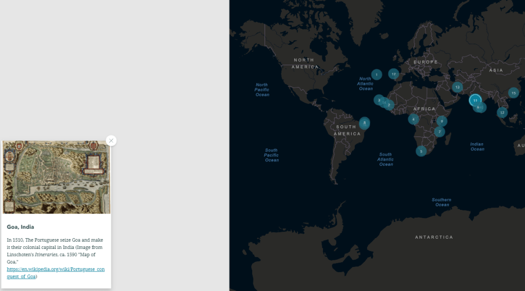
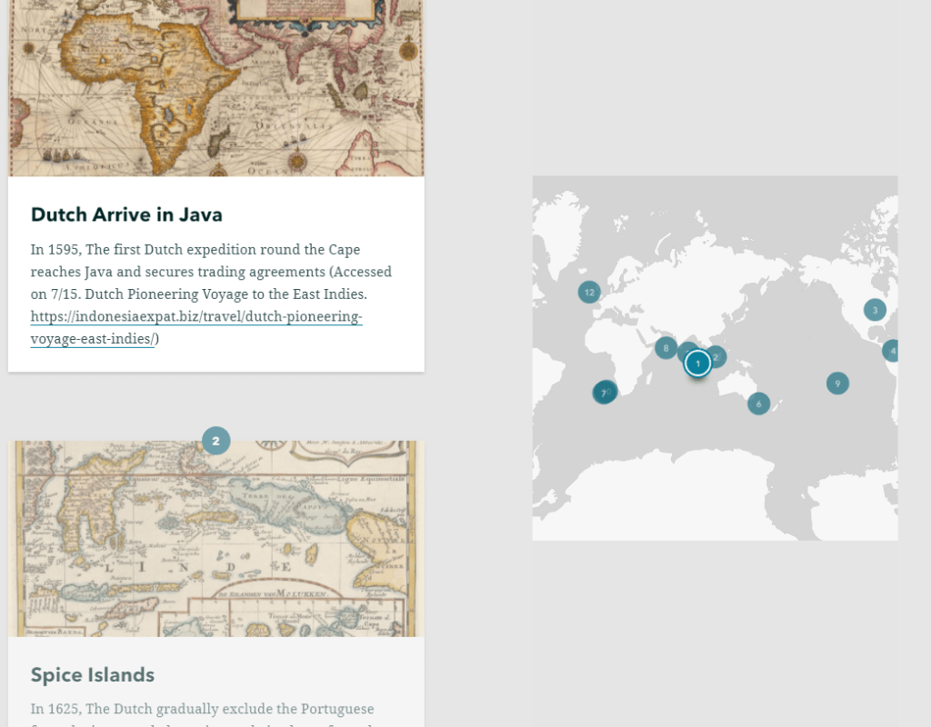
My name is Lukas Wierer, and I am a culturally responsive teacher leader in the Milwaukee Public Schools. I currently teach Ethnic Studies, Restorative Practices and Justice and You at Barack Obama School of Career and Technical Education. Obama is a K-12, but I teach in the high school, which is about 400 students, of which 98% are Black. The unit that I created will be used in my two sections of Ethnic Studies and was focused on European colonialism, specifically the impact that European colonization has had on formerly colonized nations. Throughout this unit, AGSL materials were used primarily as a way to show understanding. For example, I created an ArcGIS StoryMap (European Colonialism) that tracked colonial timelines for six European countries: Portugal, Spain, Great Britain, the Dutch (Netherlands), France, and Germany. Students were asked to examine the timelines, watch accompanying video clips, then, using the AGSL maps, they were asked to connect that content with the given map. I did identify a couple of images of statues/monuments that honor explorers whose “discoveries” were responsible for the resulting colonization of indigenous peoples. I also found a student article from the Black student newspaper, Invictus, entitled “Distortions of Colonization” which will be a good way to show a different perspective on colonialism, specifically the connection to exploitation that has emerged out of global capitalism.
In terms of how I view this unit helping my students, it is part of a sequence. We begin the year by learning about Africa before European arrival, specifically how advanced Africa was economically and politically. This unit will follow immediately and give students a better understanding of how Africa came to be exploited not only for its human resources (through the slave trade), but also for its land and the natural resources that would enrich the colonizers. With these two units as a foundation, we will be able to further examine the role that colonization and global capitalism played in the formation of racist ideas that stick with us today. Although the transition to a virtual classroom will present challenges, I have taught Telepresence for the last two years, so I am not totally unfamiliar with some strategies, but I imagine for this unit, we will spend a lot of our class time really diving deep into the AGSL maps. Because map skills are not typically real strong with my students, this is an area that I will want to explore as a group. The StoryMap and videos should be a little more straightforward for my students. I look forward to using this unit with my students and continuing to blog about how it went.
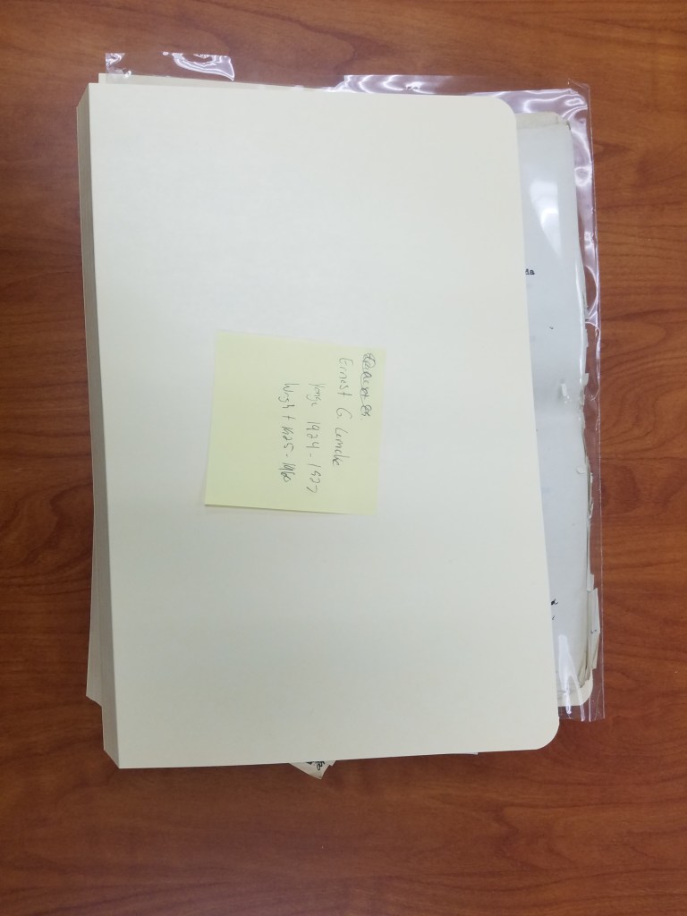
The Mysterious Case of Ernest G. Lemcke
By Lauren Maddox
Sometimes I like to pull back the curtain a bit for you– show you some of the behind-the-scenes work that goes on unseen at the AGSL. I was given a special project a few months ago that I thought the readers of this blog would be interested in hearing about.
Some things about me you need to know: I love puzzles and I have never seen Mission Impossible. Most of the AGSL staff loves puzzles; we are currently working on a 4,000 piece puzzle (which you can see if you visit us!). Generally, my work at the AGSL has me at a desk writing– that’s my job. But sometimes someone gives me something different to work on.
Susan Peschel stopped by my desk with a nondescript beige box.
“Your mission, should you choose to accept it–” she stopped to ask me if I remembered Mission Impossible. I didn’t, but I had at least heard the quote before. Susan told me that she had a puzzle for me (and that it might explode once she walked away).
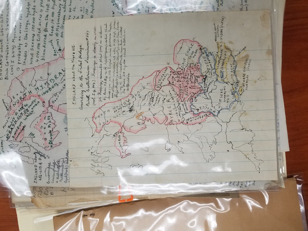
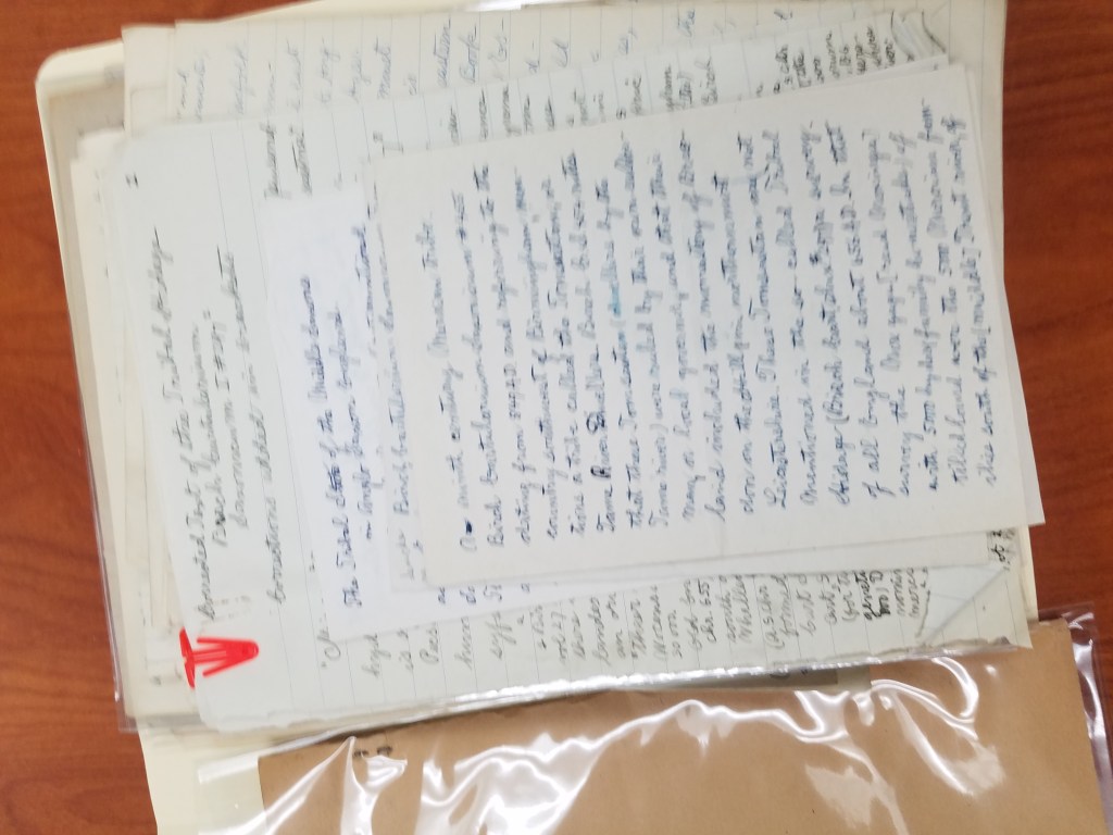
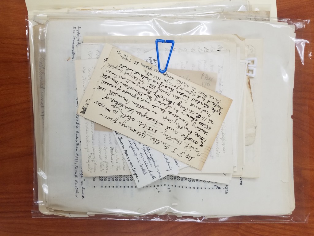
The problem with the box, which had traveled with the AGSL’s collection from New York to Milwaukee in the 70s, was that it had never been archived. The papers in the box were unsorted– no one even knew what they were. By all appearances, the collection of handwritten pages and letters seemed random. There were maps in the pile, but they were either hand-drawn or, stranger, road maps that had been drawn over. My mission (and I did accept it) was to figure out what we had and then to put it into some semblance of order.
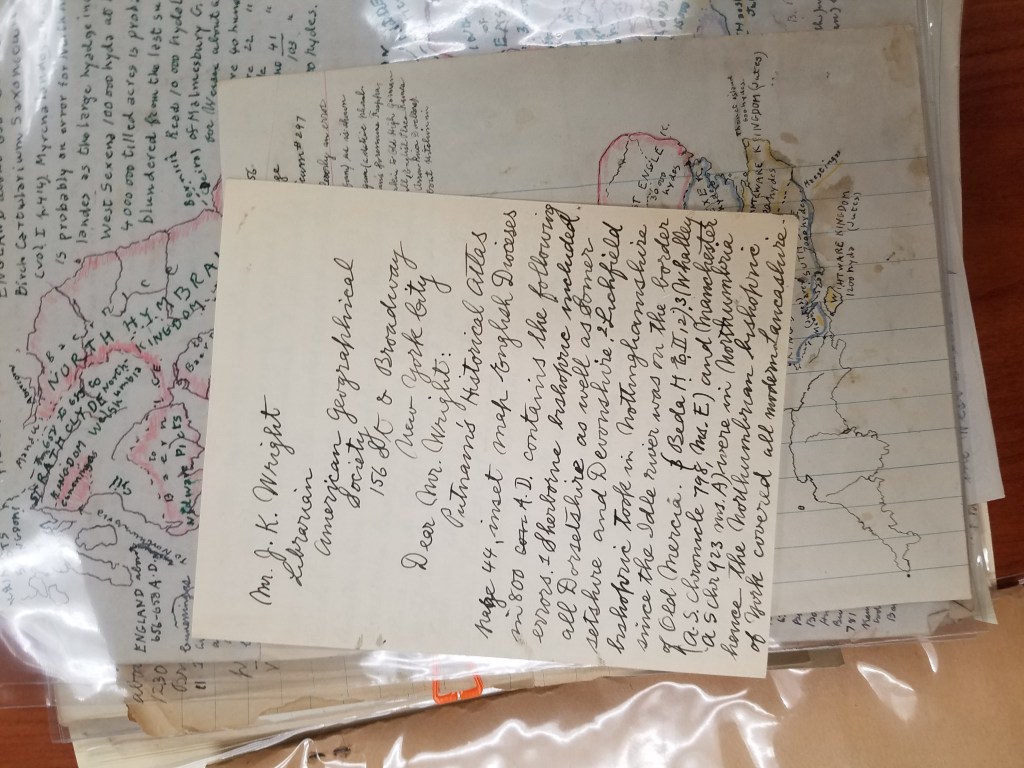
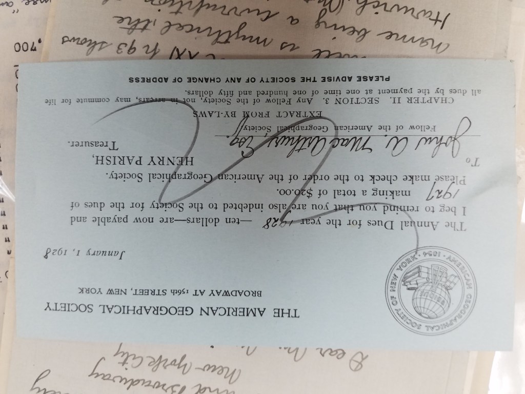
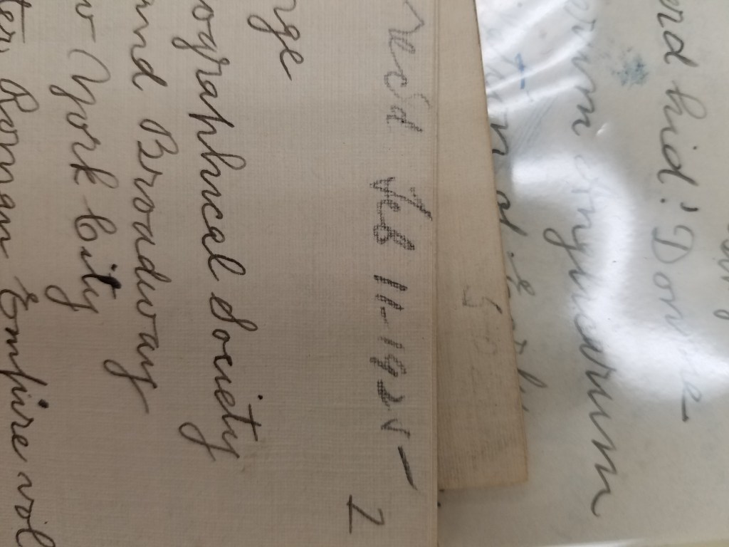
We didn’t know much, but we did know his name: Ernest G. Lemcke. We knew he was a card-carrying member of the American Geographical Society of New York because we have a record of his membership dues:
He wrote a trove of letters to Ena L. Yonge and John K. Wright. He bought a roadmap in 1926 and hand-drew a medieval military event in England from the 1300s. He was a book publisher in New York– which I discovered because some of his stationery had letterhead from Lemcke&Buechner, “Booksellers, publishers, importers.”
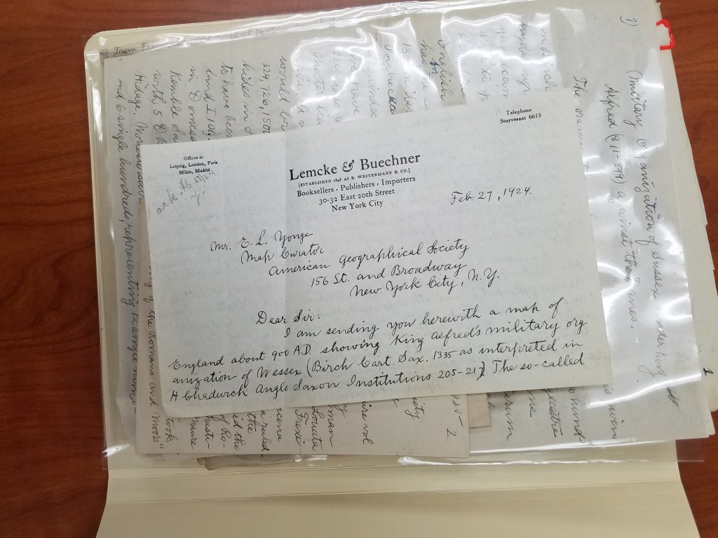
Part of the trouble with deciphering the box was figuring out what was meant for who. The maps were easy– Ena L. Yonge was map curator for the AGS of New York at the time, and his maps often came with a letter explaining what they were. But the partial manuscripts, many handwritten first drafts, and article corrections for the AGS’s periodical were mysterious and dense.
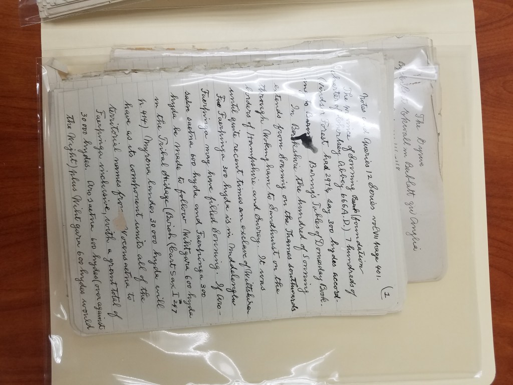
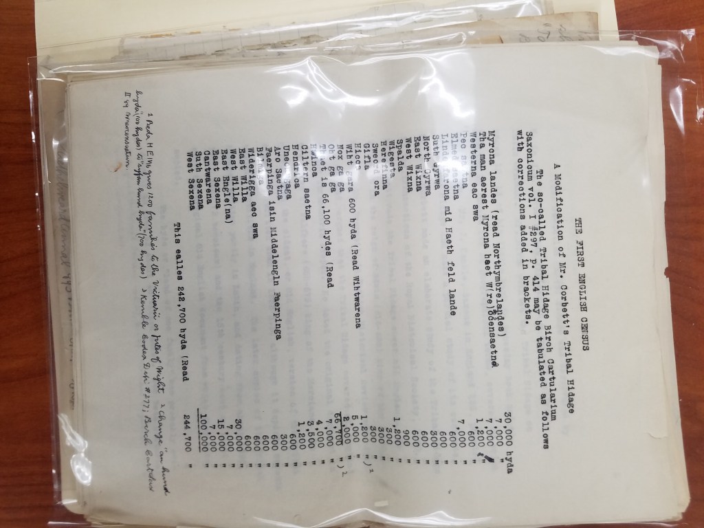
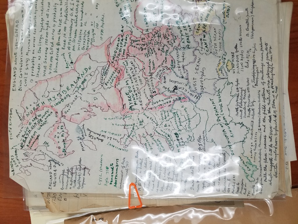
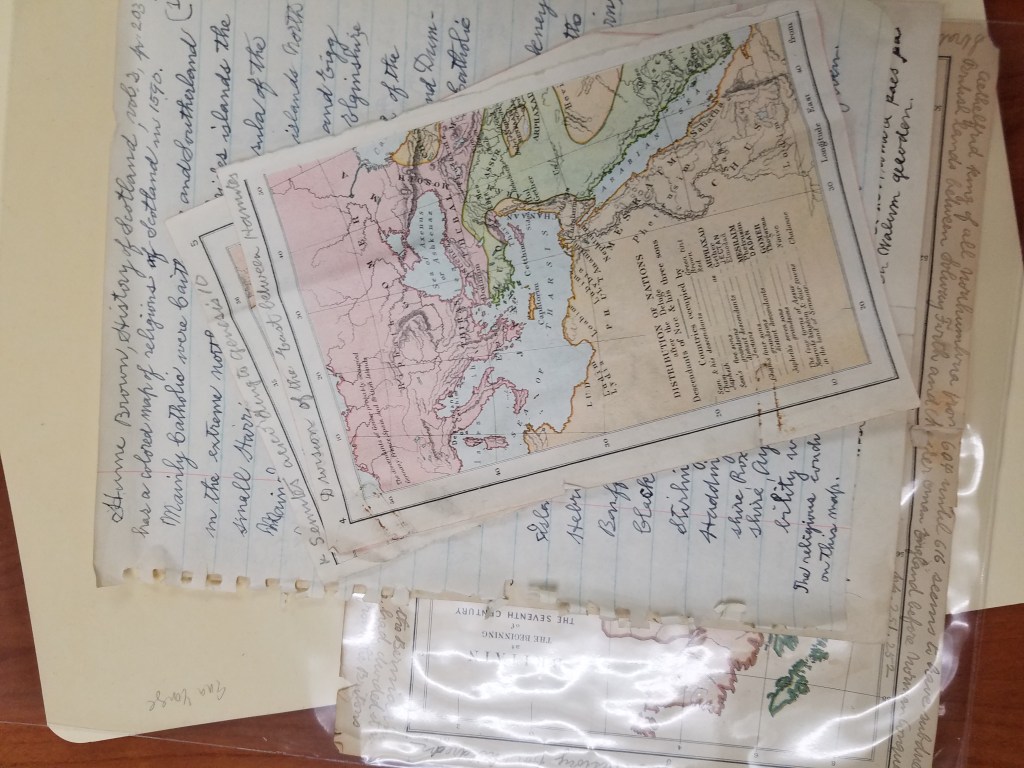
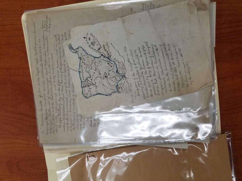
After many fruitless Google searches, I learned a few things about Lemcke: besides being a book publisher, he was also a historian with several books out, many specifically interested in the “Tribal Hidage” in Wessex. As it turns out, the University of New Hampshire also has a collection of Lemcke papers! Which was how I tracked down some of his publications and discovered that the many handwritten pages about a “tribal hidage” and the first English Census were partial drafts of his later, completed publications.
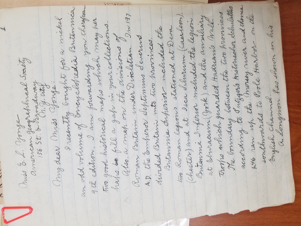
Now that I had a better idea of what we had, I came to the next part of the puzzle: putting it in order. I started with separating the things that were obviously addressed to Yonge or Wright. Maps were obviously meant for Yonge, and corresponded with letters that he had sent. John K. Wright was once director of the AGS of New York, but that didn’t help place many of Lemcke’s letters. But as it turned out, before he was director, Wright was the editor of the AGS’s regular publication from 1920-1956. This was exactly the period of time Lemcke was writing. The periodical corrections, then, seemed to be for the editor of the publication. And after reading Lemcke’s letters, I found him explaining corrections to his manuscript to Wright.
Once the letters were sorted by recipient, I started to put them in a chronological order. Some of the letters were dated– those were easy. But many of the letters weren’t dated. For several of them, I found a reference he made to an article he had just read, which helped me place it in the chronology. But many more had to be dated by their relationship to the other letters, which made for some puzzling work.
After finishing the work of putting the box in order, it was time to have it officially archived. This was definitely out of my expertise, so I reached out to fellow graduate intern Georgia Brown, who consulted our curator, Marcy Bidney, about what to do with the box.
Soon, the Lemcke papers will be officially archived! Since all of his correspondence was addressed to Ena L. Yonge and John K. Wright, the letters will be incorporated into their existing correspondence collections, cataloged, and made available for viewing! And now, with a little puzzling, we have put a years-old AGSL mystery to rest.
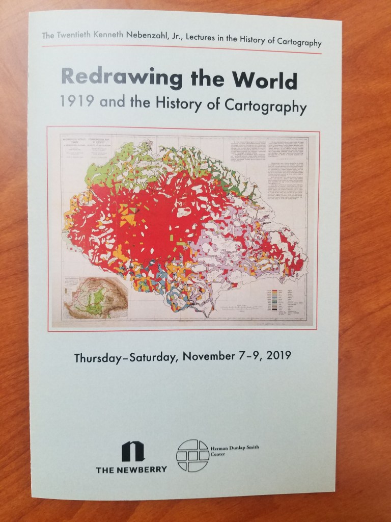
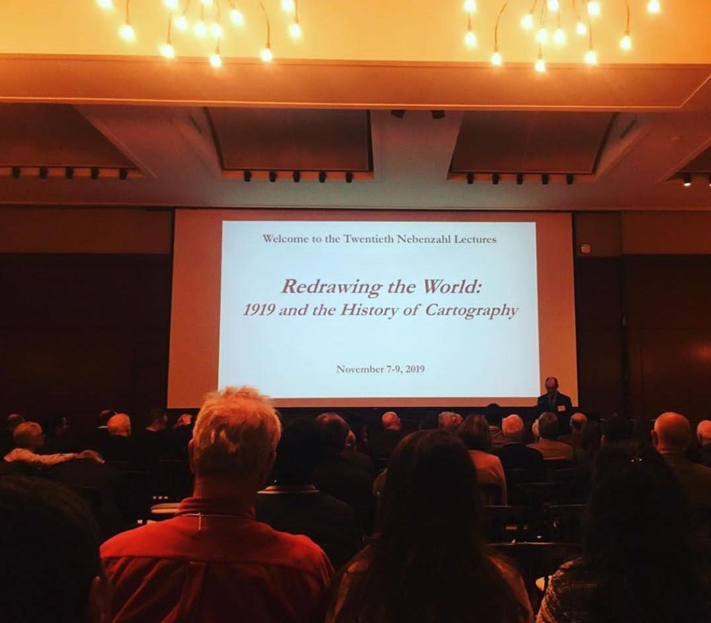
20th Nebenzahl Lectures: The AGSL Goes to Chicago
By Lauren Maddox
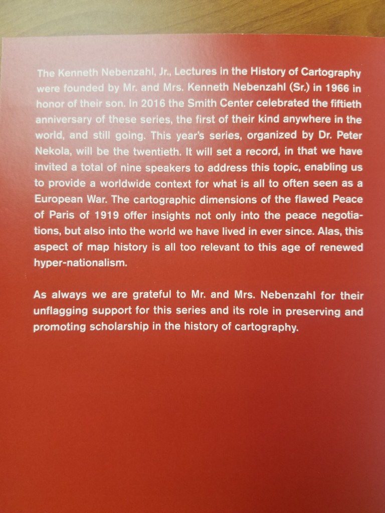
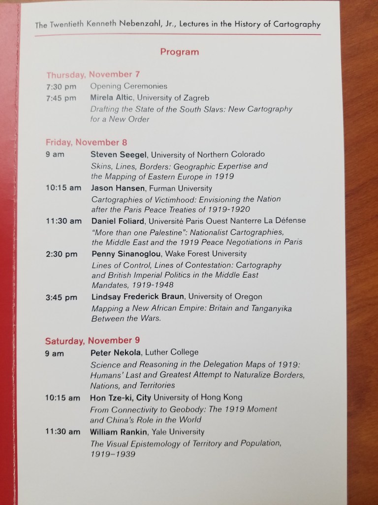
Last weekend was the 20th Nebenzahl Lectures that are held every few years at the Newberry Library in Chicago. The 2019 year’s theme was “Redrawing the World: 1919 and the History of Cartography”– which, as you can imagine, was a very exciting topic for staff at the AGSL. The lectures were held over three days and featured 9 different scholars including organizer Dr. Peter Nekola.
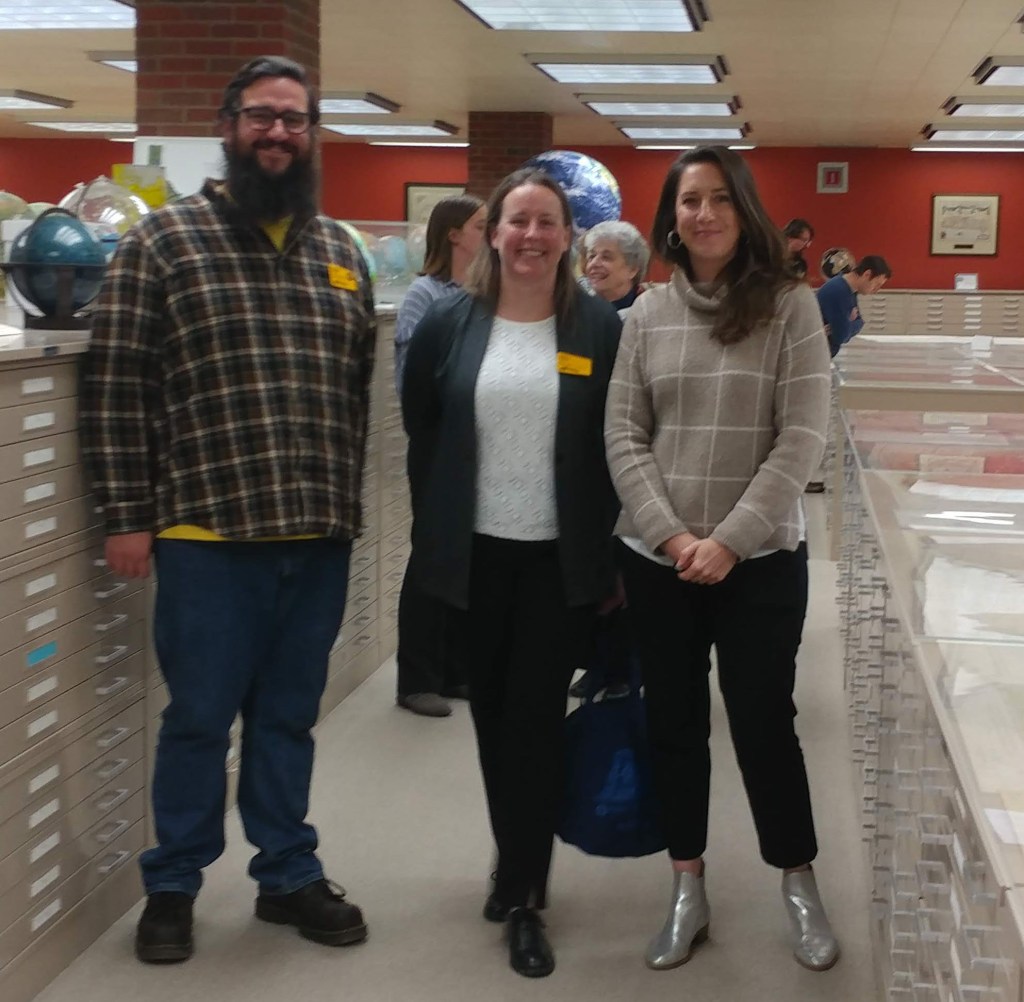
On Thursday, attendees visited the AGS Library and enjoyed a presentation by Curator, Marcy Bidney and viewing an exhibit highlighting the role of the AGS at the Paris Peace Conference following WWI. Besides providing thousands of maps, atlases, books and nautical charts from the AGS Library, which were shipped to France for use by the American delegation, the AGS building and its staff were involved in the work of the so-called “Inquiry” which preceded the actual Conference. Starting in November 1917, a team of geographers, historians, regional experts and cartographers worked in secret at the AGS headquarters building, drawing on the library’s vast resources to produce reports and maps for the American negotiators to use at the Peace Conference.
Many of the presenters at the conference, referenced resources held at the AGS Library and used in their research.
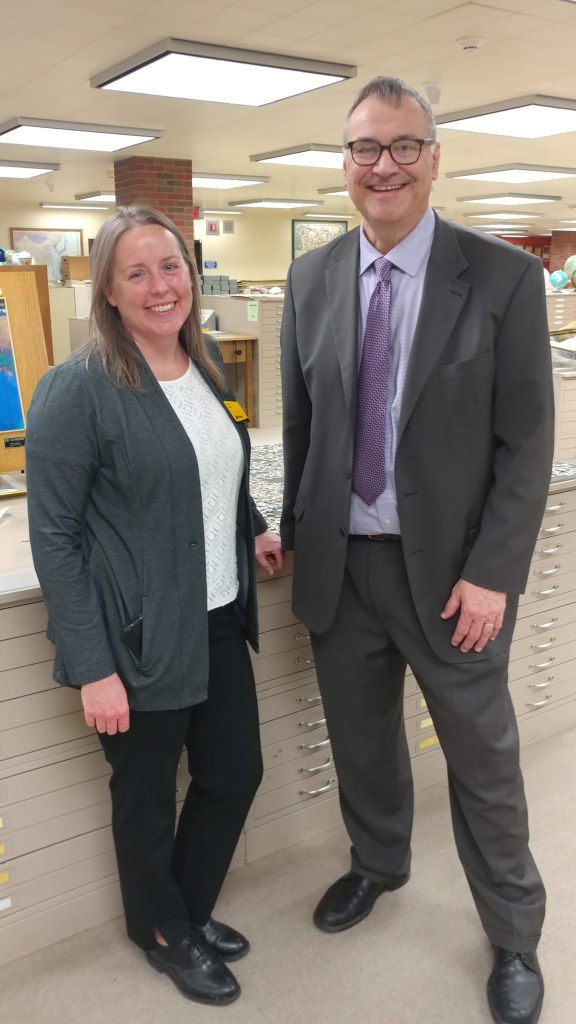
AGSL staff: Marcy Bidney, Curator ; Jovanka Ristic, Reference Librarian ; and student interns Georgia Brown and Katie Bischof attended the Lectures in Chicago. The Lectures focused on the 1919 map production boom and how cartographers helped forge the uneasy peace at the Paris Peace Treaties. Particular topics included “Mapping a New African Empire: Britain and Tanganyika Between the Wars” presented by Lindsay Frederick Braun and “Cartographies of Victimhood: Envisioning the Nation after the Paris Peace Treaties of 1919-1920” presented by Jason Hansen. The Lectures were an exciting reason to visit Chicago and the AGSL was proud to participate.
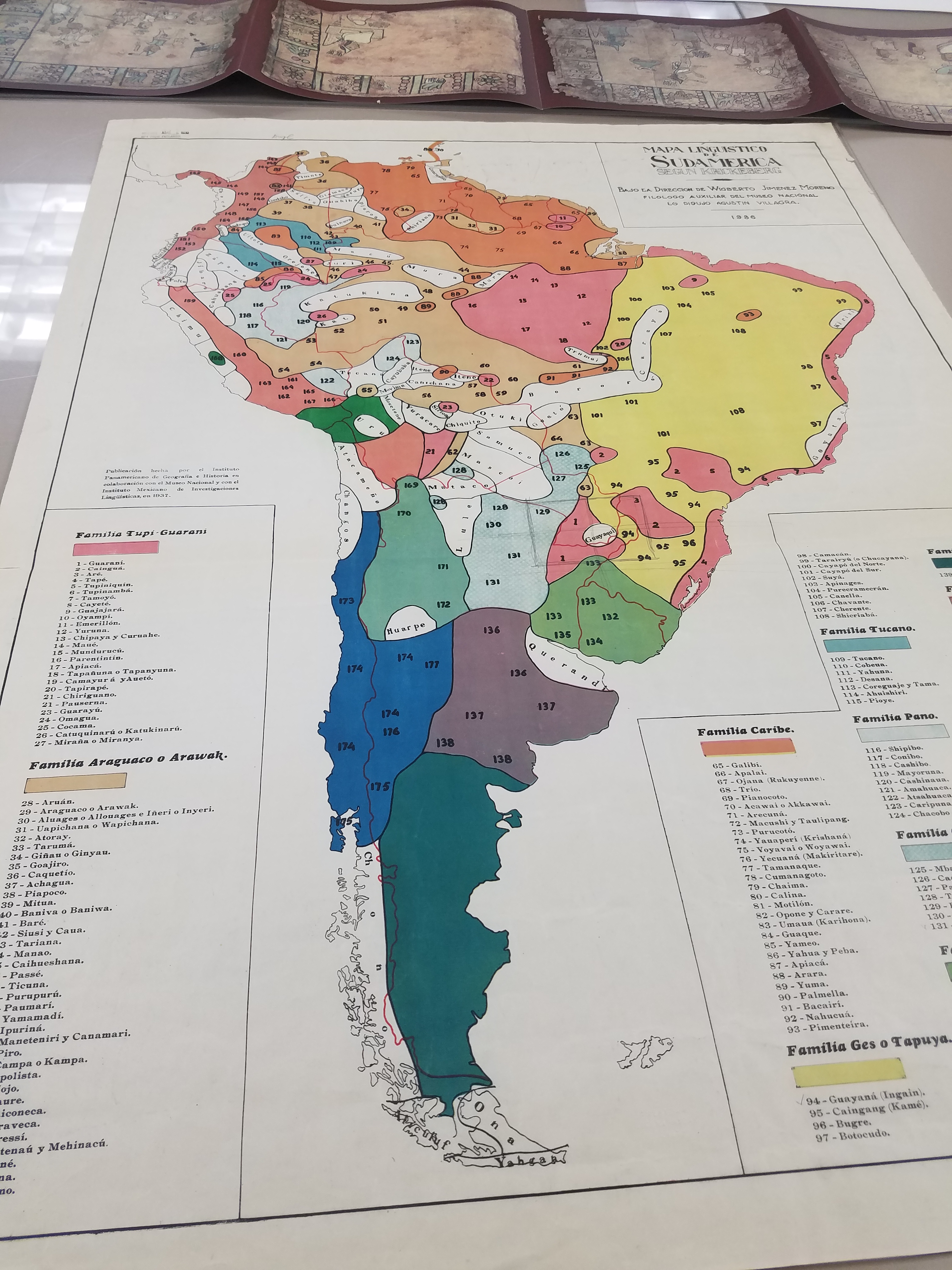
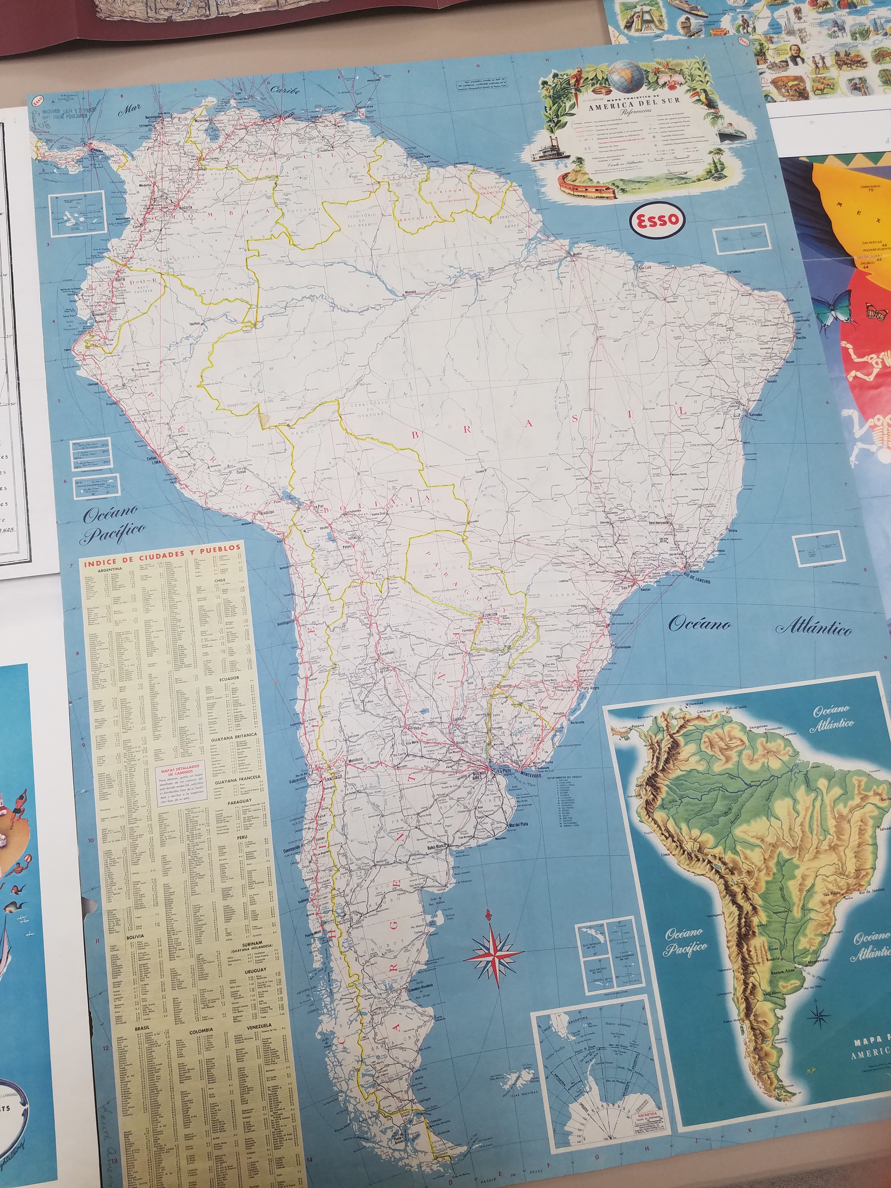
In Case You Missed Us: The National Hispanic Heritage Month Pop-Up Exhibit
By Lauren Maddox
Last month, I wrote about our then-upcoming Pop-Up Exhibit in celebration of National Hispanic Heritage Month. The exhibit was a collaborative project in conjunction with the UWM Archives to showcase some of our collections and honor this very special month. As we move into October, we will be putting up another exciting exhibit (stay tuned for more on that later!), but in case you missed this pop-up, here are some of the digital versions of pieces we featured in the exhibit:
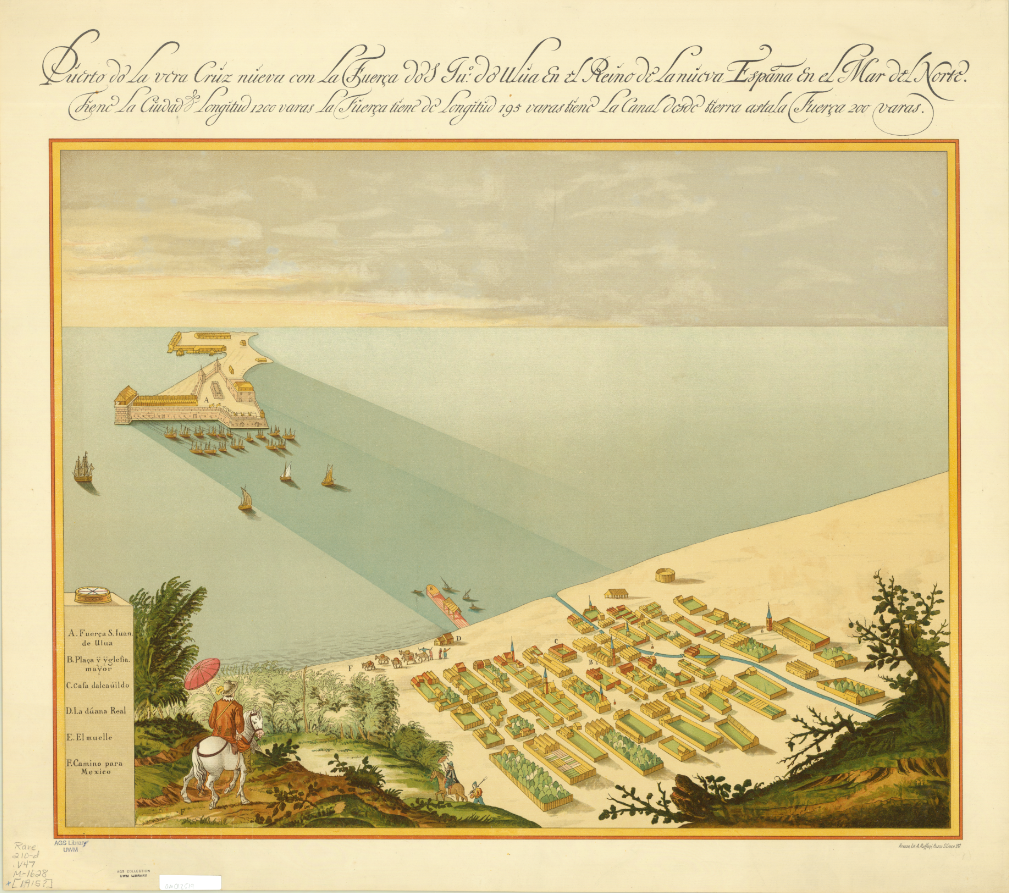
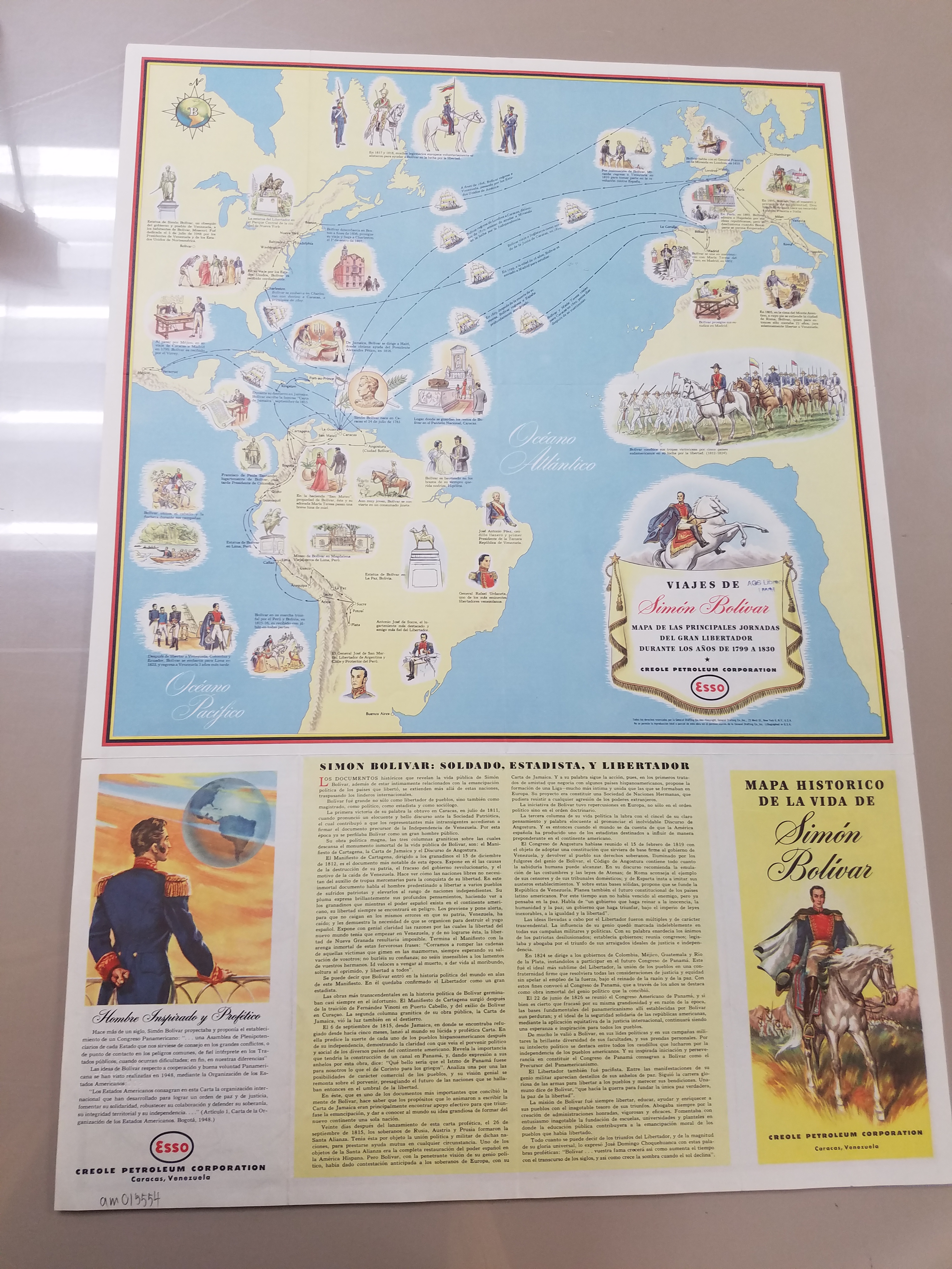
Map of San Juan Ulua Island in 1628. 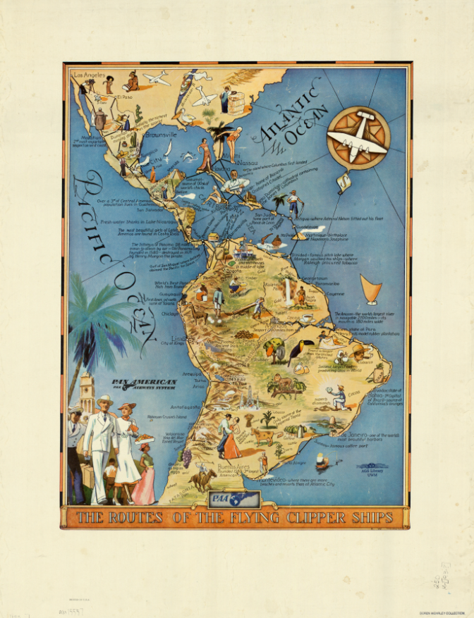
“The Routes of the Flying Clipper Ships,” 1930s. Click the links to see these maps in our Digital Collections! 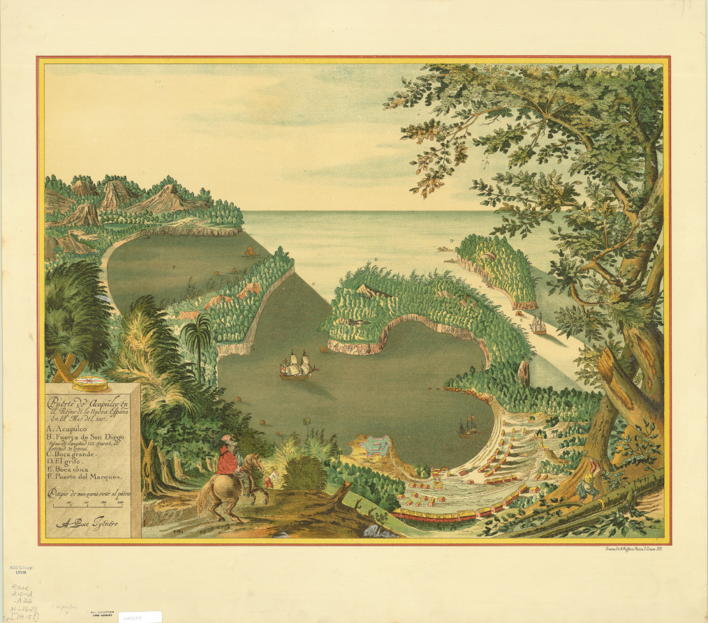
Map of San Juan Ulua Island in 1628. 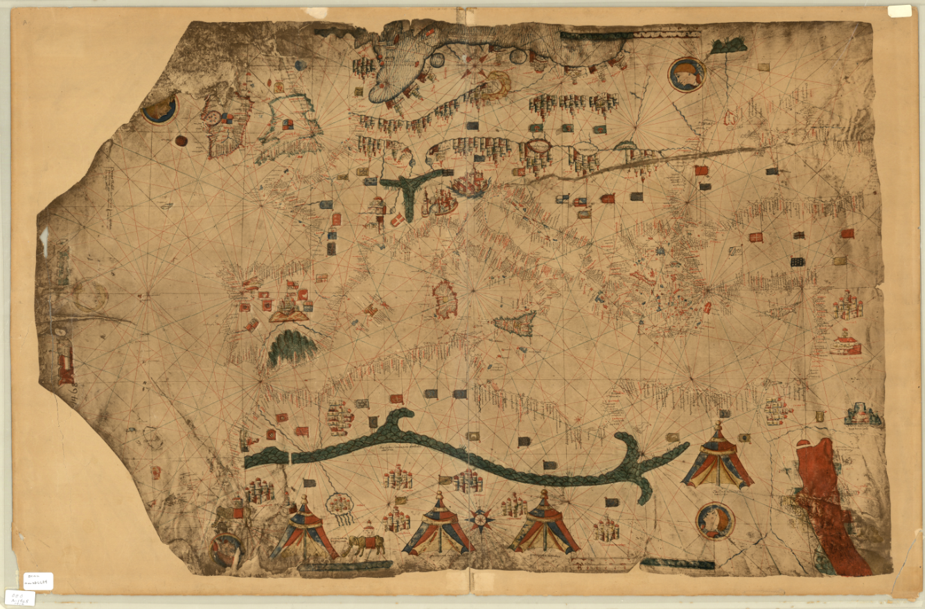
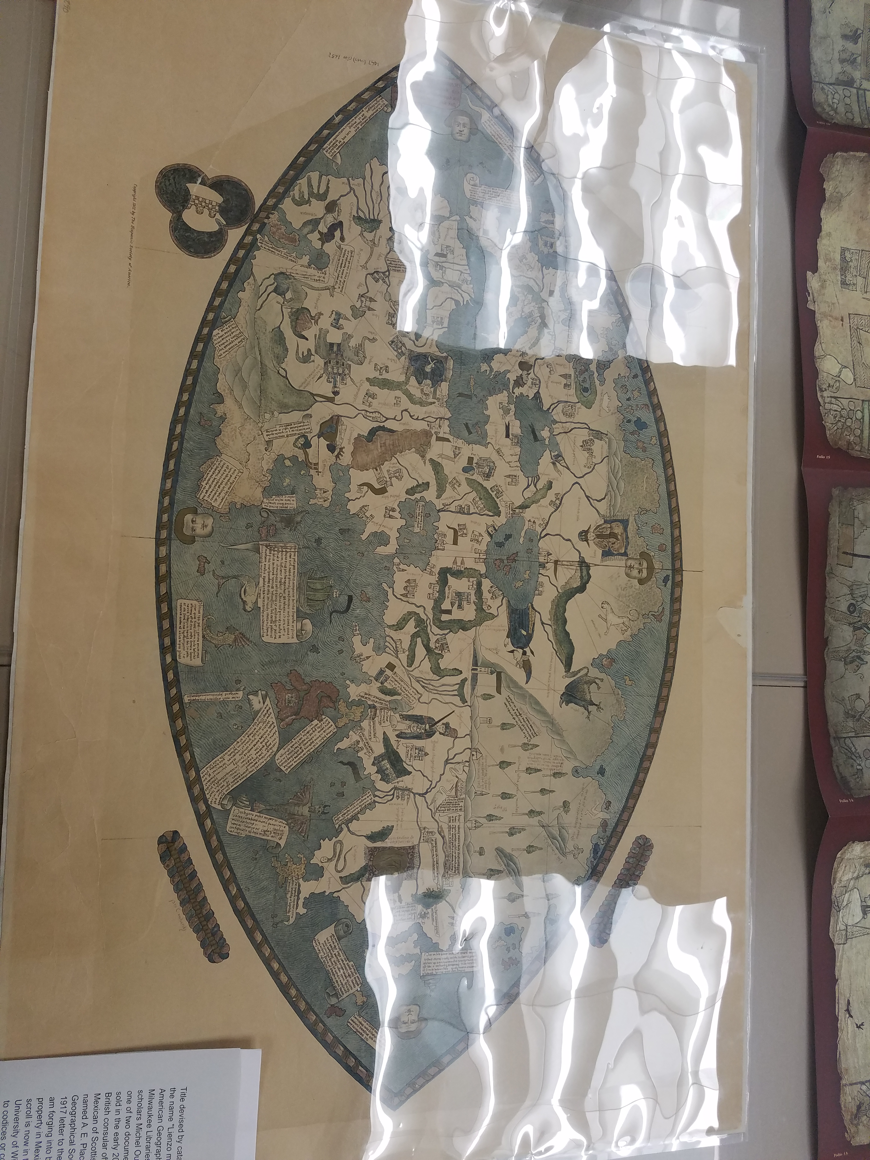
Fascimile of 1468 World Map, previously owned by the Hispanic Society of America.
And some photos of the exhibit live and in-person:
Stay tuned for more updates about future exhibits!
Hispanic Heritage Month: A Special Pop-Up Exhibit
By Lauren Maddox
This past Sunday marked the beginning of National Hispanic Heritage Month. This month is a celebration of Hispanic Americans who, according to the National Hispanic Heritage Month website, “have positively influenced and enriched our nation and society.” The tradition of a National Hispanic Heritage Month began in 1968, when Representative Edward R. Roybal sponsored legislation that would establish a National Hispanic Heritage Week. The holiday week was signed into effect under Lyndon B. Johnson and then expanded to a month-long period during Reagan’s presidency in 1988. The original start date, September 15th, was chosen to celebrate the official independence days of Costa Rica, El Salvador, Guatemala, Honduras, and Nicaragua declared in 1821. The original week also encompassed Mexico, Belize, and Chile’s independence days. Now the month-long observance, celebrated from September 15th-October 15th, includes all of these days as well as Dia de la Raza.
In honor of National Hispanic Heritage Month, many organizations including the Library of Congress, the National Gallery of Art, the Smithsonian, and the National Park Service are hosting events throughout September and October. Throughout the month, there will be a Community Day, a Hispanic Heritage Month Concert with Inca Son, a book talk with Haitian-American writer Edwidge Danticat, and a Wikipedia Edit-a-thon and more. And in addition to the live events, many digital archive collections are being made public this month– the National Hispanic Heritage Month website includes a list of all related exhibits and collections here. Some highlights from this list: the Library of Congress’s Archive of Hispanic Literature on Tape, Documents of 20th Century Latin American and Latino Art supported and hosted by the National Endowment for the Humanities, and many, many others.
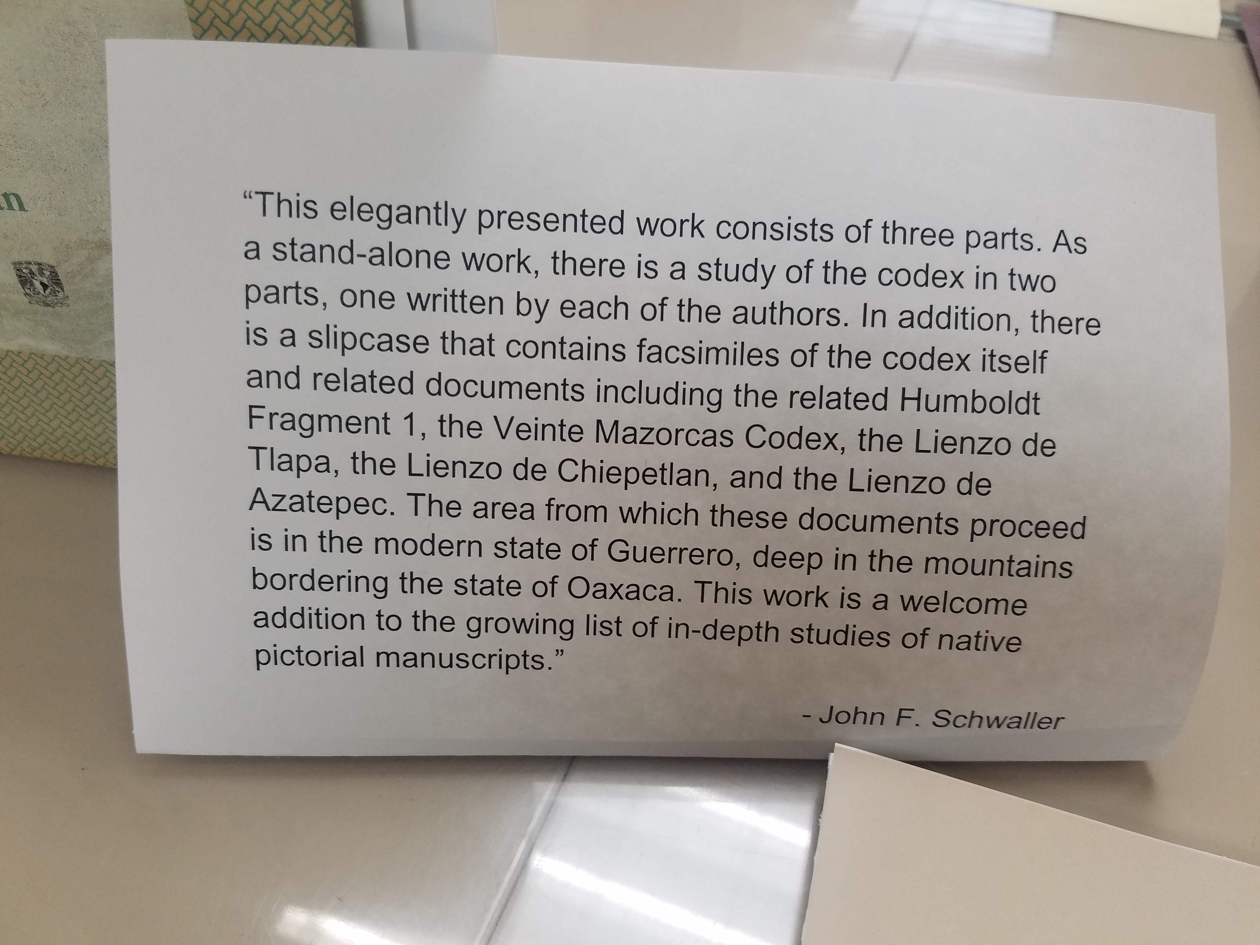
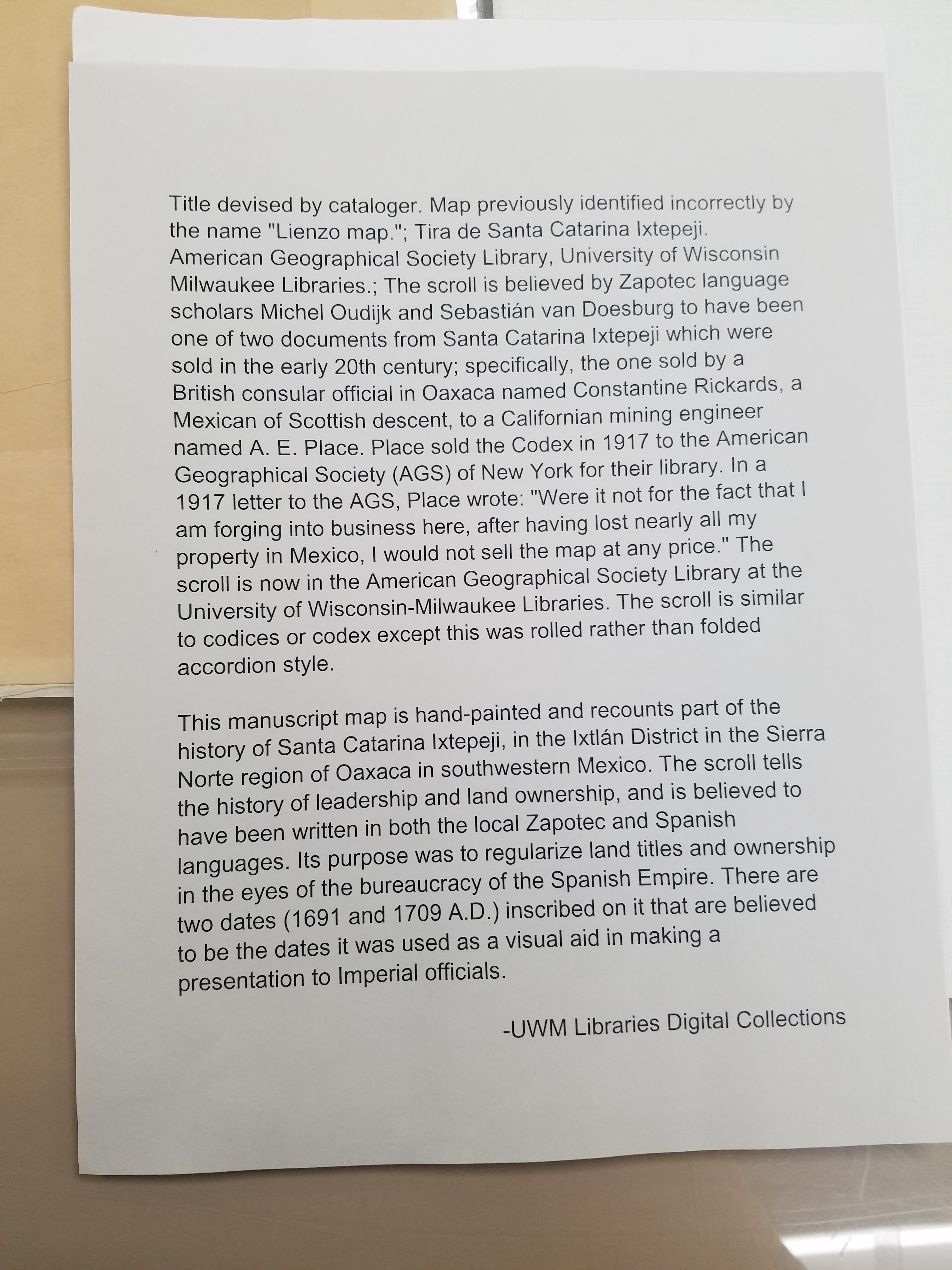
But these aren’t the only ways to celebrate National Hispanic Heritage Month! This week from September 25-27th, the AGSL and UWM Archives are collaborating on a pop-up exhibit featuring curated pieces from both libraries’ collections. The exhibit will span both of our libraries: materials from the Archives will be on display on the second floor and maps from our collections will be exhibited in the AGSL. We are especially excited to showcase the Tira de Santa Catarina Ixtepeji scroll. Please, come celebrate this historic month with us! And enjoy a preview of some of the maps included in the exhibit:
Map of San Juan Ulua Island in 1628. Fascimile of 1468 World Map, previously owned by the Hispanic Society of America. Map of Acapulco in 1628. “The Routes of the Flying Clipper Ships,” 1930s. Click the links to see these maps in our Digital Collections!
The AGSL is open from 8:30-4:30 Monday-Friday! We will also be participating in Milwaukee Open Doors this weekend on September 28th from 10-5! Please stop by and see us!
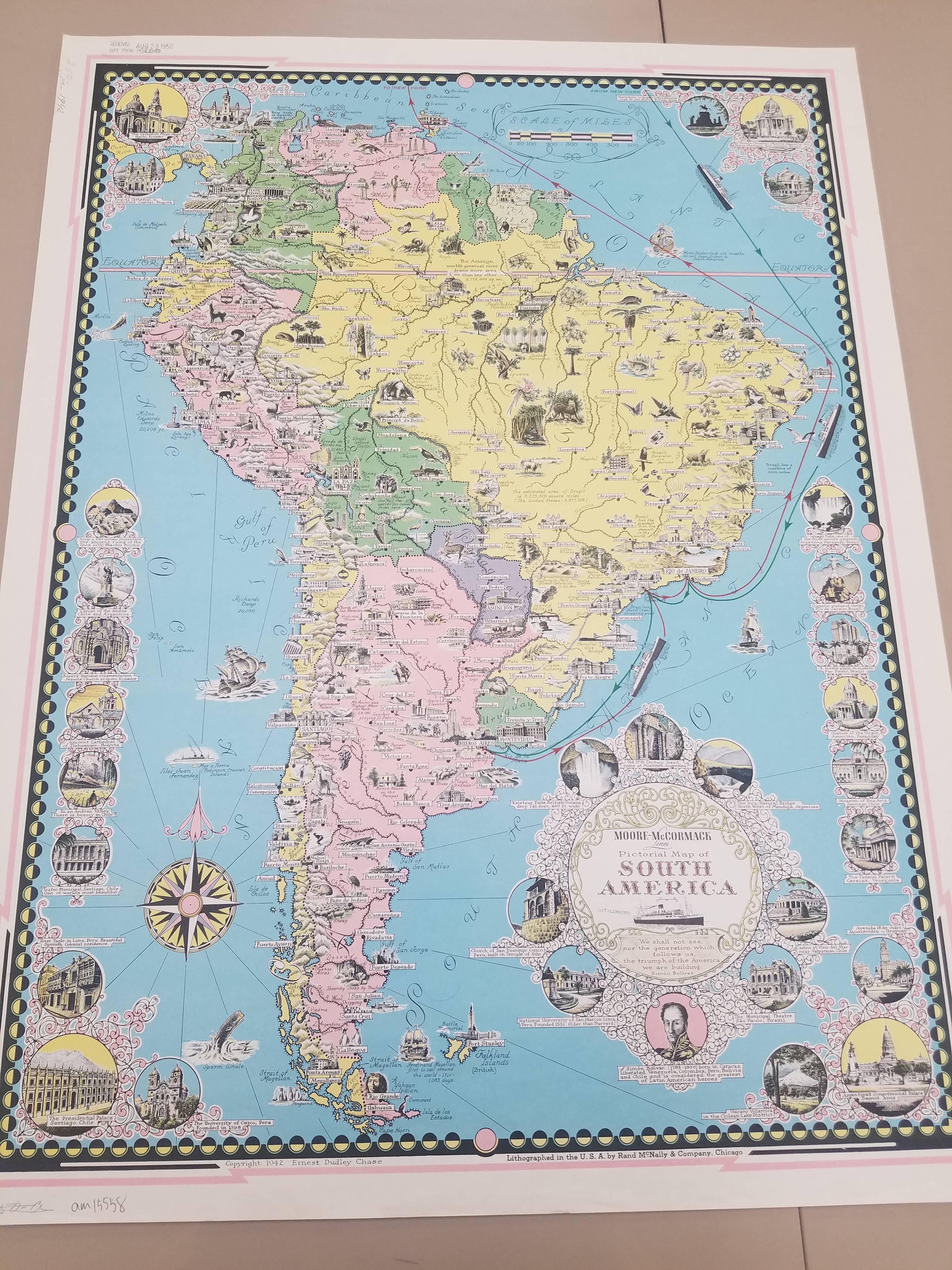
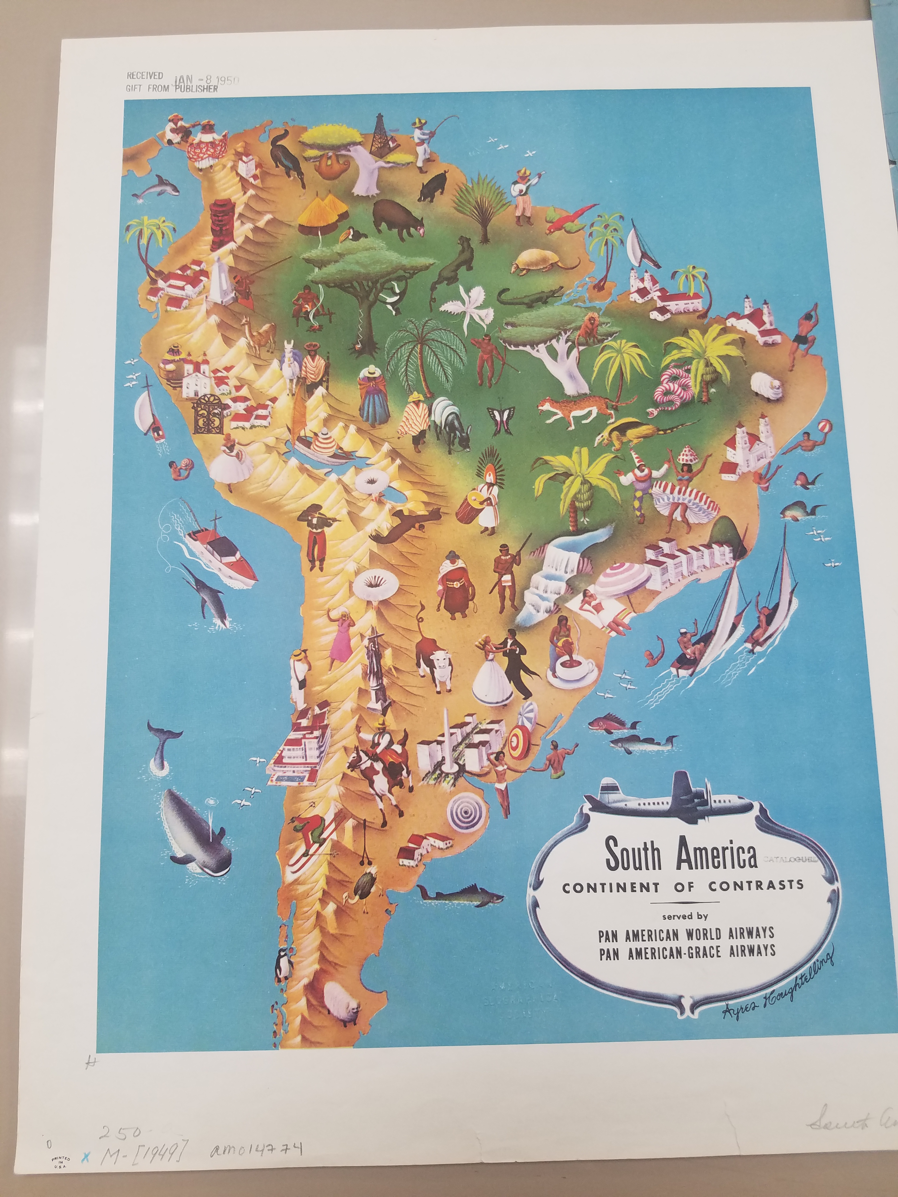
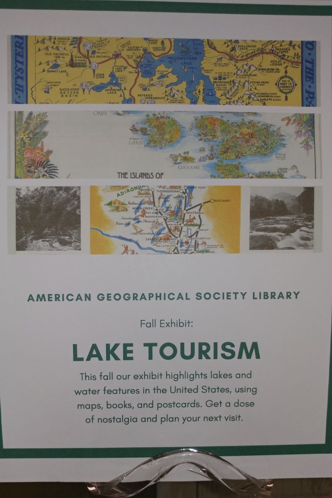
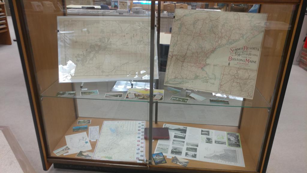
Lake Tourism Exhibit
by Angie Cope
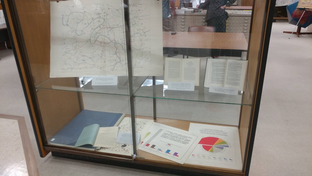
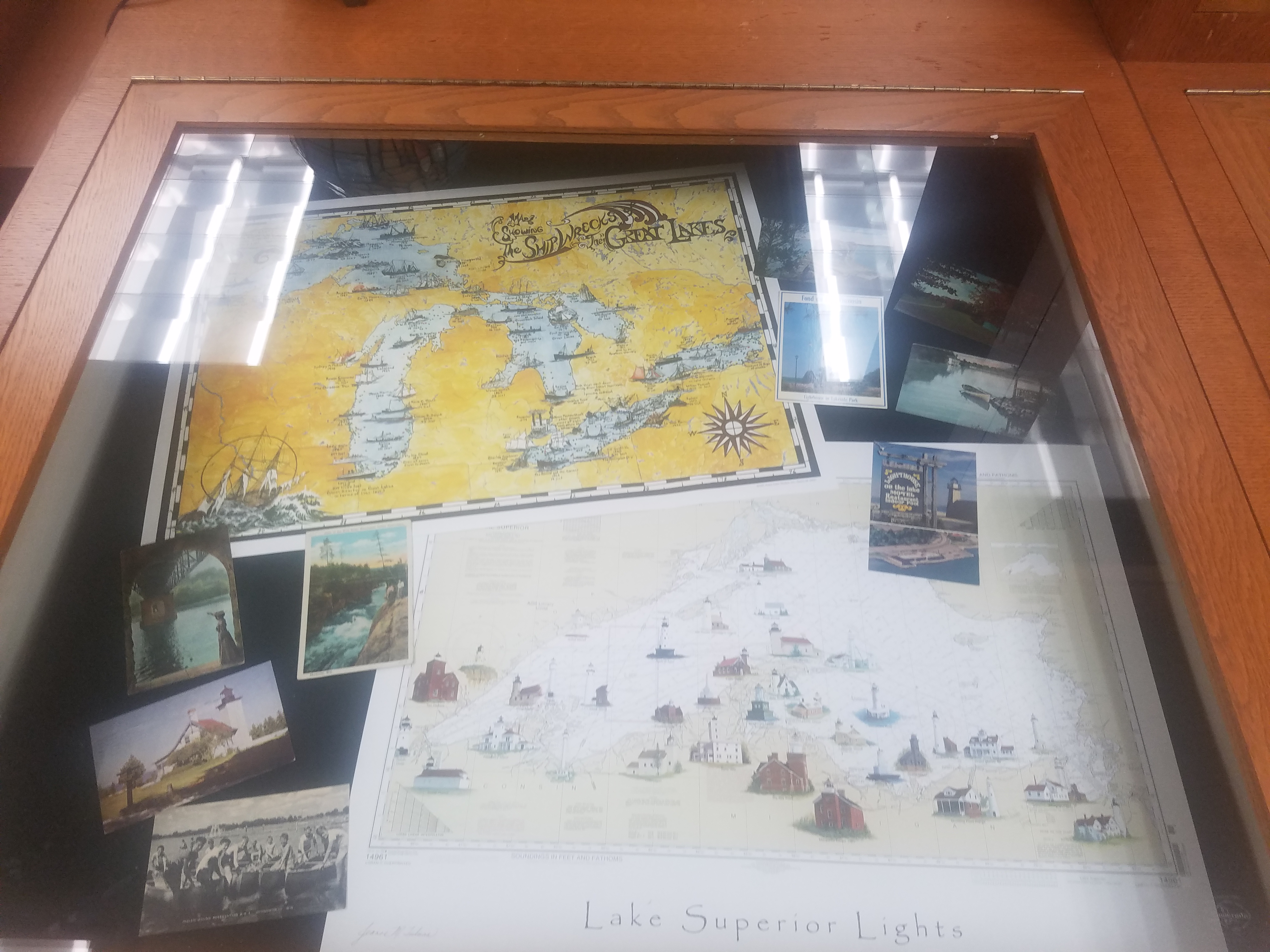
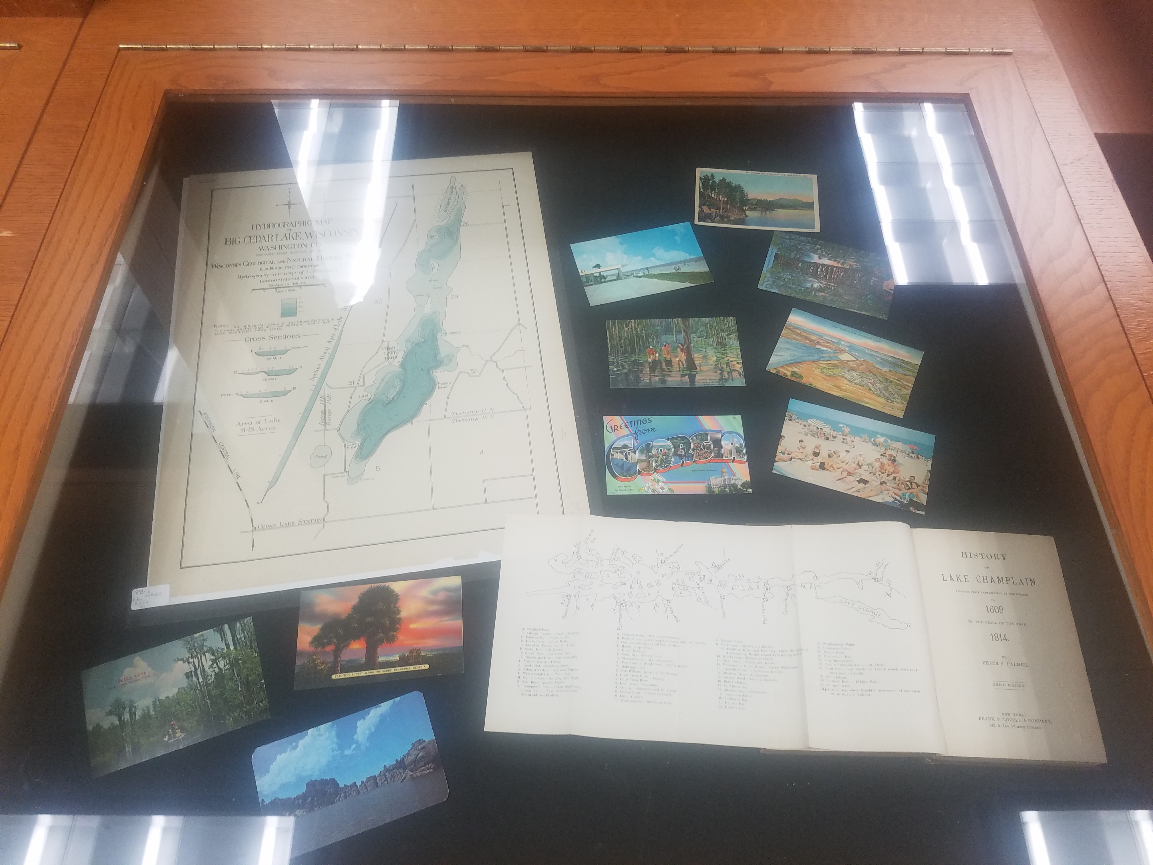
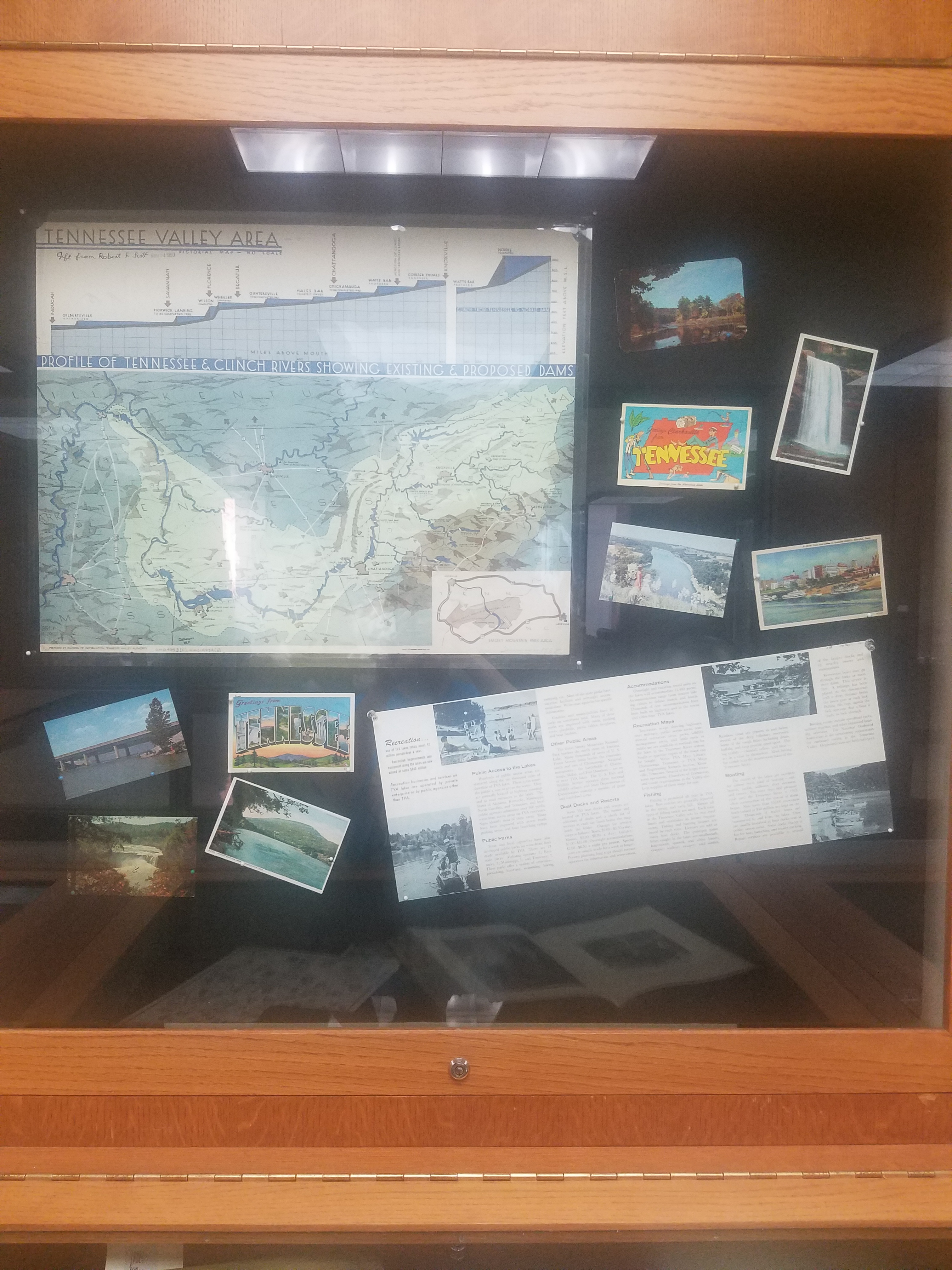
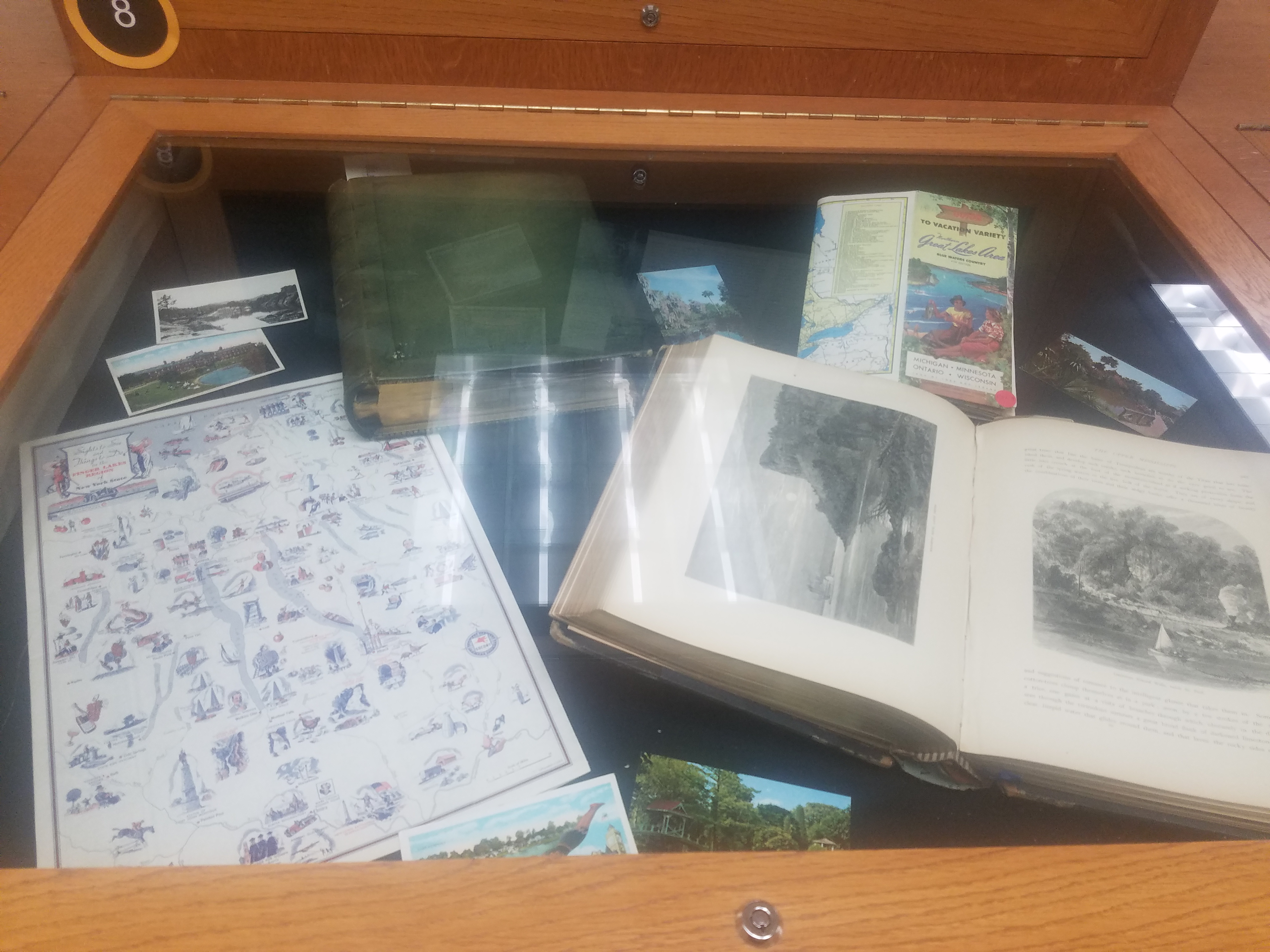
Here is a closer look at the Fall exhibit curated by Georgia Brown, Graduate Student Intern at the AGS Library. The fall exhibit highlights lakes and water features in the United States using maps, books and postcards.
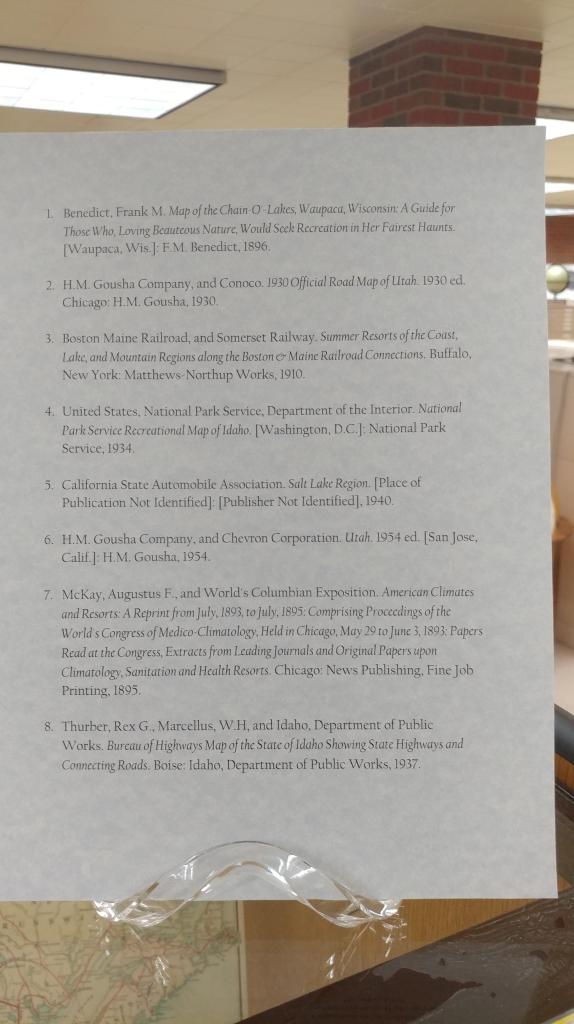
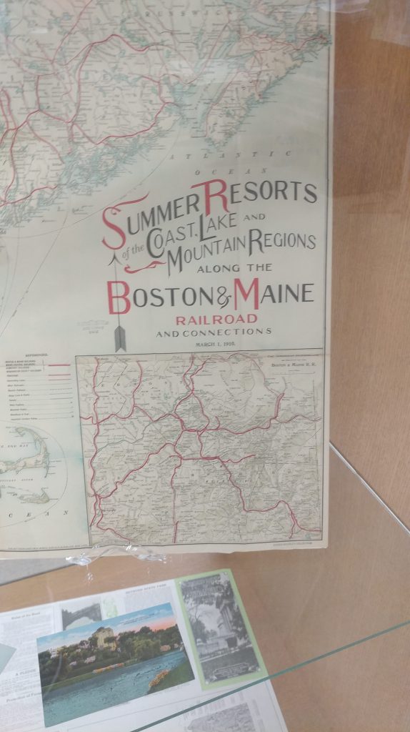
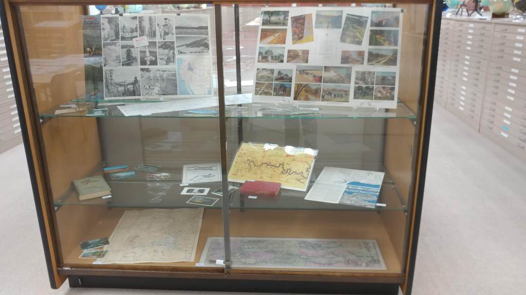
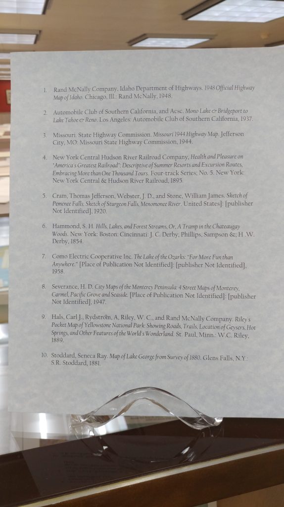
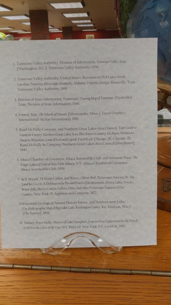
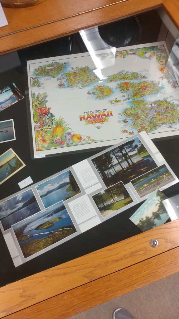
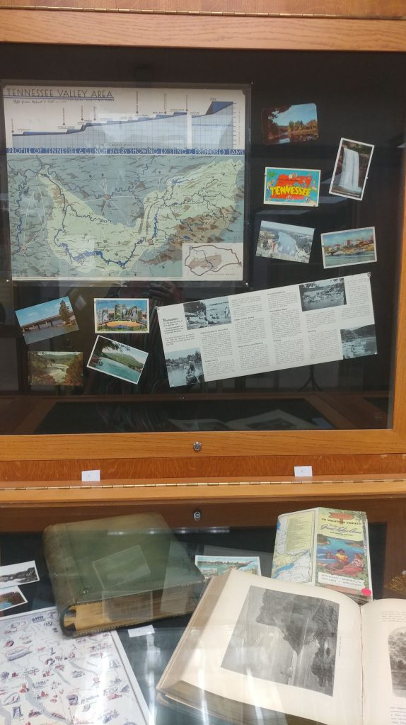
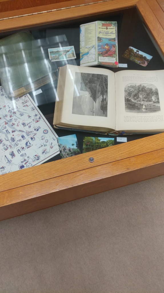
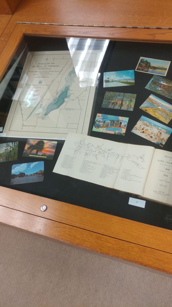
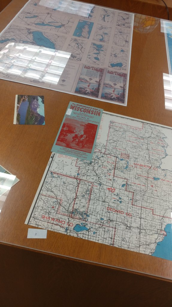
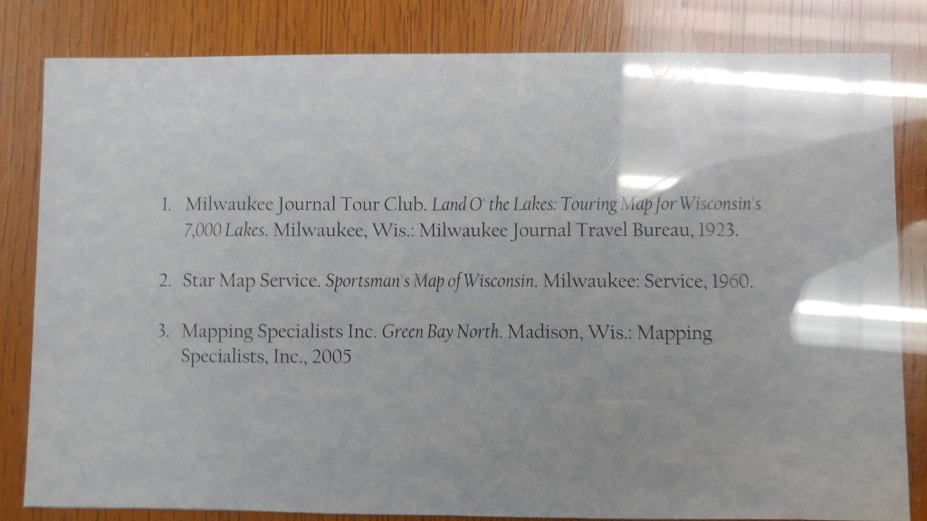
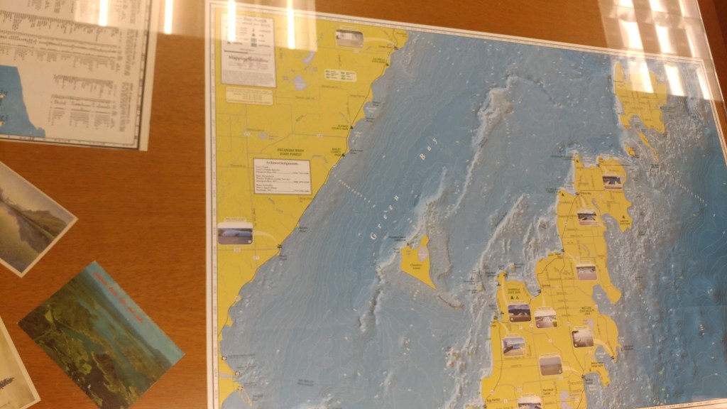
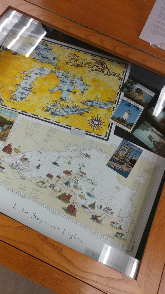
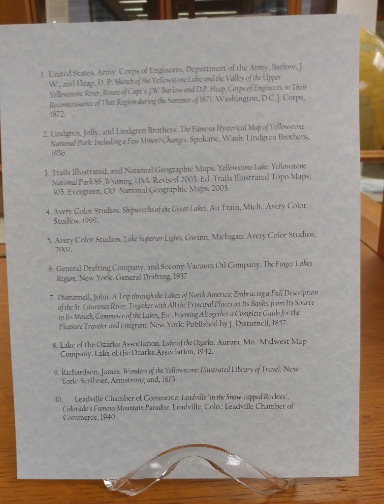
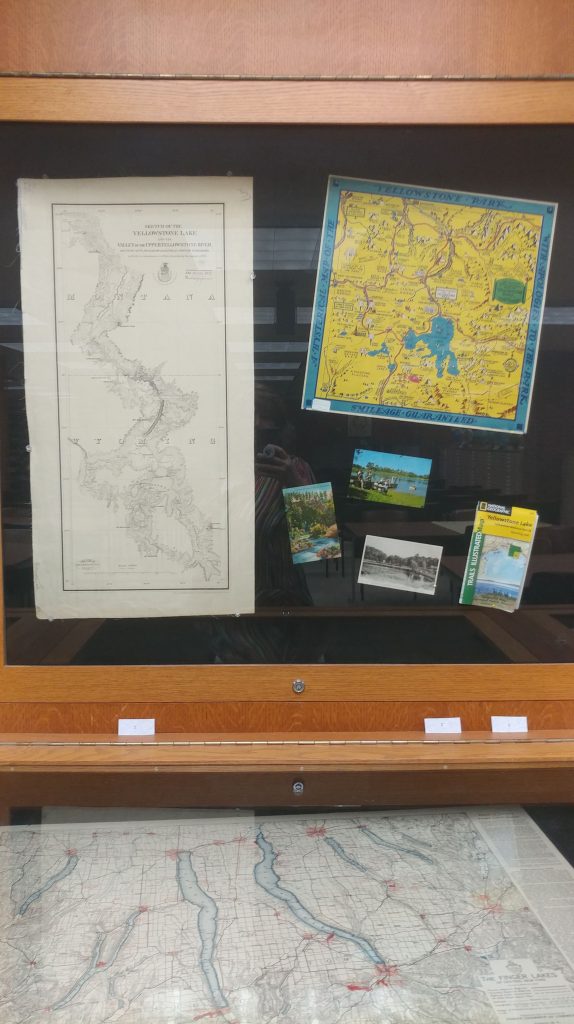
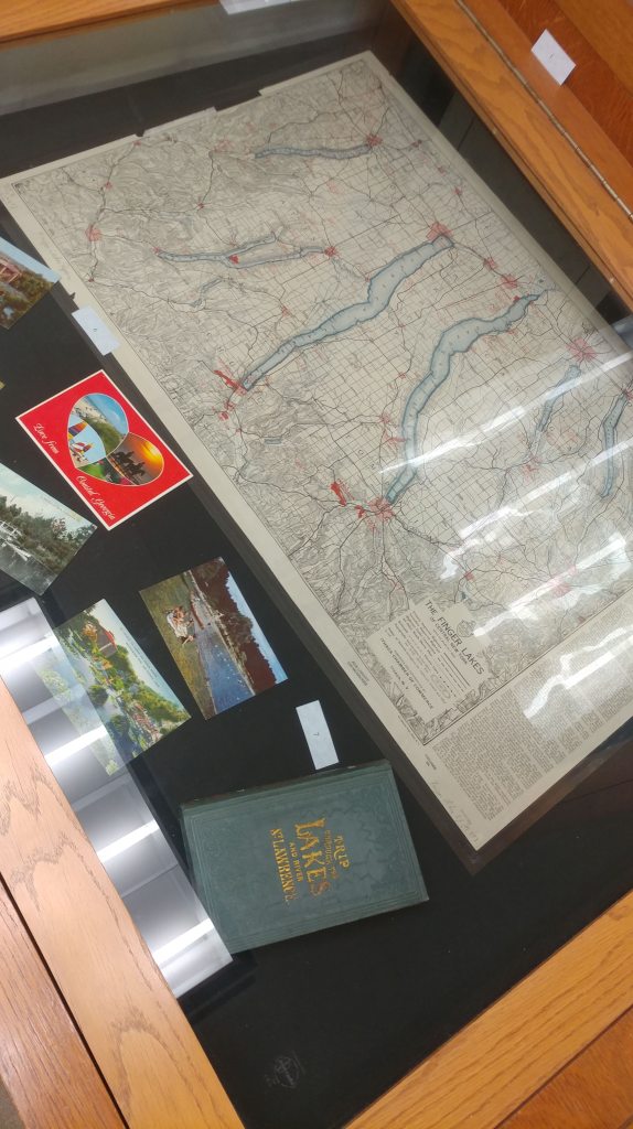
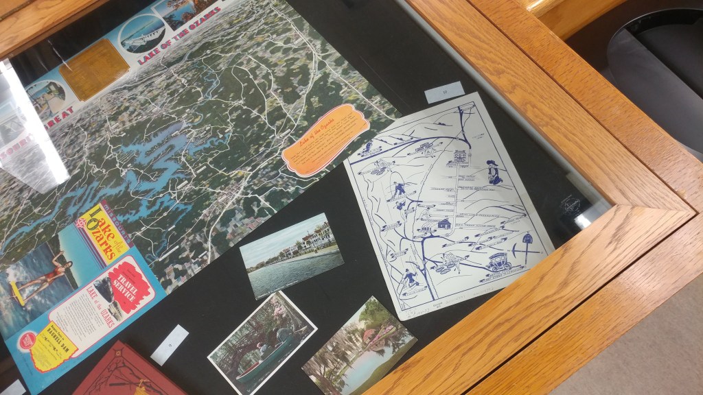
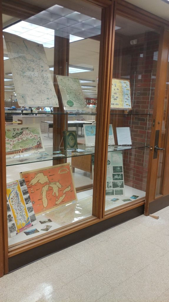
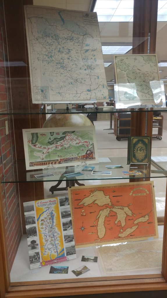
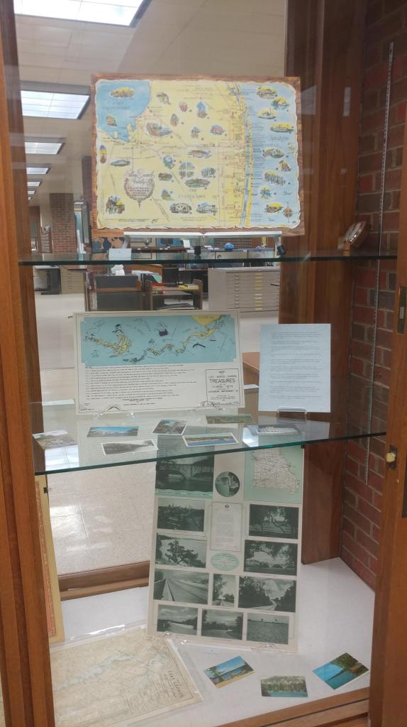
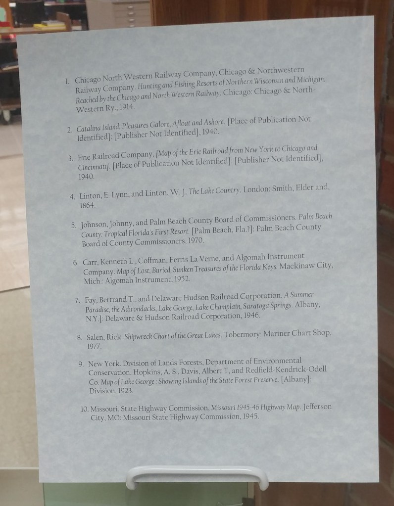
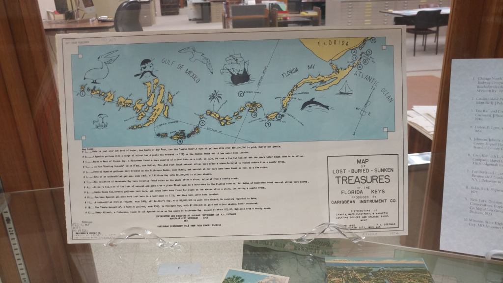
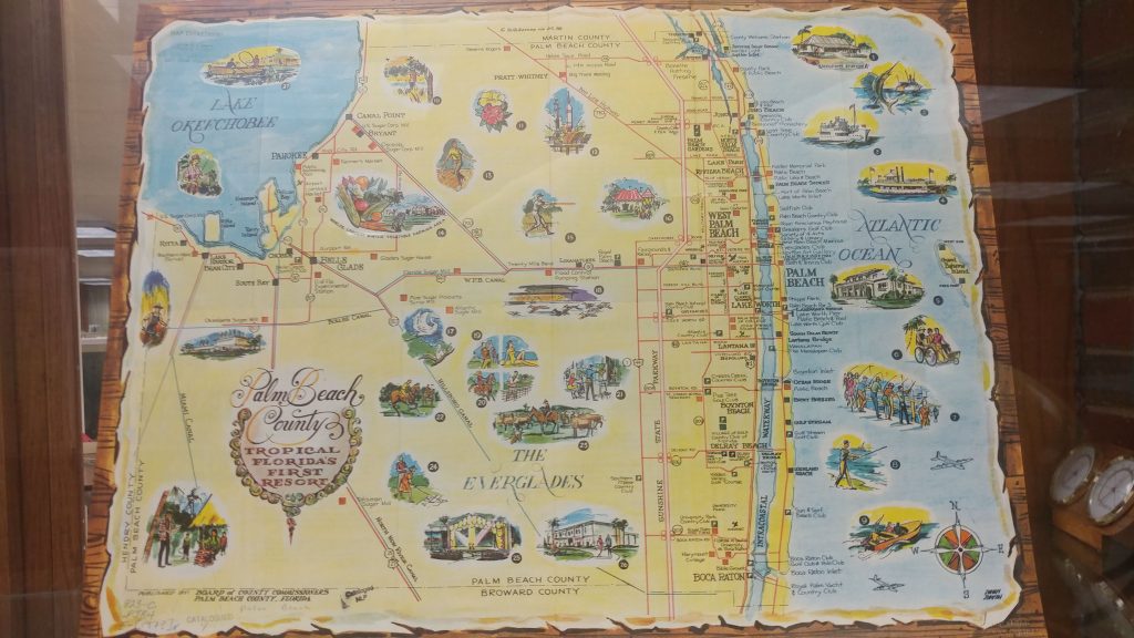
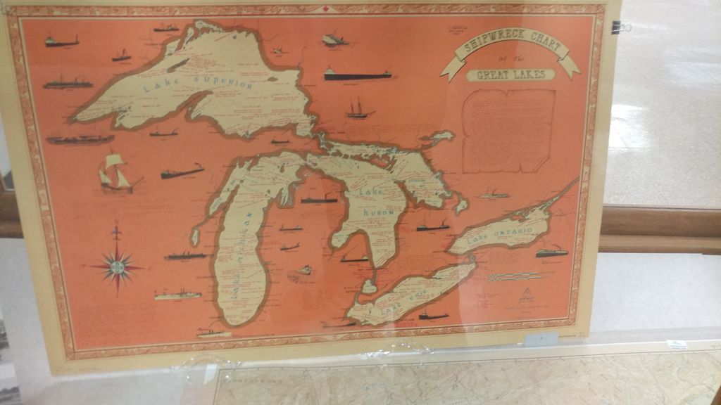
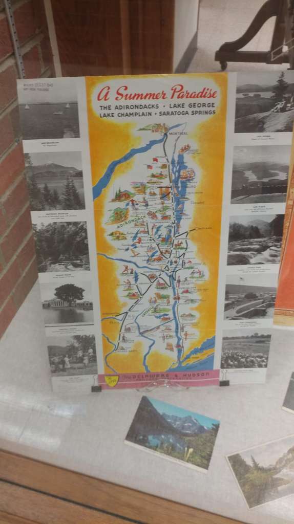
Freshwater People: An Exhibit on Lake Tourism by Georgia Brown
By Lauren Maddox
This week, the AGSL is unveiling a new featured exhibit designed by Graduate Student Intern Georgia Brown. This exhibit, which is focused on freshwater tourism and recreation, features a selection of pieces from our collections including postcards, maps, and rare, vintage travel books.
Brown has been a Graduate Student Intern with the AGSL since May 2018 (you might remember her from last month’s feature!) The exhibit is part of a final project for Brown’s Independent Study with the AGSL’s curator Marcy Bidney, which focused on cartographic resources in libraries.
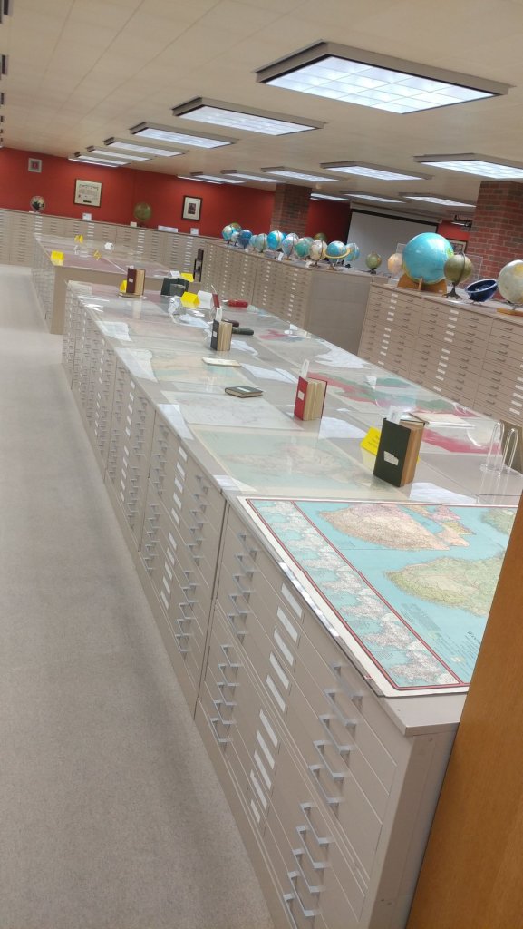
Here are few photos from the Freshwater People: An Exhibit on Freshwater Tourism:
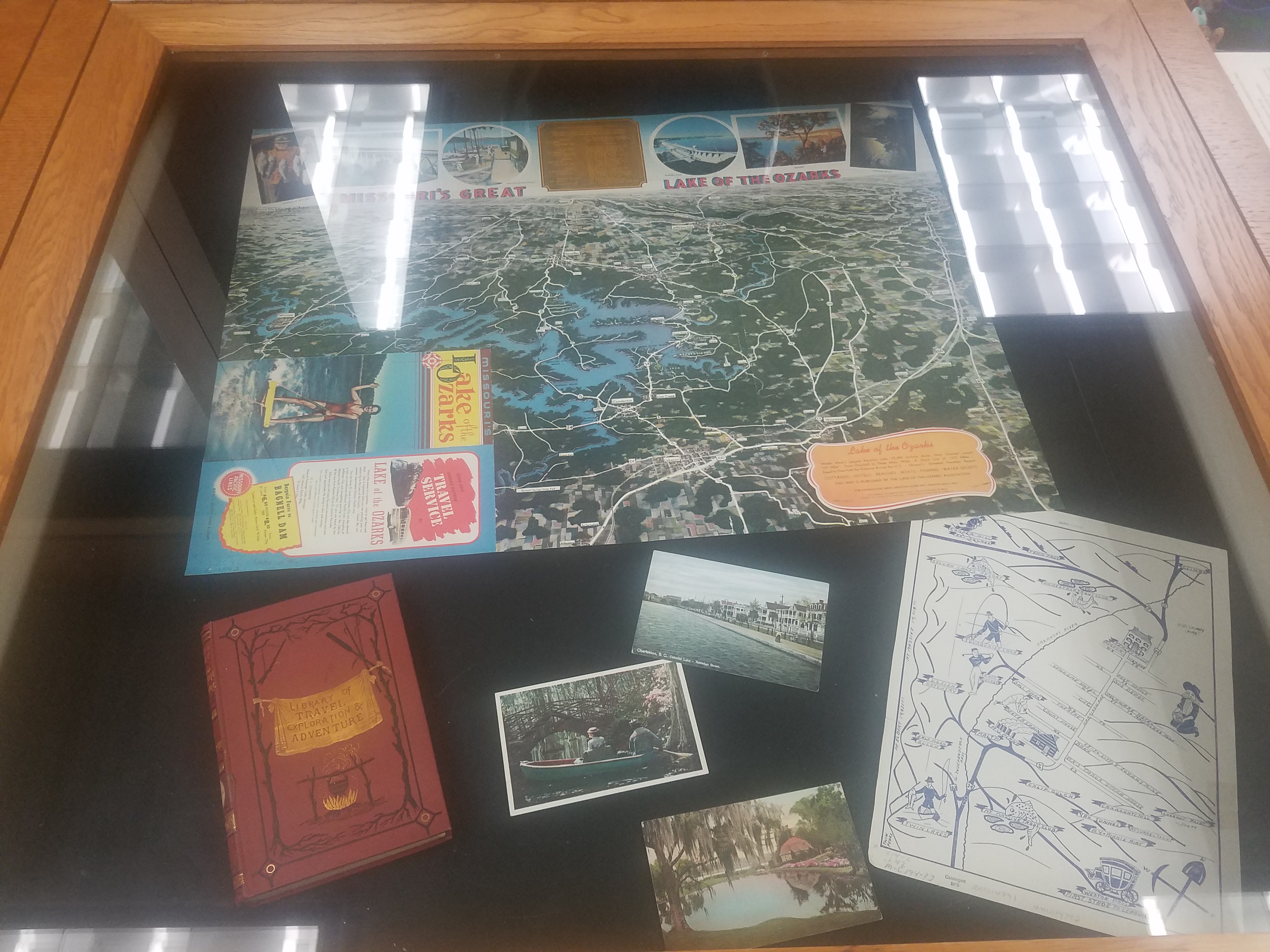
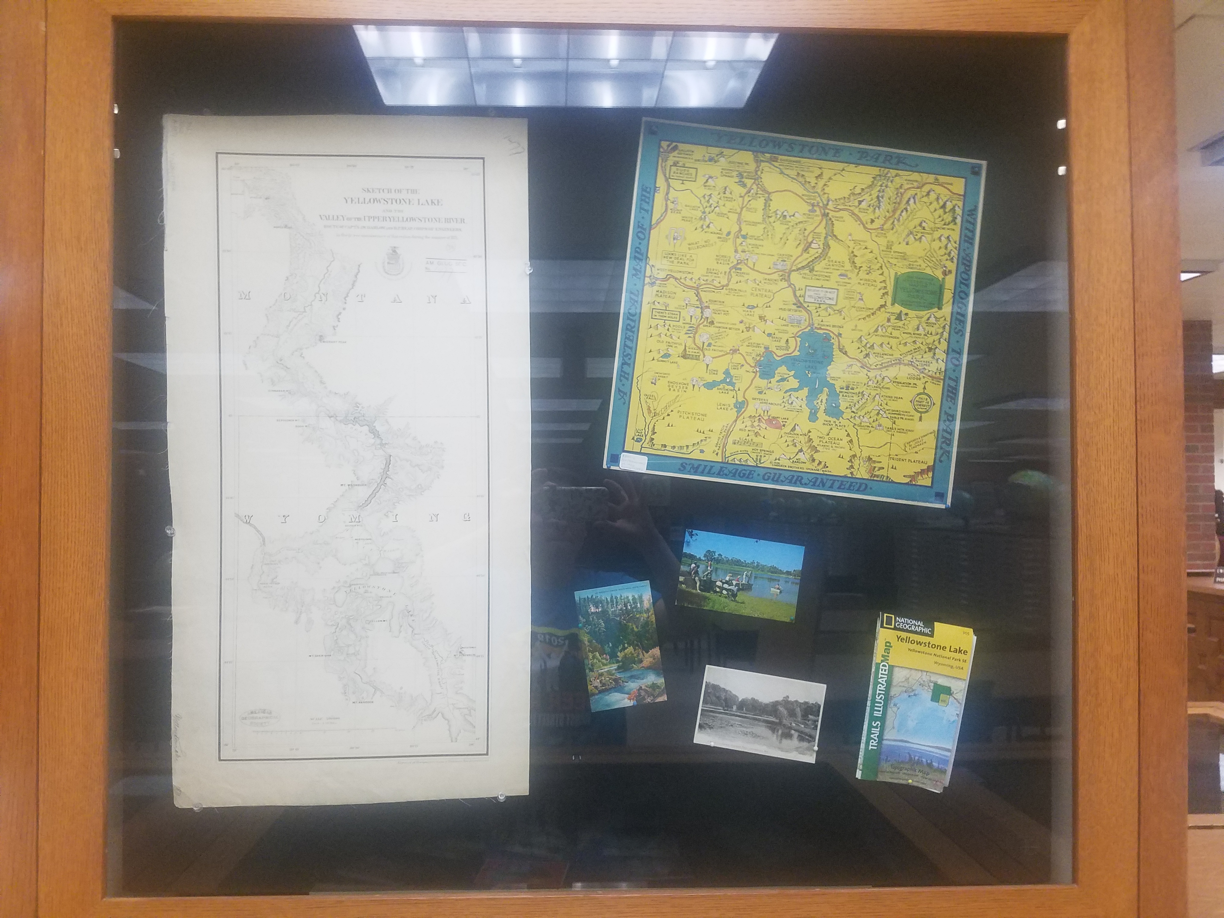
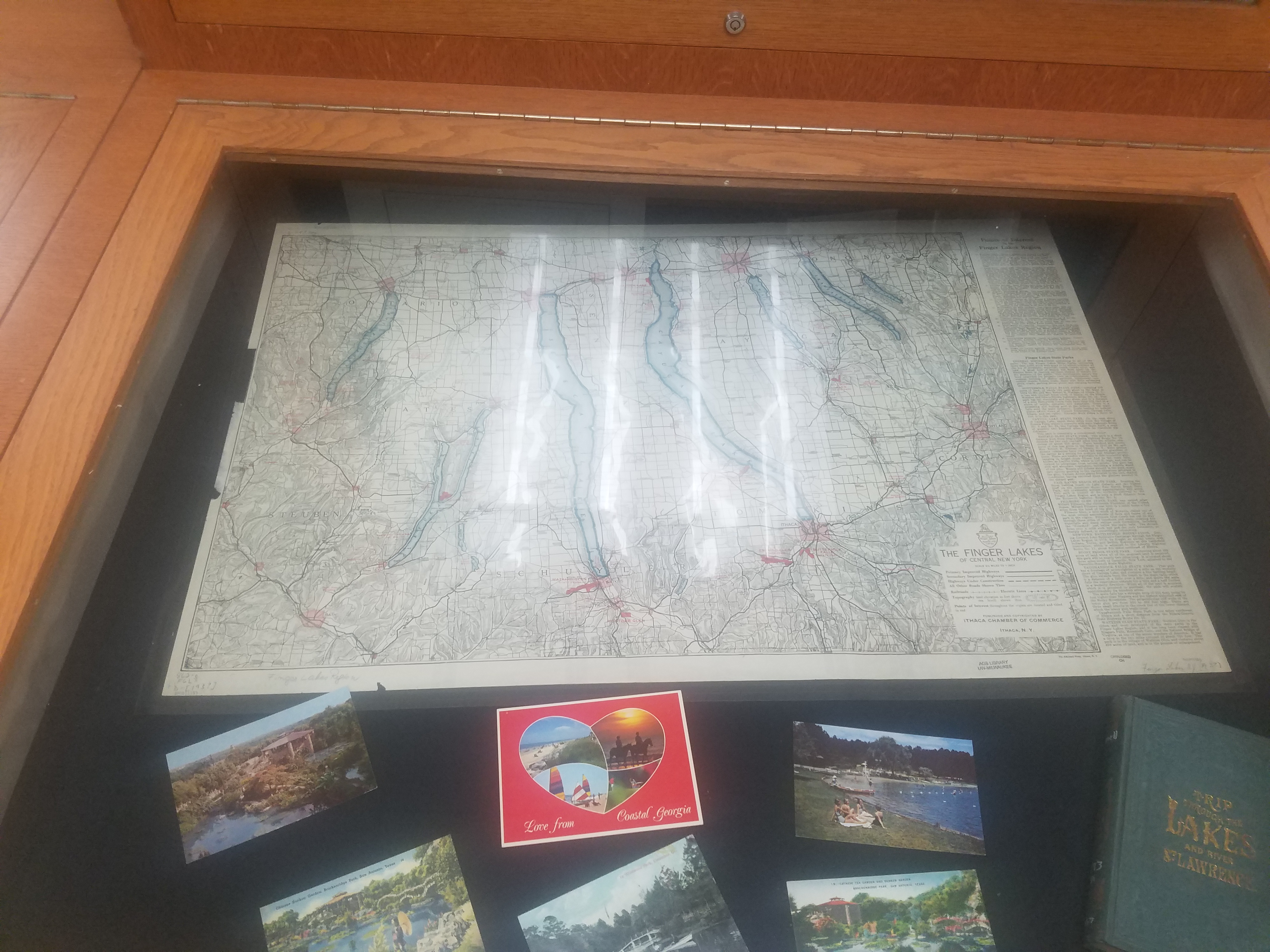
This exhibit is available and open to the public now! We encourage you to come see it in person– and enjoy the rest of the AGSL’s collections while you’re here! The AGSL is open Monday-Friday, 8:00-4:30. Please come and see us!
The AGSL Guided Tour: An Interview with Georgia Brown
Interview conducted by Lauren Maddox
This week, I sat down with Graduate Student Intern Georgia Brown to discuss one of her recent projects for the AGSL. Georgia is part of the School of Information Studies coordinated degree program working to receive her Master’s in both Library and Information Science and History. She has been a key member of the AGSL staff since 2018, contributing to many projects for the library. Recently, she designed a guided tour of the AGSL to make our collections more accessible to visitors exploring the library. To learn more about the tour and how you can take it, read on:
So, we’ve started giving visitors your Self-Guided Tour of the AGSL to help them navigate the library—could you talk a little about what the Guided Tour is and your process for creating it?
The guided tour helps people get into the space of the AGSL and really see more of the collection than is just out by the display cases. The process actually took a few months–I made a lesson plan last semester that had middle schoolers exploring the AGSL while also learning about the parts of a map. The lesson itself is a map of the library that the students use to figure out a different part of a map at each stop. After I made this, I realized that this would be an awesome way to have people just come visit the AGSL.
How would a visitor go about a Guided tour? Could you describe the process of getting a Guided Tour and what visitors see on it?
As soon as you walk into the AGSL, on the table to your right will be a stack of the guided tours. Someone on the library staff will ask if you need any help and if you are just there to look around, we’ll offer you the guided tour as a way to check out the library.
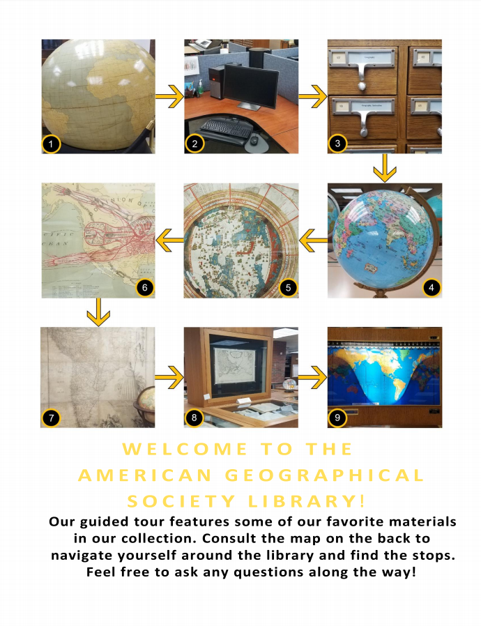
The Guided Tour, available at the front table in the AGSL 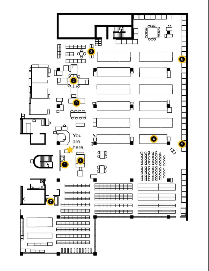
Map of the Library
Why was this a necessary project? Has it made the AGSL more accessible to visitors?
Lots of people come in to see the AGSL, and some will take the time to walk around and see everything. But one of my biggest frustrations is seeing visitors come in, spin once in a circle, and then leave. I realized there was probably more they wanted to see, but something about the space made it seem scary or hard to approach. Now that the guided tour is being handed to patrons and visitors, I feel like they are seeing more of what is on display.
What patrons benefit the most? What impact has this had on visitors’ experiences in the library?
In the two weeks that I have been handing out the guided tour, I feel like only a third of the people who start it actually finish it in its entirety. The other two thirds, however, keep getting distracted by all of our other awesome materials on display. My goal with the tour was to get people into our space, and in just a short time, I have seen people just as interested in globes and maps that aren’t on the tour as the ones that are on the tour.
Did working on this project teach you anything about the AGS Library or about libraries in general?
One cool thing about putting this together was the amount of collaboration that went into it. After I made the first version, I gave a copy to five staff members and interns, and they each gave me their notes on the project.
Thank you Georgia for joining me for this interview. To take the tour yourself and see our amazing collection in person, visit the AGSL and take the guided tour! You can find us on the third floor of UWM’s Golda Meir Library, Monday through Friday, 8:00 a.m. to 4:30 p.m. We look forward to seeing you!
