Map Collection
Nixon’s Chicago Loop Parade 1972
Curtis Wright Maps recently gifted this broadside to the AGSL showing President Nixon’s re-election event scheduled for October 30, 1972.
Richard Nixon and his wife Pat planned a re-election visit to the windy city that included bands, entertainment and a parade. An inset map on this broadside shows the route for the motorcade on La Salle Street.
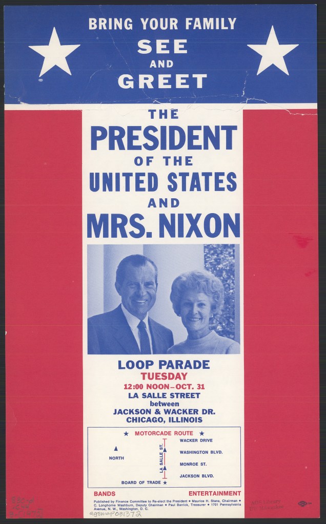
However, a day before the event was scheduled to take place, a morning rush hour commuter train crash killed 44 people and left 332 injured. Nixon cancelled the event and sent his Secretary of Transportation John A. Volpe to Chicago to guide relief efforts.
Naming of America
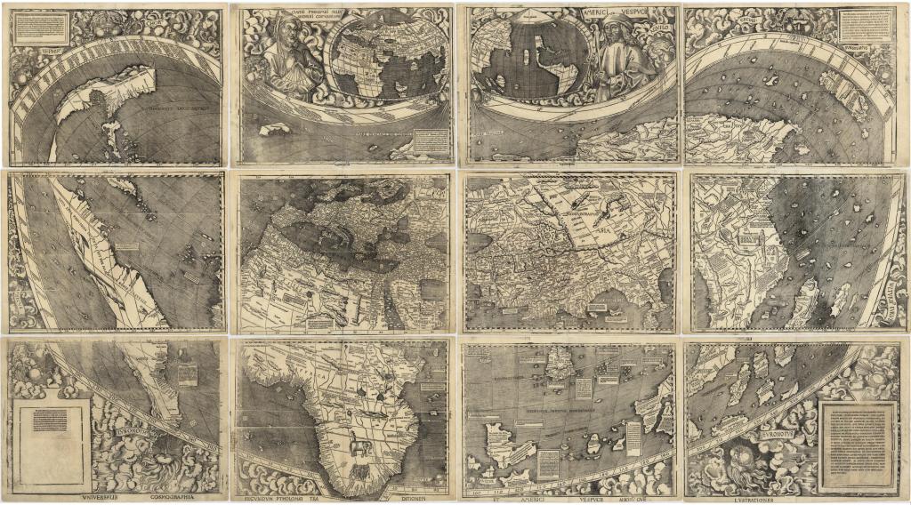
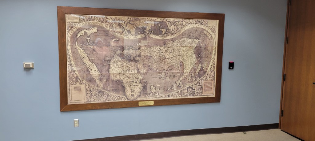
Perhaps many of you have seen the Waldseemüller’s 1507 world map reproduction hanging on the wall in the AGSL but do you know the story of the naming of America? Here is a blog from the Library of Congress, the owner of the original, manuscript Waldseemüller’s 1507 world map discussing mapping and the naming of the northern and southern continents in the Western Hemisphere.
“The story of the naming of America has been told before – not surprisingly considering the object central to the story, Martin Waldseemüller’s 1507 world map, is one of the most important treasures in the Geography and Map Division. The name was bestowed by the mapmaker to show his support for Amerigo Vespucci’s argument that the recently-discovered shores were indeed a separate continent (or two, depending on your preference). Into one of the woodblocks, roughly in what’s today northern Argentina, Waldseemüller had carved the name “America,” and from my perspective five hundred years later, it appears to have stuck.”
Click here to read the rest of the story … https://blogs.loc.gov/maps/2023/07/southern-lands-explorers-and-bears-oh-my/?loclr=eamap
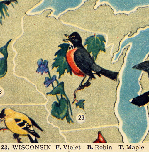
Flowers, birds and trees of the United States

This map, illustrated by Jacob Bates Abbott, is a charming map of the United States showing state birds, trees and flowers.
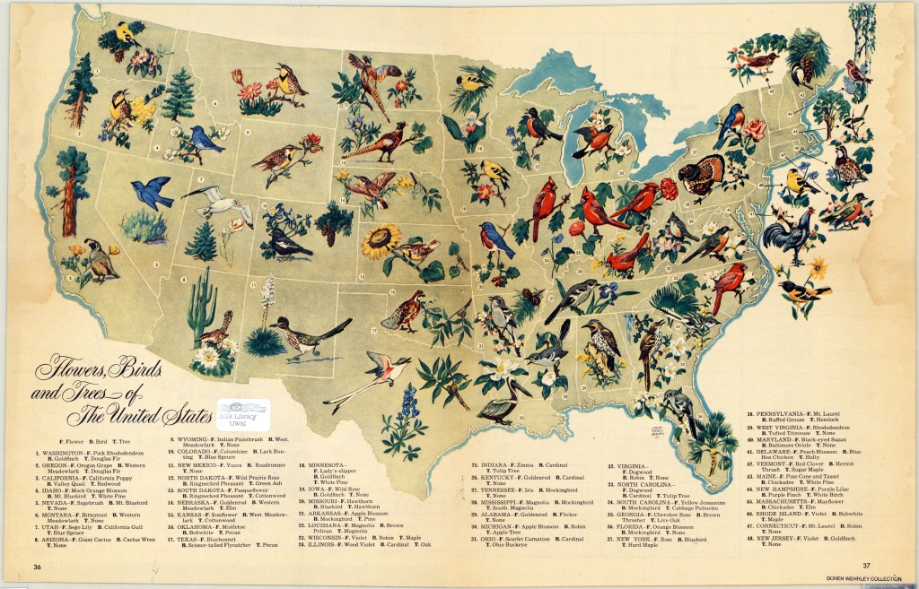
It appeared in a 1948 edition of the biweekly, general interest magazine named Look. Look magazine was published between 1937 and 1971 and was a direct competitor of Life magazine that ran from 1937 to 1972. Stanley Kubrick, Margaret Bourke-White and Normal Rockwell are among the illustrators and photographers that worked at Look magazine.
The map was presented to the AGSL as part of an extensive donation from Doren F. Wehrley, a military veteran and Milwaukee area dentist.
Click here to view this map in the AGSL Digital Map Collection.
Leardo Mappamundi 1452
Giovanni Leardo, Venice, 1452 Mappamundi (Map of the world)
The oldest world map held at the AGS Library is the Leardo Mappamundi. This is one of three known world maps signed and dated by the fifteenth century Venetian cartographer, Giovanni Leardo. The two others, that are similar but not identical, are located at the Biblioteca Comunale in Verona, Italy and the other at the Museo Civico in Vicenza, Italy.
The map was originally presented to the American Geographical Society of New York by Archer M. Huntington. Huntington was a long time member of the Society, serving as President from 1907-1911. Huntington donated this manuscript map to the AGS of NY in 1906 after having paid just under $2,000. Since the transfer of the AGS of NY research library to the University of Wisconsin-Milwaukee, the Leardo map has been veiwed by researchers and the public. In 2008, it taveled to the Field Museum in Chicago for the Maps: Finding our place in the World exhibit and later at the Walter’s Museum in Baltimore, Maryland. In preparation for this exhibit, the map underwent some slight restoration and reframing.
Description of the Map
The map depicts the parts of the world known to Europeans in the late Middle Ages. It is considered the finest example of a medieval mappamundi preserved in the Western Hemisphere.

Following a common convention of medieval mapping, Jerusalem (A) is placed at the center of the tripartite world consisting of Asia, Europe and Africa, the three known continents. These are, in turn, encircled by the ocean.
The map is “oriented” with east and the Terrestrial Paradise(B) at the top, Asia in the upper half (C), Europe at the lower left (D), and Africa to the right (E). The shapes of the Mediterranean Sea (F) and of western Europe are surprisingly well drawn and easily recognizable, most likely being based on the portolan sea charts of the time. In addition to names derived from Ptolemy’s Geographia, the names, especially those related to eastern Europe, were supplemented by Marco Polo’s travel accounts.
With the exception of the aptly colored Red Sea (G), the seas are uniformly blue. Land areas are the natural color of the bleached parchment except for a vivid red region in the far south (H) bearing the inscription “Dixerto dexabitado per caldo” (desert uninhabited due to heat) and a drab brown waste in the far north (I) marked “Dixerto dexabitado per fredo” (desert uninhabited due to cold).
All three of Leardo’s maps have a similar feature — a series of rings surrounding the circular map and constituting an elaborate calendar. These ten concentric circles present data by which one can determine the dates of Easter for ninety-five years from April 1, 1453 to April 10, 1547; the names of the months (J), and the day, year, and minute when the sun enters each sign of the zodiac; the phases of the moon; the dates on which Sunday falls in various months and years; the length of respective days; and saints’ days and festivals (K). Winds blowing from the points of the compass are shown by eight faces around the edge of the central disk. The corners of the map are occupied by figures representing the four evangelists: the lion for St. Mark (L), the bull for St. Luke (M), the angel for St. Matthew (N), and the eagle for St. John (O) .
View the Leardo map through the AGS Library Digital Map Collection
Maps at the Bottom of the Ocean
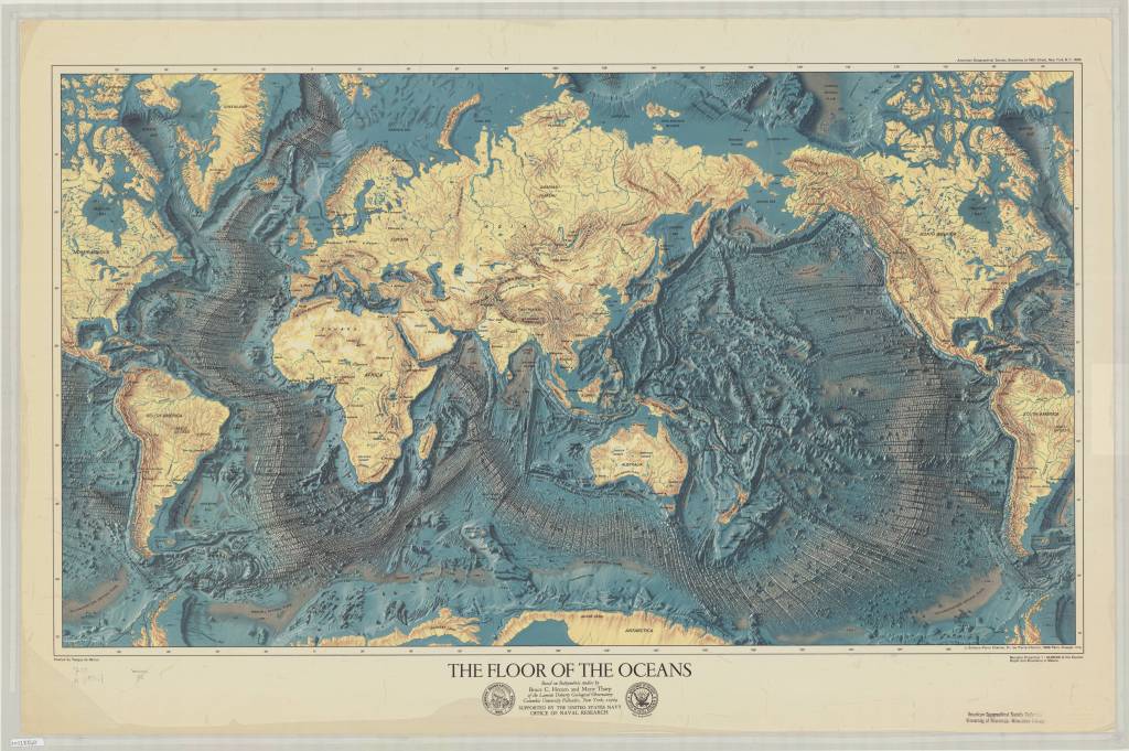
By Brendan Dooley
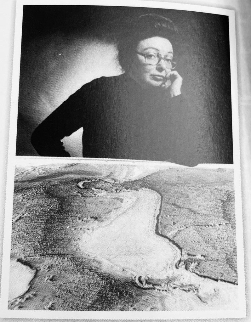
As March marks International Women’s History Month, it seems an appropriate time to reflect on the contributions of AGS member Marie Tharp (1920-2006). Before Tharp’s research and attention to detail in plotting soundings from colleagues, we might still be in the dark regarding the topography of the ocean floor, plate tectonics and a formalized idea of Pangea.
Tharp was a multi-talented researcher and true renaissance learner who had multiple minors, majors and graduate degree paths under her belt, including being an accomplished drafter which led to her work in mapping the oceans’ floors.
This barely scratches the surface of her accomplishments though, and you can learn much more about her here at a “Washington Post” story about her life, through books at every level in the AGSL circulating collection (like Theater of the World: The Maps That Made History, Ocean Speaks, and Women in American Cartography), some of her maps digitized in the AGSL collection here and more.
The AGSL is open Monday-Friday, 9 a.m. to 4:30 p.m., on the third floor of the Golda Meir Library at UWM’s campus.
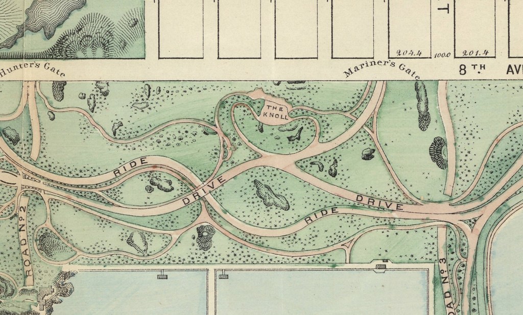
Re-discovering Seneca Village
By Brendan Dooley
It was almost two centuries ago when New York City’s first Black property owners began purchasing lots in what is now part of Central Park. Starting in 1825, Andrew Young and Epiphany Davis (both Black) and the African Methodist Episcopal Zion Church, bought the initial lots from John and Elizabeth Whitehead that would become Seneca Village (in what is now Central Park West).
The 5-acre area would become an integrated settlement of about 260 Black, Native American, Irish and German immigrant residents, with 2-3 churches, a school and more. Enter eminent domain and wealthier residents’ aspirations for a grand park to rival those of some European capitals. Central Park was an authorized entity by 1853 and land owners were starting to be meagerly compensated and evicted a few years later.
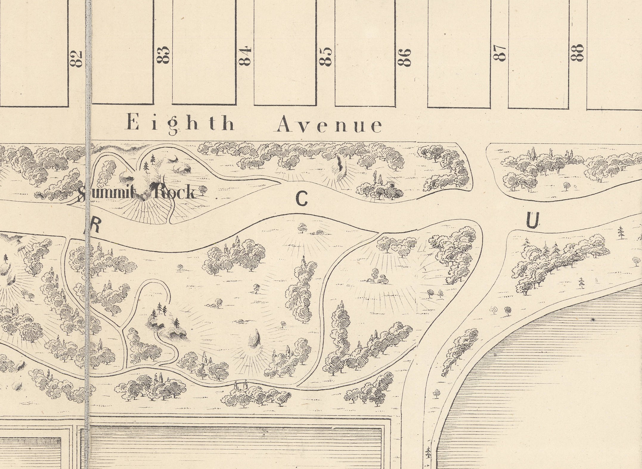
Cartographer Egbert Viele illustrated several maps of NYC, as well as Central Park in its planning stages. You can see where Seneca Village was, though it is not labeled as such. Newspapers of the time belittled residents there as “squatters” and worse in the apparent hopes of moving common will in favor of the “greater good” a park would serve. (The Seneca Village Irish in particular were said to be living in “shanties” with their “goats and hogs.”)
A renewed interest in the nearly lost history of Seneca Village has been ongoing since around the 1990s, including exhibits from the New York Historical Society. Some minor excavations of sites in the early 2000s located some small artifacts indicative of domestic living and foundational stonework of possibly one of the churches. You can check out some of these maps to look at more about Seneca Village, or learn more on the history and development of Central Park and NYC, in the AGSL Monday-Friday, 9 a.m. to 4:30 p.m. or anytime through our digital collections here.
Other links about Seneca Village:
Reading list for how to use maps in research
Recently, a faculty member in History at the University of California at Riverside asked for book recommendations that he could use for readings in an upcoming graduate seminar on “Nature, Space and Place in Historical Research.” Janet Reyes, Geospatial Information Librarian at UC Riverside, asked for suggestions via the Map Librarian discussion list, Maps-L. Here is a list of titles that were shared via that discussion that may be of interest to readers of the AGS Library Blog. These titles will teach and/or demonstrate how to focus on maps and cartography, helping students think about maps as sources, problems in their construction, how maps lie, etc., and how to bring historic maps into a GIS.
Books
Anthamatten, Peter. 2020. How to Make Maps: An Introduction to Theory and Practice of Cartography. ISBN-13: 978-1138067806, ISBN-10: 1138067806
Crampton, Jeremy. 2010. Mapping: A Critical Introduction to Cartography and GIS. ISBN-13: 978-1405121736, ISBN-10: 1405121734
Field, Kenneth. 2018. Cartography. ISBN-13: 978-1589484399, ISBN-10: 1589484398
Gurney, Alan. 2004. Compass: A Story of Exploration and Innovation. ISBN-10: 0393050734, ISBN-13: 978-0393050738
Krygier, J, and D Wood. 2016. Making Maps: A Visual Guide for Map Design for GIS. Third ed. ISBN-13: 978-1462509980, ISBN-10: 9781462509980
Monmonier, Mark. Several books to choose from. https://www.goodreads.com/author/list/6040304.Mark_Monmonier
Tyner, Judith. 2014. The World of Maps: Map Reading and Interpretation for the 21st Century. ISBN-13: 978-1462516483, ISBN-10: 1462516483
Winchester, Simon. 2021. Land: How the Hunger for Ownership Shaped the Modern World. ISBN-10: 0062938339, ISBN-13: 978-0062938336
Digital Materials
Open textbook – Mapping, Society, and Technology / Manson (2017)
World Historical Gazetteer: https://www.whgazetteer.org/teaching/
From Joseph Kerski, Esri Education Manager: Course in modern web GIS: https://community.esri.com/t5/education-blog/a-complete-first-course-in-modern-web-based-gis/ba-p/1020548
Spatial Reserves: https://spatialreserves.wordpress.com
All the News that’s Fit to Map
By Brendan Dooley
In order to keep troops around the world up to date on each week’s advances during World War II, the U.S. military developed Newsmaps, poster-sized weekly publications of geographically focused battle updates. This was a time, of course, before emails, Tweets and Instagram posts (let alone personal cellphones in every pocket), so for the sailor at sea or soldier in the woods, jungle or desert, posted Newsmaps (often literally attached to posts) might be the only regular news they would see.
The American Geographical Society Library collection recently added 30-plus Newsmap editions, growing its collection of them to 142.
Most of the Newsmaps featured news briefs on the front, keyed to either large maps or smaller insets and/or photos from the relevant theater of operations, and the backs often featured large instructional or propaganada-ish illustrations or large-scale maps detailing particular battle hot zones.
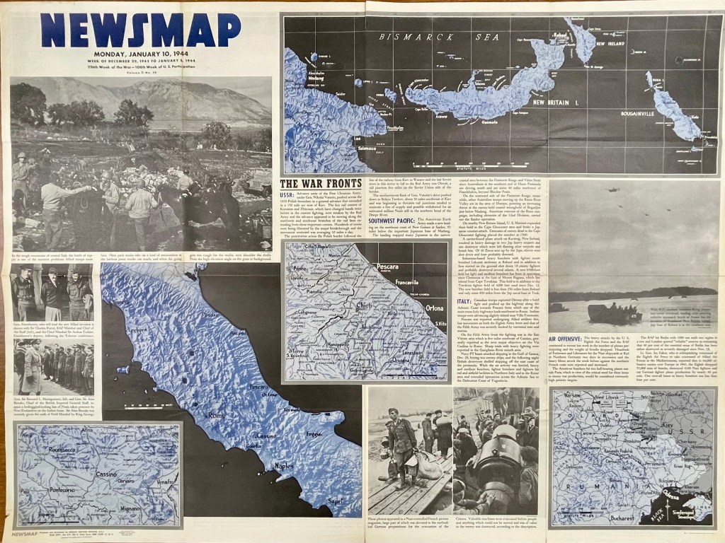
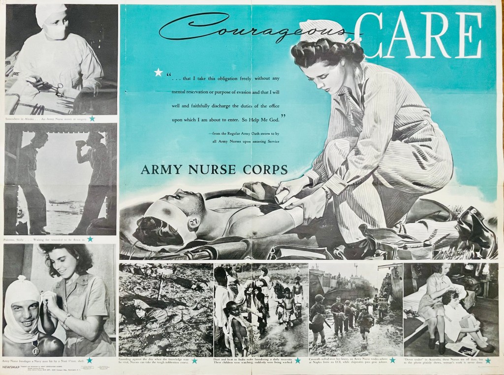
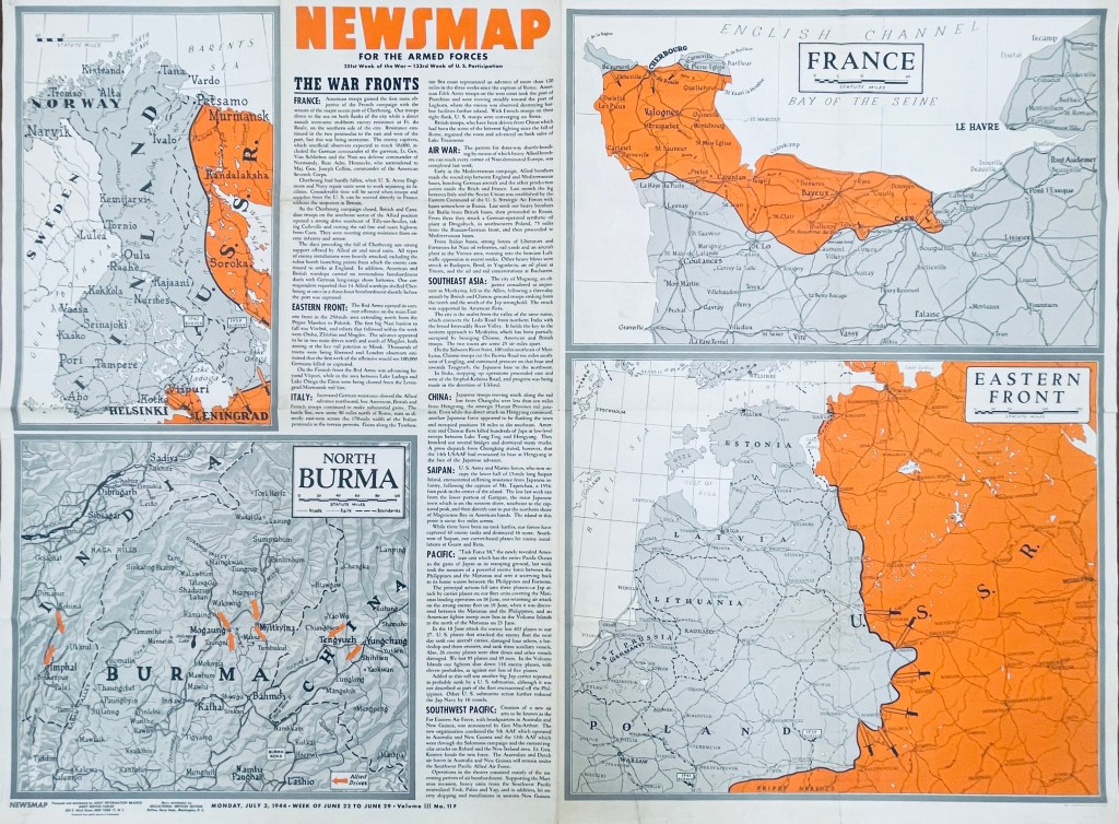

For instance, on the front of the Monday, Jan. 10, 1944, Newsmap (Vol. II, No. 38) are a collection of maps and images to go along with news briefs. The briefs that week covered the Soviet advance against Nazis in Crimea and Poland, U.S. movements against Japan on New Guinea in the Southwest Pacific, U.S. troop gains in central Italy and combined U.S. and R.A.F. bombing raids against Nazi-controlled munitions, plants and materiel in Northern Germany, Berlin and Paris (though no graphics with this last snippet). On the reverse of this Newsmap was a combined illustration and images detailing some ins and outs of the Army Nurse Corps.
In another example six months later, the front of the Monday, July 3, 1944, Newsmap (Vol. III, No. 11F) includes briefs on the Allied seizure of the port at Cherbourg, France, Soviet advances in Finland, the Allied march north through Italy (now 120-some miles past Rome), bombing raids across Germany, Poland, Italy and Yugoslavia, Chinese and British troops taking Mogaung in Burma, U.S. Marine movements on Saipan, the new “Task Force 58” maneuvers near the Philippines and air operations in the Southwest Pacific. The back of this edition (Vol. III, No. 11B) detailed the importance of Teamwork, whether by army and naval forces in combined attacks or various Allied contingents in joint planning efforts and operations.
While blue was a dominant color of the Jan. 10 Newsmap, July 3 (on the front side) uses orange to highlight interest; from week to week, Newsmaps tended to feature one main color. Of note, the Newsmaps starting within Vol. II began denoting front “F” and back “B” sides to the editions. Additionally, there were Industrial editions of the Newsmaps—sent to U.S.-based munitions plants and military factories—that were usually similar in their news and layout on the front, but did not contain B sides. (More on these Industrial editions in a future post.)
The AGSL physical collection now includes 114 military editions of the Newsmaps across Volumes 1-5 (which ran from 1942-1946), as well as 28 of the Industrial versions from Volumes 2-4. Roughly two dozen of the new military editions and 15 of the Industrial versions were added after a donation from the Milwaukee County Historical Society.
You can come up to view them Monday-Friday, 9 a.m. to 4:30 p.m. in the AGSL on the third floor of the Golda Meir Library; which is open to the public as well as UWM students. (The extent of 212 Newsmaps is also available online at the University of North Texas here.
MILWAUKEE MUNICIPAL RESEARCH CENTER MAP COLLECTION
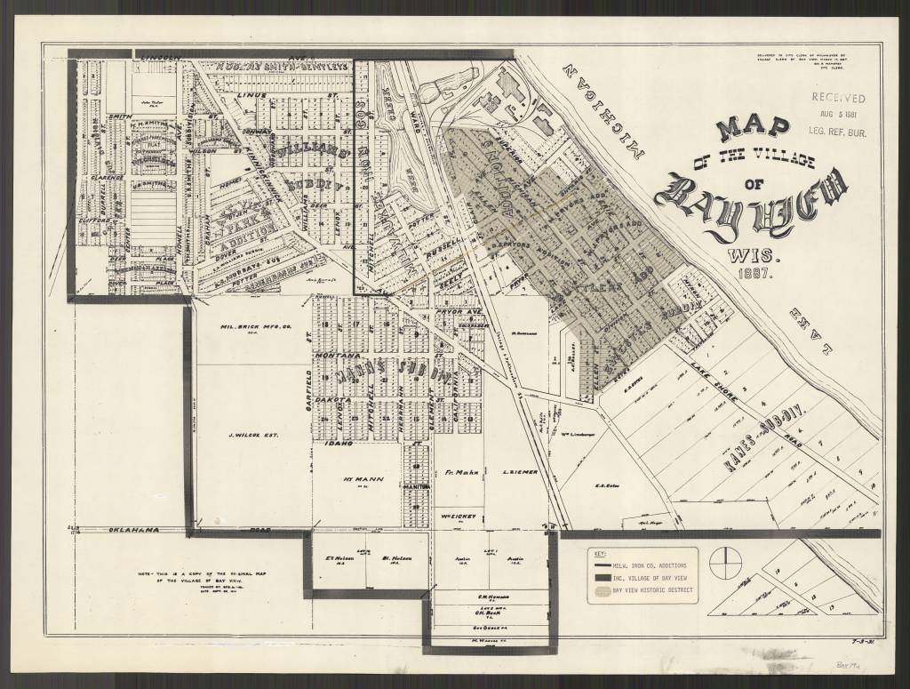
Beginning in 2020, the American Geographical Society Library partnered with the Milwaukee Municipal Research Center (MRC) to provide online access to over 250 maps. This online map collection features maps created by city departments and includes subject areas of the city’s historic geographical boundaries and annexations, current and former aldermanic districts (known as wards prior to 1972), Census tracts, neighborhoods, land use, redevelopment planning, transportation and population. The collection has both historical maps dating back to early 1800s as well as more modern maps dating into the 2000s. The technical work was done by two UWM SOIS students, Samantha Dickson and Lillian Pachner, who uploaded the files and created ContentDM metadata.
In addition to finding these 250+ maps in the American Geographical Society Library Digital Map Collection online, all of them can be used on site at the Milwaukee Municipal Research Center (MRC), located in the basement level of the Zeidler Municipal Building, 841 N. Broadway. Their hours are 8:00 am – 4:45 pm, Monday-Friday.
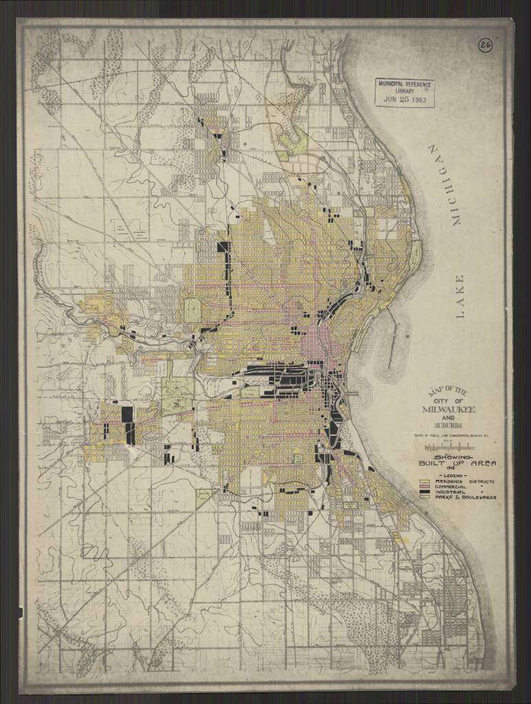
Milwaukee Wis. Annotated title: Showing Built Up Area 1919
https://collections.lib.uwm.edu/digital/collection/agdm/id/25616/rec/130
https://collections.lib.uwm.edu/digital/collection/agdm/id/25578/rec/150
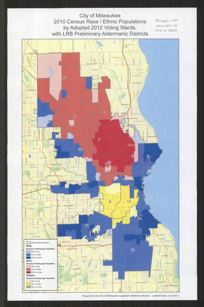
by Adopted 2012 Voting Wards, with LRB Preliminary Aldermanic Districts /
Prepared by the City of Milwaukee Legislative Reference Bureau
https://collections.lib.uwm.edu/digital/collection/agdm/id/25684/rec/135
May 30, Day of the Canary Islands
by Angie Cope
The Day of the Canary Islands (Spanish: Día de Canarias) is celebrated annually on 30 May. It is a public holiday in the Spanish autonomous community of the Canary Islands chosen as the anniversary of the first session of the Parliament of the Canary Islands, held on 30 May 1983.
At present, the Canary Islands is the only autonomous community in Spain that has two capitals: Santa Cruz de Tenerife and Las Palmas de Gran Canaria, since the Statute of Autonomy of the Canary Islands was created in 1983.
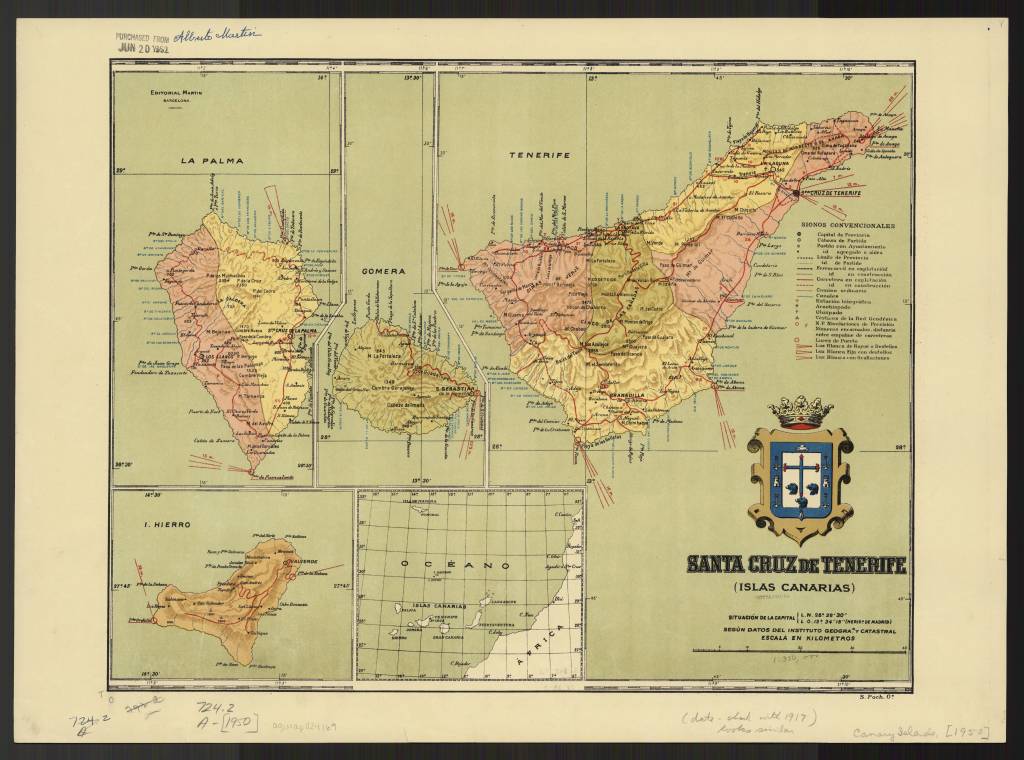
Santa Cruz de Tenerife (Islas Canarias) / by Alberto Martín, 1916
https://collections.lib.uwm.edu/digital/collection/agdm/id/15485/rec/10
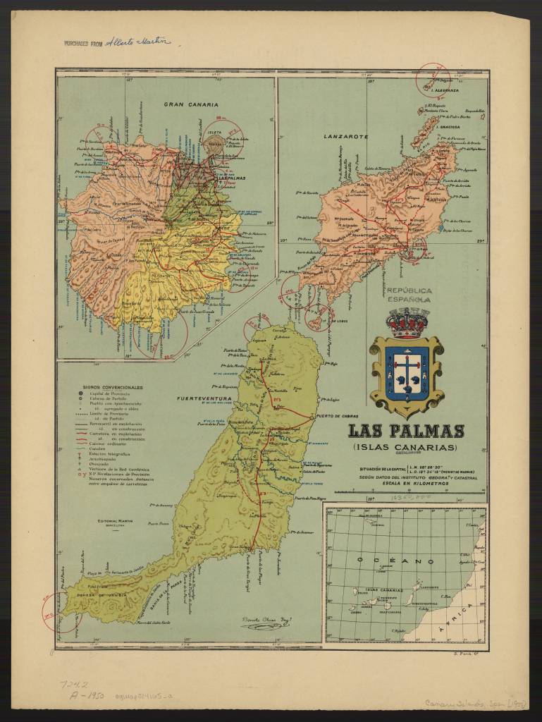
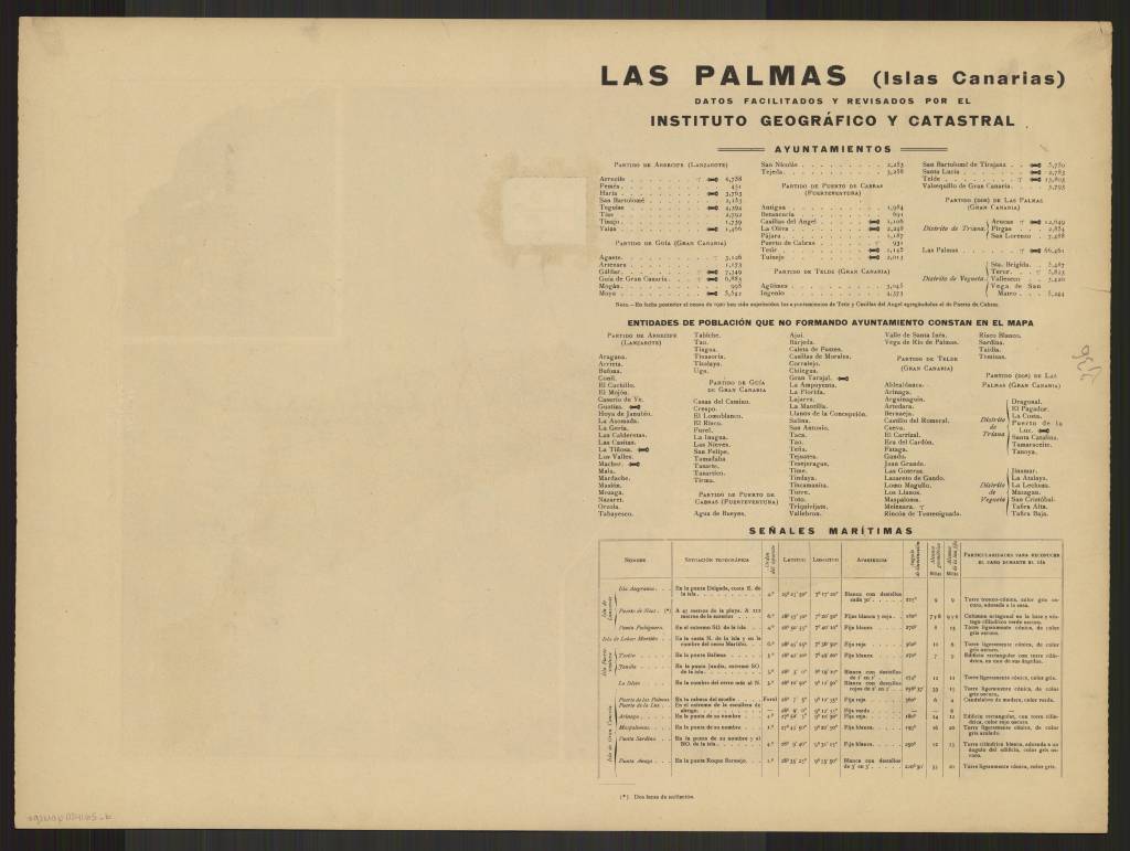
Las Palmas (Islas Canarias) / By Alberto Martin, 1922
https://collections.lib.uwm.edu/digital/collection/agdm/id/15570/rec/4
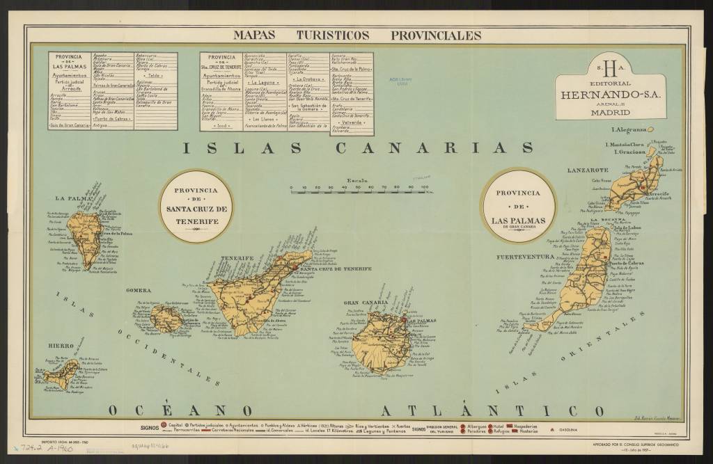
Mapas turisticos provinciales Canarias / aprobados por el Consejo Superior Geografico ; dib. Ramón Vicente Mesoner / Canarias (Islas) Mapas turísticos 1960
https://collections.lib.uwm.edu/digital/collection/agdm/id/15479/rec/5
