photo collection
The Phantom Ship on Crater Lake
By Lauren Maddox
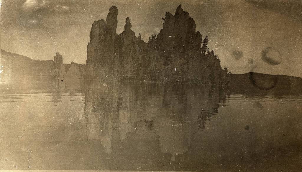
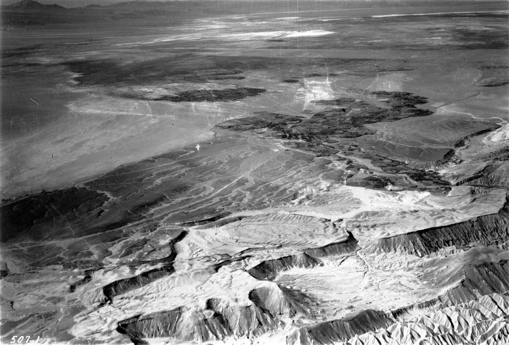
Photo of Phantom Ship Island from the AGS’s 1912 Transcontinental Excursion. Click the link to see this photo in our Digital Collections!
The Klamath people have lived near Mount Mazama for over 10,000 years. According to their histories, Llao, the Chief of the Below World, attacked the community living by the volcano when a human woman refused to become his lover. Skell, the Chief of the Above World, defended the Klamath people from Llao’s rage; he chased Llao back into the mountain and smashed the mountain peak over his head, collapsing Mount Mazama and forming a huge crater. The crater filled with rain water so blue, it turned the grey mountain birds bright blue, too.

Young Mountain Bluebird from Aubudon’s Field Guide. Click the link to learn more about Mountain Bluebirds!
Lalek, a 19th century Klamath leader, interpreted this oral history before white geologists even understood the volcanic nature of Mount Mazama: 7,700 years ago, Mount Mazama violently erupted and collapsed in on itself, forming a huge crater lake. The crater was fed with snow melt and rain instead of a running water source, so its waters remain clear and shockingly blue.
Crater Lake in Oregon is the deepest lake in the United States. It has two famous islands: Wizard Island, which is a a volcanic cinder cone formed after the massive eruption of Mount Mazama, and Phantom Ship Island. Phantom Ship Island, as its name suggest, appears to be a ship when seen from a distance. Mysteriously, when the lake is foggy, the island appears to disappear, adding to the impression that it is a phantom ship. The island is made of ancient andecite rock formations, which were shaped by the hydrothermal activity of Crater Lake.
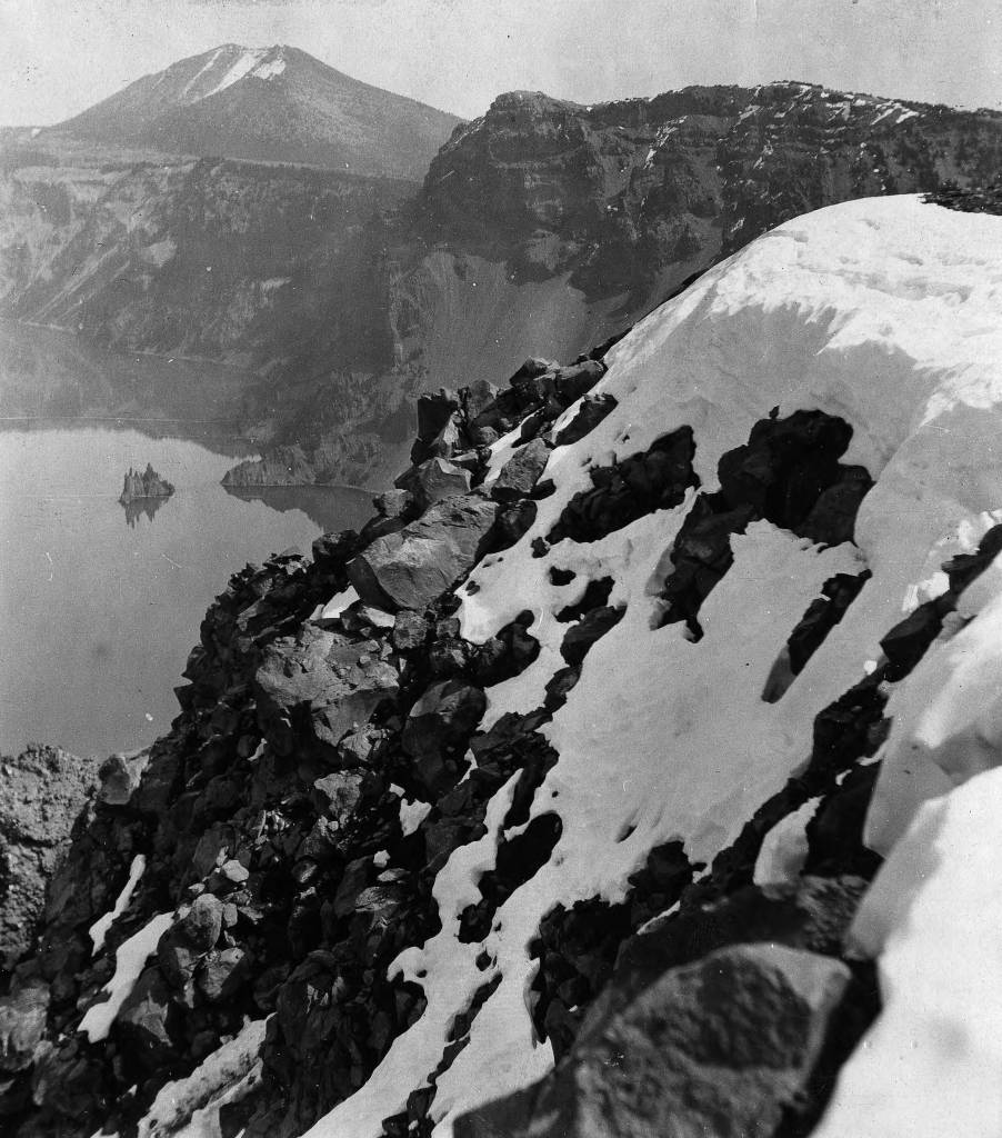
Phantom Ship Island from a distance, 1912. Click the link to see this photo in our Digital Collections!
In 1912, the American Geographical Society organized a Transcontinental Excursion to, as supposed by Geography in the Making: The American Geographical Society 1851-1951, “increase the knowledge of American geography by Europeans” and to “promote the acquaintance of European Geographers with Americans.”
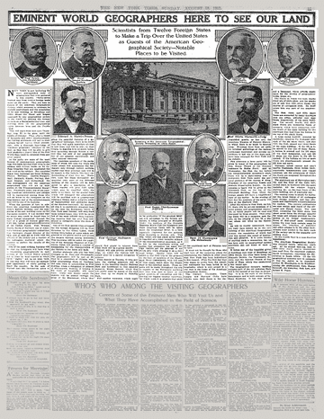
1912 Article in the New York Times. Click the link to see this article on the NY Times website! 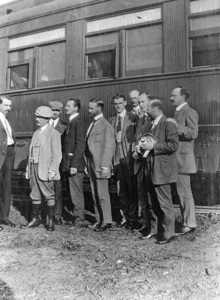
Passengers posing by AGS Transcontinental Train. Click the link to see this photo in our Digital Collections!
One of the stops on the Transcontinental Excursion’s route was Crater Lake, where several passengers took photos of Phantom Ship Lake.
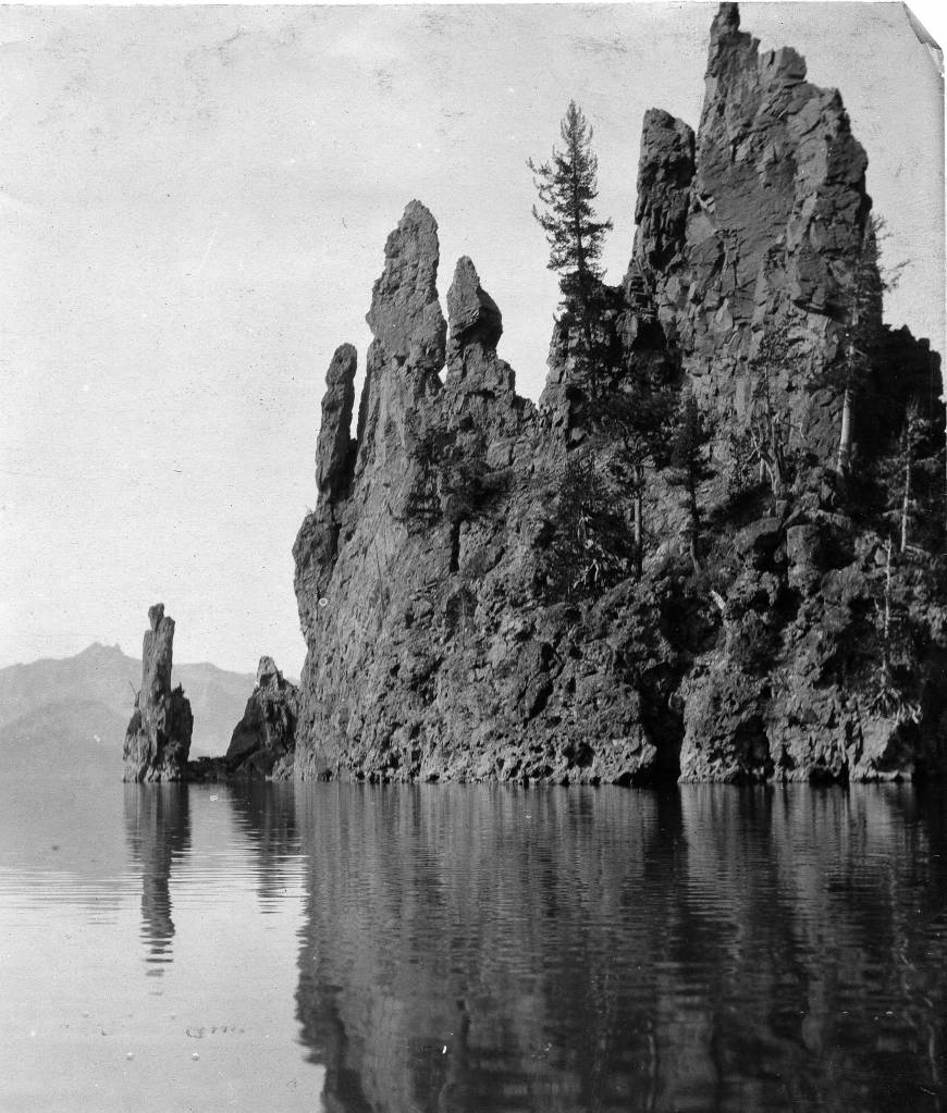
Closeup of Phantom Ship Island. Click the link to see this photo in our Digital Collections! 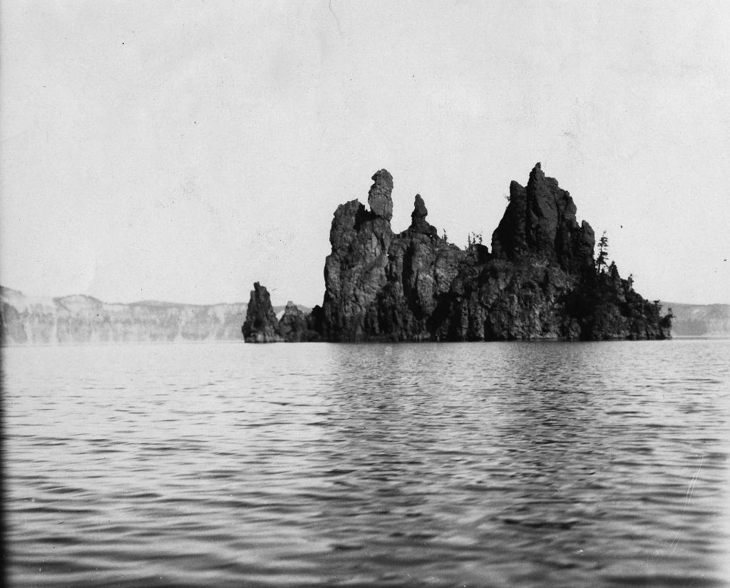
Photo of Phantom Ship Island. Click the link to see this photo in our Digital Collections!
While Phantom Ship Island may resemble a ghost ship, it is not the most mysterious phenomenon on Crater Lake. Some visitors to the park report seeing campfire on the uninhabited islands, and eerie sounds plague tourists who choose to stay in the Crater Lake Lodge. But by far, the most inexplicable occurrence on the lake.
The first account of the Old Man of the lake was written in 1902; Joseph S. Diller reported a stump floating upright in the lake. The Old Man is a more than 100 year old hemlock tree that floats, as reported, completely upright in Crater Lake. The Old Man travels by floating across the lake, sometimes over 60 miles, never upending. The Old Man is allowed to float freely now, because once, when scientists tied the Old Man to the shore to prevent him from disrupting navigation of the lake, he called a storm that didn’t subside until he was released.
Though Crater Lake has a strange and magical history, somehow Phantom Ship Island through the fog is not the most unusual sight visitors might encounter. But that doesn’t mean it isn’t eerie!
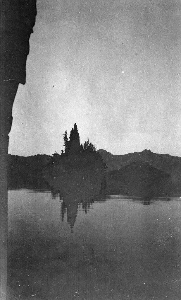
Phantom Ship Island. Click the link to see this photo in our Digital Collections!
Disney’s Darkest Day
By Lauren Maddox
July 17th is celebrated at Disneyland as the park’s official opening day. This year marks the 65th anniversary– Disney hasn’t announced any official celebration plans yet, but fans can most likely expect a birthday bash to remember. The park’s anniversary wasn’t always celebrated on July 17th, however; during Walt Disney’s life, the official date was July 18th, one day after what we consider to be the opening day now.
Walt Disney was adamant that the July 17th opening not be acknowledged as the official opening– and with good reason. July 17th, 1955 was such a disaster that Disney sometimes called it “Black Sunday.”
Expectations for the July 17th preview day were high. Disney had been planning his amusement park since at least 1948, when he sent the first memo to Dick Kelsey describing his plans for a Mickey Mouse theme-park. But the original idea pre-dated even this first draft of the park concept; Disney’s own father worked at the World’s Columbia Exposition in 1893.

Map of the Chicago World’s Fair in 1893. Click the link to see this map in our Digital Collections! 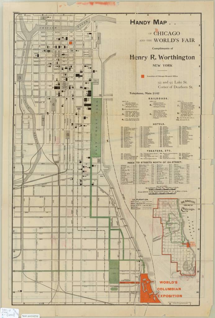
Map of the Chicago World’s Fair in 1893. Click the link to see this map in our Digital Collections!
The World’s Columbia Exposition was a Chicago’s World’s Fair held in 1893 to celebrate the 400th anniversary of Christopher Columbus’s first arrival in North America. The Fair was supposed to be a symbol of the burgeoning ideas of American exceptionalism and Chicago’s recovery from 1871 fire. The Fair was a monumental undertaking; the grounds covered more than 650 acres, and nearly 26 million visitors passed through. More important to Disney’s story than the grandiosity of the fair: the 1893 World’s Fair was the first to host a dedicated amusement park area.
His father’s memories of that Fair and its amusement rides stayed with Disney until his own fatherhood. Disney cited watching his children on a merry-go-round as the final inspiration that lead him to Disneyland.
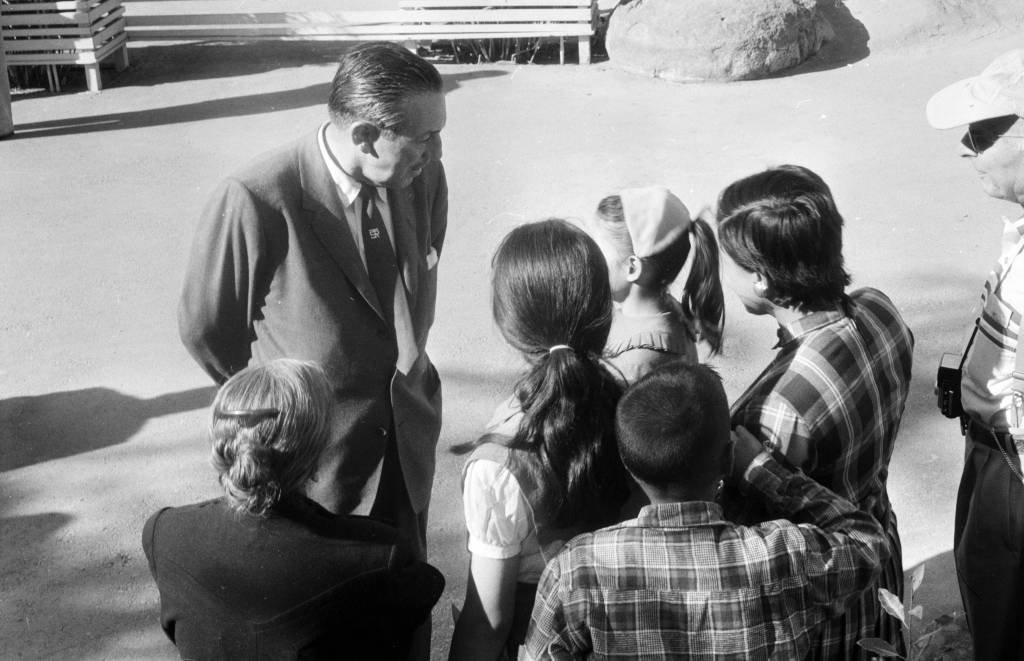
Disney talking to a group of children at Disneyland in 1957. Click the link to see this photo in our Digital Archives!
Besides his tender family memories, Disney also had a practical reason to build an amusement park. He was, after all, a businessman first. As Disney’s animation studio in Burbank gained more success, more and more fans wanted to come visit. The inside of an animation studio isn’t actually that interesting, and it would be hard to get any work done with crowds of tourists peeking in on the animators who worked there.
The original plans for Disneyland put the amusement park right next door to the Burbank studio. After realizing how much of an undertaking (and how many more acres) the amusement park was going to be, Disney moved the location to the Anaheim site.
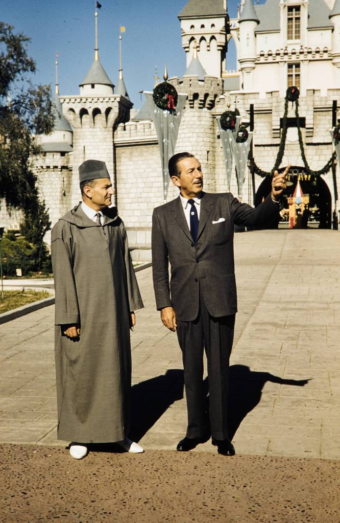
Disney entertaining King Muhammad V at Disneyland, 1957. Click the link to see this photo in our Digital Archives!
For the preview day, Disney invited a select group of 14,000 guests. This included the press as well as friends and families. This was the first thing to go wrong that day. Around twice as many guests actually showed up to the park– many had purchased counterfeit tickets to gain entry to the preview day opening, but many more simply climbed over the walls and broke into the park. Disneyland, for the day, was only prepared to serve the 14,000 intended guests; vendors ran out of food, half of the water fountains weren’t functioning because the plumbers working on the park went on strike (and offered the ultimatum “bathrooms or water fountains”). The event was sponsored by Pepsi, so many park-goers accused Disney of forcing them to buy drinks by sabotaging the water fountains. It was an unseasonably warm day for Anaheim, and the freshly poured asphalt was so soft that women’s high heels would sink into it.
Besides these critical logistical failures, the media coverage of the event was a circus. Disney himself missed the cue to read his dedication, and said, to the camera live and on air, that he’d thought he’d been given the signal to start. Bob Cummings was caught on camera flirting with the dancers and even kissing one girl. Other commentators lost their mics and had to cover for themselves while the tapes ran on.
In summary, the whole day was deeply embarrassing to Disney. He never acknowledged the July 17th preview as the opening day of Disneyland, and it was only after his death that it was adopted as the official anniversary.
Disney’s legacy lives on, for all the good and ills that entails. But perhaps his greatest contribution to the amusement park circuit, besides Disneyland itself, is the impact his choices made on amusement park cartography.
When Disney was first pitching the park idea to investors, he used maps created by Herbert Ryman to help draw the picture of the park that he was imagining and struggling to put into words. Ryman’s version of the park didn’t make it to brochures, partially because his maps were of an imaginary park that wasn’t quite the same as the real Disneyland.
The 1953 Ryman Map of Disneyland from the New York Times. Click the link to see the rest of this article!
Due to budgeting issues, the official map of Disneyland took another three years after opening day to create. Sam McKim was the artist behind the first official park maps in 1958. The maps, at this point, still had some aspirations for parts of Disneyland not yet built, but mostly functioned as tools for park-goers to use to find their way around and as free souvenirs they could take home. Sam McKim’s maps ran, with some slight adjustments over the years, until 1964. For his contributions to the Disney brand, he was named “Map Maker to the Kingdom” and a tribute to his work can still be found at Disneyland.
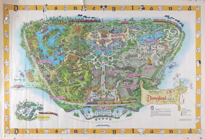
McKim’s 1958 Map of Disneyland. Click the link to see this map on Mouse Maps!
Maps as souvenirs was not a new concept; many World’s Fairs gave out artful brochure maps for visitors to remember their day at the Fair. But McKim’s willingness to push the boundaries of realistic map making in order to appeal to the imaginative and exciting nature of Disneyland revolutionized the amusement park map. After McKim, the artists behind the brochure maps became anonymous, but his impact on the work remains clear.
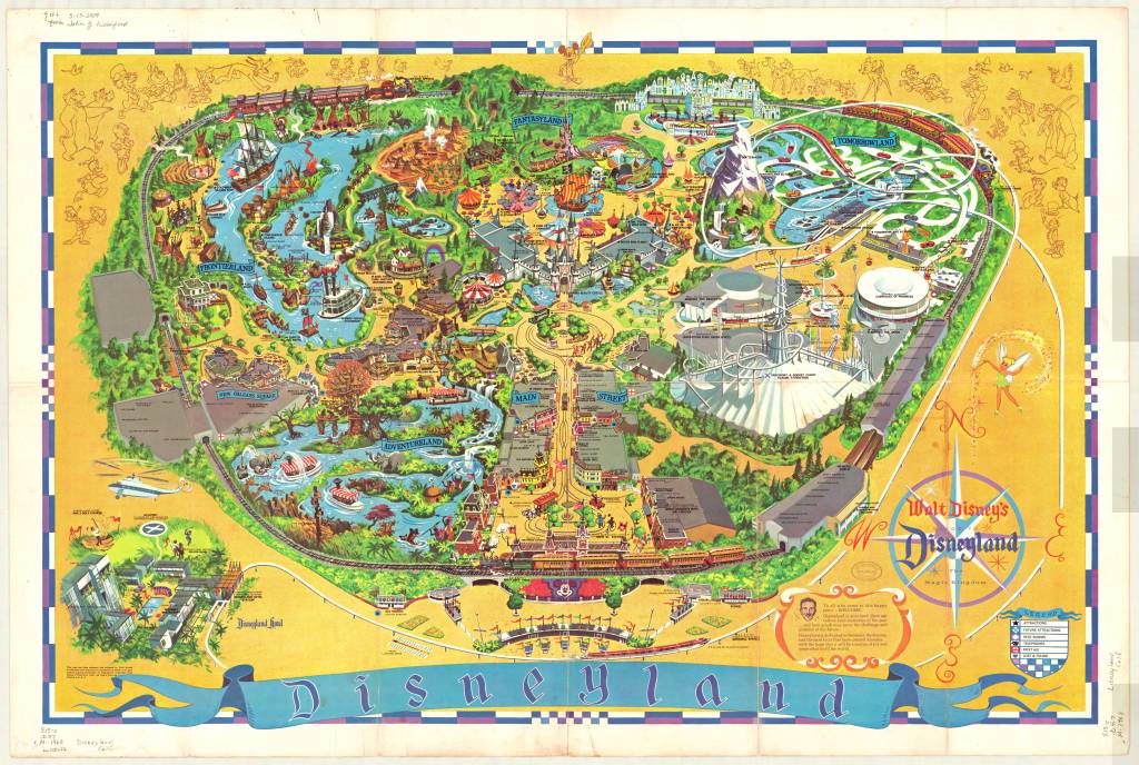
1968 Map of Disneyland. This version removed Edison Square and Liberty Park, which were not built but still included on the previous generation of maps. Click the link to see this map in our Digital Collections!
Cartography was a key tool in Disneyland’s creation. And it continues to be an important part of the Disneyland brand an experience– but more than that, the maps at Disneyland give us a way to take the park home. That first day may have been a disaster, but many, many Disney fans have experienced and loved the park since then. Happy 65th anniversary! Remember to take a map before you go–they help us find our way.
Salt of the Earth
By Lauren Maddox

Instagram has changed the way we vacation– our destinations don’t just need to look good in person. They also need to look good for the camera. This age of aesthetic vacationing has sent trendy tourists to the salt production operation in Las Coloradas, at the very tip of the Yucatan Peninsula. You’ve actually probably seen these pictures– pretty, bikini-clad women perched on flamingo pool-floaties drifting across the pink, uber-salt water of a man-made salt evaporation pond.
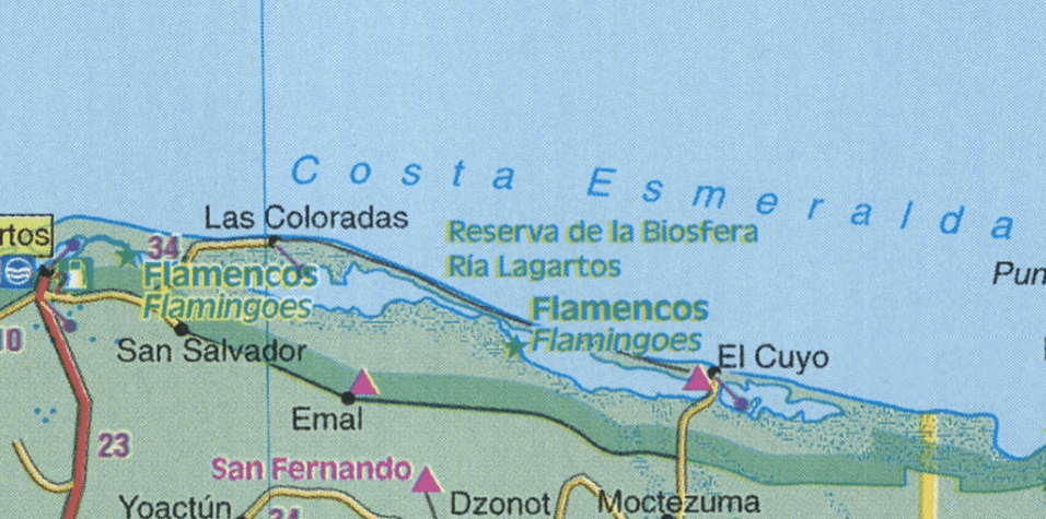
Detail of Los Coloradas 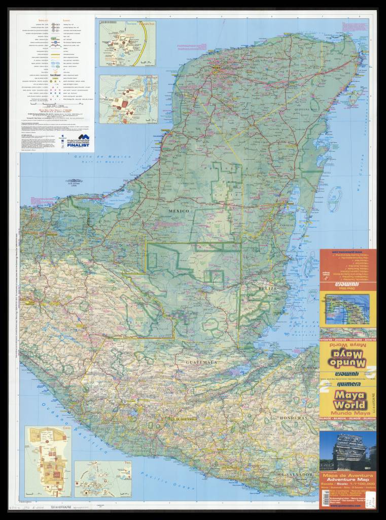
2004 Map of Yucatan. Click the link to see this map in our Digital Collections!
These places may not be as picturesque as millenial trendsetters make them out to be– in essence, the salt lakes at Los Coloradas are a step in an assembly line. They’re salt evaporation ponds designed to extract sea salt for table salt. Several different colors of salt are harvested from the lakes– though the lakes are actually pink because of the micro-organisms that thrive in highly salinated environments. But the flamingo habitat nearby still seems pretty on brand.
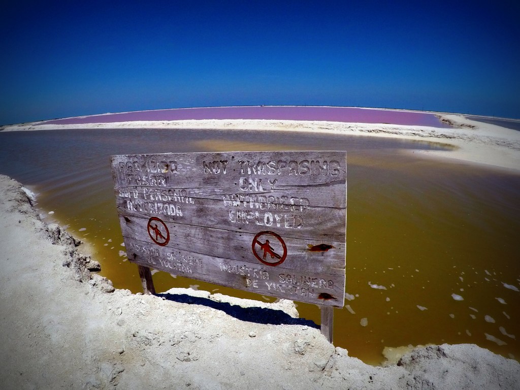
And because of the influx of tourists, the salt production plant has had to put fences around the lakes to keep people from swimming in them. You can still take a tour, but it’s not really the same without the novelty pool-floaty. The ponds aren’t dangerous to swim in, but if you had scratches, it would be a pretty unpleasant and unrefreshing dip in the pool. And this is a food production facility– people swimming in the lakes does seem like a contamination concern.
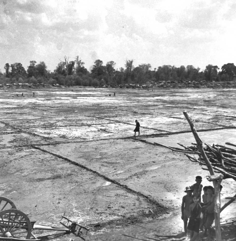
Roi Et Province in Thailand, 1940. Families turned natural brine into salt using evaporation. Click the link to see this photo in our Digital Collection!
But besides being a great photo-op, salt evaporation and collection has been a center of civilization since antiquity. The oldest known towns in Europe were centered around salt production because salt allowed for the preservation and trading of food across longer distances. The ancient roads that all lead to Rome were first used to transport salt back to the city from the empire’s many, saltier territories. Salt made other ancient empires like Egypt and China stable and prosperous, which created opportunities for technological advancement. And salt’s deep connection to the beginnings of civilization is still visible today– the word salary is derived from the Latin word for salt, English towns with names ending in -wich were named for their connection to salt production, and now Instagram influencers can pose with modern salt production facilities for the aesthetic.
The Salar de Atacama Salt Flat in San Pedro de Atacama, Chile. From Mary Light Leader and Dr. Leaders 1937 Collection of photos. Click the link to see this photo in our Digital Collections!
Now salt is pretty cheap– most people have to worry about eating too much salt. But salt production, and the old methods of salt harvesting, are still a key global industry. And a great backdrop for your vacation pics (with the facility’s permission).
Salar del Rincon in Argentina, from Isaiah Bowman’s 1913 Expedition to the Central Andes. Click the link to see this photo in our Digital Collections!
How Does Your Garden Grow? Imagining the Cemetery
By Lauren Maddox
As Halloween comes and goes, our minds drift to the dark and the macabre–we can’t help but think about spooky skeletons, werewolves, witches, ghosts, and vampires or about what those figures really represent to us: death. Death isn’t something people like to think about very much. America, in particular, has always held death at arms length with only squeamish acknowledgement.
The Church began to regulate burials around the 7th century across Europe–rituals for the dead and dying became increasingly Christian, and burying bodies in consecrated ground became an important tenant for dealing with the dead. In these early days of Christian burial, bodies were buried in mass graves so that the bones could be exhumed and stored in ossuaries in the walls of the church. But, due to lack of space, eventually bodies began to be buried in the church yard. Graves would be marked with simple stones, or is some cases, wooden crosses, unless the family was able to afford a more complicated memorial for their loved ones.
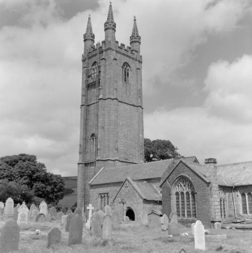
St. Pancras Church in Widecombe-in-the-Moor, England from the Clarence W. Sorenson Collection. Click the link to see this photo in our Digital Collections!
The churchyard grave was thought to be a place under the protection of the Church– it was a safe place where loved ones could be guaranteed to pass into an easy afterlife. But as populations boomed and the Industrial Revolution’s dangerous growth and unadulterated industry began to accumulate a body count, the ideation of the churchyard began to change. Instead of being a place where one might visit their loved ones and feel comforted by their presence, they became places in which disease festered and spread. Floods would unearth the recently buried and rain that passed through the churchyard might become contaminated. The proximity of the churchyard burial ceased to be a comfort and became a source of anxiety too-close-to-home.
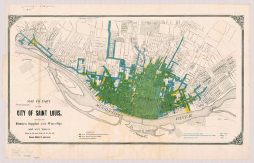
Map of St. Louis, MI in 1884. Click the link to see this map in our Digital Collections! 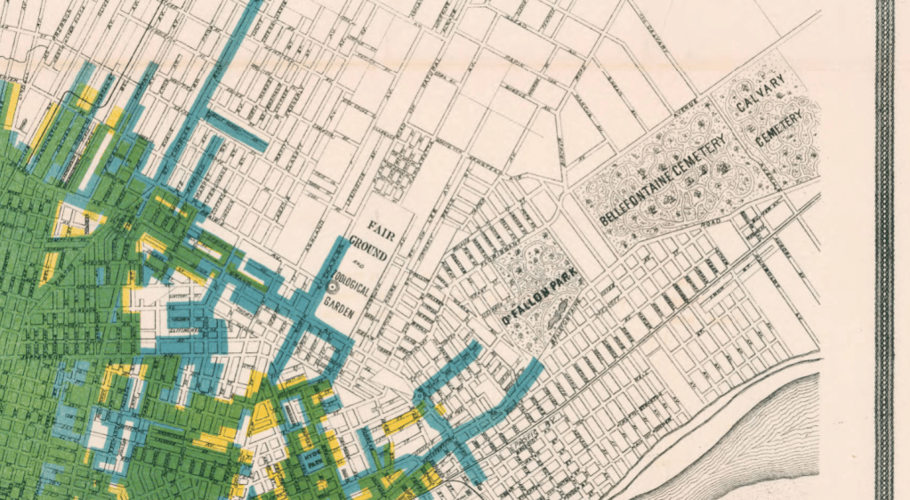
Detail from 1884 Map of St. Louis featuring the Bellefontaine Cemetery and the Calvary Cemetery.
Because of this, in the 19th century, the cemetery moved out of town. Death was an upsetting reality to have in your backyard for Americans, so cemeteries were moved away from the populated areas of the city and from the water supplies for the city. And, in a final symbolic gesture, cemeteries were gated to show that they were no longer part of the world of the living. Looking at these two late 19th century maps of St. Louis and Philadelphia, you can see how far out of town the cemeteries were moved for the safety and peace of mind of the living.

1847 Map of Philadelphia including multiple cemeteries. Click the link to see this map in our Digital Collections!
But, ironically, the cemetery also became like a public park. According to Keith Eggener, author of Cemeteries, cemeteries were free oases where people could escape the hustle and bustle of their city lives. People would bring picnics, bicycles, take strolls, and use the cemetery as a brief respite from daily life. They became immensely beautified– the cemetery was not only important as a place that separated the dead from the living, but also as a place that the living could visit at their leisure and leave again when they were satisfied.

Arlington National Cemetery from the Harrison Forman Collection. Click the link to see this photo in our Digital Collections!
We might be a little more comfortable with our cemeteries these days, but they’re still not going to be our ideal afternoon spot. But during Halloween season, when death is on our minds, it’s important to remember our relationship to the place where spooky skeletons and vampires reside. And maybe accept that those scary figures are pretty harmless– Savannah’s Bonaventure Cemetery is a beloved tourist destination, where people go to see the beautiful parks. But, remember– always “keep your distance, remain quiet and show respect for the dead.”

Illustrated Map of Bonaventure Cemetery in Savannah Georgia, 2016. Click the link to see this map in our Digital Collections! 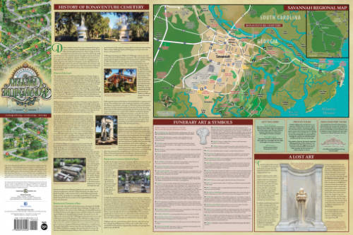
History of Bonaventure and Additional Information.
Fair and Square: A Short History of World’s Fairs
By Lauren Maddox

Unisphere Sculpture from 1964 New York World’s Fair, Taken by Harold Mayer. Click the link to see this photo in our Digital Collections!
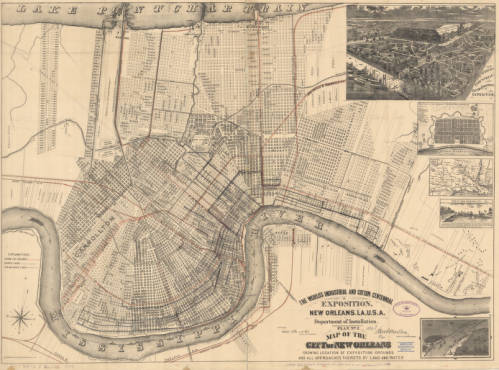
1884 Map of New Orleans’ Exposition Grounds. Click the link to see this map in our Digital Collections!
In 1984, Louisiana hosted a World’s Fair celebrating “The World of Rivers.” It was the last World’s Fair in the U.S. And it was the most financially disastrous fair in the history of World’s Fairs. To be fair, the point of hosting World’s Fairs and Expositions was never to make money– most host countries had to shell out exorbitant amounts of money to finance their fairs. But the point of the World’s Fair was never to make money; instead, these fairs were celebrations of progress and a chance to impress the international community. Host countries never expect to make a profit off of the Fair, but the 1984 Fair was particularly draining– it was the only Fair to ever go bankrupt.
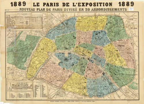
Map of Paris for the 1889 Exposition. Click the link to see this map in our Digital Collections!
But before the 1984 fair, the U.S. had a rich history as a member of the International Bureau of Exhibitions– they’ve hosted 30 World’s Fairs since their first in 1829. And before that?
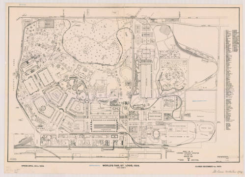
Ground Plan of Louisiana Purchase Exposition, 1904. Click the link to see this map in our Digital Collections!
The tradition of the World’s Fair is based heavily on French national expositions– but the first was actually hosted in Prague in 1791. This exposition was before World’s Fairs were standardized and regulated by the Bureau of International Expositions. These early expositions had their roots in Medieval festivals, and quickly became a way for post-revolution France to unite their new republic. The industry-focused expos continued under Napoleon but still focused on French products.
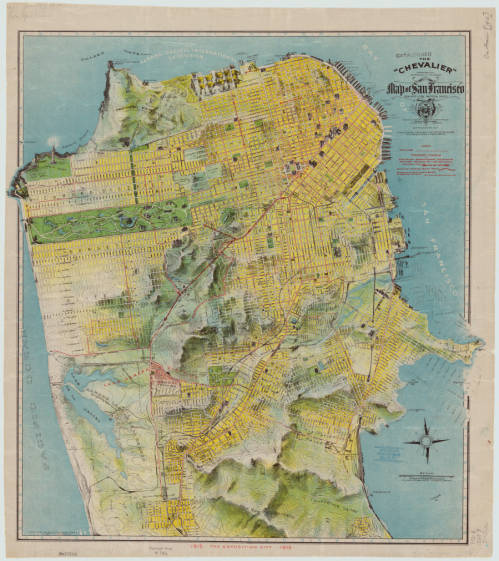
1912 Chevalier Map of San Francisco featuring the Panama-Pacific International Exposition grounds. Click the link to see this map in our Digital Collections!
The exposition most commonly cited as the first international affair is London’s Great Exposition in 1851. This World’s Fair was iconic– its great Crystal Palace became the symbol of World’s Fairs for years to come and continues to be one of the most quintessential Victorian structures.
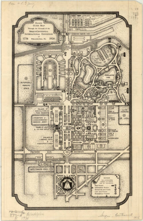
Complimentary Map of the Sesqui-Centennial International Exposition at Philadelphia, PA, 1926. Click the link to see this map in our Digital Collections! 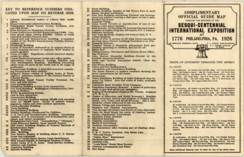
Points of Interest at the Sesqui-Centennial International Exposition at Philadelphia. Click the link to see this map in our Digital Collections!
In 1928, the Bureau of International Expositions (Bureau international des expositions) was established in order to oversee and approve of expo arrangements internationally and to set standards for expositions across nations. 170 countries are currently members of the BIE– including the United States. The BIE has remained in charge of international expositions ever since.
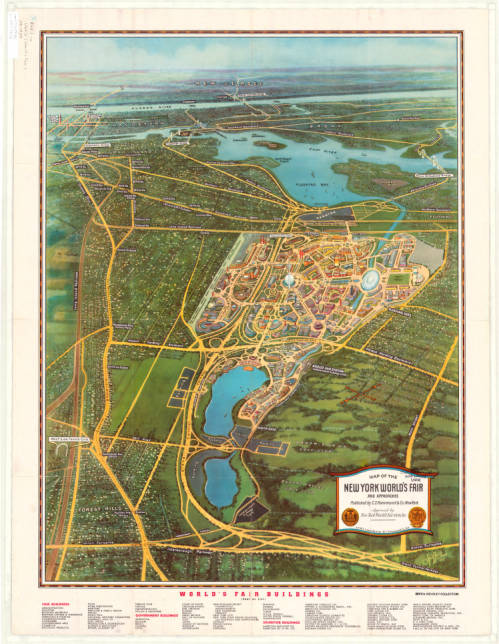
Map of the New York World’s Fair with Map of Greater New York’s Transit, 1939. Click the link to see this map in our Digital Collections! 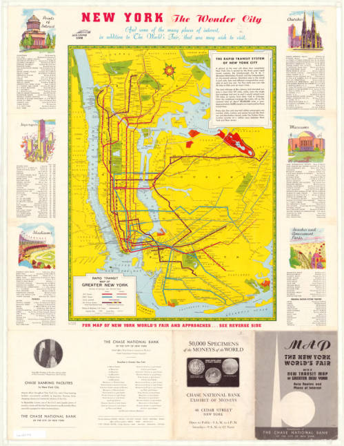
Map of New York Transit System with Points of Interest in the City, 1939. Click the link to see this map in our Digital Collections!
The nature of World’s Fairs have changed drastically since their Medieval beginnings– these fairs began as a way to unite communities, national and international, and then became an opportunity for countries to showcase their industrial prowess and establish themselves on the global stage.
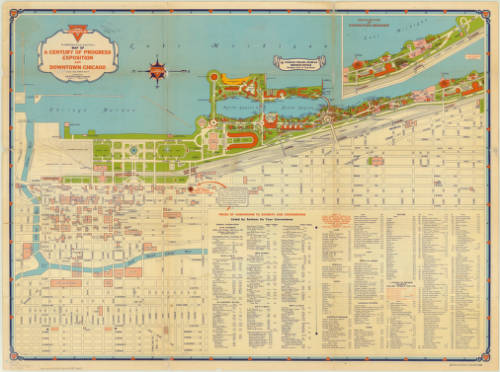
Map of Chicago’s 1933 World’s Fair. Click the link to see this map in our Digital Collections! 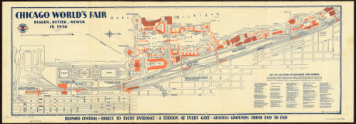
Map of Chicago’s 1934 World’s Fair. Click the link to see this map in our Digital Collections!
The 1984 exposition signaled the end of an era for World’s Fairs. It wasn’t just the last Fair to be hosted on American soil– it was also one of the first environmentally focused specialized expos. No longer are World’s Fairs an opportunity to flex wealth and status; instead, new expos are interested in environmentalism, building a sustainable future, and the building of a more united global community.
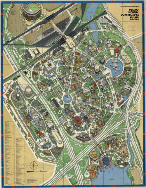
Map of New York’s 1964 World’s Fair. Click the link to see this map in our Digital Collections!
The United States withdrew membership from the BIE in 2002, but in 2017 rejoined. And maybe, in the near future, we can expect another Fair, as part of America’s long legacy of World’s Fairs, looking forward into a bright future.
To the Lighthouse: Representations of Lighthouses on Maps
By Lauren Maddox
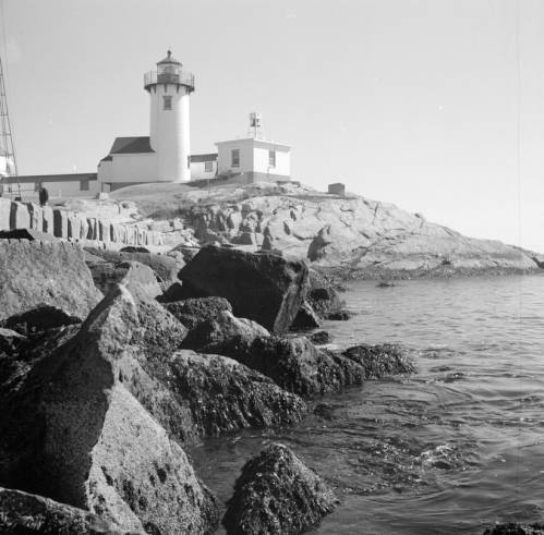
Click the link to see Clarence W. Sorensen’s photo of a lighthouse in Gloucester, c. 1934-1969 in our Digital Collections
Lighthouses have been guiding us home over the rough sea from our earliest maritime beginnings– but our understanding of lighthouses and how we represent them on maps and nautical charts has changed drastically since these beginnings. While references to early lighthouses exist, including Homer’s claim that Palamedes devised a system of lit beacons to guide sailors, the first “regularly maintained” lighthouse in antiquity was on Cape Incihisari. J. Saxby Wryde, however, claims in his British Lighthouses: Their History and Romance that the most celebrated lighthouses in antiquity were built 400 years after this. The Colossus at Rhodes was erected in 278 B.C. and destroyed by an earthquake in 224; the remains were sold as brass and carted away on camels by a merchant. In 270 B.C., the famous Lighthouse of Alexandria was constructed in honor of Ptolemy Philadelphus on a small island in the Bay of Alexandria.
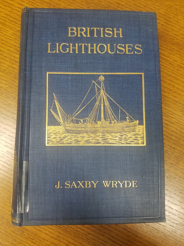
Click the link for details about the 1913 Edition of British Lighthouses 
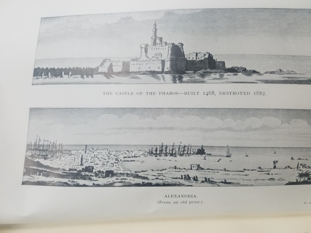
Illustration of the Lighthouse of Alexandria
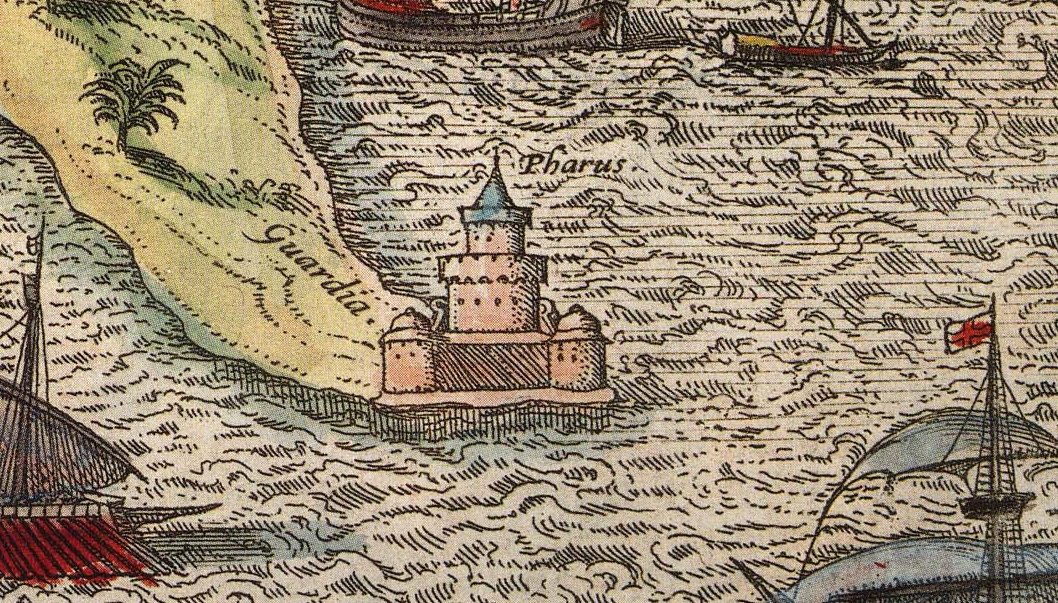
The function of lighthouses has also evolved over the years; in antiquity, lighthouses were only expected to indicate the location of ports. Lighthouses as we understand them today act as warnings for boats approaching reefs and rocky shores. This understanding of lighthouses as way markers is reflected on ancient maps. The Lighthouse of Alexandria is depicted pictorially in Braun and Hogenberg’s 16th century atlas Civitates Orbis Terrarum–the lighthouse is given the same attention as the city’s obelisk or its ruins; its existence is simply recorded and labeled with a single word: pharus for lighthouse. The lighthouse has obviously done its job, though; ships are shown moving towards the lighthouse and the port it is indicating. One ship is even flying St. George’s Cross, the British flag used by crusaders that was later adopted as the national flag in Medieval England.
Click the link to see the Atlas the illustration of The Lighthouse of Alexandria is in 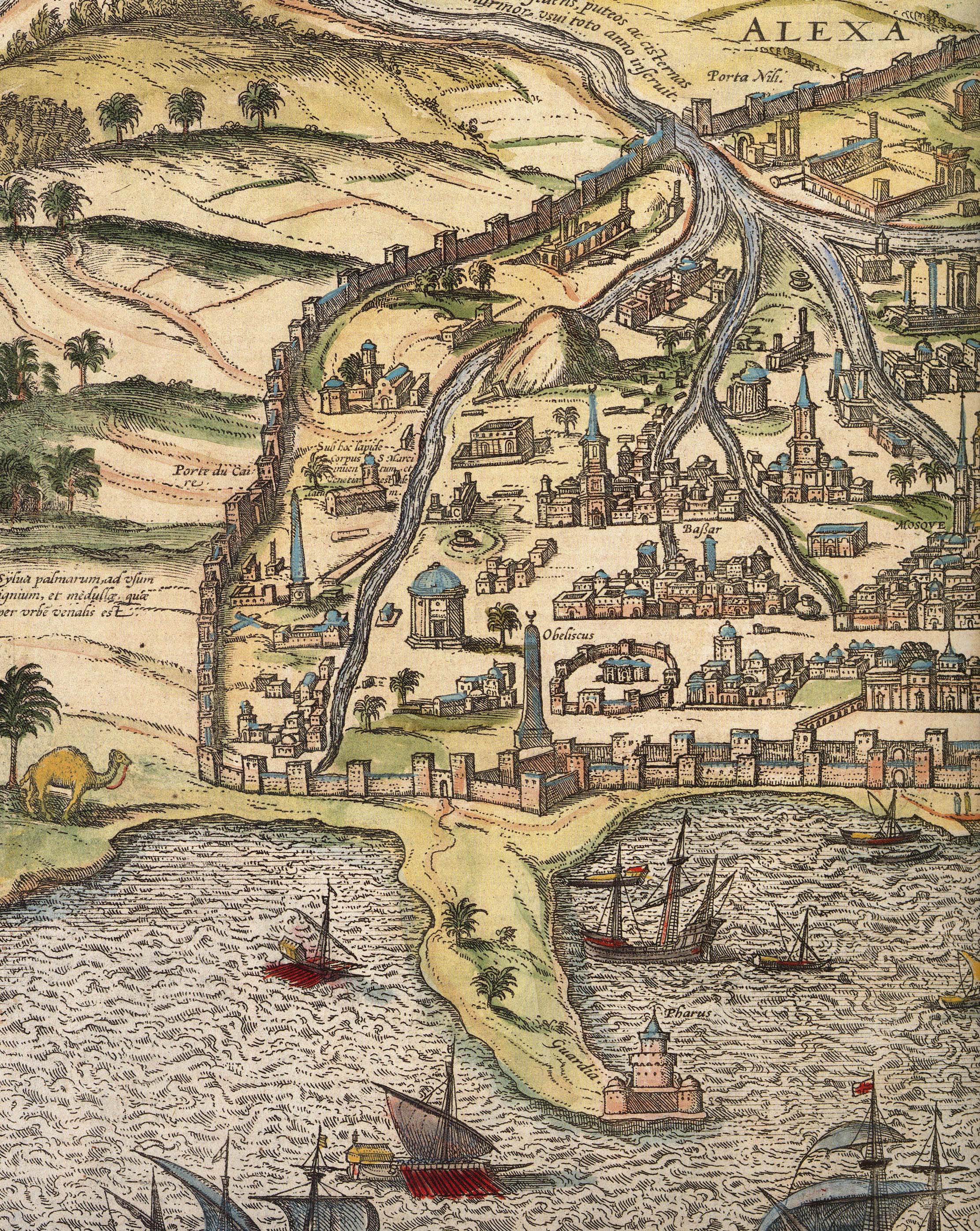
Alexandria
The Lighthouse of Alexandria was also doomed to be destroyed by earthquakes, but the bricks were used to construct the Citadel of Quaitbey. UWM professor Caroline Seymour-Jorn donated her photo collections to the AGSL , including several photos from 1996 visit to Egypt of the citadel.
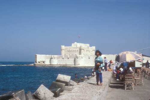
Click the link to see this photo of Alexandria, Egypt: View of Quaitbey Citadel courtesy of Caroline Seymour-Jorn in our Digital Collections
The Roman Empire adopted the Greek pharos and began building them across Italy and the Empire, including the Tower of Hercules in A Coruña, Spain and Dover. The lighthouse in A Coruña is still functional, but many Roman lighthouses were abandoned in the Middle Ages and replaced. As travel and trade by sea became more and more prevalent, the need for lighthouses grew.
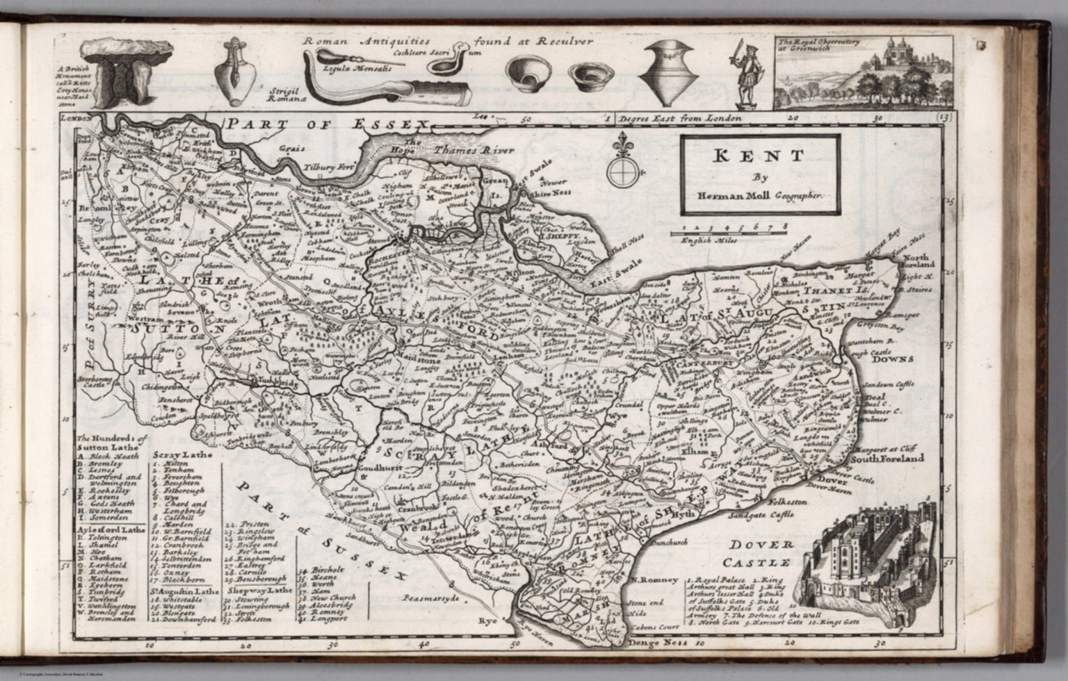
Click the link to see the 1724 Map of Kent by Herman Moll in our Digital Collections 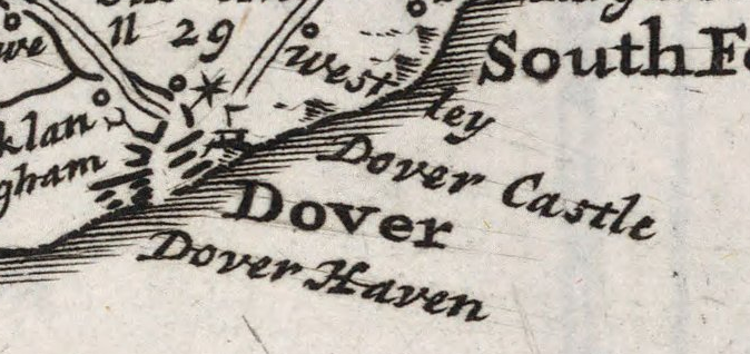
Dover, lighthouse indicated pictorially
Most lighthouses constructed during this time are no longer operational, but the Hook lighthouse in Ireland continues to be used. The building has been in operation for over 800 years and is now managed by the Commissioners of Irish Lights. Lighthouses in England were privately owned and operated during the Middle Ages and beyond. Because there was no regulation or standard policy, lighthouse keepers began to abuse their posts, stealing ship cargo and demanding payment from sailors. This problem became so pervasive that the Lighthouse Act of 1836 was passed in the hopes of making coasts safer for ships coming to port.
In the 18th century, lighthouse construction advanced to match the needs of a growing transatlantic trade. Bigger, better lighthouses were being built and were now being used as more than way markers; they could warn incoming ships and regulate boat traffic. In 1716, the first American lighthouse was built on the Boston Harbor; many more began to spring up in the subsequent years, and in 1851 Congress passed an act to facilitate the creation of the US Lighthouse Board, which would eventually be dissolved to make room for the Lighthouse Service. The AGSL has many of the Service’s records, including records of their history, finances, regulations, and buoyage and lighthouse systems.
Click the link to see the Boston Light Referenced on 1889 Map of Boston Harbor in our Digital Collections
With lighthouses increased utility and presence on coastlines, their representation on maps began to shift. Instead of being just illustrations or seamarks, lighthouses began to take on a new navigational importance. Diagrams of lighthouses, recordings of the range of their lights, and more exact buoy locations became a common part of maps.
Click the link to see Lighthouse detail from 1926 map of Puerto Deseado, Argentina in our Digital Collections 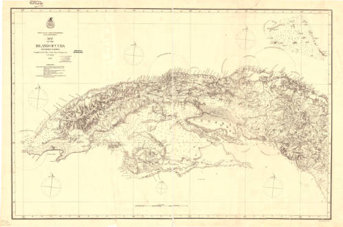
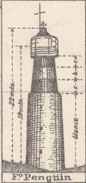
Click the link to see the Map with Lighting information for Cuba 1874 in our Digital Collections 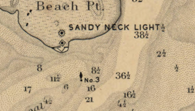
Click the link to see the Lighthouse and Buoy on Map of Barnstable Harbor, Massachusetts 1880 in our Digital Collections 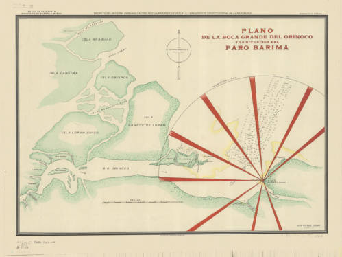
Click the link to see the Lighthouse depicted in 1906 Map of Rio Barima, Venezuela in our Digital Collections
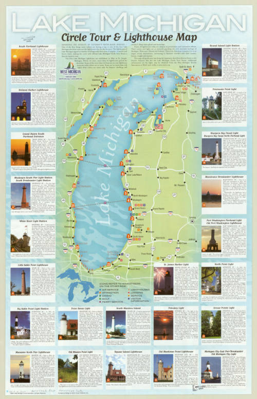
Now lighthouses have a romantic air as well as a practical use; writers and artists work to capture the lighthouse. To the Lighthouse by Virginia Woolf comes to mind. And here, in Milwaukee, where the AGSL lives, we have our share of lighthouses on our Great Lake Michigan.
The Harrison Forman Photo Collection
By Susan Dykes
I was recently asked what my favorite image is in the Harrison Forman Collection. Having become intimately familiar with tens of thousands of images Harrison Forman took, it was an overwhelming and almost impossible request to say the least. There are so many! Harrison Forman, photojournalist and adventurer, travelled the world from the 1930s through the 1970s. He was prolific, wielding his camera to capture major historical events, and the economies, infrastructures, politics, societies, educational systems, and cultures of the places he visited.
By far my favorite kinds of images Forman took are of the people living in many of these places, asking them to take a moment from their daily lives practicing their trades, spending time with their families, and simply enjoying life, to pose for a photo. Of the thousands of portraits and group photos he took, I found those of the Berber people living in the Atlas Mountains in Morocco among the most striking and beautiful in the collection.
My favorite image, taken in the 1960s, shows a Berber woman in the foreground, eyes closed, wearing a delicate lace veil and coin jewelry, two Berber men behind her in traditional clothing wearing turbans, and another man in the background, photo bombing the shot.

There’s something very serene about the woman. Perhaps she just blinked, but I choose to think she was soaking up the sun on her face and possibly the moment. The two men, eager to be a part of the photograph, looking directly at the camera and the man in the back with a look of wonder, curious about the activity.
Forman’s enthusiasm about documenting people and cultures outside of the Western world is evident in this photograph. He wanted to share the beauty of people in places unfamiliar to us at the time of his work, which in an historical context, makes a much richer scholarly endeavor today.
While this image is in black and white, as well as the other images of the Berbers in the UWM Libraries Digital Collections online, the Harrison Forman Collection includes over 50,000 color slides that have yet to be digitized, some of which Forman took of the Berber people. It is our hope that we will be able to obtain the funding to digitize the slides in the near future and make them accessible online, in all their full color glory!
In the meantime, check out the rest of Forman’s images of the Berber people in Morocco:
http://collections.lib.uwm.edu/cdm/search/searchterm/forman%20berber/mode/all/order/nosort/page/2
And, explore images of the other people around the world Forman photographed:
http://collections.lib.uwm.edu/cdm/search/searchterm/forman%20people/order/nosort
If you have questions about the Harrison Forman Collection, or would like to know more about the color slides, please contact Susan Peschel at the American Geographical Society Library.
