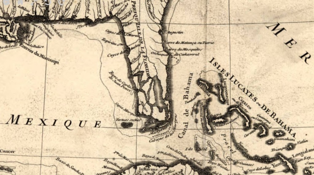
Florida
Map of the Caribbean by Jean-Baptiste Bourgulgnon d’Anville, 1731
By Angie Cope
This 1731 map of the Caribbean was originally created to be part of one of the first histories of the Caribbean entitled: Histoire de L’Isle Espagnole ou de S. Domingue by Father Pierre François Xavier de Charlevoix. The map was reproduced and corrected a number of times and this copy reflects the second state of the first edition of the map. French geographer Jean-Baptiste Bourgulgnon d’Anville (1697-1782), the creator of this map, is cited as greatly developing the technical proficiency of mapmaking during his lifetime.
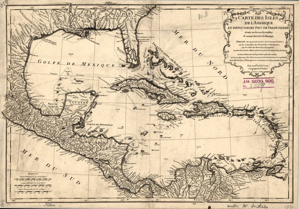
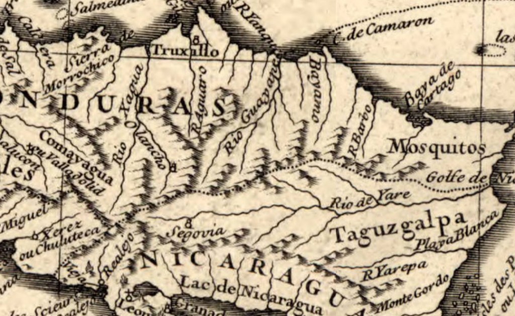
The maps shows the Florida Keys at the south emphasizing their archipelagic nature. River and waterway details are abundant with the entrances to major rivers shown such as the Mississippi, the Rio Bravo and the Orinoco. Terrain is show with illustrations of mountains.
Text in decorative cartouche in upper right translates to:
Map of the isles of America and several countries of the mainland located in front of these Isles & around the Gulf of Mexico.
Made based on a large number of particular maps, on the instructions of navigators and travelers, on the recitals of the Spanish historians, which furnish details which have not been entered into the maps. The whole diminishes under the most favorable projection, and agrees with astronomical determinations of longitude of Martinique, Santo Domingo, Jamaica, Cartagena, and Louysiana
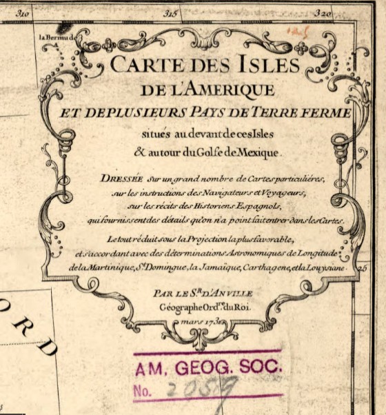
Title: Carte des isles de l’Amerique et de plusieurs pays de terre ferme situes au devant de ces isles & autour du Golfe de Mexique / dressee sur un grand nombre de cartes particulieres, sur les instructions des navigateurs et voyageurs, sur les recits des historiens espagnols, qui fournissent des details quon na point fait entrer dans les cartes ; le tout reduit sous la projection la plus favorable et s’accordant avec des determinations astronomiques de longitude de la Martinique, St. Domingue, la Jamaique, Carthagene et la Louysiane ; par le sr. d’Anville, geographe ordre. du roi, mars 1731 ; Delahaye sculpsit.
Call number: (AGS) (RARE) 230 B-1731
Scale: 1:10,000,000
Published by: Jean-Baptiste Bourgulgnon d’Anville in Paris
Dimensions: 1 map ; 31 x 44 cm
View map in the Digital Collection: https://collections.lib.uwm.edu/digital/collection/agdm/id/361/rec/1
Splendid China was abandoned, looted, turned to rubble and transformed into Margaritaville
by Angie Cope
I’ve been working from home cataloging maps that were donated to the AGS Library. I thought I’d be able perform this task very quickly but, every other map I encounter seems more interesting than the last and distracts me. Today I ran across one called “Splendid China.”
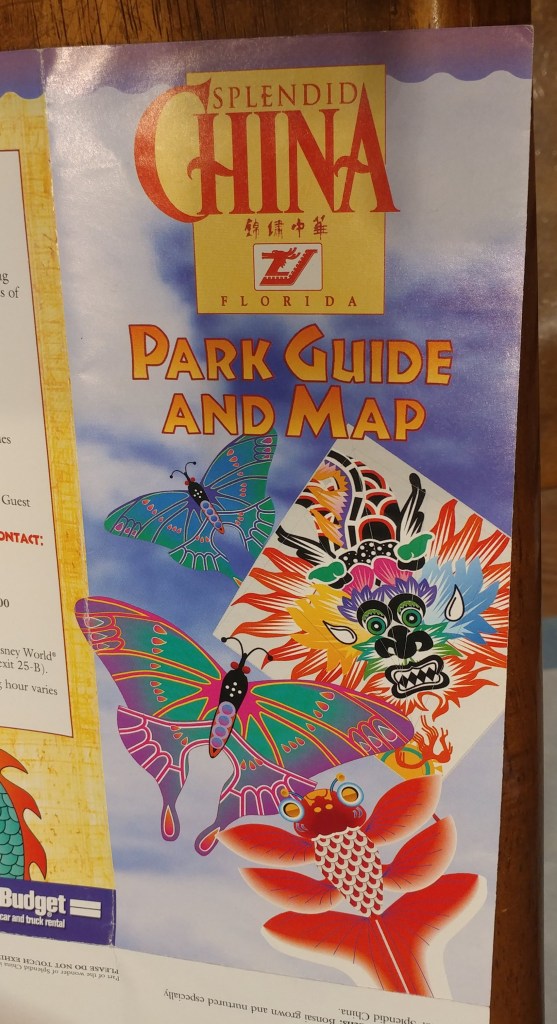
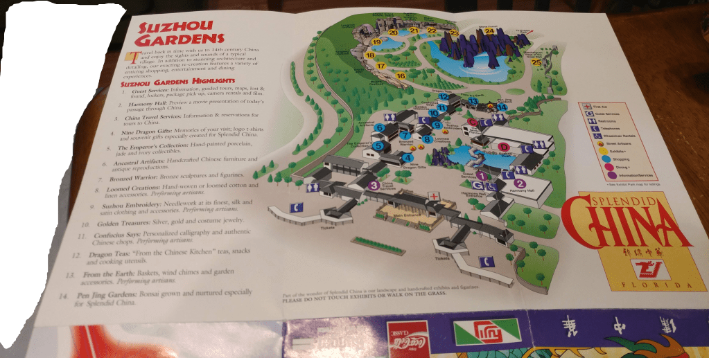
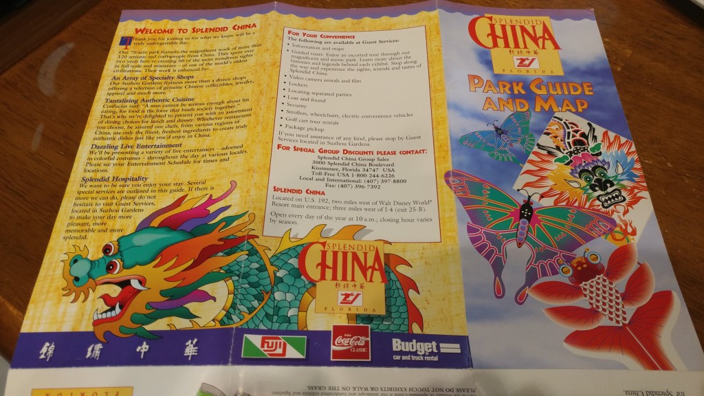
Splendid China was a theme park in Florida near Walt Disney World. The park opened in 1993, and closed on December 31, 2003. Splendid China, Florida had a sister park in Shenzhen, China which remains open today.

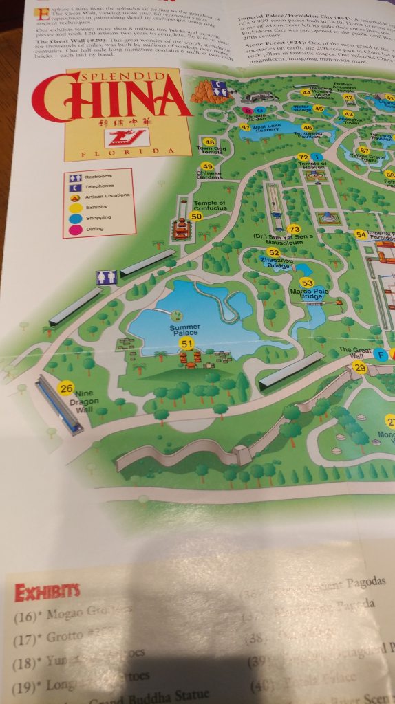
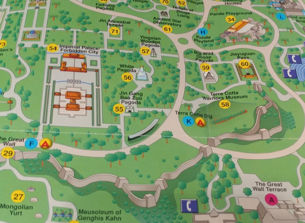
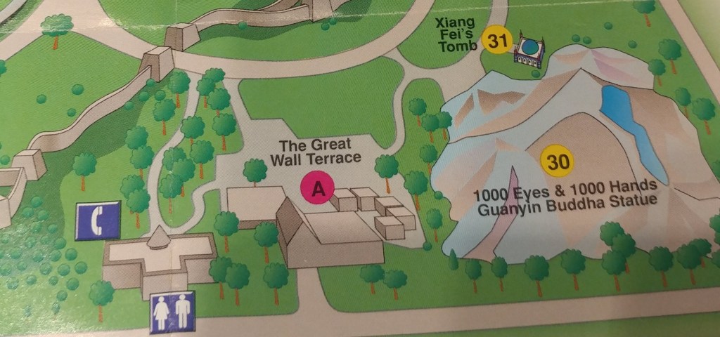
The Florida park contained over 60 one tenth scale detailed replicas of China’s most famous landmarks such as the Great Wall, Forbidden City, and the Terra Cotta Warriors. After years of controversy and protests, the park closed in 2003, vandals looted what wasn’t nailed down and the park was reduced to rubble.
In 2018 the site was officially cleared, making way for the American resort Margaritaville that opened in 2018.
Read more about Splendid China, Florida
Atlas Obscura: https://www.atlasobscura.com/places/splendid-china-orlando
Wikipedia: https://en.wikipedia.org/wiki/Splendid_China_(Florida)
Roadside America: https://www.roadsideamerica.com/story/2057
