Milwaukee
MILWAUKEE MUNICIPAL RESEARCH CENTER MAP COLLECTION
Beginning in 2020, the American Geographical Society Library partnered with the Milwaukee Municipal Research Center (MRC) to provide online access to over 250 maps. This online map collection features maps created by city departments and includes subject areas of the city’s historic geographical boundaries and annexations, current and former aldermanic districts (known as wards prior to 1972), Census tracts, neighborhoods, land use, redevelopment planning, transportation and population. The collection has both historical maps dating back to early 1800s as well as more modern maps dating into the 2000s. The technical work was done by two UWM SOIS students, Samantha Dickson and Lillian Pachner, who uploaded the files and created ContentDM metadata.
In addition to finding these 250+ maps in the American Geographical Society Library Digital Map Collection online, all of them can be used on site at the Milwaukee Municipal Research Center (MRC), located in the basement level of the Zeidler Municipal Building, 841 N. Broadway. Their hours are 8:00 am – 4:45 pm, Monday-Friday.
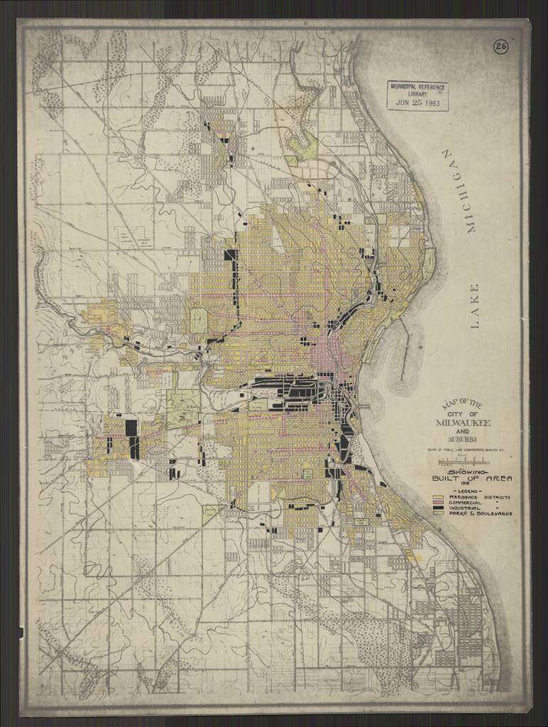
Milwaukee Wis. Annotated title: Showing Built Up Area 1919
https://collections.lib.uwm.edu/digital/collection/agdm/id/25616/rec/130
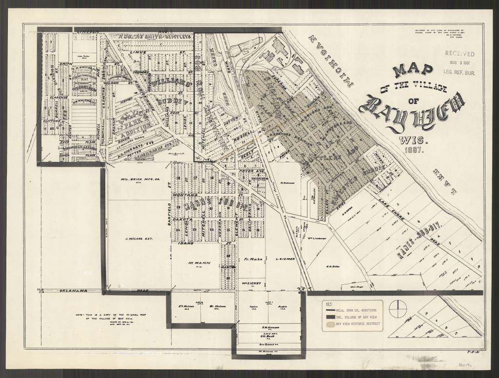
https://collections.lib.uwm.edu/digital/collection/agdm/id/25578/rec/150
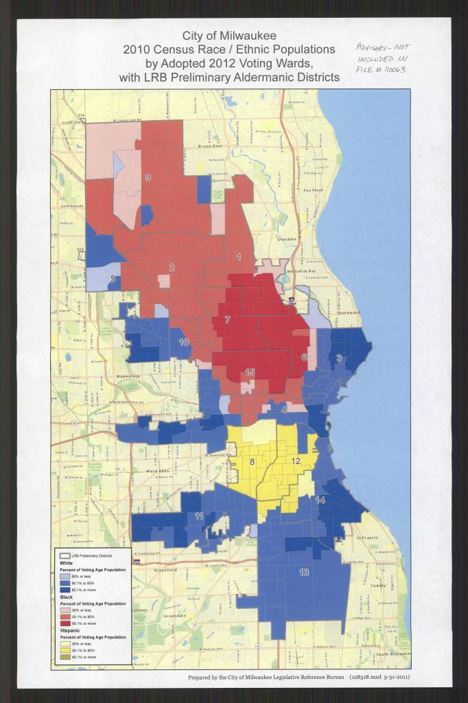
by Adopted 2012 Voting Wards, with LRB Preliminary Aldermanic Districts /
Prepared by the City of Milwaukee Legislative Reference Bureau
https://collections.lib.uwm.edu/digital/collection/agdm/id/25684/rec/135
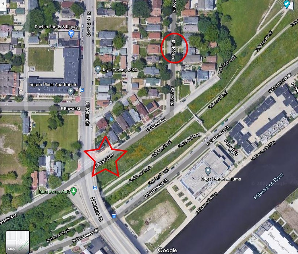
Milwaukee Streets named after Black Wisconsinites Joshua Glover and Sherman Booth
by Angie Cope
Joshua Glover escaped enslavement from Benammi Stone Garland’s Missouri farm in 1852 and traveled by foot to Racine, Wisconsin. Because of The Fugitive Slave Act, Garland was legally able to hunt down Glover and recapture him in March 1854. Garland and his men took Glover to a jail in Milwaukee with the plan of returning Glover to Missouri.
However, the morning after Glover’s jailing, it is said that abolitionist Sherman Booth and a mob stormed the jail. Glover was freed but then spent 40 years on the run, finding safe spots along the Underground Railroad system. After decades of running, Glover found ultimate freedom in Canada, where he died.
In 1857, Booth Street in Milwaukee’s Riverwest neighborhood was named after Sherman Booth.
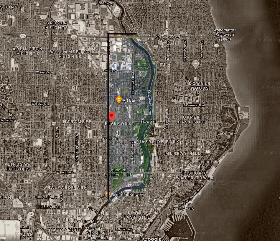
In 2016, some homeowners in the area signed a petition approving the renaming of part of Reservoir Avenue to Glover Avenue. Now there is a cross where Booth Street and Glover Avenue intersect.
View the maps in more detail
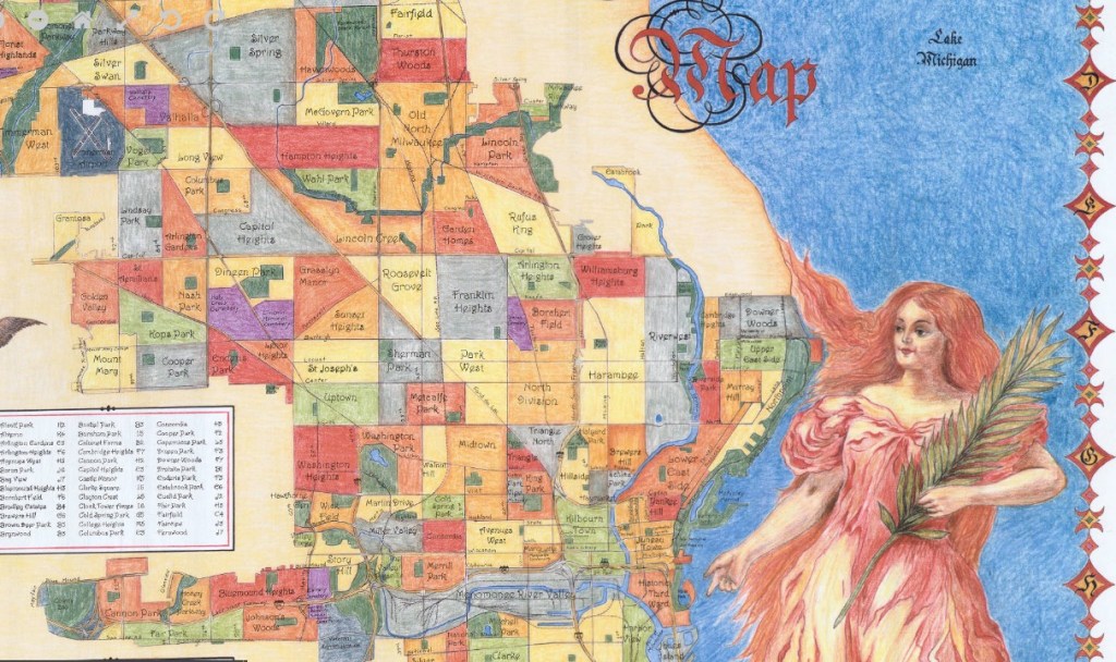
Milwaukee neighborhood map / V. Robie and Big Stick, Inc. 2002
https://collections.lib.uwm.edu/digital/collection/agdm/id/11909/rec/2
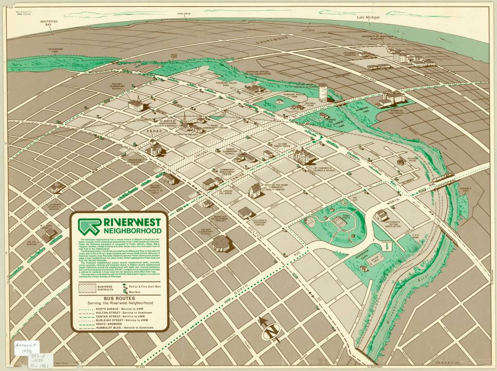
Riverwest neighborhood / Dru Maki, artist 1981
https://collections.lib.uwm.edu/digital/collection/agdm/id/5918/rec/6
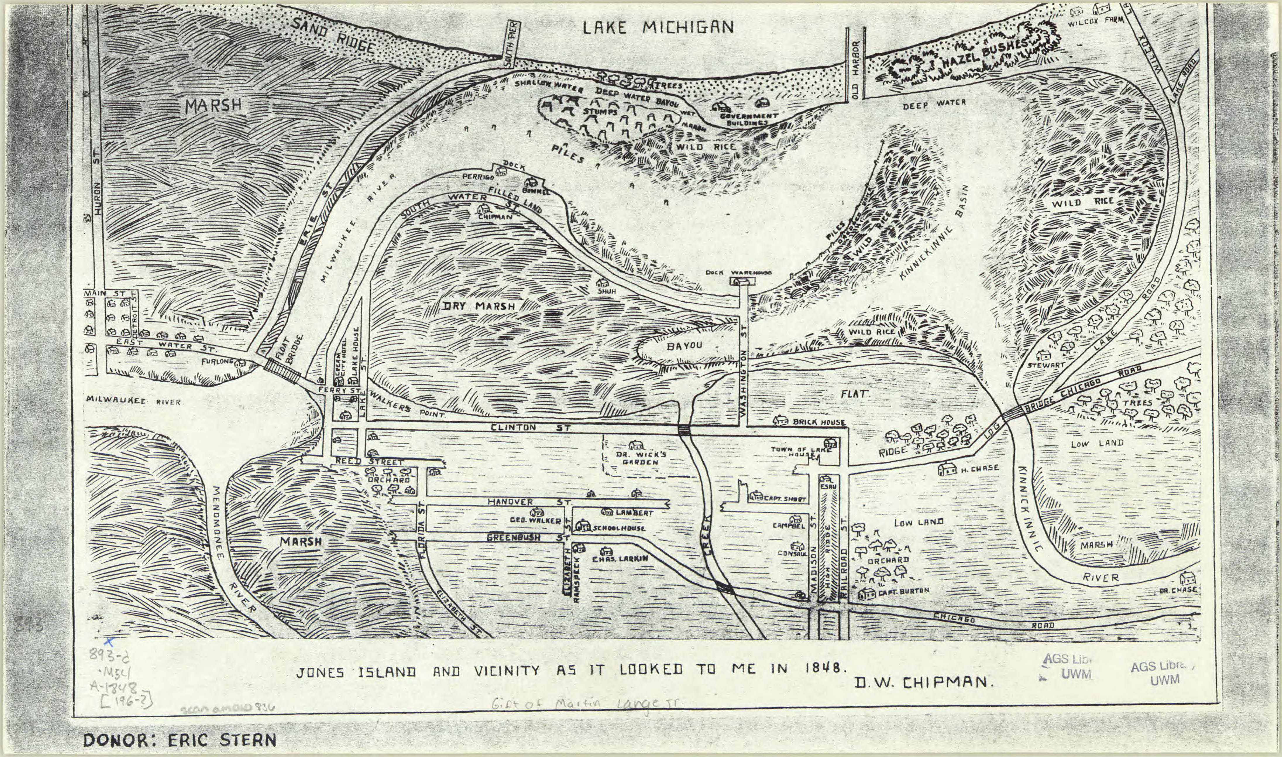
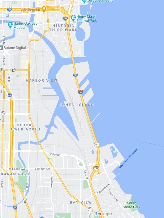
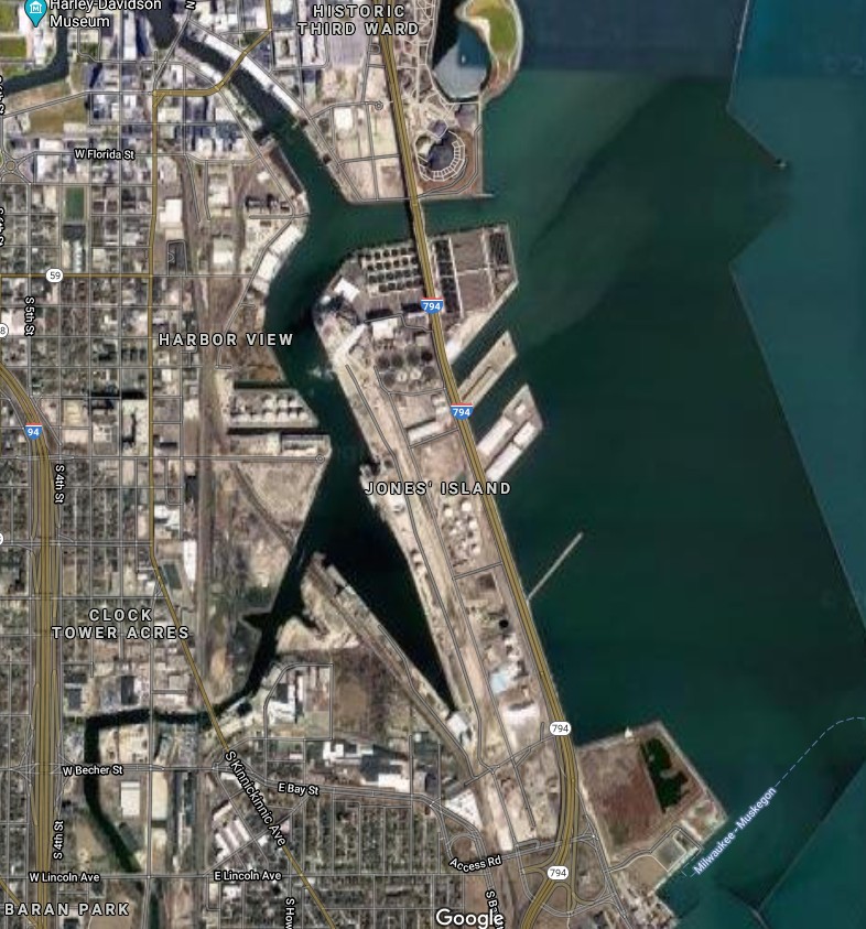
Jones Island, Milwaukee, Wisconsin
by Angie Cope
Jones island is an industrialized peninsula in Milwaukee, Wisconsin between the Milwaukee and Kinnickinnic rivers.
https://collections.lib.uwm.edu/digital/collection/agdm/id/5459/rec/1
The island was originally marsh land when German immigrants settled there in the 1870s. Without proper land deeds, the immigrants were considered squatters and were evicted to make way for a shipping port. Between 1920 and 1940s the final European immigrants were removed.

https://collections.lib.uwm.edu/digital/collection/agdm/id/21/rec/7
Today Jones Island is home to the Port of Milwaukee, the Milwaukee Metropolitan Sewerage District’s primary wastewater treatment plant, and other municipal services. It also supports the long-arch Hoan Bridge that spans across the Milwaukee River inlet. The land is heavily industrialized, containing only a couple of mature trees.

Map of Jones Island 1960s facsimile of an 1848 map
https://collections.lib.uwm.edu/digital/collection/agdm/id/5459/rec/1
View of Jones Island from an 1869 map of Milwaukee
https://collections.lib.uwm.edu/digital/collection/agdm/id/21/rec/7
Modern map of Jones Island, Milwaukee, Wisconsin 2020
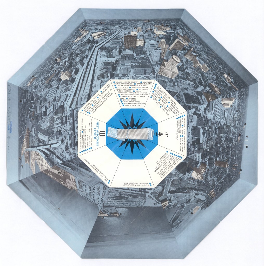
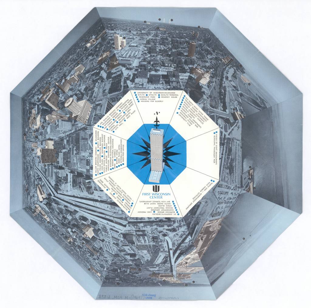
View of Milwaukee, Wisconsin 1972
by Angie Cope
Milwaukee as seen from atop the First Wisconsin Center in 1972.

The First Wisconsin Center located at 777 Wisconsin Avenue is the original name of a skyscraper located in downtown Milwaukee. It is noted for being the tallest building in the state standing 601 feet tall with 42 stories. Construction of the building was announced in 1969 and completed in 1972. Today the building is named the U.S. Bank Center and continues to offer a spectacular view of the city.
An observation deck on the 41st floor is open to the public during the “Doors Open Milwaukee” event usually held in September each year. Visit their website for more information: https://historicmilwaukee.org/doors-open/
In July 1987, a hacking box was installed outside the 41st floor to allow peregrine falcons to nest as part of the Wisconsin Department of Natural Resources (DNR) Peregrine Falcon Recovery Plan.Since the launch of the program in 1987, 67 falcons have fledged from the hacking box atop the tower.
Visit “Encyclopedia of Milwaukee” to learn more about the US Bank Center: https://emke.uwm.edu/entry/us-bank-center/
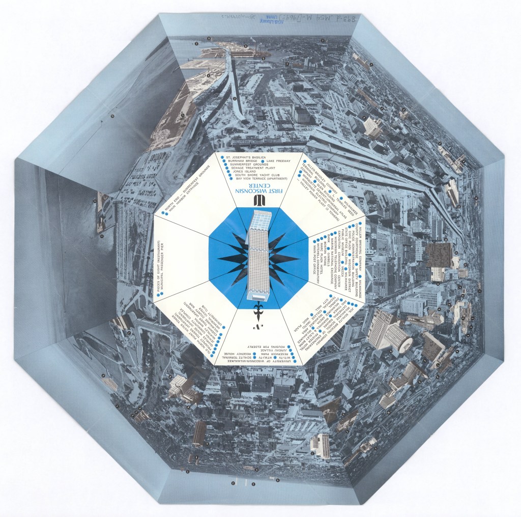
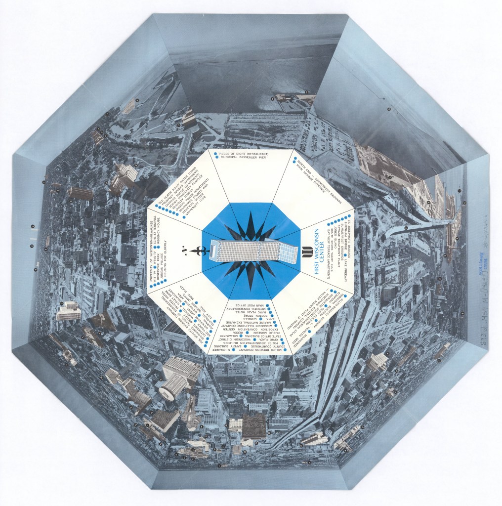
View this item in the American Geographical Society Library Digital Map Collection here:
The Sanborn Fire Insurance Maps: Milwaukee Before and After the Third Ward Fire of 1892
By Lauren Maddox
The 1894 and 1910 Sanborn Maps of Milwaukee currently featured on the AGSL website catalog over 12,000 detailed color map sheets of Milwaukee. The Sanborn map collection, which, in its entirety, contains roughly fifty thousand editions of fire insurance maps, was intended to inform fire insurance agents about fire hazards associated with individual properties in a city. The maps contain relevant information about building materials, layout, and fire prevention measures in residential and industrial buildings throughout Milwaukee as well as the actual layout of the city.
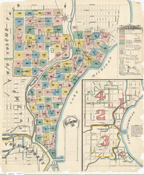
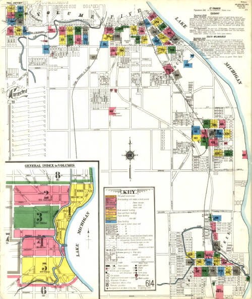
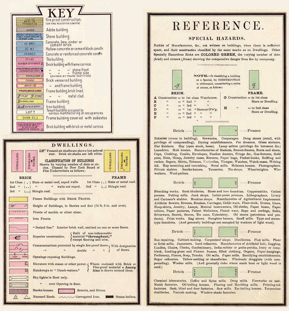
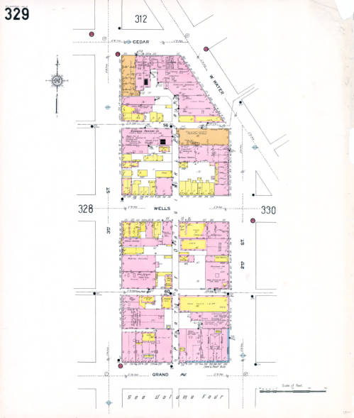
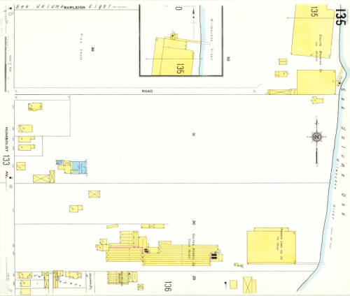
But these maps don’t just detail the fire hazards of a city– they also capture the changes that happen in an ever-growing and ever-evolving urban space. The Sanborn maps have been described as the “the single most important record of urban growth and development in the United States during the past one hundred years” and detail over 12,000 towns across the United States, Canada, and Mexico from 1867 to today. The AGSL digitized its collection of Milwaukee Sanborn maps in 2007 and made them available through the AGSL Digital Collections. Then in 2017, former AGSL student assistant Belle Lipton and the Milwaukee County Land Information Office georeferenced the AGSL’s collection of 1910 Sanborn map sheets to create the Sanborn Discovery App 1910: a seamless and immersive version of the 1910 Sanborn map sheets that overlay a current satellite map of Milwaukee. The Sanborn maps contain references to buildings that no longer exist and empty lots that have since been developed; the Riverside Printing Company on sheet 329 is now a parking lot, and underneath the mostly empty map sheet 135 now sits Carver Park’s two baseball diamonds. Looking at these two maps right on top of the other, it’s easy to see how much Milwaukee has changed in the intermediate 107 years.
However, we know that the city’s face was changing even before the Sanborn maps began to record it. Just two years before the first Sanborn fire insurance maps of Milwaukee in 1984, the historic Third Ward burned down. And years before that, the city was still growing and changing with time. The Sanborn maps capture what the city was like two years after the fire– but earlier maps in the AGSL archives reveal what the city looked like before the Sanborn fire insurance maps, before the tragic Third Ward fire, and before even the founding of Milwaukee.
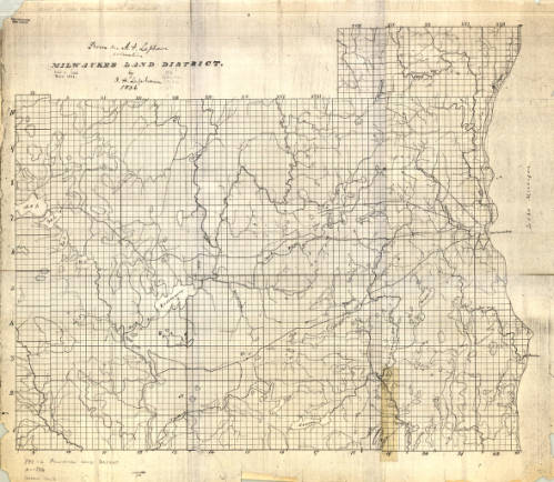
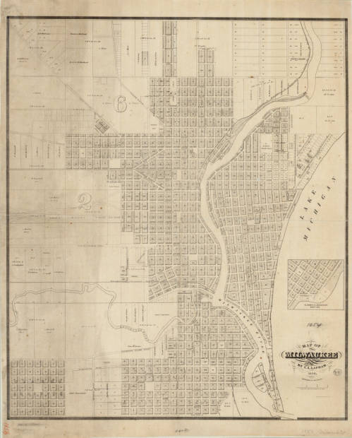
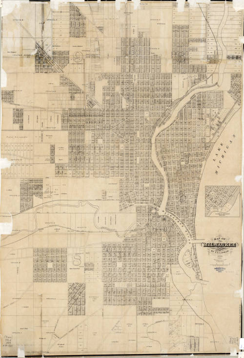
The three maps shown above, created by I.A. Lapham spanning from 1836 to 1869, illustrate Milwaukee’s growth over thirty-three years. Together, they create a picture of the city’s founding and continued development. The first map depicts the Milwaukee land district before the city was officially founded. The two later maps were recorded after Juneautown, Kilbourntown, and Walker’s Point were combined and incorporated as the City of Milwaukee. There was substantial development between 1856 and 1869, which is made even more obvious by comparing the two maps side-by-side.
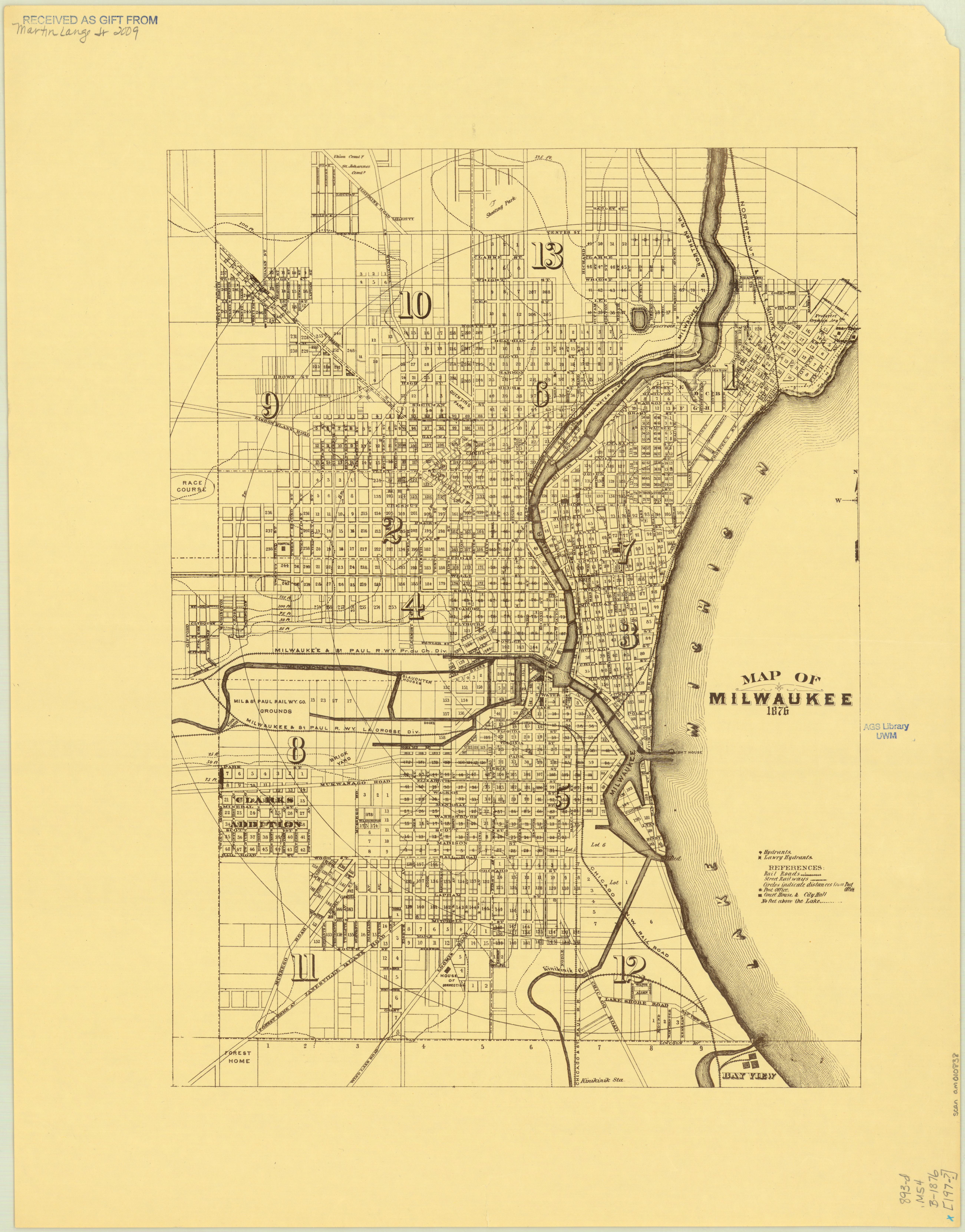
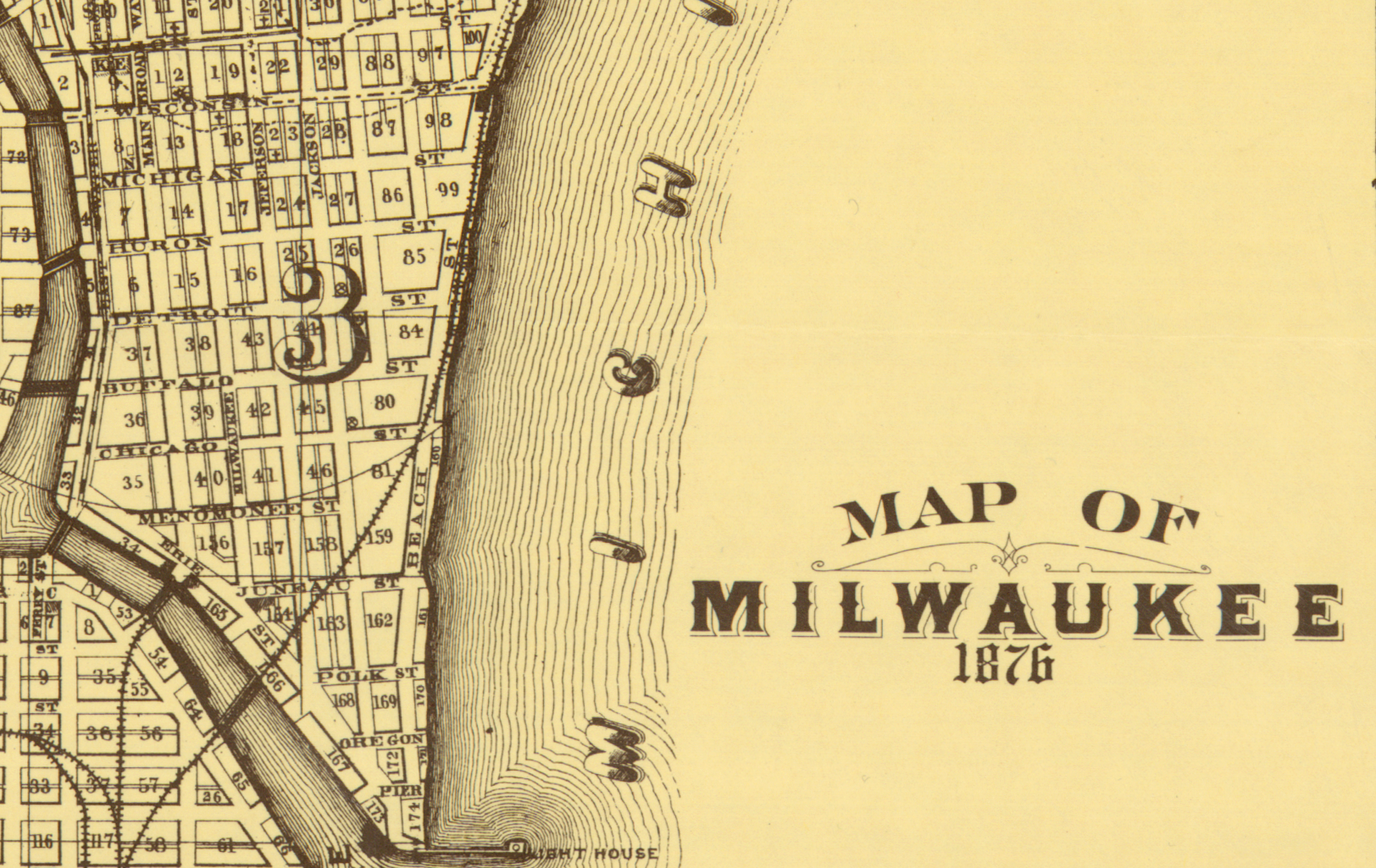
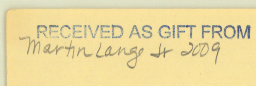
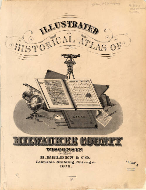
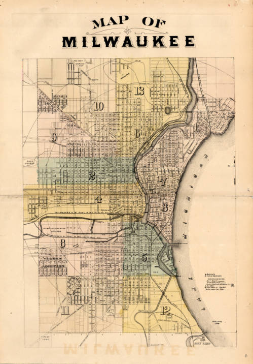
The 1876 map of Milwaukee by H. Belden and Co. presents an even more developed Milwaukee than the previous Lapham maps. The map was originally drawn up in 1876 and included in the Atlas of the State of Wisconsin in 1876, but was reprinted in 1881 as a part of the expanded Illustrated Historical Atlas of Milwaukee County Wisconsin. The first version of the map shown was donated to the AGSL by Martin Lange Jr. in 2009.
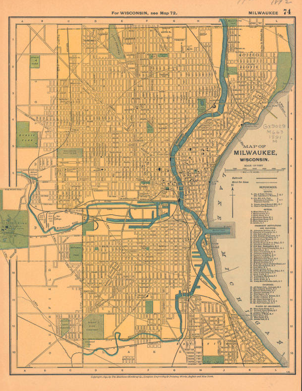
This 1891 map of Milwaukee, Wisconsin published by the Matthews-Northrup Company just one year before fire in the Third Ward gives us one last look at the city before the fire. The Third Ward was growing with the rest of the city, but sudden catastrophes will always change a place.
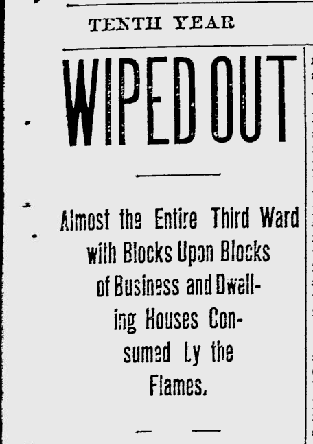
At 5:12, 5:20, and 5:40 p.m., October 28th, 1892, fire alarms rang out across Bradford and Bartlett, Greenfield Avenue, and Eleventh Avenue. Then, at 5:43, the fire alarm at East Water Street was sounded, signaling to firefighters that the Union Oil Company warehouse building was burning. The smaller fires throughout the neighborhood prevented responders from reaching the Union Oil building for fifteen minutes, by which point the fire had already become an inferno. The oil in the warehouse provided plenty of fuel, which burned brilliantly into the evening. The crisp Autumn wind carried the embers from the Union Oil Company warehouse fire to other buildings throughout the Third Ward, including a distillery, a soap factory, and countless homes.
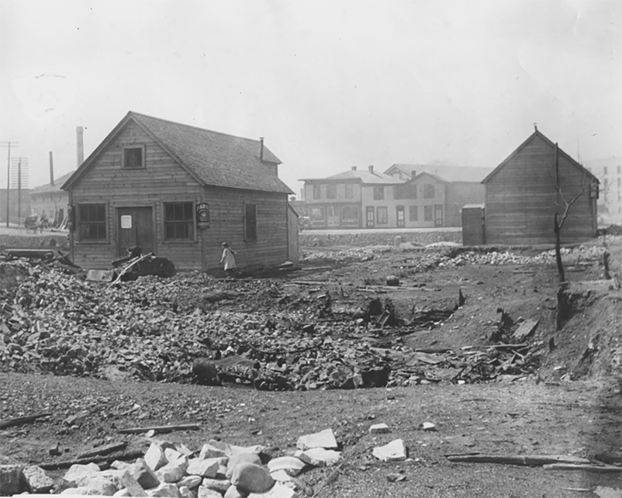
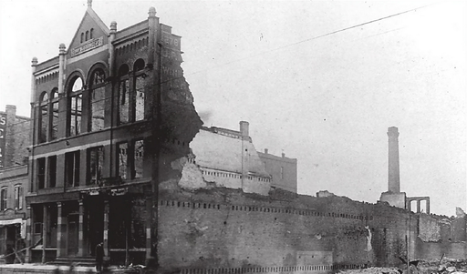
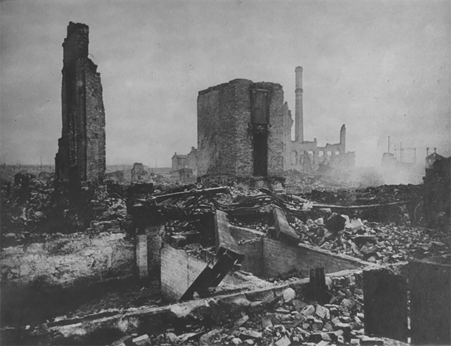
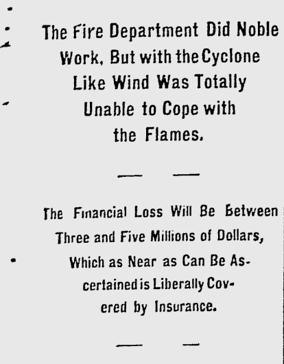
By midnight, the fire had burned through 16 city blocks, destroyed 440 buildings, killed five,injured dozens, and displaced hundreds of families. The Milwaukee Journal estimated that the total property loss was equivalent to somewhere between three and five million dollars– something more like 60 million today. Relief committees sprang up to shelter and feed victims of the fire who had lost their homes; some even endeavored to employ those whose workplaces had been destroyed overnight. The damage was so extensive that many residents were unable to rebuild. Only a small percentage of homeowners had fire insurance, and the pressure to add expensive fire-proof brick shells to their homes while rebuilding prevented many from returning. The Ward’s population shrank as residents were forced to move to other parts of the city in search of housing and work.
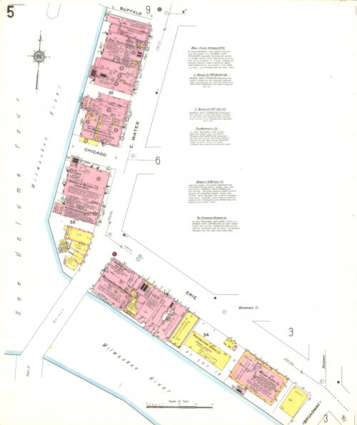
Vol. 1 Sheet 005 1910 Sanborn Map of Milwaukee depicting East Water Street 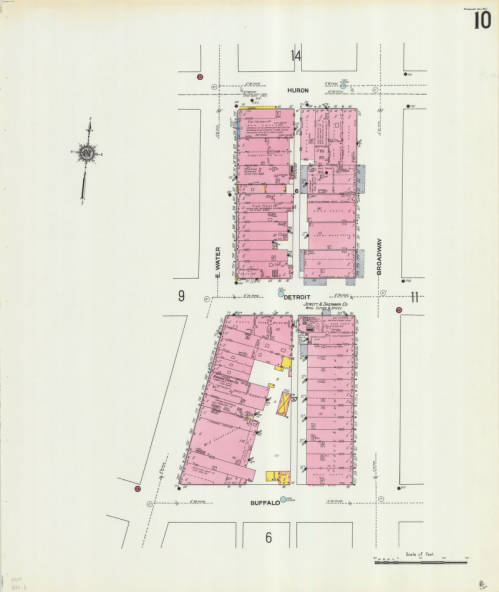
Vol. 1 Sheet 010 depicting East Water Street
This catastrophic fire transformed the Third Ward and Milwaukee as a whole. Efforts to rebuild began immediately, and over the next 30 years the Third Ward slowly became a busy commerce district again. The two Sanborn map sheets shown depict East Water St., where the Union Oil Company fire began. The neighborhood continued to change over the years until it eventually became the Historic Third Ward as we know it today.
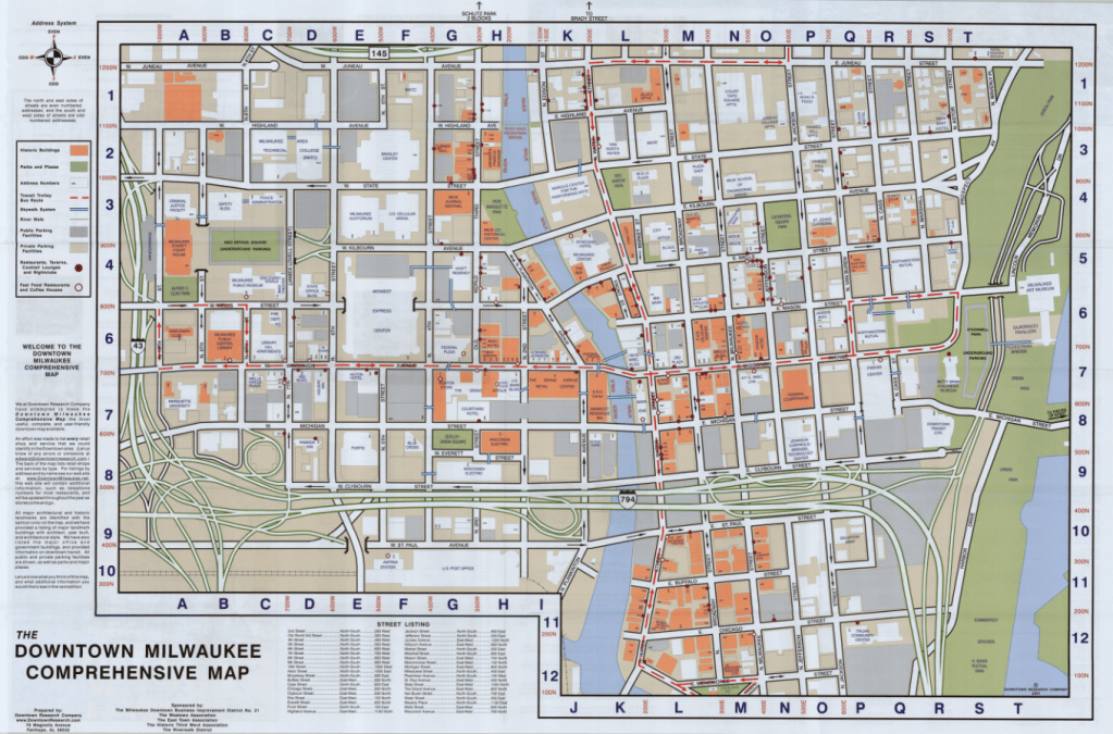
The Comprehensive Map of Downtown Milwaukee 2001 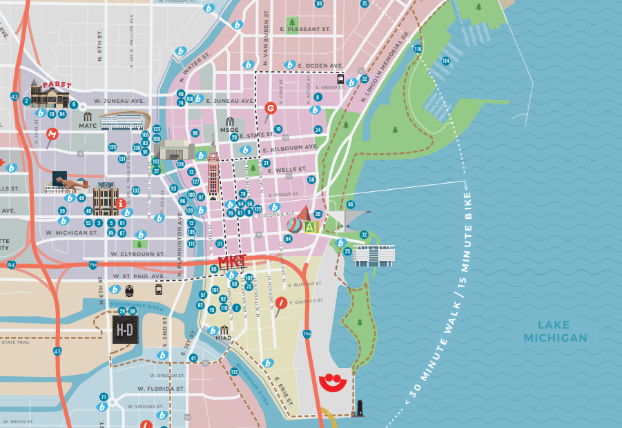
Section of the Official 2019 Milwaukee Visitors Map from Visit Milwaukee
The Historic Third Ward Association marks the Third Ward as the “site of Milwaukee’s most devastating fire and its most remarkable rebuilding efforts.” Today, the historic neighborhood is host to over 500 businesses, 20 galleries and art studios, and 1,200 residential units. It’s home to Summerfest, the Public Market, the Broadway Theatre Center, and so much more; it is, as the Association puts it, a neighborhood in renaissance. The Sanborn maps, and the many other maps of Milwaukee before and after the fire, remind us how much Milwaukee has grown, built, and rebuilt over its history, and how much we are still growing.
