Jones Island
Jones Island, Milwaukee, Wisconsin
by Angie Cope
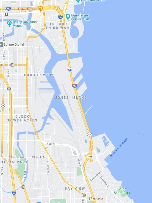
Jones island is an industrialized peninsula in Milwaukee, Wisconsin between the Milwaukee and Kinnickinnic rivers.
https://collections.lib.uwm.edu/digital/collection/agdm/id/5459/rec/1
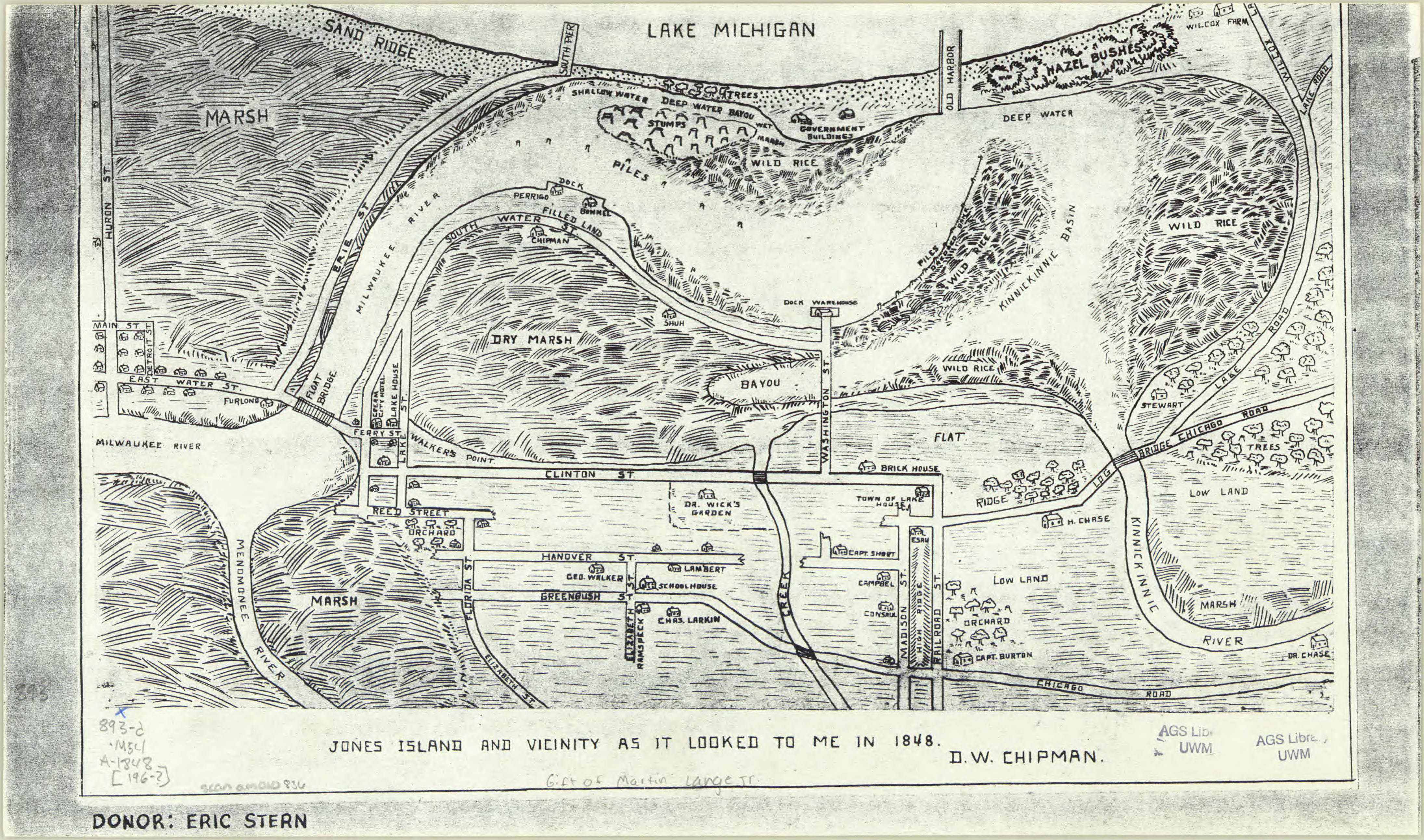
The island was originally marsh land when German immigrants settled there in the 1870s. Without proper land deeds, the immigrants were considered squatters and were evicted to make way for a shipping port. Between 1920 and 1940s the final European immigrants were removed.

https://collections.lib.uwm.edu/digital/collection/agdm/id/21/rec/7
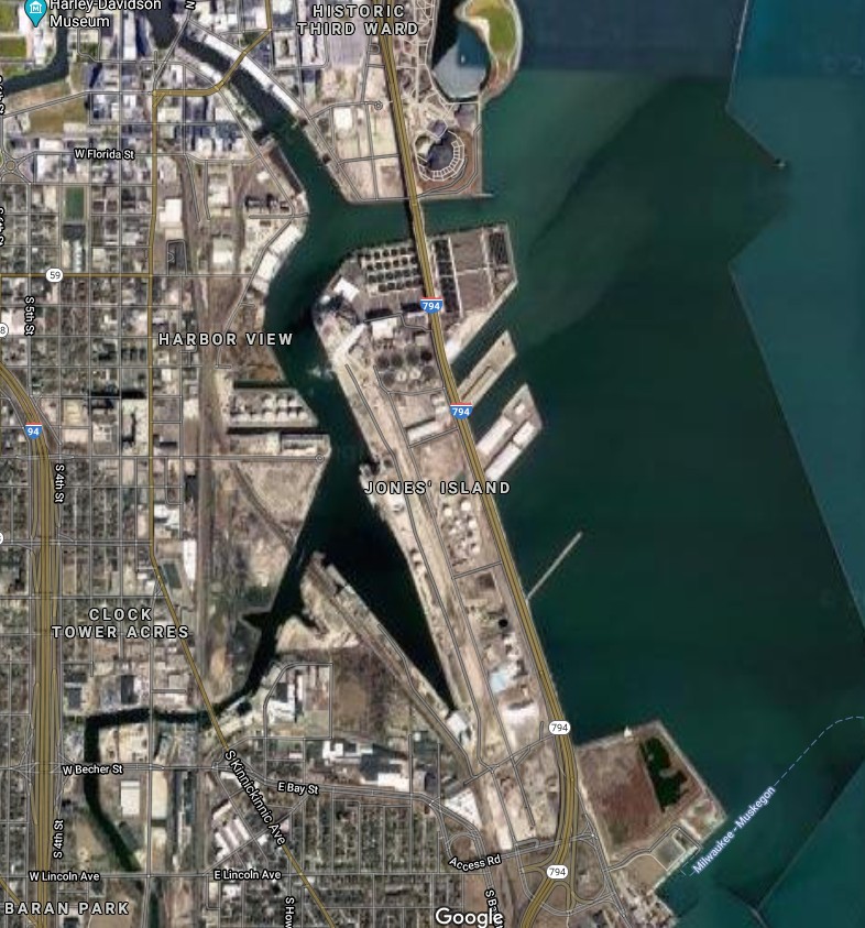
Today Jones Island is home to the Port of Milwaukee, the Milwaukee Metropolitan Sewerage District’s primary wastewater treatment plant, and other municipal services. It also supports the long-arch Hoan Bridge that spans across the Milwaukee River inlet. The land is heavily industrialized, containing only a couple of mature trees.

Map of Jones Island 1960s facsimile of an 1848 map
https://collections.lib.uwm.edu/digital/collection/agdm/id/5459/rec/1
View of Jones Island from an 1869 map of Milwaukee
https://collections.lib.uwm.edu/digital/collection/agdm/id/21/rec/7
Modern map of Jones Island, Milwaukee, Wisconsin 2020
