Archive Collections
The Mysterious Case of Ernest G. Lemcke
By Lauren Maddox
Sometimes I like to pull back the curtain a bit for you– show you some of the behind-the-scenes work that goes on unseen at the AGSL. I was given a special project a few months ago that I thought the readers of this blog would be interested in hearing about.
Some things about me you need to know: I love puzzles and I have never seen Mission Impossible. Most of the AGSL staff loves puzzles; we are currently working on a 4,000 piece puzzle (which you can see if you visit us!). Generally, my work at the AGSL has me at a desk writing– that’s my job. But sometimes someone gives me something different to work on.
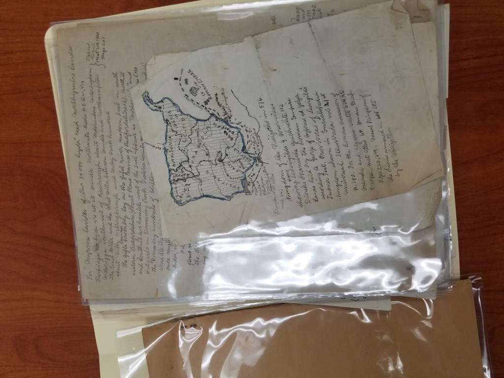
Susan Peschel stopped by my desk with a nondescript beige box.
“Your mission, should you choose to accept it–” she stopped to ask me if I remembered Mission Impossible. I didn’t, but I had at least heard the quote before. Susan told me that she had a puzzle for me (and that it might explode once she walked away).
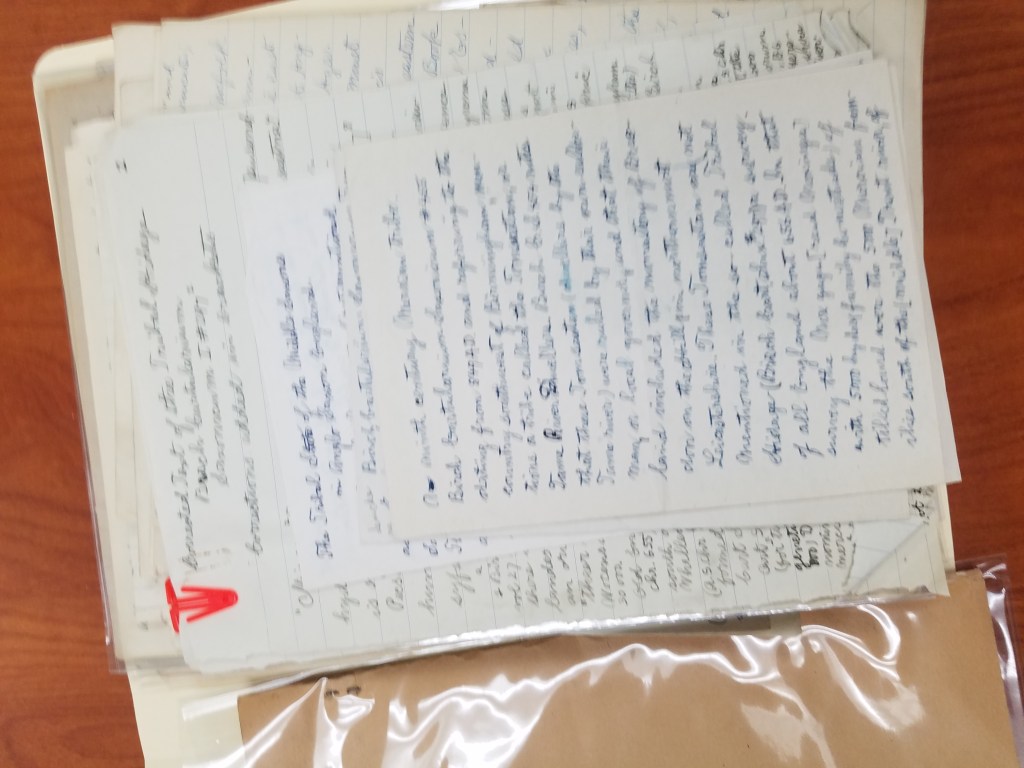
The problem with the box, which had traveled with the AGSL’s collection from New York to Milwaukee in the 70s, was that it had never been archived. The papers in the box were unsorted– no one even knew what they were. By all appearances, the collection of handwritten pages and letters seemed random. There were maps in the pile, but they were either hand-drawn or, stranger, road maps that had been drawn over. My mission (and I did accept it) was to figure out what we had and then to put it into some semblance of order.
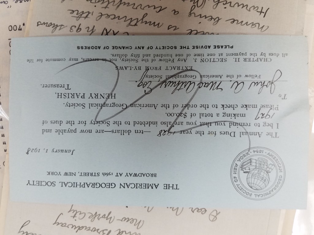
We didn’t know much, but we did know his name: Ernest G. Lemcke. We knew he was a card-carrying member of the American Geographical Society of New York because we have a record of his membership dues:
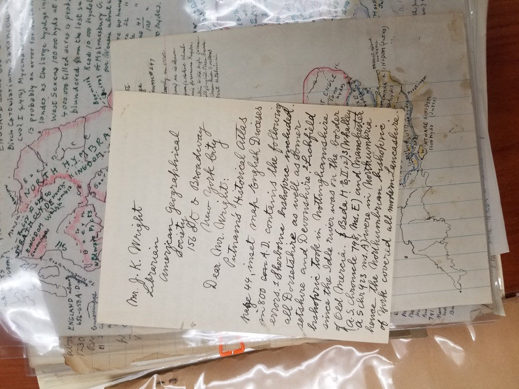
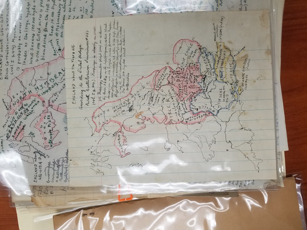
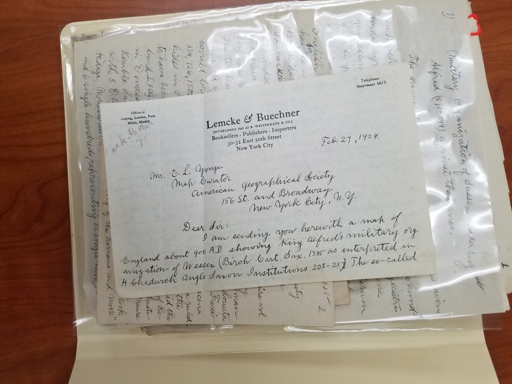
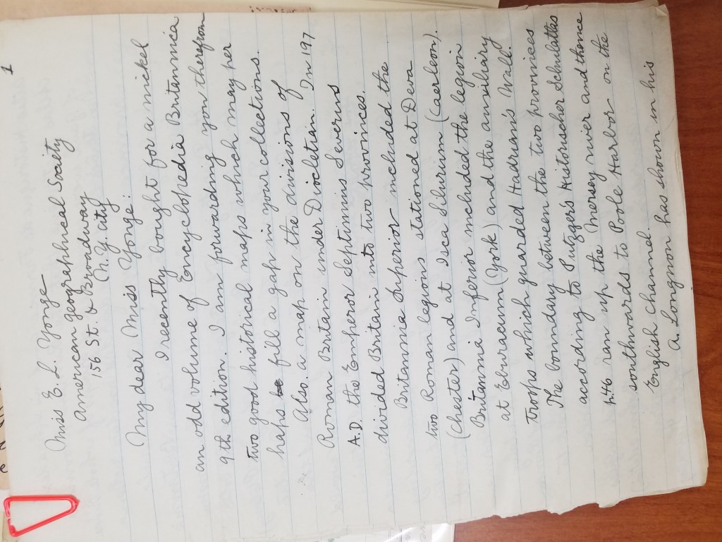
He wrote a trove of letters to Ena L. Yonge and John K. Wright. He bought a roadmap in 1926 and hand-drew a medieval military event in England from the 1300s. He was a book publisher in New York– which I discovered because some of his stationery had letterhead from Lemcke&Buechner, “Booksellers, publishers, importers.”
Part of the trouble with deciphering the box was figuring out what was meant for who. The maps were easy– Ena L. Yonge was map curator for the AGS of New York at the time, and his maps often came with a letter explaining what they were. But the partial manuscripts, many handwritten first drafts, and article corrections for the AGS’s periodical were mysterious and dense.
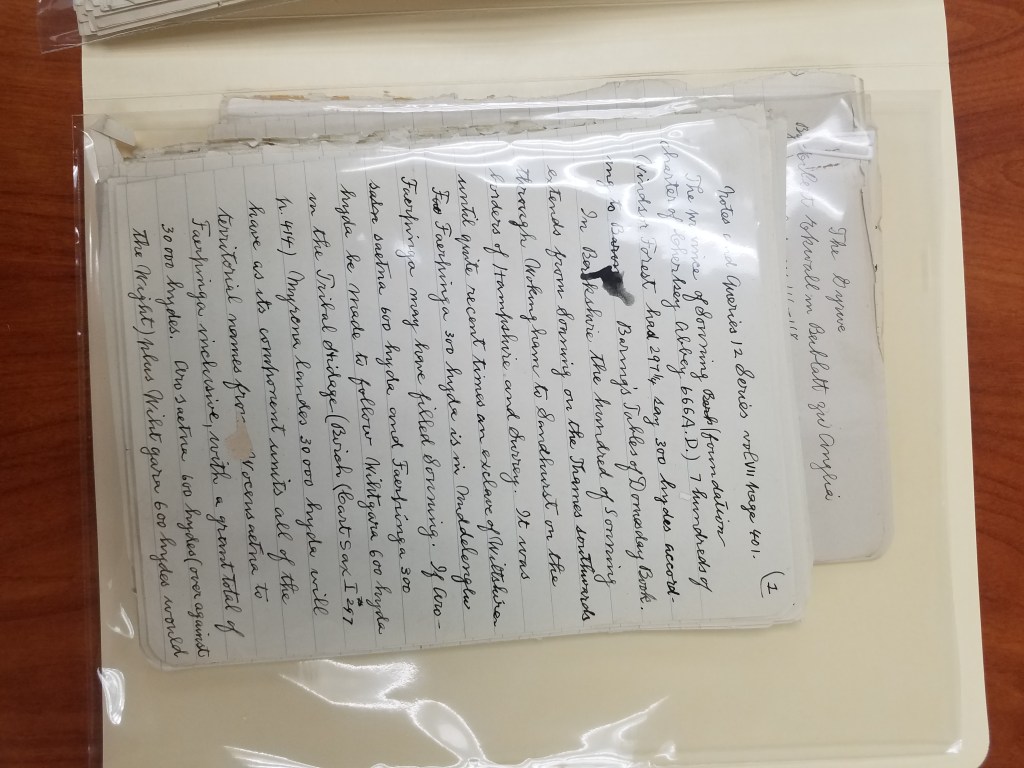
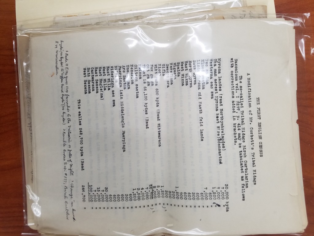
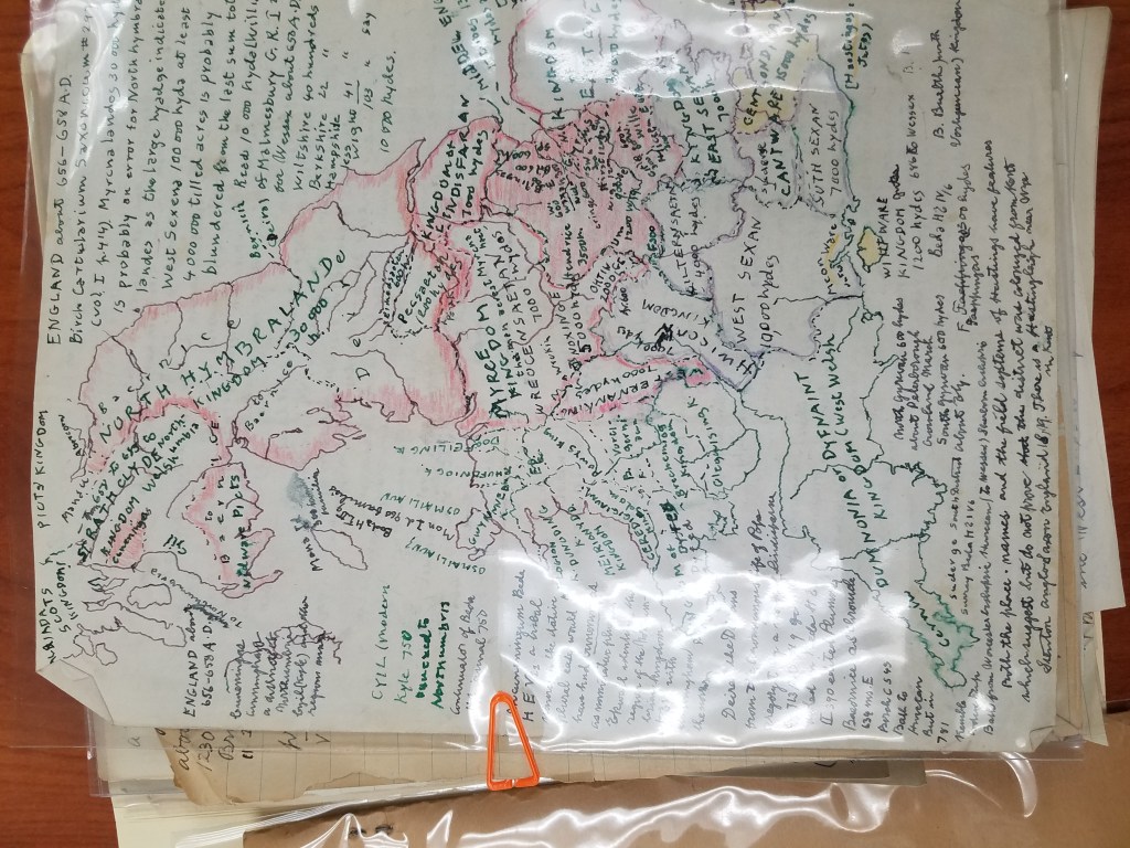
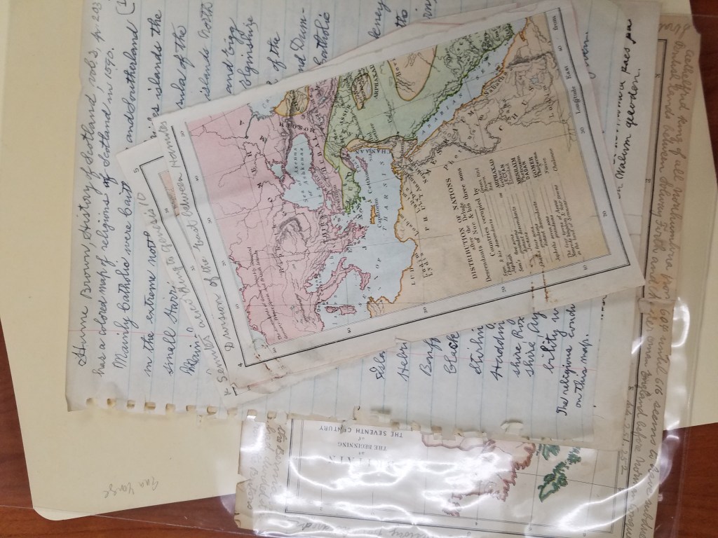
After many fruitless Google searches, I learned a few things about Lemcke: besides being a book publisher, he was also a historian with several books out, many specifically interested in the “Tribal Hidage” in Wessex. As it turns out, the University of New Hampshire also has a collection of Lemcke papers! Which was how I tracked down some of his publications and discovered that the many handwritten pages about a “tribal hidage” and the first English Census were partial drafts of his later, completed publications.
Now that I had a better idea of what we had, I came to the next part of the puzzle: putting it in order. I started with separating the things that were obviously addressed to Yonge or Wright. Maps were obviously meant for Yonge, and corresponded with letters that he had sent. John K. Wright was once director of the AGS of New York, but that didn’t help place many of Lemcke’s letters. But as it turned out, before he was director, Wright was the editor of the AGS’s regular publication from 1920-1956. This was exactly the period of time Lemcke was writing. The periodical corrections, then, seemed to be for the editor of the publication. And after reading Lemcke’s letters, I found him explaining corrections to his manuscript to Wright.
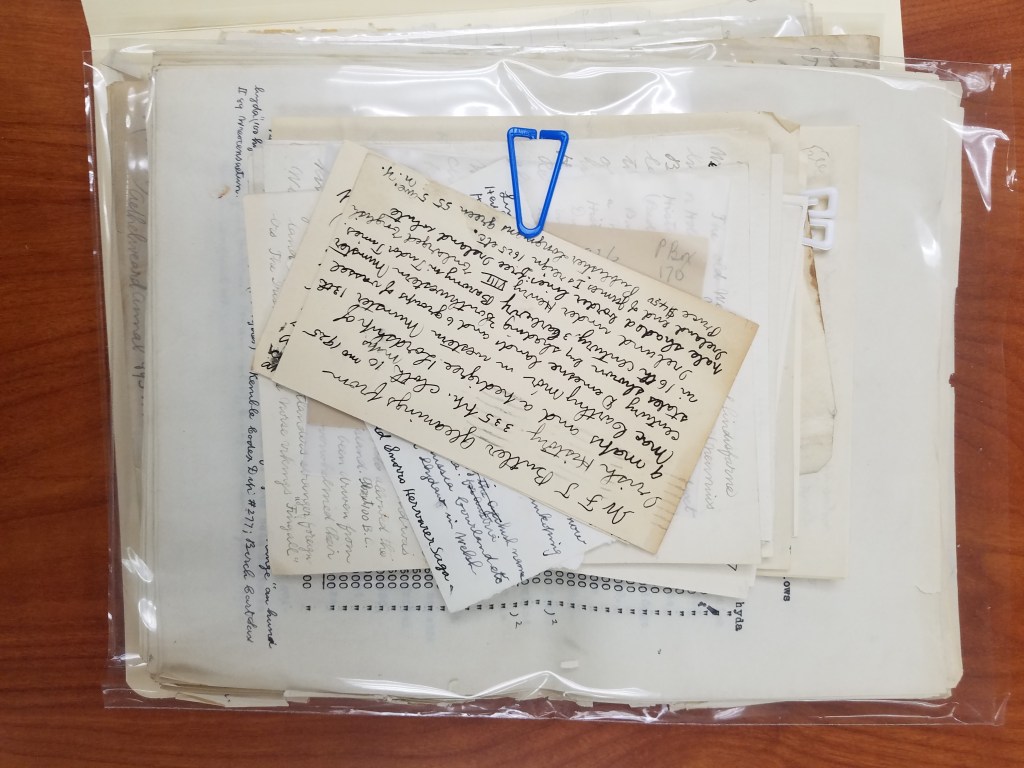
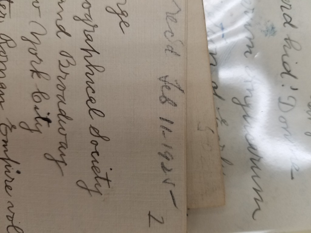
Once the letters were sorted by recipient, I started to put them in a chronological order. Some of the letters were dated– those were easy. But many of the letters weren’t dated. For several of them, I found a reference he made to an article he had just read, which helped me place it in the chronology. But many more had to be dated by their relationship to the other letters, which made for some puzzling work.
After finishing the work of putting the box in order, it was time to have it officially archived. This was definitely out of my expertise, so I reached out to fellow graduate intern Georgia Brown, who consulted our curator, Marcy Bidney, about what to do with the box.

Soon, the Lemcke papers will be officially archived! Since all of his correspondence was addressed to Ena L. Yonge and John K. Wright, the letters will be incorporated into their existing correspondence collections, cataloged, and made available for viewing! And now, with a little puzzling, we have put a years-old AGSL mystery to rest.
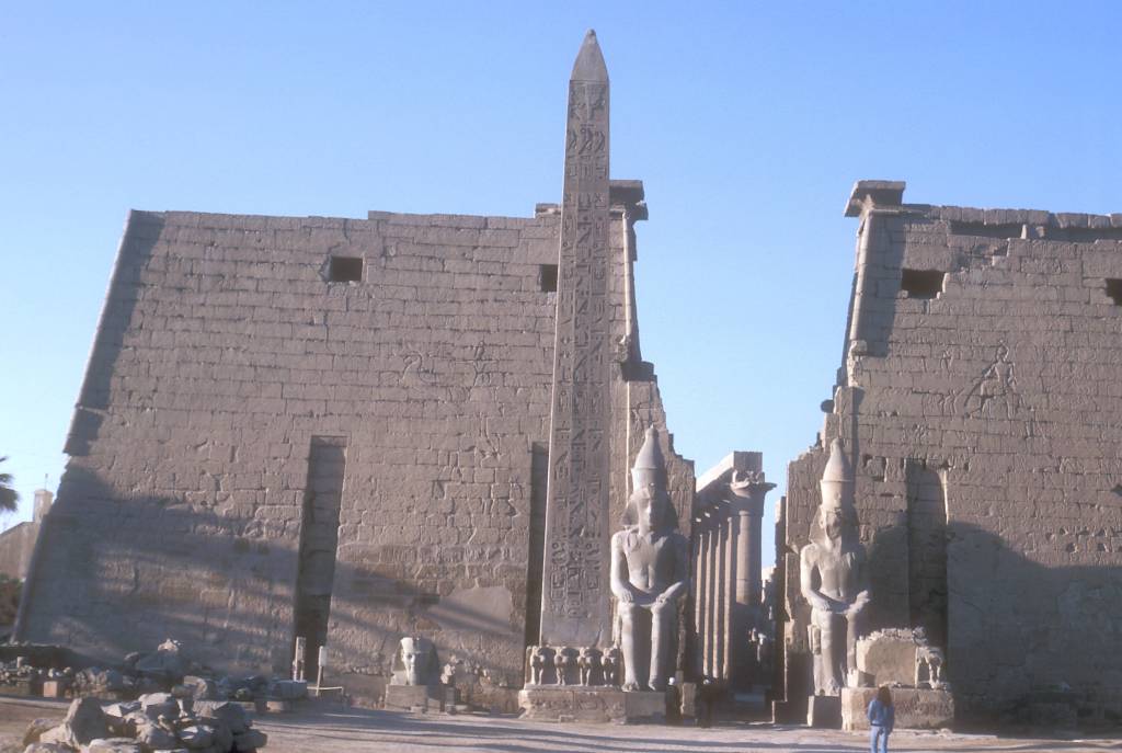
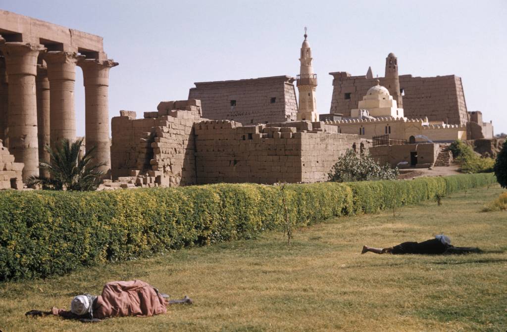
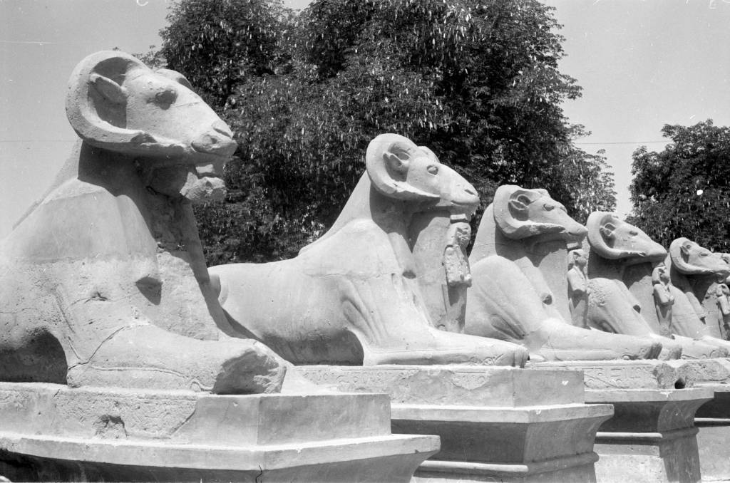
Egyptomania in the AGSL Archives
By Lauren Maddox
In 1798, Napoleon launched an invasion into then-Ottoman territories in Egypt and Syria in order to disrupt Eastern trade for Britain. Napoleon wanted to “liberate” India from British rule, but knew that France’s newly formed navy was not going to be a match for Britain’s own naval forces. So, to avoid a confrontation at sea, Napoleon chose to confront the British and their allies over land.
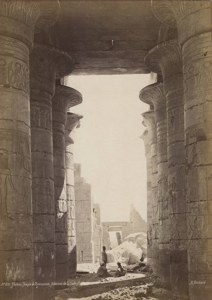
Henri Bechard’s Photo of the Hypostile Hall in Ramesseum Temple in Thebes. Click the link to see this image in our Digital Archives!
The primary motivation of the invasion was to challenge British trade structures, but Napoleon was also interested in promoting scientific pursuits in the region and making new discoveries about the ever-romanticized ancient Egypt. Napoleon styled himself as Roman, after all. Napoleon was a fierce Corsican nationalist, and of course became the emperor of France, but often identified most with an Italian ancestry of conquerors and colonizers. Some of his interest in Egypt could have been related to this stylization. Octavius annexed Egypt into the Roman Empire after deposing Pharaoh Cleopatra, officially incorporating it as the Roman province of Egypt in 30 B.C.E. Napoleon, a self-styled descendant of Roman imperialists, was interested in Egypt as a former piece of the Roman Empire, and as a leader looking to establish a French Empire.
The invasion was a failure; the three factions of the Ottoman Empire and the British forces overpowered French troops, forcing them to withdraw without having achieved their primary military goals. But the impact of Napoleon’s military operation went beyond its failure. Besides the military forces, Napoleon also recruited a large number of scholars (called his “savants”) to accompany the army in an exploratory expedition. There is some debate about Napoleon’s motives– the inclusion of the savants could have been proof of his dedication to the ideals of the Enlightenment, or a ruse to cover the campaign’s true militaristic and colonial intentions.
Whatever their true purpose, the savants attempted to create passage through the Suez Canal, drafted maps of roads and ancient cities, established an institute to promote scientific and agricultural advancement in Egypt, recorded and cataloged the flora and fauna of the region, uncovered and collected artifacts (without the permission of Egyptians, it is worth noting), and even “recovered” the Rosetta Stone. Few of the artifacts ever actually made it to France; much of the work was confiscated by the British and is now displayed in British Museums. Of course, these artifacts are rightfully Egyptian, and were taken as part of colonial appropriation, but were not returned by the French or the British even after colonization efforts ceased.
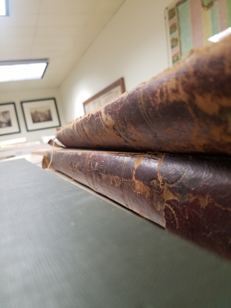
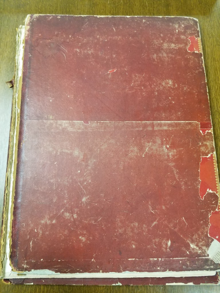
Volumes of Description. 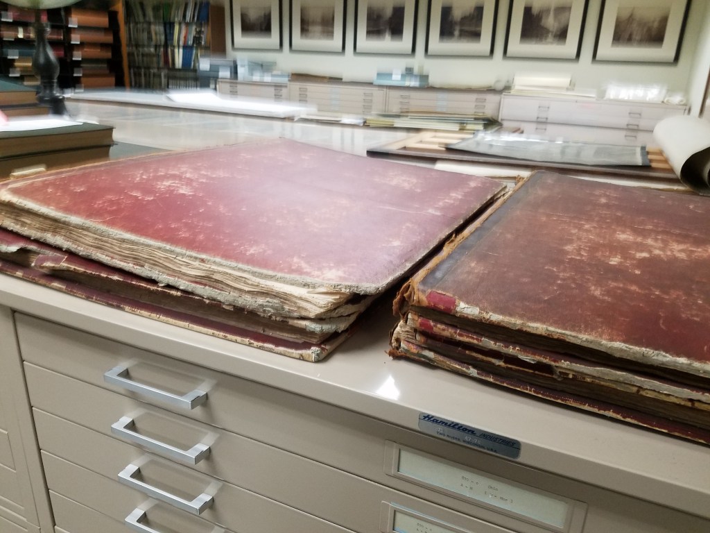
Photo of multiple volumes of Description in our rare collections room. 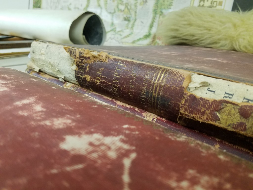
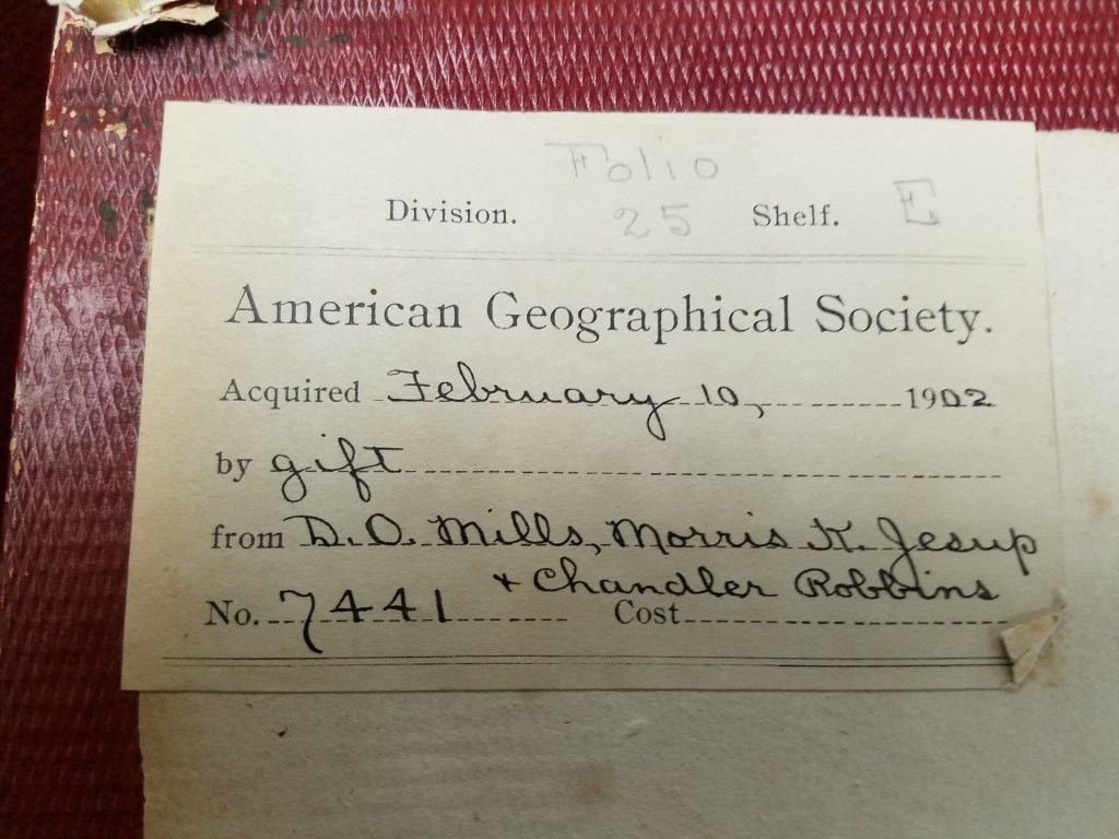
Note of Acquisition by the AGSL. 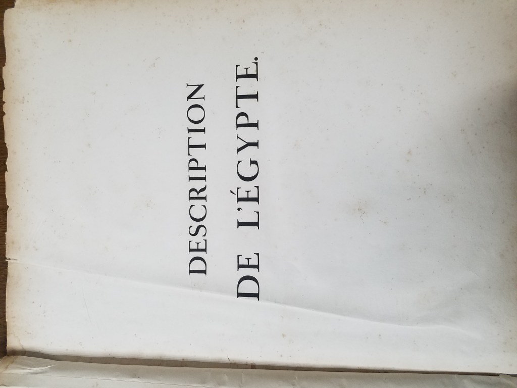
Title Page 
Condition of the volume. 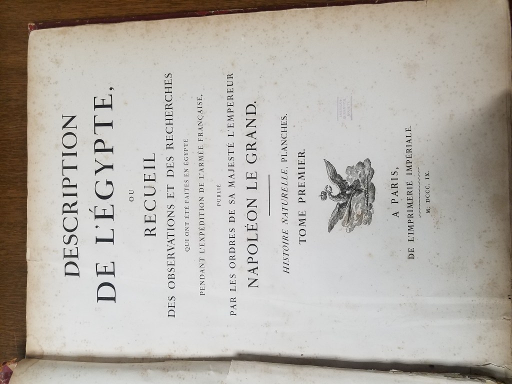
Title Page 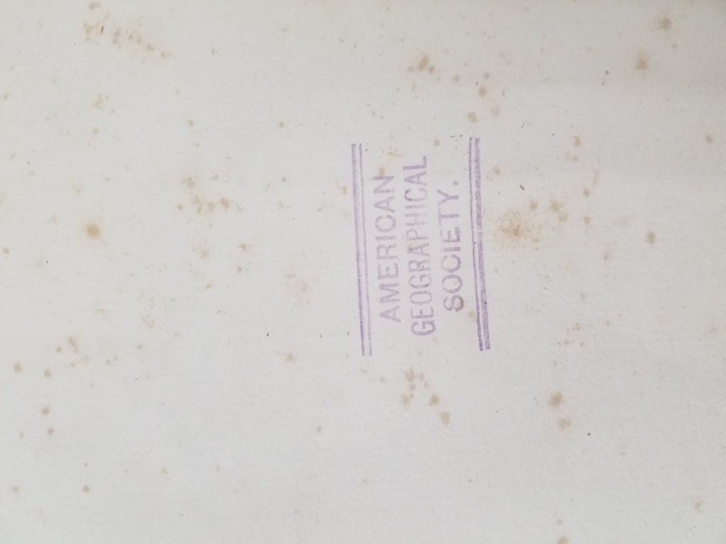
AGSL Stamped! 
Royal Armorial Crest
To bring this new knowledge of Egypt to the people back in France, the savants compiled an initial collection of their findings in 4 volumes: Mémoires sur l’Égypte. After defeat in Egypt, Napoleon had a more comprehensive collection compiled and published: the Description de l’Egypte. The first edition included 23 volumes compiled through the collaboration of the 167 savants and thousands of artists and technicians, including 400 engravers.

Description was wildly popular in Enlightened France, where interest in foreign places was high. The vivid engravings and detailed descriptions sparked interest in the West– Egyptology was born. Egyptology, which became a Western pastime and eventually developed into a full-on craze for hobby-historians and professionals alike, covers the ancient history, religion, language, architecture, and art of Egypt. Ancient Egypt continued to be an exotic fantasy to Westerners.
Egyptomania spread through Europe and the rest of the West– especially the United States of America, where Egypt became a model for the young nation still developing its identity as a sovereign state. Throughout the 19th century and well into the 20th, echoes of Egyptian (or, as the case may be, “Egyptian”) art and architecture resounded through the West.
The influence of Egyptomania can still be seen in famous architecture, monuments, and art. Some very obvious examples: the Washington Monument and the Luxor Hotel.
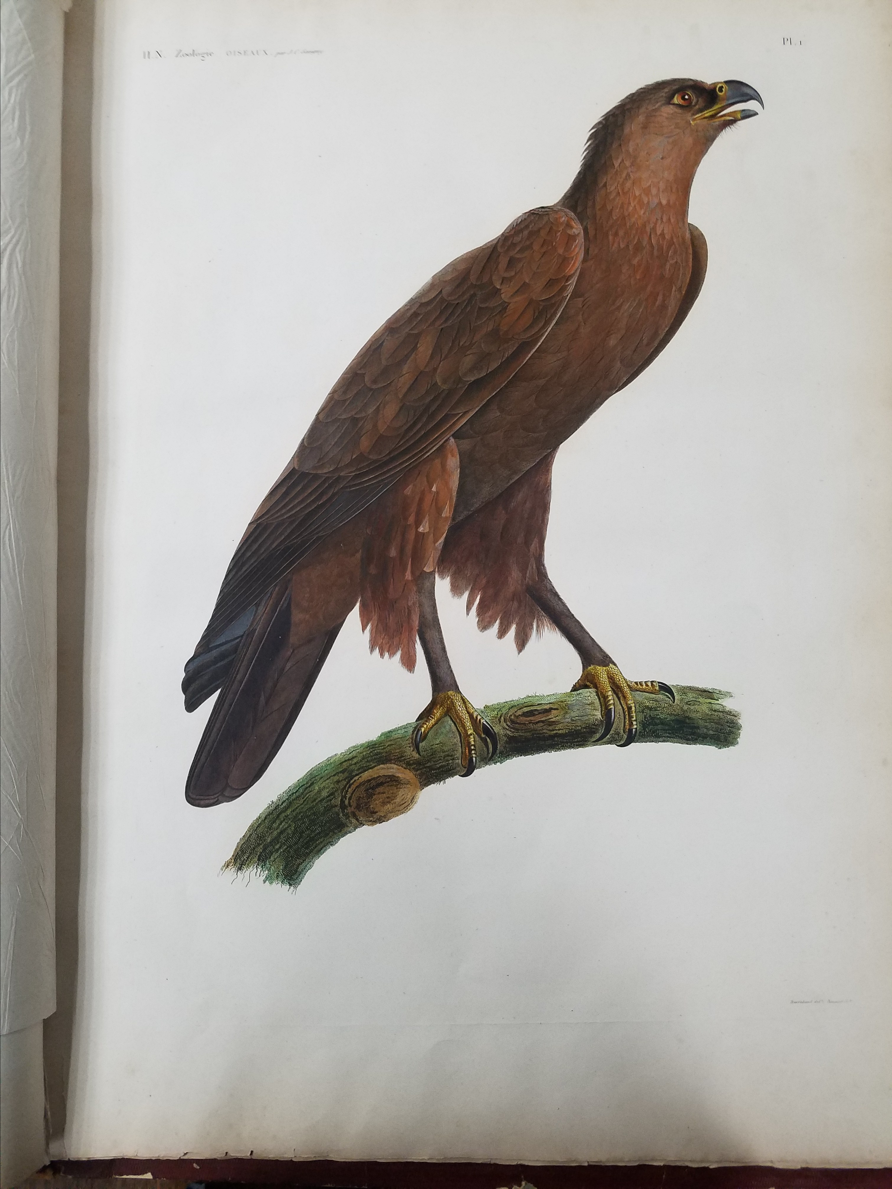

A fire at the Institut d’Egypte was rumored to have destroyed the original manuscript, but the volumes were recovered and restored safely. The collection that started it all, Napoleon’s savants’ Description de l’Egypte still survives! And we have a first edition copy here at the AGSL. The volumes are filled with beautifully colored engravings, particularly in Books 19 and 20, which cover Egypt’s natural history. The level of detail in the engravings is remarkable. This is an amazing piece of history that’s here in our library! Which, in its own way, is a sign that Egyptomania persists in the West– or at least it does here in the AGSL.
Fair and Square: A Short History of World’s Fairs
By Lauren Maddox

Unisphere Sculpture from 1964 New York World’s Fair, Taken by Harold Mayer. Click the link to see this photo in our Digital Collections!
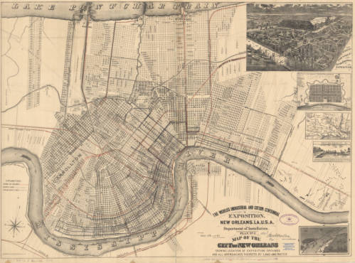
1884 Map of New Orleans’ Exposition Grounds. Click the link to see this map in our Digital Collections!
In 1984, Louisiana hosted a World’s Fair celebrating “The World of Rivers.” It was the last World’s Fair in the U.S. And it was the most financially disastrous fair in the history of World’s Fairs. To be fair, the point of hosting World’s Fairs and Expositions was never to make money– most host countries had to shell out exorbitant amounts of money to finance their fairs. But the point of the World’s Fair was never to make money; instead, these fairs were celebrations of progress and a chance to impress the international community. Host countries never expect to make a profit off of the Fair, but the 1984 Fair was particularly draining– it was the only Fair to ever go bankrupt.
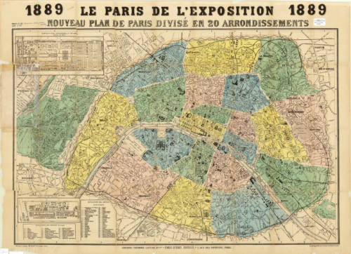
Map of Paris for the 1889 Exposition. Click the link to see this map in our Digital Collections!
But before the 1984 fair, the U.S. had a rich history as a member of the International Bureau of Exhibitions– they’ve hosted 30 World’s Fairs since their first in 1829. And before that?
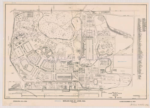
Ground Plan of Louisiana Purchase Exposition, 1904. Click the link to see this map in our Digital Collections!
The tradition of the World’s Fair is based heavily on French national expositions– but the first was actually hosted in Prague in 1791. This exposition was before World’s Fairs were standardized and regulated by the Bureau of International Expositions. These early expositions had their roots in Medieval festivals, and quickly became a way for post-revolution France to unite their new republic. The industry-focused expos continued under Napoleon but still focused on French products.
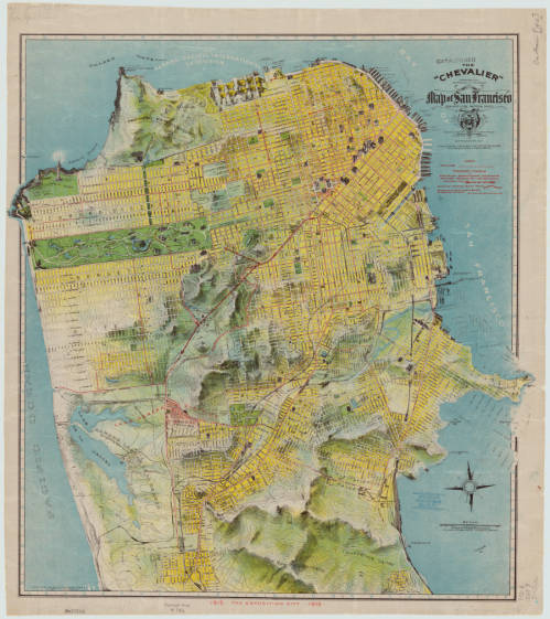
1912 Chevalier Map of San Francisco featuring the Panama-Pacific International Exposition grounds. Click the link to see this map in our Digital Collections!
The exposition most commonly cited as the first international affair is London’s Great Exposition in 1851. This World’s Fair was iconic– its great Crystal Palace became the symbol of World’s Fairs for years to come and continues to be one of the most quintessential Victorian structures.
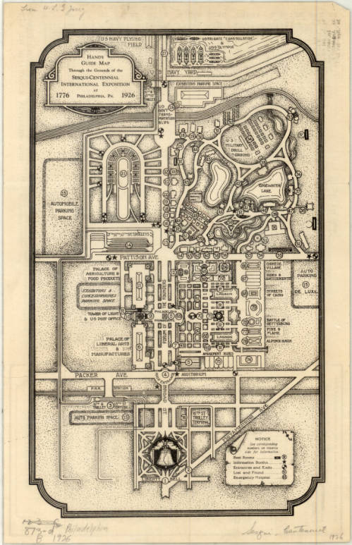
Complimentary Map of the Sesqui-Centennial International Exposition at Philadelphia, PA, 1926. Click the link to see this map in our Digital Collections! 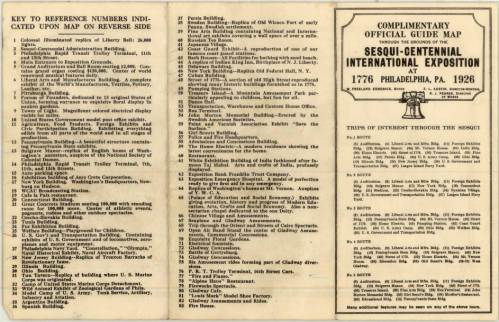
Points of Interest at the Sesqui-Centennial International Exposition at Philadelphia. Click the link to see this map in our Digital Collections!
In 1928, the Bureau of International Expositions (Bureau international des expositions) was established in order to oversee and approve of expo arrangements internationally and to set standards for expositions across nations. 170 countries are currently members of the BIE– including the United States. The BIE has remained in charge of international expositions ever since.
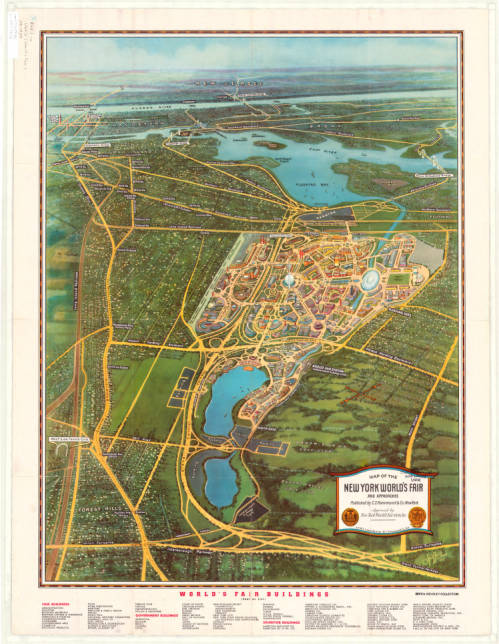
Map of the New York World’s Fair with Map of Greater New York’s Transit, 1939. Click the link to see this map in our Digital Collections! 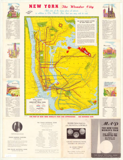
Map of New York Transit System with Points of Interest in the City, 1939. Click the link to see this map in our Digital Collections!
The nature of World’s Fairs have changed drastically since their Medieval beginnings– these fairs began as a way to unite communities, national and international, and then became an opportunity for countries to showcase their industrial prowess and establish themselves on the global stage.
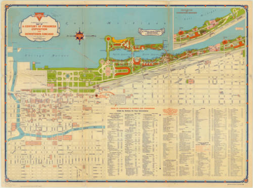
Map of Chicago’s 1933 World’s Fair. Click the link to see this map in our Digital Collections! 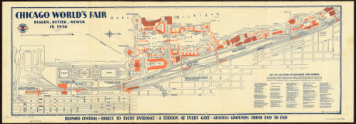
Map of Chicago’s 1934 World’s Fair. Click the link to see this map in our Digital Collections!
The 1984 exposition signaled the end of an era for World’s Fairs. It wasn’t just the last Fair to be hosted on American soil– it was also one of the first environmentally focused specialized expos. No longer are World’s Fairs an opportunity to flex wealth and status; instead, new expos are interested in environmentalism, building a sustainable future, and the building of a more united global community.
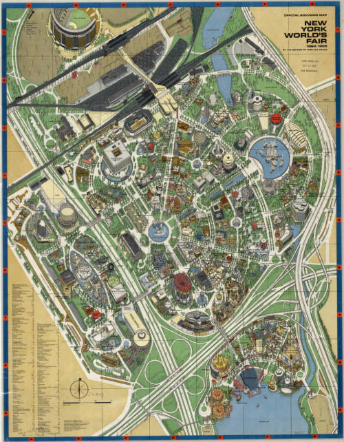
Map of New York’s 1964 World’s Fair. Click the link to see this map in our Digital Collections!
The United States withdrew membership from the BIE in 2002, but in 2017 rejoined. And maybe, in the near future, we can expect another Fair, as part of America’s long legacy of World’s Fairs, looking forward into a bright future.
To the Lighthouse: Representations of Lighthouses on Maps
By Lauren Maddox
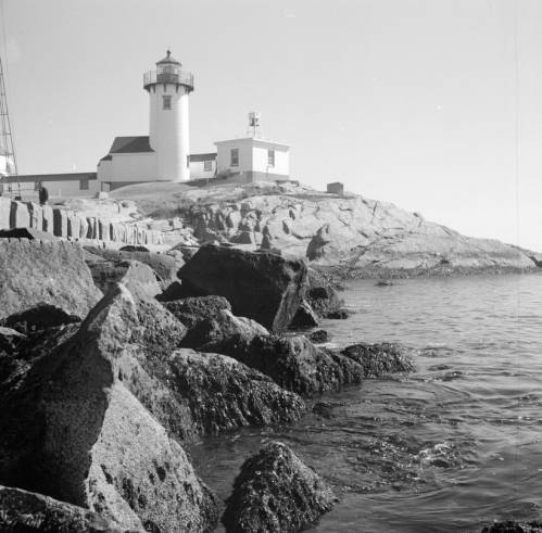
Click the link to see Clarence W. Sorensen’s photo of a lighthouse in Gloucester, c. 1934-1969 in our Digital Collections
Lighthouses have been guiding us home over the rough sea from our earliest maritime beginnings– but our understanding of lighthouses and how we represent them on maps and nautical charts has changed drastically since these beginnings. While references to early lighthouses exist, including Homer’s claim that Palamedes devised a system of lit beacons to guide sailors, the first “regularly maintained” lighthouse in antiquity was on Cape Incihisari. J. Saxby Wryde, however, claims in his British Lighthouses: Their History and Romance that the most celebrated lighthouses in antiquity were built 400 years after this. The Colossus at Rhodes was erected in 278 B.C. and destroyed by an earthquake in 224; the remains were sold as brass and carted away on camels by a merchant. In 270 B.C., the famous Lighthouse of Alexandria was constructed in honor of Ptolemy Philadelphus on a small island in the Bay of Alexandria.
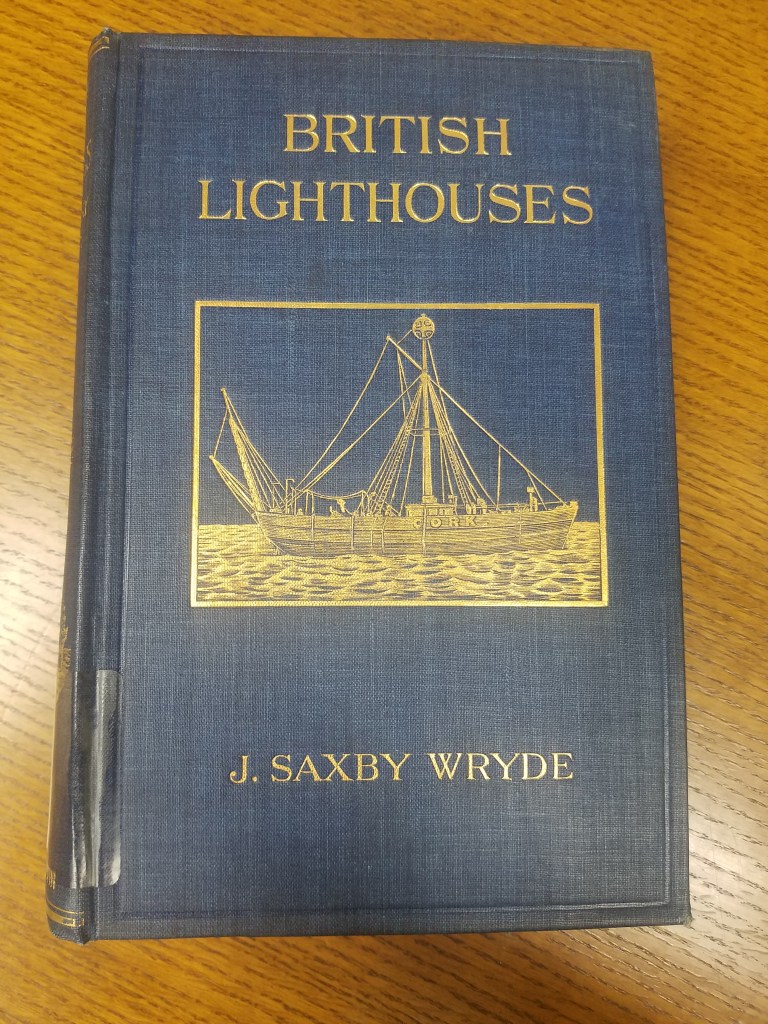
Click the link for details about the 1913 Edition of British Lighthouses 
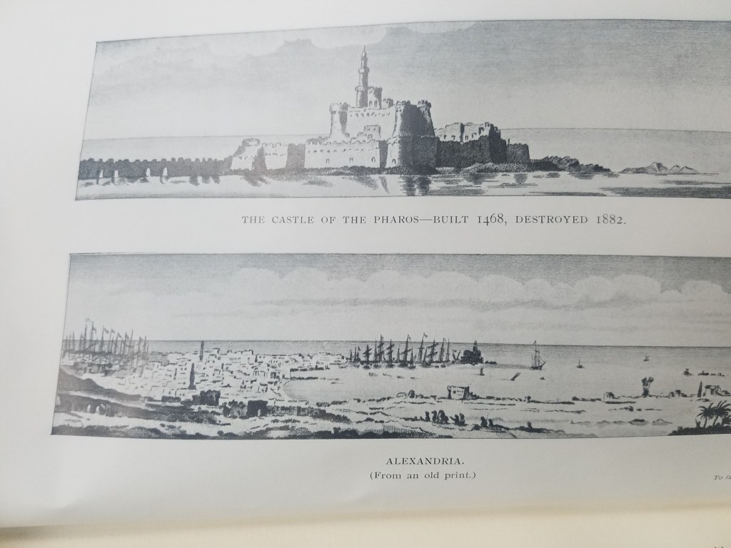
Illustration of the Lighthouse of Alexandria
The function of lighthouses has also evolved over the years; in antiquity, lighthouses were only expected to indicate the location of ports. Lighthouses as we understand them today act as warnings for boats approaching reefs and rocky shores. This understanding of lighthouses as way markers is reflected on ancient maps. The Lighthouse of Alexandria is depicted pictorially in Braun and Hogenberg’s 16th century atlas Civitates Orbis Terrarum–the lighthouse is given the same attention as the city’s obelisk or its ruins; its existence is simply recorded and labeled with a single word: pharus for lighthouse. The lighthouse has obviously done its job, though; ships are shown moving towards the lighthouse and the port it is indicating. One ship is even flying St. George’s Cross, the British flag used by crusaders that was later adopted as the national flag in Medieval England.
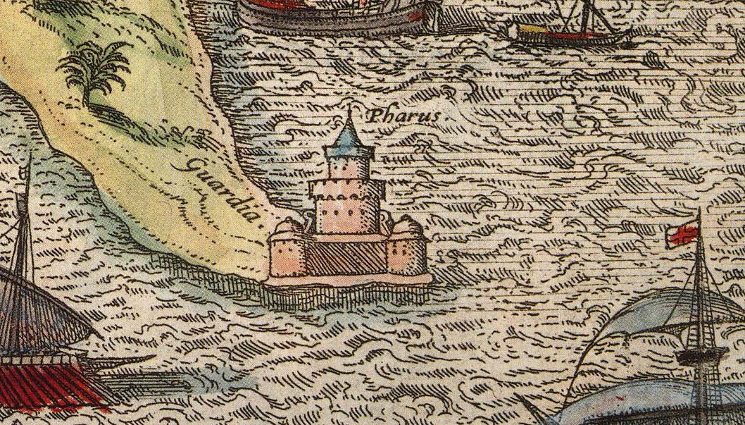
Click the link to see the Atlas the illustration of The Lighthouse of Alexandria is in 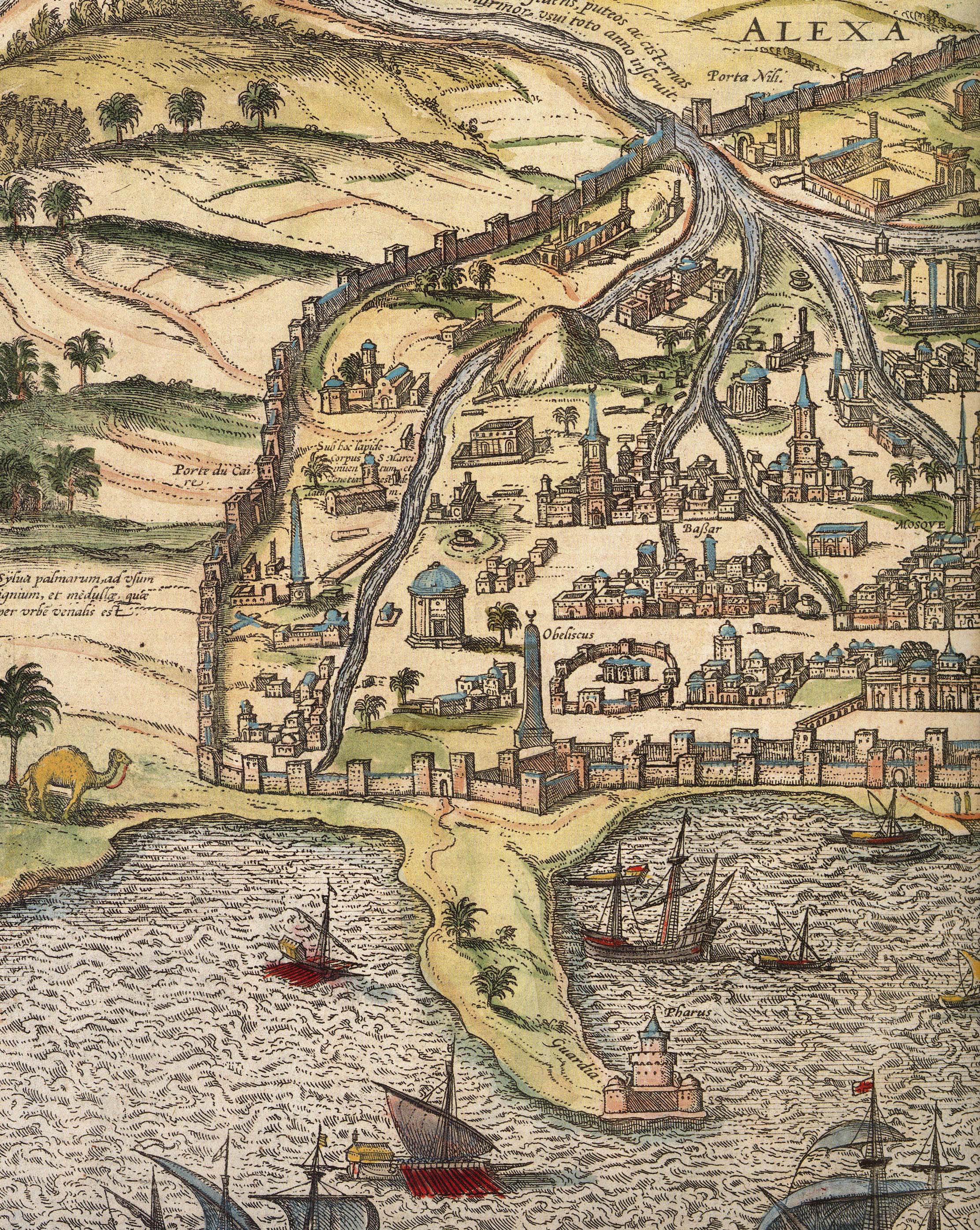
Alexandria
The Lighthouse of Alexandria was also doomed to be destroyed by earthquakes, but the bricks were used to construct the Citadel of Quaitbey. UWM professor Caroline Seymour-Jorn donated her photo collections to the AGSL , including several photos from 1996 visit to Egypt of the citadel.
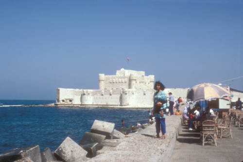
Click the link to see this photo of Alexandria, Egypt: View of Quaitbey Citadel courtesy of Caroline Seymour-Jorn in our Digital Collections
The Roman Empire adopted the Greek pharos and began building them across Italy and the Empire, including the Tower of Hercules in A Coruña, Spain and Dover. The lighthouse in A Coruña is still functional, but many Roman lighthouses were abandoned in the Middle Ages and replaced. As travel and trade by sea became more and more prevalent, the need for lighthouses grew.
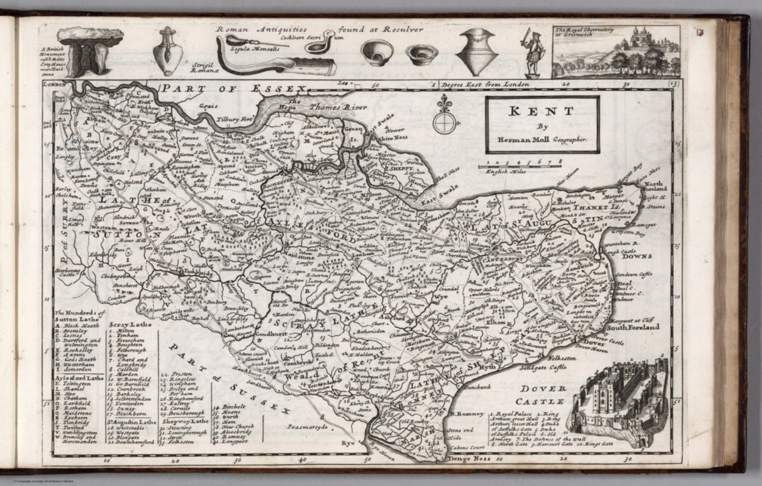
Click the link to see the 1724 Map of Kent by Herman Moll in our Digital Collections 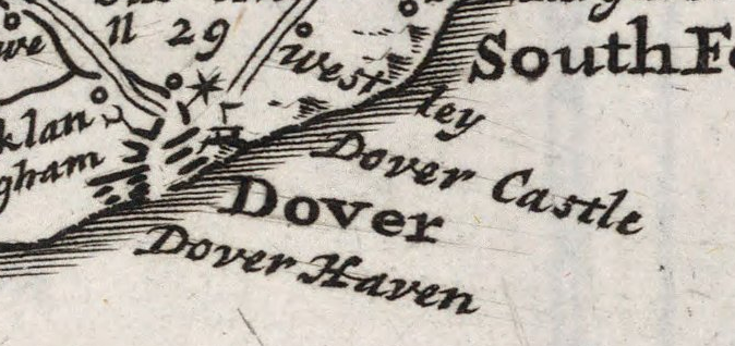
Dover, lighthouse indicated pictorially
Most lighthouses constructed during this time are no longer operational, but the Hook lighthouse in Ireland continues to be used. The building has been in operation for over 800 years and is now managed by the Commissioners of Irish Lights. Lighthouses in England were privately owned and operated during the Middle Ages and beyond. Because there was no regulation or standard policy, lighthouse keepers began to abuse their posts, stealing ship cargo and demanding payment from sailors. This problem became so pervasive that the Lighthouse Act of 1836 was passed in the hopes of making coasts safer for ships coming to port.
In the 18th century, lighthouse construction advanced to match the needs of a growing transatlantic trade. Bigger, better lighthouses were being built and were now being used as more than way markers; they could warn incoming ships and regulate boat traffic. In 1716, the first American lighthouse was built on the Boston Harbor; many more began to spring up in the subsequent years, and in 1851 Congress passed an act to facilitate the creation of the US Lighthouse Board, which would eventually be dissolved to make room for the Lighthouse Service. The AGSL has many of the Service’s records, including records of their history, finances, regulations, and buoyage and lighthouse systems.
Click the link to see the Boston Light Referenced on 1889 Map of Boston Harbor in our Digital Collections
With lighthouses increased utility and presence on coastlines, their representation on maps began to shift. Instead of being just illustrations or seamarks, lighthouses began to take on a new navigational importance. Diagrams of lighthouses, recordings of the range of their lights, and more exact buoy locations became a common part of maps.
Click the link to see Lighthouse detail from 1926 map of Puerto Deseado, Argentina in our Digital Collections 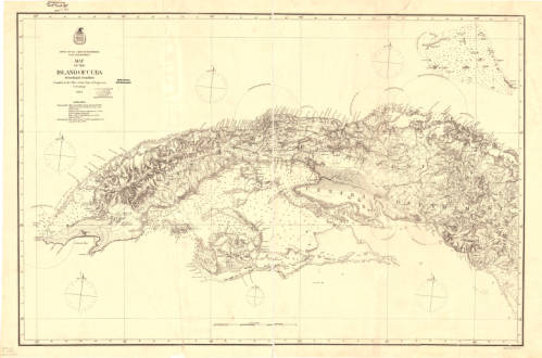
Click the link to see the Map with Lighting information for Cuba 1874 in our Digital Collections 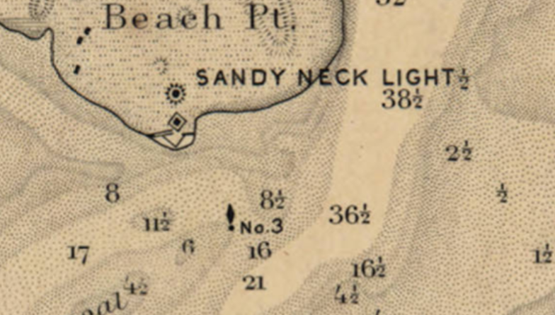
Click the link to see the Lighthouse and Buoy on Map of Barnstable Harbor, Massachusetts 1880 in our Digital Collections 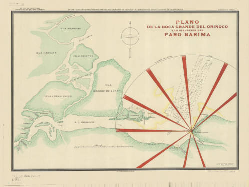
Click the link to see the Lighthouse depicted in 1906 Map of Rio Barima, Venezuela in our Digital Collections
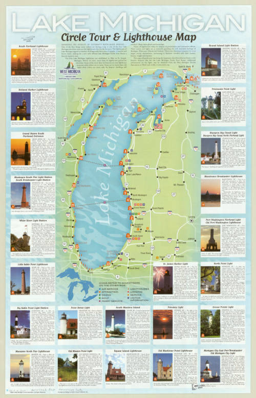
Now lighthouses have a romantic air as well as a practical use; writers and artists work to capture the lighthouse. To the Lighthouse by Virginia Woolf comes to mind. And here, in Milwaukee, where the AGSL lives, we have our share of lighthouses on our Great Lake Michigan.
The AGSL Guided Tour: An Interview with Georgia Brown
Interview conducted by Lauren Maddox
This week, I sat down with Graduate Student Intern Georgia Brown to discuss one of her recent projects for the AGSL. Georgia is part of the School of Information Studies coordinated degree program working to receive her Master’s in both Library and Information Science and History. She has been a key member of the AGSL staff since 2018, contributing to many projects for the library. Recently, she designed a guided tour of the AGSL to make our collections more accessible to visitors exploring the library. To learn more about the tour and how you can take it, read on:
So, we’ve started giving visitors your Self-Guided Tour of the AGSL to help them navigate the library—could you talk a little about what the Guided Tour is and your process for creating it?
The guided tour helps people get into the space of the AGSL and really see more of the collection than is just out by the display cases. The process actually took a few months–I made a lesson plan last semester that had middle schoolers exploring the AGSL while also learning about the parts of a map. The lesson itself is a map of the library that the students use to figure out a different part of a map at each stop. After I made this, I realized that this would be an awesome way to have people just come visit the AGSL.
How would a visitor go about a Guided tour? Could you describe the process of getting a Guided Tour and what visitors see on it?
As soon as you walk into the AGSL, on the table to your right will be a stack of the guided tours. Someone on the library staff will ask if you need any help and if you are just there to look around, we’ll offer you the guided tour as a way to check out the library.
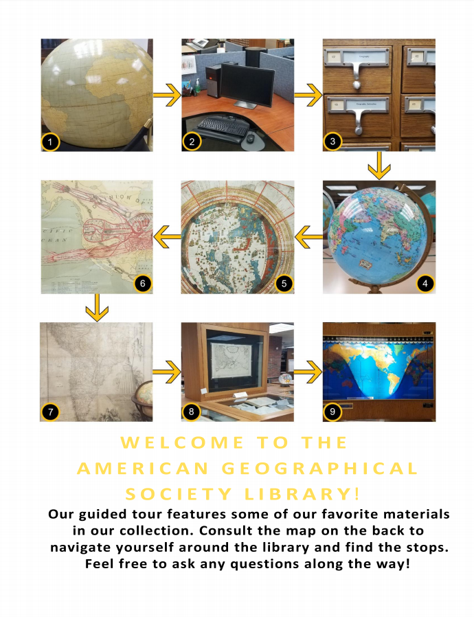
The Guided Tour, available at the front table in the AGSL 
Map of the Library
Why was this a necessary project? Has it made the AGSL more accessible to visitors?
Lots of people come in to see the AGSL, and some will take the time to walk around and see everything. But one of my biggest frustrations is seeing visitors come in, spin once in a circle, and then leave. I realized there was probably more they wanted to see, but something about the space made it seem scary or hard to approach. Now that the guided tour is being handed to patrons and visitors, I feel like they are seeing more of what is on display.
What patrons benefit the most? What impact has this had on visitors’ experiences in the library?
In the two weeks that I have been handing out the guided tour, I feel like only a third of the people who start it actually finish it in its entirety. The other two thirds, however, keep getting distracted by all of our other awesome materials on display. My goal with the tour was to get people into our space, and in just a short time, I have seen people just as interested in globes and maps that aren’t on the tour as the ones that are on the tour.
Did working on this project teach you anything about the AGS Library or about libraries in general?
One cool thing about putting this together was the amount of collaboration that went into it. After I made the first version, I gave a copy to five staff members and interns, and they each gave me their notes on the project.
Thank you Georgia for joining me for this interview. To take the tour yourself and see our amazing collection in person, visit the AGSL and take the guided tour! You can find us on the third floor of UWM’s Golda Meir Library, Monday through Friday, 8:00 a.m. to 4:30 p.m. We look forward to seeing you!
William E. Merrill Collection Now Available
By Georgia Brown
Our newest collection holds the papers of the Civil War soldier and Chief Engineer William E. Merrill, who was called “the most innovative and conscientious exponent of mapping during the Civil War.” As the chief topographer of the Army of the Cumberland, his direction of the mapping of Georgia before General Sherman’s late 1864 March to the Sea led to its success.
William Emery Merrill (1837-1891) was an American soldier and military engineer. He was born at Fort Howard, Wisconsin and was a cadet at West Point beginning in 1854. After graduating first in his class in 1859, he served as an instructor in engineering at West Point until mid-1861 when Merrill was called into active duty in the Civil War. Throughout the war, he spent time in the as Assistant Engineer of Department of the Ohio, Assistant Engineer of the Army of the Potomac during part of the Peninsular Campaign, Superintending Engineer in Kentucky, and then Chief Engineer of the Army of the Cumberland. It was during this time that he supervised the making of the map used by General Sherman during the March to the Sea.
Following the war, he was raised from the regular army rank of captain to major and by 1883 he had risen to the rank of lieutenant colonel. After the war, he spent his time working for the government as an engineer.
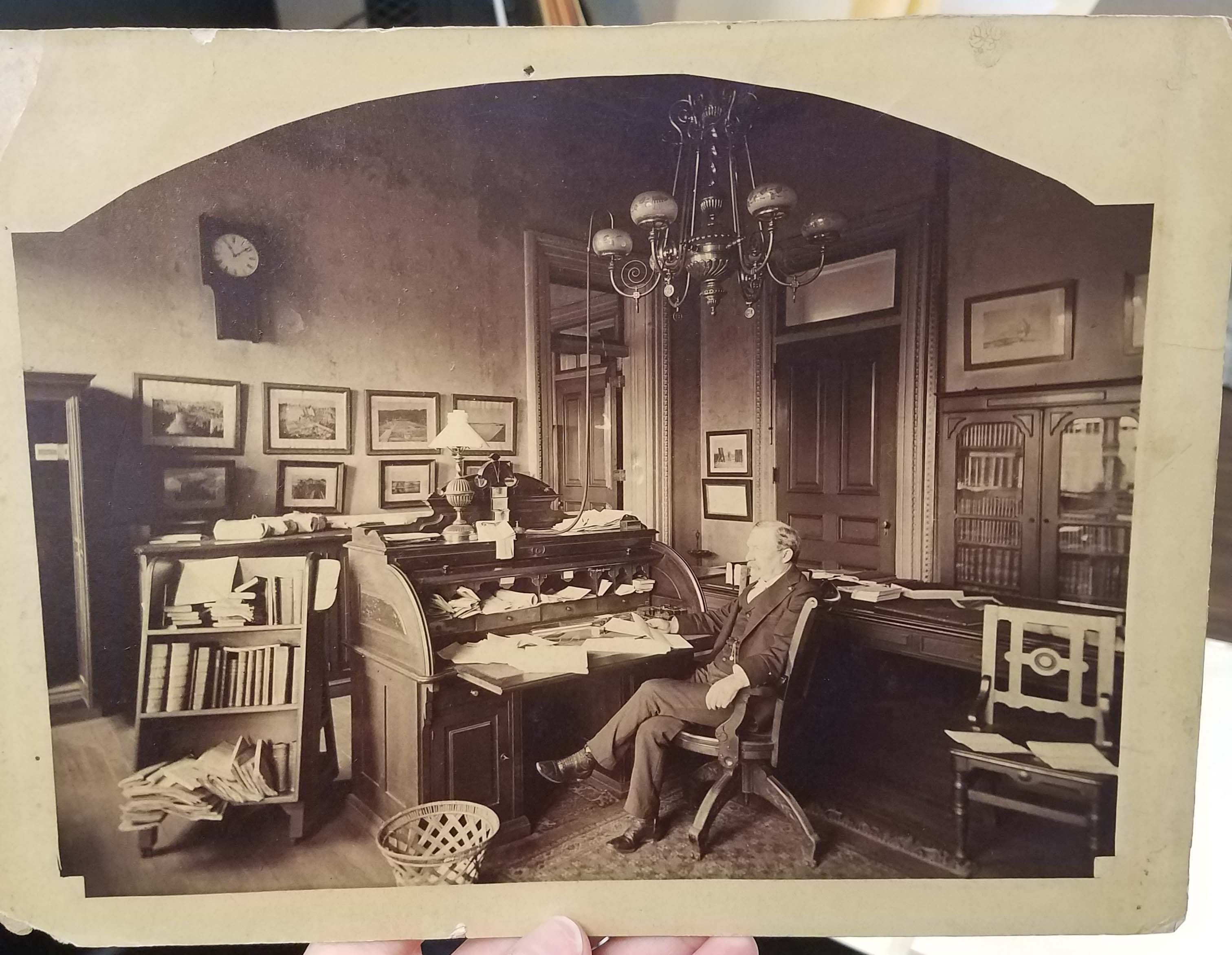
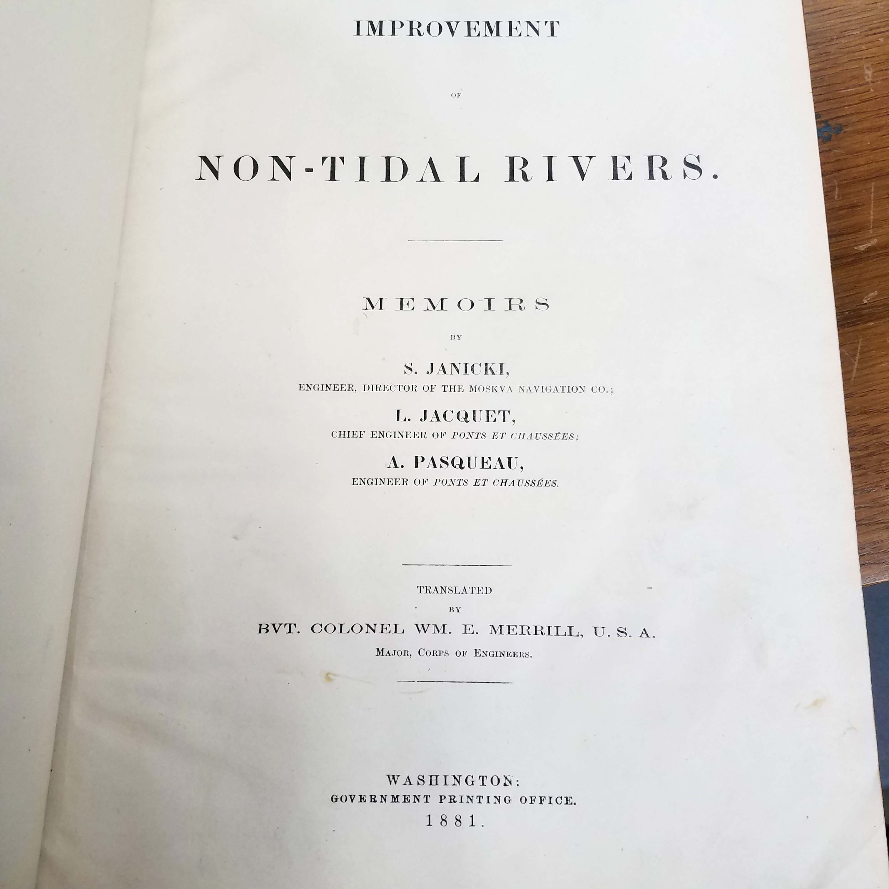
One of Merrill’s most notable engineering works was the Chanoine wicket movable dam constructed by him at Davis’s Island, 5.5 miles below Pittsburgh, Pennsylvania. The Davis Island Lock & Chanoine Dam experimental project was the first lock and dam ever constructed on the Ohio River. Its achievements also included the first rolling lock gates, the largest movable dam built in the 19th century, and the widest chamber in world history. In 1889, Merrill represented the United States Engineering Corps at the International Congress of Engineers in Paris. He died in 1891.
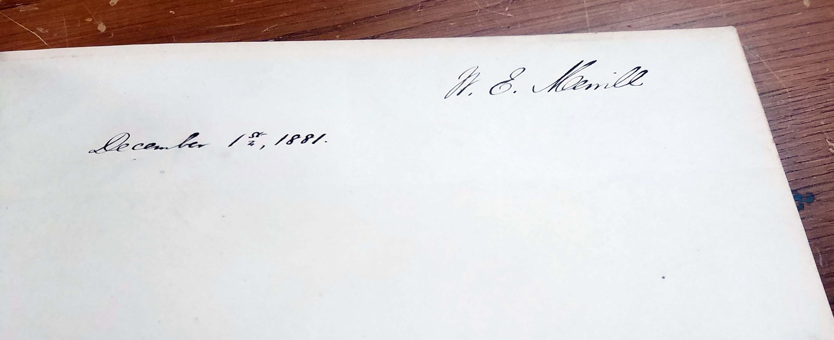
The collection was donated in August of 2018 by Susan E. Williams. She collected items individually over the course of many years. Ms. Williams added several additions of her own research about various items in the collection. To access the finding aid, follow the link here: http://digital.library.wisc.edu/1711.dl/wiarchives.uw-agsl-agslmss0035
