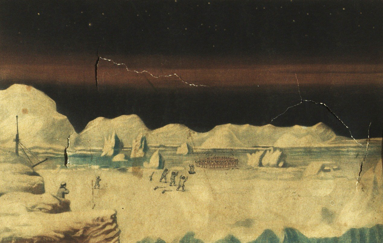
Arctic
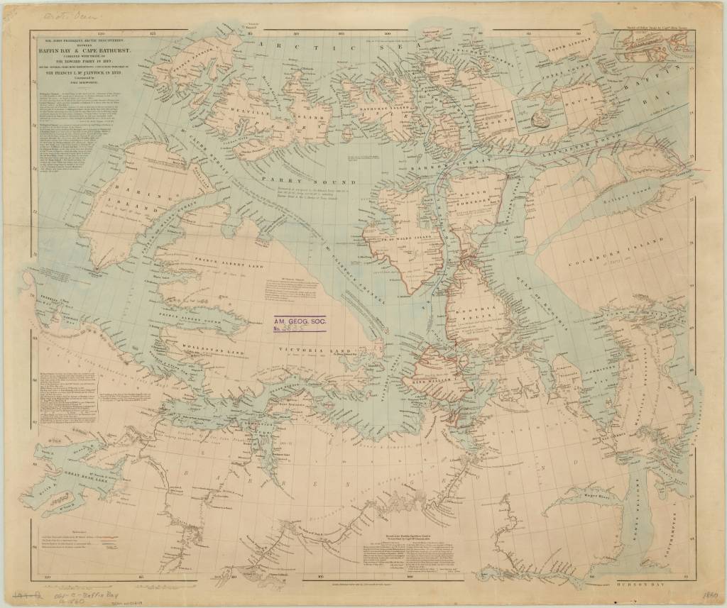
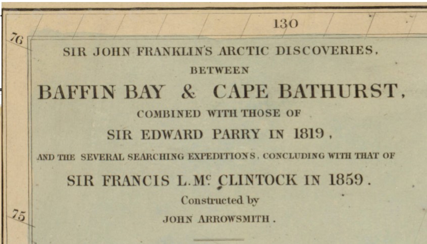
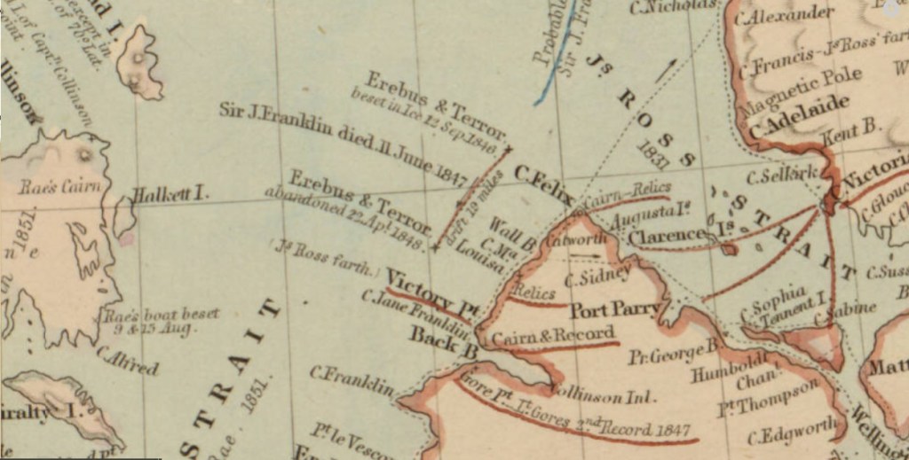
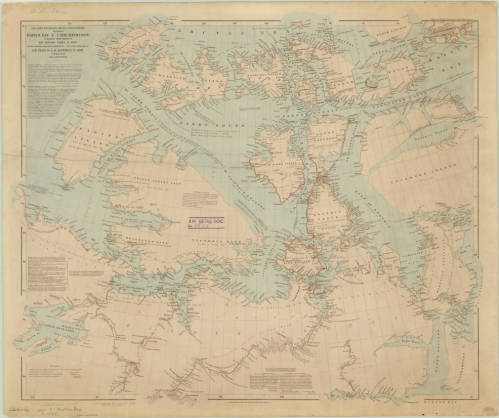
John Arrowsmith’s 1860 Arctic discoveries map
by Angie Cope
If you’re watching the AMC series “The Terror” you’ve experienced the dramatization of Sir John Franklin’s final voyage in 1845 in HMS Erebus and HMS Terror. The journey ended in tragedy for him and all his men, becoming the worst disaster in the history of British polar exploration.
Sir John Franklin’s Arctic discoveries, between Baffin Bay & Cape Bathurst, combined with those of Sir Edward Parry in 1819, and the several searching expeditions, concluding with that of Sir Francis L. McClintock in 1859 / constructed by John Arrowsmith, 1860
https://collections.lib.uwm.edu/…/colle…/agdm/id/21392/rec/4
From Royal Museums Greenwich:
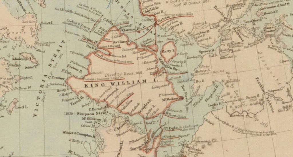
Franklin’s two naval vessels sailed up the Wellington Channel before turning south toward Beechey Island, where they would spend the winter. In the spring, they sailed south down Peel Sound but, off the northernmost point of King William Island, were trapped by the ice flow down the McClintock Channel.
In the spring of 1847, a party from the expedition travelled across the ice to Point Victory on shore and deposited a written record of their progress. It is thought they reached Cape Herschel on the south coast of the island, filling in the unexplored part of the North-West Passage. Sir John Franklin died in June that year.
Still trapped in the ice, Erebus and Terror drifted south until Captain Crozier ordered their abandonment in April 1848. Weakened by starvation and scurvy, the 105 surviving men headed south for the Great Fish River. Most died on the march along the west coast of King William Island.
To read the entire article. https://www.rmg.co.uk/…/john-franklin-final-north-west-pass….
The New Northwest Passage: Tourism through the Arctic
By Lauren Maddox
At the beginning of the summer, I did a series of posts discussing some of the AGSL’s connections to Arctic exploration and the famous explorers of that age (or, more accurately, the scandalous love lives of those explorers). But the Northwest Passage is still a part of the public’s romantic imagination– it’s a largely untraversable and unexplored wild full of cold beauty. And the fact that a Northwest Passage has been a geographical mystery for so many generations of Western explorers doesn’t hurt. As shrinking sea ice opens new routes through the storied Northwest Passage, more and more ships are passing through. Shipping freights are taking advantage of the new possible alternative to the Panama Canal for pan-oceanic travel– but in 2016, the first cruise ship passed through the Northwest Passage on a 28-day cruise through the Arctic.
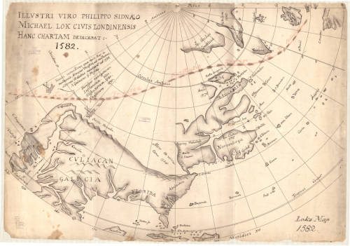
The Northwest Passage has been the subject of years of conjecture and speculation for European travelers–there is even some evidence that Vikings traveled to the Arctic and traded with indigenous peoples before the Little Ice Age. Early attempts to discover a true Northwest Passage were spearheaded the English; Henry VII sent John Cabot on a search for a direct route to Asia that could be used for more open trading in 1497. Several later explorers followed suit: Estaban Gomez in 1524, Martin Frobisher in 1576, Humphrey Gilbert in 1583, and on and on into the next two centuries.
Explorers were also interested in finding alternative entry routes into the Passage– if they couldn’t traverse the Northwest Passage in its entirety, then maybe they could find another way onto the path. In 1539, Francisco De Ulloa embarked on an expedition to sail around the Baja California Peninsula– you might remember this from my July post about the island of California. Besides confirming the fact that California is indeed an island (just kidding), Ulloa also believed that the strait between California and the mainland would lead to an accessible Northwest Passage.
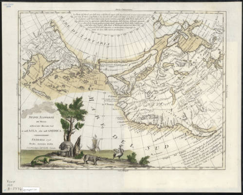
1776 Illustrative Map of the a proposed Northwest Passage through the Hudson Bay. Click the link to see this map in our digital collections! 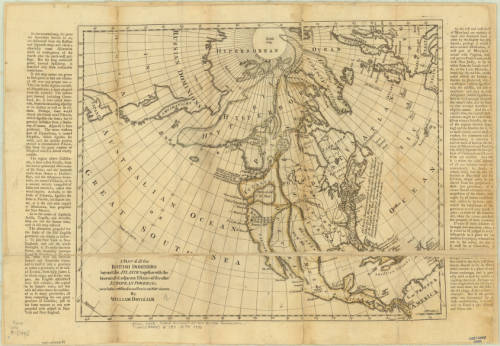
1770 Map of the Arctic, including a possible Northwest Passage. Click the link to see this map in our digital collections!
Many of these expeditions ended in tragedy– the truth was, at the time, there was no reliable pathway through the ice for ships to take. Routes that might be clear in one season would be completely frozen in another. Ships would often become stuck in the ice and forced to winter over where they were or abandon ship. In the 19th century, another rush of Arctic exploration swept Europe and the United States. In an earlier post, I go into some detail about the lost Franklin expedition and the scramble to discover their fate. This was one tragic ending of many expeditions– even Elisha Kent Kane’s rescue expedition in search of Franklin ended in a narrow escape from the deadly winter after which Kane’s health never recovered. Many thought that a purely ship-based expedition would never be possible; John Rae, the man who discovered the true fate of Franklin and his men, made many overland expeditions exploring the continent by using techniques already honed by native peoples who had managed to live there since, well, before the Vikings came to trade with them.
1860 Map of the Arctic Region. Click the link to see this map in our digital collection!
The Northwest Passage would prove impenetrable by ship until 1906, when Roald Amundsen and his six-person crew made a three-year journey through the icy waters in a tiny herring boat. His route through the Rae Strait was full of fairly young ice that was navigable and breakable, but the waters were shallow and only a small boat like the Gjøa could have made the trip.
As time passed and our climate has changed, the sea ice that prevented so many travelers from passing through the Northwest Passage has been shrinking. The Earth’s poles are more susceptible to the effects of climate change, and so the Arctic is warming at a faster rate than the rest of the world. The sea ice normally freezes and melts throughout the year, but the maximum coverage of the ice in winter has been shrinking at an alarming rate. This has some pretty huge implications for the state of our world, but has also led to an uptick in arctic tourism.
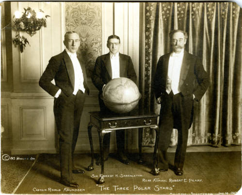
“The Three Polar Stars”: Photo of Amundsen, Shackleton, and Peary. Click the link to see this photo in our digital collection! 
Amundsen’s 1925 Expedition with Ellsworth. Click the link to see this photo in our digital collections!
Because of the melting sea ice, larger boats can pass through the Northwest Passage. During the most recent Arthur Holzeimer Lecture at the AGSL, speaker Lauren Beck commented that, for the first time in history, the Northwest Passage of European imagination has become reality. Only because of the quickly degrading sea ice is the Northwest Passage actually a traversable ship passage.
Amundsen’s successful trip through the Northwest Passage did not turn it into an icy thoroughfare– the ice was still too much of a problem for large cargo ships and the water often dangerously shallow. In 2012, two astonishing events happened: arctic sea ice hit record lows, and ship passage through the Northwest Passage hit record highs. The Panama-Canal was still the better, more consistent choice for trans-ocean shipments, but the new open waterways inspired a different kind of ship-traffic.
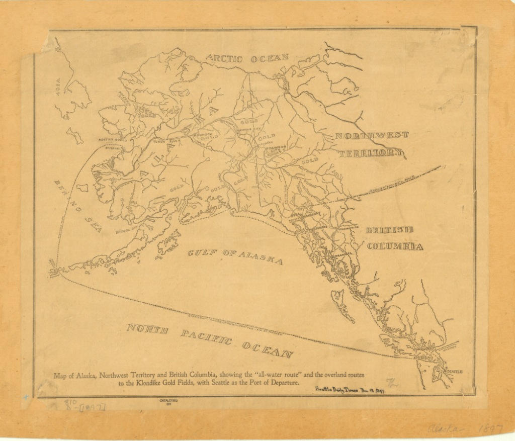
1897 Map of Alaska, Northwest Territory and British Columbia. Click the link to see this in our digital collections!
In 2016, the Crystal Serenity made an unprecedented voyage through the Northwest Passage; though not the first, it was the largest cruise ship to ever pass through the Northwest Passage. The cruise ship had to be escorted by a Polar-Grade ship that could break the ice for the cruise ship to pass though– or perform a rescue. While Crystal Cruises proudly took the Serenity through the Northwest Passage on multiple voyages for “true explore[s]” and is expecting the delivery of a Polar-Grade ship for more cruises, there is some concern about what tourism in the Arctic really means.
For one thing, the communities living there don’t have the infrastructure to deal with the influx of people and garbage. Townships are overwhelmed even by limited groups of tourists visiting. And the effect that human interference has on local flora and fauna– never mind the impending catastrophic oil or fuel spill that seems inevitable with increased traffic– can have deadly consequences for local indigenous communities.
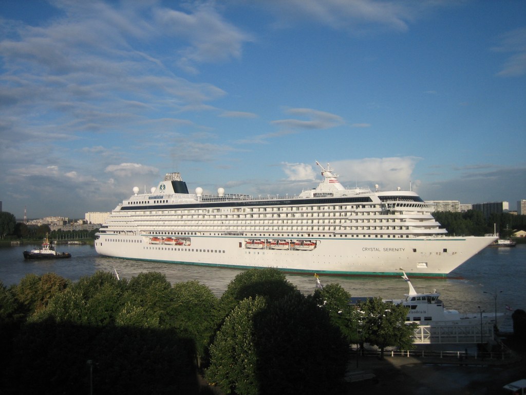
Photo of the Crystal Serenity in Antwerp
For many people, Arctic tourism is a “last-chance” to see an environment that might be on the brink of destruction. And while it is true that experiencing the Arctic has inspired many to defend it from climate destruction, the increased number of ships creates an increased risk of disaster for the environment, the people who live there, and even the tourists themselves. But ignoring the real possibility of climate disaster (or a shipwreck stranding hundreds of tourists on the Arctic Ocean), Arctic tourism also has a troubling philosophical component. Last-chance tourism forces us to think about the destruction of our natural world and how we want to face it. Do we want to put it at potential risk for the chance that tourists become potential activists? Or do we protect it from commercial interference as long as possible?
The answers to these questions are unclear, but as the Arctic tourism industry grows, the search for answers becomes more urgent.
The Lost Franklin Expedition and the Early Years of the AGS
By Lauren Maddox
On May 19th, 1845, John Franklin, Francis Crozier, and the crews of the HMS Terror and HMS Erebus set out from Greenhithe, England on an expedition intended to explore previously unexplored areas of the Canadian Arctic and to complete the Northwest Passage. Lady Jane Franklin, with no word from Franklin and concerned for the welfare of her husband, began petitioning the British Admiralty to begin searching for the lost expedition as soon as 1847.
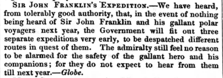
Click the link to see this excerpt From the November 13, 1847 Edition of Sheffield and Rotherham Independent
The Franklin expedition had been supplied with three years worth of canned goods to supplement the men’s hunting efforts; the British Admiralty assumed that the crew could comfortably survive another year before needing rescue. Unfortunately, the food provisioning contract had been awarded to Stephen Goldner just weeks before the Terror and Erebus set out. In his rush to fulfill the order of 8,000 cans of food, Goldner failed to check the quality of lead soldering on the tins. The food spoiled quickly, leaving the crew without proper provisions on their journey and unable to hunt once the ship was trapped in ice.
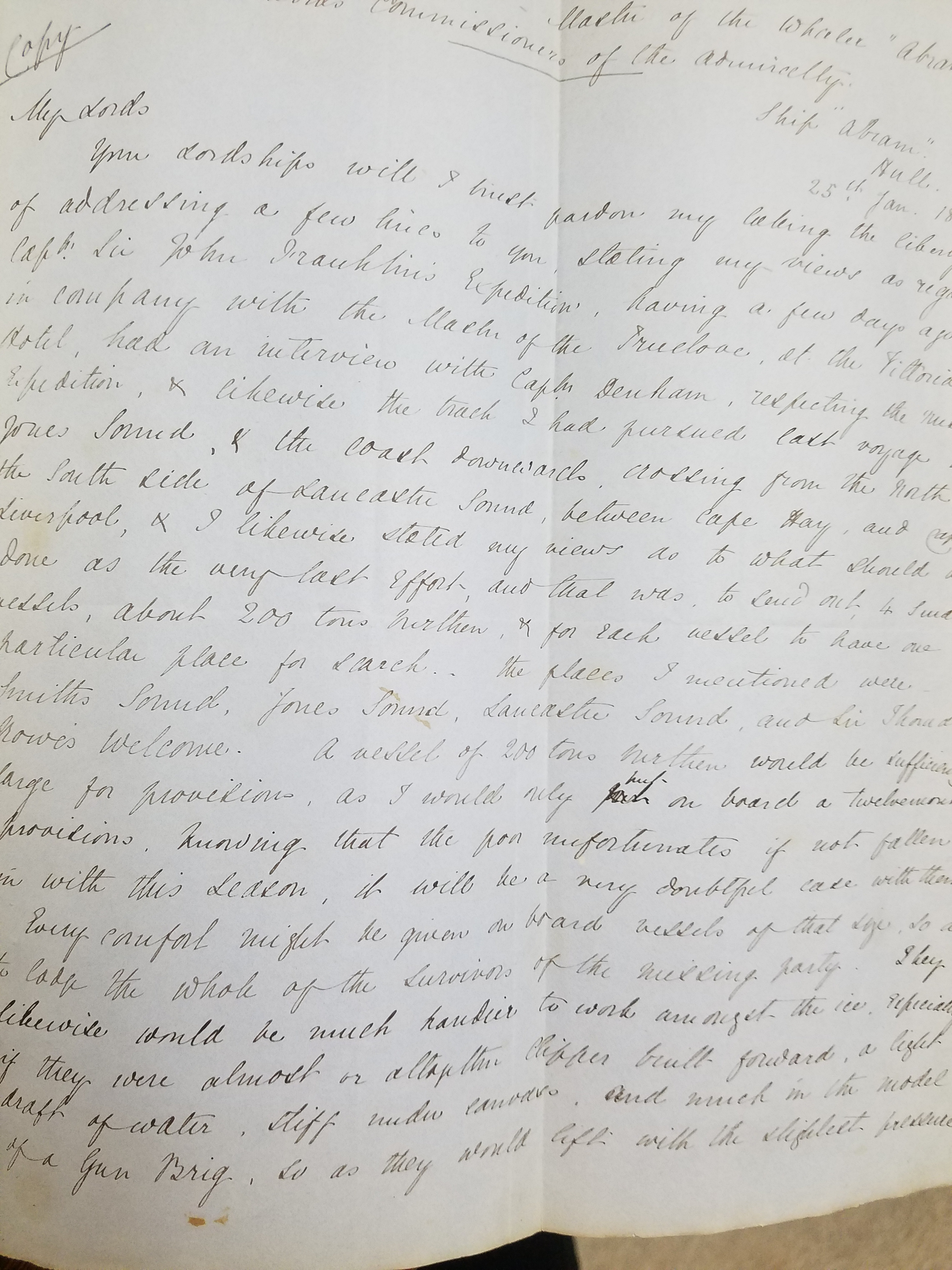
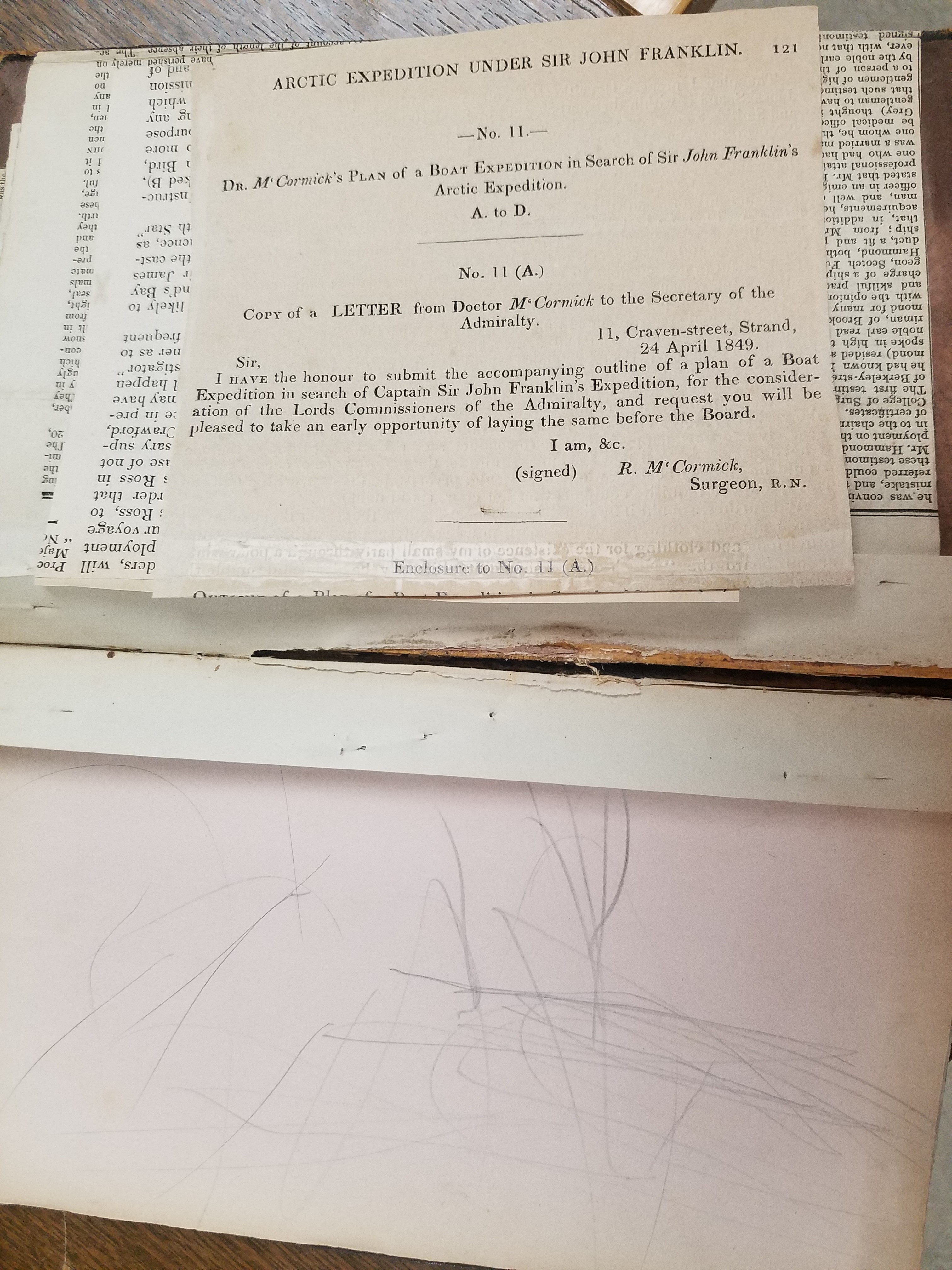
Official preparations for the rescue effort began in 1847– the Admiralty chose the three most likely routes that the Franklin expedition might have taken. The ships were likely icebound, so an overland rescue expedition would have to be arranged. Sir John Richardson, a seasoned arctic explorer who had traveled with Franklin on previous expeditions, chose a route along the Mackenzie River and the shores of Victoria Land and Wollaston Land, now Victoria Island and Wollaston Peninsula, which seemed most consistent with Franklin’s original travel plans. John Rae, another arctic explorer well-known for his prowess at safe and efficient overland travel, as well as his rapport with local indigenous peoples, was included in the rescue plans.

Click the link to see these Tracings of Dr. Rae’s Discoveries in the Arctic, 1851 from the AGS-NY Archives 
Flip Side
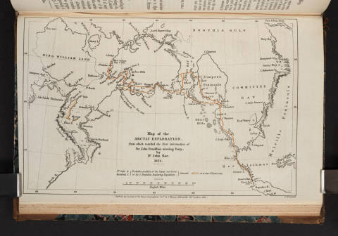
After travelling together overland and gathering information from locals, the men wintered in Fort Confidence; using the fort as a base of operations, Rae continued his search around the areas between the Mackenzie and Coppermine Rivers. In 1849, the two men decided that Rae would take the single boat and continue the journey on their intended route with a smaller crew of six men. Richardson returned to Liverpool on November 6, 1849. The above tracings of John Rae’s sketch maps outline his discoveries in 1851. Rae would continue charting the area and searching for signs Franklin’s lost expedition into 1854, but during this time, several other search expeditions were launched, including Henry Grinnell’s.
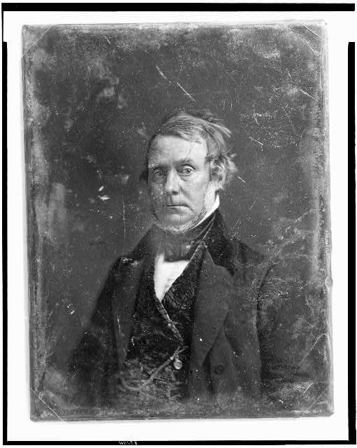
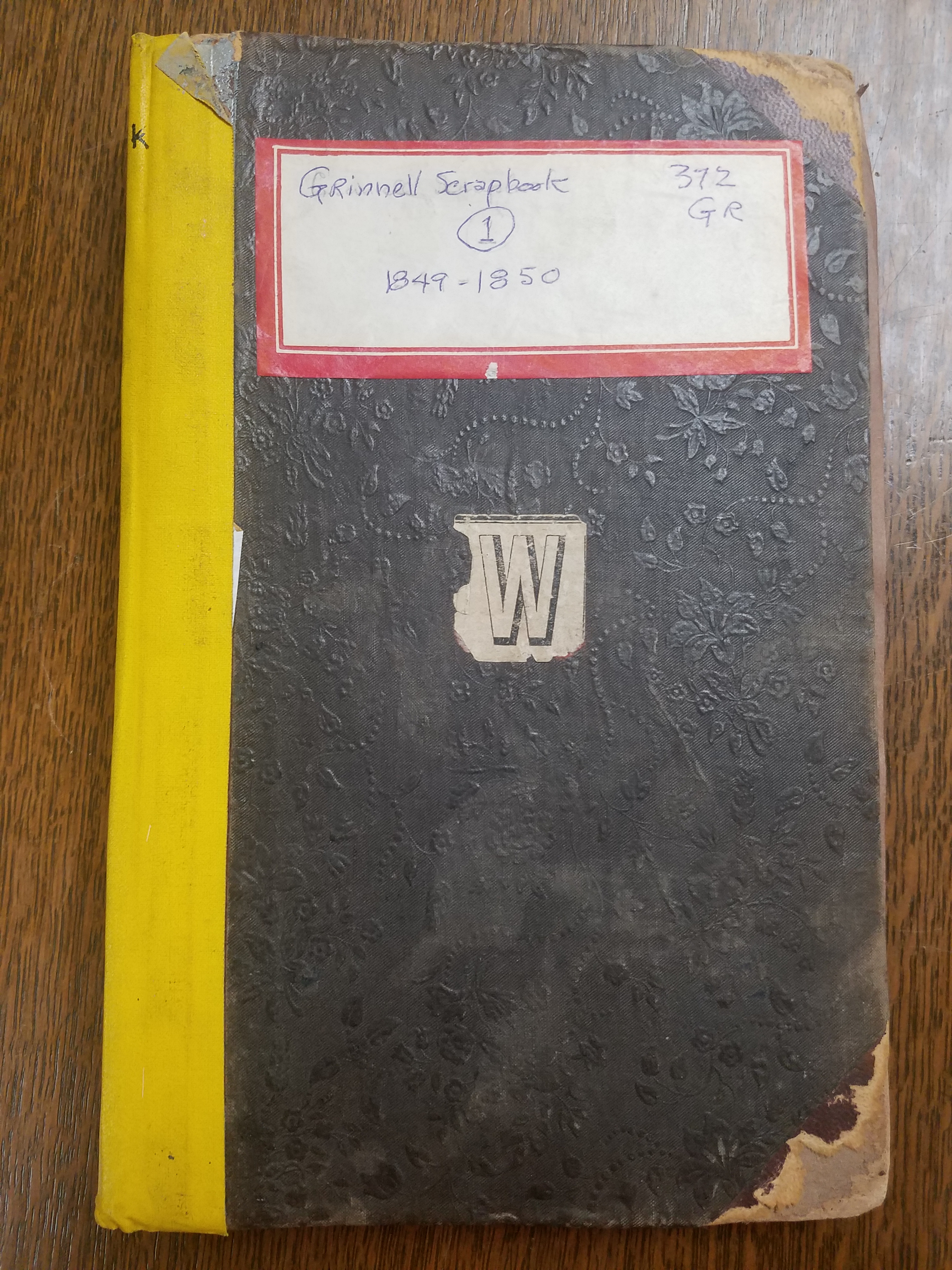
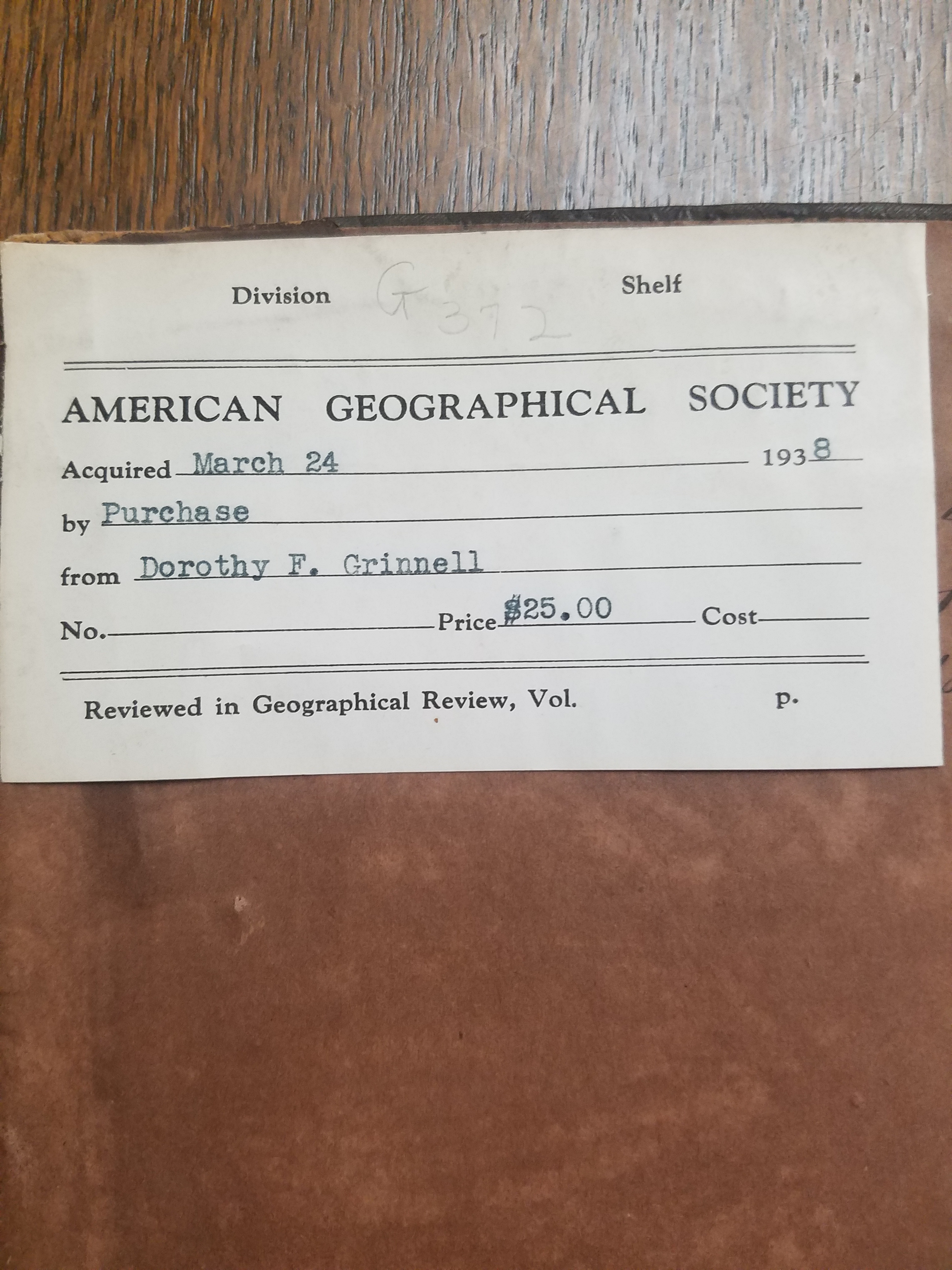
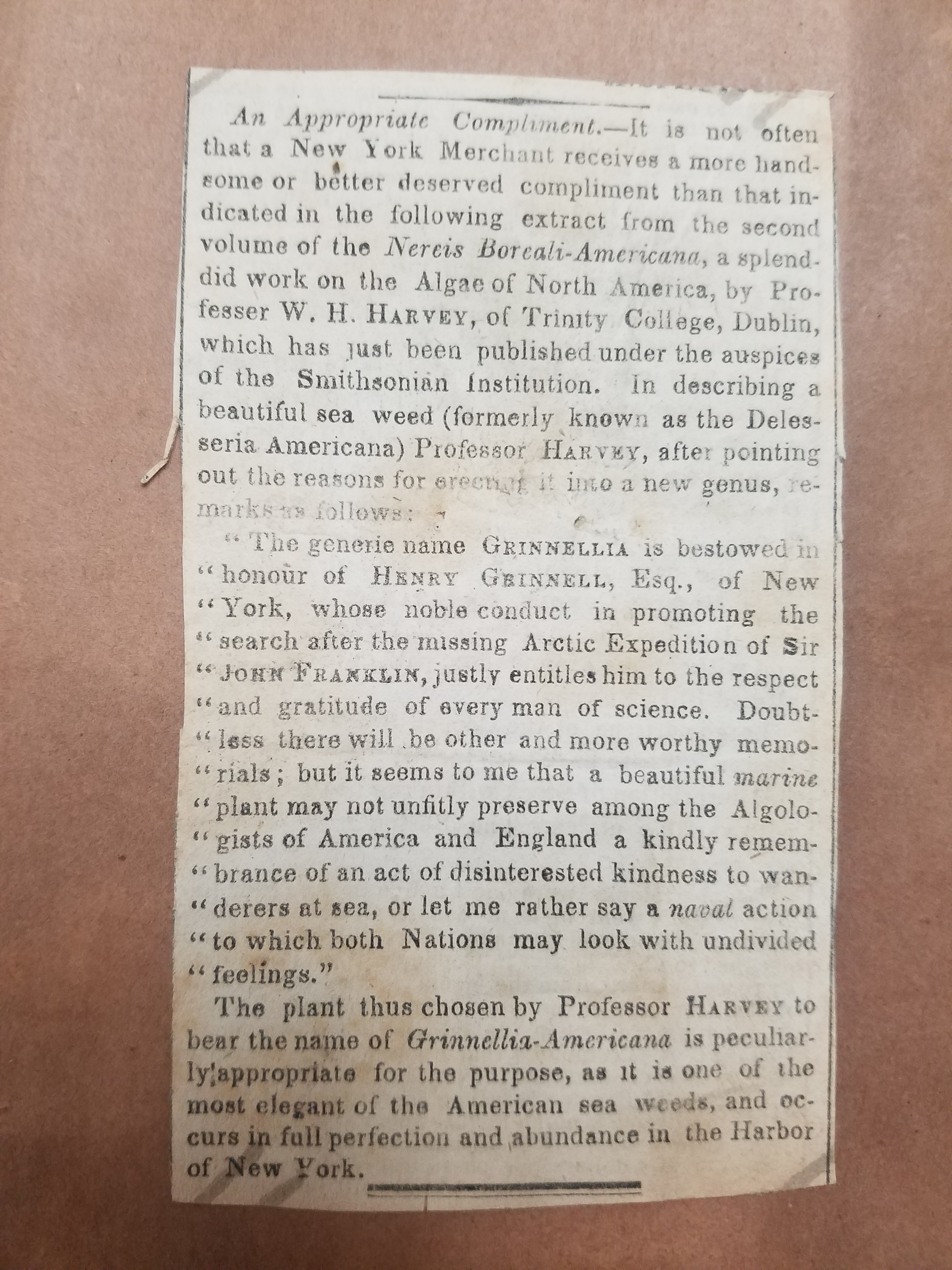
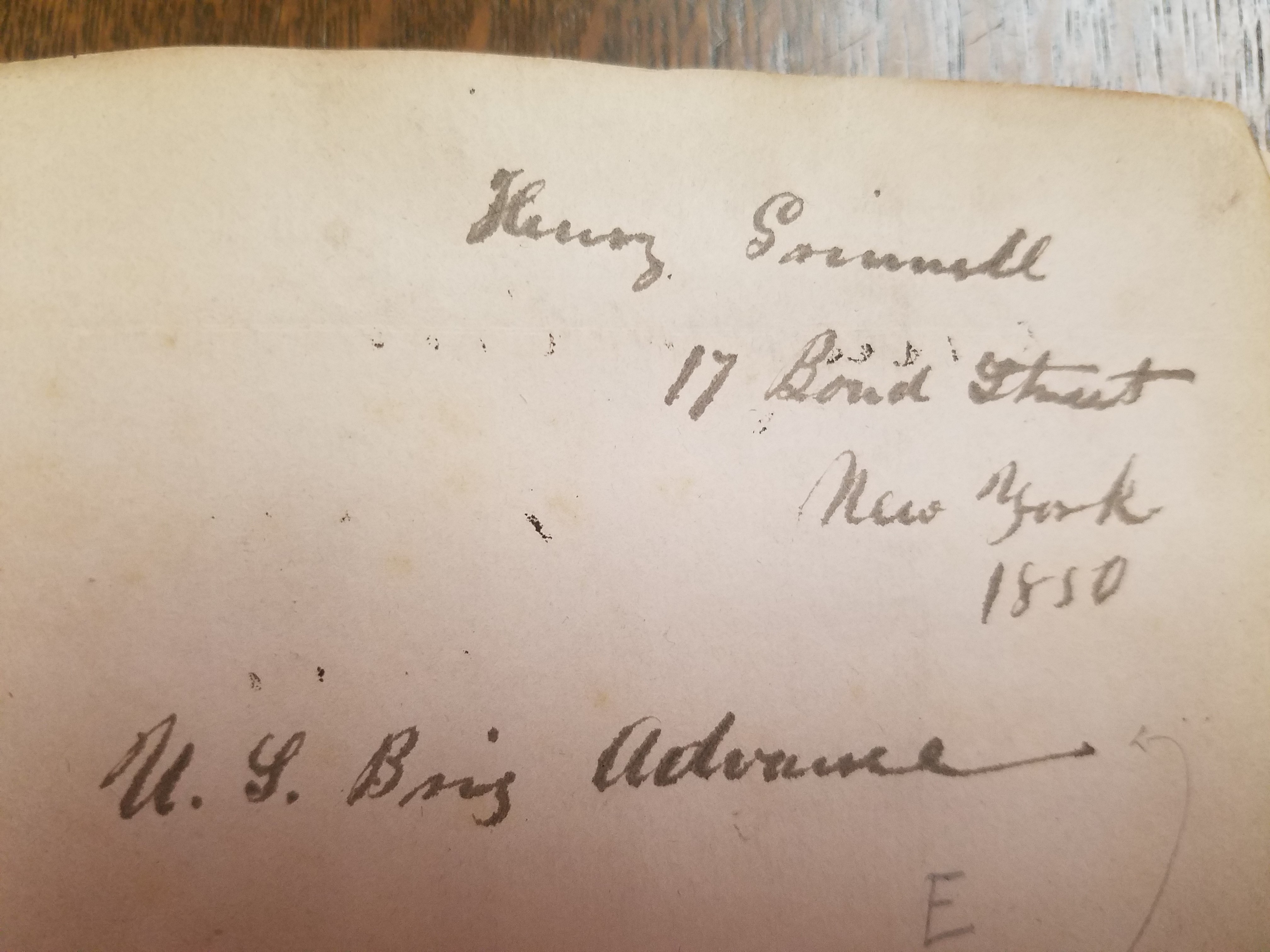
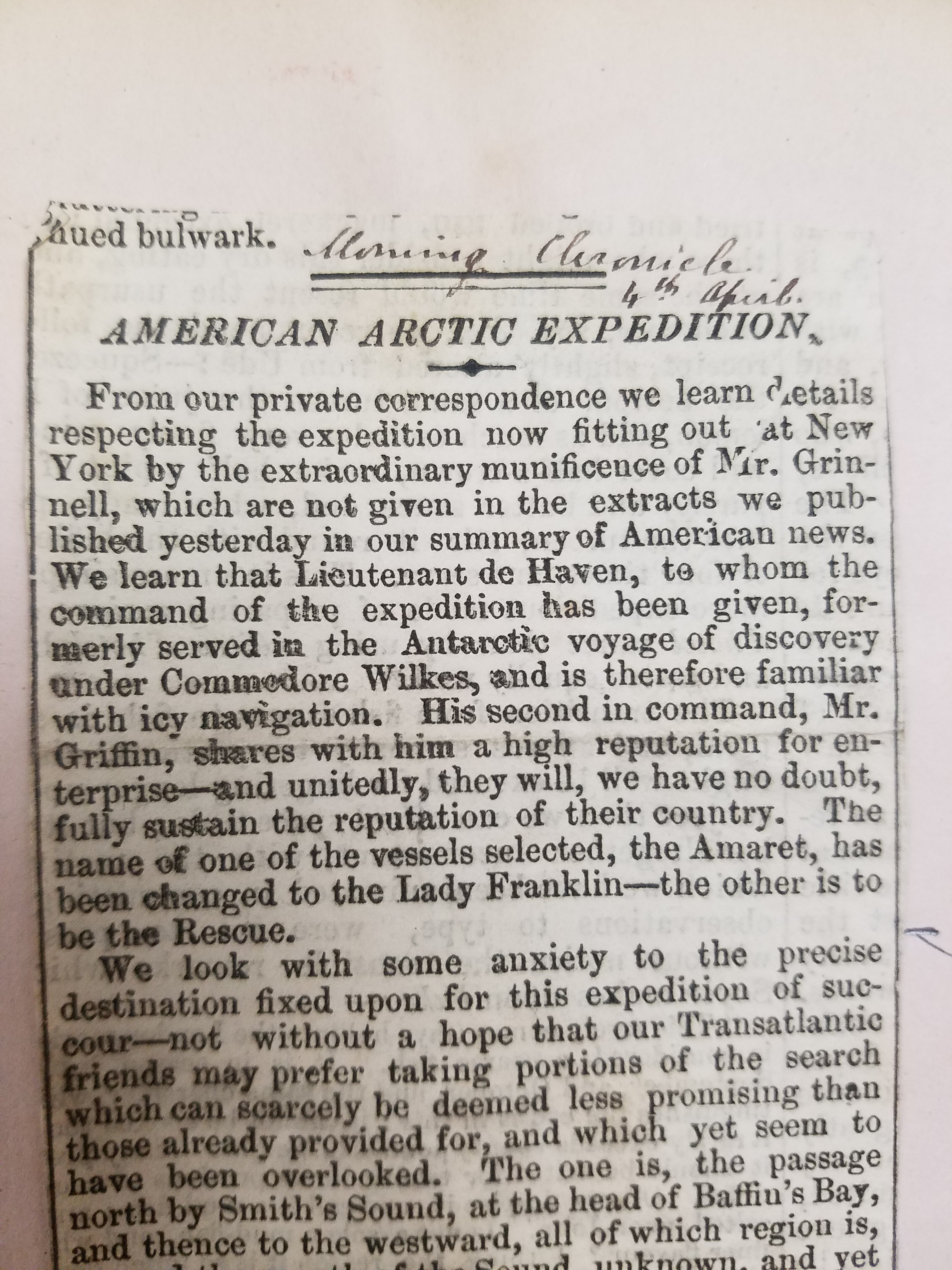
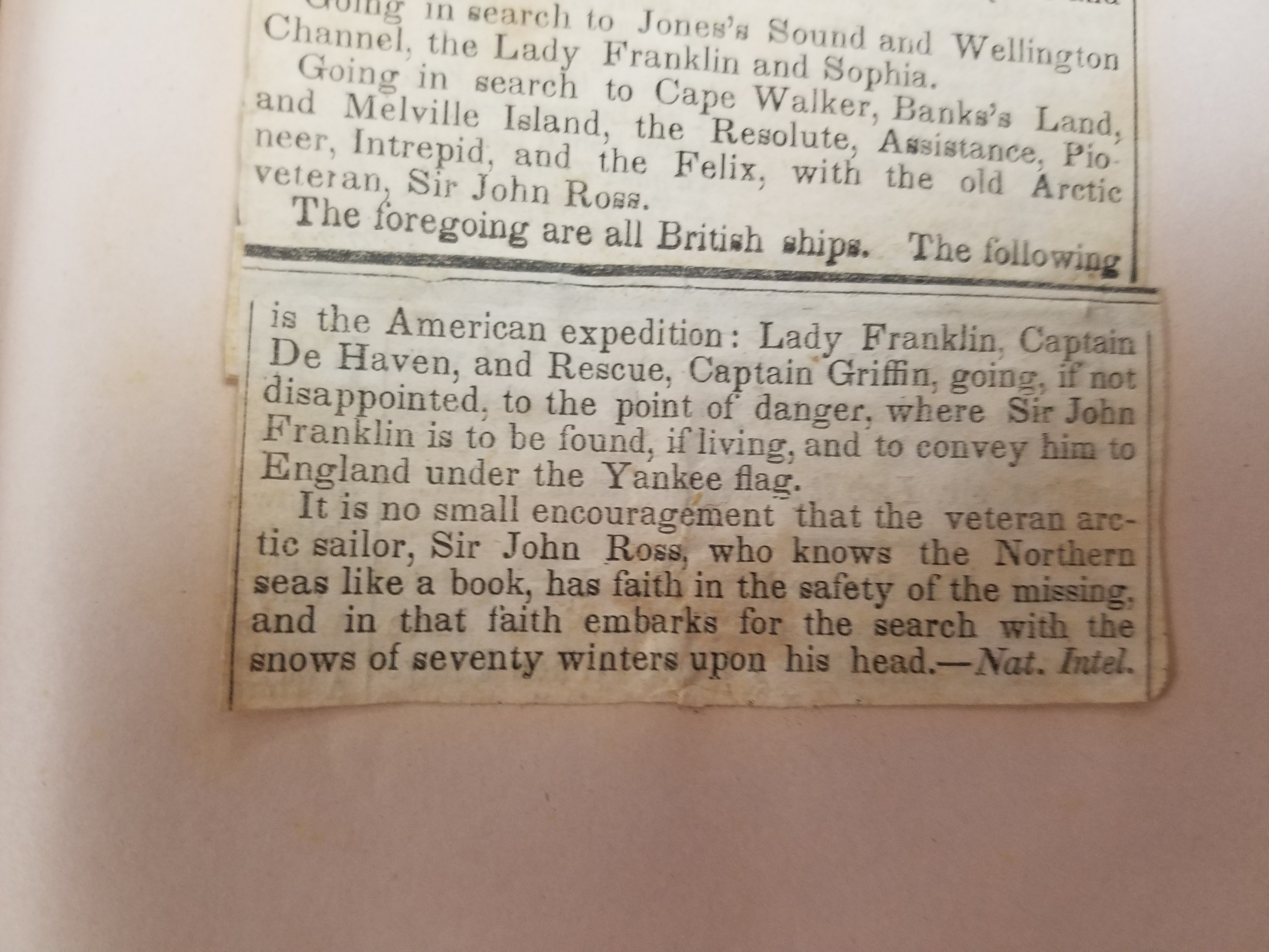
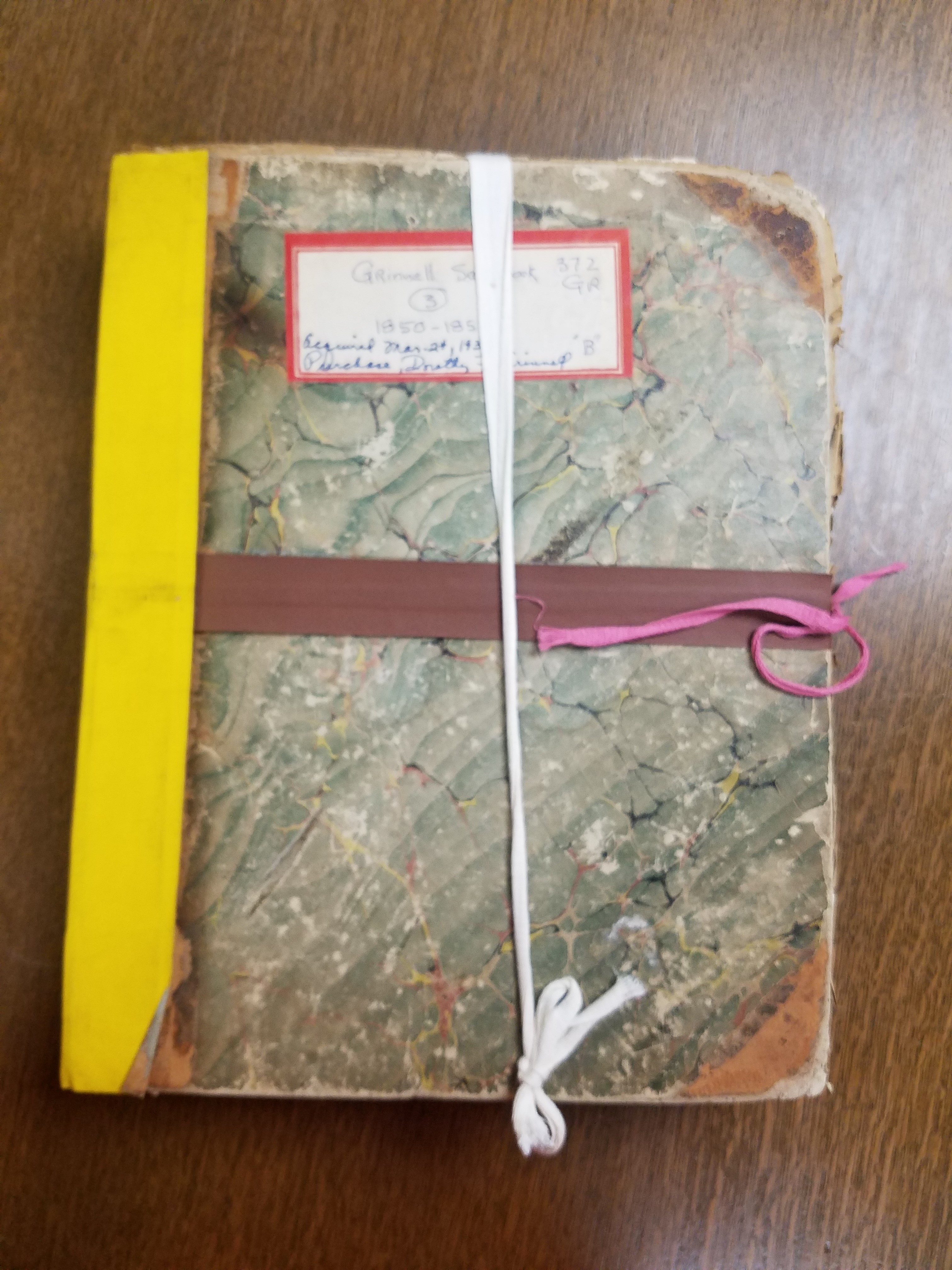
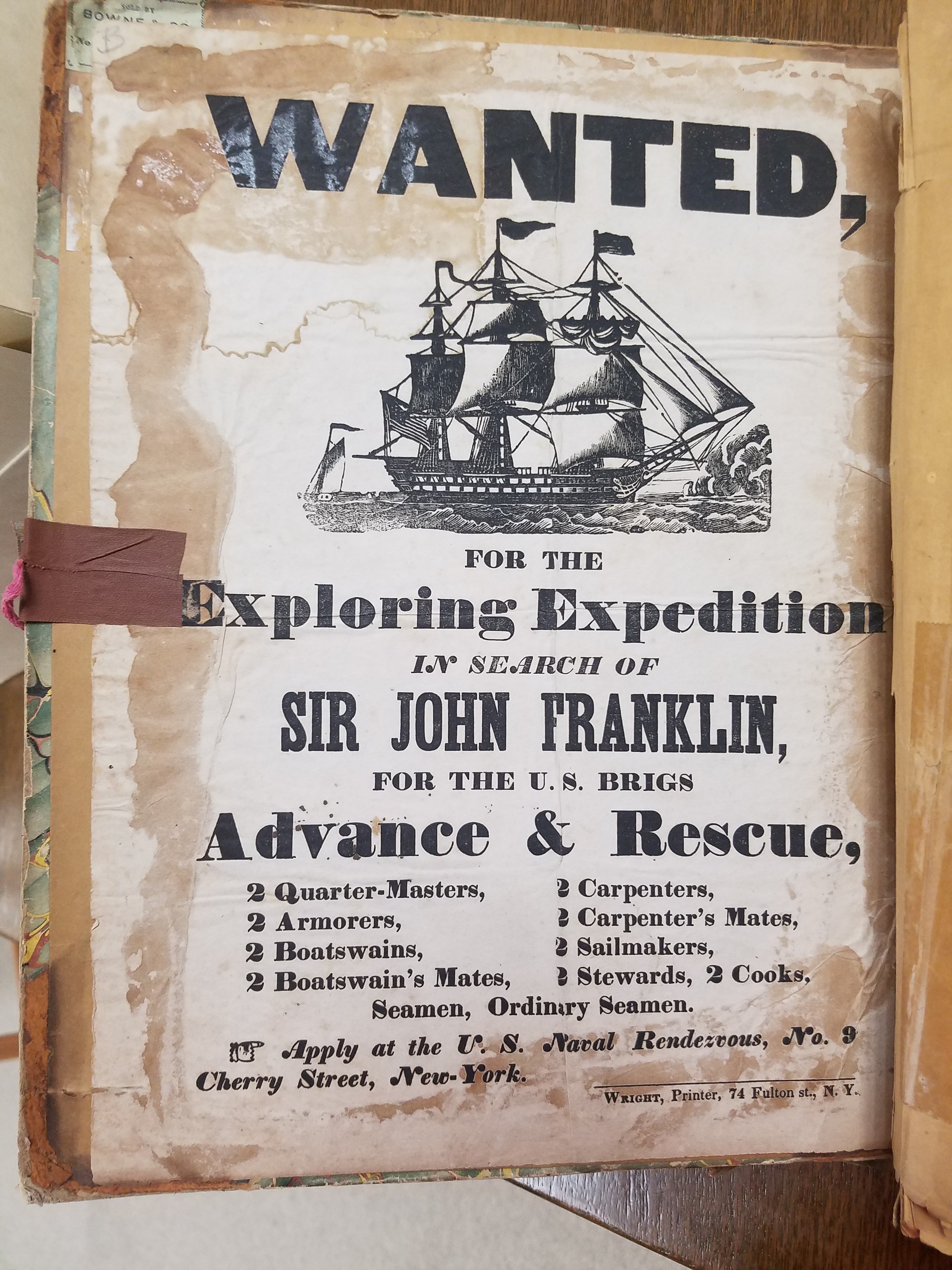
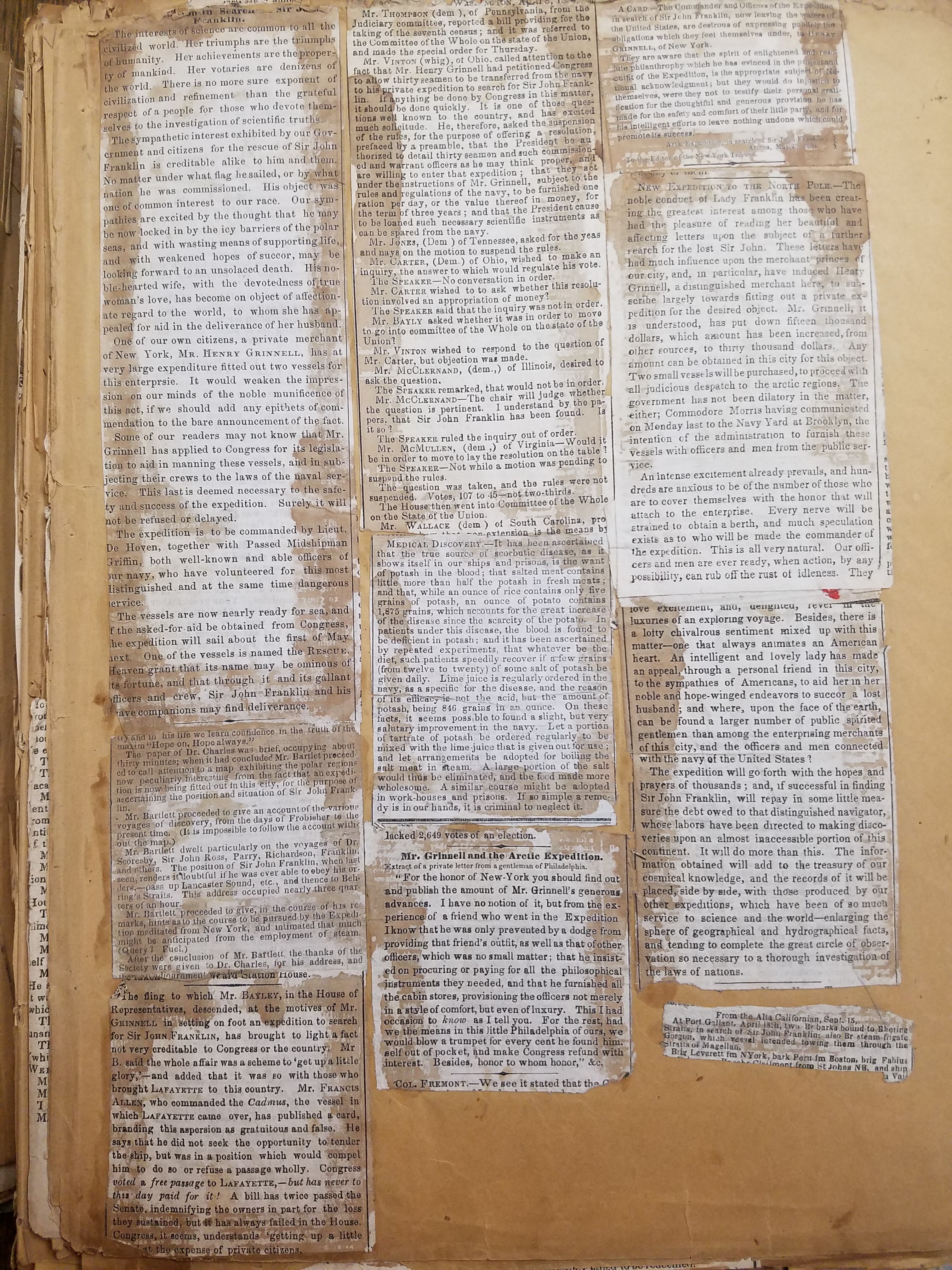
The Lost Franklin expedition would turn out to be instrumental in the foundation of the American Geographical Society. Henry Grinnell, wealthy merchant and the first elected president of the AGS, retired in 1850 to dedicate his life to philanthropy. Grinnell was a passionate follower of the search for John Franklin; in its collection, the AGSL has several scrapbooks of newspaper clippings following the story collected by Grinnell himself. The scrapbooks contain materials on previous expeditions as well as Grinnell’s own. He was particularly moved by Lady Jane Franklin’s continued appeals to American President Zachary Taylor for help finding her lost husband; when Congress hesitated to provide the aid required for a rescue expedition, Grinnell himself bought and refitted two brigs for arctic travel. He loaned these ships to the US Navy for use in an arctic exploration expedition in the hopes that John Franklin, or some trace of what happened to him, could be found.
Click the link to see Chart Exhibiting Discoveries of the First Grinnell Expedition submitted by Kane in our Digital Archives
Click to see this Unidentified Notebook, 1854 found aboard the HMS Resolute after it was abandoned in the search for Franklin in our Digital Collections
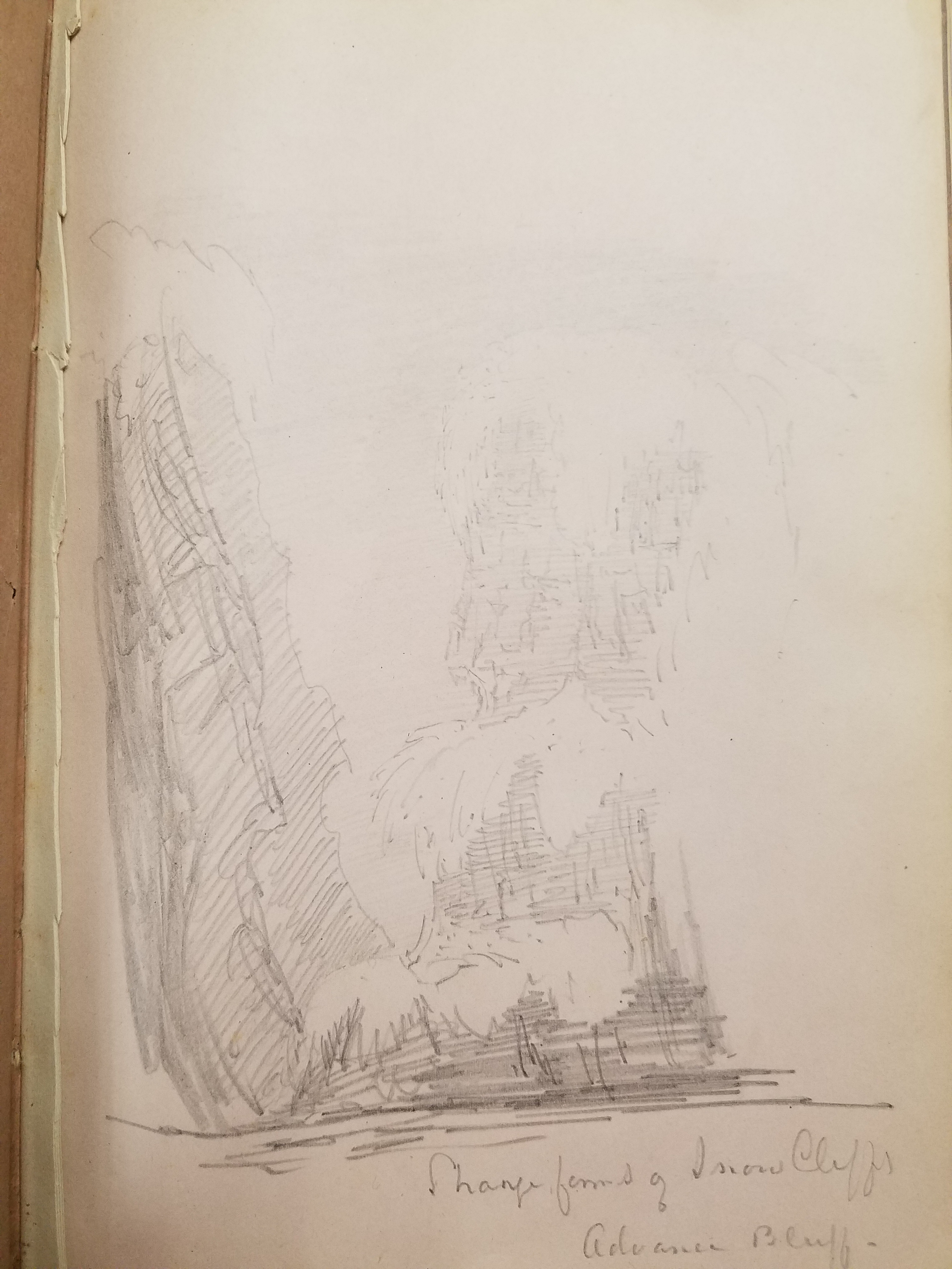
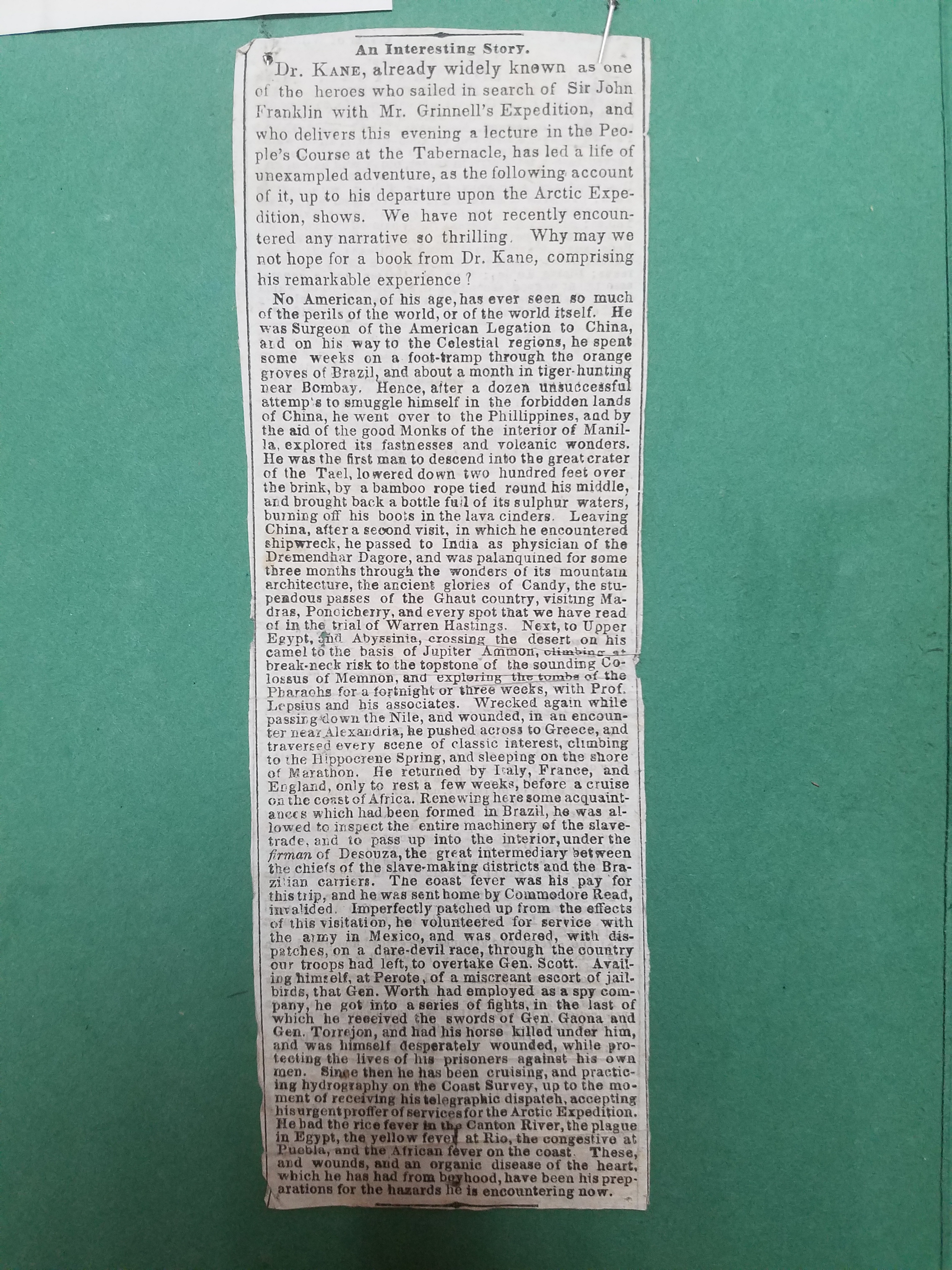
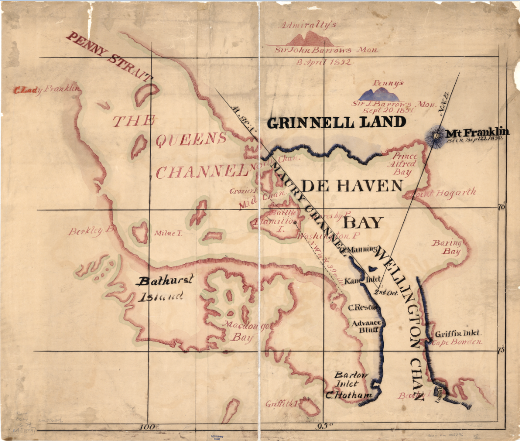
The First Grinnell expedition set out in the summer of 1850– the same year preliminary talks about founding an American geographical society began. Geography in the Making: The American Geographical Society 1851-1951 intimates in a single sentence that, though there is no “positive evidence” that Grinnell’s polar interests influence the foundation of the Society, the timing of his arctic expeditions and his election as president seem to suggest it. The expedition, lead by Edwin de Haven and including Elisha Kent Kane, set out in May and would continue their search through ice and bad weather for a year. They met with British search parties, including the first expedition on the HMS Resolute lead by, and joined forces to comb the area thoroughly– during the winter, however, the Advance and the Rescue were separated and icebound. Elisha Kane submitted a chart with a revised survey of the coast of Greenland and the party’s escape route south. This chart also shows the newly christened Grinnell Land, which De Haven named in honor of the expedition’s patron. After being forced to winter over in the ice, it was decided that the two ships should return with what news they had, though it was not very much: all the expedition had discovered about the lost Franklin party was their first camp, abandoned, and three graves on Beechy Island.
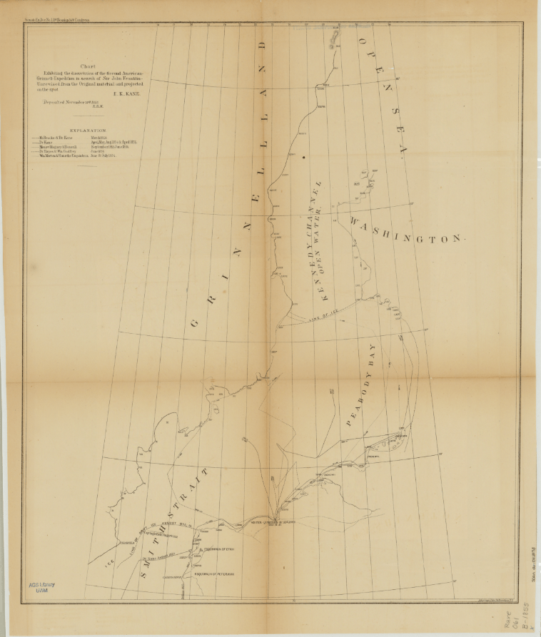
Click the link to see this Chart Exhibiting Discoveries of the Second Grinnell Expedition by Kane in our Digital Collections
Unsatisfied with the results of the first expedition, Grinnell began planning a second search for Franklin. Elisha Kane would lead the expedition north of Beechy Island where Franklin’s first camp was found and into the open summer polar sea. The search plan was approved by the American Geographical Society in New York and financially supported by Grinnell and other philanthropists. Isaac Israel Hayes, another well-known name in the AGSL archives, signed onto the expedition as surgeon. The small crew set out on the Advance on May 30th, 1853 with meager provisions and research instruments. This expedition would shed no new light of the disappearance of Franklin’s expedition, but it would go farther north than any expedition before it, setting a new record, and allow Kane to gather useful geographical, climate, and magnetic observations. The journey was harrowing and the men, trapped for two winters in the ice, running low on supplies, and afflicted with scurvy, would be forced to abandon the Advance in search of rescue. Three men were lost during the expedition and Kane’s health would continue to deteriorate. He died in 1857, just two years after the expedition returned– the same year as his account of the journey was published.
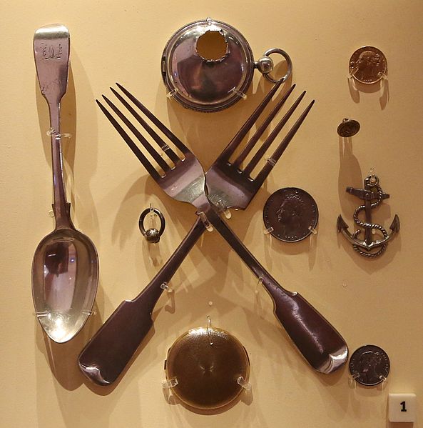
Click the link to see these Items Recovered by Rae, currently housed in the National Maritime Museum in Greenwich, London
The Grinnell Expeditions were unsuccessful in discovering the fate of the lost Franklin expedition. But during this time, John Rae’s own expedition was still on-going. In 1853, he encountered a group of Inuit who had several artifacts from Franklin’s crew in their possession. This included several pieces of monogrammed silverware, coins, and a pocket watch. Rae purchased these items from the Inuit and began interviewing locals. This was how he eventually discovered the sad fate of the Franklin expedition. While completing his survey of West Boothia, Rae heard about a group of white men who had starved four years earlier in a camp nearby. Rae continued his search until he discovered the final camp of the Franklin expedition. In his letter to the Admiralty, he described the state of the camp and the signs of cannibalism he found there. But, “any tidings, however meager and unexpectedly obtained” were better than none in Rae’s opinion.
Click the link to see “Arctic Exploration, With Information Respecting Sir John Franklin’s Missing Party.” 1855
The British Admiralty published John Rae’s letter without his knowledge before his return to England in 1854. The public was outraged by his claims; Charles Dickens maligned him in the press and his findings were mostly ignored by Lady Jane Franklin who continued her search into the 1880s. However, later expeditions would only confirm what Rae had discovered, and the British Admiralty officially presumed the entire crew of the Franklin expedition dead. Rae’s crew collected the reward, but his reputation never recovered. Other explorers who had joined in the search for Franklin were knighted, but Rae, for implying that officers of the Royal Navy would stoop to cannibalism, was mostly kept out of the picture.
Rae published several articles in the Journal of the American Geographical Society of New York after his days of Arctic exploration were behind him. He shared his discoveries and practical advice with other explorers in the spirit of the AGS’s organizational purpose: “furthering the understanding of the role of geography in our lives.” After his death in 1893, the AGS published his obituary in their journal, honoring John Rae for his 35 years as a Corresponding Member of the AGS and his important contributions to geography. The Society had this to say about Dr. John Rae: “He wrote with simplicity and force, but he was more concerned to do things worthy of record than to record them. He had the gifts of the born explorer, the habit of exact observation, courage and fertility of resource, untiring energy, activity and strength; and with these a firmness and generosity of character that won the respect and the affection of men.”
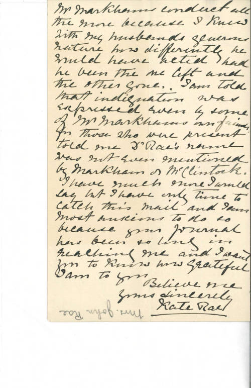
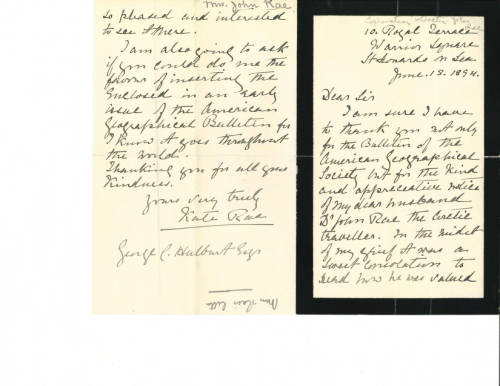
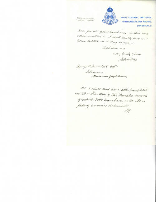
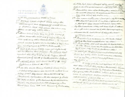
And in the AGSL archives, relics of a longstanding friendship between the Society and Rae: a collection of years of correspondence from Rae and his wife Kate to the AGS.


The young beginnings of the American Geographical Society were tied to those first Arctic expeditions to find Franklin, and this legacy of Arctic exploration continued into the 20th century. Luckily, records from these early years remain in the AGSL collection as a reminder of these tragic and exciting origins.
A Fan with a View
by Bob Jaeger
Arctic Fan. Kinda sounds like an industrial strength air-conditioner, one that would keep your house extra cool in the summer. But these words describe a nineteenth-century hand-held fan with an Arctic view painted on it. This fan is held at the AGS Library, UW Milwaukee as part of the American Geographical Society of New York Archives.
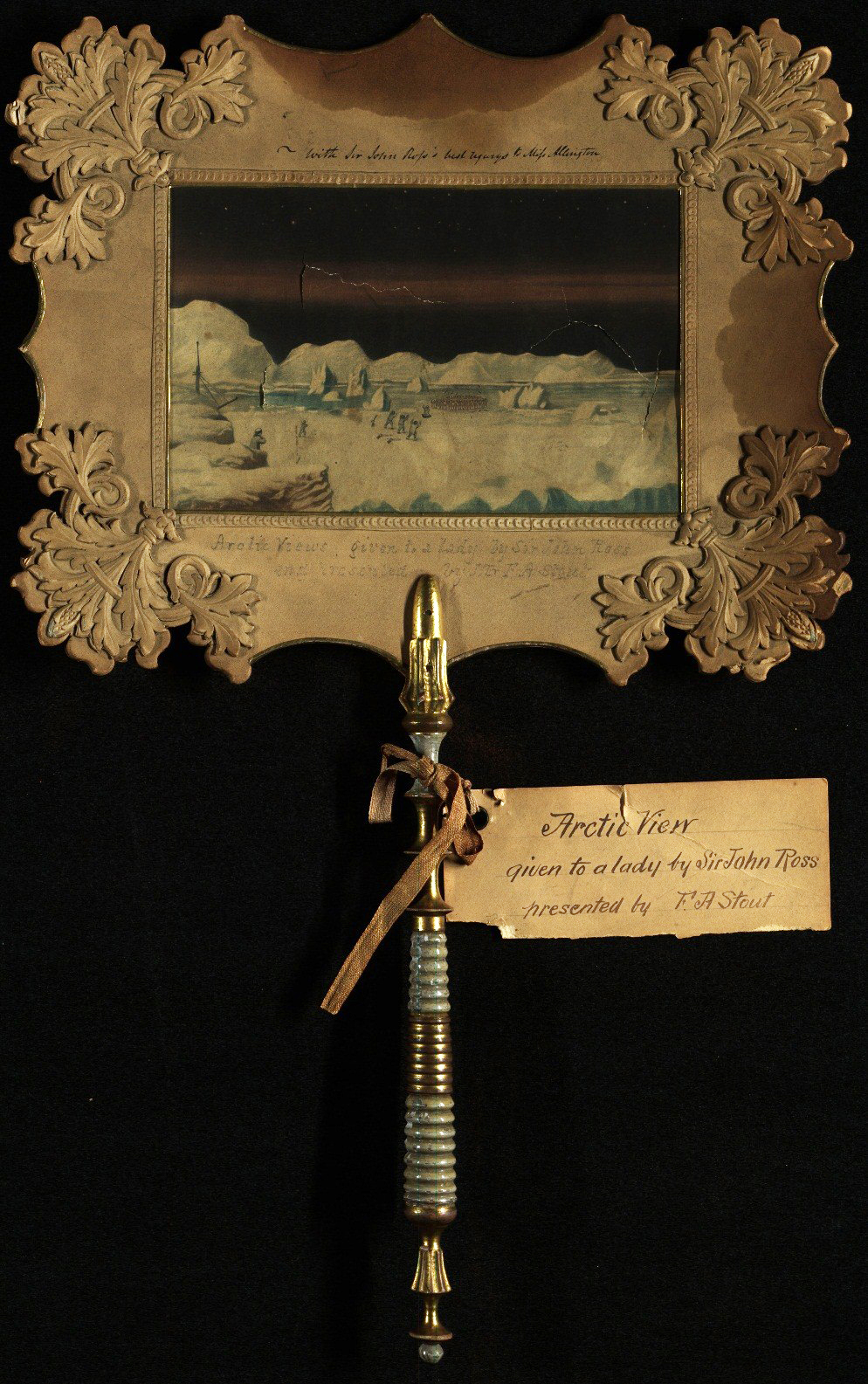
While it is unclear who painted the image, the fan was given to a Miss Allington by the Arctic explorer John Ross (1777-1856), who made three voyages to the Arctic. It was later presented to the AGS by one of its vice presidents, Francis A. Stout in 1871.
The fan is ornately designed, with a watercolor painting of an Arctic scene, an elaborate wooden handle, and a decorative trim and border. In an era without air conditioning, a snowy landscape like this might have helped keep the user a little bit cooler when looking upon this wintery scene.
We’d love to learn more about this fan and invite comments below.
Crocker Land: The Land of Mist
By Robert Jaeger
During Robert Peary’s attempt at reaching the North Pole in 1906, he claimed to have spotted a previously unidentified island off the northwest coast of Greenland. He named it Crocker Land, after one of his primary financial supporters, George Crocker.
While Peary may have fabricated the island’s existence in order to obtain further funding from Crocker for his next attempt at the Pole in 1909, Crocker Land nevertheless became a hot topic in 1909 after Frederick Cook and Peary both claimed to have reached the Pole.
During his expedition to the Pole, Cook stated that he traveled across the area Peary called Crocker Land and there was no land present. In an effort to prove the existence of Crocker Land and discredit Cook, George Borup and Donald MacMillan, both assistants of Peary on his trip to the Pole in 1909, were chosen to lead an expedition to Crocker land. However, Borup died unexpectedly, delaying the start of the expedition and leaving MacMillan to lead the expedition by himself.
MacMillan set out 1913, and the expedition was immediately beset with a series of misfortunes. Among them, a shipwreck on the way to Greenland, two failed rescue missions, the alleged murder of an Inuit guide, and the biggest of all: that Crocker Land turned out to be an illusion. At first MacMillan refused to believe it was a mirage caused by mist, but after several days of attempting to reach it, he was forced to accept the truth and turn back.
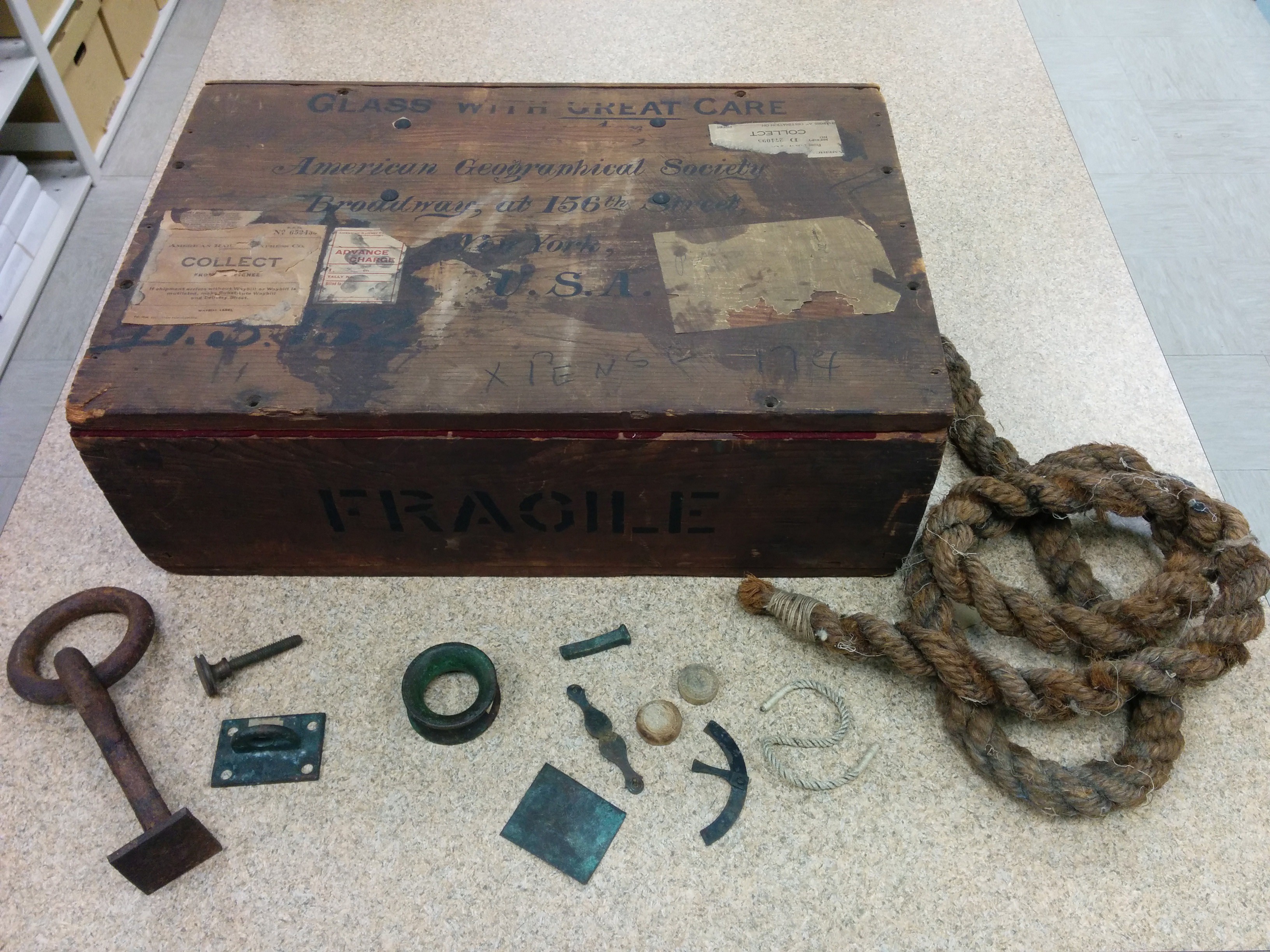
The expedition finally returned in 1917. As the AGS was one of the main sponsors of the expedition, the AGS-NY Archives at UW Milwaukee contains many of the records from it. These records provide much scientific data, helping to salvage something from the expedition. Included are geographical, mammalogical, and ornithological reports, along with meteorological and astronomical records. There is also a large wooden box, containing numerous artifacts from previous Arctic expeditions. Among these are items from Elisha Kent Kane and Robert Peary.