The Sanborn Fire Insurance Maps: Milwaukee Before and After the Third Ward Fire of 1892
By Lauren Maddox
The 1894 and 1910 Sanborn Maps of Milwaukee currently featured on the AGSL website catalog over 12,000 detailed color map sheets of Milwaukee. The Sanborn map collection, which, in its entirety, contains roughly fifty thousand editions of fire insurance maps, was intended to inform fire insurance agents about fire hazards associated with individual properties in a city. The maps contain relevant information about building materials, layout, and fire prevention measures in residential and industrial buildings throughout Milwaukee as well as the actual layout of the city.
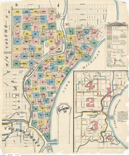
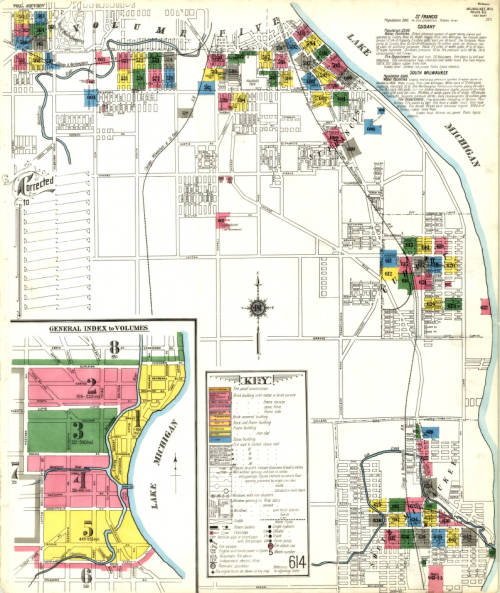
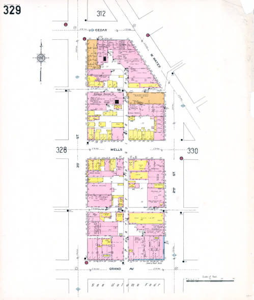
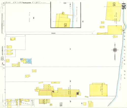
But these maps don’t just detail the fire hazards of a city– they also capture the changes that happen in an ever-growing and ever-evolving urban space. The Sanborn maps have been described as the “the single most important record of urban growth and development in the United States during the past one hundred years” and detail over 12,000 towns across the United States, Canada, and Mexico from 1867 to today. The AGSL digitized its collection of Milwaukee Sanborn maps in 2007 and made them available through the AGSL Digital Collections. Then in 2017, former AGSL student assistant Belle Lipton and the Milwaukee County Land Information Office georeferenced the AGSL’s collection of 1910 Sanborn map sheets to create the Sanborn Discovery App 1910: a seamless and immersive version of the 1910 Sanborn map sheets that overlay a current satellite map of Milwaukee. The Sanborn maps contain references to buildings that no longer exist and empty lots that have since been developed; the Riverside Printing Company on sheet 329 is now a parking lot, and underneath the mostly empty map sheet 135 now sits Carver Park’s two baseball diamonds. Looking at these two maps right on top of the other, it’s easy to see how much Milwaukee has changed in the intermediate 107 years.
However, we know that the city’s face was changing even before the Sanborn maps began to record it. Just two years before the first Sanborn fire insurance maps of Milwaukee in 1984, the historic Third Ward burned down. And years before that, the city was still growing and changing with time. The Sanborn maps capture what the city was like two years after the fire– but earlier maps in the AGSL archives reveal what the city looked like before the Sanborn fire insurance maps, before the tragic Third Ward fire, and before even the founding of Milwaukee.
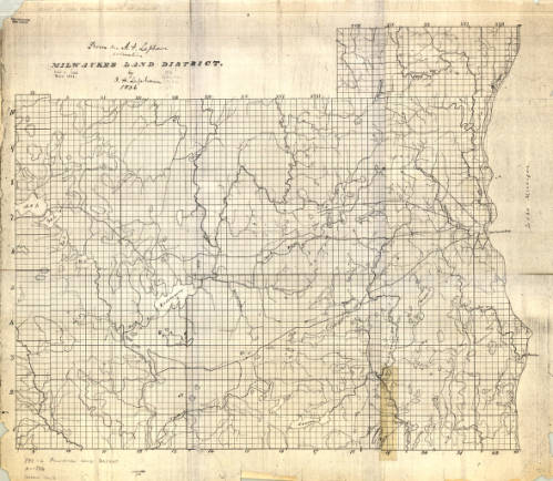
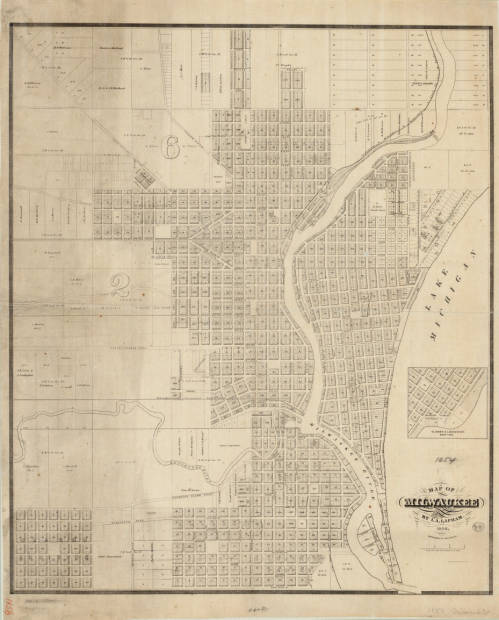
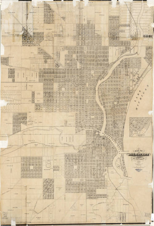
The three maps shown above, created by I.A. Lapham spanning from 1836 to 1869, illustrate Milwaukee’s growth over thirty-three years. Together, they create a picture of the city’s founding and continued development. The first map depicts the Milwaukee land district before the city was officially founded. The two later maps were recorded after Juneautown, Kilbourntown, and Walker’s Point were combined and incorporated as the City of Milwaukee. There was substantial development between 1856 and 1869, which is made even more obvious by comparing the two maps side-by-side.
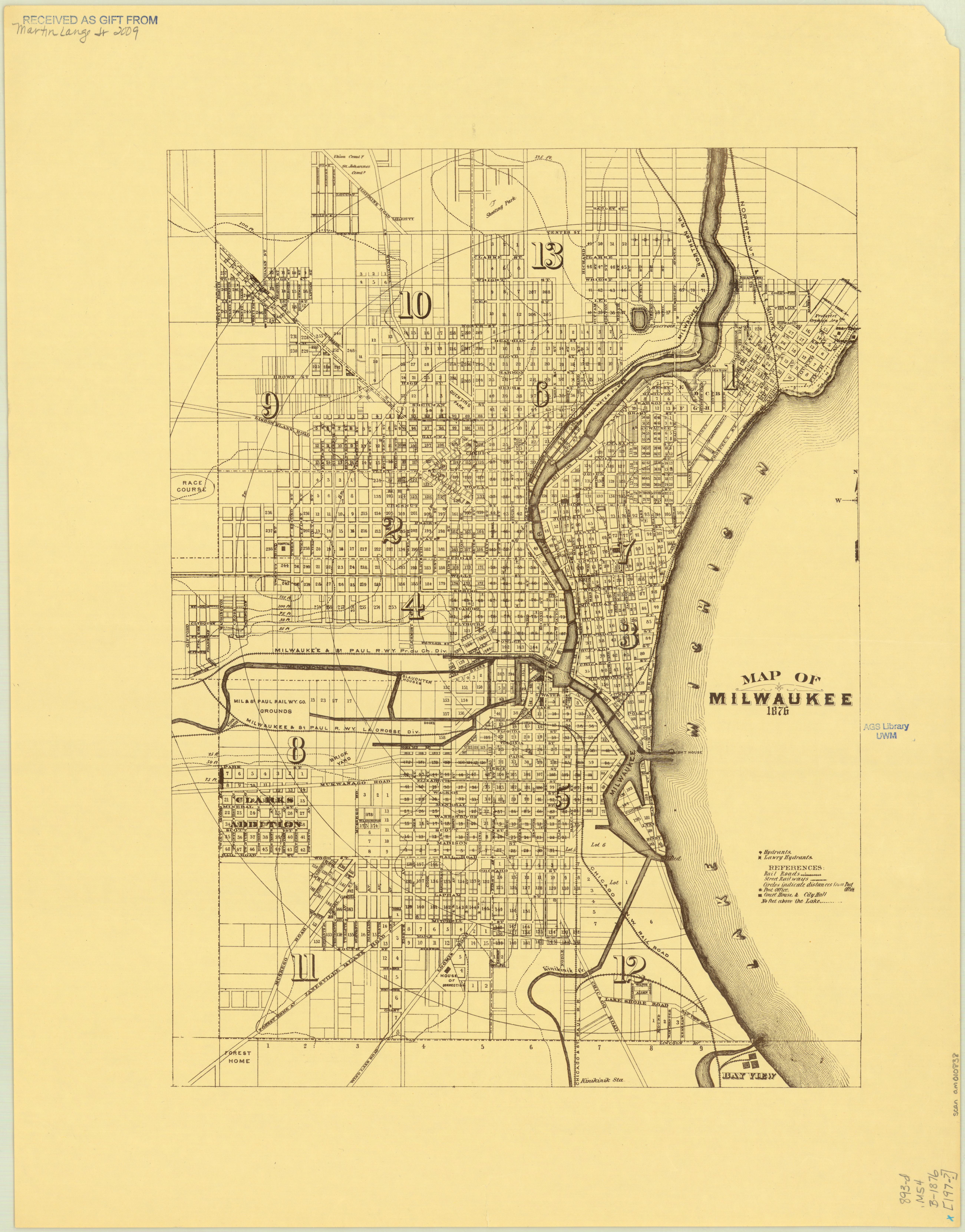
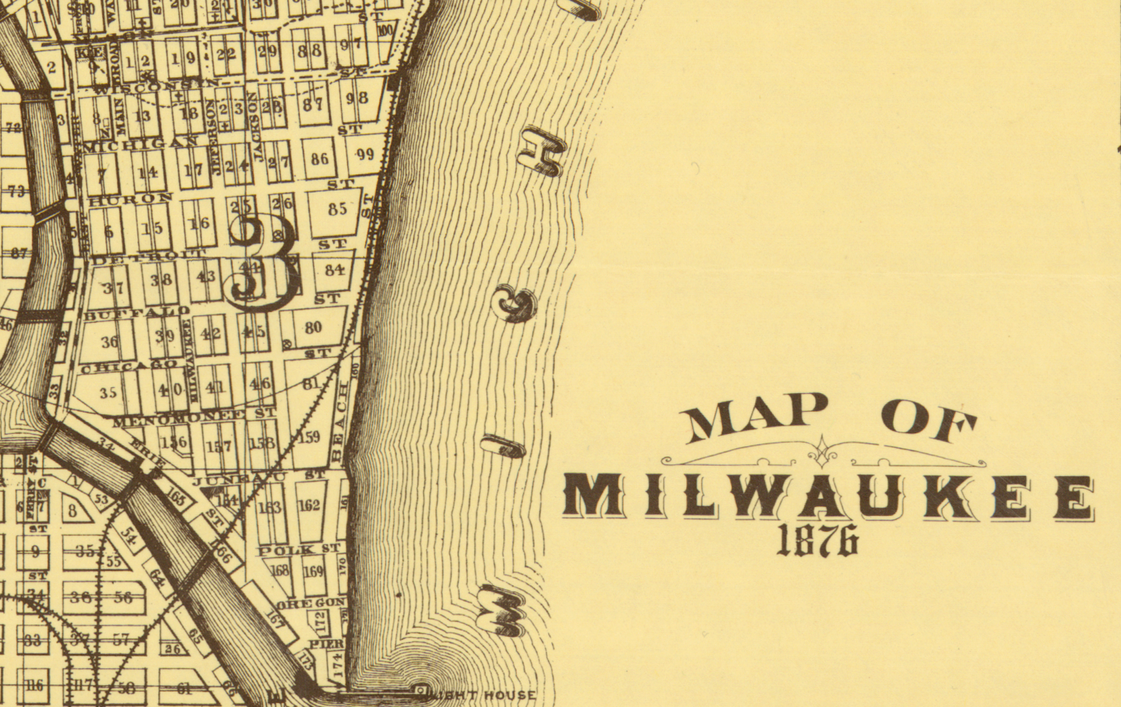
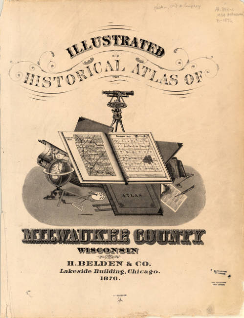
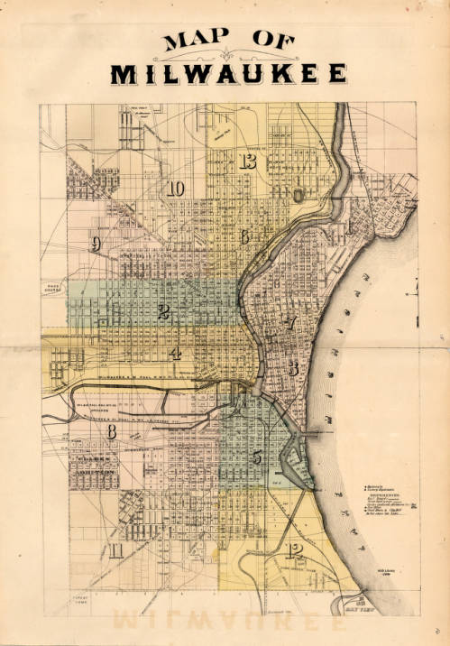
The 1876 map of Milwaukee by H. Belden and Co. presents an even more developed Milwaukee than the previous Lapham maps. The map was originally drawn up in 1876 and included in the Atlas of the State of Wisconsin in 1876, but was reprinted in 1881 as a part of the expanded Illustrated Historical Atlas of Milwaukee County Wisconsin. The first version of the map shown was donated to the AGSL by Martin Lange Jr. in 2009.
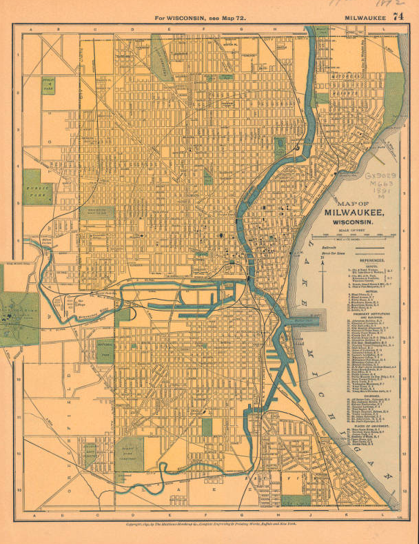
This 1891 map of Milwaukee, Wisconsin published by the Matthews-Northrup Company just one year before fire in the Third Ward gives us one last look at the city before the fire. The Third Ward was growing with the rest of the city, but sudden catastrophes will always change a place.
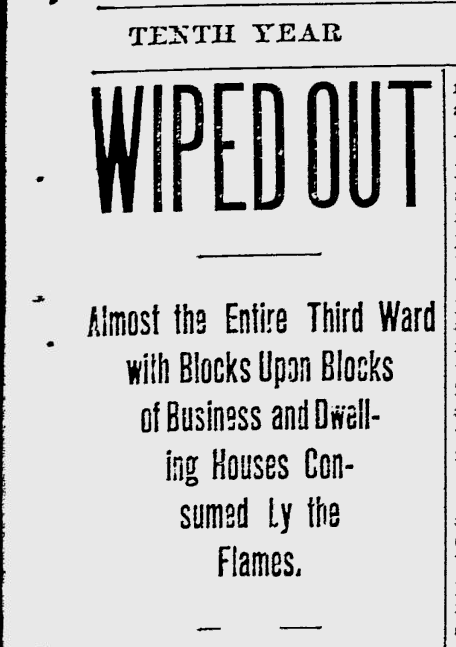
At 5:12, 5:20, and 5:40 p.m., October 28th, 1892, fire alarms rang out across Bradford and Bartlett, Greenfield Avenue, and Eleventh Avenue. Then, at 5:43, the fire alarm at East Water Street was sounded, signaling to firefighters that the Union Oil Company warehouse building was burning. The smaller fires throughout the neighborhood prevented responders from reaching the Union Oil building for fifteen minutes, by which point the fire had already become an inferno. The oil in the warehouse provided plenty of fuel, which burned brilliantly into the evening. The crisp Autumn wind carried the embers from the Union Oil Company warehouse fire to other buildings throughout the Third Ward, including a distillery, a soap factory, and countless homes.
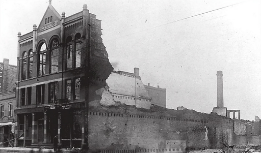
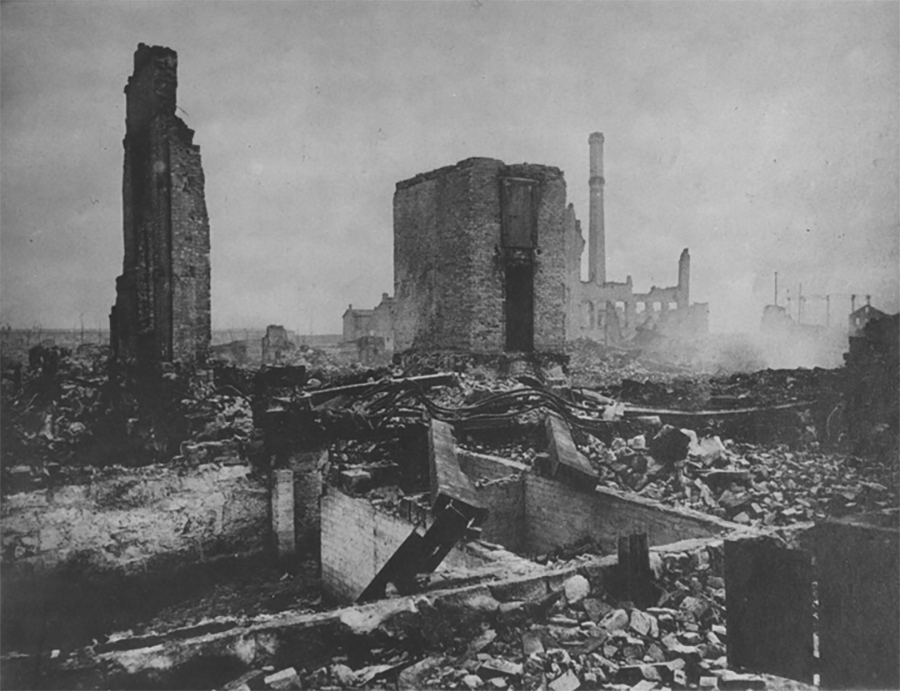
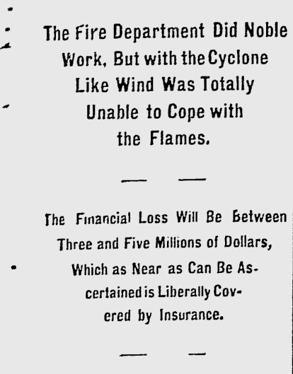
By midnight, the fire had burned through 16 city blocks, destroyed 440 buildings, killed five,injured dozens, and displaced hundreds of families. The Milwaukee Journal estimated that the total property loss was equivalent to somewhere between three and five million dollars– something more like 60 million today. Relief committees sprang up to shelter and feed victims of the fire who had lost their homes; some even endeavored to employ those whose workplaces had been destroyed overnight. The damage was so extensive that many residents were unable to rebuild. Only a small percentage of homeowners had fire insurance, and the pressure to add expensive fire-proof brick shells to their homes while rebuilding prevented many from returning. The Ward’s population shrank as residents were forced to move to other parts of the city in search of housing and work.
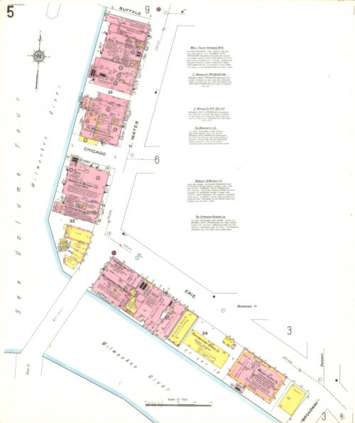
Vol. 1 Sheet 005 1910 Sanborn Map of Milwaukee depicting East Water Street 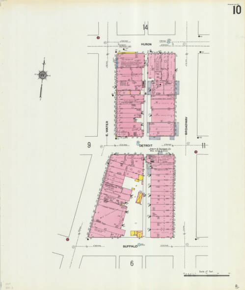
Vol. 1 Sheet 010 depicting East Water Street
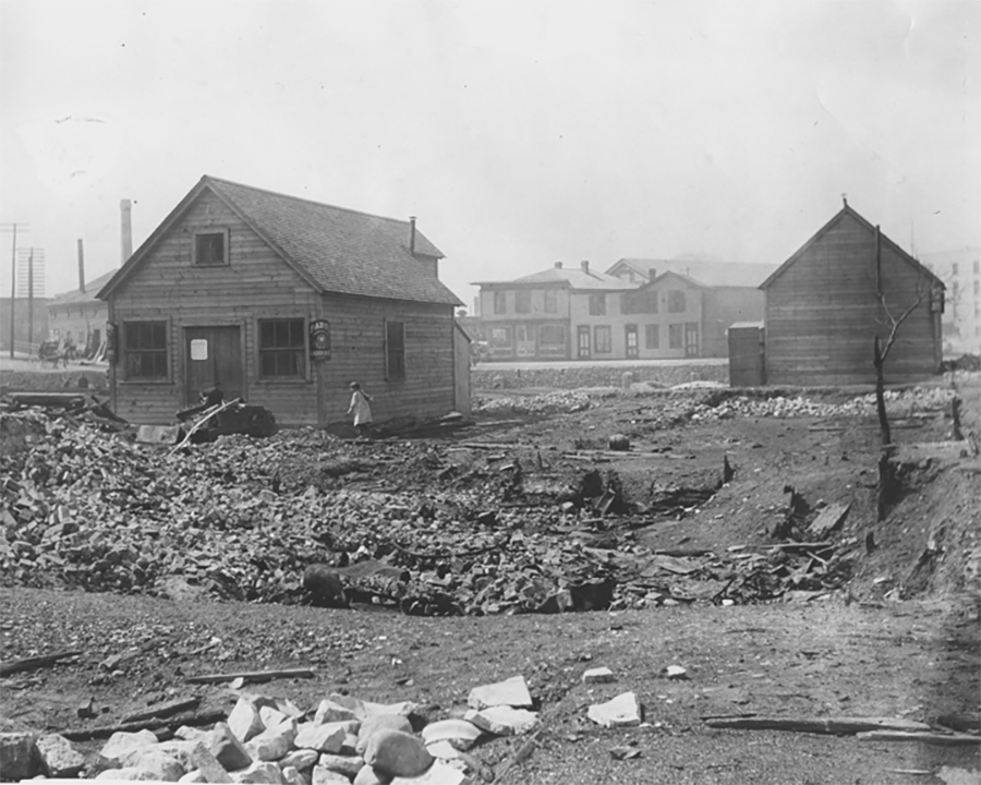
This catastrophic fire transformed the Third Ward and Milwaukee as a whole. Efforts to rebuild began immediately, and over the next 30 years the Third Ward slowly became a busy commerce district again. The two Sanborn map sheets shown depict East Water St., where the Union Oil Company fire began. The neighborhood continued to change over the years until it eventually became the Historic Third Ward as we know it today.
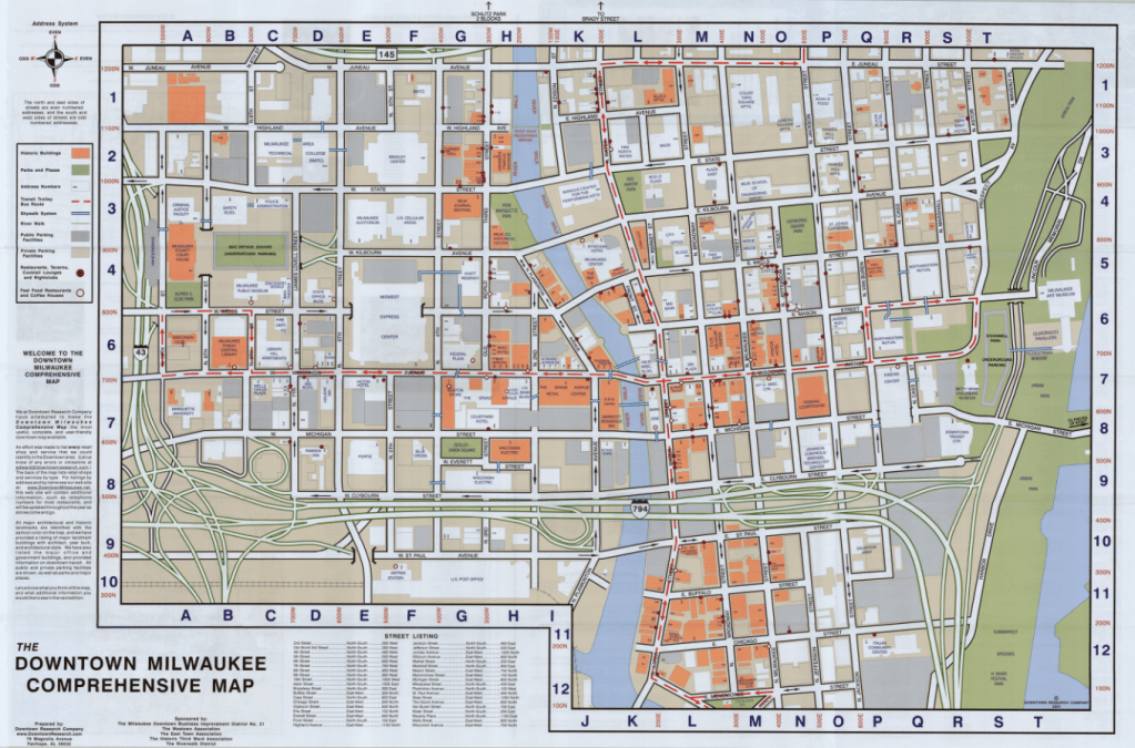
The Comprehensive Map of Downtown Milwaukee 2001 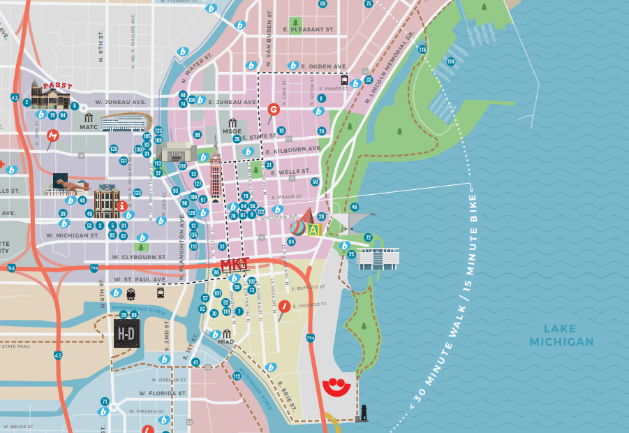
Section of the Official 2019 Milwaukee Visitors Map from Visit Milwaukee
The Historic Third Ward Association marks the Third Ward as the “site of Milwaukee’s most devastating fire and its most remarkable rebuilding efforts.” Today, the historic neighborhood is host to over 500 businesses, 20 galleries and art studios, and 1,200 residential units. It’s home to Summerfest, the Public Market, the Broadway Theatre Center, and so much more; it is, as the Association puts it, a neighborhood in renaissance. The Sanborn maps, and the many other maps of Milwaukee before and after the fire, remind us how much Milwaukee has grown, built, and rebuilt over its history, and how much we are still growing.

July 2, 2019 at 9:21 pm
Excellent article.