geographic education
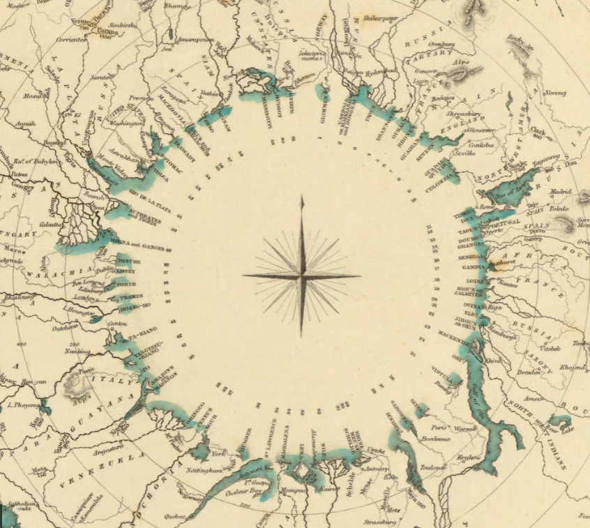
Comparative river chart by the Society for the Diffusion of Useful Knowledge
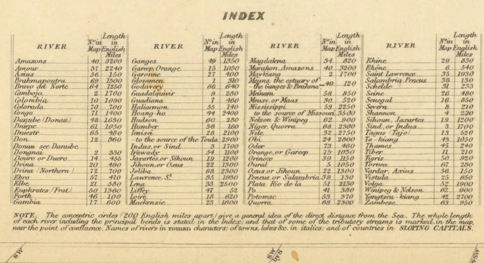
This chart shows the general lengths of 92 of the great rivers of the world.
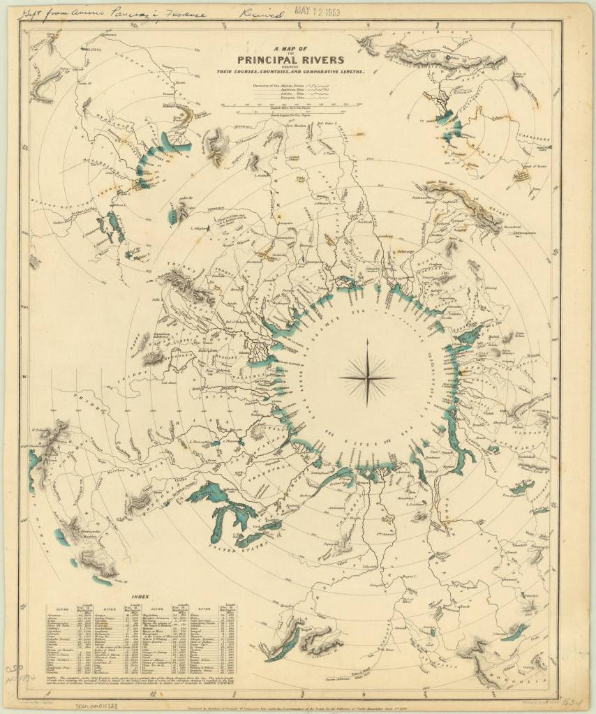
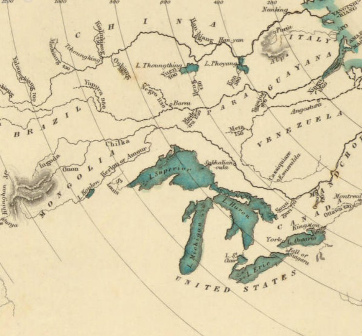
A map of the principal rivers shewing their courses, countries, and comparative lengths / published by Baldwin & Cradock, under the superintendence of the Society for the Diffusion of Useful Knowledge ; engraved by Thos. Starling, 1834. https://collections.lib.uwm.edu/…/agdm/id/5294/rec/1
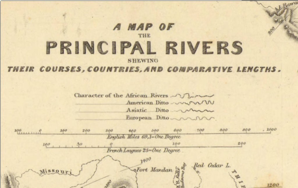
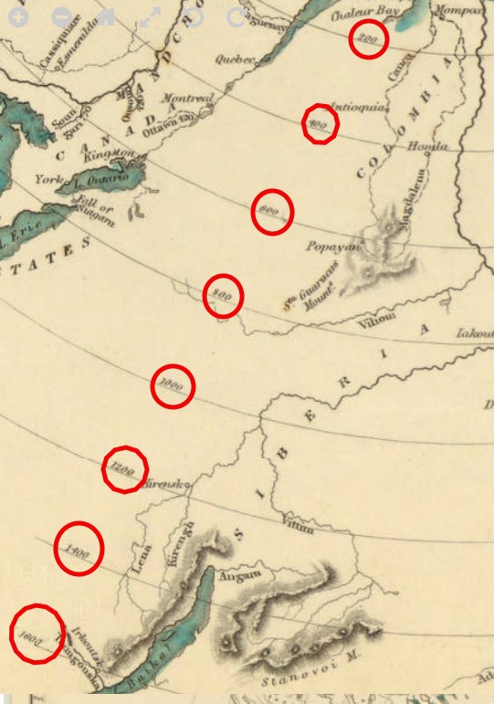
Concentric circles depict approximate distances, with exact lengths given in the index in the lower left.
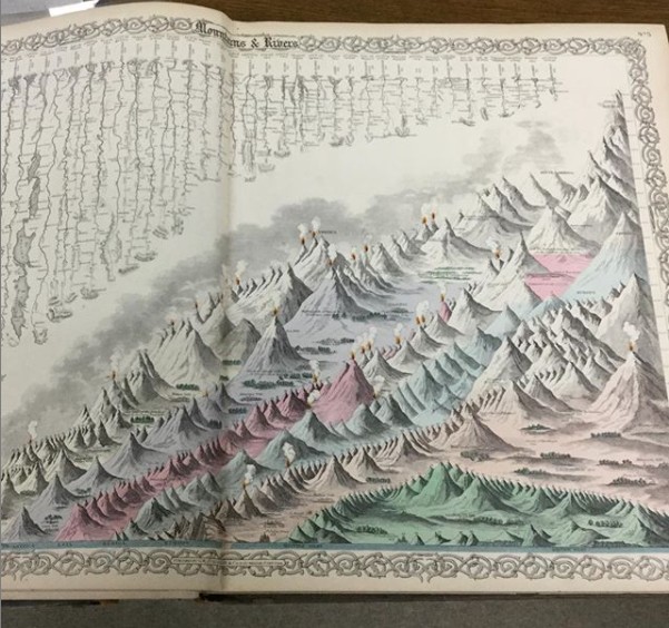
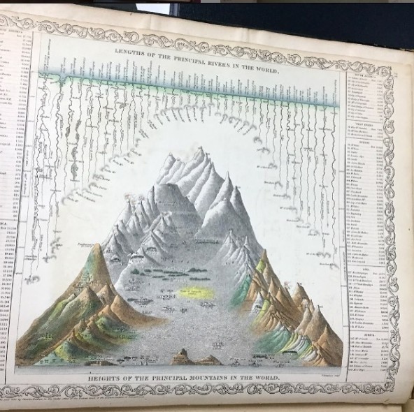
Shading and hachures are used to shows selected mountains and volcanoes. There are actually 3 diagrams within this chart – 2 smaller diagrams are hidden in the top 2 corners.
A lovely compass rose graces the center of the chart.
The Society for the Diffusion of Useful Knowledge (SDUK) was a London-based organization dedicated to the dissemination of self-education materials for individuals without access to formal education. SDUK was founded in 1826 at the urging of Lord Brougham, who became Lord High Chancellor of Great Britain. The Society also published the Library of Useful Knowledge, which was a series of accessible scientific books published biweekly. The SDUK aimed to provide working-class people with access to knowledge at an affordable price.
The style of comparative chart shown here never became popular in geographic education. Instead, charts showing comparative mountains and rivers were used in geography texts.
A wonderful book was published in 2019 on just this topic.
An atlas of geographical wonders : from mountaintops to riverbeds : a selection of comparative maps and tableaux / Jean-Christophe Bailly, Jean-Marc Besse, Philippe Grand, Gilles Palsky. New York : Princeton Architectural Press, 2019.
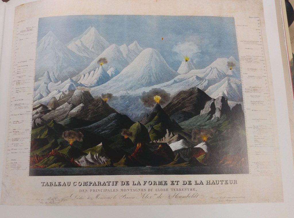
This is the first book to catalog comparative maps and tableaux that visualize the heights and lengths of the world’s mountains and rivers. Produced predominantly in the nineteenth century, these beautifully rendered maps emerged out of the tide of exploration and scientific developments in measuring techniques. Beginning with the work of explorer Alexander von Humboldt, these historic drawings reveal a world of artistic and imaginative difference. Many of them give way—and with visible joy—to the power of fantasy in a mesmerizing array of realistic and imaginary forms.
