Utopia
1927 Chicago Tribune Map of Chicagoland
by Judy Aulik

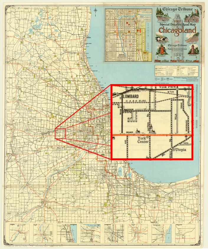
The Milwaukee Journal was not the only Midwestern newspaper giant to publish road maps. But unlike the Journal, the Chicago Tribune still has maps produced in its behalf, albeit by Rand McNally. The folding style of Chicagoland map was a mainstay of Illinois drivers for many years. It developed some delightful idiosyncrasies, such as the locations of radio broadcast transmitter towers, but at this early date, the “Trib map,” as called by residents, only showed some colleges, religious institutions, cemeteries, parks, and golf courses as landmarks and destinations. In addition, on this 1927 edition, US highways were designated by the route number in a red circle, instead of the shields used by the Rand McNally portion.
What is noticeable is the number of communities which have ceased to exist. Northeastern Illinois is notable for the number of communities denoted by the railroad stations on the major lines, spaced at fairly regular intervals. For example, on the C.B.&Q. (now the BNSF, or Burlington Northern & Santa Fe) were communities such as Belmont, now part of Downers Grove; Eola, now part of Aurora; and Lovedale, no longer extant.
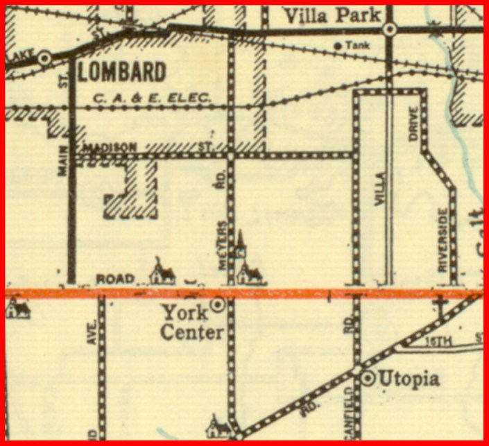
Communities located on highways were not immune. On Roosevelt Road, once US 30A and today IL 38, was York Center, still denoted by churches but incorporated into Lombard. On Butterfield Road, parts of which have become IL 56, was Utopia, which is today’s Oakbrook Terrace, famous for its vast stretches of shopping malls.
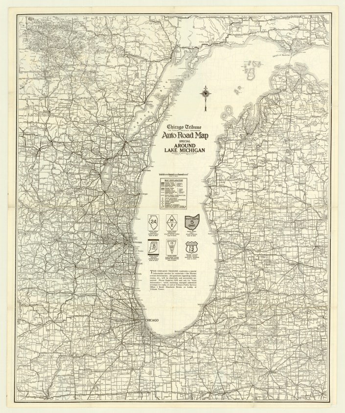
Interestingly, the reverse, a map of the states contiguous with Lake Michigan, shows us that the Tribune‘s relationship with the Chicago map giant dates back to the earliest map of the series. “Rand McNally” above “Auto Road Map” is replaced by “Chicago Tribune: The World’s Greatest Newspaper,” but with the characteristic compass rose, cartography, and copyright statement, no one would be fooled. In addition, I have a 1927 Illinois map, issued by the Tribune, but published by Rand McNally.
From a collector’s standpoint, the Chicagoland maps are common, but very difficult to find in acceptable condition. The vast majority are misfolded, heavily worn, and many are taped together, proof of the maps’ popularity. Probably due to the growth of the region–the Tribune maps did not show land beyond the Fox River–the Chicagoland map ceased publication sometime in the 1990s, with one last 2000 map. Even today, I carry a Tribune/Rand McNally 7-county street guide in my car when traveling, despite GPS. It lacks the charm of the old maps, but still gets the job done–until the next round of highway construction.

View the map in the AGS Library Digital Map Collection here
