before 1800
The Island of California
By Lauren Maddox
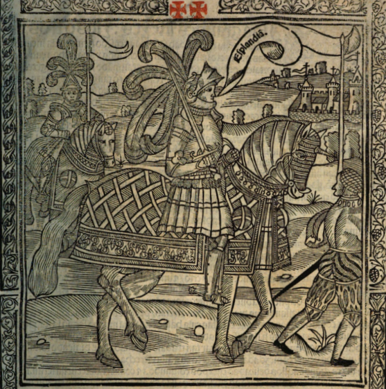
Illustration from La sergas de Esplandián
“Know that, on the right hand of the Indies, there is an island called California, very near to the Terrestrial Paradise;” this description, found in Chapter 157 of Las sergas de Esplandián, names a California at least sixteen years before Cortez spotted the coast of the land he would name California. The Spanish romance, which was a sequel to Garci Rodríguez de Montalvo’s better-known and better-received Amadis de Gaula, was largely forgotten despite being the first mention of a place named California. Esplandián was considered an inferior sequel and faded into insignificance; it’s greatest claim to fame is its brief appearance in Don Quixote’s library in Cervantes’s comical romance. And even that reference was unflattering. The curate chose to burn Esplandián instead of Amadis de Gaula because, he said, we should not “spare the son for the virtues of the father.”
So, Las sergas de Esplandián was a failed romance that was quickly forgotten. But, as the first recorded use of California, it stands to reason that this forgettable Spanish romance could have inspired Cortez when he encountered the lowest tip of the Baja California Peninsula, 775 miles from where the peninsula joins the mainland. As far as Coretz could tell from his ship, he had found an island on the right hand of the Indies, very near to the Terrestrial Paradise.
The misconception that California was an island would persist throughout the 16th century, and resurface with new, incorrect maps released in the 17th and 18th century. In 1539, Cortez’s navigator Francisco de Ullou ventured northward into California and discovered it was a peninsula, debunking the theory that California was an island just six years after the first sighting of the peninsula. Somehow, the legend persisted despite fairly correct representations of the peninsula being published as early as 1569.
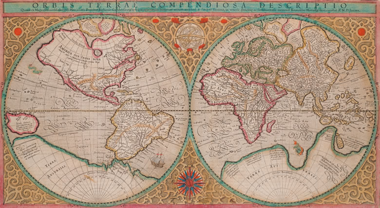
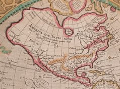
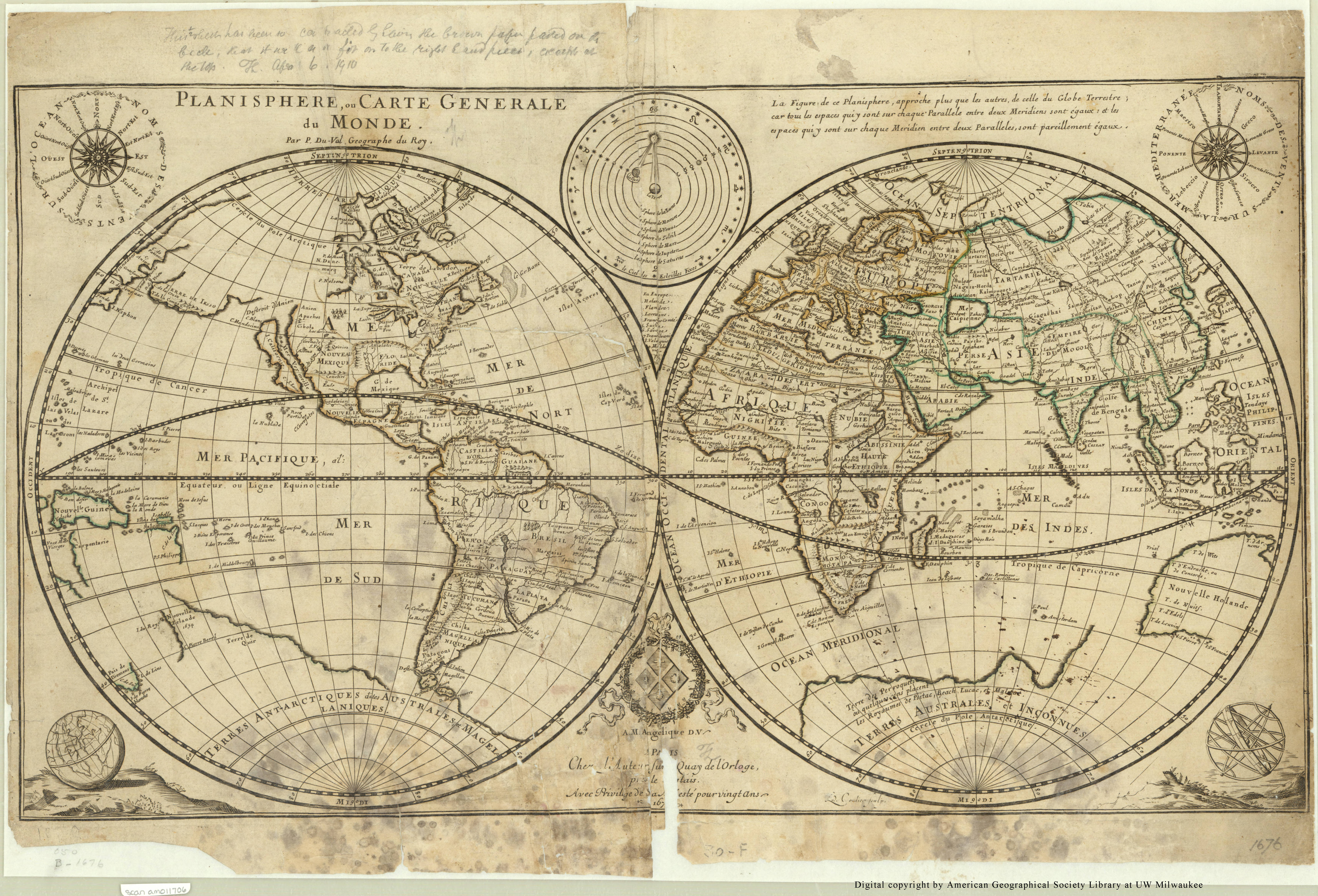
Mercator’s 1569 edition of Orbis terrae compendiosa descriptio from Envisioning the World: The First Printed Maps 1472-1700 Click the link to see this map in our Digital Collections
America in the Mercator Map
Many cartographers incorporated Ullou’s discovery of the peninsula into their maps, including this 1569 world map by Gerard Mercator. If you look closely at America, you can see the Baja California Peninsula clearly and correctly attached to the mainland. This representation wouldn’t stick–the Baja California Peninsula would be confused for an island again after Juan de Fuca’s voyage at the turn of the century. In 1592, de Fuca claimed to have found a strait he thought could be the Northwest Passage with a large island at its mouth. Only one account of this discovery survived, and the location of de Fuca’s strait was confused with California, reviving the representation of California as an Island.
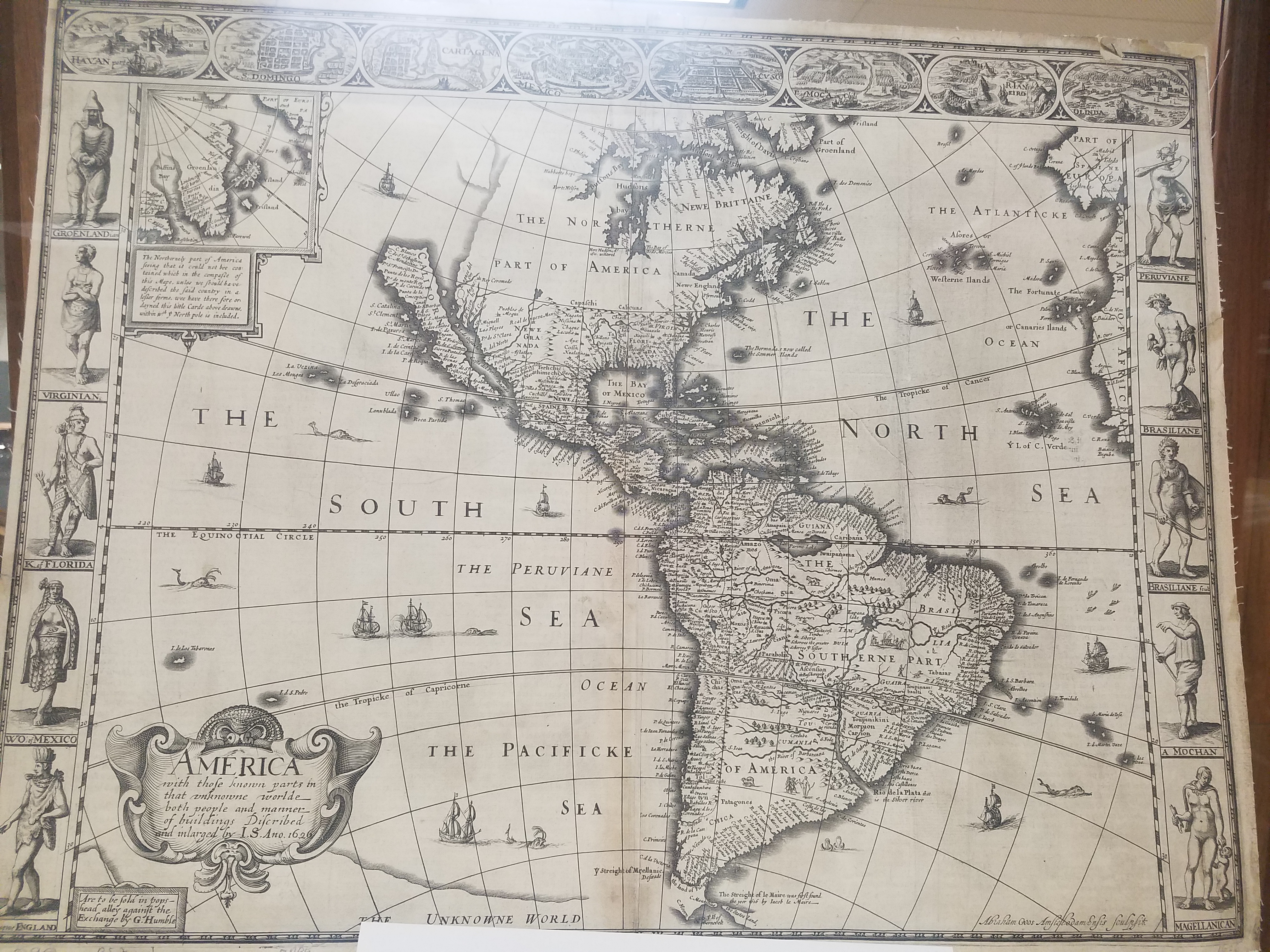
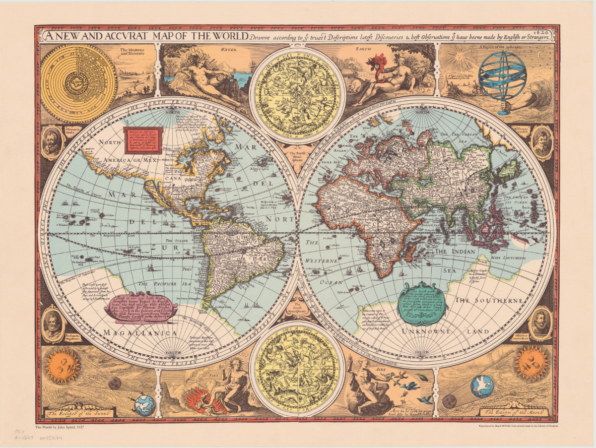
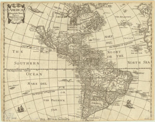
An overland expedition in 1602-1604 should have disproved de Fuca’s claim to have found a Northwest Passage, or at least cleared up any confusion about whether the Baja California Peninsula was the island he had claimed to see at the mouth of the strait. Despite Juan de Onate’s reports, the northern terminus of the Gulf of California was left vague on maps by the Spanish so that Cortez’s claim to the territory in 1533 could invalidate Drake’s later claim in 1579. Several maps released after Mercator’s map and de Onate’s reports show the peninsula detached from the mainland. One of the first atlas maps to depict California as an island was English mapmaker and historian John Speed’s America with those Known Parts in that Unknowne World both People and Manner of Building from 1626 or 27. This representation of America, seen again his A new and accurat map of the world reproduced by Randy McNally in 1966, also includes a fairly accurate mapping of the United States’ East Coast.
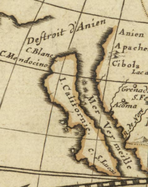
William Trevethen’s 1666 Americ descriptio nova depicts the Island of California once again. The Trevethen map also places Sir Francis Drake’s Nova Albion on the island; Nova Albion was actually a part of continental Mexico, and the English claim to Nova Albion was their foothold into claiming further continental territory, which is why the Spanish worked so hard to invalidate that claim. Nova Albion is now Point Reyes, which is just Northwest of the San Francisco area. The region North of the Island of California is marked “terra incognita” with a sea monster lurking in the waters to indicate the unknown and unexplored continent.
Click the link to see the Americ descriptio nova 1666, published in 1670 edition of Peter Heylyn’s Cosmography in our Digital Collections
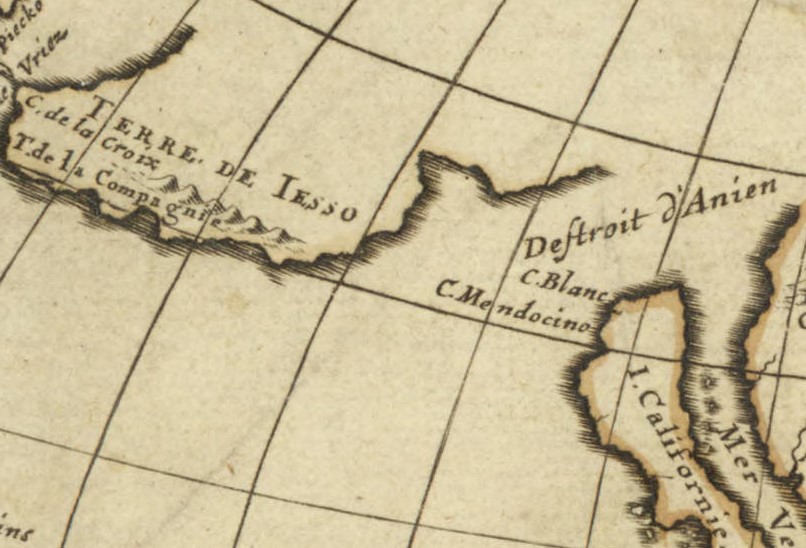
A 1677 world map in the AGSL collection by Pierre Duval includes the Island of California at the mouth of an approximately placed strait. This map also includes a vague coast line marked “terre de Iaso” just Northwest of California. The “terre de Iaso” was thought to be a region where Japan connected to North America.
L’America Settentrionale, another 1677 map by Guillaume Sanson, leaves the unexplored areas of North America blank to indicate the unknown, but clearly includes the island of California. Remarkably, the French maps do not include Nova Albion.
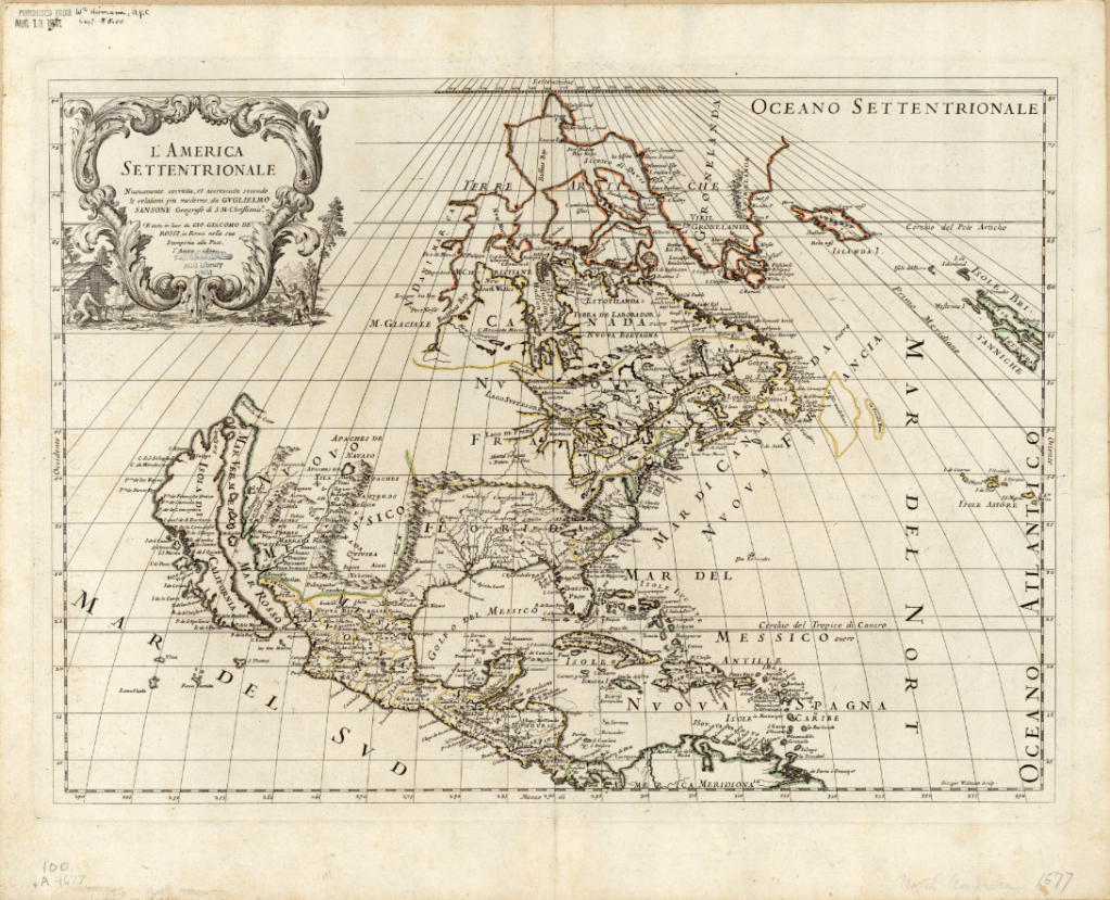
Click the link to see Guillaume Sanson’s 1677 Map of America in our Digital Collections
At the end of the 16th century, Dutch cartographers Gerard and Leonard Valck produced another map depicting California as an island. The Valck map, like the 1677 Duval map, includes a reference to an area connecting North America and Asia. On the Valck map, it is referred to as the “Terra Esonis.” The Valcks only include the vague coastline of the fabled connection, leaving a blank space– perhaps to leave room for future discoveries. The map includes detailed records of place names and waterways, as well as an illustrated cartouche depicting a pair of “Americans” surrounded by bountiful crops and exotic animals.
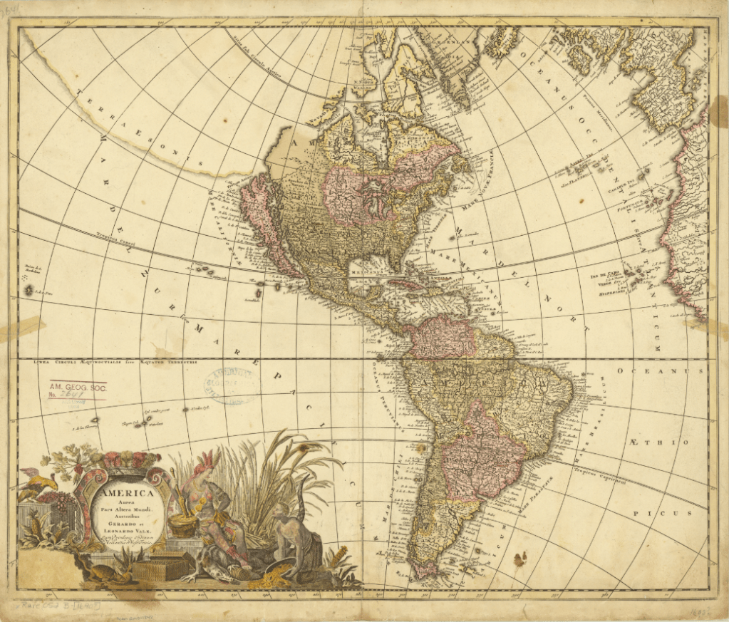
Click the link to see the Valcks’ 1690 Map of America in our Digital Collections
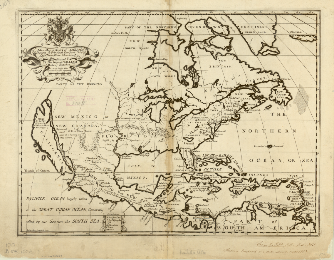
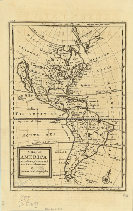
This map was produced just eight years before Eusebio Francisco Kino’s series of overland expeditions, which would finally confirm that the Baja California Peninsula was indeed a peninsula. Kino, a Jesuit missionary and cartographer, believed that California was an island until he began to explore deeper into the continent. He initially intended to establish a route between Jesuit missions in Sonoran and Baja California on his expeditions from 1698-1706, but also reported and confirmed the land connection and reestablished the existence of the Baja California Peninsula. The Jesuit order generally accepted his claims, but Europeans were slow to incorporate the peninsula into their own maps because of conflicting reports from Juan Mateo Manje, who joined Kino on several expeditions. Maps created into the 18th century by Europeans still recorded the Island of California’s existence; these two English maps were created just a few years after Kino’s final confirmation of the peninsula’s land connection. The first map, Michael Burgher’s 1714 A New Map of North America, depicts the topography of the area, as well as records of new discoveries, settlements, and claimed and unclaimed territory. The 1717 Map of America by Herman Moll has a similar focus, but includes South America.
The latest map in the AGSL collection depicting California as an island is Matthaeus Seutter’s 1740 map. The hand-colored map is filled with notes and ship routes, as well as two detailed cartouches depicting local peoples and their conversion to Christianity. Seutter’s map also references an Ocean of California surrounding the island and several sketches of aquatic plants.
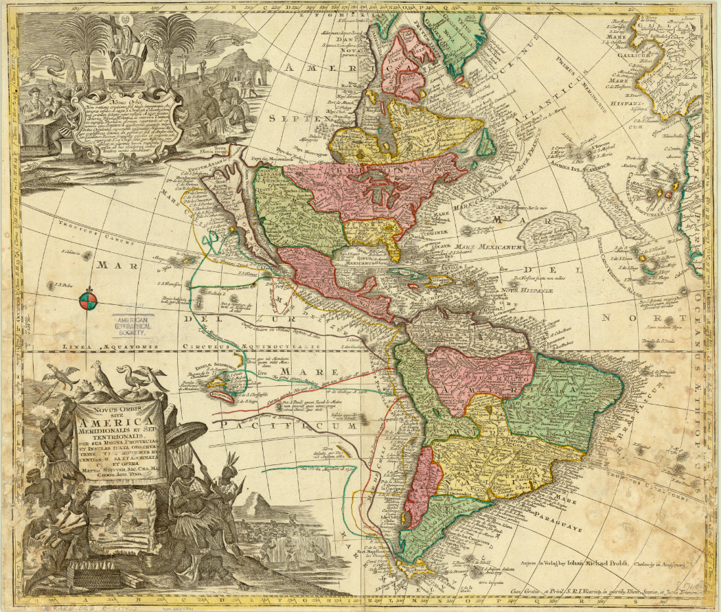
Click the link to see the 1740 Seutter Map in our Digital Collections
Montalvo’s lost romance tells stories of a bountiful and fertile island ruled by women adorned in gold and jewels, and the Queen Calafia who fell in love with a Spanish man and forfeited her power, treasures, and land to their king for the chance to marry him. In Las sergas de Esplandián, the island of California is full of potential coveted by conquering Europeans. In many ways, this fiction became reality– California became an island, first by misconception, and then deception as the Spanish maneuvered to maintain their claim on the land and prevent English settlement. And in our collections, we have 200 years of maps recording one of cartography’s longest-lived errors.
