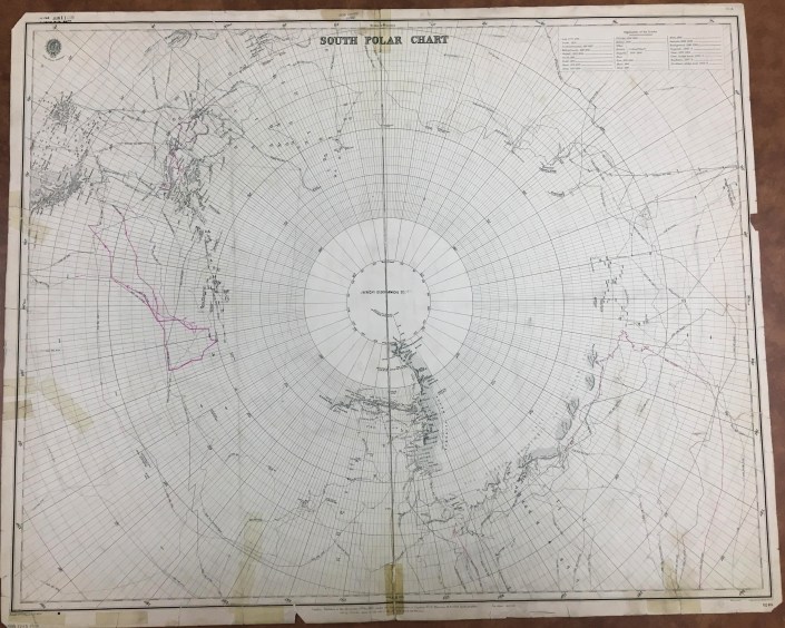
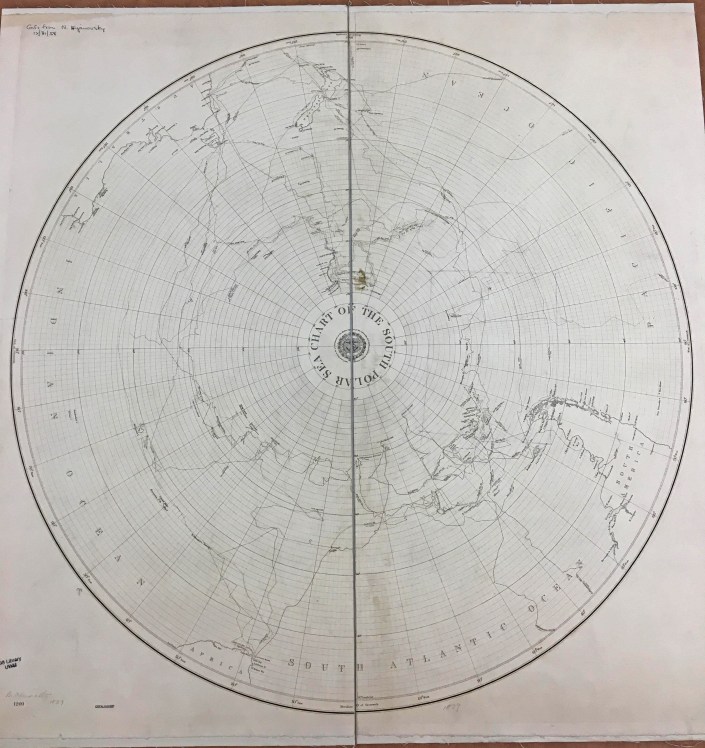
British Admiralty Charts
Polar Exploration and the Hollow Earth
by Sam Balistreri-Daum
As I continued to catalog the British Admiralty charts this fall I was impressed by the way the AGS Library Nautical Chart collection in many ways shows the progress of exploration, especially in those last frontiers of the planet Earth, the Arctic and Antarctic Polar Regions. In today’s age of Google Maps and satellite imagery it becomes hard for us to imagine a time when every corner of the Earth was not known or explored. It still isn’t! Just think of the deepest parts of the oceans. So I decided I needed to learn more about what it was like in a time when polar exploration was at its most fervent if not urgent and theories, however crazy, were numerous as to what could be discovered at the poles.
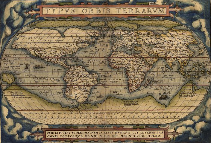
John Blake, in The Sea Chart: The Illustrated History of Nautical Maps and Navigational Charts (2016) gives a concise summary of the attempts to explore and reasons for the exploration of both poles. Exploration of the northern Polar Regions has a longer history than that of the South Polar Region, which is due to the “discovery” of America and the obsession of European explorers to find a Northwest Passage to Asia and India. Although a Northwest Passage does technically exist (during certain seasons), it is not a viable and profitable trade route. Interestingly, much of the exploration of both Arctic and Antarctic regions was made possible by an increased availability of British Naval vessels in the period following the Napoleonic Wars. Many of the names of ships and personnel responsible for these voyages such as William Parry, Commodore John Ross, Captains George Lyon and Frederick Beechey and His Majesty’s Ships Victory, Investigator and Enterprise to name a few can be found on the British Admiralty charts in the AGS Library collection. The Antarctic region around the South Pole, though explored much later, inspired much anticipation and excitement among explorers and colonizers as many European nations had far-flung colonial empires. Many early world maps and atlases, including Ortelius’ Theatrum Orbis Terrarum (1570) depicted large continents at the poles, especially the massive “Terra Incognita Australis” in the South Polar Region. There was even speculation that this large southern continent would have a temperate climate and would be populated with indigenous plants, animals and people. Imagine that! Realistic attempts at coastal exploration of what is today Antarctica did not occur until the Mid-19th Century and was often a byproduct of whaling and seal hunting expeditions.
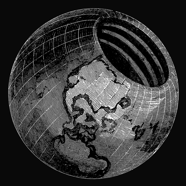
Remember how I said there were many theories about unexplored regions of Earth “however crazy”? Enter John Cleves Symmes (1780-1829), a military captain and veteran of the War of 1812. A timely listen to an episode of American history / comedy podcast The Dollop introduced me to Symmes and his theory. Symmes even spoke to the AGS in New York about his theory! Here at the AGSL we actually have a copy of The Symmes Theory of Concentric Spheres: Demonstrating That the Earth is Hollow, Habitable Within, and Widely Open about the Poles (1878) compiled by Symmes’ son Americus Symmes. They sure didn’t skimp on the title. The theory posits that the Earth is “globular, hollow, and open at the poles”, with a northern opening 2,000 miles in diameter and a southern opening that is “somewhat larger” (because why not, right?). The elder Symmes took his theory on the road, beginning in 1818 with an open letter calling for the exploration of the Arctic Polar Region to look for an opening, touring and lecturing until his death in 1829. Much like the speculation that a southern continent would have a temperate climate and be teeming with plant and animal life, the supposed hollow interior of the Earth according to Symmes would have a moderate climate and an abundance of flora and fauna. To Symmes and those convinced of his theory, the hollow Earth and its openings explained several phenomena including climate variation among various regions occupying the same latitude (for example temperate Europe vs. cold U.S. and Canada in winter), the Auroras (Borealis and Australis) and the counterintuitive migration patterns of various fish, bird and mammal species and groups of people. Want proof? Symmes claimed that looking at the example of Saturn’s Rings (discovered in 1610) proves that concentricity can exist. He also advanced the notion that not only Earth, but the rest of the planets in the solar system were probably hollow too. Including the sun! Needless to say Hollow Earth Theory doesn’t have much traction these days, except on the fringe where theories such as flat earth and the hollow moon (Aliens stole our moon and replaced it with a hollow one to spy on us?! Makes sense…) among others are alive and well.


The AGS Library is home not only to maps like the nautical charts that I have been working on cataloging during my time here, but a multitude of books, atlases and print materials that can be just as surprising as discovering the Earth is hollow.
Sources:
Blake, John. The Sea Chart: The Illustrated History of Nautical Maps and Navigational Charts. Conway/Bloomsbury, 2016.
Symmes, John Cleves. The Symmes Theory of Concentric Spheres: Demonstrating that the Earth is Hollow, Habitable Within, and Widely Open about the Poles/ compiled by Americus Symmes from the writings of his father, Capt. John Cleves Symmes. Bradley & Gilbert, 1878.
“Hollow Earth.” The Dollop from SoundCloud, 14 May 2015, https://soundcloud.com/the-dollop/80-the-hollow-earth
