cherubs
Planiglobii terrestris world map from 1716
by Angie Cope
Planiglobii terrestris cum utroq hemisphaerio caelesti generalis repraesentatio : quam ex novissimis probatissimisque recentium geographorum scriptis concinnatam, multisq[ue] phaenomenis illustratam / publice proponit Io. Bapt. Homann …
1716
Call number: Rare 050 A-[1716]
https://collections.lib.uwm.edu/digital/collection/agdm/id/1156
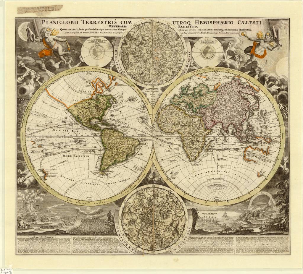
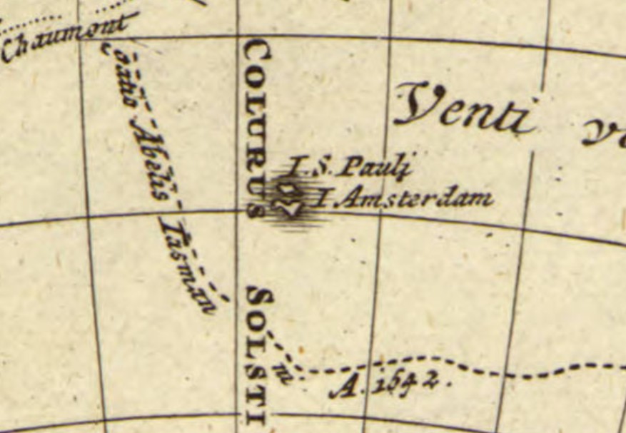
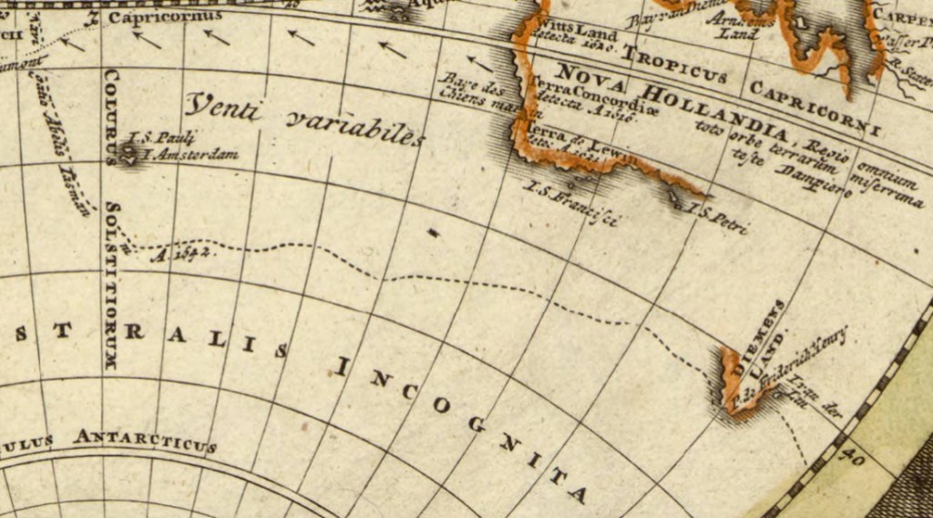
Here is a 1716 map by Johann Baptist Homann from a period in history when geographic knowledge was often unknown. The Australia, New Guinea and New Zealand coastlines are all incomplete, though they include some place names, notes of the early discoverers and tracks of Magellan’s (1522) and Tasman’s (1642) voyages.
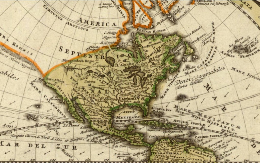
Cartographic inaccuracies can be seen on this map such as the east-west trend of the northwest coast of North America, the distorted treatment of Japan, and the absence of an Antarctic continent. However, California does appear as a peninsula.
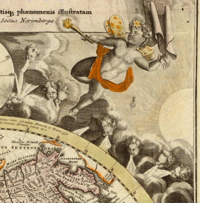
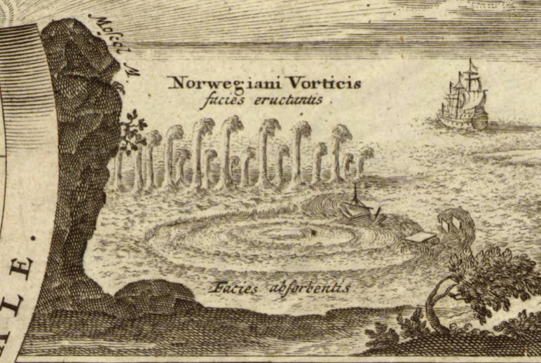
In spite of the inaccuracies, the map is appealing through the detailed use of decorative vignettes: two celestial hemispheres, an eruption of Mt. Etna, an earthquake, the tides, a whirlpool off the Norwegian coast, and diagrams explaining the seasons add interest. Numerous cherubs and windheads, representations of the stars, sun and moon and other decorative features also give the map added visual appeal.
Planiglobii Terrestris was produced by Johann Homann (1663-1724) and first appeared in his Neuer Atlas (1707). Homann was a leading figure in the scientific community of Nuremburg and the preeminent German cartographic publisher of his time.
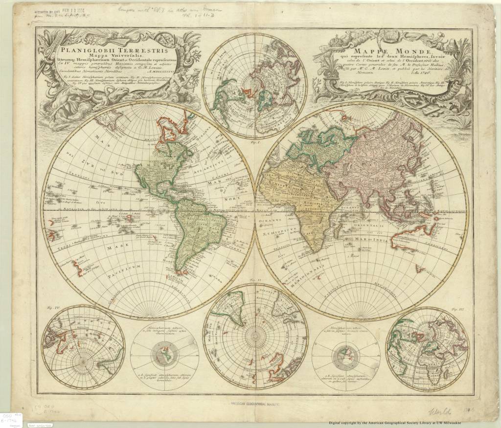
This map came to the AGS of NY in 1924 as a gift from Mr. F.W. Lafrentz who also donated a 1746 Planiglobii Terrestris.
https://collections.lib.uwm.edu/digital/collection/agdm/id/1215/rec/1