Czech Republic
Moravia 1741 by Georges-Louis le Rouge
by Angie Cope
Carte particulière de la Moravie Divisée en six Cercles avec les Principaux Postes de ce Marquisat / pour l’intelligence de la Guerre presente a Paris par et chez le Sr. Le Rouge Ingr. Geographe du Roy … 1741
This map was created a year after the unsuccessful invasion by Prussian forces under Frederick the Great in 1740. Moravia and Bohemia formed a powerful kingdom of the Holy Roman Empire from the 16th Century to the early 20th Century. After the First World War, Moravia was integrated into the new state of Czechoslovakia.
Symbols used for cities and topography; title detail ; detail of Olmutz (Olomouc)
This map is attributed to Georges-Louis le Rouge who was a Paris based map publisher. He was born in Hanover, Germany as Georg Ludwig where he was educated and employed as a military engineer, hydrographer and cartographer. This map of Moravia was made a year after Le Rouge moved to Paris and Francophied his name. He set up shop on the Rue Des Grands Augustins and produced thousands of maps and diagrams ranging from city and town plans, to atlases, plans of military campaigns and sea charts. He received the title “Geographe du Roi” to King Louis XV. Le Rouge also worked with Benjamin Franklin to produce the important 1769 Franklin/Folger Map of the Gulf Stream. Franklin, who met Le Rouge in Paris, writes that “He [Le Rouge] is, I believe, a proper person.” *
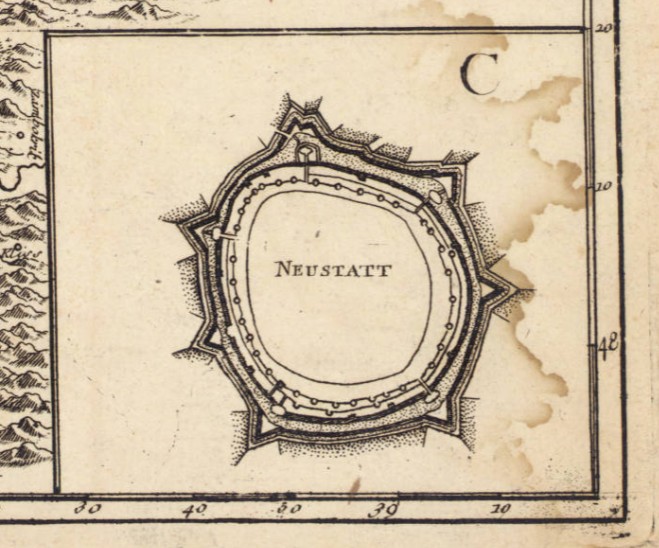
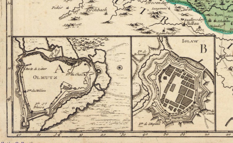
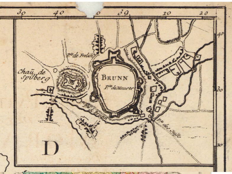
Includes 4 inset maps: A. Olmutz — B. Iglaw — C. Neustatt — D. Brunn.
The copy of the map held at the AGS Library is from the personal collection of Albert Gallatin (1761-1849) who served as the Secretary of the Treasury under both Presidents Thomas Jefferson and James Madison between 1801 and 1814. The maps were given to the American Geographical Society of New York in 1919 by Gallatin’s great grandson, Albert Eugene Gallatin (1882-1952) who served on the AGS Council in 1913. The maps, spanning the years 1700 to 1842, were originally bound as an atlas factice entitled “Atlas generale,” but have been disbound and conserved by the AGS Library at UW Milwaukee Libraries.
*Le Rouge Cohn, Ellen R., Benjamin Franklin, Georges-Louis Le Rouge and the Franklin/Folger Chart of the Gulf Stream, Imago Mundi, Vol. 52, (2000), pp. 124-142.
