polar projection
Planisphere physique by Philippe Buache, 1756
by Angie Cope
The AGS Library recently acquired a map of the world on a north polar projection. The map was made by French geographer Philippe Buache (1700-1770) who was one of the first to recognize the importance of watersheds. Buache trained under the geographer Guillaume Delisle and was married to Delisle’s daughter.
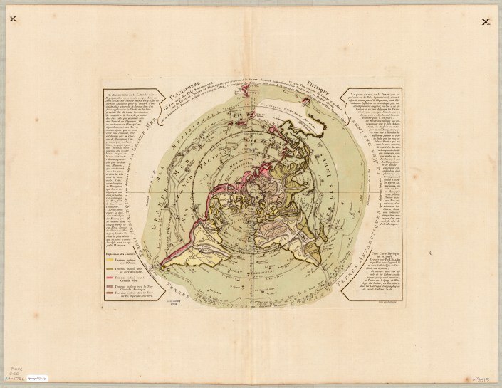
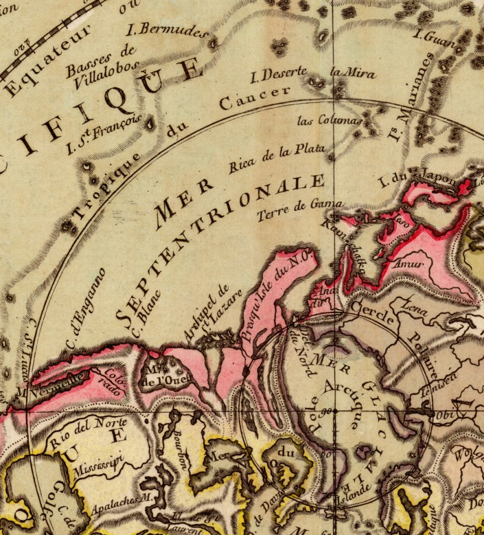
This map shows mountains and how each flows via rivers to the seas. Buache correctly identified the existence of Alaska and the Bering Strait, years before they were officially discovered.
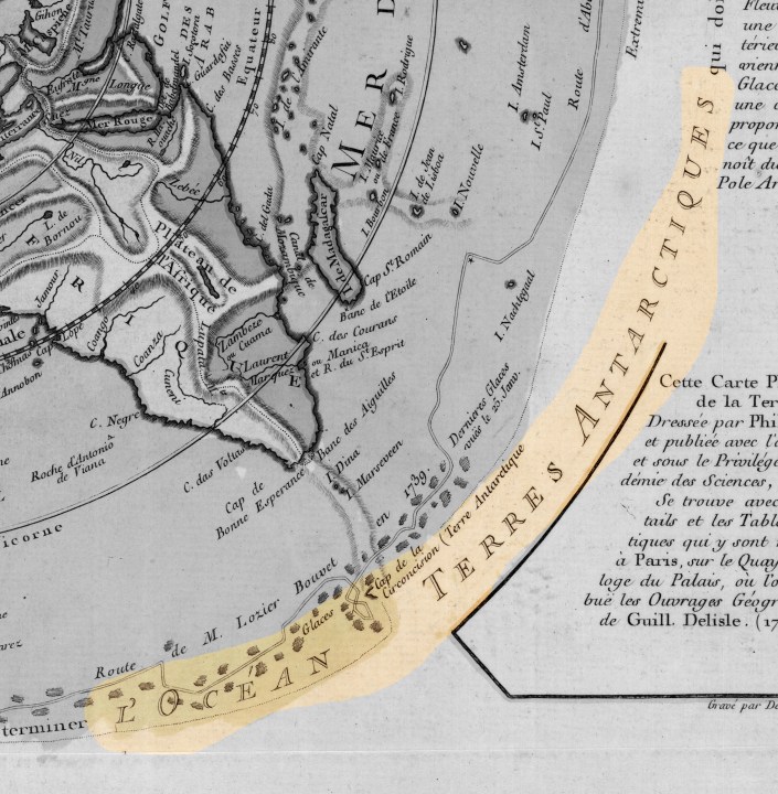
On the map he depicts an Antarctic Sea which turned out to be inaccurate.
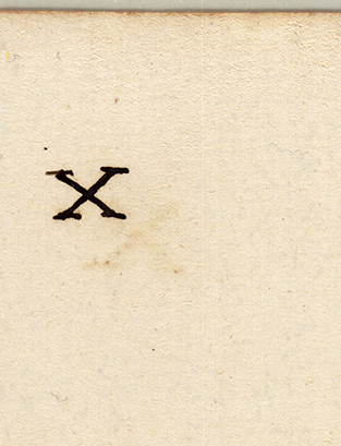
The AGS Library copy of this map is larger than other known copies at 56 x 74 cm in size (compared to 34 x 46 cm of other maps). The AGS Library map also has “Xs” in the top right and left corners on both the front and back of the map.
The text along the edges describes various expeditions and includes mention of Bouvet de Lozier’s 1738-1739 discovery of icebergs between 200-300 feet high and half a league to 2 or 3 leagues in circumference.
The AGSL copy of this map is available at the UWM Digital Map Collection. Click here to view it in more detail including zoom, pan, etc.
Library of Congress copy can be viewed in more detail here.

