Selna
Cataloging, Sleuthing and Land Consolidation in Croatia
by Angie Cope
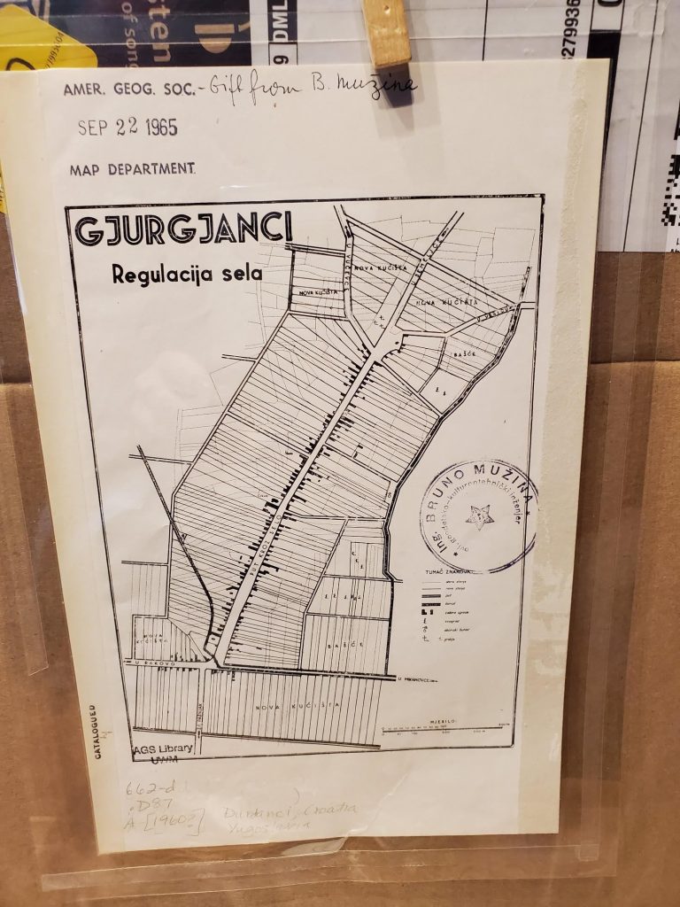
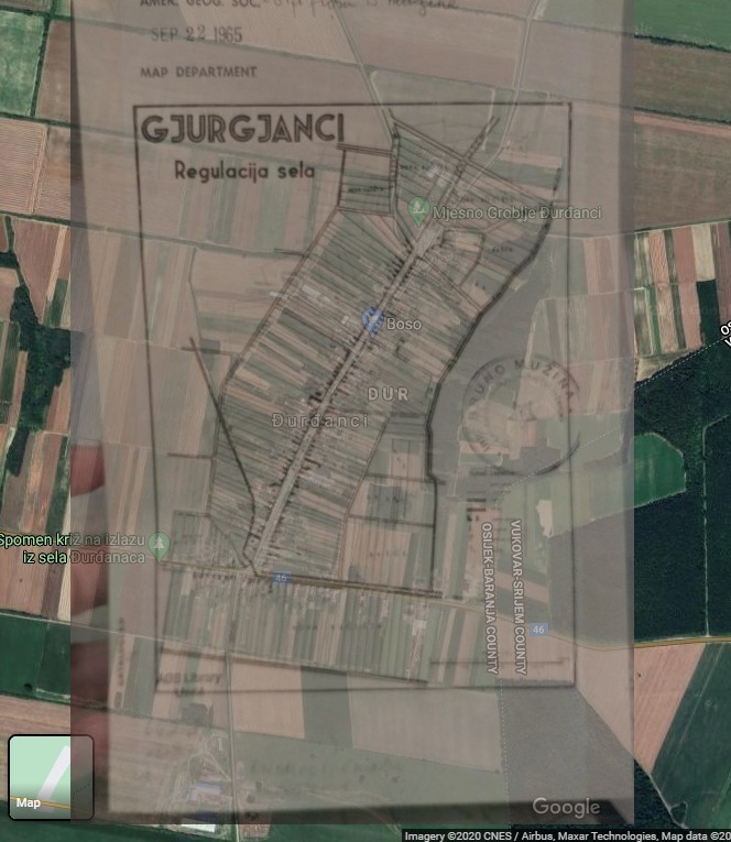
Recently I’ve been cataloging a back log of maps from Eastern Europe. If you’re familiar with the AGS Library’s situation, all our maps are cataloged – in an old fashioned card catalog. Efforts have been underway for … a long time … to get everything cataloged in the online environment. The other day I ran across this little map titled “Gjurgjanci Regulacija sela” (24 x 16 cm). After some detective work, I was able to identify the modern place name and some other interesting information about it.
A Google search for “Gjurgjanci” – took me to a place in Kosovo, but the details didn’t match. Gjurgjanci doesn’t show up in the Getty geographic thesaurus, the U.S. Board on Geographic Names or the Library of Congress subject heading authorities, so my detective work continued.
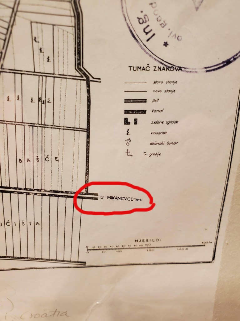
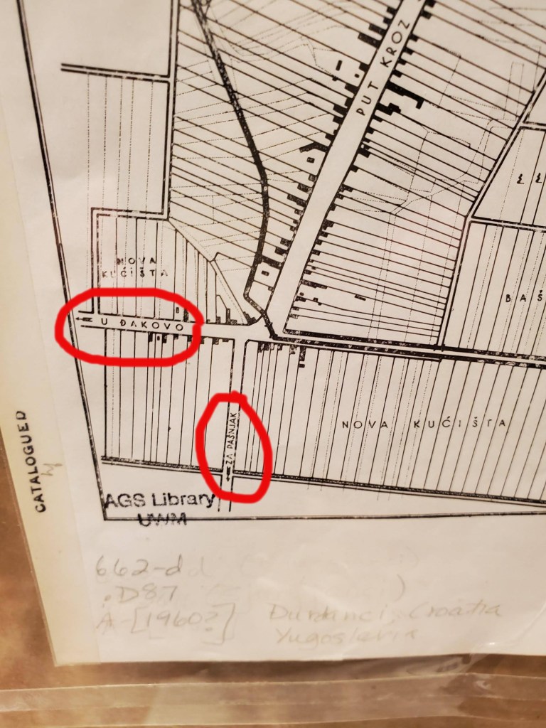
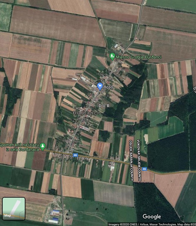
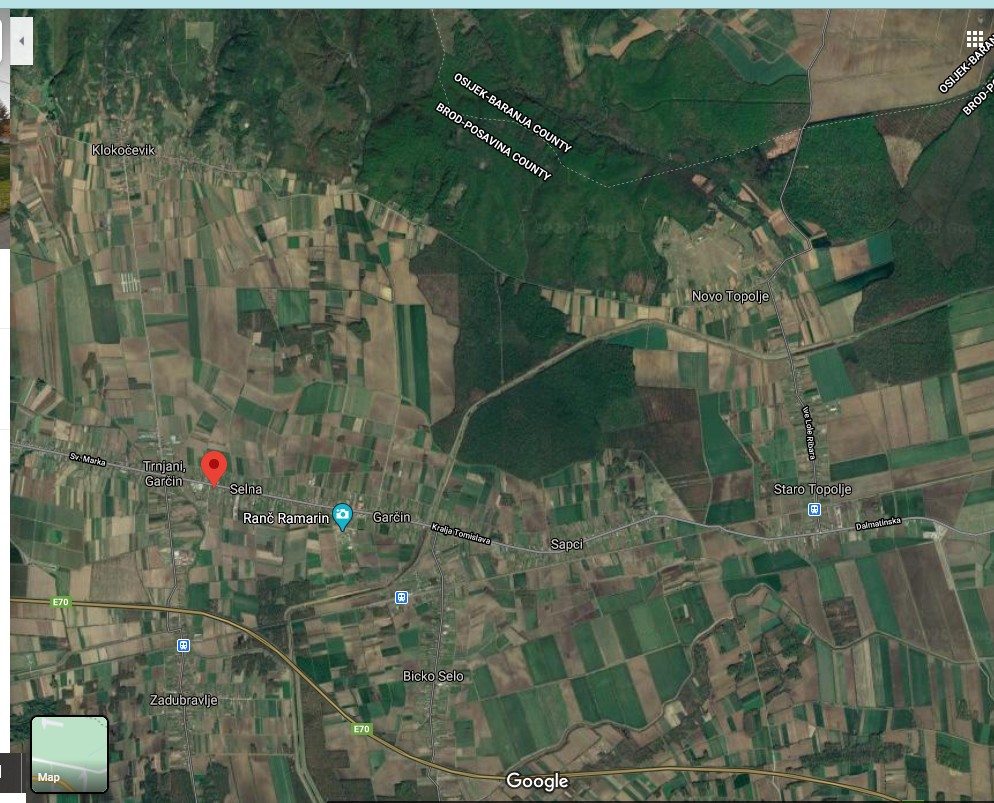
On the map, I noticed that some roads are labeled with directions to neighboring cities. I searched those place names until I zeroed in and identified the correct location of my map – Đurđanci in the county of Osijek-Baranja, Croatia.
It was great to learn WHERE the map was of, but I still didn’t know anything else about it such as subject, date or publisher. I cataloged that map as best I could and continued on my cataloging journey through Yugoslavia.
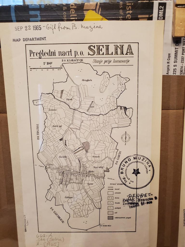
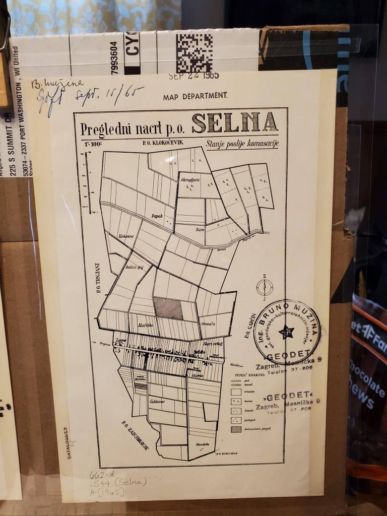
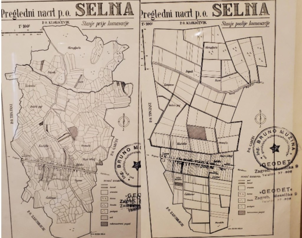
The next day I came across two similar maps with similar problems – I was not able to find the place name in a Google search, a Getty geographic thesaurus search or a Library of Congress subject heading authorities search.
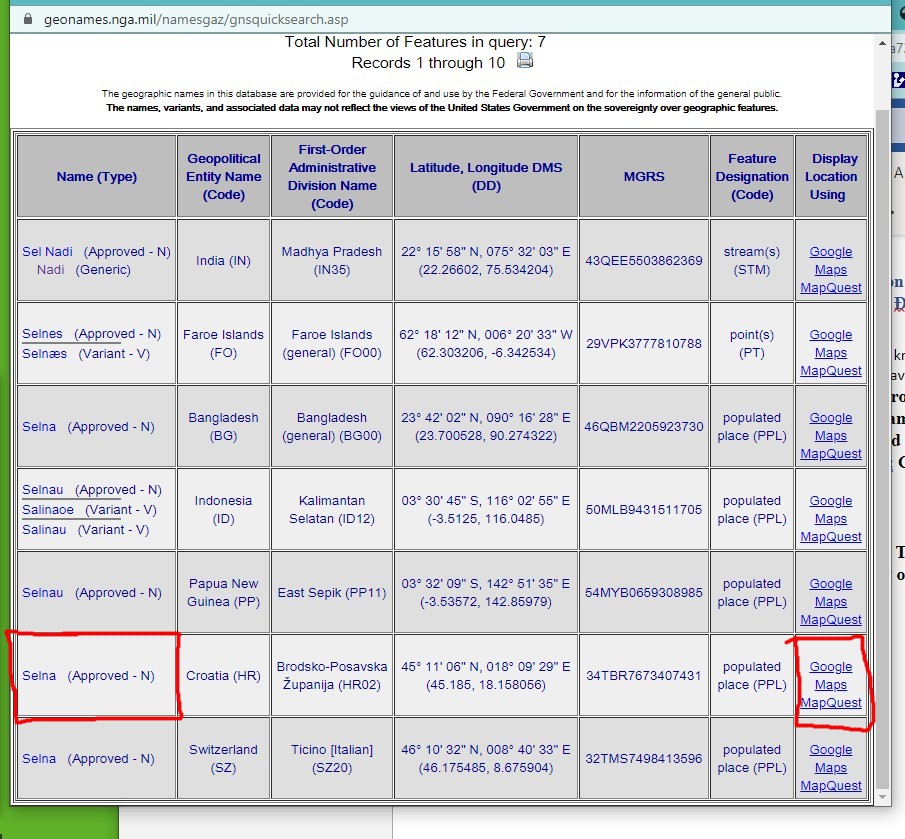
Fortunately, in this case, the US Board on Geographic Names site included a record for Selna. The search results at US Board on Geographic Names allow you to click on a link to the map. You can see the modern map lines up with details from these historical paper maps.
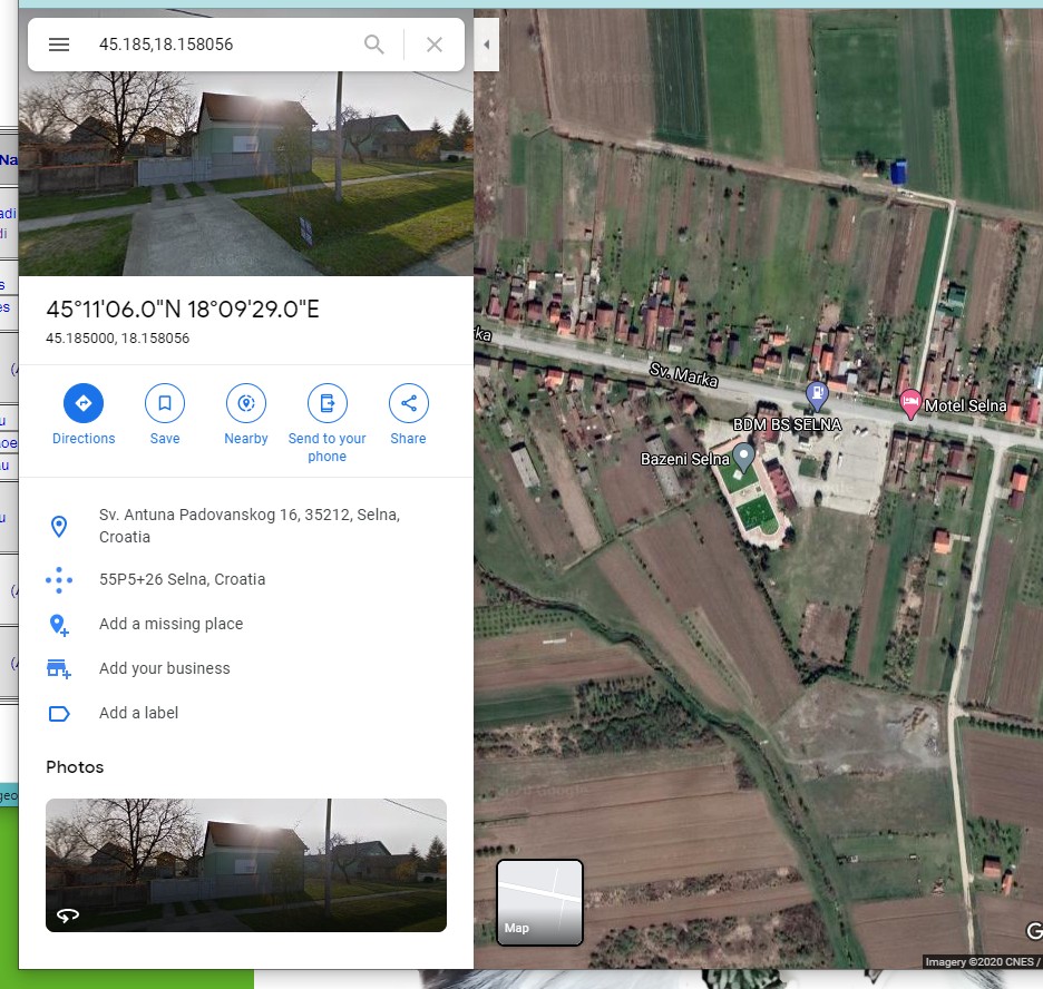
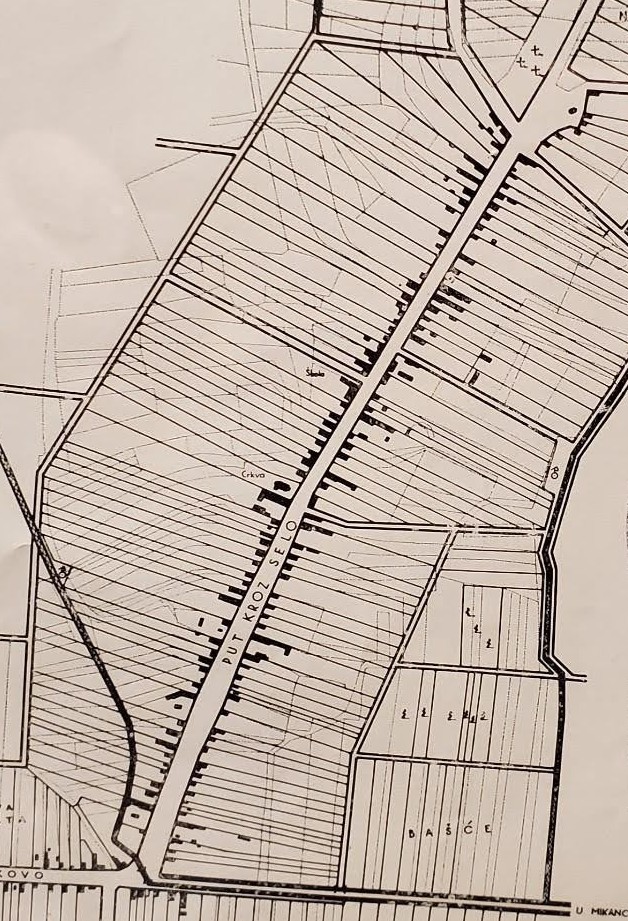
While I still don’t know much about these maps in regard to their date or publisher, I was able to learn that these maps show Croatian/Yugoslavian land consolidation. The subtitles on the Selna maps read: Stanje prije komasacije — Stanje poslije komasacije or Condition before consolidation – Condition after consolidation.
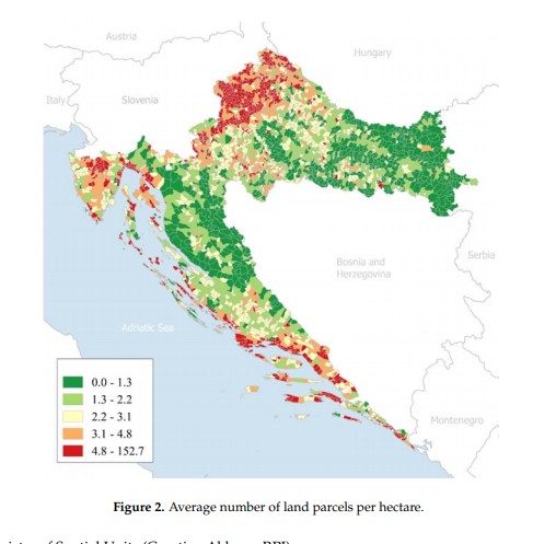
Apparently there have been multiple attempts to consolidate land in Croatia. Today, Croatia has approximately 14 million cadastral parcels and the total land area is 56,594 km2. Cadastral parcels are heavily fragmented (Figure 2). From the figure it is visible that average number of land parcels per hectare is relatively high.
Faculty of Geodesy, University of Croatia. Published: 9 March 2018
The maps held at the AGS Library were received as gifts from “Ing. Bruno Muzina ovl. Geodetsko-kulturnotehnički inženjer” in 1965. My guess is that he worked at “”Geodet” Zagreb, Mesnička” as indicated by the stamps on the maps. The publication date is at least 1965 or earlier based on the gift date. However, I don’t know an exact date or publisher or if the maps were removed from a report and if so, what report.
With this added knowledge, the details of the maps become quite interesting. The first map of Gjurgjanci/ Đurđanci has the consolidated property lines layered over the historical, fragmented parcels. The Selna maps have the two versions side by side. One can clearly see the fragmented historical parcels. The idea is that fragmented agricultural land raises the cost of agricultural production. The land consolidation effort would merge partitioned lands into larger and more regularly shaped parcels. Roads and canal networks would also be arranged to improve the conditions of agricultural production. Understanding a little more about both the where and the what my maps were showing is critical when assigning subject headings. In this case, I assign both the place names as well as a topical heading: Consolidation of land holdings — Croatia — Maps.
As a cataloger I make decisions about how far to proceed when creating data for my records. Do I continue to research this question, learn the Croatian language so I can read up on land consolidation, travel to Croatia to comb the local archives, conduct a séance? Or, do I make the decision to put as much information as I can, make educated guesses, include information in brackets and just move on with my life (see one of my cataloging records below).
Perhaps this blog will be seen by someone out there who can offer information about the publisher or date of the land consolidation being shown on my maps.
hashtags to consider … #workingfromhome #https://pixlr.com/x/ #pixlr_is_awesome #gettingbywithphonephotos #googlemapsrock #ilovecataloging
007 a ǂb j ǂd a ǂe a ǂf n ǂg z ǂh n
040 GZN ǂb eng ǂe rda ǂc GZN
0341 a ǂb 10000
043 e-ci—
090 ǂb
049 GZNA
24500Gjurgjanci Regulacija sela.
255 Scale approximately 1:10,000.
264 1[Place of publication not identified] : ǂb [publisher not indentified], ǂc [1960?]
300 1 map ; ǂc 18 x 13 cm, on sheet 24 x 16 cm
336 cartographic image ǂ2 rdacontent
337 unmediated ǂ2 rdamedia
338 sheet ǂ2 rdacarrier
500 Stamped: Ing. Bruno Muzina ovl. Geodetsko-kulturnotehnički inženjer.
500 “Gift from B. Muzina, Sep 22 1965.”
500 Đurđanci, Osijek-Baranja County, Croatia.
6500Consolidation of land holdings — Croatia — Đurđanci — Maps
651 0Đurđanci (Croatia) ǂv Maps.
650 0Cities and towns ǂz Yugoslavia ǂv Maps.
650 0Cities and towns ǂz Croatia ǂv Maps.
