Humboldt Bay
Humboldt Bay, California 1850s
by Angie Cope
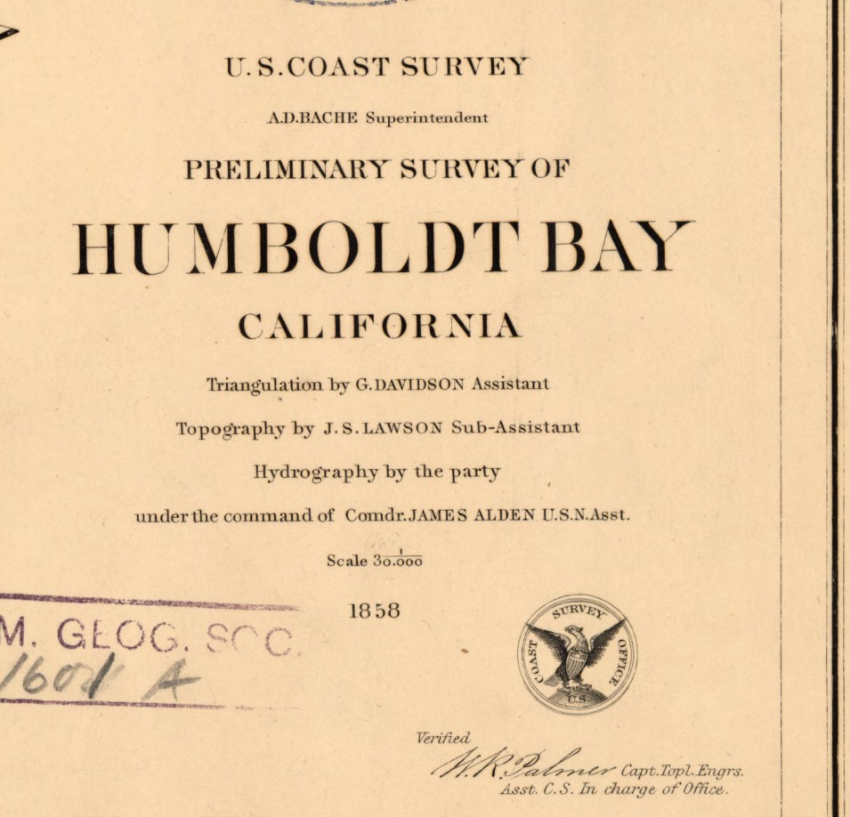
Preliminary survey of Humboldt Bay, California / U.S. Coast Survey, 1858.
Rare Map: Chart CS Pacific Humboldt Bay 1858
https://collections.lib.uwm.edu/…/collec…/agdm/id/6097/rec/1

Humboldt Bay is a natural bay located on the rugged North Coast of California between San Francisco Bay and Puget Sound. The Bay is home to more than 100 plant species, 300 invertebrate species, marine and land mammals, hundreds of fish species, and more than 200 species of birds.
The Wiyot people were the first to inhabit the Humboldt Bay region, estimated to have arrived around 900 A.D. Their name for the bay is Wike or Wiki. Indian villages shown on this 1858 map are circled in pink.
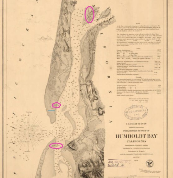
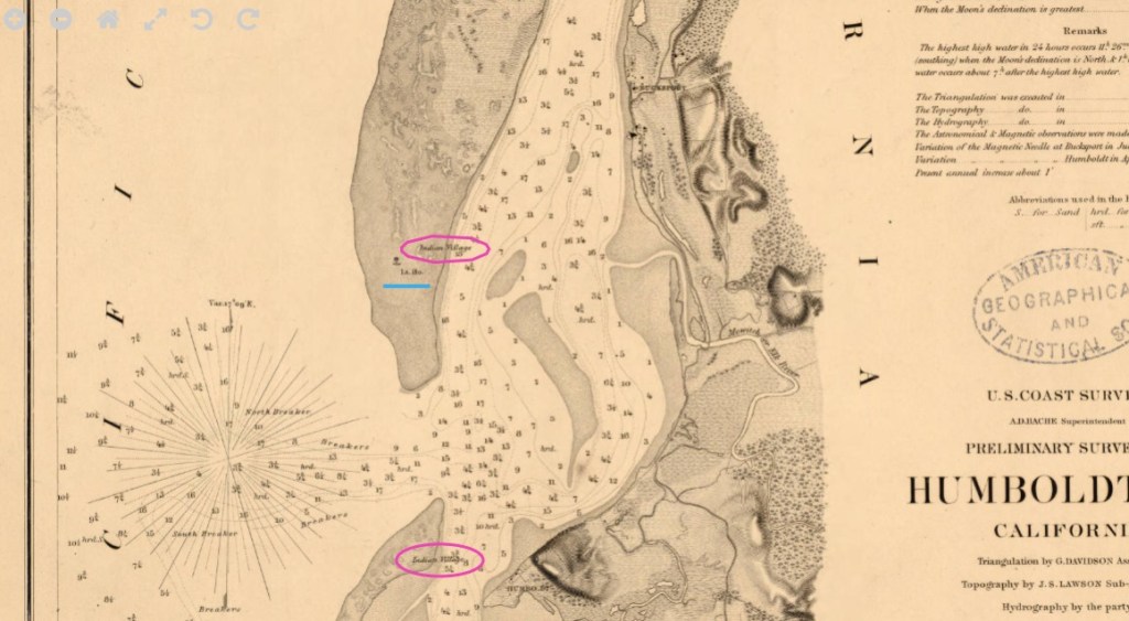
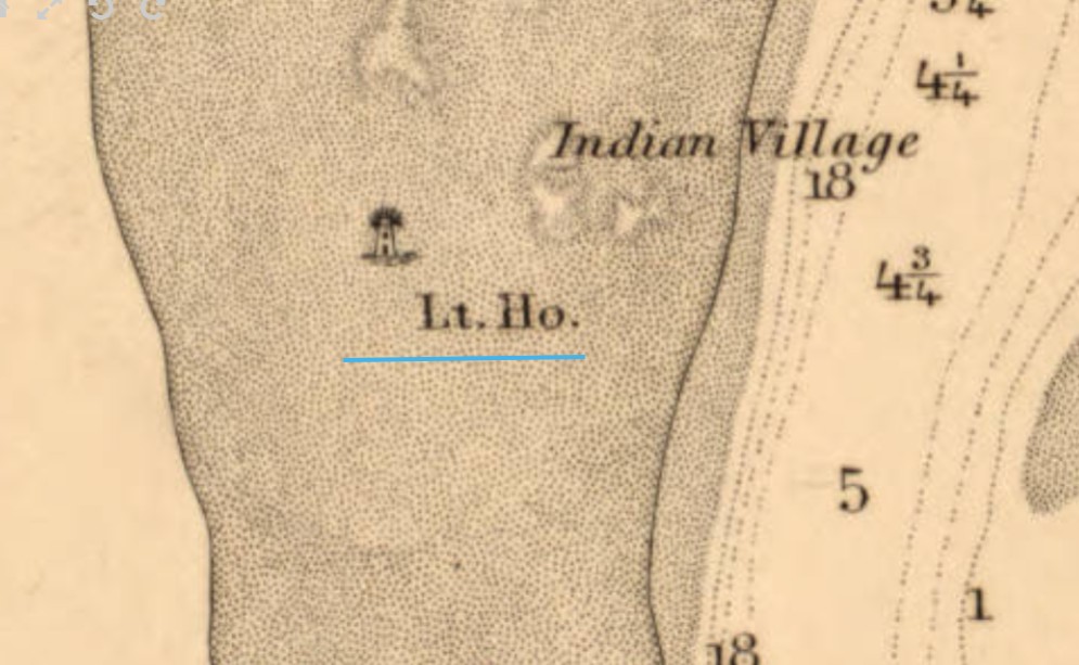
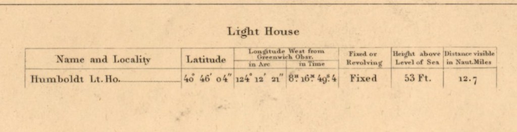
Beginning in the 1850s, settlers used the bay for shipbuilding and the export of lumber. In 1856 the Humboldt Harbor Light was built on the north spit (underlined in blue).
Interesting factoid: There is a memorial to the USS Milwaukee in Eureka, California on Humboldt Bay. In 1917, the USS Milwaukee ran aground while trying to tow a beached submarine. Remnants of the wreck are still visible today at low tide.
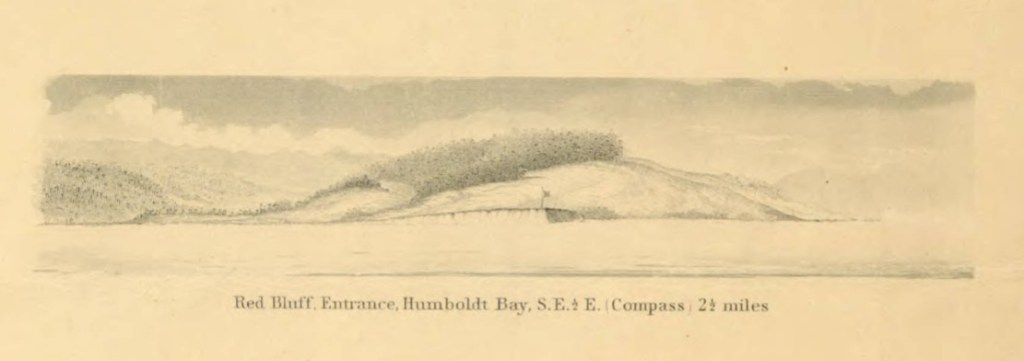
Illustrated view: Red Bluff entrance, Humboldt Bay, S.E. 1/2 E. (compass) 2 1/2 miles
From: Reconnaissance of the western coast of the United States : middle sheet : from San Francisco to Umpquah [sic.] River, 1854
https://collections.lib.uwm.edu/digital/collection/agdm/id/6717/rec/17
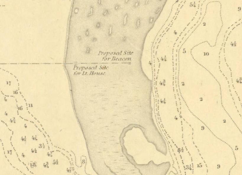
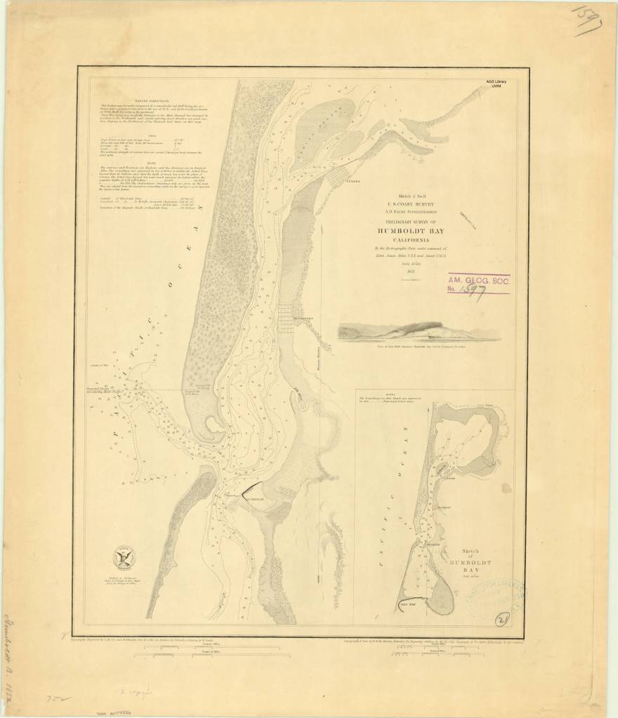
Preliminary survey of Humboldt Bay, California / U.S. Coast Survey, 1852
https://collections.lib.uwm.edu/digital/collection/agdm/id/4778/rec/1,
Shows the proposed site for the light house built in 1856.