Angie’s Blog
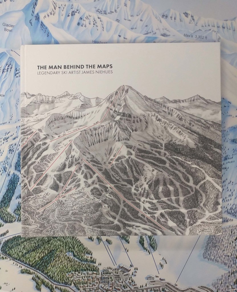
The man behind the maps : legendary ski artist James Niehues
by Angie Cope
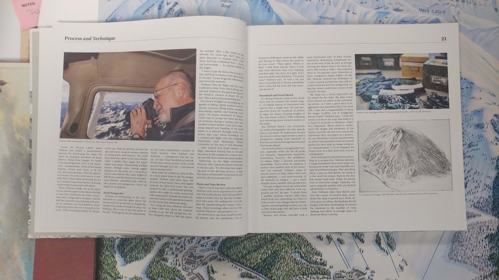
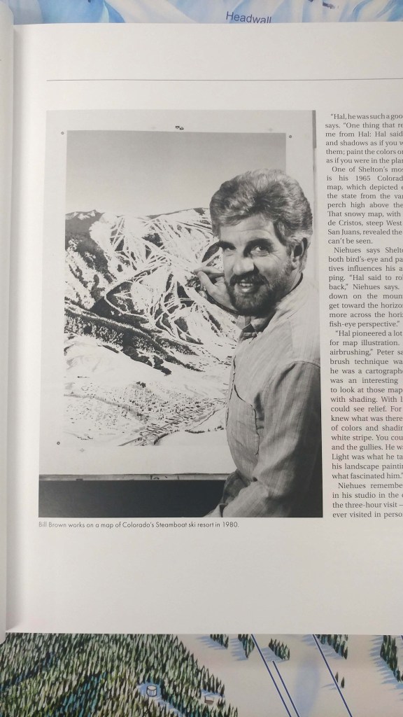
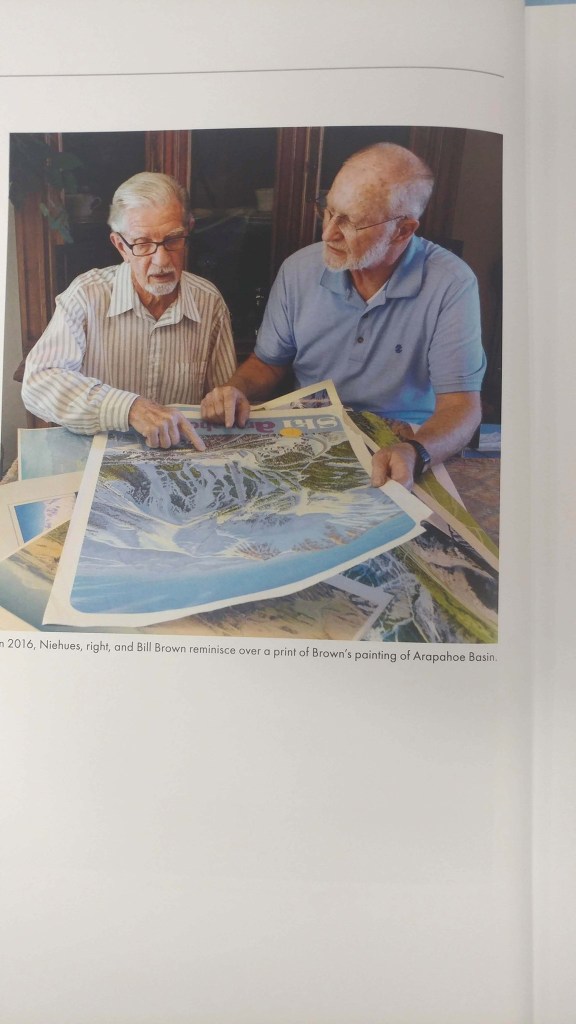
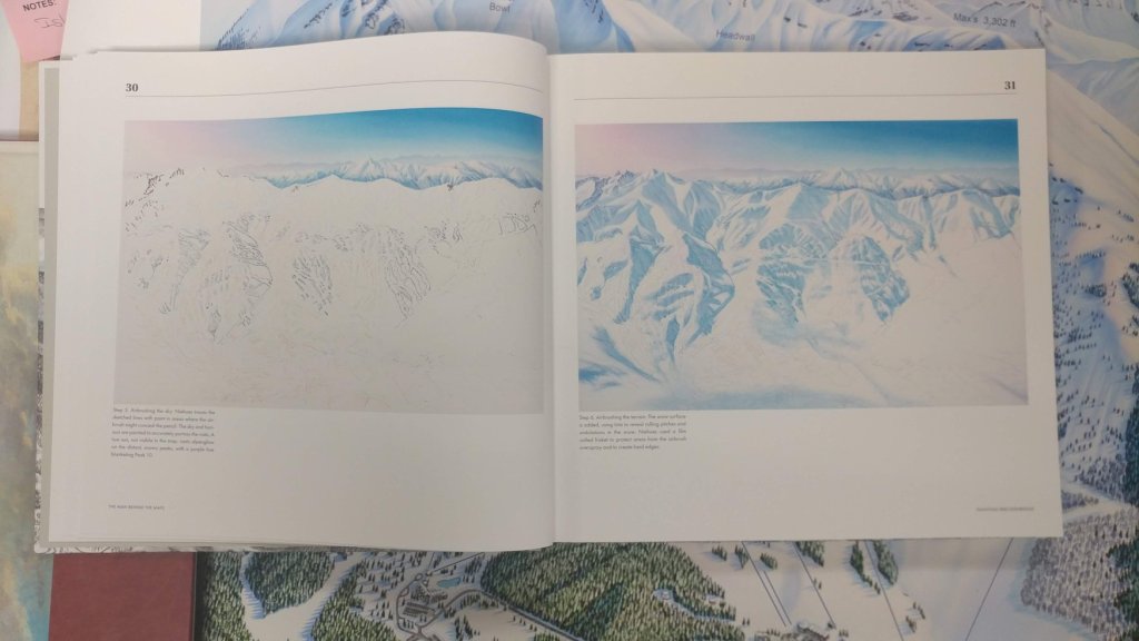
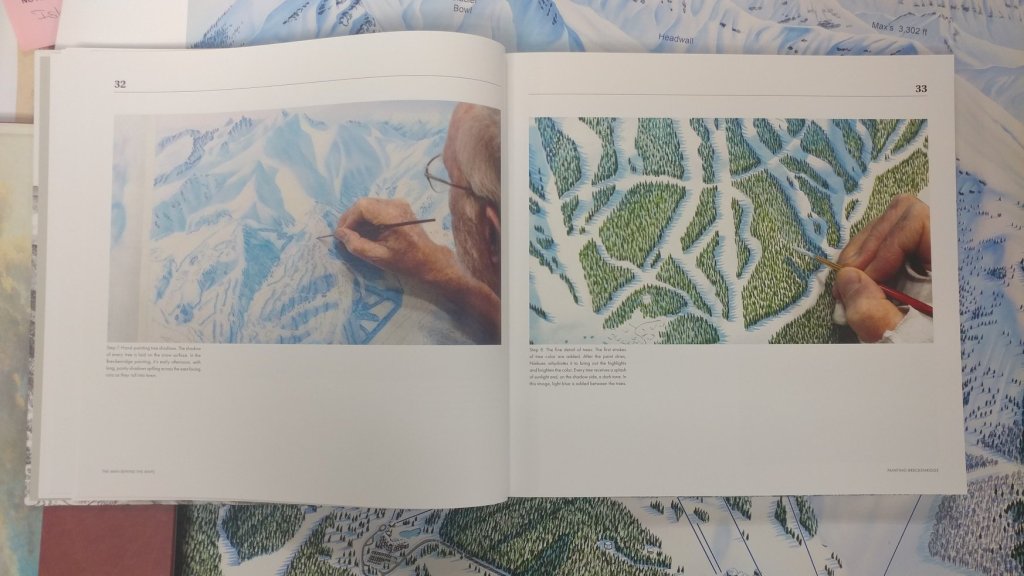
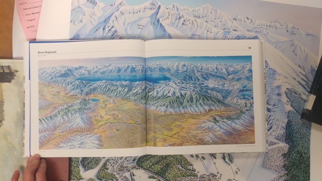
The AGSL ordered a copy of “The man behind the maps : legendary ski artist James Niehues.” The introduction tells about Niehues, his inspirations including his mentor and friend, Bill Brown. The book details Niehues’s process and includes over 200 pages of color illustrations of Niehues’ mountain maps. Beautifully colored images of Niehues’s maps are included in the book from the United States, Canada, Australia, Chile, New Zealand and Serbia. This is a beautiful book, that, yes, smells great. It can be purchased here: https://jamesniehues.com/pages/the-man-behind-the-map
Mount Vesuvius, Italy
by Angie Cope
Vesuvius is a volcano located on the Gulf of Naples in Campania, Italy, about 5.6 miles east of Naples and a short distance from the shore. The height of the main cone has been constantly changed by eruptions but was 4,203 feet in 2010.
Vesuvius was formed as a result of the collision of the African and the Eurasian tectonic plates. The infamous eruption of Mount Vesuvius in AD 79 destroyed the Roman cities of Pompeii, Herculaneum, Oplontis and Stabiae, as well as several other settlements. The eruption ejected a cloud of stones, ashes and volcanic gases to a height of 21 miles, erupting molten rock and pulverized pumice at the rate of 7.8 × 10⁵ cubic yards per second.
Vesuvius has erupted many times since then and is the only volcano on the European mainland to have erupted within the last hundred years. Today, it is regarded as one of the most dangerous volcanoes in the world because of the population of 3,000,000 people living near enough to be affected, with 600,000 directly in the danger zone.
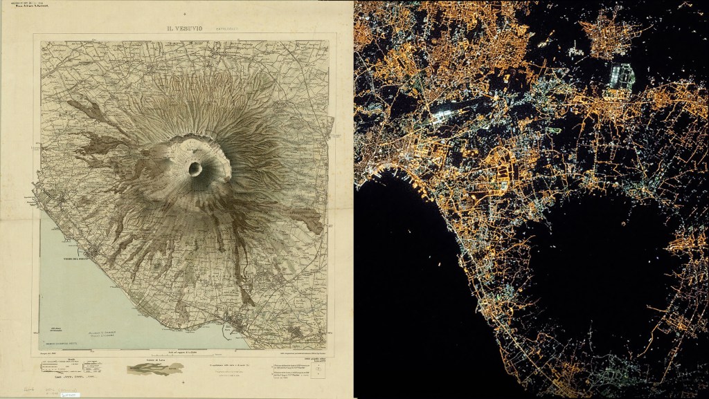
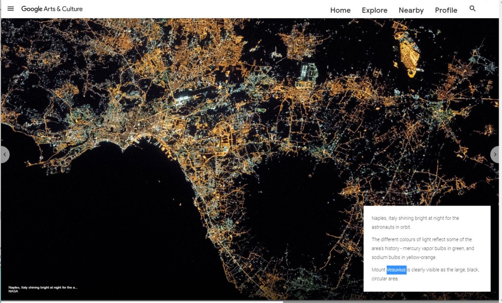
Here is an image shared by Google from the International Space Station showing Mount Vesuvius as the large, black, circular area. Naples, Italy shines bright at night and the different colors of light reflect some of the area’s history – mercury vapor bulbs in green, and sodium bulbs in yellow-orange.
Here is a map donated to the AGS of NY in 1918 from Allison Armour showing Mount Vesuvius in 1908. Il Vesuvio / Istituto Geografico Militare
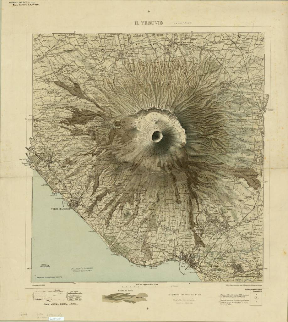
https://collections.lib.uwm.edu/digital/collection/agdm/id/3379/rec/1
Here is another view of Moutn Vesuvius on this 1913 map of Campania, Italy
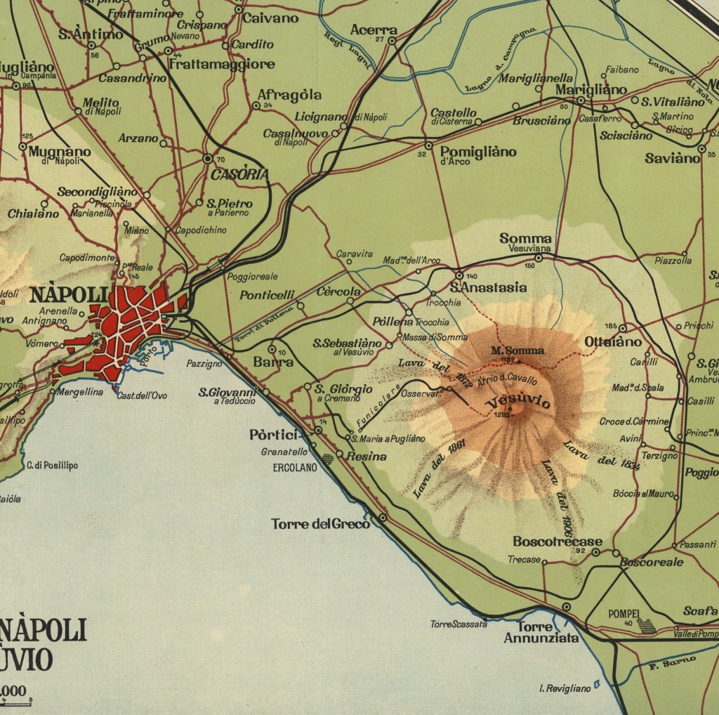
https://collections.lib.uwm.edu/digital/collection/agdm/id/15436/rec/69
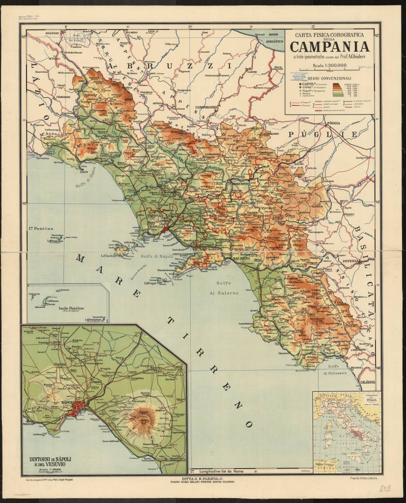
Carta fisica-corografica della Campania / a tinte ipsometriche, curata dal Prof. A. Ghisleri ; costrutta ed eseguita nell’Off. Cartogr. Nani & Longhi ; proprieta Artistico-Letteraria ; Ditta G.B. Paravia & C. ; lit. Bolis 1913
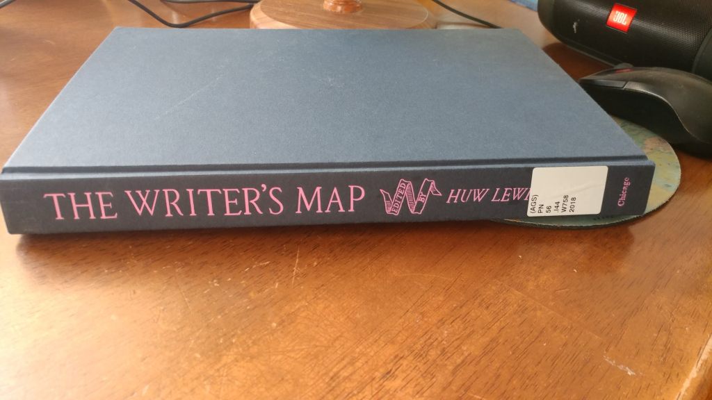
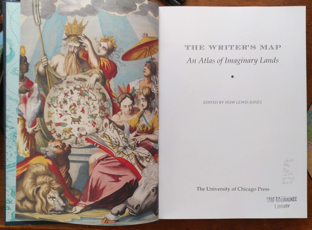
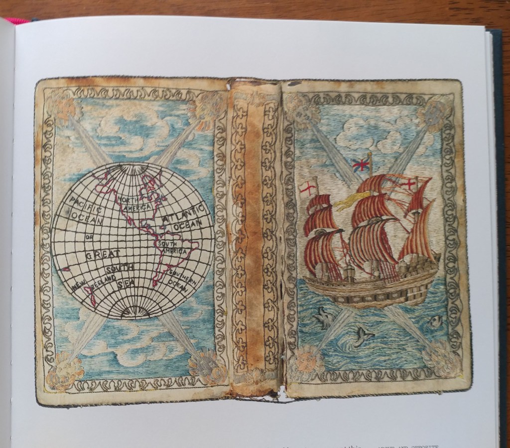
The Writer’s Map – an atlas for creative storytellers
by Angie Cope
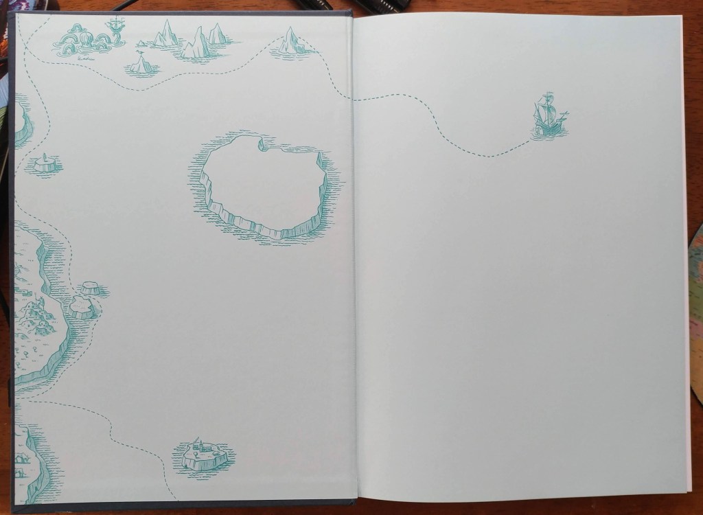
The Writer’s Map is an atlas of the journeys that our most creative storytellers have made throughout their lives. This magnificent collection encompasses not only the maps that appear in their books but also the many maps that have inspired them, the sketches that they used while writing, and others that simply sparked their curiosity.
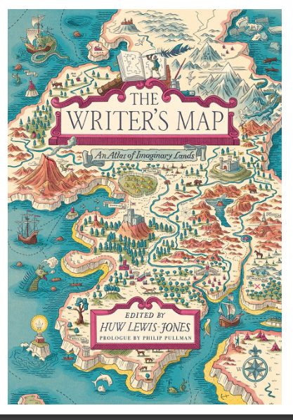
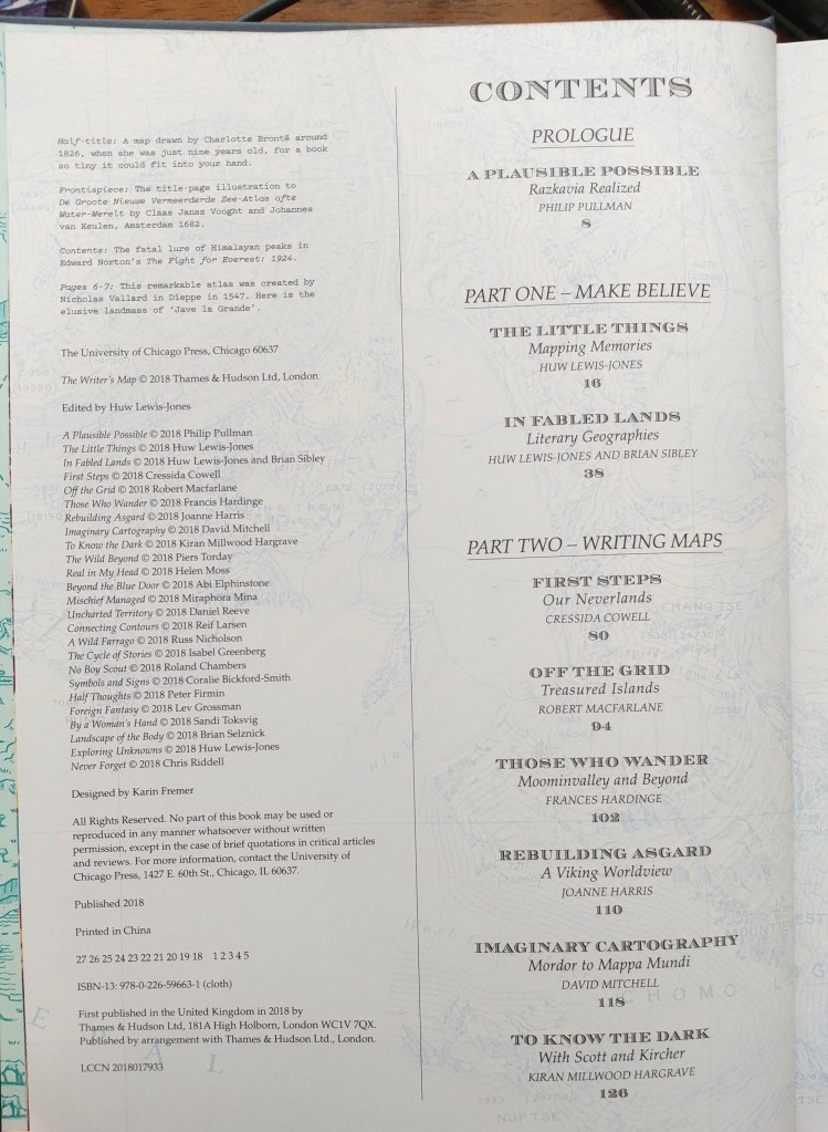
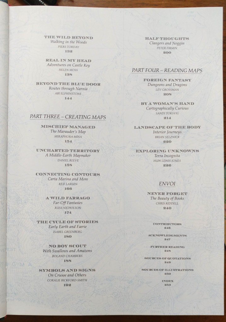
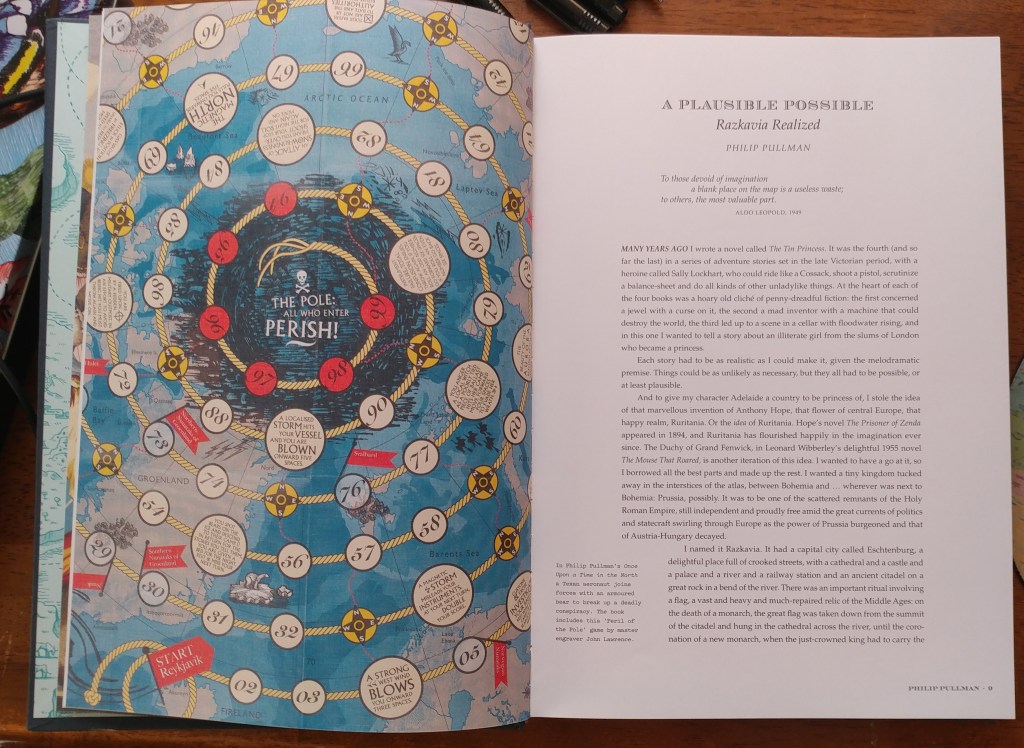
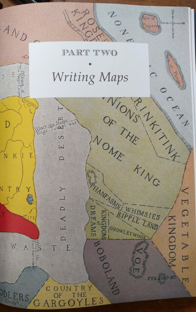
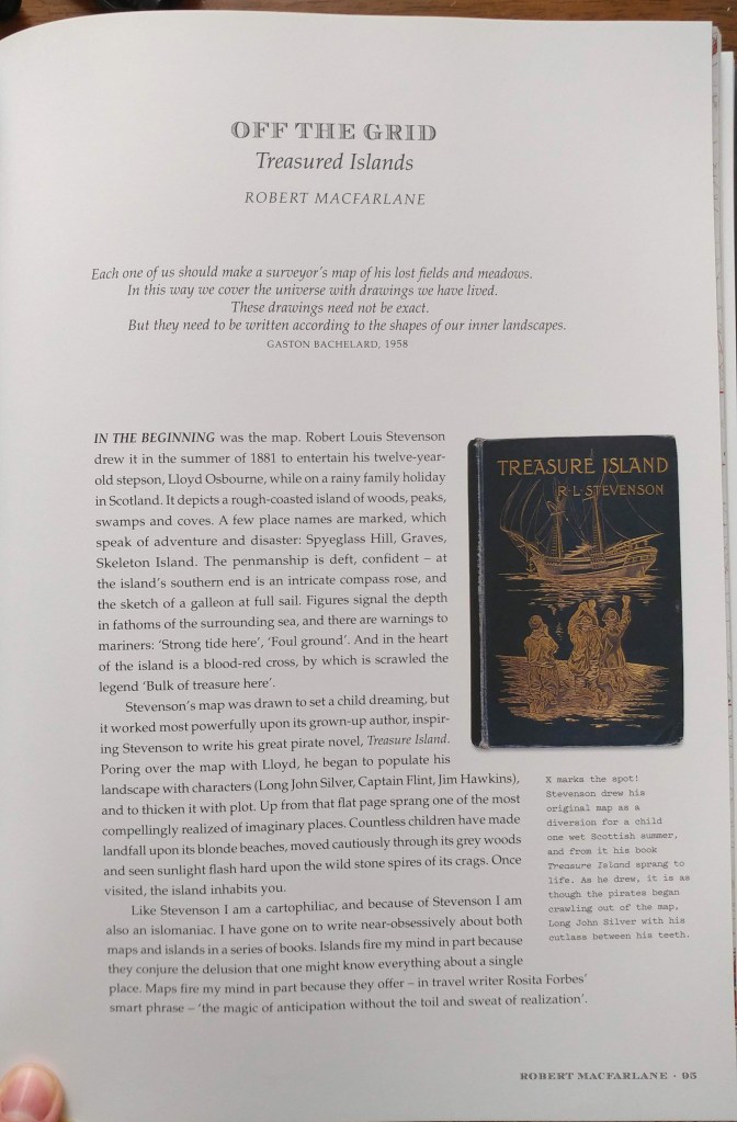
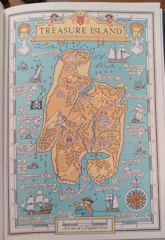
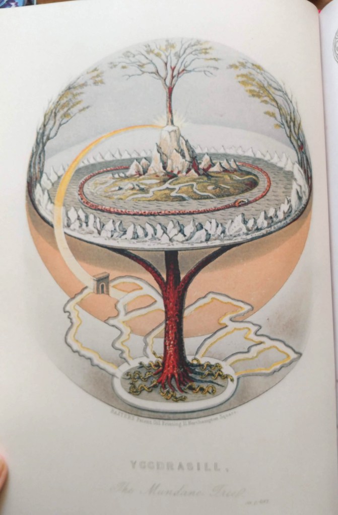
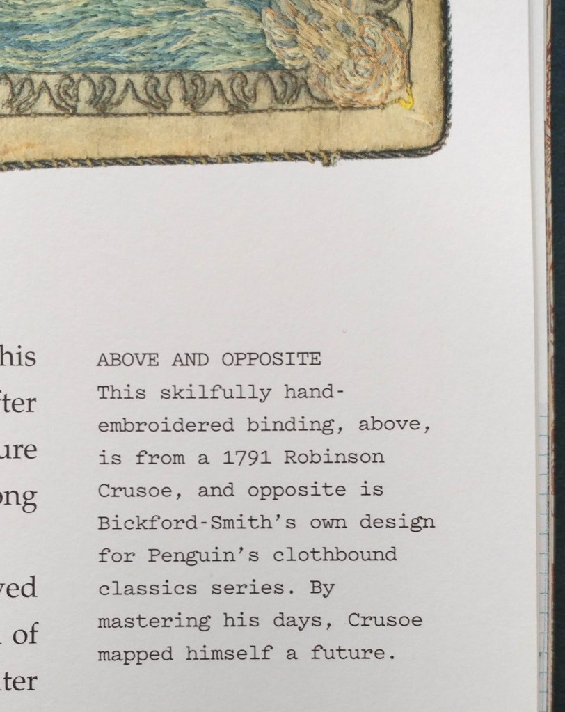
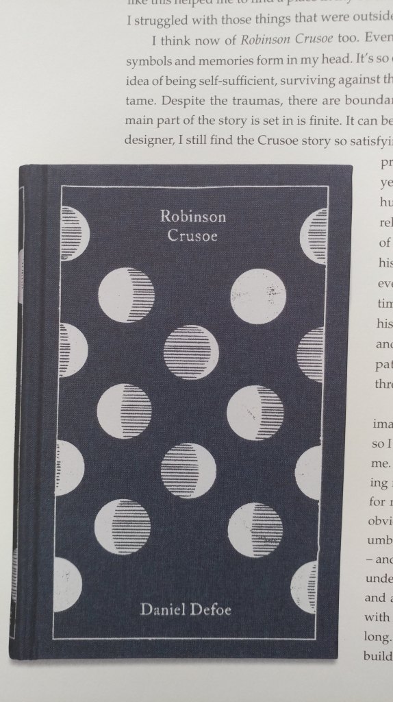
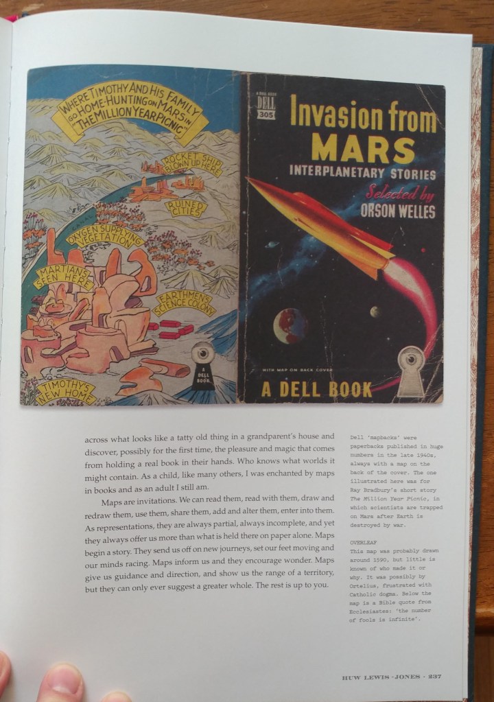
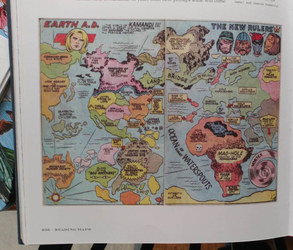
Philip Pullman recounts the experience of drawing a map as he set out on one of his early novels, The Tin Princess. Miraphora Mina recalls the creative challenge of drawing up ”The Marauder’s Map” for the Harry Potter films. David Mitchell leads us to the Mappa Mundi by way of Cloud Atlas and his own sketch maps. Robert Macfarlane reflects on the cartophilia that has informed his evocative nature writing, which was set off by Robert Louis Stevenson and his map of Treasure Island. Joanne Harris tells of her fascination with Norse maps of the universe. Reif Larsen writes about our dependence on GPS and the impulse to map our experience. Daniel Reeve describes drawing maps and charts for The Hobbit film trilogy. This exquisitely crafted and illustrated atlas explores these and so many more of the maps writers create and are inspired by—some real, some imagined—in both words and images.
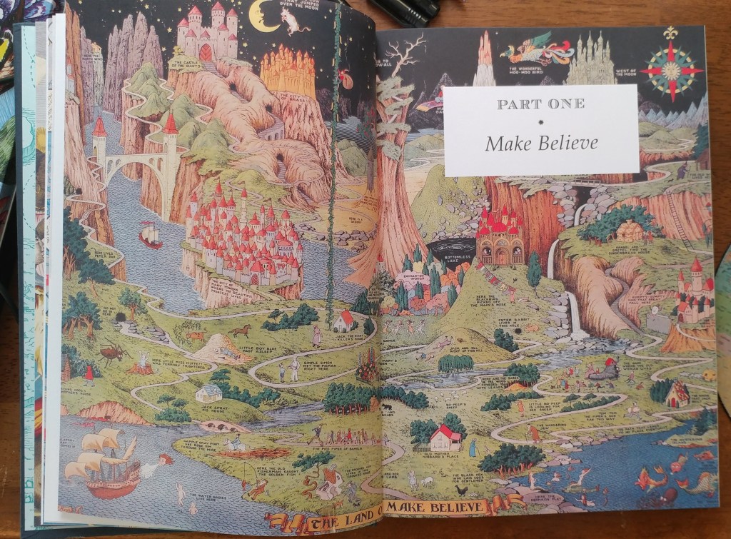
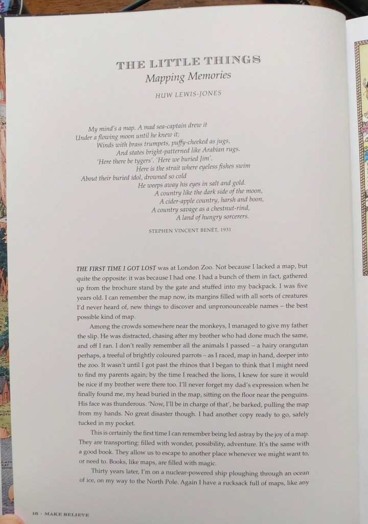
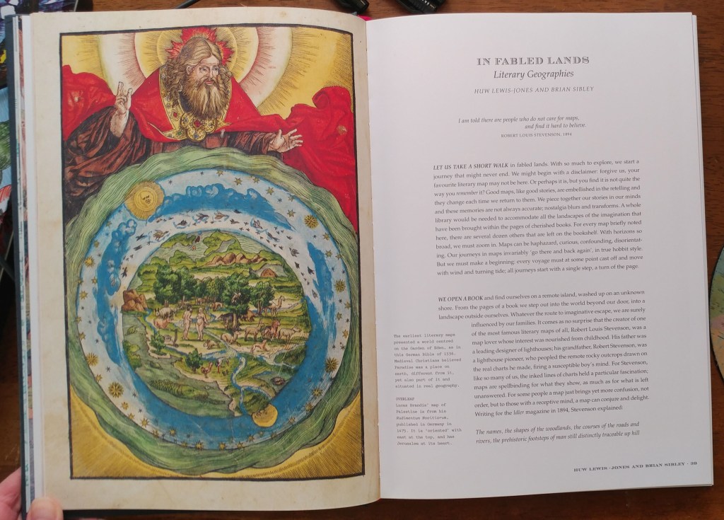
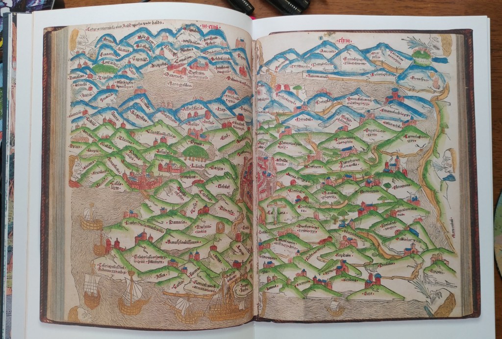
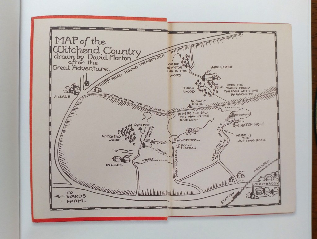
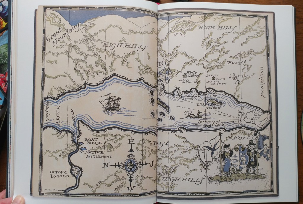
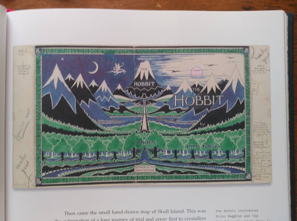
Amid a cornucopia of 167 full-color images, we find here maps of the world as envisaged in medieval times, as well as maps of adventure, sci-fi and fantasy, nursery rhymes, literary classics, and collectible comics. An enchanting visual and verbal journey, The Writer’s Map will be irresistible for lovers of maps, literature, and memories—and anyone prone to flights of the imagination.
Huw Lewis-Jones is a historian of exploration with a PhD from the University of Cambridge. He was formerly curator at the Scott Polar Research Institute, Cambridge, and the National Maritime Museum, London. His books include Arctic, Ocean Portraits, In Search of theSouth Pole, The Conquest of Everest, The Crossing of Antarctica, and Across the Arctic Ocean. Most recently, he is also coauthor of the internationally bestselling Explorers’ Sketchbooks.
End of Semester Me Time
by Angie Cope
If you’re a frequent visitor to the AGS Library, you know that you can’t find all our materials by searching in the UWM Libraries online catalog. We have an old fashioned card catalog that does list everything acquired between 1851 and 1978. Most things acquired between 1980 and 2019 are cataloged, but staff are still hard at work getting all 500,000 maps and 12,000 atlases cataloged in the digital environment.
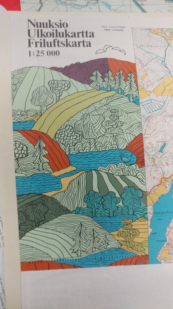
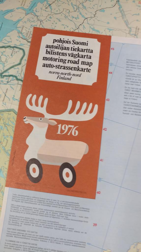
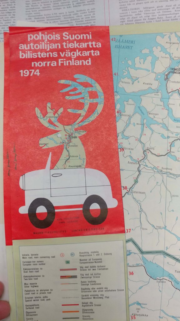
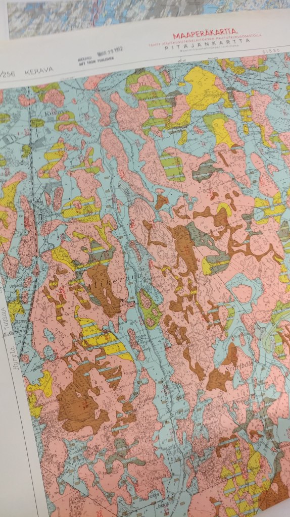
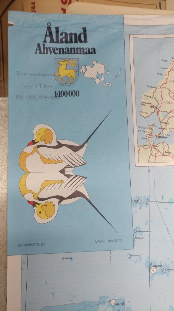
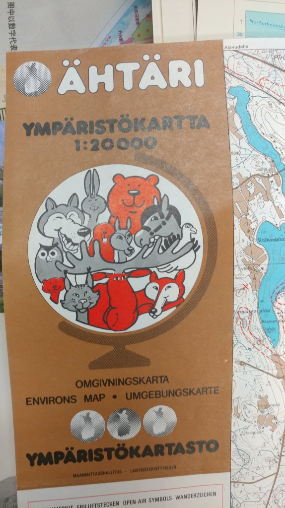
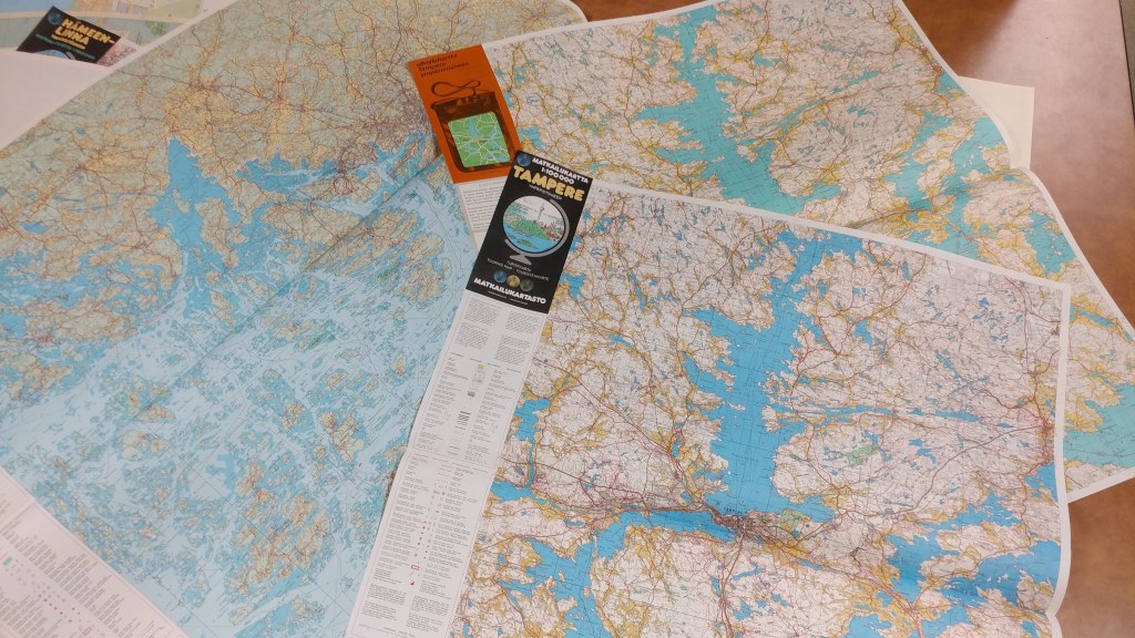
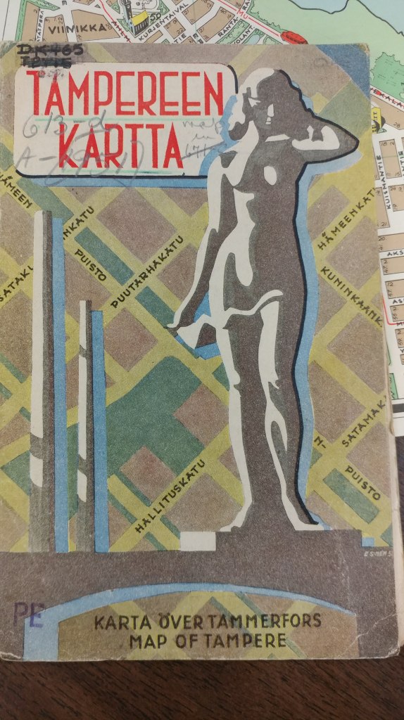
During each semester break, I like to tackle some of the cataloging of these older materials and this winter break I’m indulging in some me time and focusing on a region I adore: Scandinavia. Iceland got some attention:
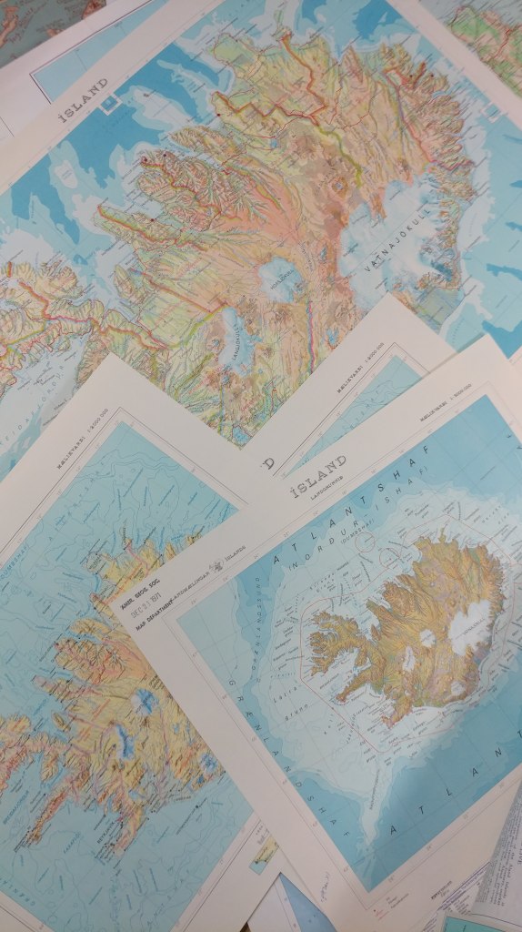
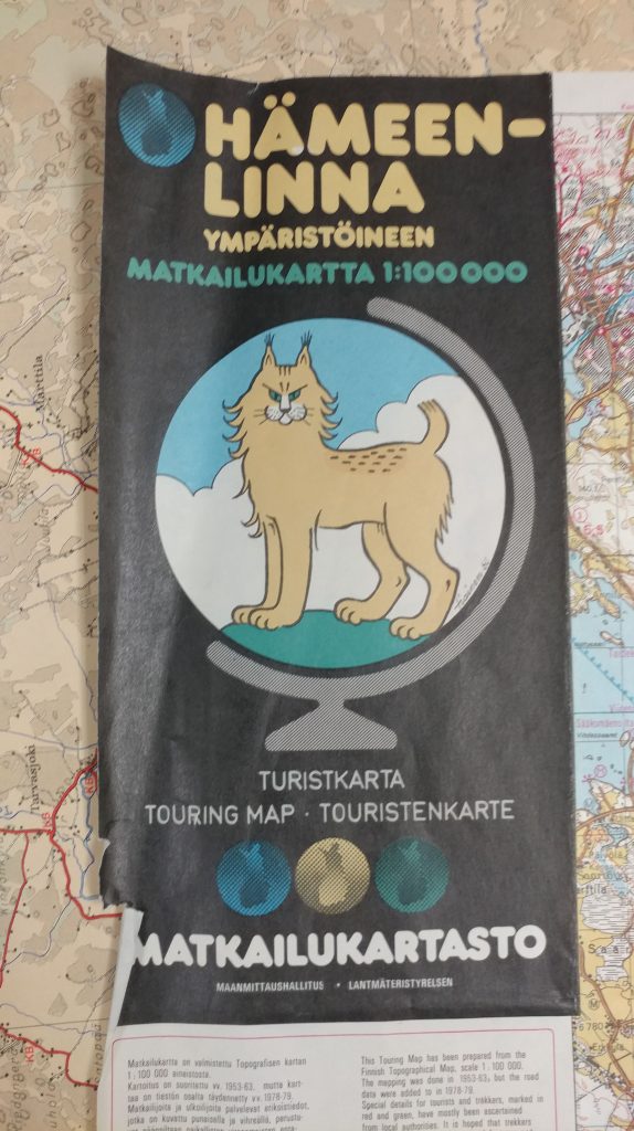
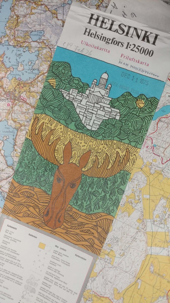
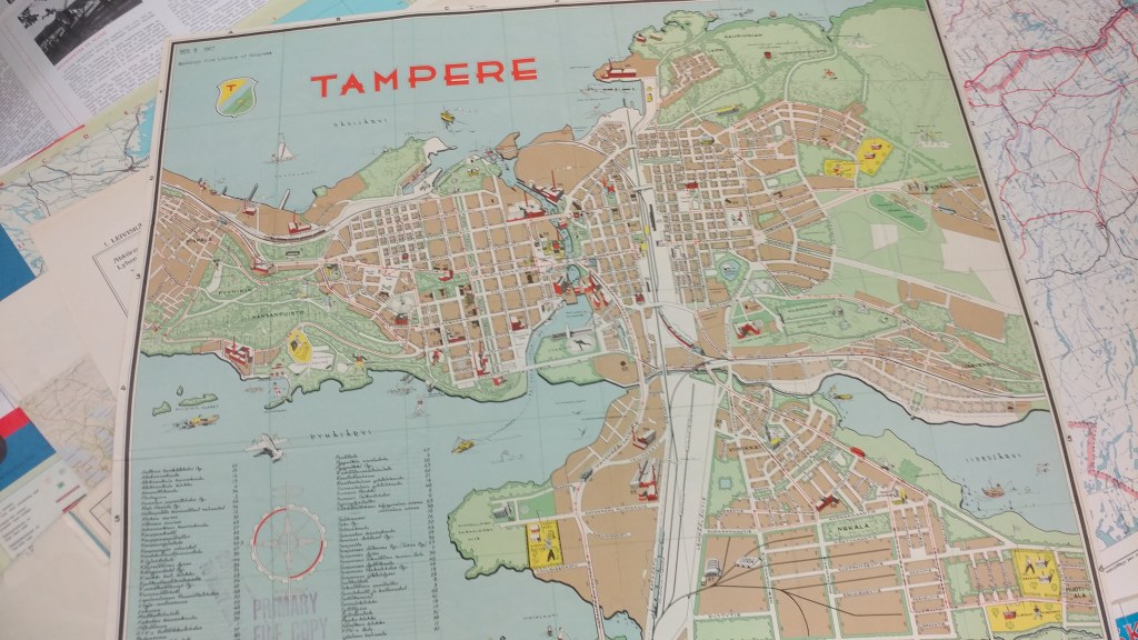
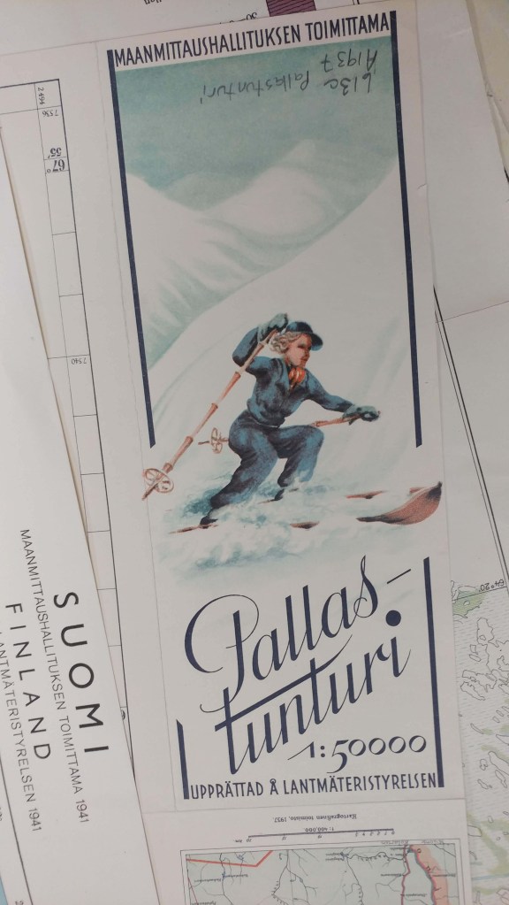
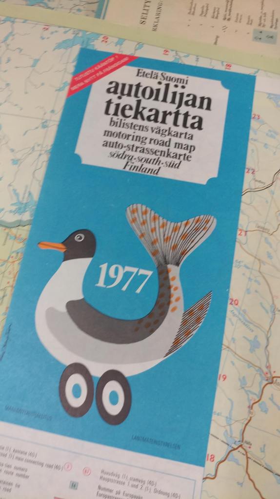
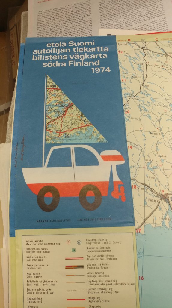
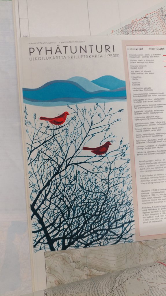
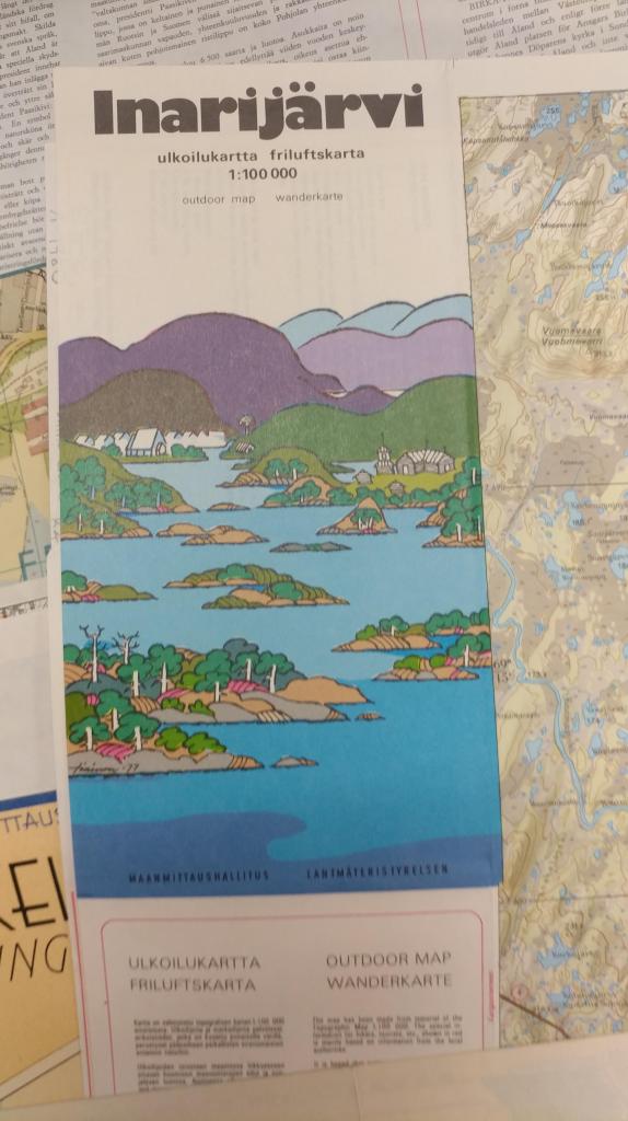
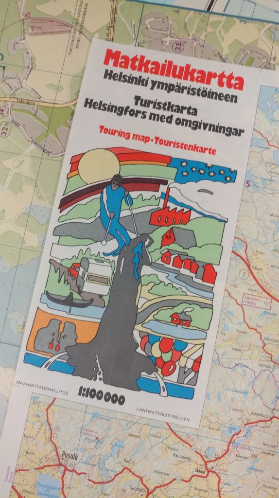
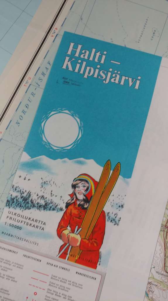
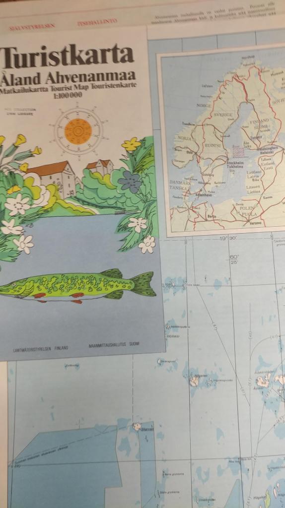
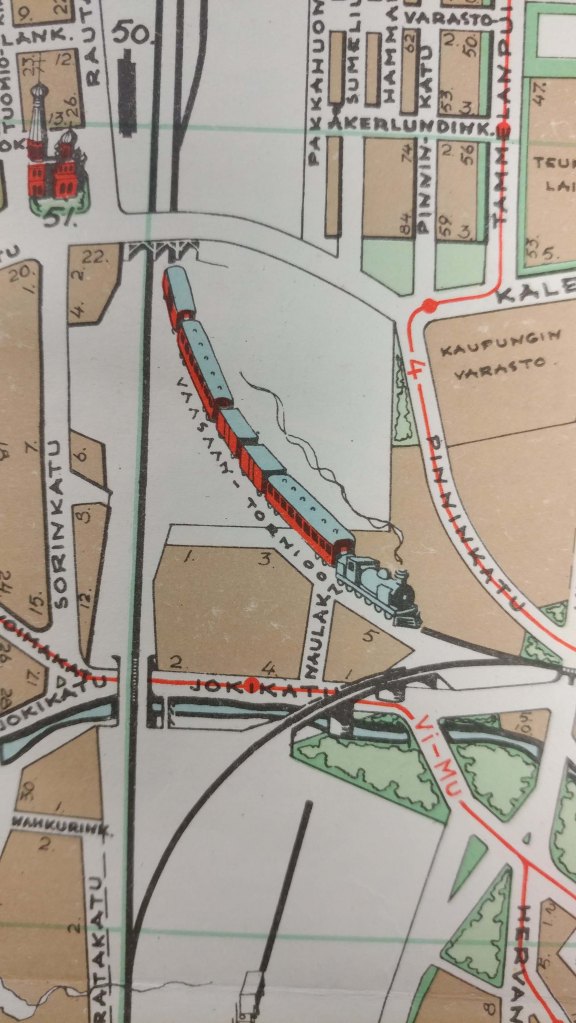
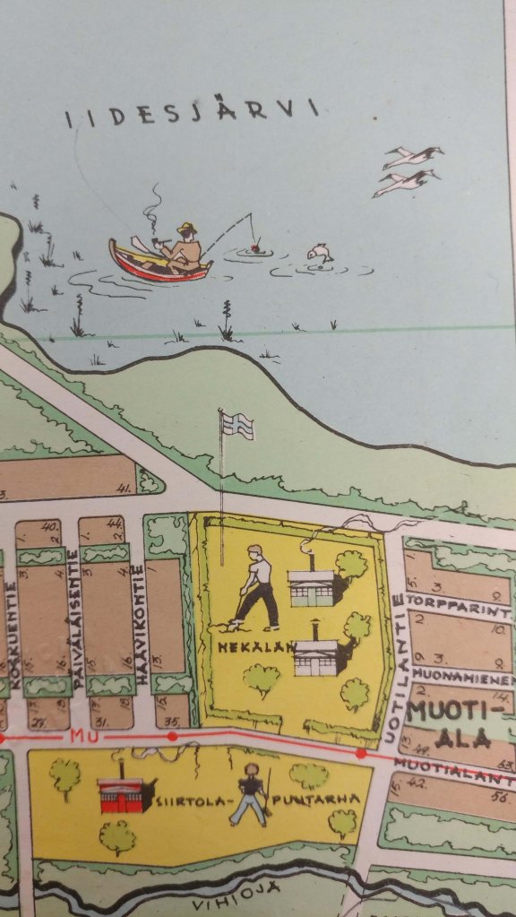
And next I’m traveling to Finland. I think the maps from these areas are simply amazing. Between the color choices and graphics used, I find them some of the most beautiful maps made. I’d like to share a few images with you from our collections in Finland.
__________________________________________
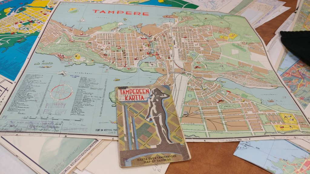
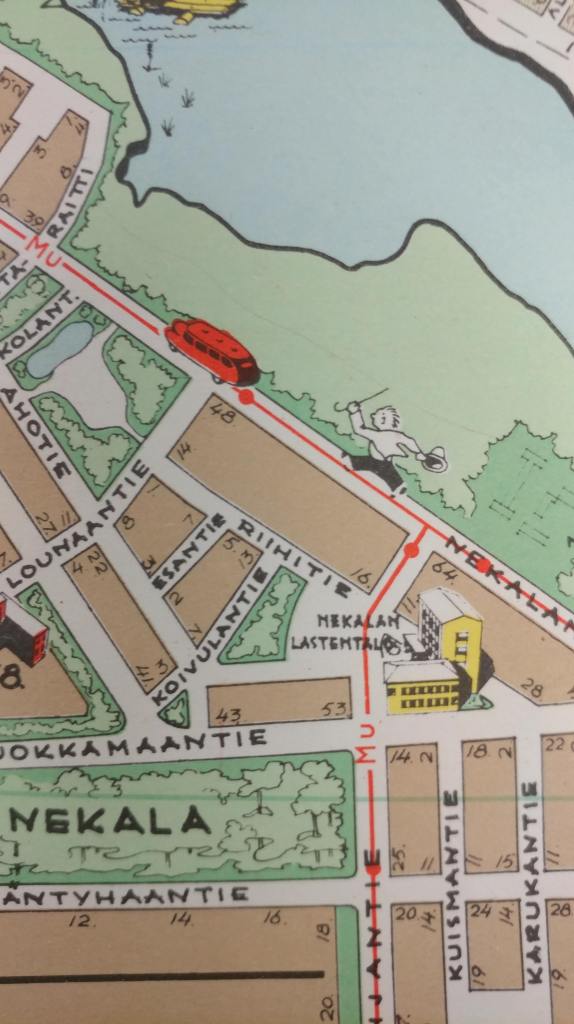
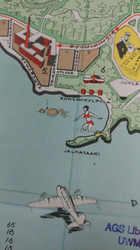
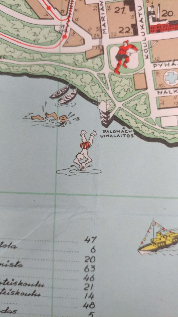
_________________________
In addition to trying to get everything searchable in an online catalog format, we are also working on getting more and more items scanned and viewable in our Digital Map Collection.
Click here to view the maps of Iceland in the digital collection so far.
Click here to view maps of Finland in the digital collection so far.
Click here to view maps of Norway in the digital collection so far (and my favorite, Vardo).
Click here to view maps of Sweden in the digital collection so far.
And, click here to view maps of Denmark in the digital collection so far.
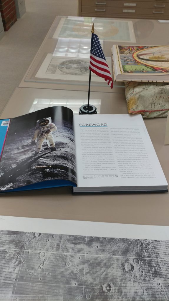
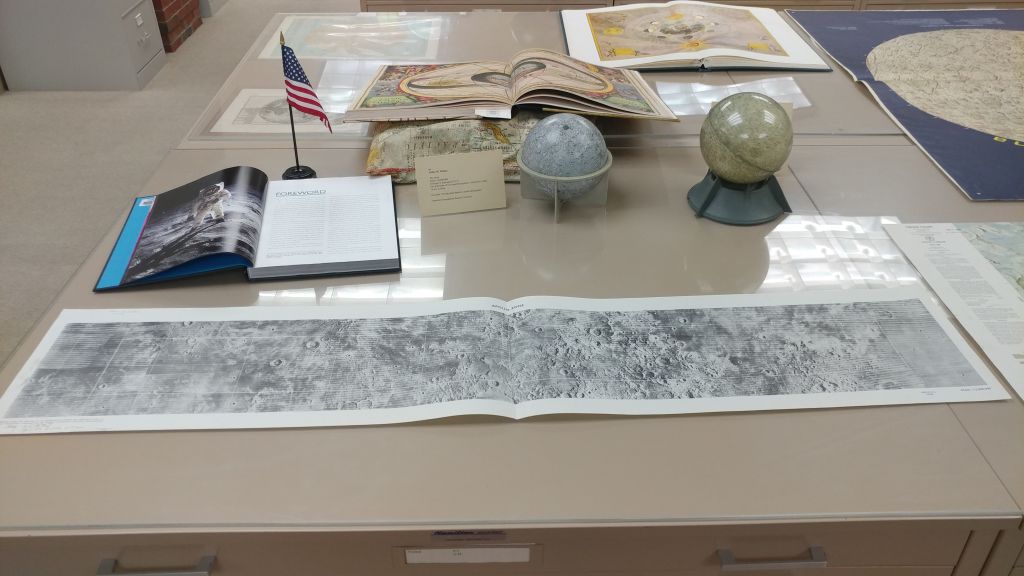
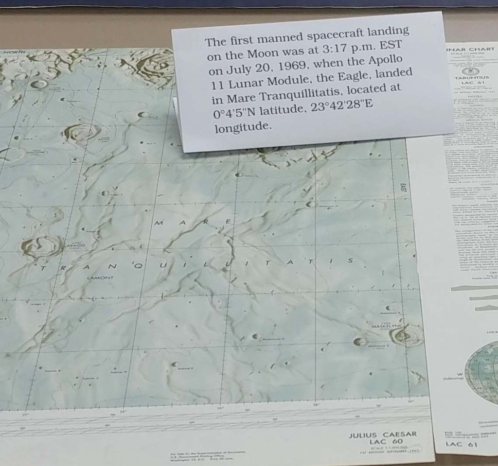
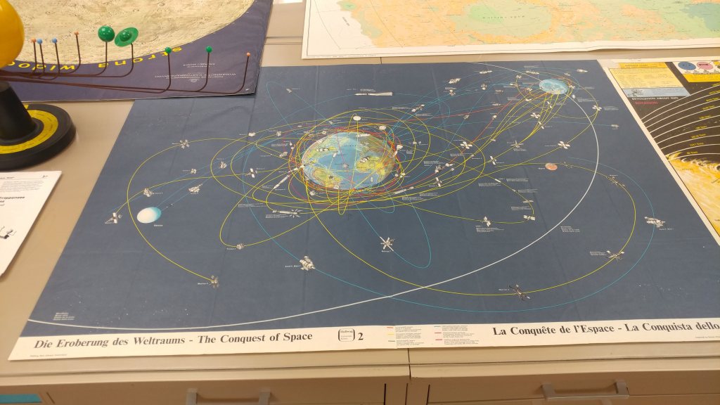
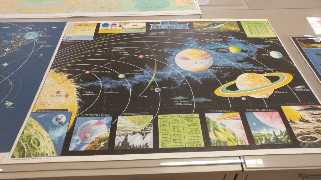
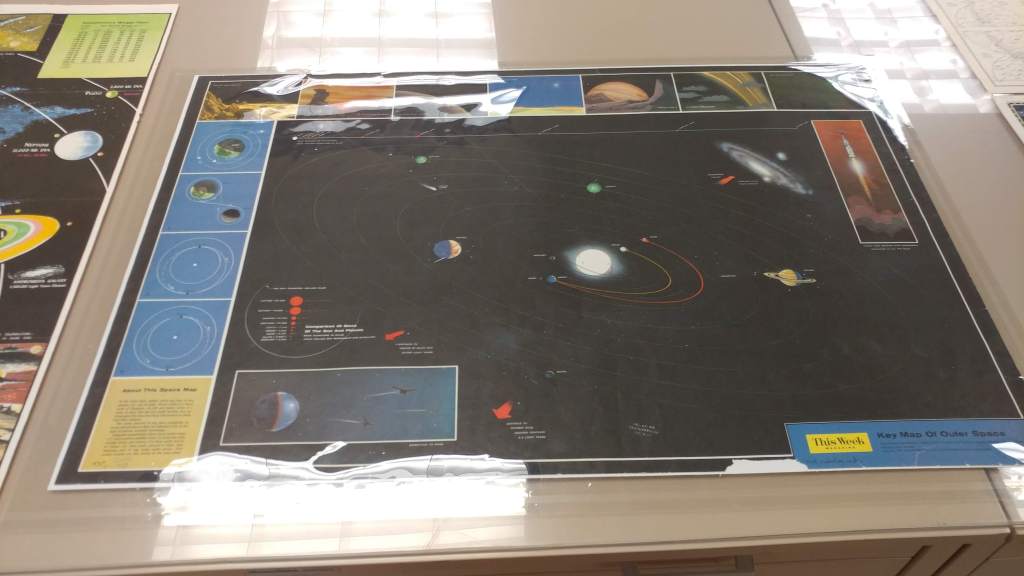
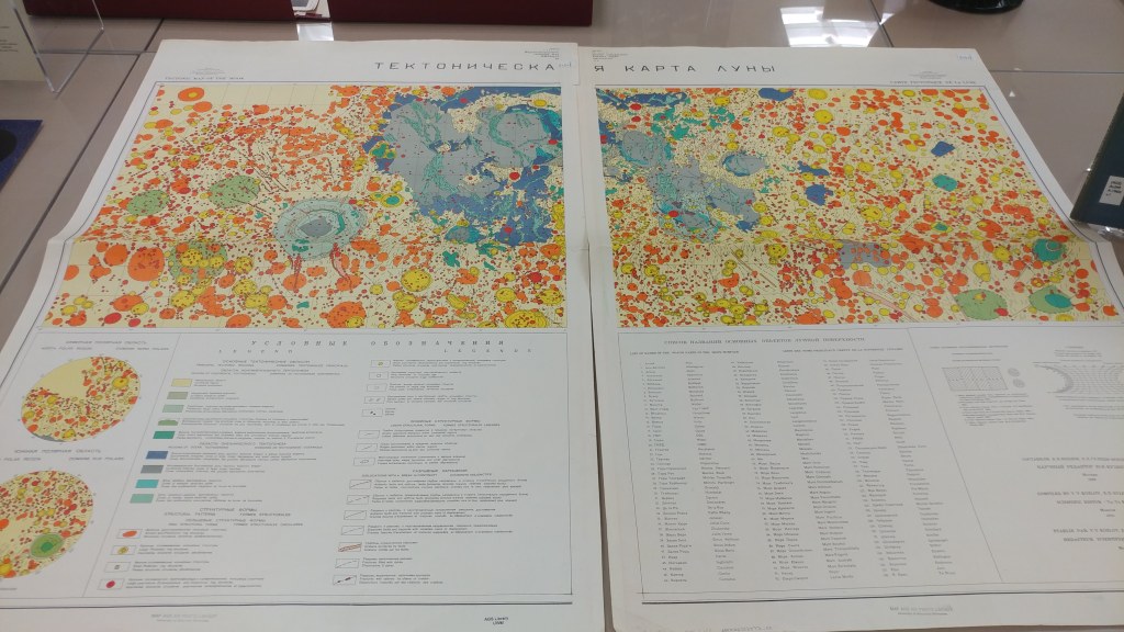
50th Anniversary of the Apollo 11 Moon Landing pop-up exhibit in the AGSL
by Angie Cope
The exhibit will be up from July 16 – July 26 during regular hours (M-F 8am-4:30pm).
Many of our maps have been scanned and are viewable in the AGS Library Digital Map Collection. https://collections.lib.uwm.edu/digital/collection/agdm/search/searchterm/moon
Catholic education in Milwaukee
by Angie Cope
In 2015, Tom and Lisa Marcz donated a map to the AGSL on behalf of Tom’s father, Frank Marcz.
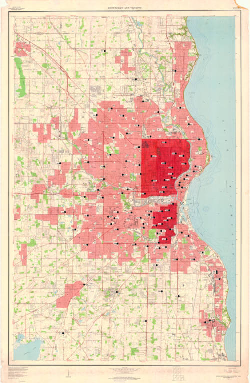
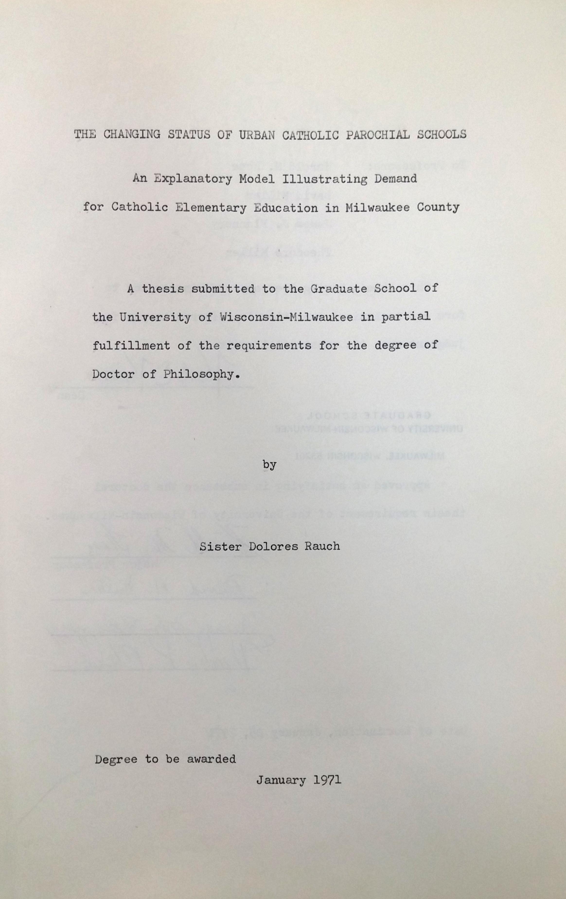
Upon further investigation, and interviews with Tom Marcz, it was discovered that the map was annotated by Sister Dolores Rausch and used as part of her 1971 PhD dissertation, “The changing status of urban Catholic parochial schools; an explanatory model illustrating demand for Catholic elementary education in Milwaukee County.” The Marcz family were long time friends with Sister Dolores.
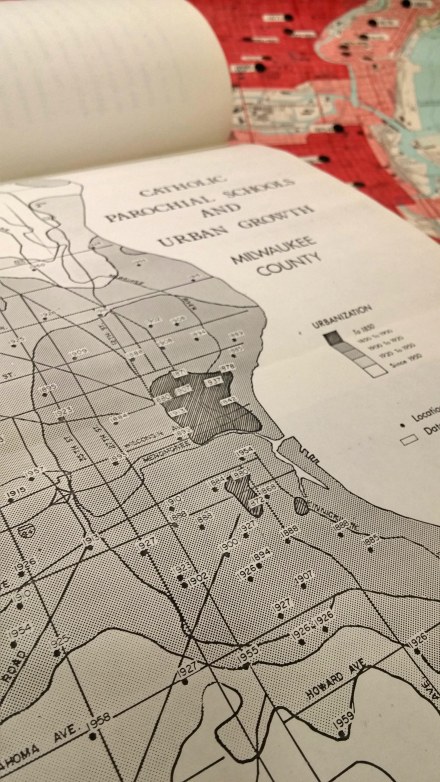
The base map is “Milwaukee and vicinity, Wisconsin : 1959” by the U.S. Geological Survey and the annotations show location of catholic schools and the date of establishment.
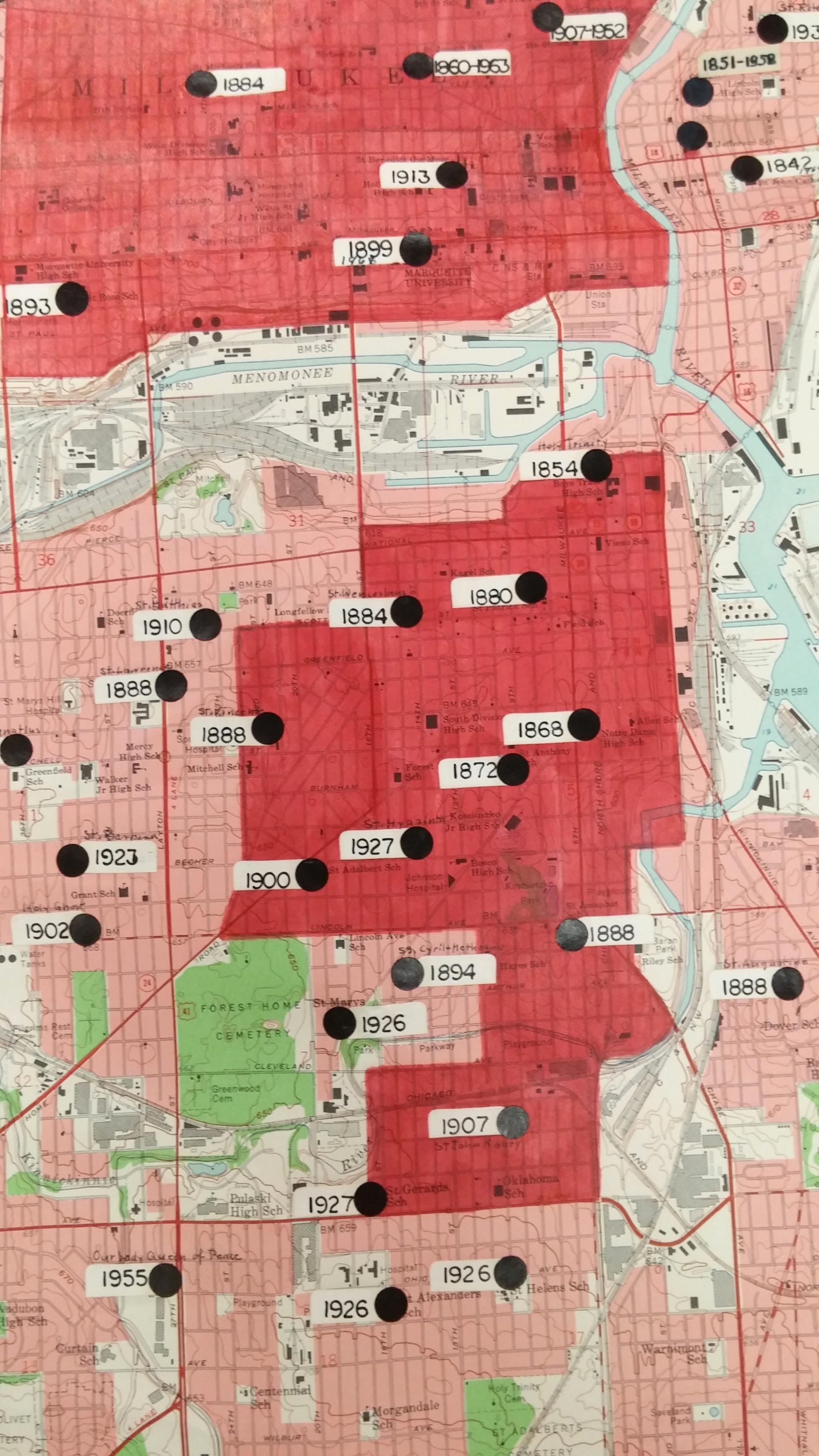
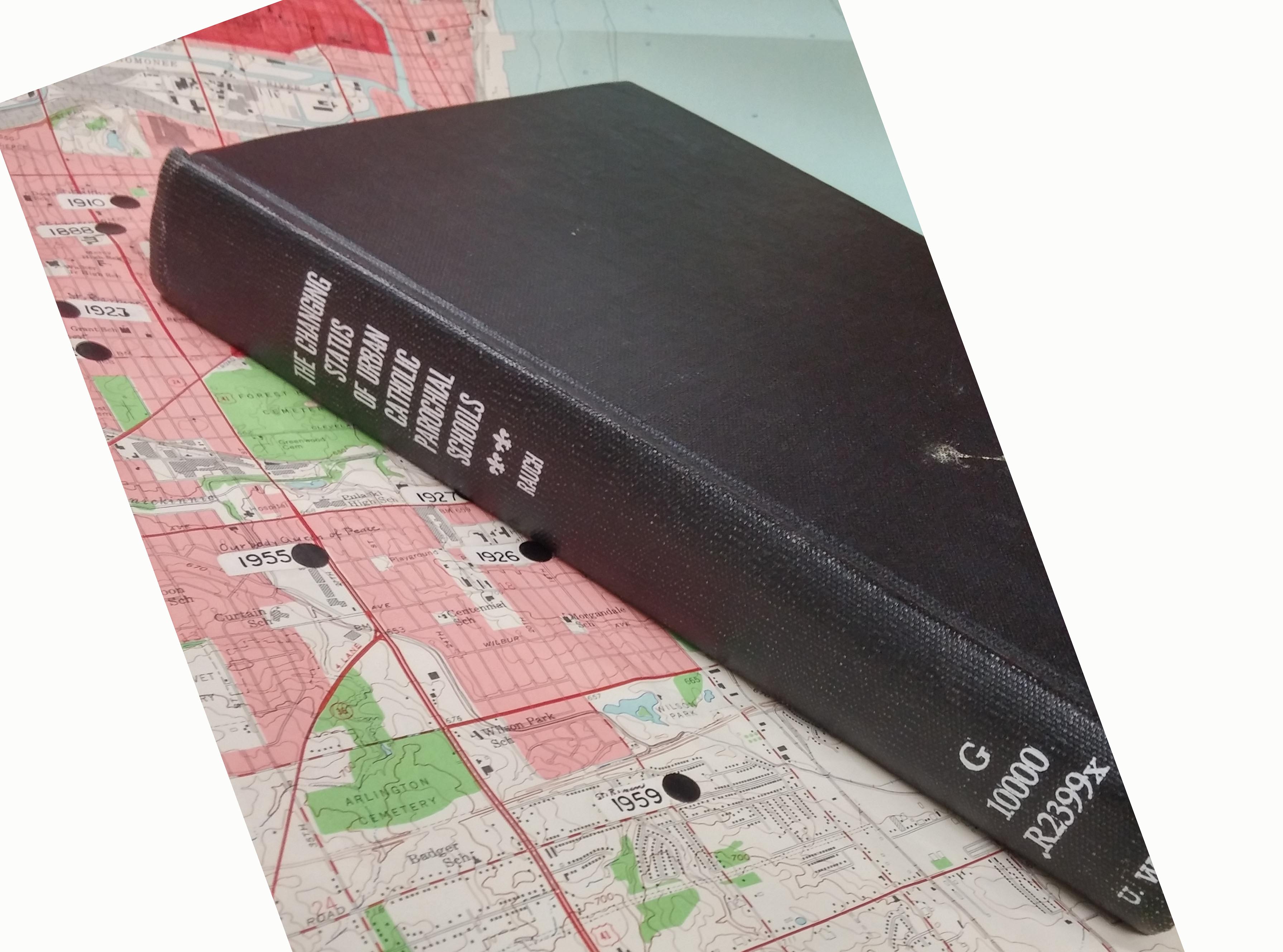
Sister Dolores was the first PhD student to graduate from the Geography Department at UW Milwaukee. The 181 page dissertation includes many maps, similar to the annotated map above.
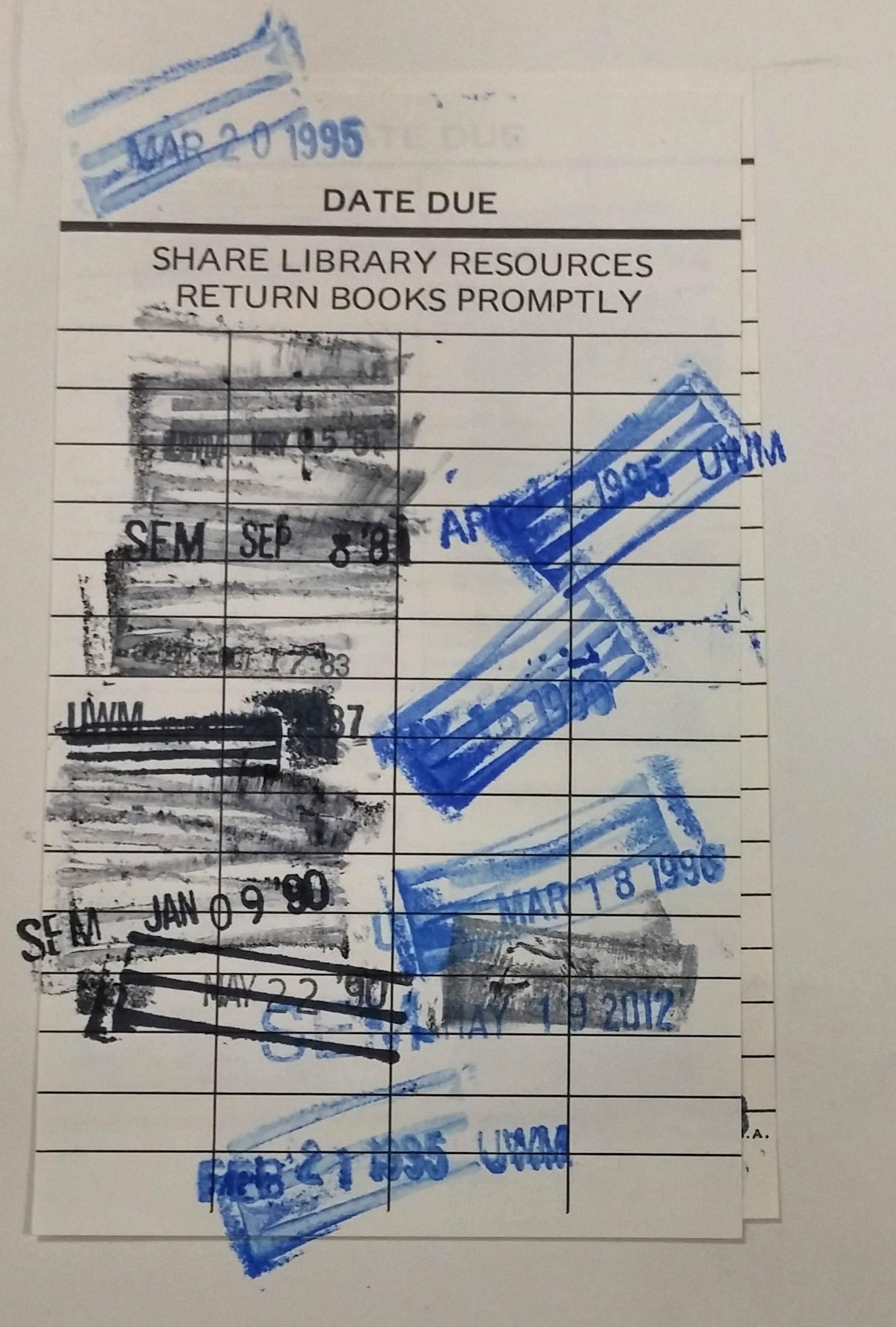
Her dissertation is popular and has been checked out often from the UWM Libraries.
Sister Dolores Rausch (1915-2011) touched many lives and was an incredible citizen of the Milwaukee area. If you’re interested in learning more about Sister Dolores, here are some biographical resources:
Sister Dolores Rauch, compiled by Sister Victoria Wiethaler in 2003. https://atlanticmidwest.org/posts/sister-dolores-rauch
Tale of two sisters by Dr. David Snowdon. http://www.sturdyroots.org/ns_taleotsister.htm
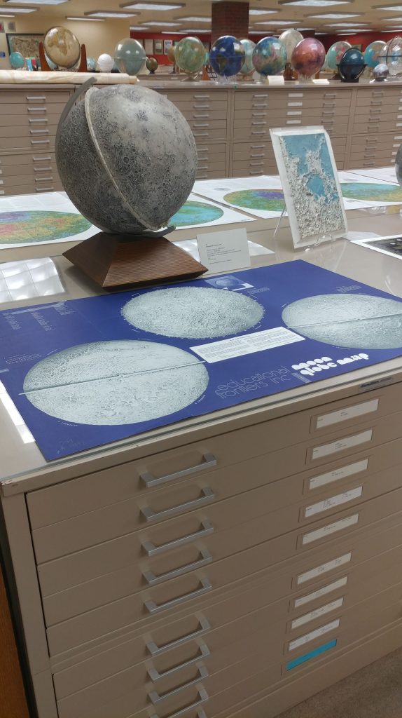
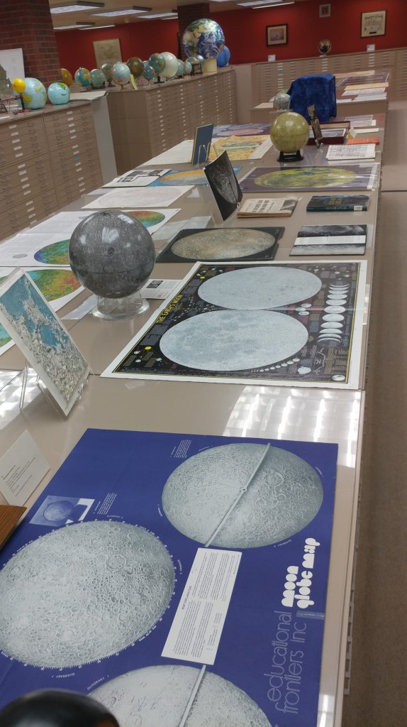
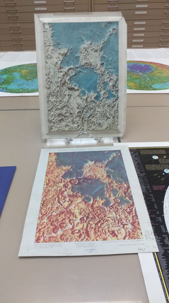
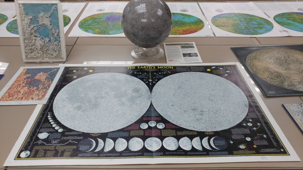
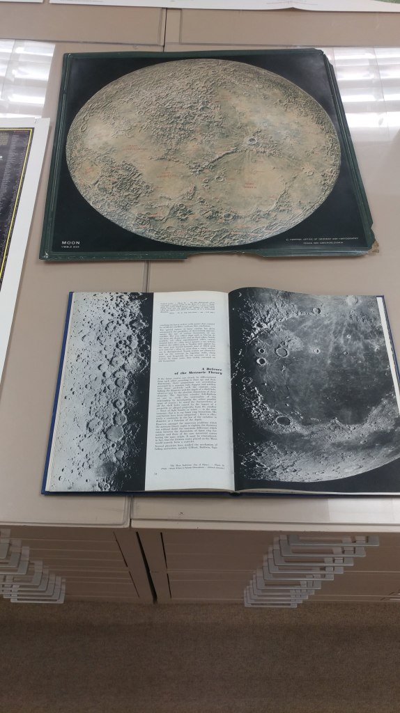
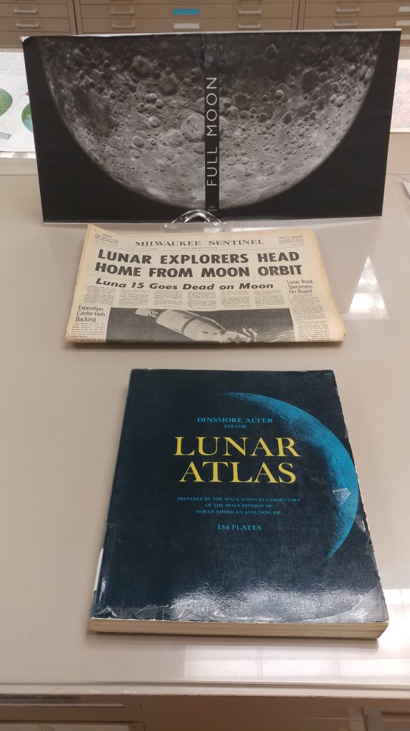
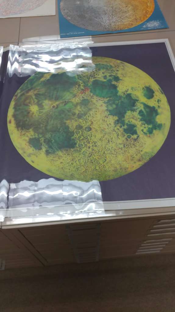
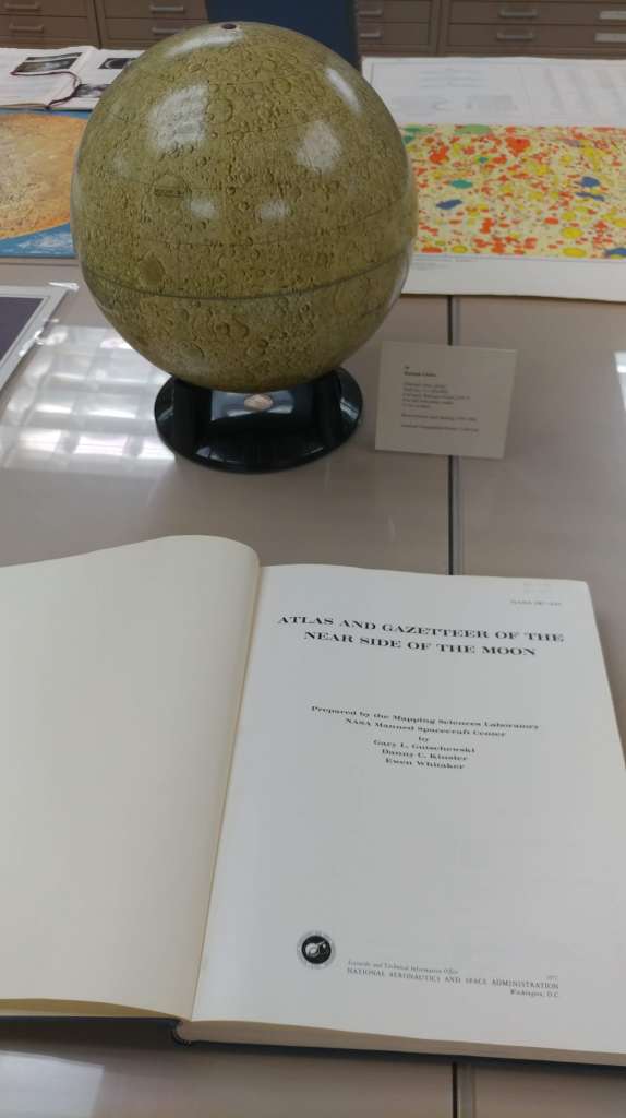
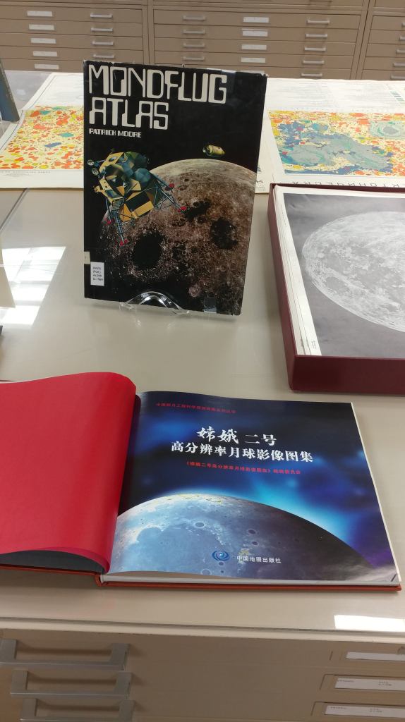
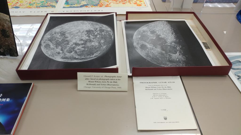
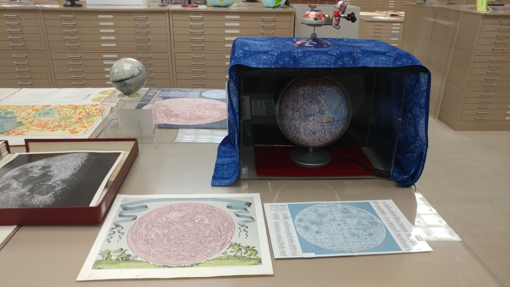
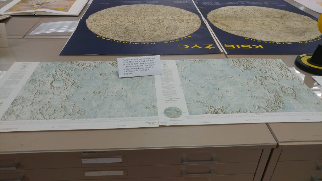
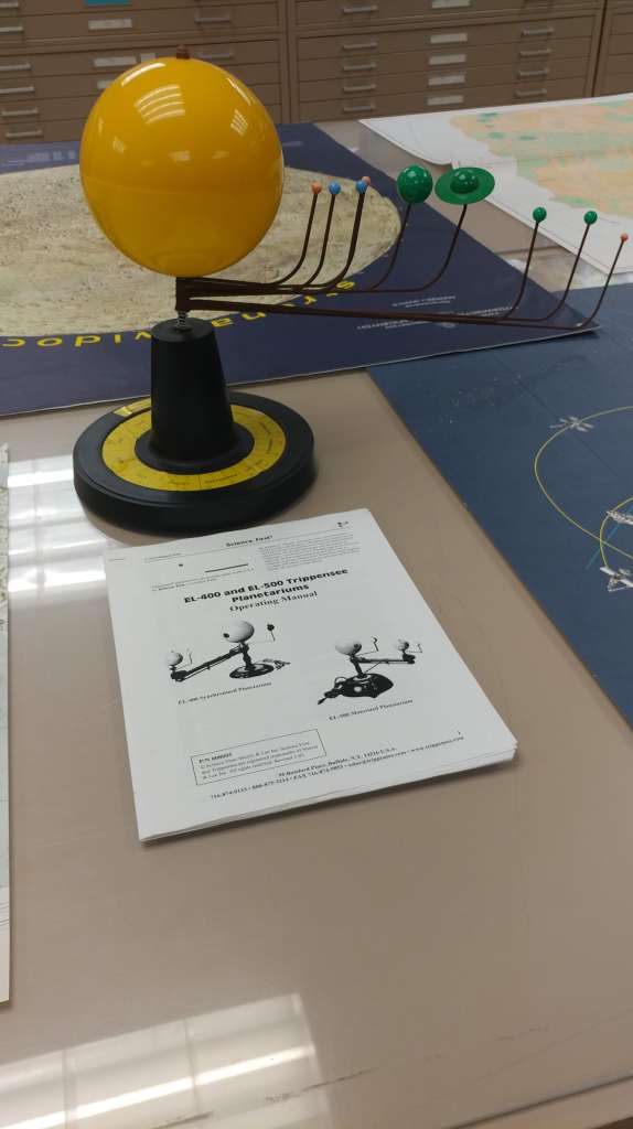
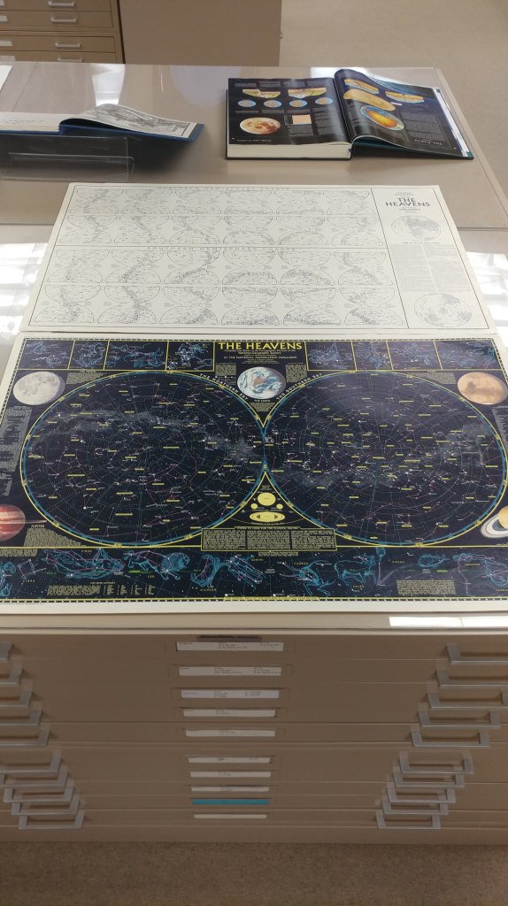
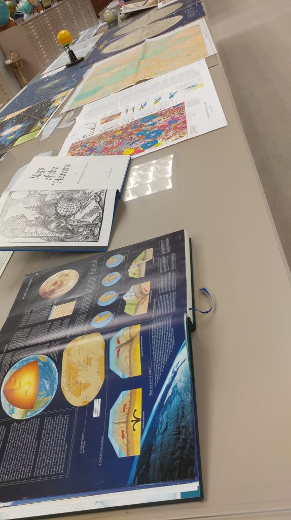
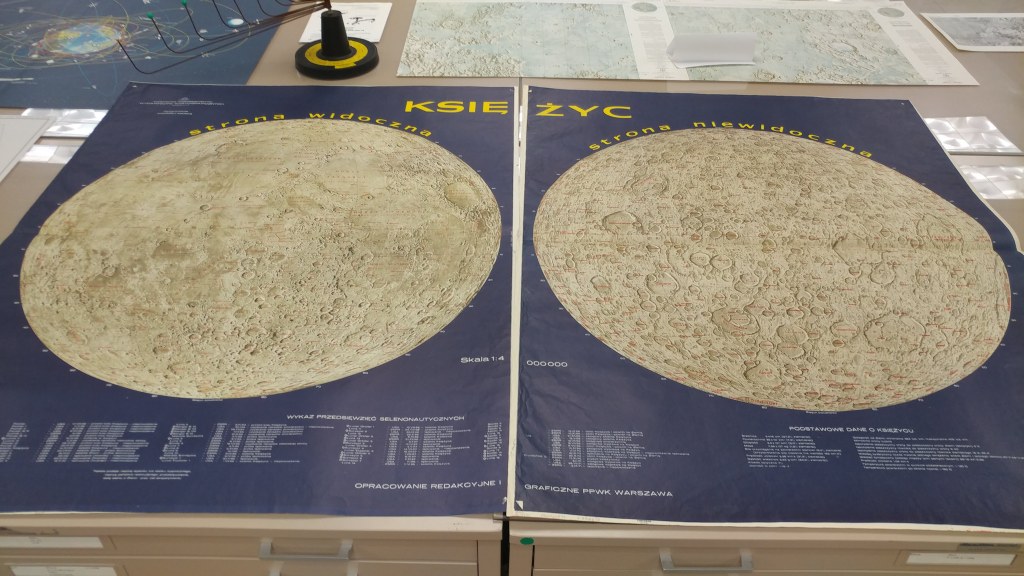
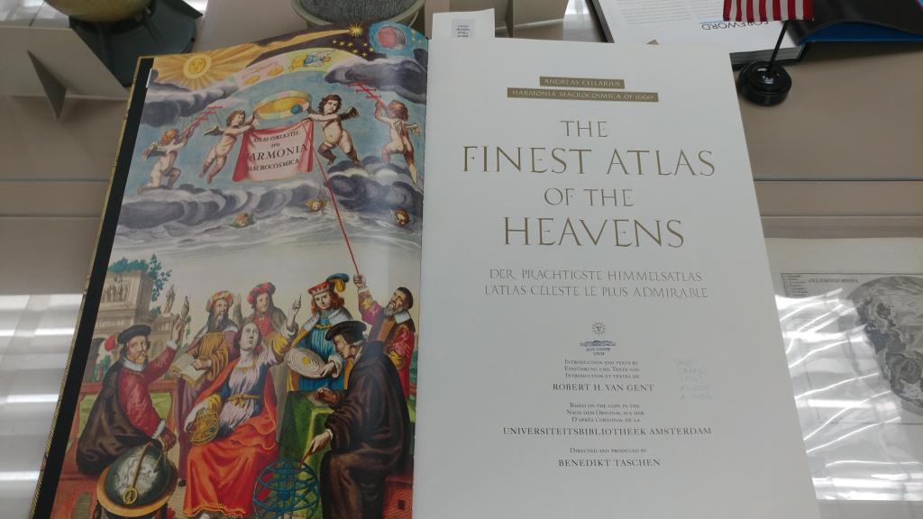
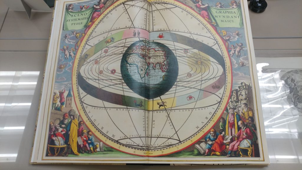
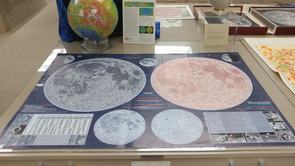
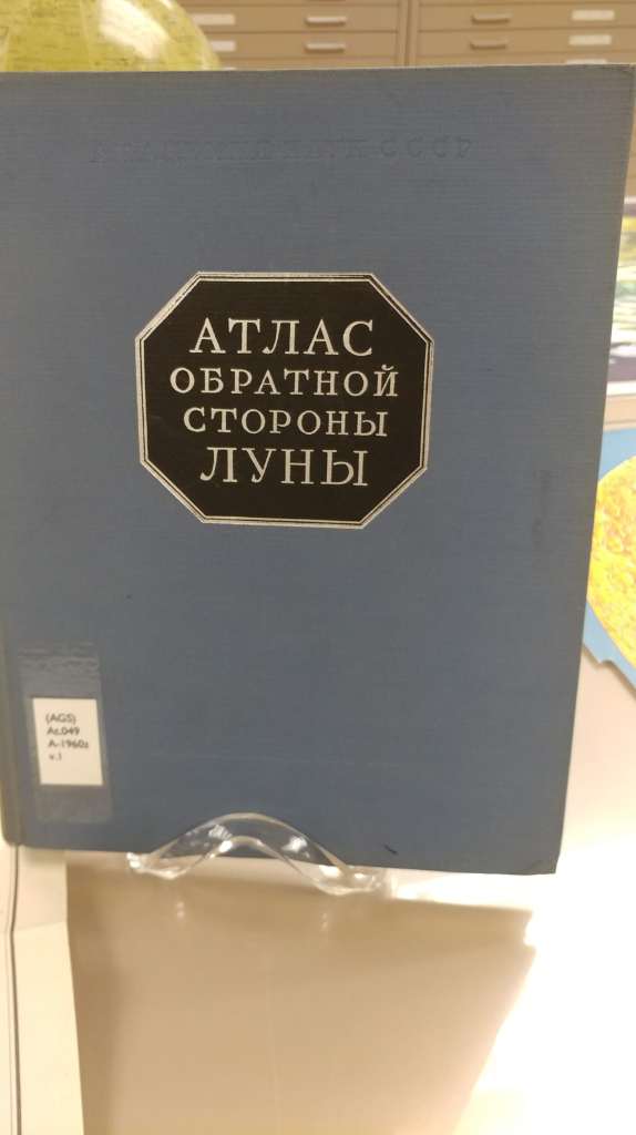
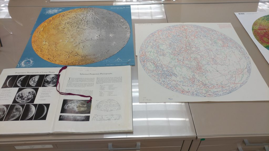
Visualizing the Moon Exhibit 2019
The latest exhibit is entitled: “Visualizing the Moon.” It features lunar maps, atlases, books, globes, and photographs. This is in conjunction with Marcy Bidney’s presentation on “Imagining the Moon: A History of Lunar Visualizations,” which was rescheduled for April 3, and is co-sponsored by the UWM Planetarium as part of their event series celebrating the 50th anniversary of the Apollo Moon Landing. The exhibit will be up through April 19.


Preservation for the private collection
by Angie Cope
Librarians at the AGS Library are often asked about best practices for caring for private collections. A recent “conversation” at the EXLIBRIS rare and special collections discussion list generated many useful sources to help answer that question.


___________________________
American Institute for Conservation (AIC) – Caring for your treasures
Northeast Document Conservatin Center (NEDCC) – Preservation Leaflet Series
American Library Association (ALA) – Saving for your stuff (audio, film, books, data, textiles, paper, slides, photos, scrapbooks, artifacts)
Gaylord Archival – Guide to collections care
Gaylord Archival Resources
Archival 101: Dealing with Suppliers of Archival Product by Peter D. Verheyen
Bookcraft Book Repair Guide early editions are available via HaithiTrust
Photos from the AGS Library efforts of caring for our collection with some before and after photos.


")

")


Manuscript maps by Adolph N. Krug, an American missionary in Cameroon in the early 20th Century
by Angie Cope
The AGS Library has 3 manuscript maps drawn by Adolph N. Krug, an American missionary in Cameroon in the early 20th Century.
Krug was born in 1873 in Germany and immigrated to the United States at the age of 15. He studied at Amherst College, graduating in 1903. That same year, he married Miss Evelyn E. Saul and they both left for Cameroon under the appointment of the Board of Foreign Missions of the Presbyterian Church of the USA.
Krug traveled the country, opening schools and churches and mapping the trails. It was his mapping efforts that led to his membership as a fellow in both the the Royal Geographical Society and the American Geographical Society.
Toward the end of his career, Krug was in charge of the village school in Foulassi. In 1941 he and his wife returned to the states to address Krug’s health condition. Krug died of heart failure in 1942. Mrs. Krug returned to Cameroon where she lived until her death in 1951. Their four children became missionaries in Asia and Africa.
Two of the manuscript maps held at the AGSL depict the trails, missionary sites, rivers and locations where Krug set up schools and churches. One of these is a “photostat” made by the American Geographical Society of Krug’s manuscript map. It is unknown where the original is located – perhaps at the Royal Geographical Society.
The third manuscript map is Krug’s manuscript reproduction of Dr. Marcel Chambon’s map showing the French medical survey of Cameroon. Chambon was a colleague of Dr. Eugene Jamot and the two of them working together were instrumental in trying to combat the African sleeping sickness
In addition to his mission work, Krug was interested in the life of the indigenous peoples, especially their folklore. The Journal of American Folklore published a number of “Bulu Tales” collected by Krug over his 39 years in Africa.


Click on any image above to open a larger view.
Map 1
Part of district of Ebolowa with outposts of Sangemalima and Ako’o Afem / drawn by A.N. Krug, M.A., cyclometer measures and compass direction. [Photostat/photocopy]
Adolph N Krug ; American Geographical Society of New York.
Foulassi, Cameroun : Adolph N. Krug New York, New York : American Geographical Society of New York ; 1911
Map 2
District subdivision, Sangmelima, Cameroun.
Adolph N Krug
1927?
Map 3
French medical survey of sleeping sickness in Sangmelima / Dr. Chambon (copied with his permission by A.N. Krug).
Marcel Chambon ; Adolph N Krug
192-?
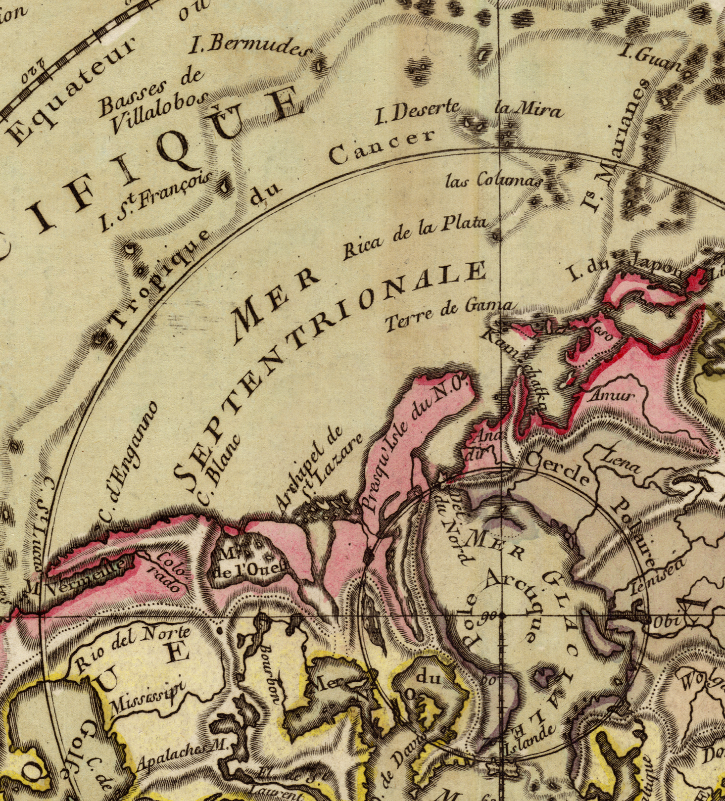
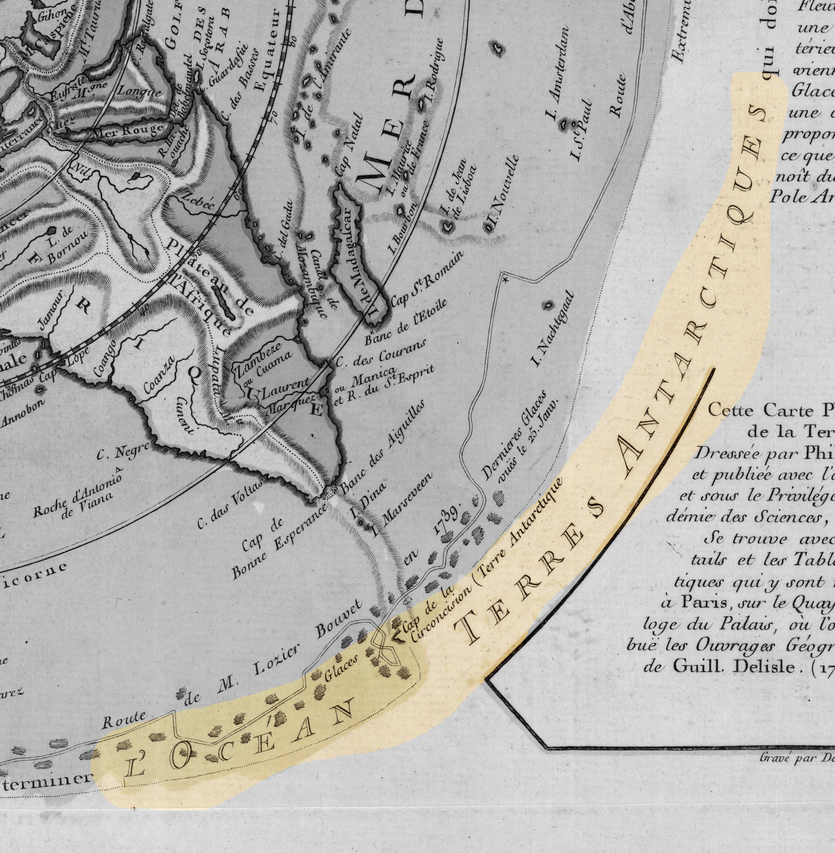
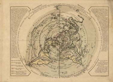
Planisphere physique by Philippe Buache, 1756
by Angie Cope
The AGS Library recently acquired a map of the world on a north polar projection. The map was made by French geographer Philippe Buache (1700-1770) who was one of the first to recognize the importance of watersheds. Buache trained under the geographer Guillaume Delisle and was married to Delisle’s daughter.
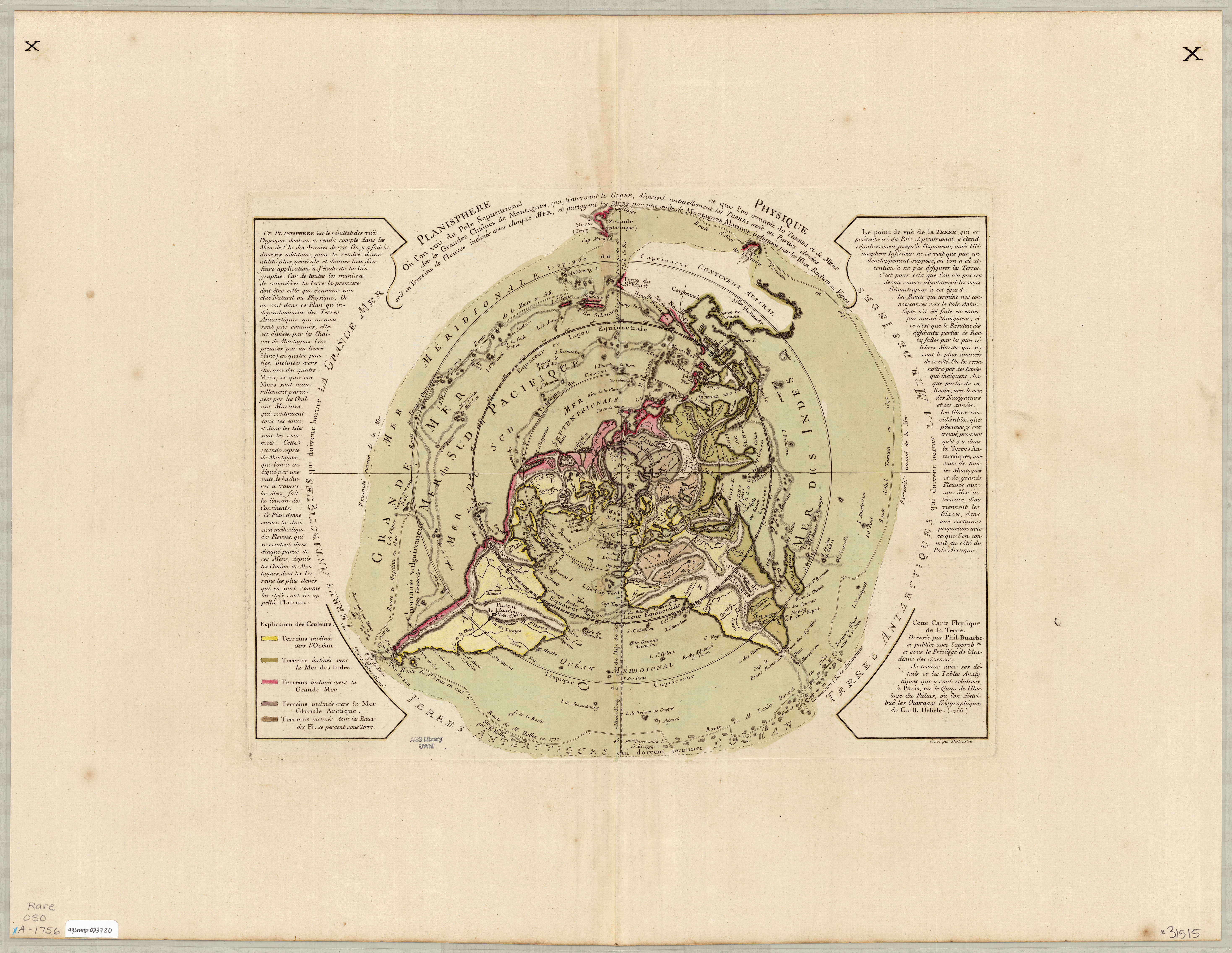
This map shows mountains and how each flows via rivers to the seas. Buache correctly identified the existence of Alaska and the Bering Strait, years before they were officially discovered.
On the map he depicts an Antarctic Sea which turned out to be inaccurate.
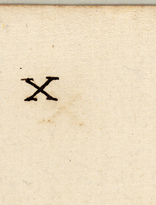
The AGS Library copy of this map is larger than other known copies at 56 x 74 cm in size (compared to 34 x 46 cm of other maps). The AGS Library map also has “Xs” in the top right and left corners on both the front and back of the map.
The text along the edges describes various expeditions and includes mention of Bouvet de Lozier’s 1738-1739 discovery of icebergs between 200-300 feet high and half a league to 2 or 3 leagues in circumference.
The AGSL copy of this map is available at the UWM Digital Map Collection. Click here to view it in more detail including zoom, pan, etc.
Library of Congress copy can be viewed in more detail here.
- ← Previous
- 1
- …
- 3
- 4
- 5
- Next →
