Angie’s Blog
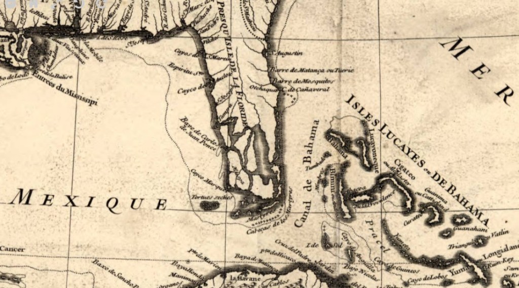
Map of the Caribbean by Jean-Baptiste Bourgulgnon d’Anville, 1731
By Angie Cope
This 1731 map of the Caribbean was originally created to be part of one of the first histories of the Caribbean entitled: Histoire de L’Isle Espagnole ou de S. Domingue by Father Pierre François Xavier de Charlevoix. The map was reproduced and corrected a number of times and this copy reflects the second state of the first edition of the map. French geographer Jean-Baptiste Bourgulgnon d’Anville (1697-1782), the creator of this map, is cited as greatly developing the technical proficiency of mapmaking during his lifetime.
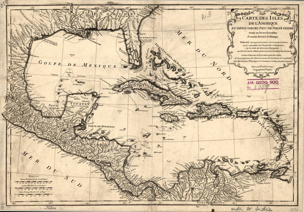
The maps shows the Florida Keys at the south emphasizing their archipelagic nature. River and waterway details are abundant with the entrances to major rivers shown such as the Mississippi, the Rio Bravo and the Orinoco. Terrain is show with illustrations of mountains.
Text in decorative cartouche in upper right translates to:
Map of the isles of America and several countries of the mainland located in front of these Isles & around the Gulf of Mexico.
Made based on a large number of particular maps, on the instructions of navigators and travelers, on the recitals of the Spanish historians, which furnish details which have not been entered into the maps. The whole diminishes under the most favorable projection, and agrees with astronomical determinations of longitude of Martinique, Santo Domingo, Jamaica, Cartagena, and Louysiana
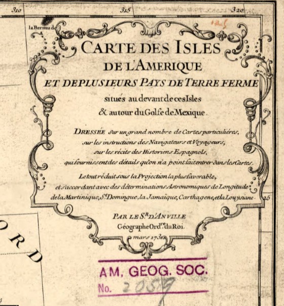
Title: Carte des isles de l’Amerique et de plusieurs pays de terre ferme situes au devant de ces isles & autour du Golfe de Mexique / dressee sur un grand nombre de cartes particulieres, sur les instructions des navigateurs et voyageurs, sur les recits des historiens espagnols, qui fournissent des details quon na point fait entrer dans les cartes ; le tout reduit sous la projection la plus favorable et s’accordant avec des determinations astronomiques de longitude de la Martinique, St. Domingue, la Jamaique, Carthagene et la Louysiane ; par le sr. d’Anville, geographe ordre. du roi, mars 1731 ; Delahaye sculpsit.
Call number: (AGS) (RARE) 230 B-1731
Scale: 1:10,000,000
Published by: Jean-Baptiste Bourgulgnon d’Anville in Paris
Dimensions: 1 map ; 31 x 44 cm
View map in the Digital Collection: https://collections.lib.uwm.edu/digital/collection/agdm/id/361/rec/1
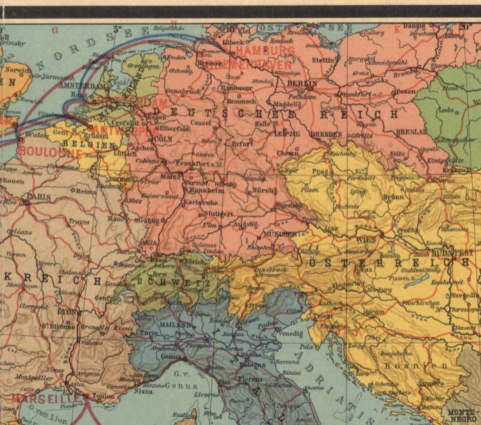
Ocean liner routes between Germany and Africa, 1914
by Angie Cope
Afrika / Geograph. Anstalt von Wagner & Debes, ; L. Friederichsen & Co. ; Woermann-Linie A.G.
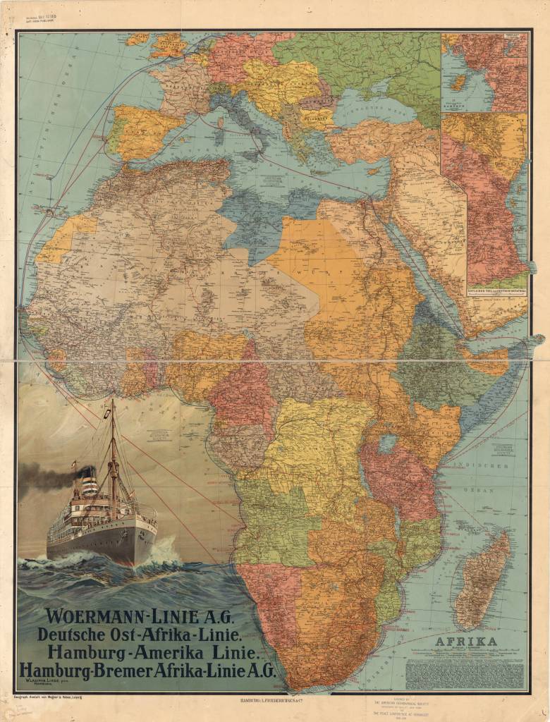
This map of Africa was published in Germany in 1914, shortly before the outbreak of World War I. It shows the ocean liner routes between Germany and Africa, as well as coastal and inland routes.
Relief is shown by hachures and spot elevations. In the lower left are an illustration of a steamship on the high seas and a listing of the major German steamship lines providing service to Africa, Woermann-Linie A.G., Deutsche Ost-Afrika Linie, Hamburg-Amerika Linie, and Hamburg-Bremer Afrika-Linie A.G.
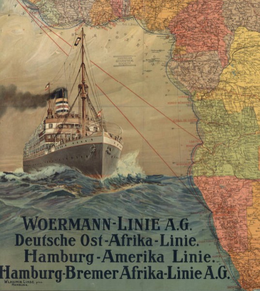
In the upper right is an inset map of the coastal region of the German colony of Cameroon and an inset to the inset showing the inland course of the Cameroon River. Below these maps is another inset showing the eastern part of German East Africa. The key at the lower right indicates the wealth of information contained in the map.
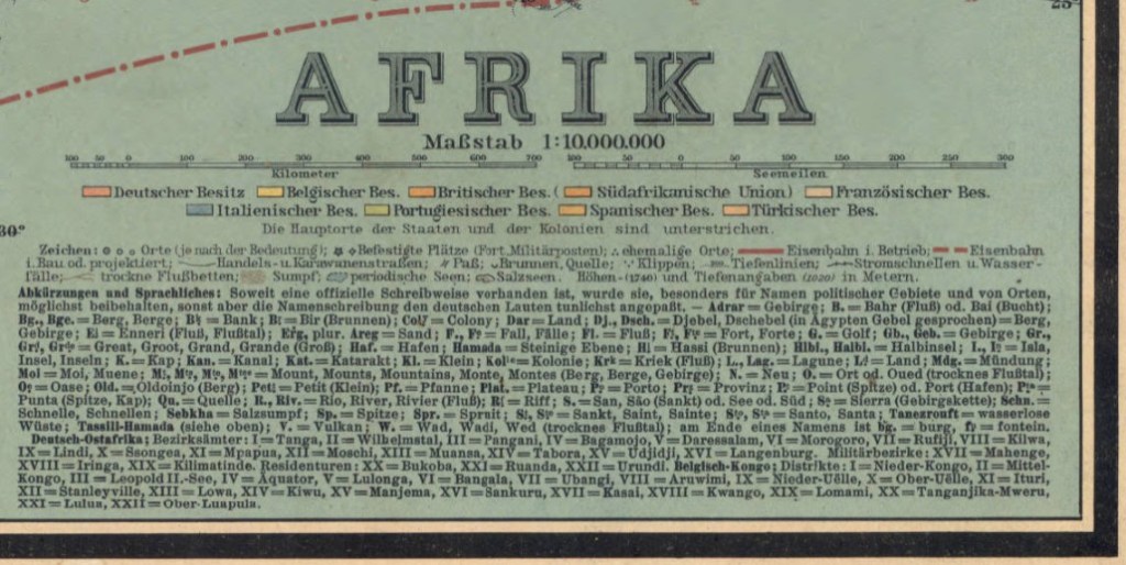
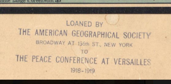
Two distance scales are provided, kilometers and nautical miles. Different colors are used to mark the colonial possessions of Germany, Great Britain, Belgium, France, Italy, Portugal, Spain, and Turkey. Symbols indicate cities and towns by population size, forts and military posts, ruins, railroads (operational and planned), caravan routes, mountain passes, wells and springs, and swamps and other geographic features. There is an alphabetical list of abbreviations for geographic terms in local languages and their German equivalents. Roman numerals are used to identify the districts and other administrative divisions in the Belgian Congo and German East Africa. The map was prepared by Wagner & Debes, a German firm that specialized in providing maps for inclusion in the famous guidebooks for travelers published by Karl Baedeker in the 19th and early 20th centuries. A stamp at the bottom indicates that the map was loaned by the American Geographical Society of New York to the Peace Conference at Versailles, 1919.
View map in the American Geographical Society Library Digital Map Collection
https://collections.lib.uwm.edu/digital/collection/agdm/id/364/rec/1
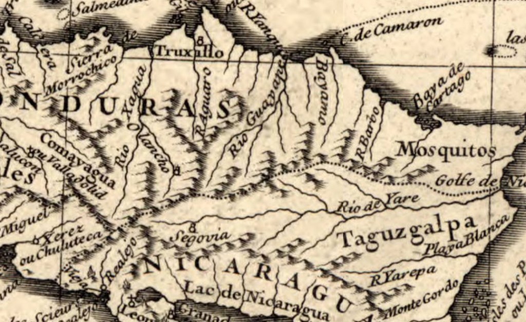
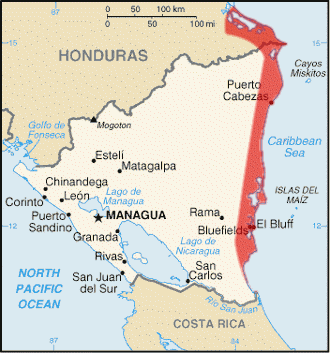
Mosquito Coast, Nicaragua 1845
By Angie Cope
The Mosquito Coast is the region along Nicaragua’s eastern coast. It was claimed by Great Britain from 1655 until 1820s. The region became part of Nicaragua in 1860, with a northern portion granted to Honduras in 1960. In 1840s, when this map was created, Nicaragua was studied as a possible transoceanic canal connecting the Atlantic and Pacific Oceans. The region also provided a route for travelers from the eastern United States during the California Gold Rush, via the use of the San Juan River and Lake Nicaragua.
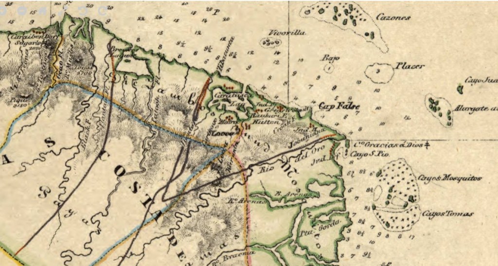
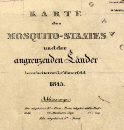
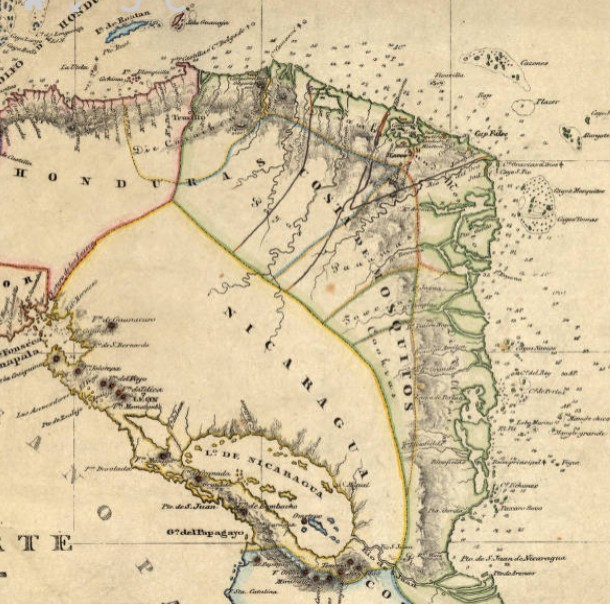
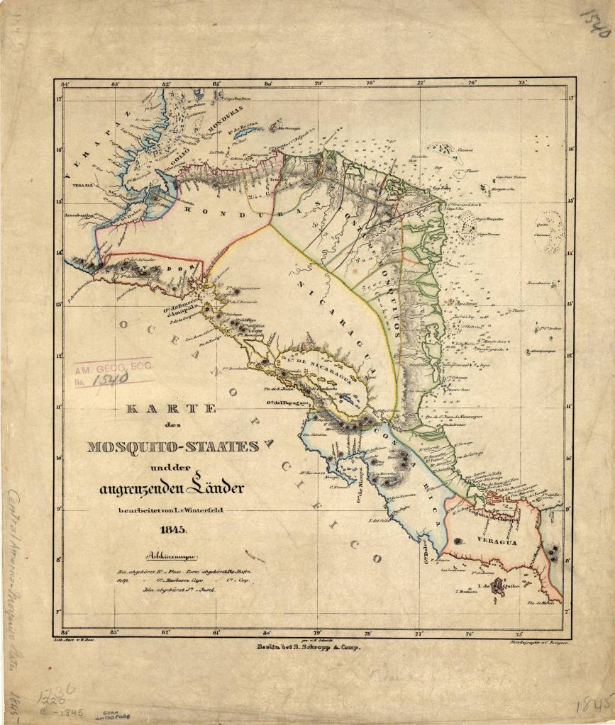
Karte des Mosquito-Staates undder angrenzenden Länder / bearbeitet von L. v. Winterfeld ; S. Schropp & Comp., 1845
Call number: (AGS) (RARE) 220 B-1845
1 map : color ; 33 x 30 cm.
Published in Berlin by Simon Schropp’sche Hof-Landkartenhandlung.
https://collections.lib.uwm.edu/digital/collection/agdm/id/360/rec/1
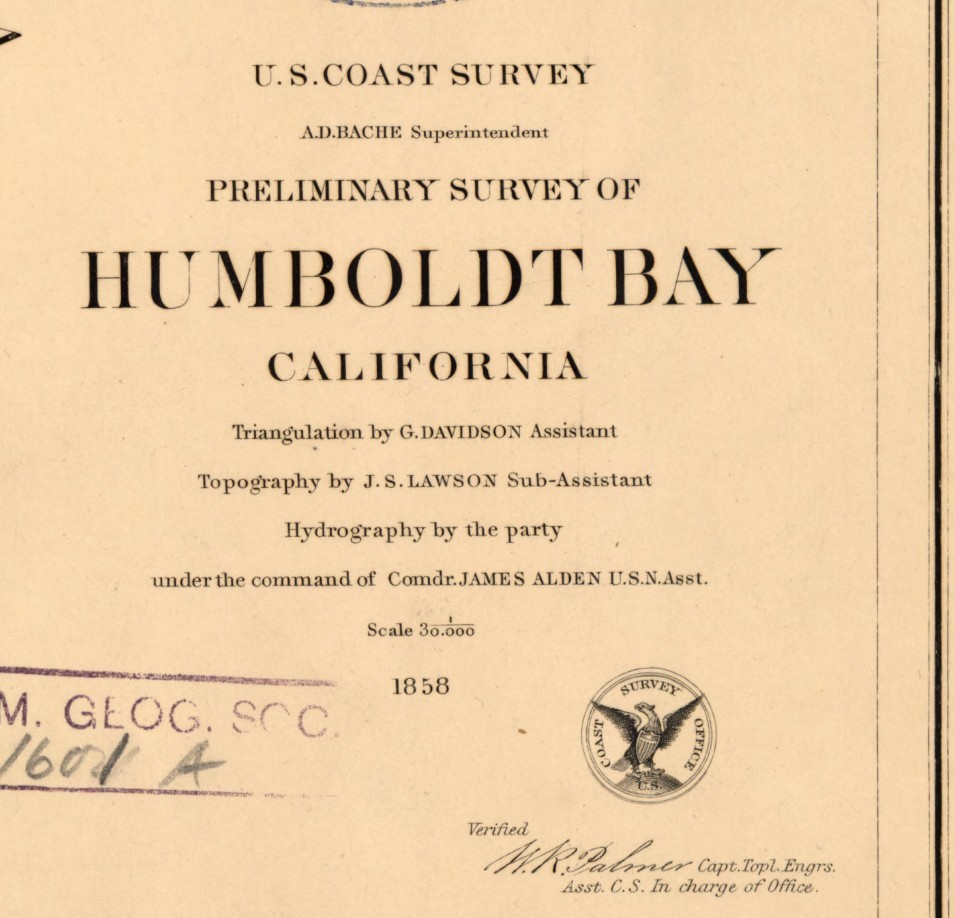
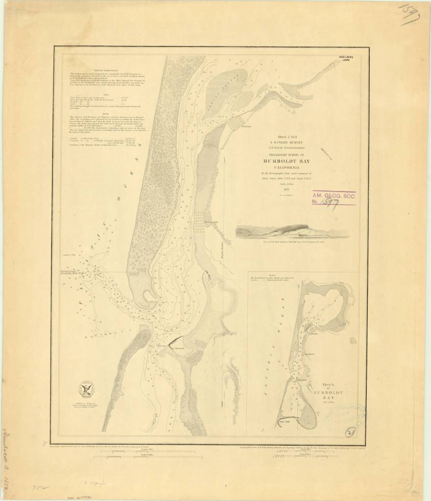
Humboldt Bay, California 1850s
by Angie Cope
Preliminary survey of Humboldt Bay, California / U.S. Coast Survey, 1858.
Rare Map: Chart CS Pacific Humboldt Bay 1858
https://collections.lib.uwm.edu/…/collec…/agdm/id/6097/rec/1

Humboldt Bay is a natural bay located on the rugged North Coast of California between San Francisco Bay and Puget Sound. The Bay is home to more than 100 plant species, 300 invertebrate species, marine and land mammals, hundreds of fish species, and more than 200 species of birds.
The Wiyot people were the first to inhabit the Humboldt Bay region, estimated to have arrived around 900 A.D. Their name for the bay is Wike or Wiki. Indian villages shown on this 1858 map are circled in pink.
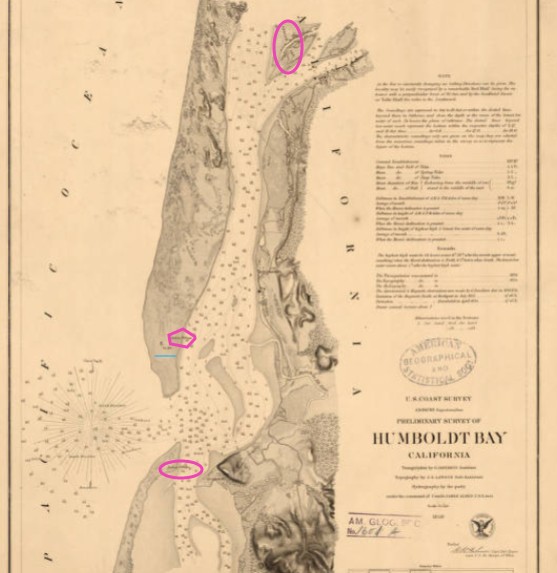
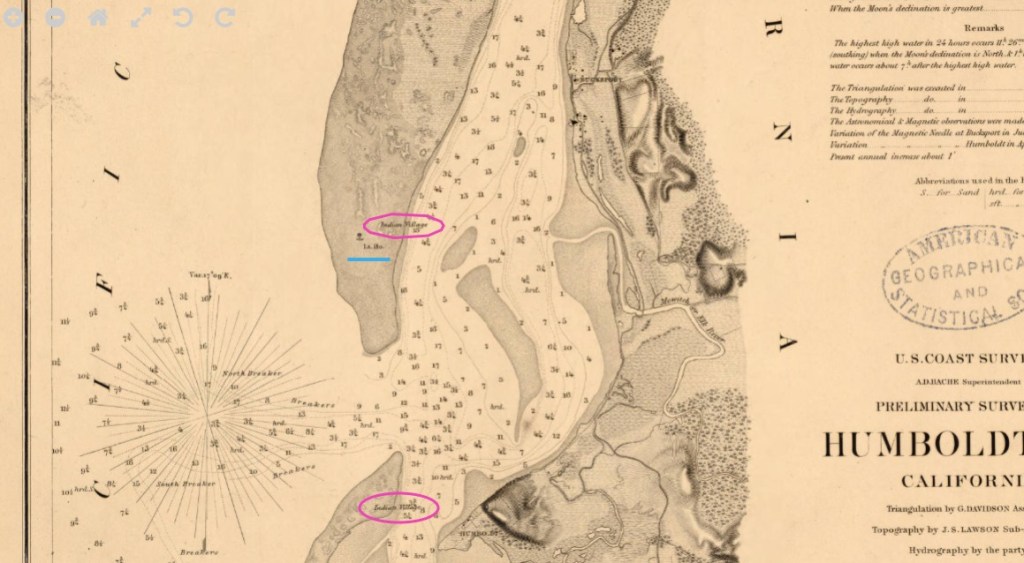
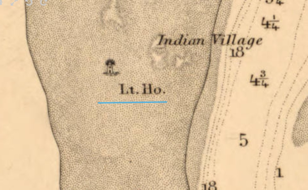
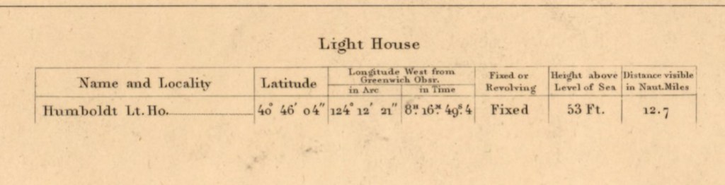
Beginning in the 1850s, settlers used the bay for shipbuilding and the export of lumber. In 1856 the Humboldt Harbor Light was built on the north spit (underlined in blue).
Interesting factoid: There is a memorial to the USS Milwaukee in Eureka, California on Humboldt Bay. In 1917, the USS Milwaukee ran aground while trying to tow a beached submarine. Remnants of the wreck are still visible today at low tide.
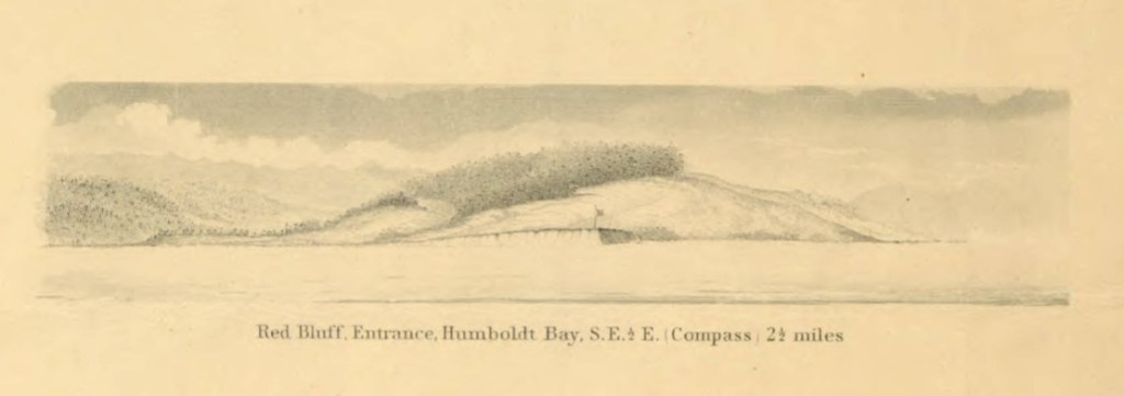
Illustrated view: Red Bluff entrance, Humboldt Bay, S.E. 1/2 E. (compass) 2 1/2 miles
From: Reconnaissance of the western coast of the United States : middle sheet : from San Francisco to Umpquah [sic.] River, 1854
https://collections.lib.uwm.edu/digital/collection/agdm/id/6717/rec/17
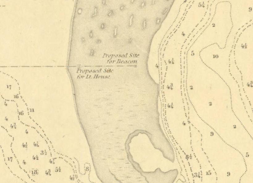
Preliminary survey of Humboldt Bay, California / U.S. Coast Survey, 1852
https://collections.lib.uwm.edu/digital/collection/agdm/id/4778/rec/1,
Shows the proposed site for the light house built in 1856.
John Arrowsmith’s 1860 Arctic discoveries map
by Angie Cope
If you’re watching the AMC series “The Terror” you’ve experienced the dramatization of Sir John Franklin’s final voyage in 1845 in HMS Erebus and HMS Terror. The journey ended in tragedy for him and all his men, becoming the worst disaster in the history of British polar exploration.
Sir John Franklin’s Arctic discoveries, between Baffin Bay & Cape Bathurst, combined with those of Sir Edward Parry in 1819, and the several searching expeditions, concluding with that of Sir Francis L. McClintock in 1859 / constructed by John Arrowsmith, 1860
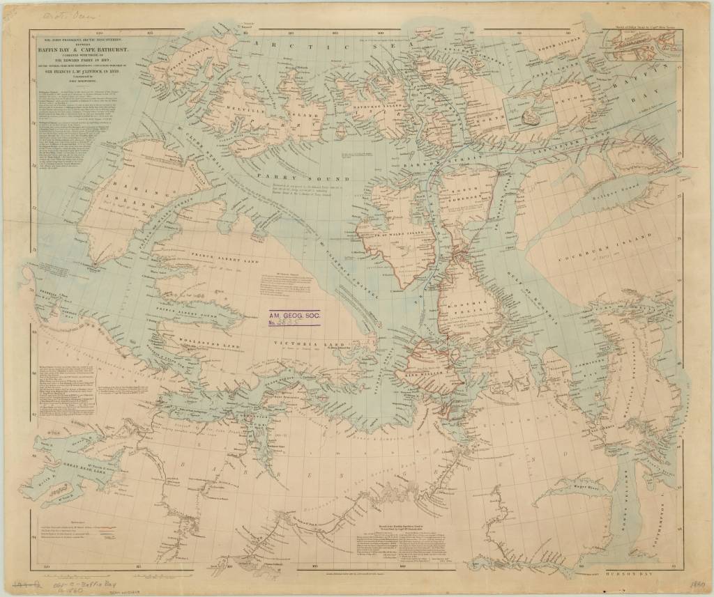
https://collections.lib.uwm.edu/…/colle…/agdm/id/21392/rec/4
From Royal Museums Greenwich:
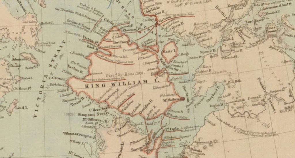
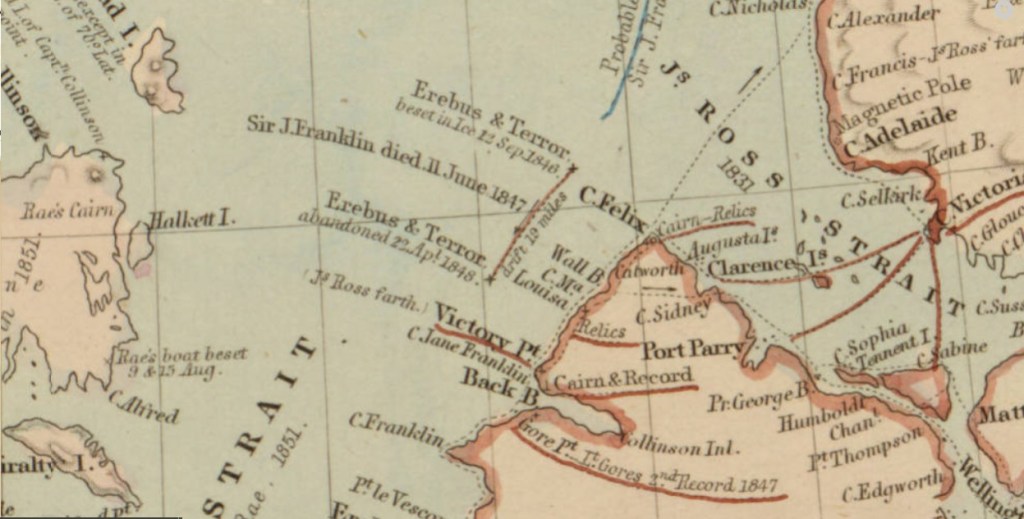
Franklin’s two naval vessels sailed up the Wellington Channel before turning south toward Beechey Island, where they would spend the winter. In the spring, they sailed south down Peel Sound but, off the northernmost point of King William Island, were trapped by the ice flow down the McClintock Channel.
In the spring of 1847, a party from the expedition travelled across the ice to Point Victory on shore and deposited a written record of their progress. It is thought they reached Cape Herschel on the south coast of the island, filling in the unexplored part of the North-West Passage. Sir John Franklin died in June that year.
Still trapped in the ice, Erebus and Terror drifted south until Captain Crozier ordered their abandonment in April 1848. Weakened by starvation and scurvy, the 105 surviving men headed south for the Great Fish River. Most died on the march along the west coast of King William Island.
To read the entire article. https://www.rmg.co.uk/…/john-franklin-final-north-west-pass….
Moravia 1741 by Georges-Louis le Rouge
by Angie Cope
Carte particulière de la Moravie Divisée en six Cercles avec les Principaux Postes de ce Marquisat / pour l’intelligence de la Guerre presente a Paris par et chez le Sr. Le Rouge Ingr. Geographe du Roy … 1741
This map was created a year after the unsuccessful invasion by Prussian forces under Frederick the Great in 1740. Moravia and Bohemia formed a powerful kingdom of the Holy Roman Empire from the 16th Century to the early 20th Century. After the First World War, Moravia was integrated into the new state of Czechoslovakia.
Symbols used for cities and topography; title detail ; detail of Olmutz (Olomouc)
This map is attributed to Georges-Louis le Rouge who was a Paris based map publisher. He was born in Hanover, Germany as Georg Ludwig where he was educated and employed as a military engineer, hydrographer and cartographer. This map of Moravia was made a year after Le Rouge moved to Paris and Francophied his name. He set up shop on the Rue Des Grands Augustins and produced thousands of maps and diagrams ranging from city and town plans, to atlases, plans of military campaigns and sea charts. He received the title “Geographe du Roi” to King Louis XV. Le Rouge also worked with Benjamin Franklin to produce the important 1769 Franklin/Folger Map of the Gulf Stream. Franklin, who met Le Rouge in Paris, writes that “He [Le Rouge] is, I believe, a proper person.” *
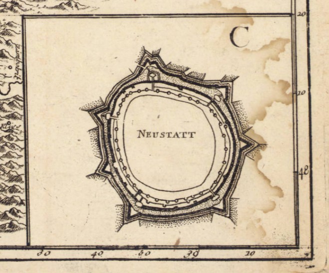
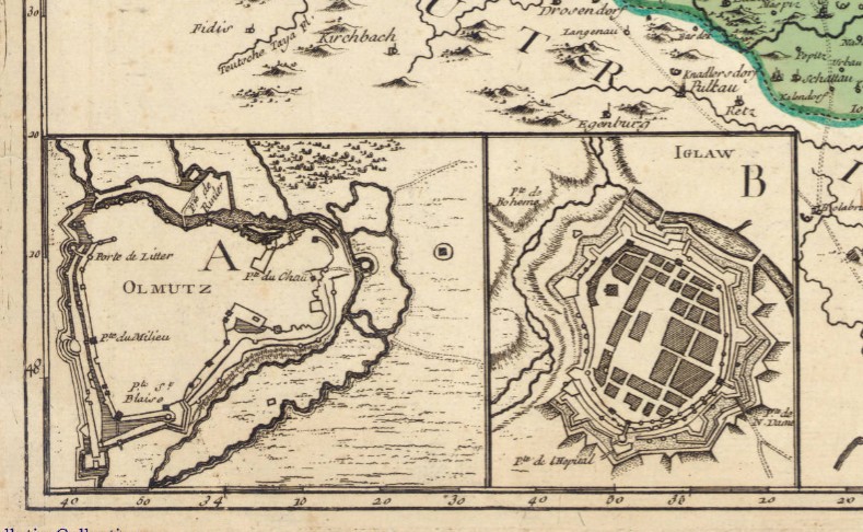
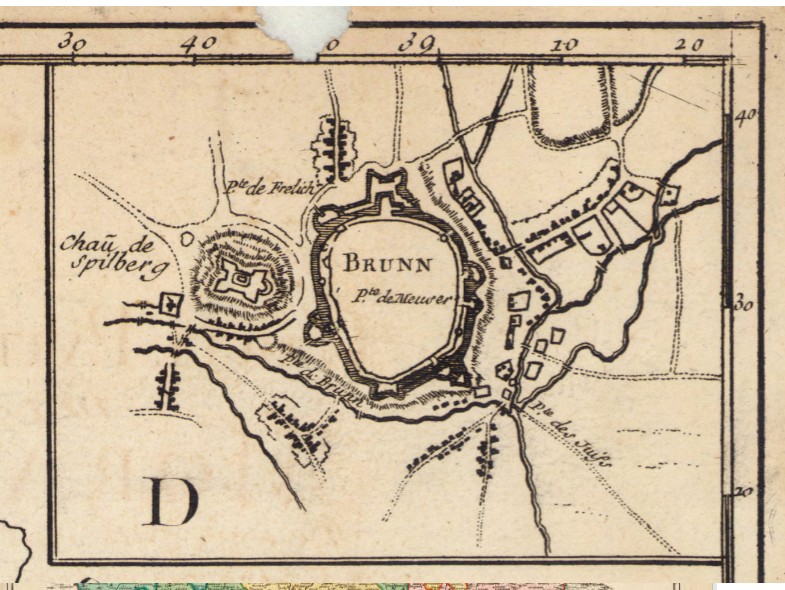
Includes 4 inset maps: A. Olmutz — B. Iglaw — C. Neustatt — D. Brunn.
The copy of the map held at the AGS Library is from the personal collection of Albert Gallatin (1761-1849) who served as the Secretary of the Treasury under both Presidents Thomas Jefferson and James Madison between 1801 and 1814. The maps were given to the American Geographical Society of New York in 1919 by Gallatin’s great grandson, Albert Eugene Gallatin (1882-1952) who served on the AGS Council in 1913. The maps, spanning the years 1700 to 1842, were originally bound as an atlas factice entitled “Atlas generale,” but have been disbound and conserved by the AGS Library at UW Milwaukee Libraries.
*Le Rouge Cohn, Ellen R., Benjamin Franklin, Georges-Louis Le Rouge and the Franklin/Folger Chart of the Gulf Stream, Imago Mundi, Vol. 52, (2000), pp. 124-142.
Splendid China was abandoned, looted, turned to rubble and transformed into Margaritaville
by Angie Cope
I’ve been working from home cataloging maps that were donated to the AGS Library. I thought I’d be able perform this task very quickly but, every other map I encounter seems more interesting than the last and distracts me. Today I ran across one called “Splendid China.”
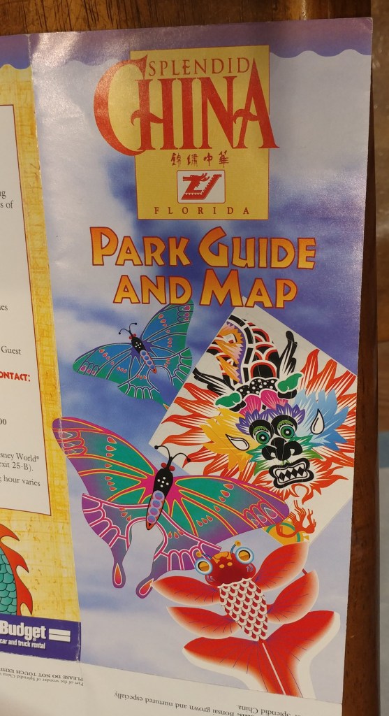
Splendid China was a theme park in Florida near Walt Disney World. The park opened in 1993, and closed on December 31, 2003. Splendid China, Florida had a sister park in Shenzhen, China which remains open today.

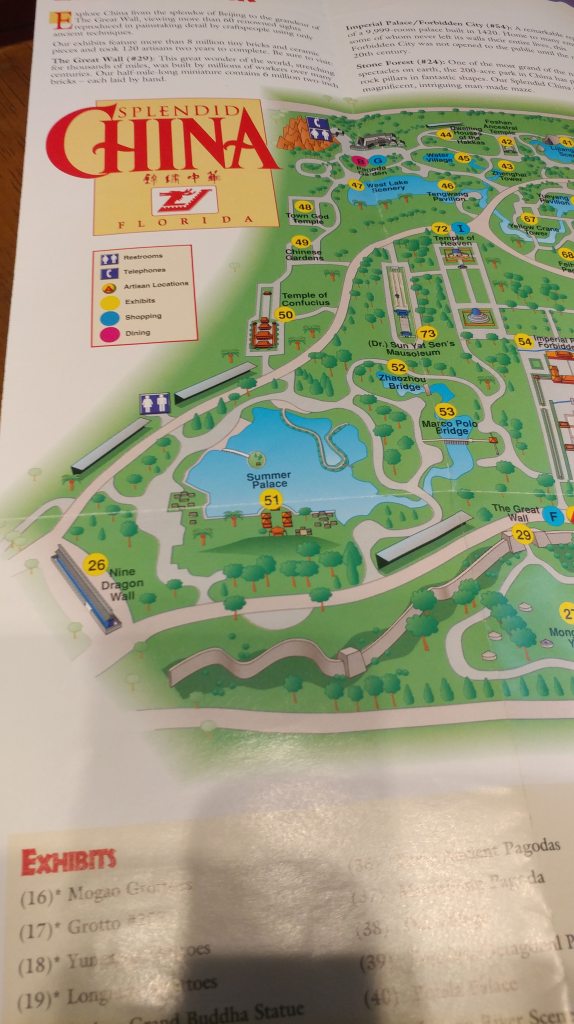
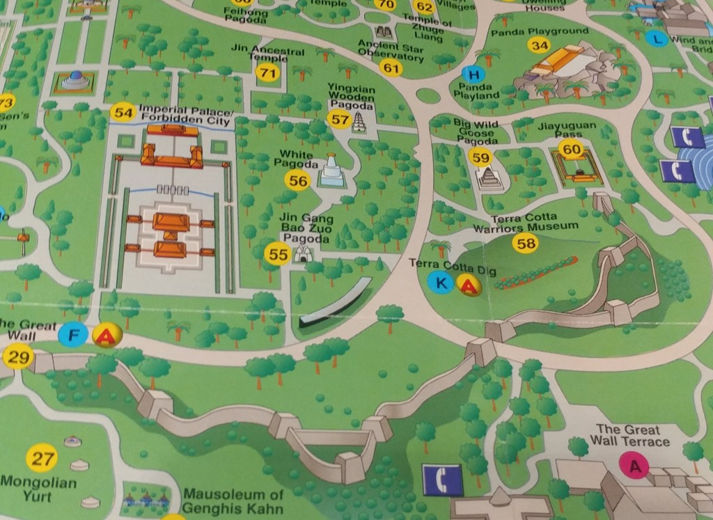
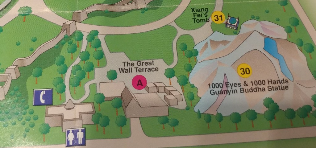
The Florida park contained over 60 one tenth scale detailed replicas of China’s most famous landmarks such as the Great Wall, Forbidden City, and the Terra Cotta Warriors. After years of controversy and protests, the park closed in 2003, vandals looted what wasn’t nailed down and the park was reduced to rubble.
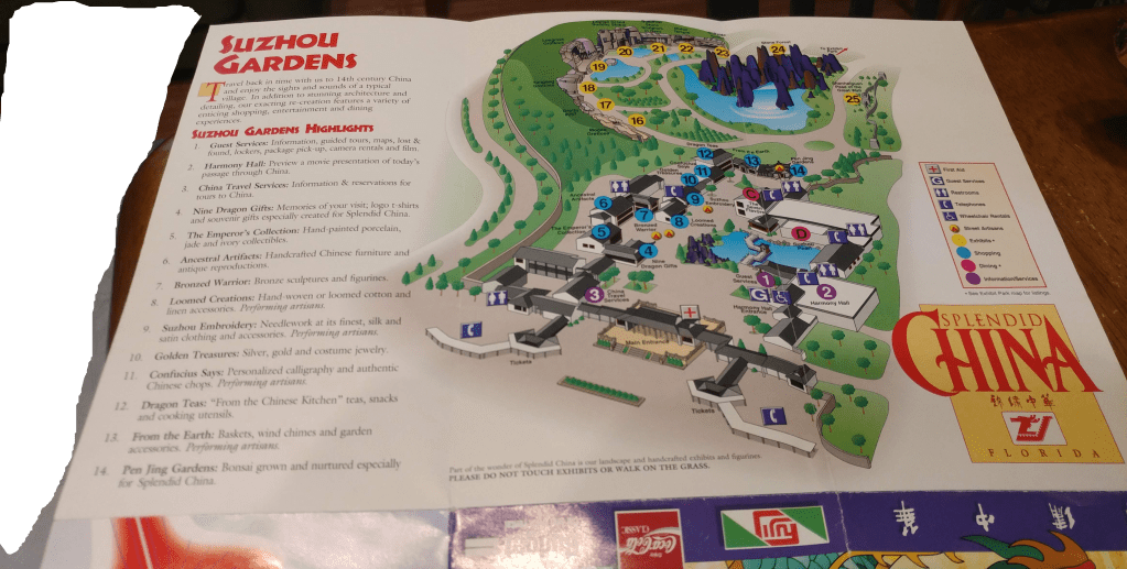
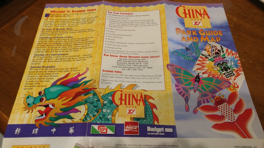
In 2018 the site was officially cleared, making way for the American resort Margaritaville that opened in 2018.
Read more about Splendid China, Florida
Atlas Obscura: https://www.atlasobscura.com/places/splendid-china-orlando
Wikipedia: https://en.wikipedia.org/wiki/Splendid_China_(Florida)
Roadside America: https://www.roadsideamerica.com/story/2057
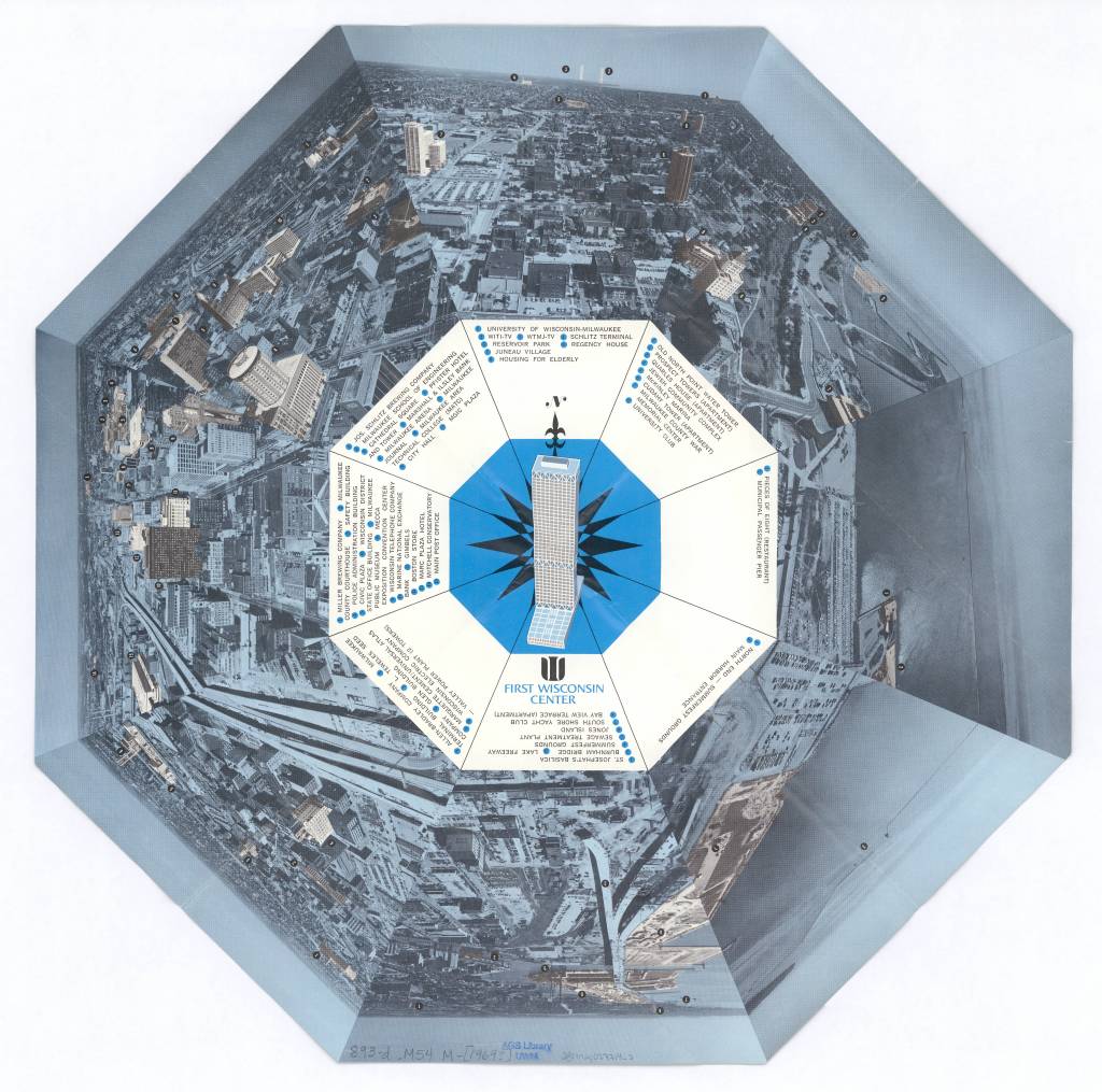
View of Milwaukee, Wisconsin 1972
by Angie Cope
Milwaukee as seen from atop the First Wisconsin Center in 1972.

The First Wisconsin Center located at 777 Wisconsin Avenue is the original name of a skyscraper located in downtown Milwaukee. It is noted for being the tallest building in the state standing 601 feet tall with 42 stories. Construction of the building was announced in 1969 and completed in 1972. Today the building is named the U.S. Bank Center and continues to offer a spectacular view of the city.
An observation deck on the 41st floor is open to the public during the “Doors Open Milwaukee” event usually held in September each year. Visit their website for more information: https://historicmilwaukee.org/doors-open/
In July 1987, a hacking box was installed outside the 41st floor to allow peregrine falcons to nest as part of the Wisconsin Department of Natural Resources (DNR) Peregrine Falcon Recovery Plan.Since the launch of the program in 1987, 67 falcons have fledged from the hacking box atop the tower.
Visit “Encyclopedia of Milwaukee” to learn more about the US Bank Center: https://emke.uwm.edu/entry/us-bank-center/
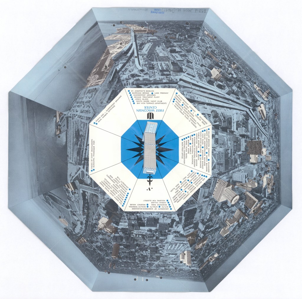
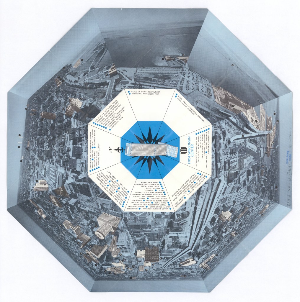
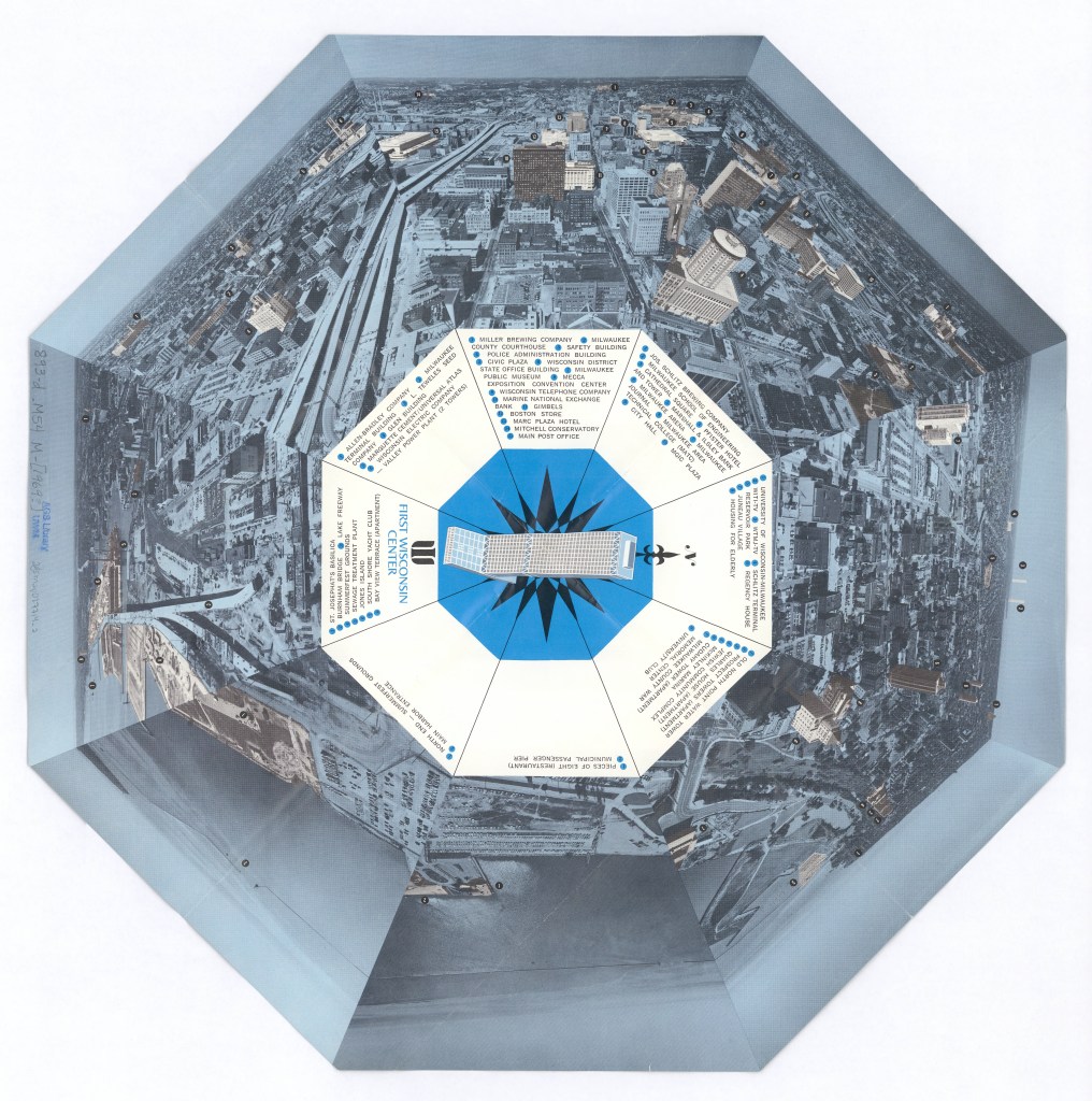
View this item in the American Geographical Society Library Digital Map Collection here:
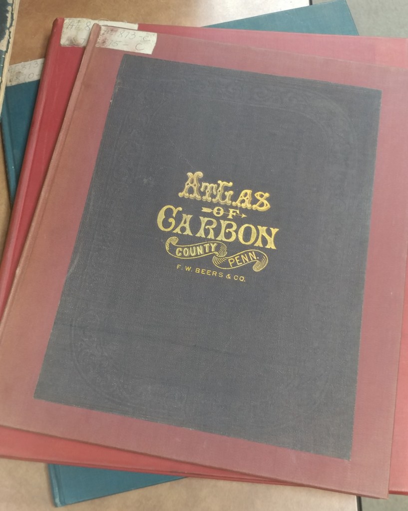
Historical County Atlases
by Angie Cope
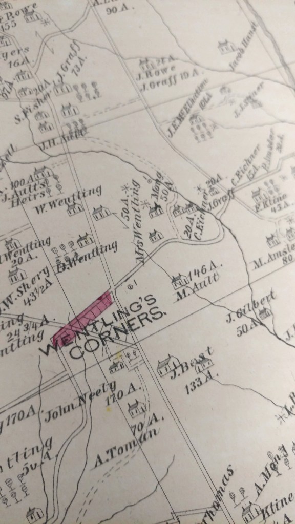
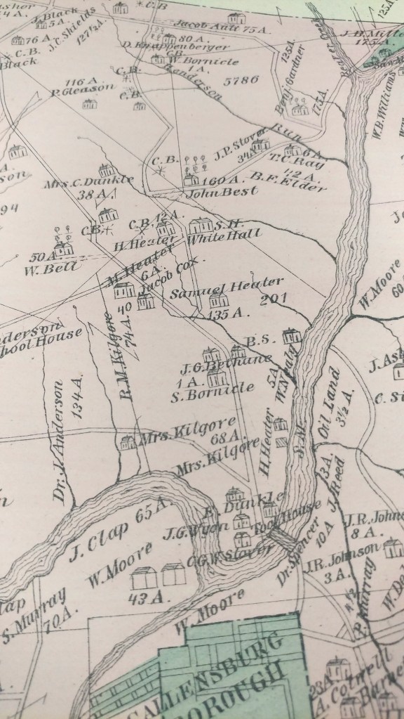
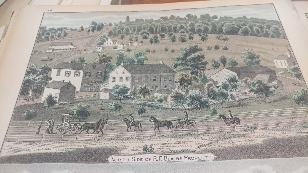
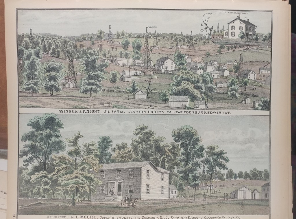
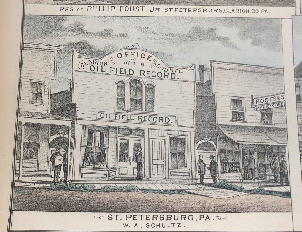
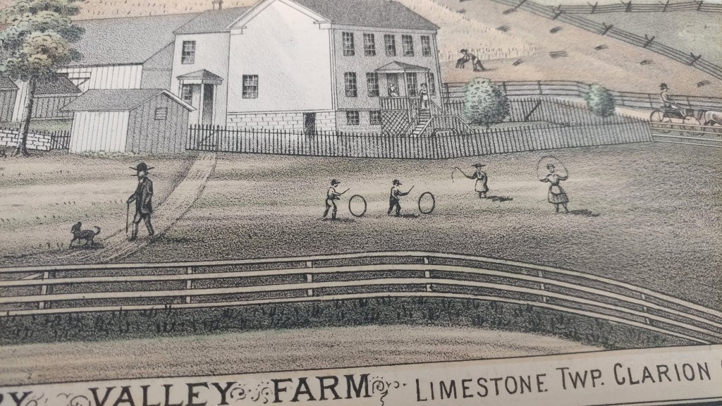
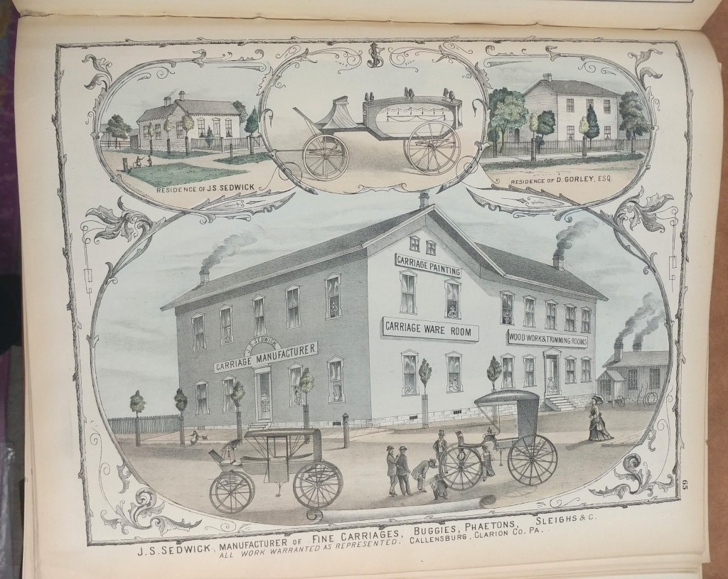
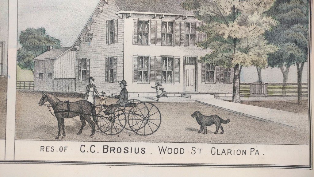
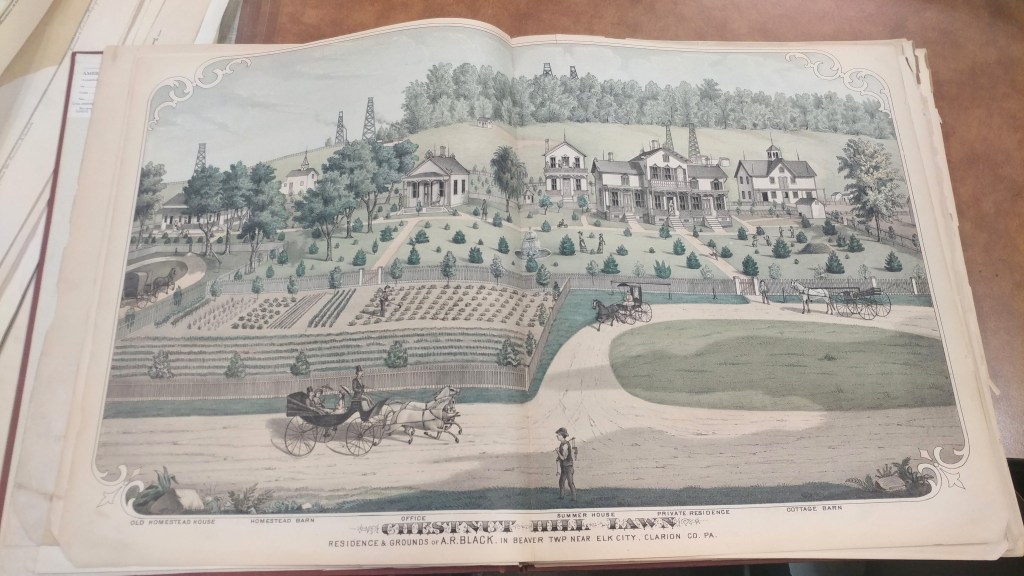
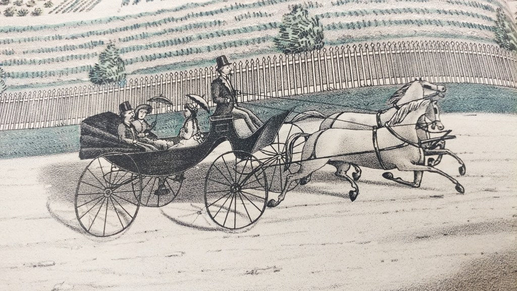
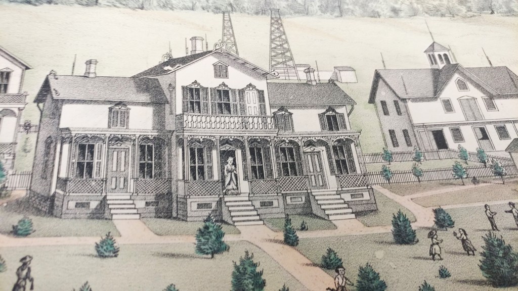
Historical county atlases show property boundaries and land ownership for every parcel of land in a county. In addition to rivers, hills and roads, these maps showed churches, cemeteries, schools, administrative boundaries, railways and roads. Each region had unique features such as Clarion County, Pennsylvania’s orchards, oil wells and coal banks.
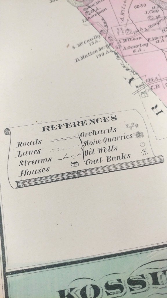
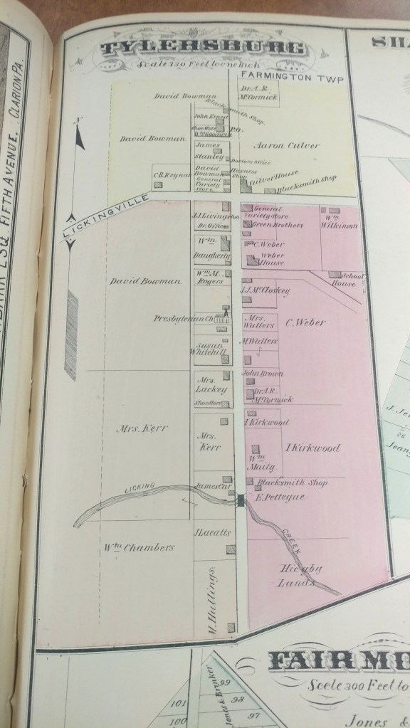
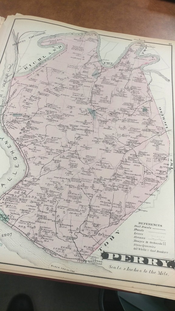

These historical county atlases provide a detailed snapshot of much of the United States during periods of great population expansion of the 19th and early 20th Century.
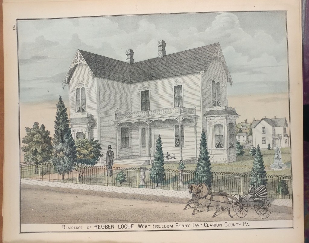
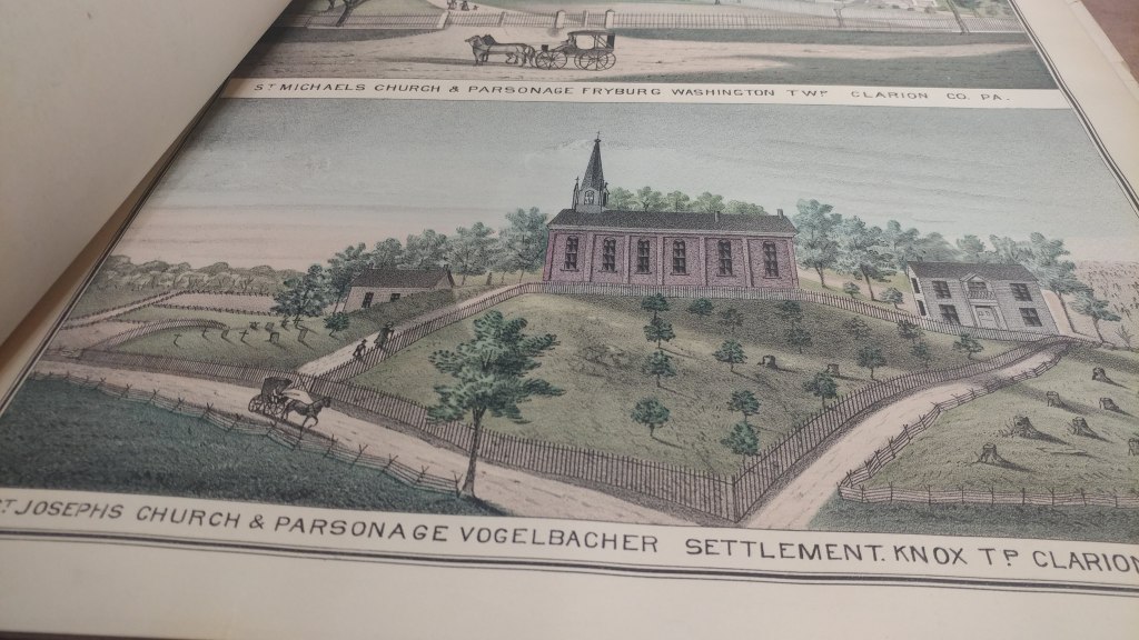
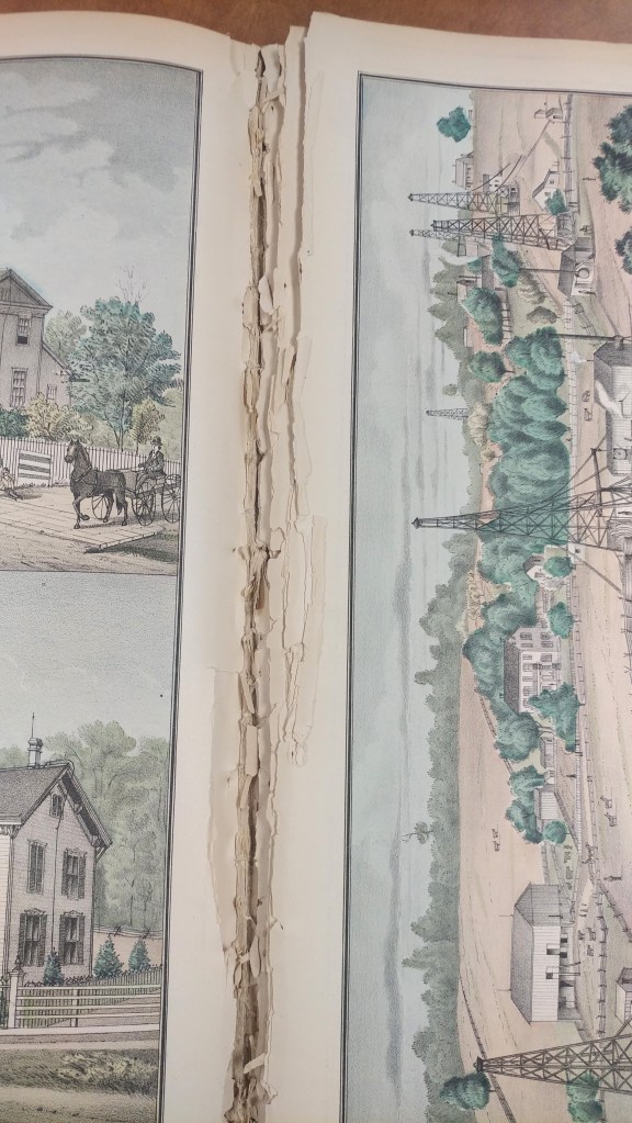
Preparation was often financed through support of local patrons who paid a fee to door-to-door salesmen. The atlases would then include patron directories and biographies, giving credit to this financial support. Many atlases include detailed illustrations of patrons and their homes, businesses and families. As in the example of this Clarion County, Pennsylvania atlas, the illustrations are numerous and beautiful.
These atlases can be found in libraries across the country but the paper used wasn’t always the best quality. At the AGS Library even re-binding didn’t guarantee use of acid-free materials.
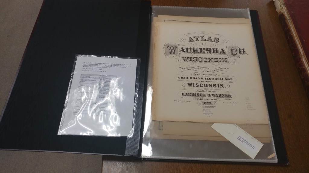
Scanning atlases is a way to provide increased access, preserve information and limit handling to avoid additional damage. At the AGS Library we have nearly 1,000 atlases of this type. Other libraries are also scanning their atlases and making them available to researchers.
Atlas of Waukesha Co., Wisconsin : drawn from actual surveys and the county records, to which is added a rail road & sectional map of the state of Wisconsin / published by Harrison & Warner ; engraved by Worley & Bracher ; printed by H.J. Toudy & Co. ; Oldach & Mergenthaler, Bookbinders, 1873.
https://collections.lib.uwm.edu/digital/collection/agdm/id/3626/rec/2
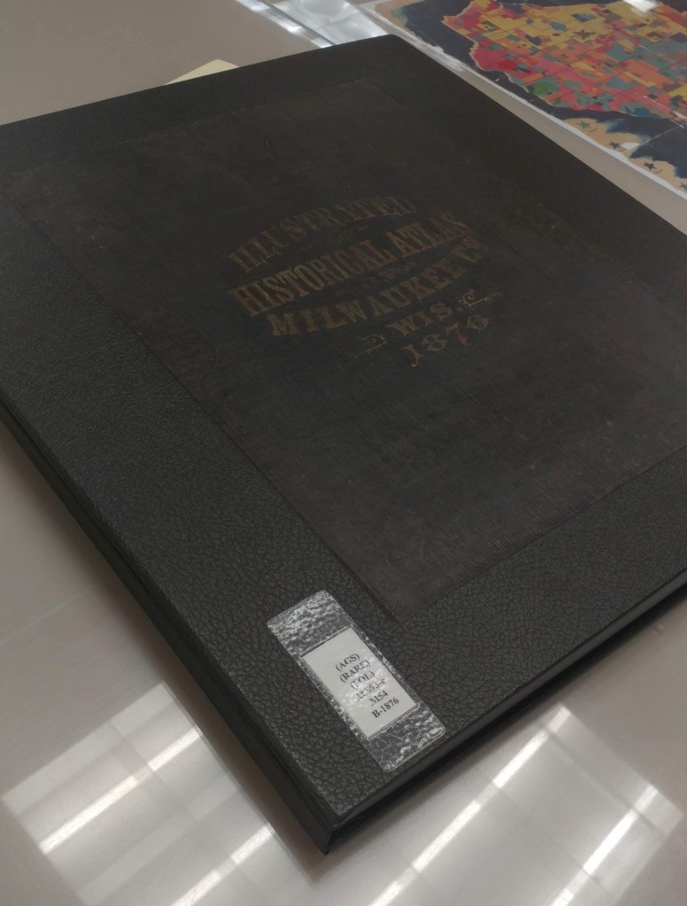
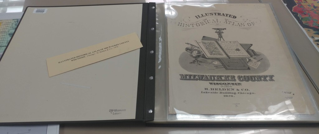
Illustrated historical atlas of Milwaukee County, Wisconsin / by H. Belden & Co., 1876.
https://collections.lib.uwm.edu/digital/collection/agdm/id/3746/rec/4
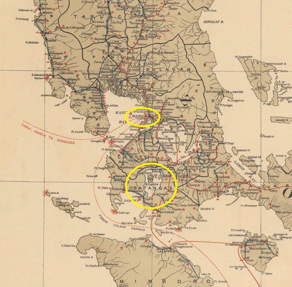
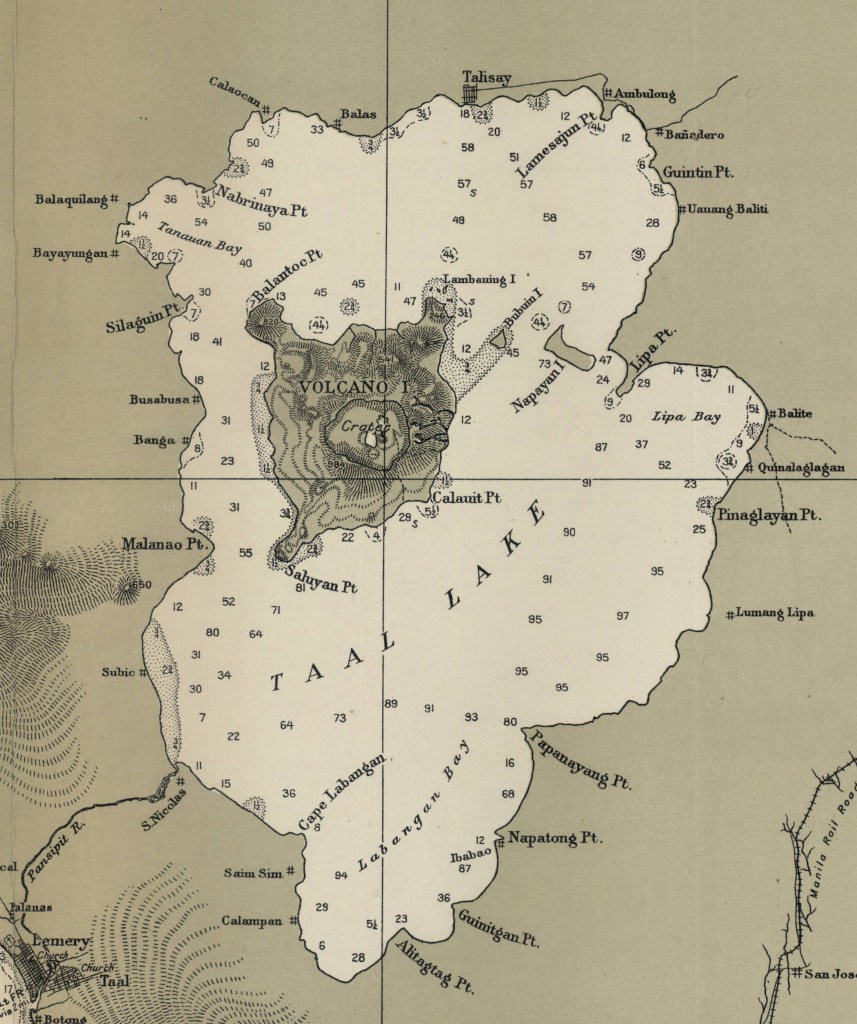
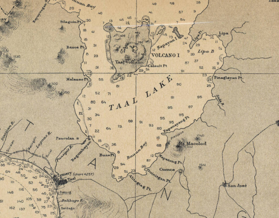
Taal Volcano, Philippines
by Angie Cope
The Taal Volcano in the Philippines is about 37 miles (60 kilometers) south of the capital Manila on the island of Luzon. The volcano sent a plume of ash, steam and rock six to nine miles into the sky with a violent explosion on Sunday, January 12, 2020. The area remains on an alert level four out of five which means a “hazardous eruption” is immenent in a region which is heavily farmed and popular for tourism.
Scientists warned that new fissures were appearing in the ground, and about 50 earthquakes jolted the area in just eight hours on Tuesday, all signs that another, possibly larger eruption was coming.
Around 459,000 people reside within a danger zone with a 14-kilometer (8.7 miles) radius around the volcano, according to a map by the agency, while more than 930,000 people live in a wider 17-kilometer (10.5 miles) danger zone.
Taal has been spewing fountains of red hot lava half a mile high, sparking its own spectacular lightning storms and turning green, tropical vistas grey with ash.
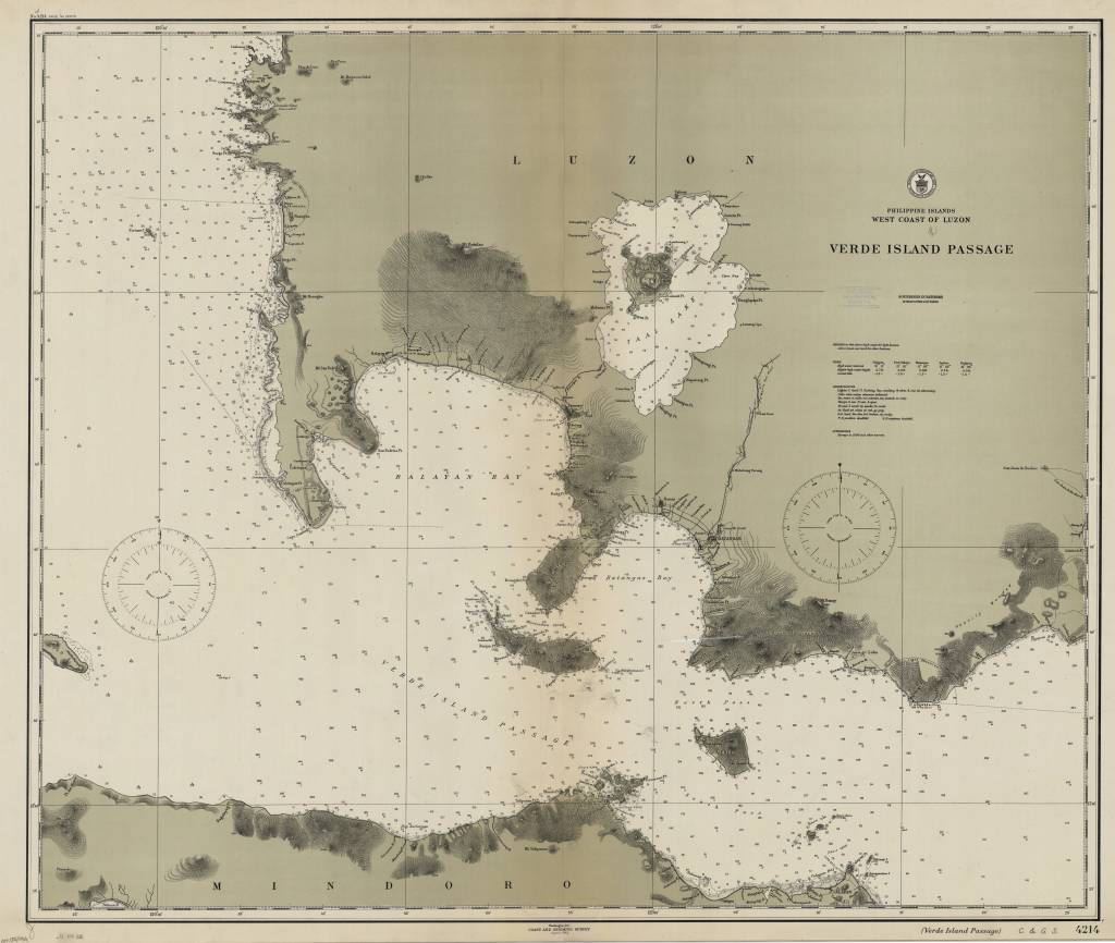
Philippine Islands, west coast of Luzon : Verde Island Passage / [U.S.] Coast and Geodetic Survey 1912
https://collections.lib.uwm.edu/digital/collection/agdm/id/6440/rec/30
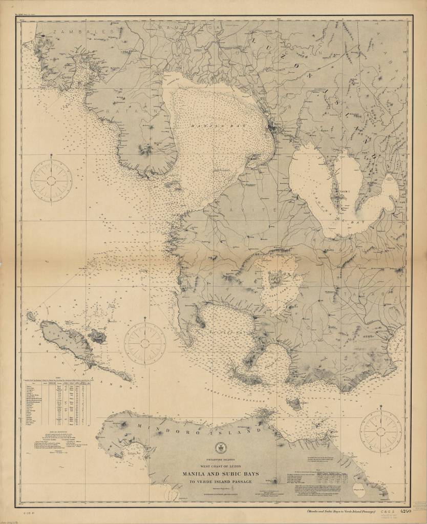
Philippine Islands, west coast of Luzon : Manila and Subic Bays to Verde Island Passage / published … by the Coast and Geodetic Survey, O.H. Tittmann, Superintendent ; compiled from surveys by the Coast and Geodetic Survey … and from Spanish and other sources 1907
https://collections.lib.uwm.edu/digital/collection/agdm/id/6373/rec/4
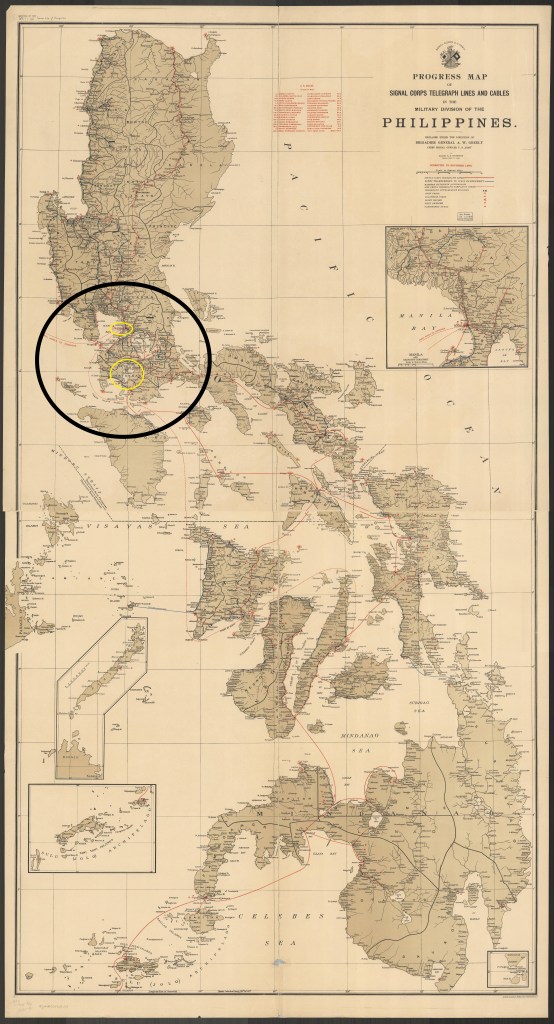
Progress map of Signal Corps telegraph lines and cables in the Military Division of the Philippines / prepared under the direction of Brigadier General A.W. Greely chief signal officer U.S. Army ; by Major R.E. Thompson Signal Corps, U.S. Army 1903
https://collections.lib.uwm.edu/digital/collection/agdm/id/25398/rec/23