The Sanborn Fire Insurance Maps: Milwaukee Before and After the Third Ward Fire of 1892
By Lauren Maddox
The 1894 and 1910 Sanborn Maps of Milwaukee currently featured on the AGSL website catalog over 12,000 detailed color map sheets of Milwaukee. The Sanborn map collection, which, in its entirety, contains roughly fifty thousand editions of fire insurance maps, was intended to inform fire insurance agents about fire hazards associated with individual properties in a city. The maps contain relevant information about building materials, layout, and fire prevention measures in residential and industrial buildings throughout Milwaukee as well as the actual layout of the city.
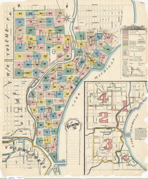
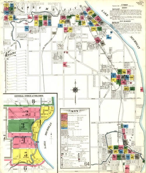
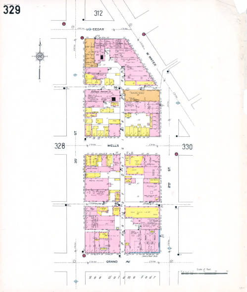
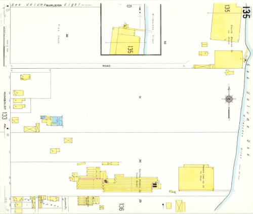
But these maps don’t just detail the fire hazards of a city– they also capture the changes that happen in an ever-growing and ever-evolving urban space. The Sanborn maps have been described as the “the single most important record of urban growth and development in the United States during the past one hundred years” and detail over 12,000 towns across the United States, Canada, and Mexico from 1867 to today. The AGSL digitized its collection of Milwaukee Sanborn maps in 2007 and made them available through the AGSL Digital Collections. Then in 2017, former AGSL student assistant Belle Lipton and the Milwaukee County Land Information Office georeferenced the AGSL’s collection of 1910 Sanborn map sheets to create the Sanborn Discovery App 1910: a seamless and immersive version of the 1910 Sanborn map sheets that overlay a current satellite map of Milwaukee. The Sanborn maps contain references to buildings that no longer exist and empty lots that have since been developed; the Riverside Printing Company on sheet 329 is now a parking lot, and underneath the mostly empty map sheet 135 now sits Carver Park’s two baseball diamonds. Looking at these two maps right on top of the other, it’s easy to see how much Milwaukee has changed in the intermediate 107 years.
However, we know that the city’s face was changing even before the Sanborn maps began to record it. Just two years before the first Sanborn fire insurance maps of Milwaukee in 1984, the historic Third Ward burned down. And years before that, the city was still growing and changing with time. The Sanborn maps capture what the city was like two years after the fire– but earlier maps in the AGSL archives reveal what the city looked like before the Sanborn fire insurance maps, before the tragic Third Ward fire, and before even the founding of Milwaukee.
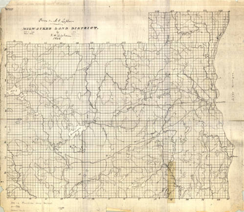
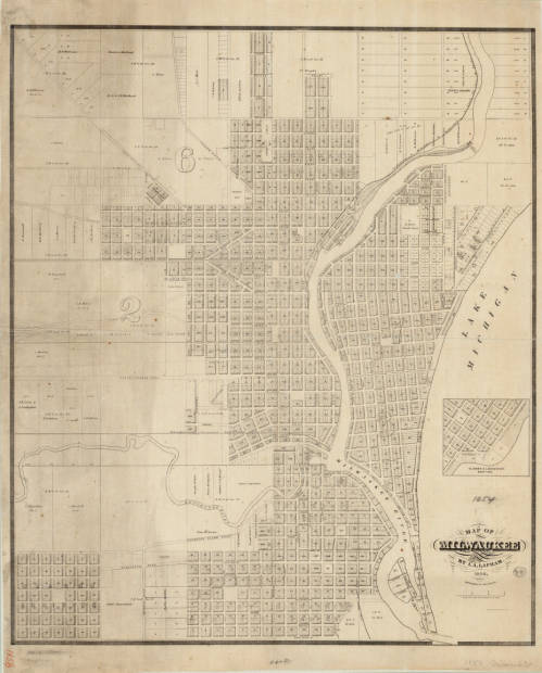
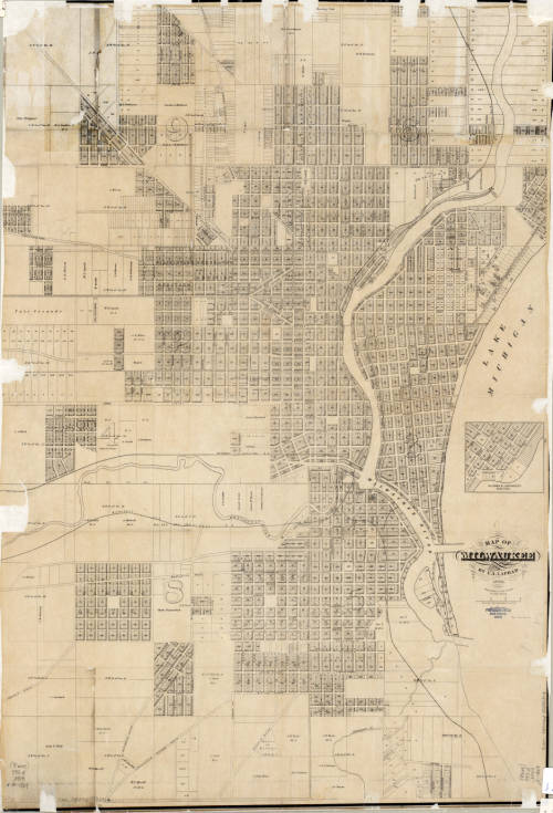
The three maps shown above, created by I.A. Lapham spanning from 1836 to 1869, illustrate Milwaukee’s growth over thirty-three years. Together, they create a picture of the city’s founding and continued development. The first map depicts the Milwaukee land district before the city was officially founded. The two later maps were recorded after Juneautown, Kilbourntown, and Walker’s Point were combined and incorporated as the City of Milwaukee. There was substantial development between 1856 and 1869, which is made even more obvious by comparing the two maps side-by-side.
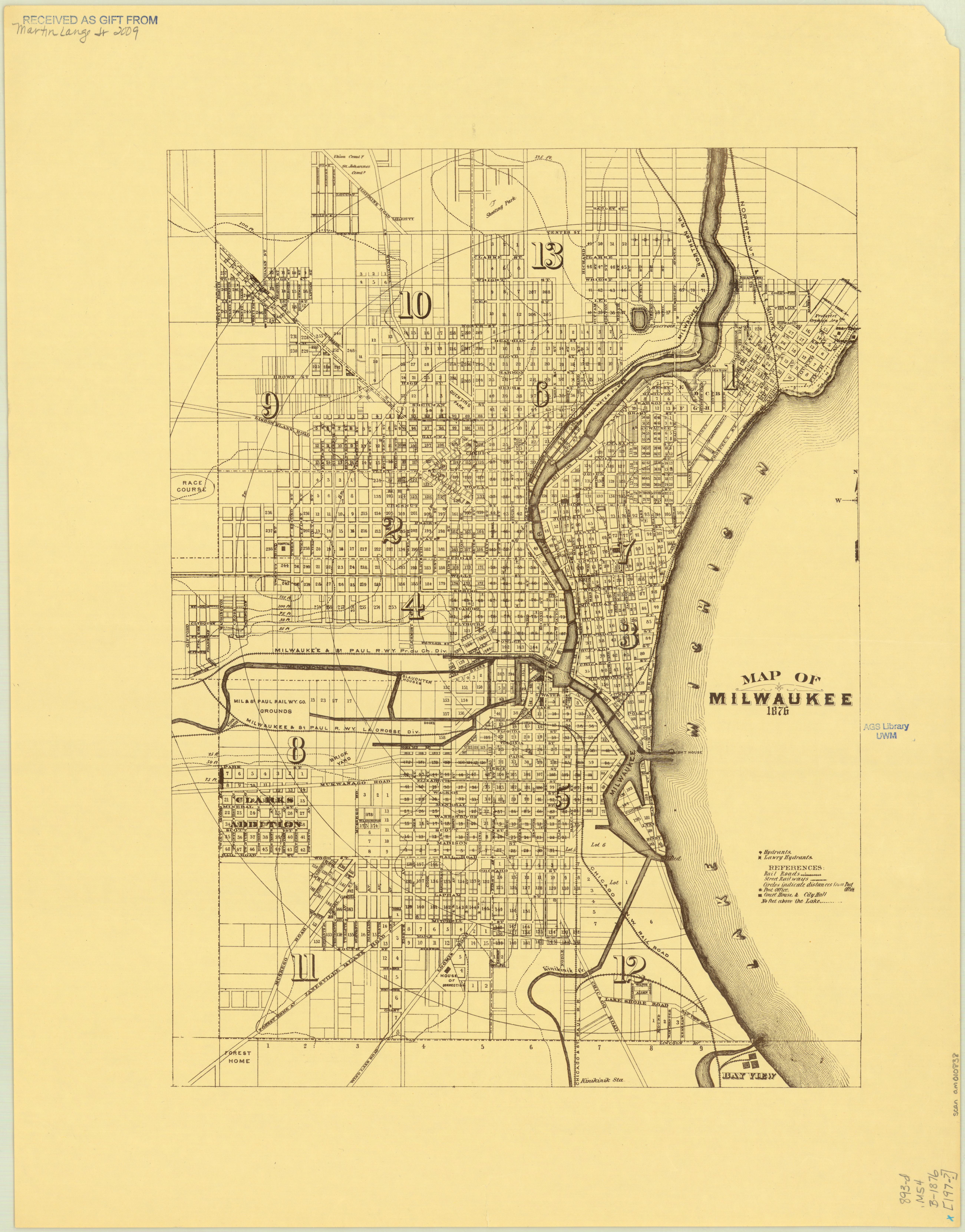
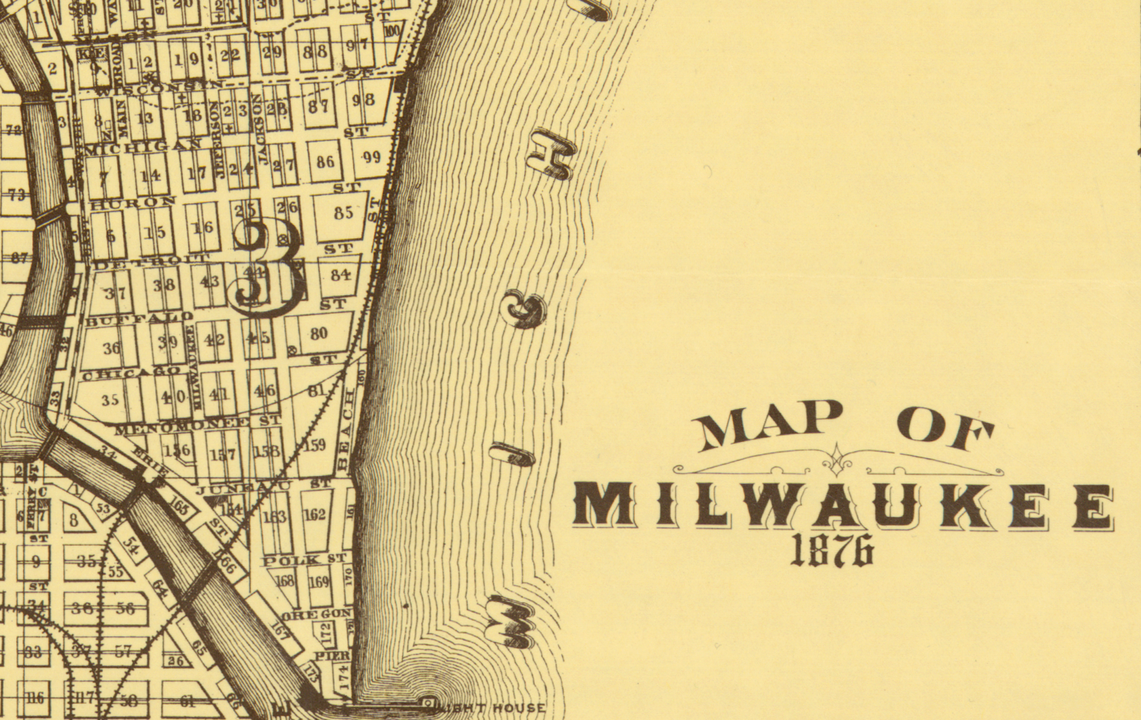
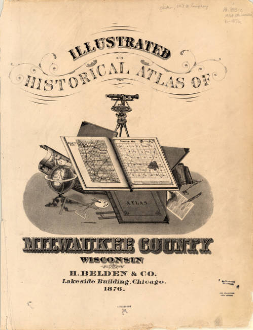
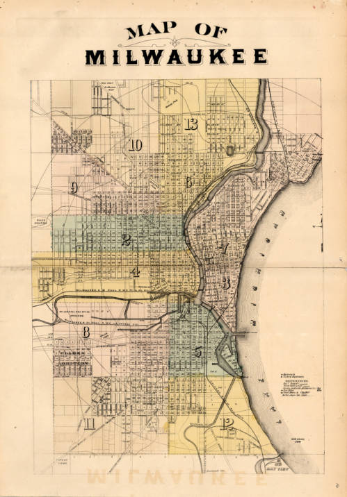
The 1876 map of Milwaukee by H. Belden and Co. presents an even more developed Milwaukee than the previous Lapham maps. The map was originally drawn up in 1876 and included in the Atlas of the State of Wisconsin in 1876, but was reprinted in 1881 as a part of the expanded Illustrated Historical Atlas of Milwaukee County Wisconsin. The first version of the map shown was donated to the AGSL by Martin Lange Jr. in 2009.
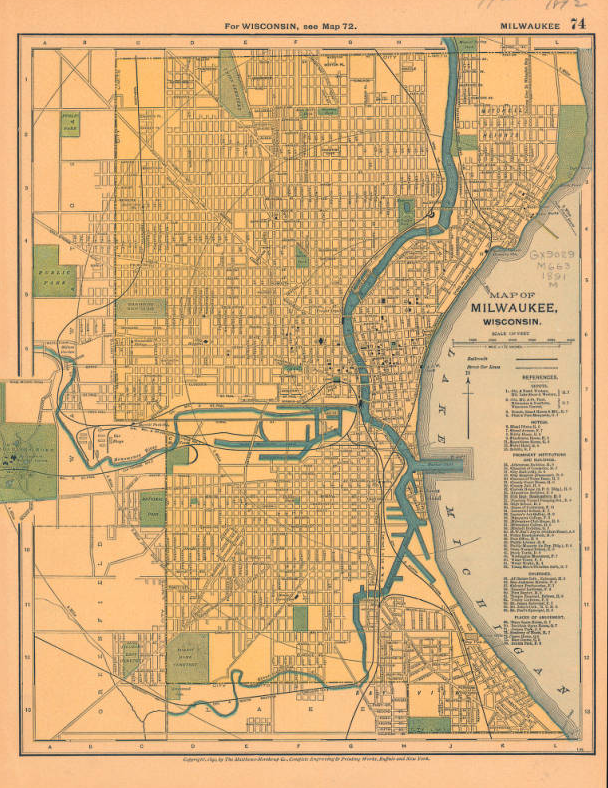
This 1891 map of Milwaukee, Wisconsin published by the Matthews-Northrup Company just one year before fire in the Third Ward gives us one last look at the city before the fire. The Third Ward was growing with the rest of the city, but sudden catastrophes will always change a place.
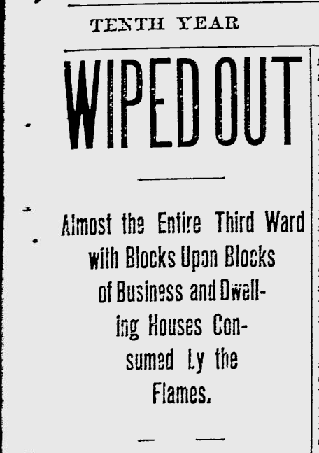
At 5:12, 5:20, and 5:40 p.m., October 28th, 1892, fire alarms rang out across Bradford and Bartlett, Greenfield Avenue, and Eleventh Avenue. Then, at 5:43, the fire alarm at East Water Street was sounded, signaling to firefighters that the Union Oil Company warehouse building was burning. The smaller fires throughout the neighborhood prevented responders from reaching the Union Oil building for fifteen minutes, by which point the fire had already become an inferno. The oil in the warehouse provided plenty of fuel, which burned brilliantly into the evening. The crisp Autumn wind carried the embers from the Union Oil Company warehouse fire to other buildings throughout the Third Ward, including a distillery, a soap factory, and countless homes.
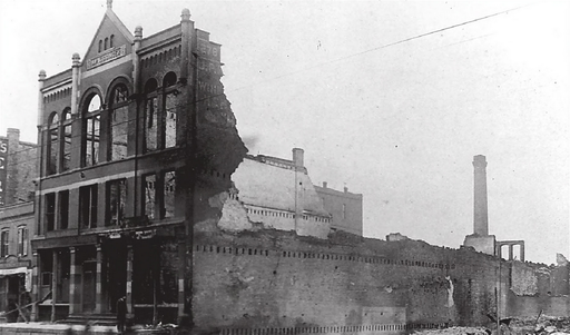
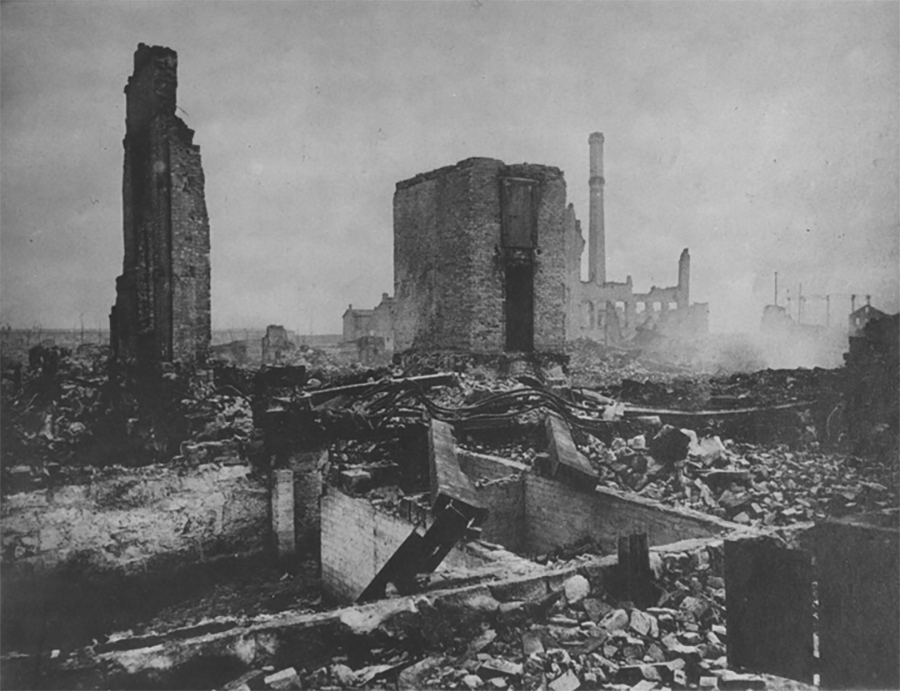
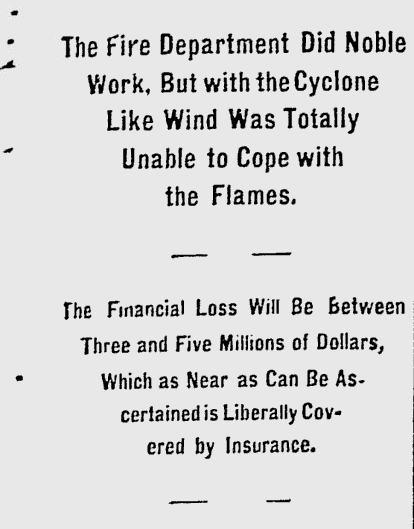
By midnight, the fire had burned through 16 city blocks, destroyed 440 buildings, killed five,injured dozens, and displaced hundreds of families. The Milwaukee Journal estimated that the total property loss was equivalent to somewhere between three and five million dollars– something more like 60 million today. Relief committees sprang up to shelter and feed victims of the fire who had lost their homes; some even endeavored to employ those whose workplaces had been destroyed overnight. The damage was so extensive that many residents were unable to rebuild. Only a small percentage of homeowners had fire insurance, and the pressure to add expensive fire-proof brick shells to their homes while rebuilding prevented many from returning. The Ward’s population shrank as residents were forced to move to other parts of the city in search of housing and work.
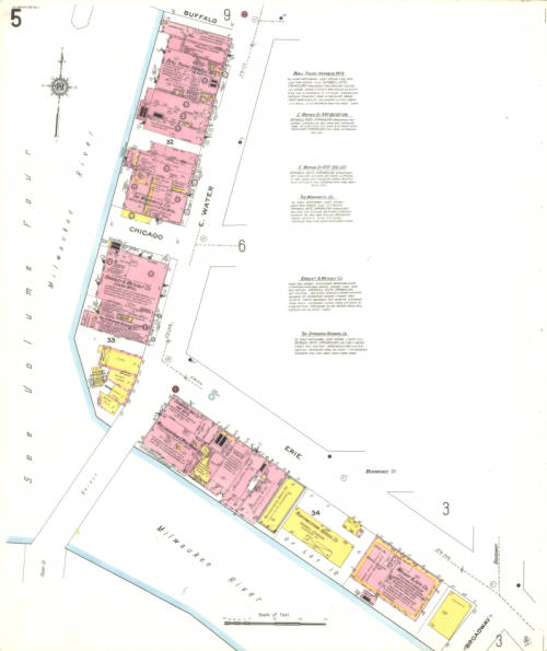
Vol. 1 Sheet 005 1910 Sanborn Map of Milwaukee depicting East Water Street 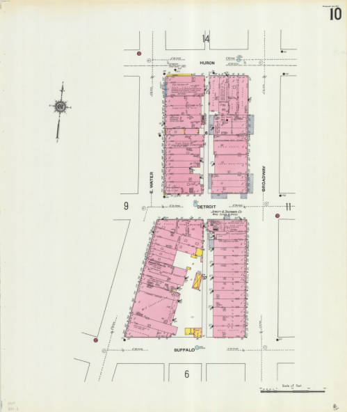
Vol. 1 Sheet 010 depicting East Water Street
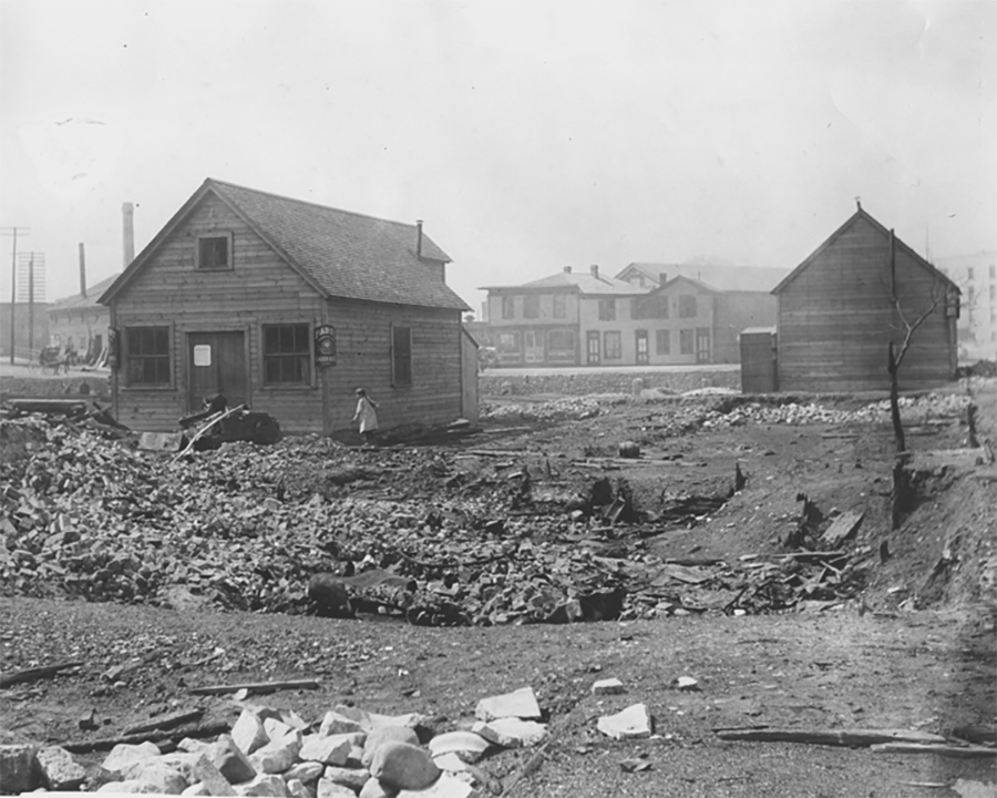
This catastrophic fire transformed the Third Ward and Milwaukee as a whole. Efforts to rebuild began immediately, and over the next 30 years the Third Ward slowly became a busy commerce district again. The two Sanborn map sheets shown depict East Water St., where the Union Oil Company fire began. The neighborhood continued to change over the years until it eventually became the Historic Third Ward as we know it today.
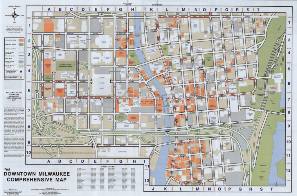
The Comprehensive Map of Downtown Milwaukee 2001 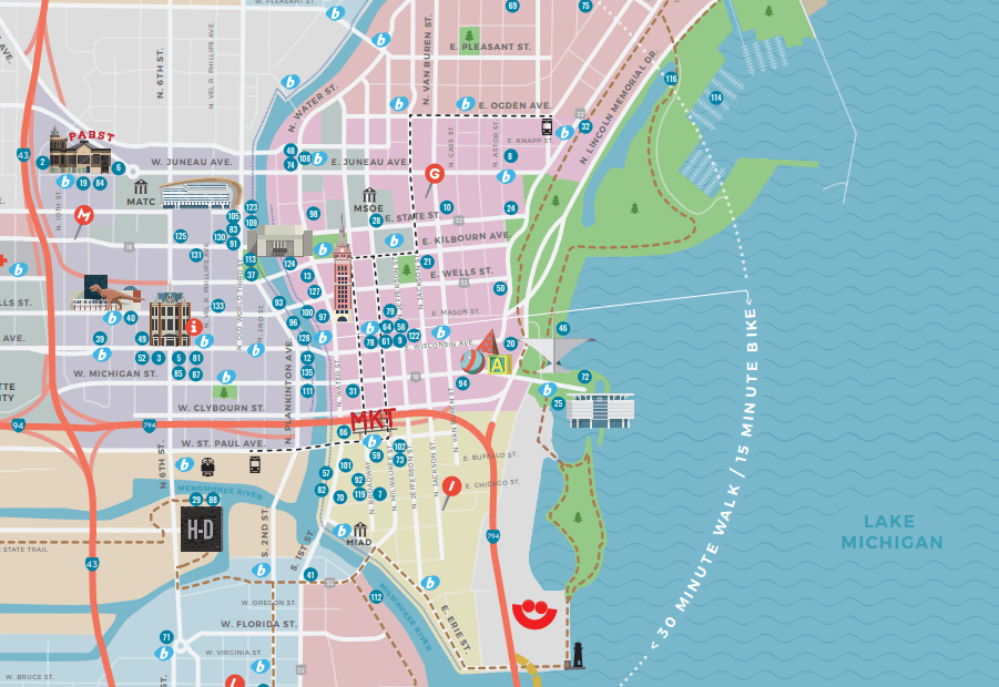
Section of the Official 2019 Milwaukee Visitors Map from Visit Milwaukee
The Historic Third Ward Association marks the Third Ward as the “site of Milwaukee’s most devastating fire and its most remarkable rebuilding efforts.” Today, the historic neighborhood is host to over 500 businesses, 20 galleries and art studios, and 1,200 residential units. It’s home to Summerfest, the Public Market, the Broadway Theatre Center, and so much more; it is, as the Association puts it, a neighborhood in renaissance. The Sanborn maps, and the many other maps of Milwaukee before and after the fire, remind us how much Milwaukee has grown, built, and rebuilt over its history, and how much we are still growing.
William E. Merrill Collection Now Available
By Georgia Brown
Our newest collection holds the papers of the Civil War soldier and Chief Engineer William E. Merrill, who was called “the most innovative and conscientious exponent of mapping during the Civil War.” As the chief topographer of the Army of the Cumberland, his direction of the mapping of Georgia before General Sherman’s late 1864 March to the Sea led to its success.
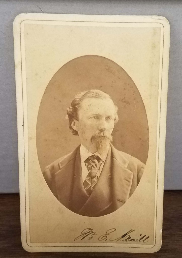
William Emery Merrill (1837-1891) was an American soldier and military engineer. He was born at Fort Howard, Wisconsin and was a cadet at West Point beginning in 1854. After graduating first in his class in 1859, he served as an instructor in engineering at West Point until mid-1861 when Merrill was called into active duty in the Civil War. Throughout the war, he spent time in the as Assistant Engineer of Department of the Ohio, Assistant Engineer of the Army of the Potomac during part of the Peninsular Campaign, Superintending Engineer in Kentucky, and then Chief Engineer of the Army of the Cumberland. It was during this time that he supervised the making of the map used by General Sherman during the March to the Sea.
Following the war, he was raised from the regular army rank of captain to major and by 1883 he had risen to the rank of lieutenant colonel. After the war, he spent his time working for the government as an engineer.
One of Merrill’s most notable engineering works was the Chanoine wicket movable dam constructed by him at Davis’s Island, 5.5 miles below Pittsburgh, Pennsylvania. The Davis Island Lock & Chanoine Dam experimental project was the first lock and dam ever constructed on the Ohio River. Its achievements also included the first rolling lock gates, the largest movable dam built in the 19th century, and the widest chamber in world history. In 1889, Merrill represented the United States Engineering Corps at the International Congress of Engineers in Paris. He died in 1891.
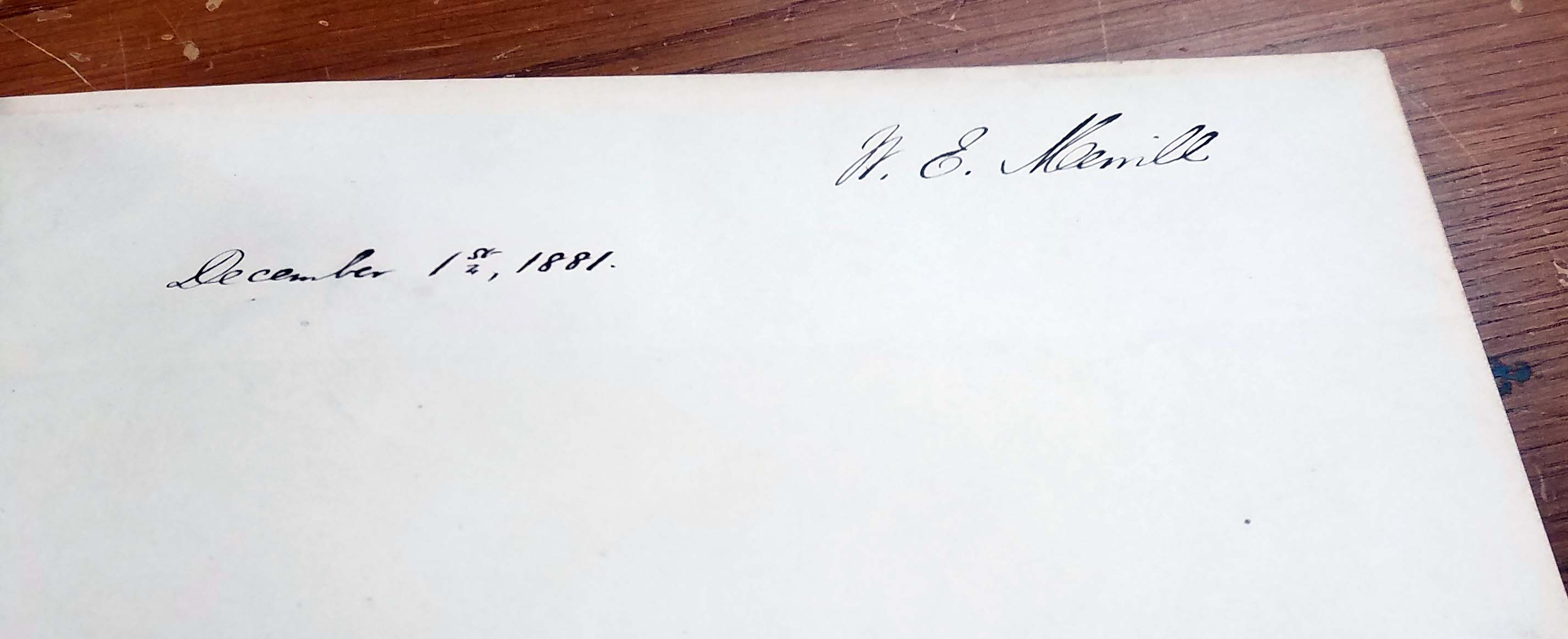
The collection was donated in August of 2018 by Susan E. Williams. She collected items individually over the course of many years. Ms. Williams added several additions of her own research about various items in the collection. To access the finding aid, follow the link here: http://digital.library.wisc.edu/1711.dl/wiarchives.uw-agsl-agslmss0035
Catholic education in Milwaukee
by Angie Cope
In 2015, Tom and Lisa Marcz donated a map to the AGSL on behalf of Tom’s father, Frank Marcz.
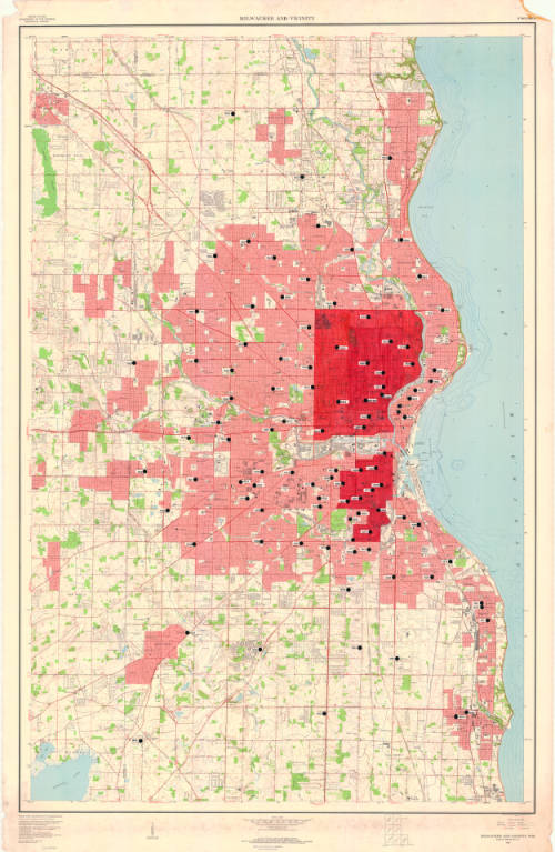
Upon further investigation, and interviews with Tom Marcz, it was discovered that the map was annotated by Sister Dolores Rausch and used as part of her 1971 PhD dissertation, “The changing status of urban Catholic parochial schools; an explanatory model illustrating demand for Catholic elementary education in Milwaukee County.” The Marcz family were long time friends with Sister Dolores.
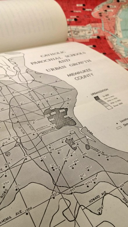
The base map is “Milwaukee and vicinity, Wisconsin : 1959” by the U.S. Geological Survey and the annotations show location of catholic schools and the date of establishment.
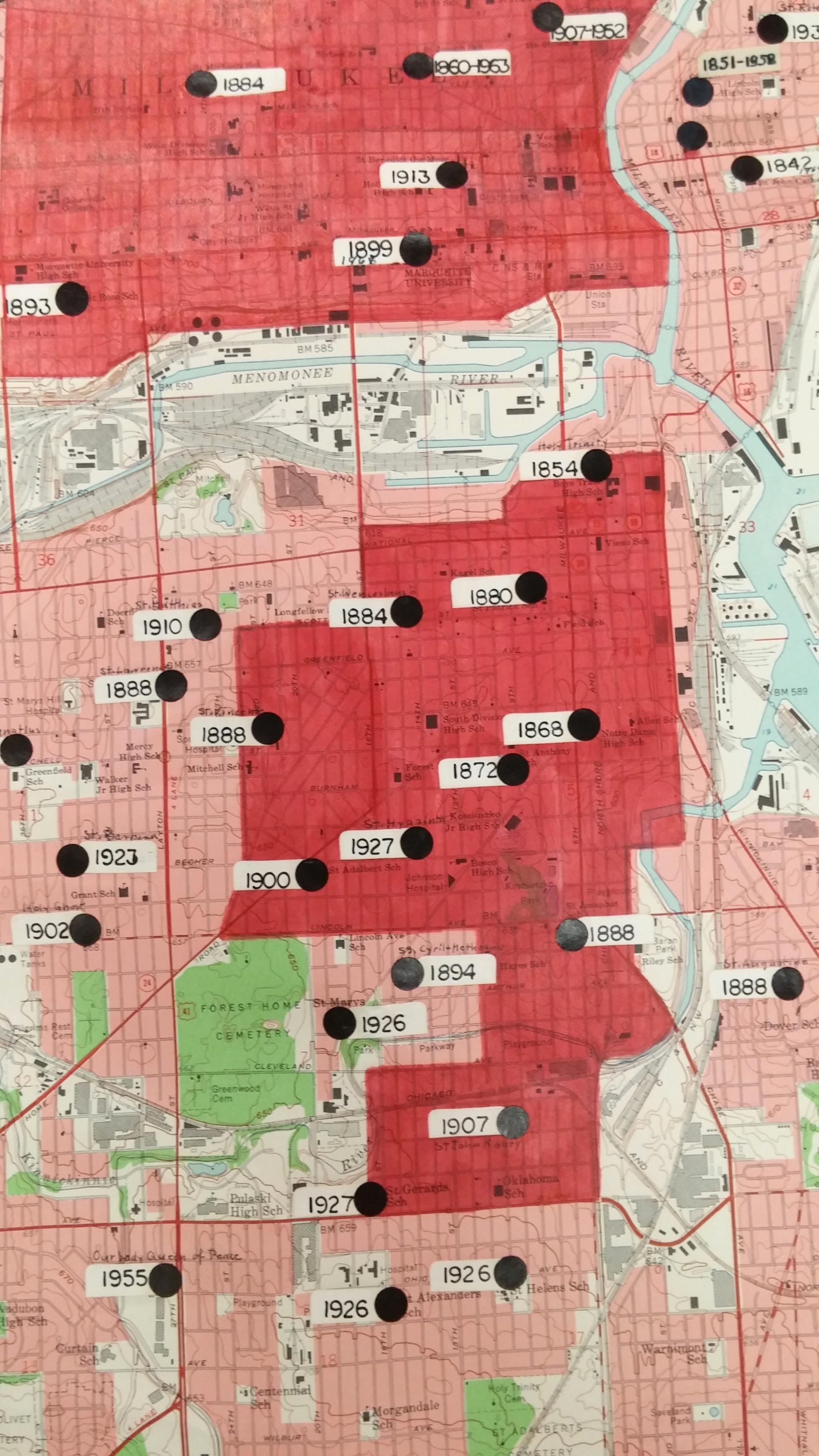
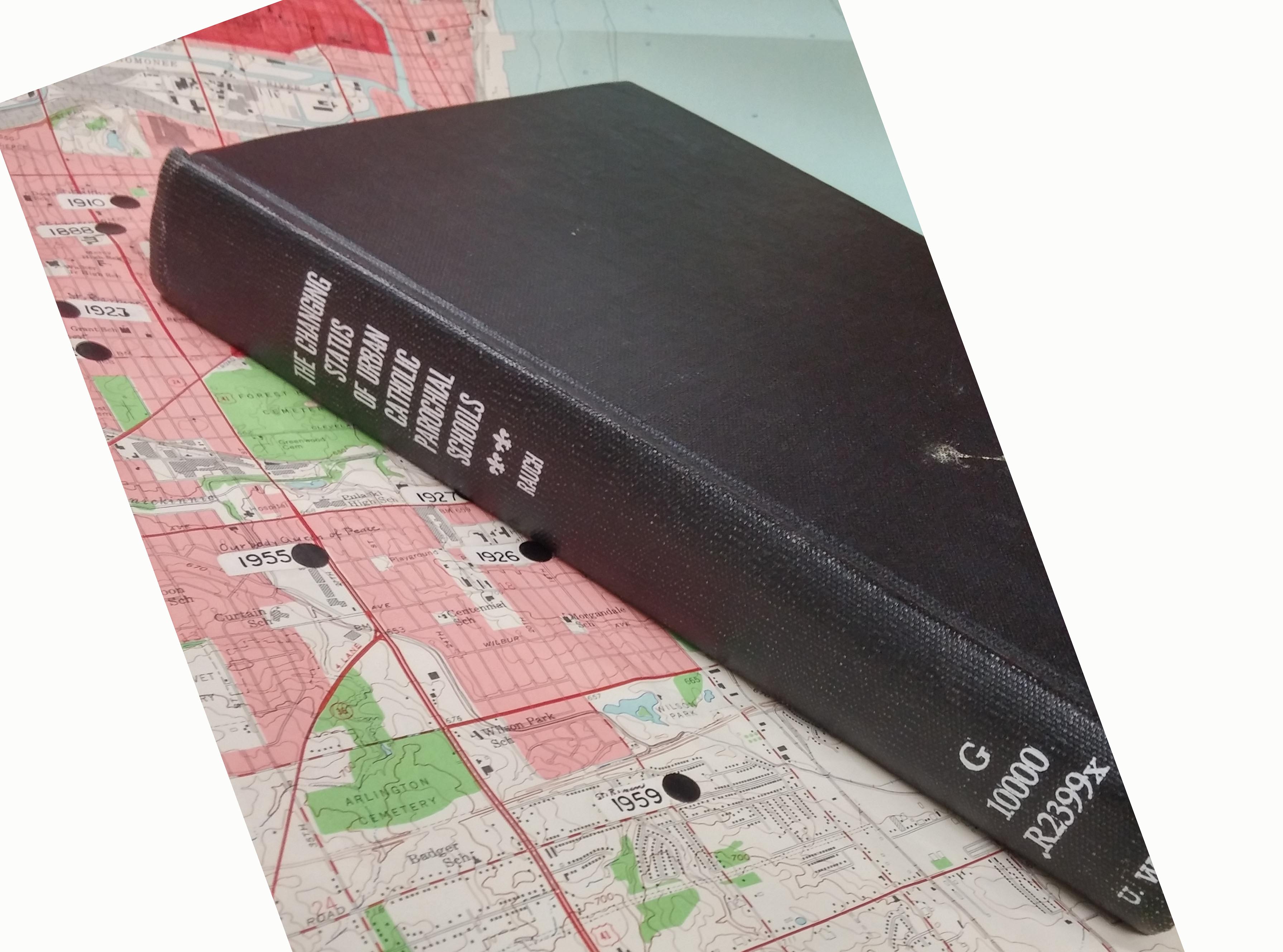
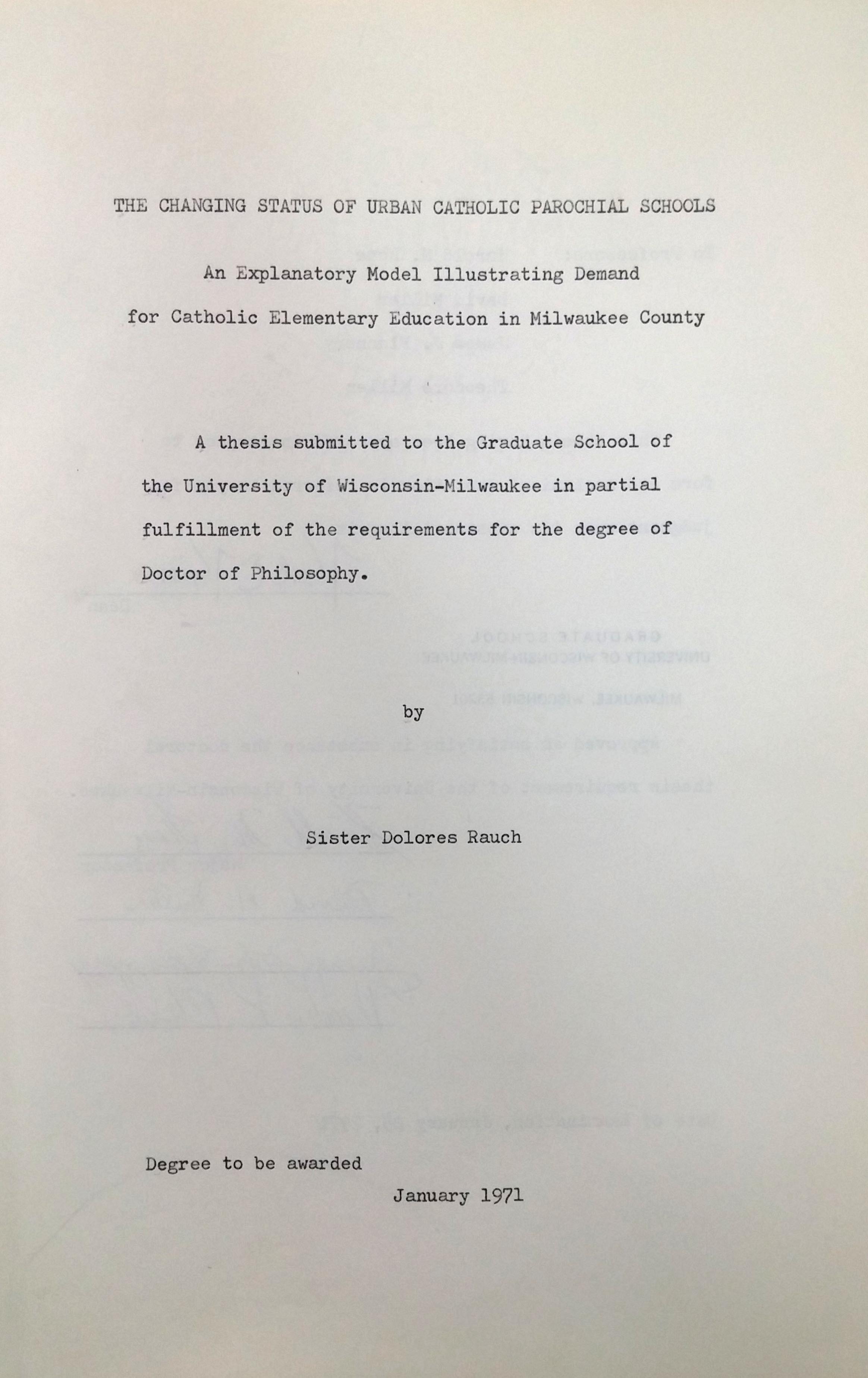
Sister Dolores was the first PhD student to graduate from the Geography Department at UW Milwaukee. The 181 page dissertation includes many maps, similar to the annotated map above.
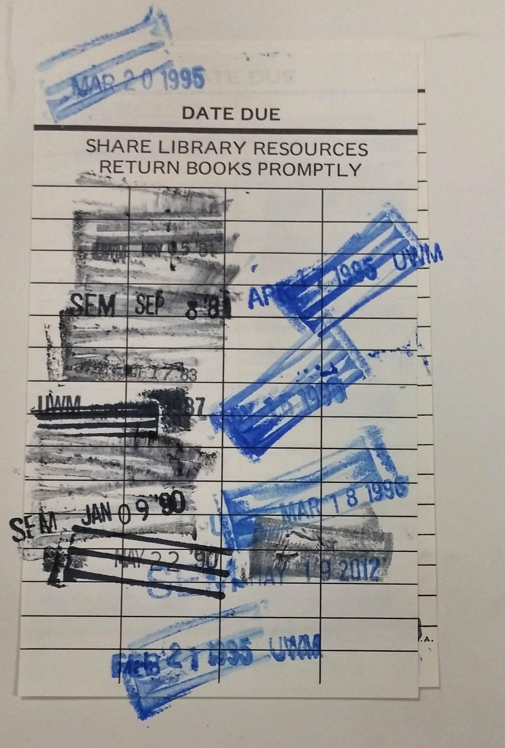
Her dissertation is popular and has been checked out often from the UWM Libraries.
Sister Dolores Rausch (1915-2011) touched many lives and was an incredible citizen of the Milwaukee area. If you’re interested in learning more about Sister Dolores, here are some biographical resources:
Sister Dolores Rauch, compiled by Sister Victoria Wiethaler in 2003. https://atlanticmidwest.org/posts/sister-dolores-rauch
Tale of two sisters by Dr. David Snowdon. http://www.sturdyroots.org/ns_taleotsister.htm
Visualizing the Moon Exhibit 2019
The latest exhibit is entitled: “Visualizing the Moon.” It features lunar maps, atlases, books, globes, and photographs. This is in conjunction with Marcy Bidney’s presentation on “Imagining the Moon: A History of Lunar Visualizations,” which was rescheduled for April 3, and is co-sponsored by the UWM Planetarium as part of their event series celebrating the 50th anniversary of the Apollo Moon Landing. The exhibit will be up through April 19.


AGS Library Bucket List
Your AGS Library experience can be an adventure. Come in and explore all that the AGS Library has to offer, from fabulous collections to tours for visitors. Finish the list? Receive a free set of map reproductions. What will you check off first?
- Follow one or more of our social media sites:


- Discover a favorite globe (view some of our globes at Flickr — view a list of the over 200 globes held at the AGS Library).
- Attend an Academic Adventures lecture on a Friday afternoon and hear about a UWM faculty or staff’s adventures abroad and afield.
- Discover genealogical map resources such as plat atlases, historic topographic maps and gazetteers.
- View stereo photos through a stereo viewer.
- Show off this Milwaukee treasure to your visiting family and friends.
- Celebrate your bachelor party or honeymoon with a visit.
- Attend the annual Maps & America lecture in April featuring leading international speakers in the field of the history of cartography of the Americas.
- View the oldest map in Milwaukee in person, the 1452 Leardo Mappamundi.
- Attend the annual Geographic Information Science (GIS) Day in November for vendor presentations, guest speakers, free workshops, a map gallery, tours of the AGS Library, and more.
- Find your home town on a unique map (old, in a foreign language, etc.).
- Discover cartographic oddities.
- See maps about imaginary places and people — Atlantis, Lord of the Rings, Game of Thrones, Star Wars, Santa Claus, etc.
- Discover AGS Library resources through the UWM Libraries Digital Collections
- See and use a real library card catalog.
Important and unusual acquisitions of AGS Library since 1978
The AGS Library at UW-Milwaukee: Celebrating 40 Years In August, 1978, Milwaukee welcomed the American Geographical Society (AGS) Library to its new home at the UW-Milwaukee Libraries.
Our exhibits for this special anniversary year highlight the library’s activities and achievements over the last 40 years, including this one focusing on some of the important and unusual acquisitions of the AGS Library since coming to Milwaukee.
October 2018 through January 2019


Mapcon at the AACA Museum in Hershey, Pennsylvania
By Judy Aulik
Every year the RMCA (Road Map Collectors Association) holds a meeting and map show. This year, for the first time, it will be held in conjunction with the AACA (Antique Automobile Club of America) Museum, an affiliate of the Smithsonian, in Hershey, PA. The RMCA will have a display wing devoted to navigation, i.e., the history of the road map and road atlas, beginning with a British 1904 Pratts atlas, through the modern station locator maps, still given out by some gasoline/convenience store chains.
Keeping with organizational tradition, Thursday night (Sept. 20) is devoted to room-to-room trading at our hotel, but Friday and Saturday are more formal, with trade with our member/dealers from 9:00-5:00 on the 21st, and from 9:00-2:00 on the second day. (Shortened Saturday hours accommodate the members’ meeting.) We are proud to have Robert Spencer, of the Osher Map Library and Smith Center for Cartographic Education at the University of Southern Maine, as our guest speaker at our hotel dinner.
Non-dealers attending will be able to not only see the RMCA area but can tour the museum for the admission cost of $12 for adults, $11 for Seniors (61+) and $1 less for AAA members. To help offset the admission fee, all attendees receive a voucher that is worth 10 free maps from the $1 table which has hundreds to choose from or 10 free State Official maps. We will have our State Official Map table at the entrance.
Preservation for the private collection
by Angie Cope
Librarians at the AGS Library are often asked about best practices for caring for private collections. A recent “conversation” at the EXLIBRIS rare and special collections discussion list generated many useful sources to help answer that question.


___________________________
American Institute for Conservation (AIC) – Caring for your treasures
Northeast Document Conservatin Center (NEDCC) – Preservation Leaflet Series
American Library Association (ALA) – Saving for your stuff (audio, film, books, data, textiles, paper, slides, photos, scrapbooks, artifacts)
Gaylord Archival – Guide to collections care
Gaylord Archival Resources
Archival 101: Dealing with Suppliers of Archival Product by Peter D. Verheyen
Bookcraft Book Repair Guide early editions are available via HaithiTrust
Photos from the AGS Library efforts of caring for our collection with some before and after photos.


")

")


Manuscript maps by Adolph N. Krug, an American missionary in Cameroon in the early 20th Century
by Angie Cope
The AGS Library has 3 manuscript maps drawn by Adolph N. Krug, an American missionary in Cameroon in the early 20th Century.
Krug was born in 1873 in Germany and immigrated to the United States at the age of 15. He studied at Amherst College, graduating in 1903. That same year, he married Miss Evelyn E. Saul and they both left for Cameroon under the appointment of the Board of Foreign Missions of the Presbyterian Church of the USA.
Krug traveled the country, opening schools and churches and mapping the trails. It was his mapping efforts that led to his membership as a fellow in both the the Royal Geographical Society and the American Geographical Society.
Toward the end of his career, Krug was in charge of the village school in Foulassi. In 1941 he and his wife returned to the states to address Krug’s health condition. Krug died of heart failure in 1942. Mrs. Krug returned to Cameroon where she lived until her death in 1951. Their four children became missionaries in Asia and Africa.
Two of the manuscript maps held at the AGSL depict the trails, missionary sites, rivers and locations where Krug set up schools and churches. One of these is a “photostat” made by the American Geographical Society of Krug’s manuscript map. It is unknown where the original is located – perhaps at the Royal Geographical Society.
The third manuscript map is Krug’s manuscript reproduction of Dr. Marcel Chambon’s map showing the French medical survey of Cameroon. Chambon was a colleague of Dr. Eugene Jamot and the two of them working together were instrumental in trying to combat the African sleeping sickness
In addition to his mission work, Krug was interested in the life of the indigenous peoples, especially their folklore. The Journal of American Folklore published a number of “Bulu Tales” collected by Krug over his 39 years in Africa.


Click on any image above to open a larger view.
Map 1
Part of district of Ebolowa with outposts of Sangemalima and Ako’o Afem / drawn by A.N. Krug, M.A., cyclometer measures and compass direction. [Photostat/photocopy]
Adolph N Krug ; American Geographical Society of New York.
Foulassi, Cameroun : Adolph N. Krug New York, New York : American Geographical Society of New York ; 1911
Map 2
District subdivision, Sangmelima, Cameroun.
Adolph N Krug
1927?
Map 3
French medical survey of sleeping sickness in Sangmelima / Dr. Chambon (copied with his permission by A.N. Krug).
Marcel Chambon ; Adolph N Krug
192-?
18th Century Missional Maps in the Amazon Basin Exhibit at the AGS Library
April 26th was the Maps & America lecture sponsored by Arthur and Jan Holzheimer. The speaker was Dr. Carme Montaner, Head, Unitat Cartoteca de Catalunya, Institut Cartogràfic i Geològic de Catalunya, Barcelona. Her talk “18th Century Missional Maps in the Amazon Basin: The Case of Ocapa Monastery in Peru” was accompanied by an exhibit of materials from the AGS Library as curated by Jovanka Ristic.
Here are photos from the exhibit. Click on any image to open a larger view.


Posted by Angie Cope
