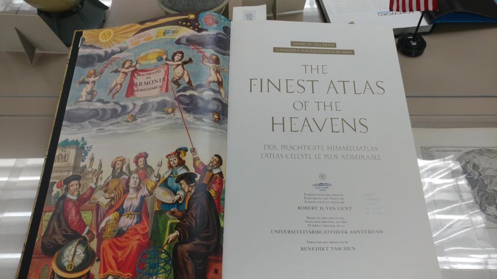
Franklinia: The Fourteenth State in the Union
By Lauren Maddox
After the American Revolution, North Carolina was in debt. To be fair, the entire country was in debt; it was just that Congress, who was also dealing with their own debts, began to collect. North Carolina didn’t have any capital to pay off their debts to Congress– instead, they voted in April 1784 to give Congress a parcel of land, around 29 thousand acres, between Appalachia and the Mississippi River.
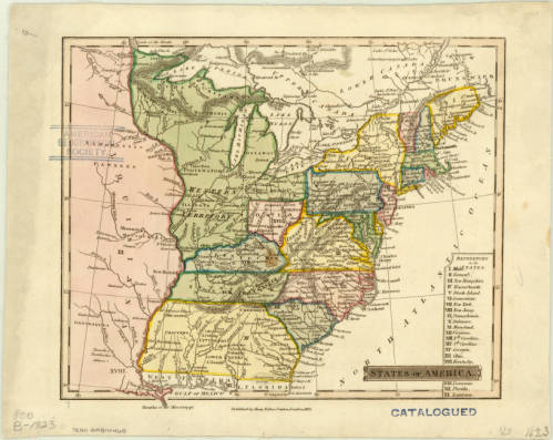
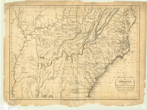
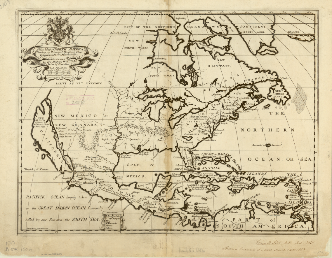
Click the link to see the States of America, 1832. Rare map recording the existence of a territory called “Franklinia” in our Digital Collections
This parcel of land– which is now East Tennessee– was left unprotected while North Carolina waited for Congress to take possession. The territory was ceded on one condition: Congress had to assume ownership of the area within two years. Without protection, the people living there were vulnerable; they weren’t well-situated for easy trade and had displaced, sometimes violently, the indigenous peoples who lived there originally.
Congress was unable to take ownership before North Carolina decided to rescind their offer just four months after their initial vote, so North Carolina made plans to reincorporate the territory– except that the people who lived there didn’t want to be reincorporated. As it turned out, despite being more exposed, being independent from North Carolina was a better deal. They weren’t as heavily taxed, and they weren’t satisfied with the protection North Carolina was providing anyway, so there didn’t seem to be any good reason to go back to being part of North Carolina.
And two men were already seeking to create a new Western state; John Sevier and Arthur Campbell had been discussing the possibility of establishing their proposed state with territory from Virginia, North Carolina, Alabama, and the region that would become Georgia, Kentucky, and Tennessee for years. Campbell’s call for a new state was well-received by other frontiersmen, but Virginia Governor Patrick Henry shot down his initial attempt by passing a law to prevent the use of Virginia territory in the creation of new states. They had made some headway in Kentucky, but the unclaimed territory ceded by North Carolina was a golden opportunity to establish the independent state they had been endeavoring to create for so long.
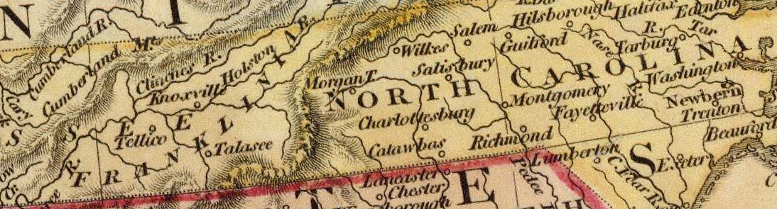
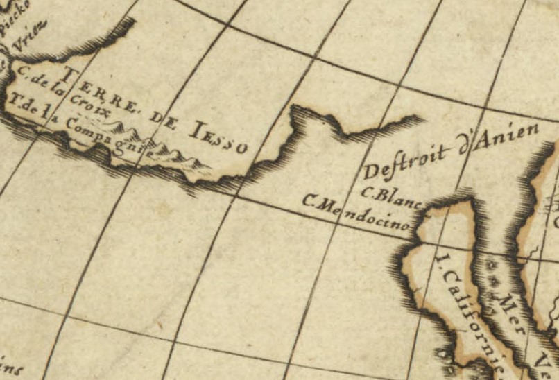
Detail of Franklinia 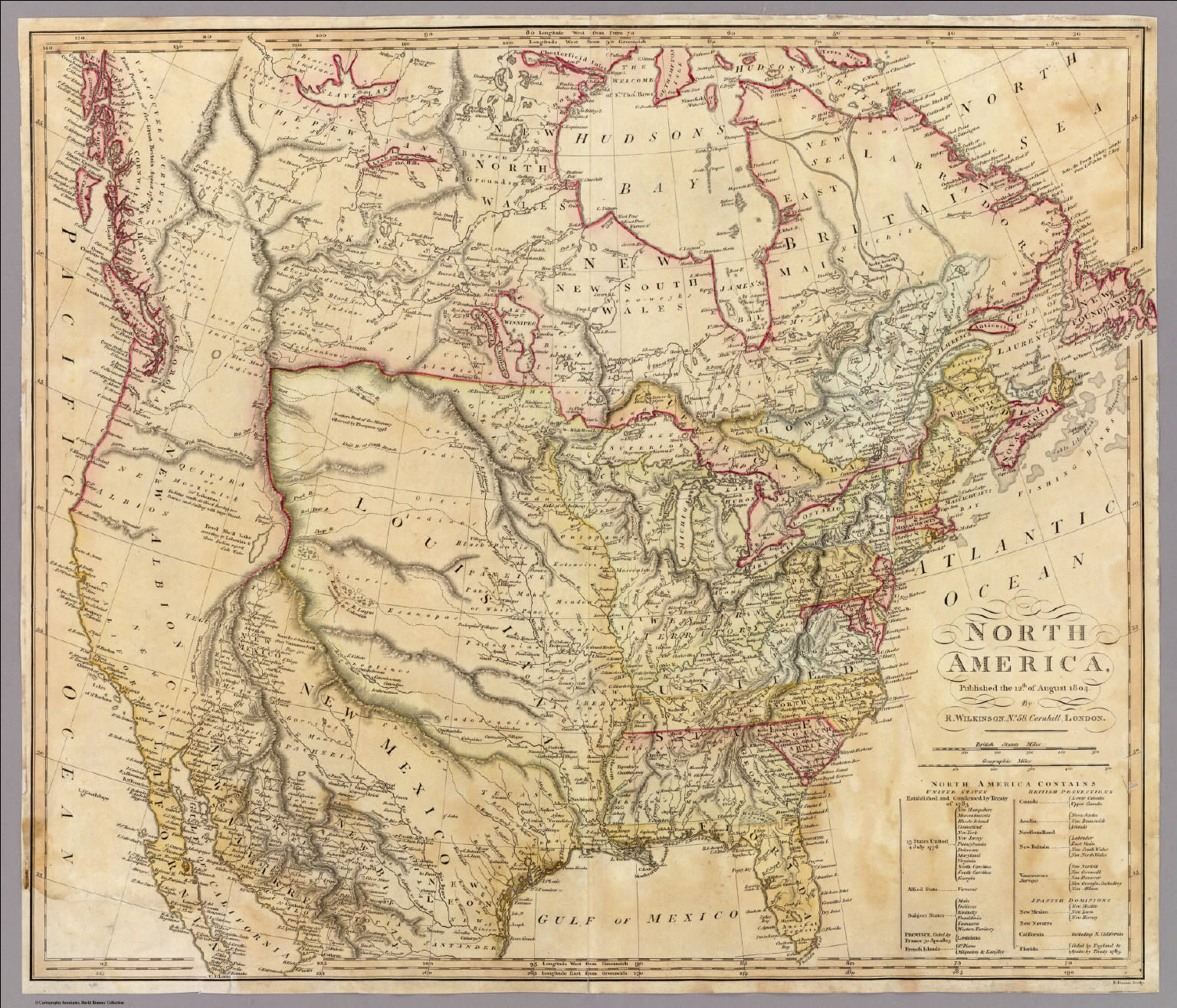
Click the link to see the 1804 Map of North America from the David Rumsey Map Collection
On August 23, 1784, delegates from the unincorporated counties met in Jonesborough to discuss whether or not they would rejoin North Carolina. They voted to become independent. Leaders were quickly elected; John Sevier became governor and a constitutional convention was called in December. The original draft of their constitution forbade doctors, lawyers, and preachers from becoming elected officials, but this was unpopular and this draft was dropped in favor of just using North Carolina’s state constitution.
The following May, just a year after the territory was originally ceded by North Carolina, a delegation petitioned Congress to become the fourteenth state in the union as Frankland. The delegation decided to use the name Franklin as an homage to Benjamin Franklin in the hopes that he might express some support for the new state. Unfortunately, Franklin wrote back that he didn’t know enough about their endeavor to support them, but wished the State of Franklin luck anyway. The final vote to establish Frankland as a state failed with less than the required two-thirds majority.
By December 1785, Franklinia (which had undergone several name changes by this point) was operating as an independent republic. Its issues with North Carolina were never resolved, and so they refused to rejoin their original state. The economy was in shambles; there was no official currency and bartering became the standard exchange. John Sevier himself was paid in deer skins. Citizens were granted a reprieve from taxes while the economy stabilized. A new capital was chosen because Jonesborough was so close to the North Carolina seat of government, and a new constitution drafted.
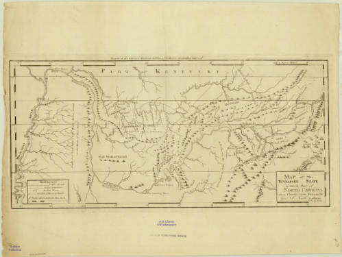
Click the link to see the Map of Tennessee “Formerly Part of North Carolina” 1796 in our Digital Collections
In 1786, North Carolina made Franklinia a new offer: if they rejoined North Carolina, they wouldn’t have to pay any back-taxes. Franklinian delegates refused this offer, which was the beginning of the end. Several key supporters of the movement withdrew and North Carolina began to militarily reunite Franklinia with its state government. Using armed force, North Carolina re-established government facilities alongside the Franklinian courts and jails. Franklinia’s decline took place over several years. In 1787, Franklin began forcibly seizing Native American territory, angering their neighbors. In 1788, three men were killed in a skirmish over John Sevier’s property; the conflict lasted ten minutes before Sevier’s handful of troops were forced to withdraw. Trying to protect Franklinia from the Chickamauga and Chickasaw tribes he had angered in his landgrab, Sevier began negotiating with Spain. North Carolina, resistant to Spanish interference, arrested Sevier. In 1789, the last few loyal Franklinians swore allegiance to North Carolina again. The government of Franklinia was officially and completely dissolved in 1791. Maps of Franklinia are rare because of how short-lived the de facto republic actually was; the AGSL has a single map featuring the state– it is not noted on other maps of the area from this time.
Click the link to see the Map of the Southern States of America in 1795, including territory labelled “Tennessee Government” in our Digital Collections
But after everything it took to reunite the State of Franklin and North Carolina, North Carolina ceded the territory again in 1790 to form the Southwest Territory. This territory would become Tennessee– and John Sevier was its first governor.
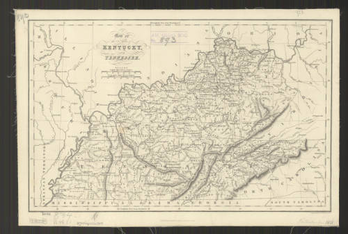
Click the link to see the 1832 Map of Kentucky and Tennessee in our Digital Collections
“A New World of Pleasure”: The 105th Anniversary of the Panama Canal
By Lauren Maddox
On August 15, 1914 the United States officially opened the Panama Canal. It took thirty-three years for the construction to come to fruition; France began building the Canal in 1881, but were unable to carry the project forward. Workers were dying and the engineers hit roadblock after roadblock. The United States took over the project in 1904.
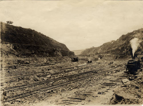
Click the link to see “Railroad Tracks at the Panama Canal Zone” 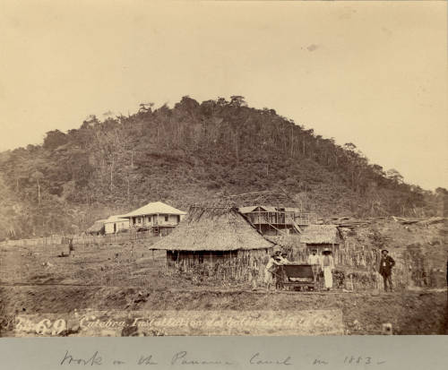
Click the link to see “People Working on the Panama Canal.” 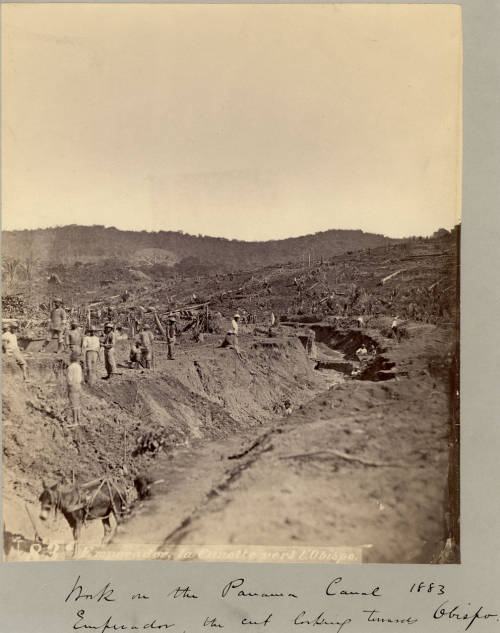
Click the link to see “Work on the Panama Canal 1883.”
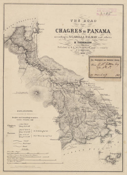
Click the link to see 1851 Map of the Road from Chagres to Panama with Proposed Canal Route in our Digital Collections
Click the link to see the 1866 French Map of the Isthmus in our Digital Collections
European colonists have had ideas about the Panama Canal since 1513; Vasco Nunez de Balboa crossed the Isthmus of Panama and wondered about a water-passage shortcut for ships crossing the Atlantic and Pacific. But imagination ran past ability, and the technology needed for such an undertaking would not be developed until the 19th century. France began the initial efforts. The project was led by canal engineer Ferdinand de Lesseps. But amid the disease and trouble financing the project, they were only able to complete half of the canal. As soon as the project was abandoned, the US expressed interest in the picking it up again, but US involvement with the Panama Canal was unpopular at home. French failure to complete the project was disheartening and the Colombian government was unenthused about the idea of an American canal to say the least.
For the US to be granted the rights to continue work on the canal, some political finagling was required. Philippe-Jean Bunau-Varilla, a businessman and engineer who had financed the original attempt, stood to lose his investment if the canal was left unfinished. He began lobbying US lawmakers and encouraging Panamanian independence movements which would prevent Colombian interference with US building efforts. It didn’t hurt that the US maintained an active military presence during the building to discourage conflict. American engineers also moved away from the original plans for a sea-level canal and began work on a lock-controlled canal which would would help them avoid the building problems the French had. Advancements in healthcare for workers and a new focus on mosquito control also helped save workers from catching the diseases that had killed so many during French construction.
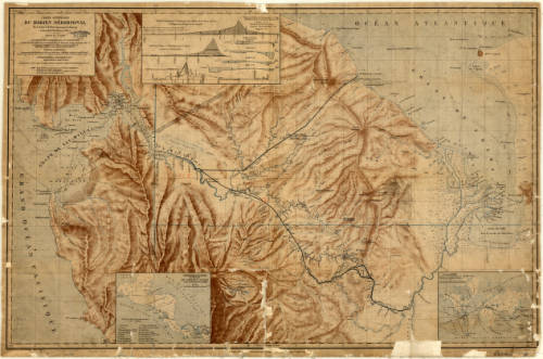
Click the link to see the 1877 Map of the Isthmus in our Digital Collections
The AGSL has an extensive collection of materials on the Panama Canal. Theodore Roosevelt, a longtime friend and council member of the AGS until his presidency forced him to resign, was a great proponent of the canal. And the one of AGS’s own directors, Isaiah Bowman, made several trips to South America during his doctoral work and beyond, and championed efforts to create a map of “Hispanic America” as part of the international map of the world. Bowman, a controversial figure who was a known antisemite, contributed a large portion of the AGSL’s records on the Panama Canal. His particular interest in South America made the way for revolutionary cartographic work in the area, and the continued AGS sponsored expeditions are named for him.
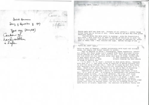
Click the link to see a Transcription of Bowman’s Diaries from his 1907 trip to Panama in our Digital Collections 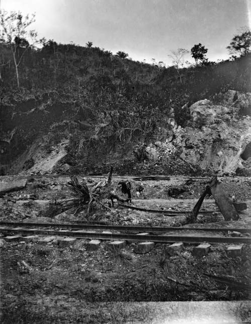
Click the link to see a Photo of Railroad Tracks built during Canal Construction, Taken by Bowman 1907 in our Digital Collections
Work on the lock-controlled canal began in 1904, when the US was officially granted the rights to build by the newly-independent Panamanians. The French ship Alexandre la Valley made the first test-crossing of the canal in January 1914. Construction began winding down; pop-up towns were demolished, workers were laid off, and more permanent governance of the canal was established. A grand opening celebration was planned– but when World War I broke out, the festivities were downsized to something more modest. On August 15, 1914 the SS Ancon made the first official crossing, marking the grand opening of the Panama Canal. No international officials attended the opening, so George Washington Goethals, engineer and first governor of the Canal Zone, tracked the ships progress by train. The AGSL has several maps of the Panama Canal before and after its opening. Since its first ship-crossing, the Panama Canal has only grown; Panama took ownership of the canal in 1977, new construction began in 2007, and annual traffic has risen to nearly a million crossings.
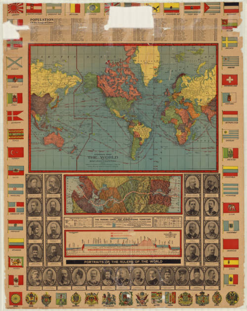
Highly Decorative World Map with Ancillary Map of Panama Canal, 1905 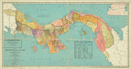
1910 Map of the Republic of Panama 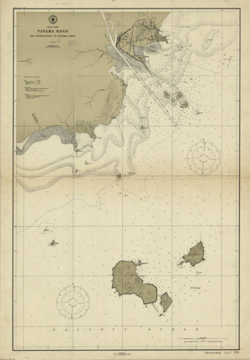
1911 Map of Canal Zones with Panama Road and Approaches to the Canal 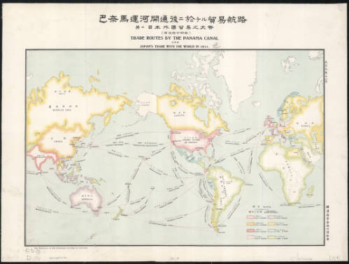
1911 Bilingual English and Japanese Map of Trade Routes by the Panama Canal 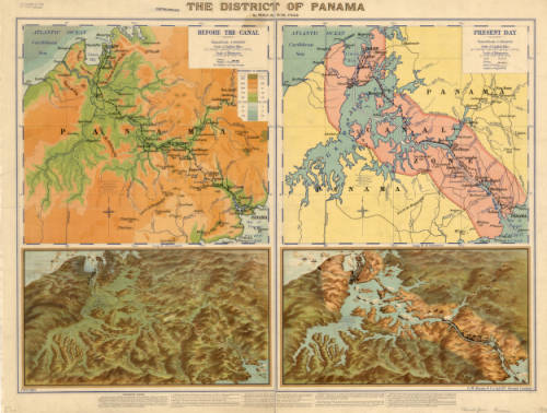
1915 Map of the District of Panama 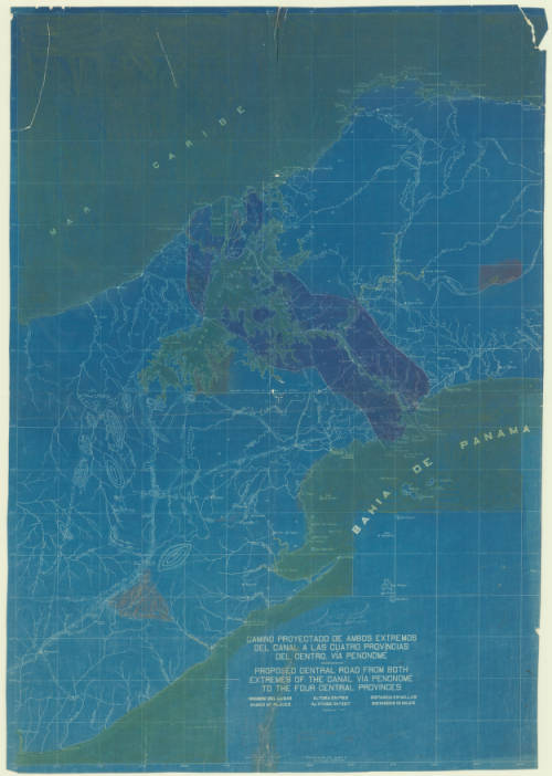
1922 Plans for a Main Road Across the Canal Route 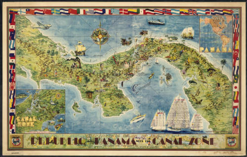
1941 Illustrated Map of the Republic of Panama and the Canal Zone 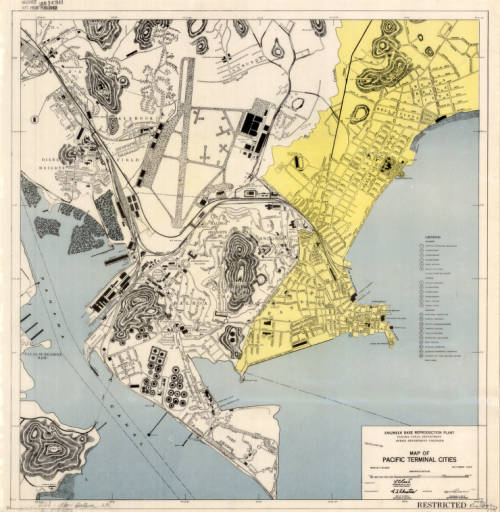
1947 Map of Terminal Cities in the Pacific 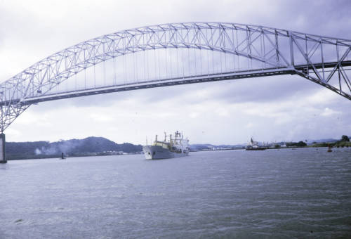
Harrison Forman’s Photo of the Bridge Across the Canal Entrance 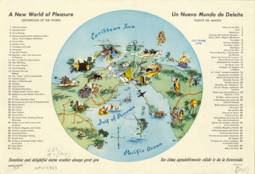
1950 “A New World of Pleasure: Crossroads of the World”
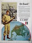
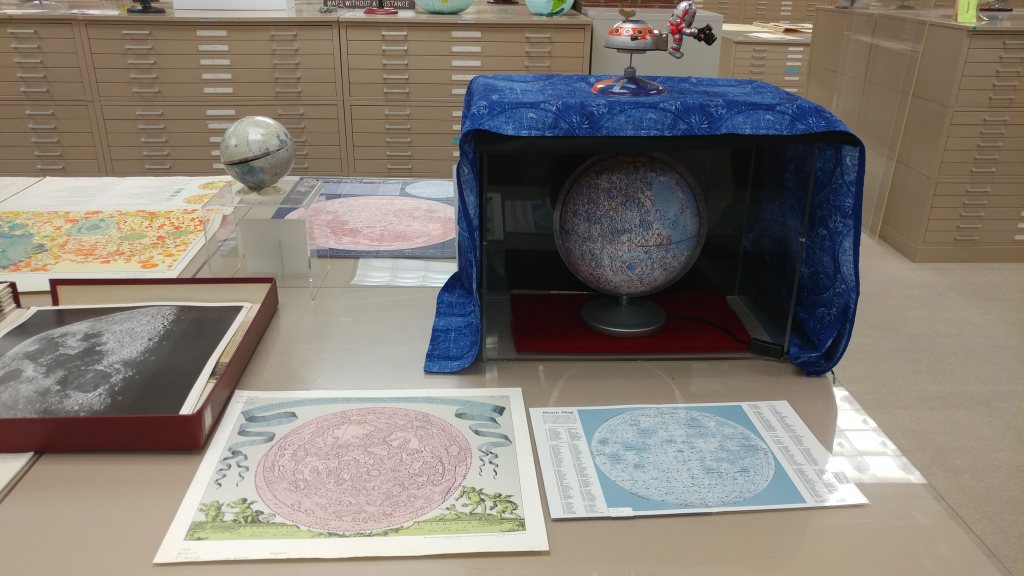
Globes in Advertising
by Kay Guildner
What associations come to your mind when you see images of a world globe these days?
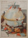

Nowadays, it is typically the environment, globalization, Mother Earth, etc. The image has been used by any advertisers you can name at one time or another. It has served as a prop for commodities of all sorts, as a symbol of power, as well as a symbol of unity. It has become a visual metaphor for whatever the ad is trying to convey, be it networking, environmentalism, and consumerism, the suggestion of manifest destiny, conquest and empire.


In news features and political cartoons, globes and maps aid in conveying a sense of scope to the message as well, no matter your politics. It also sells soap, liquor, buttons, computers, spark plugs, cereal, soda, needles, bicycles, and, truly, soup to nuts. It suggests a universal theme, something common to us all.


Ads use globes to add a level of sophistication to their products as well, and in the movies the presence of a globe in the home suggests an educated tenant.
One place that nearly always relied on a globe to suggest unity was the World’s Fair, anywhere. It celebrated both our similarities and our differences. All were welcome, no exceptions.
Globes are often anthropomorphic, smiling or interacting with a person or product as well. After all, if “it” pleases the world, why not you?


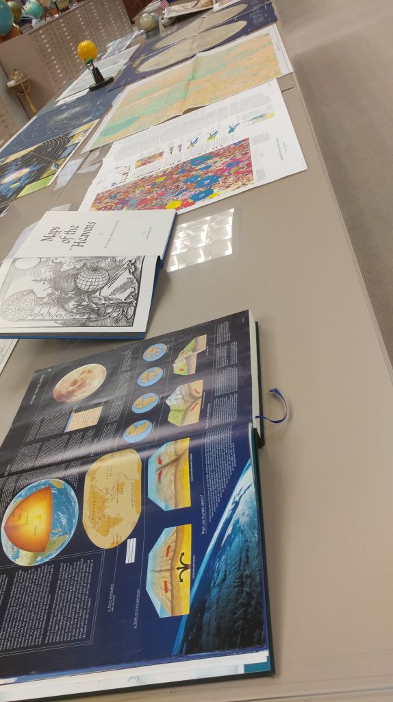
Here at the American Geographical Society Library we have 230 globes on permanent view. The collection includes globes of all types including celestial, physical, terrestrial, political, planetary, the ocean floor, air and transport routes, continental drift, satellite images, hydrographic, and many, many more.
The premier piece might be the President’s globe, coming in at 50 inches in diameter, created by Weber-Costello in Chicago in 1942. It was commissioned by OSS Director William J. Donovan during WWII and presented to both President Roosevelt and Winston Churchill as Christmas gifts from the US Army. Eleven were made, and the one at UW-Milwaukee was transferred here on permanent loan from UW-Madison in 1996.
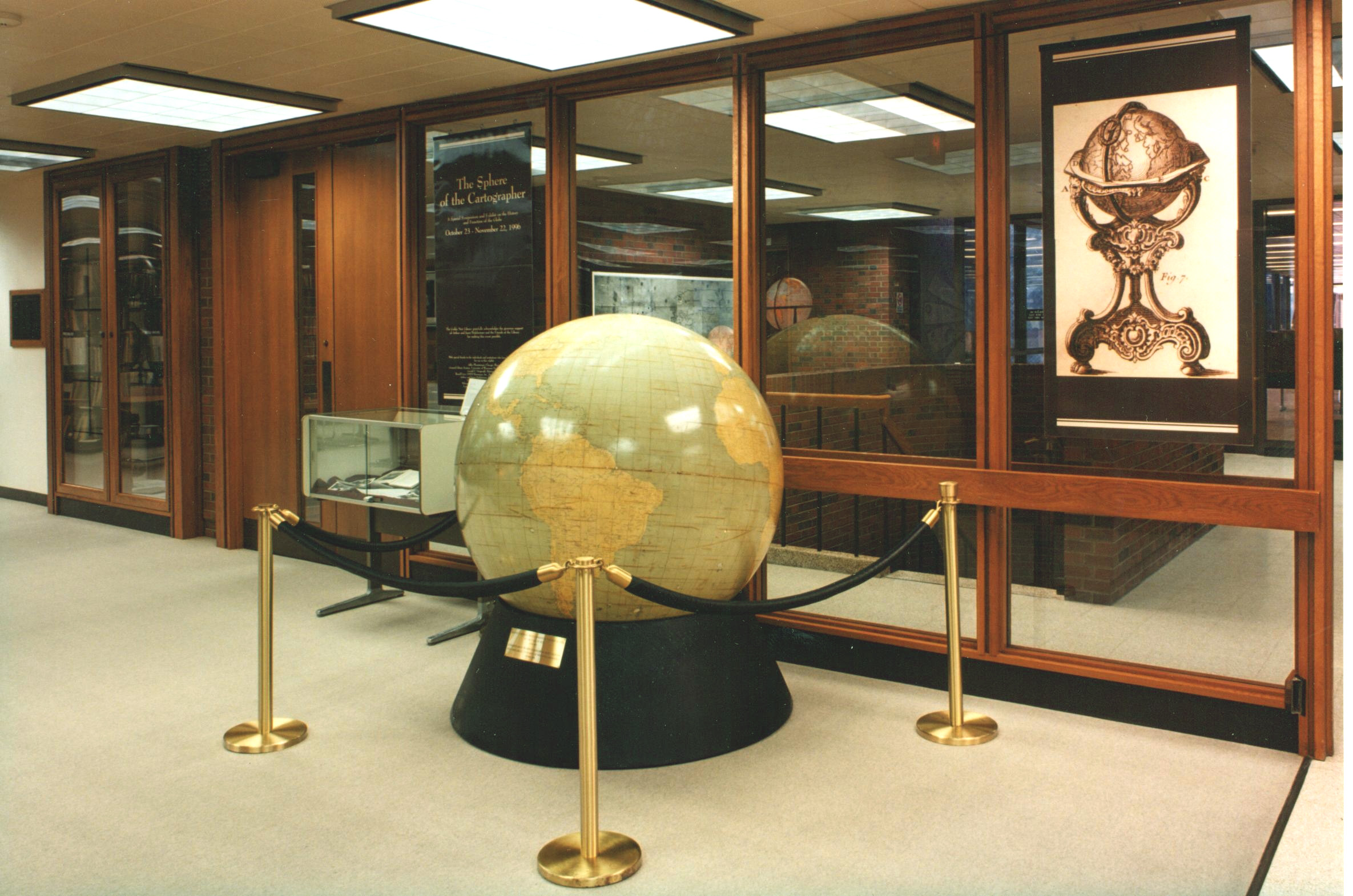
Globes in the AGS Library collection date from 1613 to the present and include globes in many languages. We see guests and researchers from all over the world, and the first thing they notice are all the globes. Come visit us and pick your favorite!
To the Lighthouse: Representations of Lighthouses on Maps
By Lauren Maddox
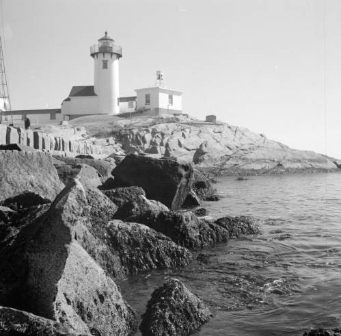
Click the link to see Clarence W. Sorensen’s photo of a lighthouse in Gloucester, c. 1934-1969 in our Digital Collections
Lighthouses have been guiding us home over the rough sea from our earliest maritime beginnings– but our understanding of lighthouses and how we represent them on maps and nautical charts has changed drastically since these beginnings. While references to early lighthouses exist, including Homer’s claim that Palamedes devised a system of lit beacons to guide sailors, the first “regularly maintained” lighthouse in antiquity was on Cape Incihisari. J. Saxby Wryde, however, claims in his British Lighthouses: Their History and Romance that the most celebrated lighthouses in antiquity were built 400 years after this. The Colossus at Rhodes was erected in 278 B.C. and destroyed by an earthquake in 224; the remains were sold as brass and carted away on camels by a merchant. In 270 B.C., the famous Lighthouse of Alexandria was constructed in honor of Ptolemy Philadelphus on a small island in the Bay of Alexandria.
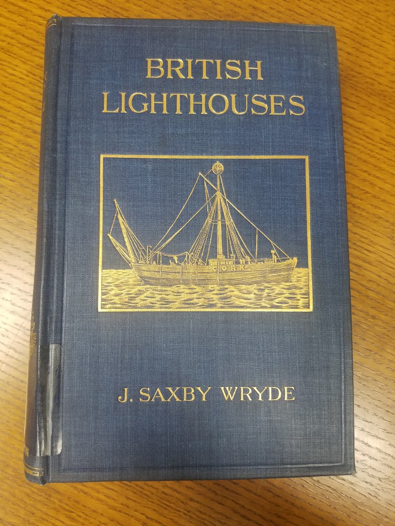
Click the link for details about the 1913 Edition of British Lighthouses 
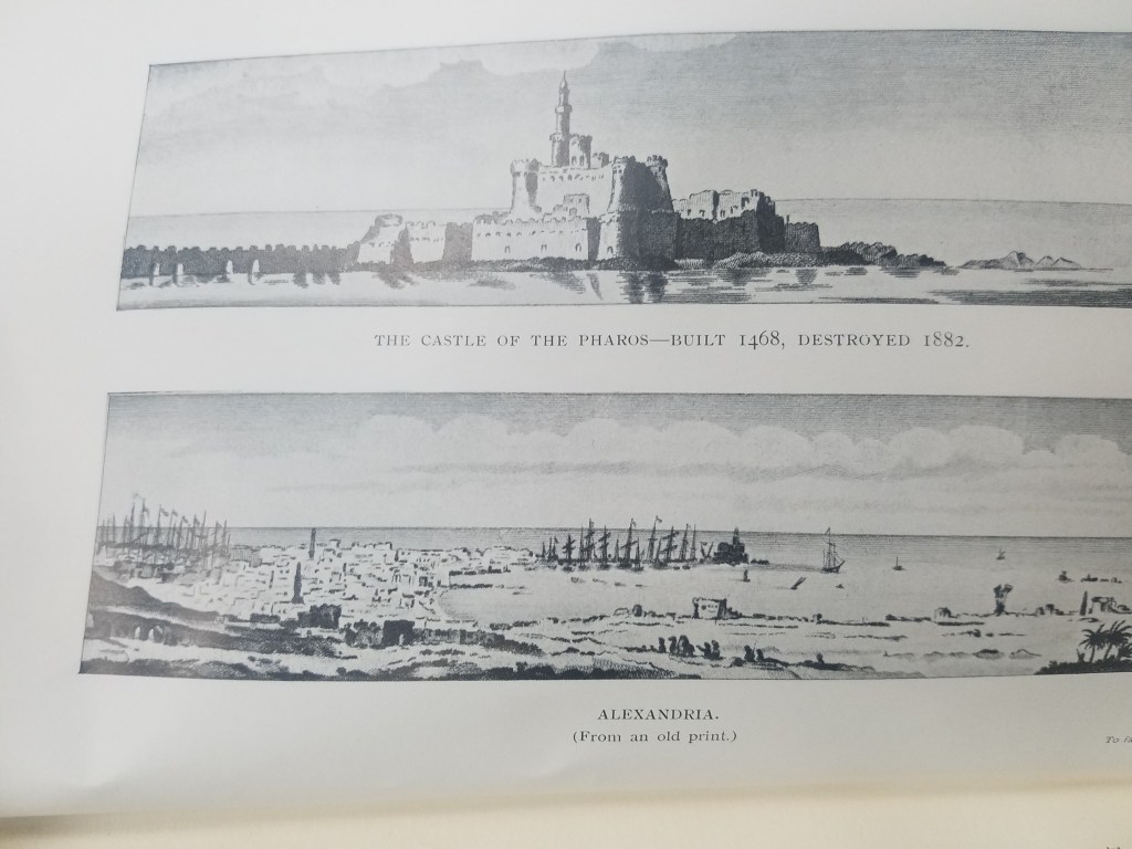
Illustration of the Lighthouse of Alexandria
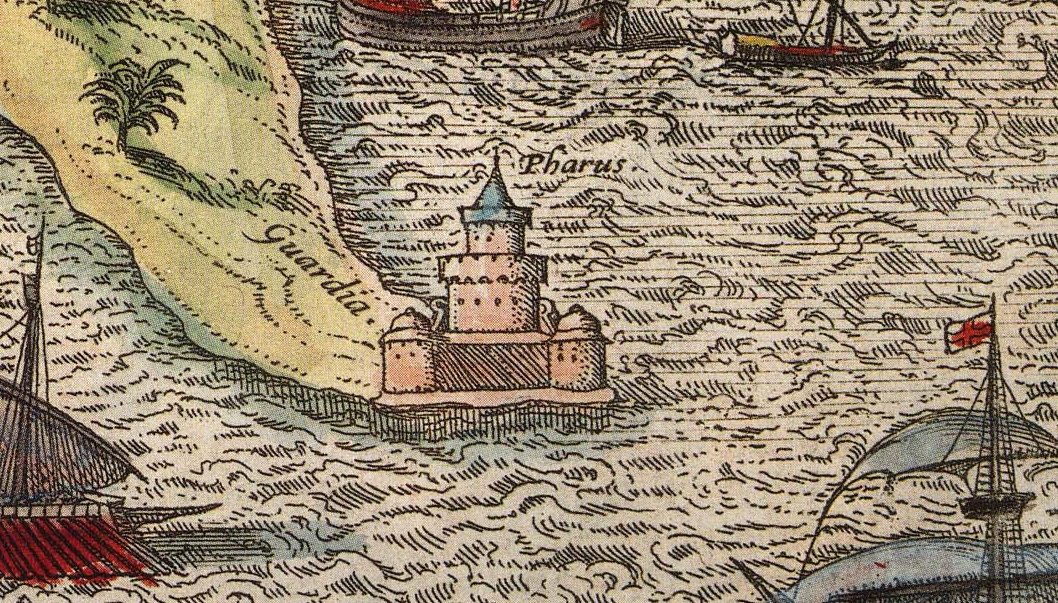
The function of lighthouses has also evolved over the years; in antiquity, lighthouses were only expected to indicate the location of ports. Lighthouses as we understand them today act as warnings for boats approaching reefs and rocky shores. This understanding of lighthouses as way markers is reflected on ancient maps. The Lighthouse of Alexandria is depicted pictorially in Braun and Hogenberg’s 16th century atlas Civitates Orbis Terrarum–the lighthouse is given the same attention as the city’s obelisk or its ruins; its existence is simply recorded and labeled with a single word: pharus for lighthouse. The lighthouse has obviously done its job, though; ships are shown moving towards the lighthouse and the port it is indicating. One ship is even flying St. George’s Cross, the British flag used by crusaders that was later adopted as the national flag in Medieval England.
Click the link to see the Atlas the illustration of The Lighthouse of Alexandria is in 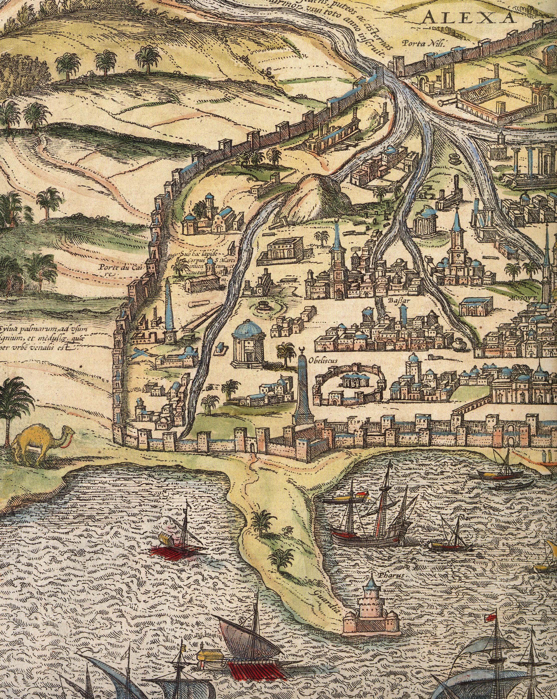
Alexandria
The Lighthouse of Alexandria was also doomed to be destroyed by earthquakes, but the bricks were used to construct the Citadel of Quaitbey. UWM professor Caroline Seymour-Jorn donated her photo collections to the AGSL , including several photos from 1996 visit to Egypt of the citadel.
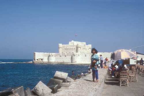
Click the link to see this photo of Alexandria, Egypt: View of Quaitbey Citadel courtesy of Caroline Seymour-Jorn in our Digital Collections
The Roman Empire adopted the Greek pharos and began building them across Italy and the Empire, including the Tower of Hercules in A Coruña, Spain and Dover. The lighthouse in A Coruña is still functional, but many Roman lighthouses were abandoned in the Middle Ages and replaced. As travel and trade by sea became more and more prevalent, the need for lighthouses grew.
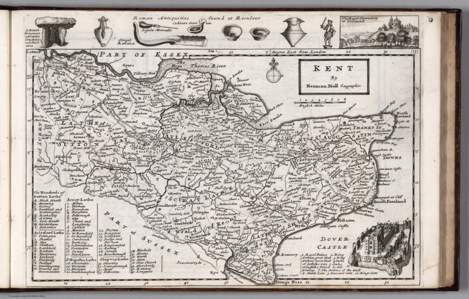
Click the link to see the 1724 Map of Kent by Herman Moll in our Digital Collections 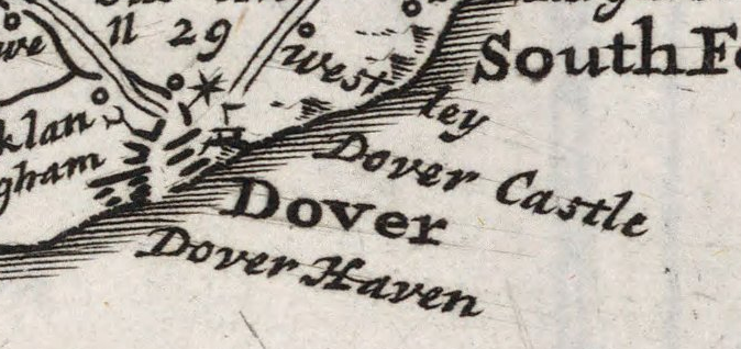
Dover, lighthouse indicated pictorially
Most lighthouses constructed during this time are no longer operational, but the Hook lighthouse in Ireland continues to be used. The building has been in operation for over 800 years and is now managed by the Commissioners of Irish Lights. Lighthouses in England were privately owned and operated during the Middle Ages and beyond. Because there was no regulation or standard policy, lighthouse keepers began to abuse their posts, stealing ship cargo and demanding payment from sailors. This problem became so pervasive that the Lighthouse Act of 1836 was passed in the hopes of making coasts safer for ships coming to port.
In the 18th century, lighthouse construction advanced to match the needs of a growing transatlantic trade. Bigger, better lighthouses were being built and were now being used as more than way markers; they could warn incoming ships and regulate boat traffic. In 1716, the first American lighthouse was built on the Boston Harbor; many more began to spring up in the subsequent years, and in 1851 Congress passed an act to facilitate the creation of the US Lighthouse Board, which would eventually be dissolved to make room for the Lighthouse Service. The AGSL has many of the Service’s records, including records of their history, finances, regulations, and buoyage and lighthouse systems.
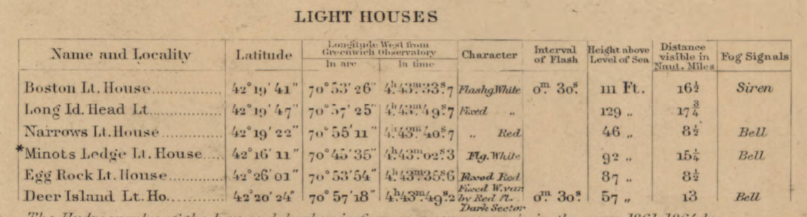
Click the link to see the Boston Light Referenced on 1889 Map of Boston Harbor in our Digital Collections
With lighthouses increased utility and presence on coastlines, their representation on maps began to shift. Instead of being just illustrations or seamarks, lighthouses began to take on a new navigational importance. Diagrams of lighthouses, recordings of the range of their lights, and more exact buoy locations became a common part of maps.
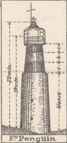
Click the link to see Lighthouse detail from 1926 map of Puerto Deseado, Argentina in our Digital Collections 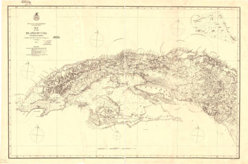
Click the link to see the Map with Lighting information for Cuba 1874 in our Digital Collections 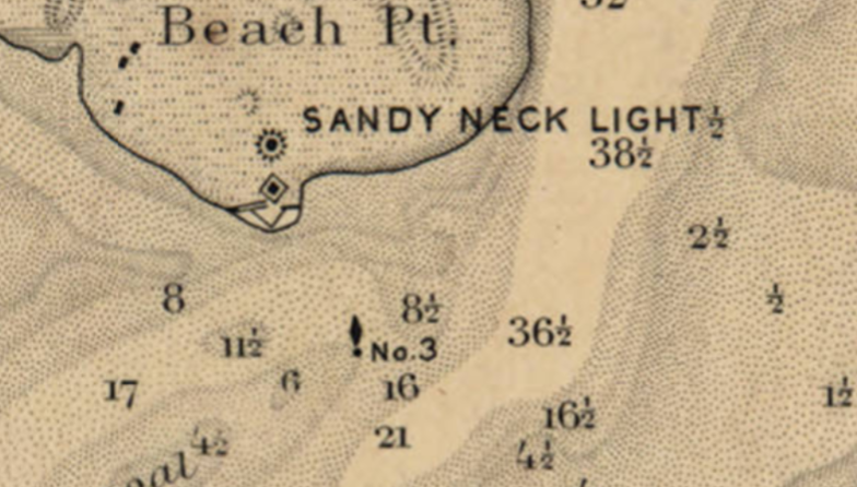
Click the link to see the Lighthouse and Buoy on Map of Barnstable Harbor, Massachusetts 1880 in our Digital Collections 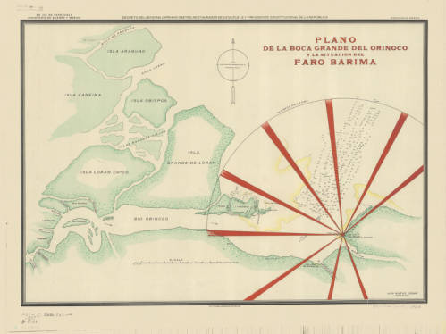
Click the link to see the Lighthouse depicted in 1906 Map of Rio Barima, Venezuela in our Digital Collections
Now lighthouses have a romantic air as well as a practical use; writers and artists work to capture the lighthouse. To the Lighthouse by Virginia Woolf comes to mind. And here, in Milwaukee, where the AGSL lives, we have our share of lighthouses on our Great Lake Michigan.

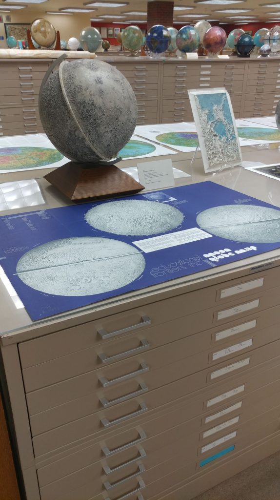
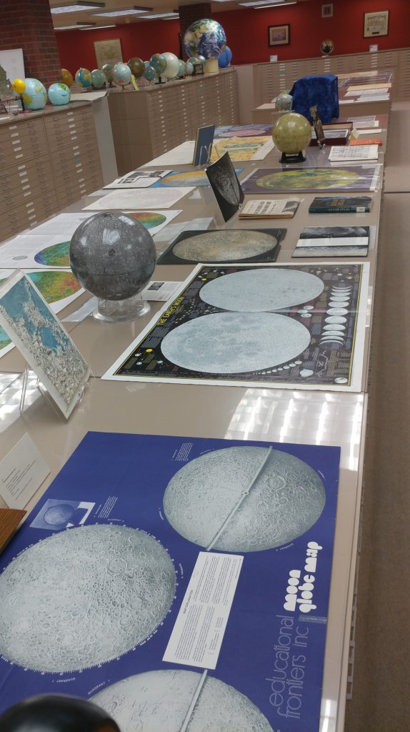
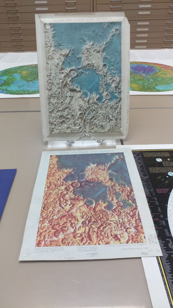
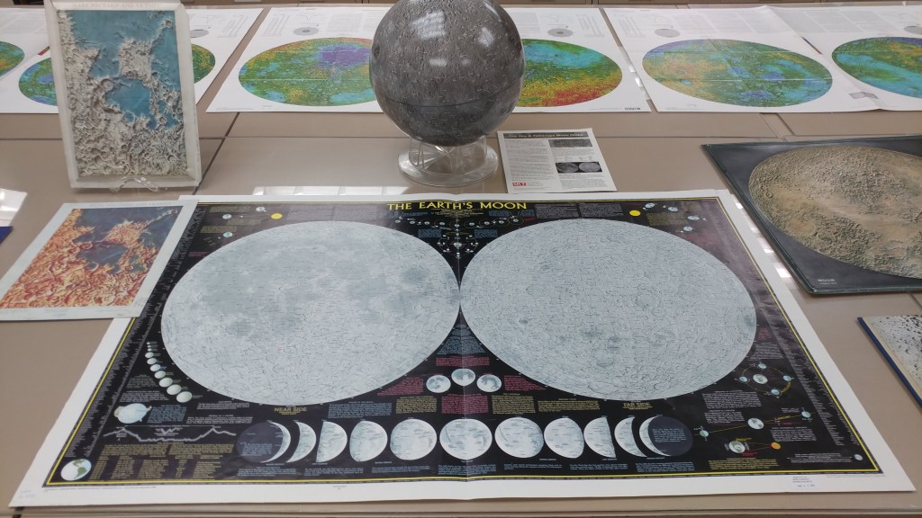
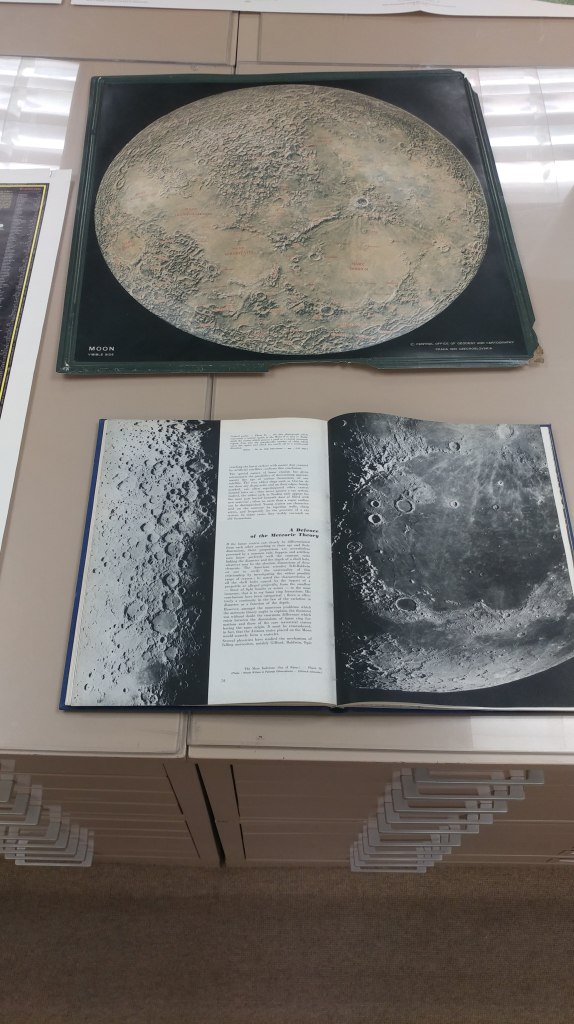
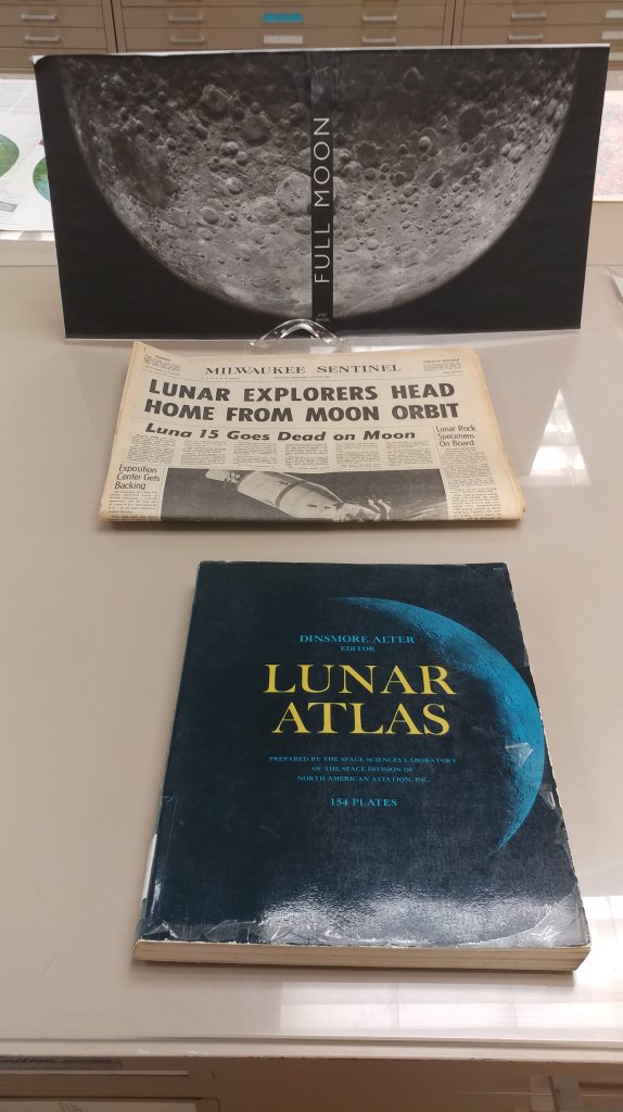
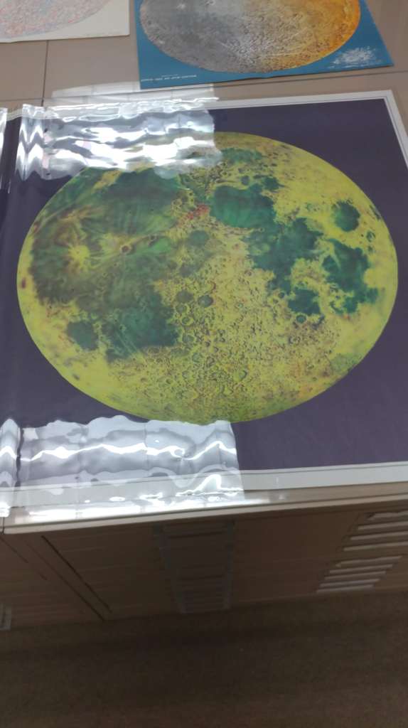
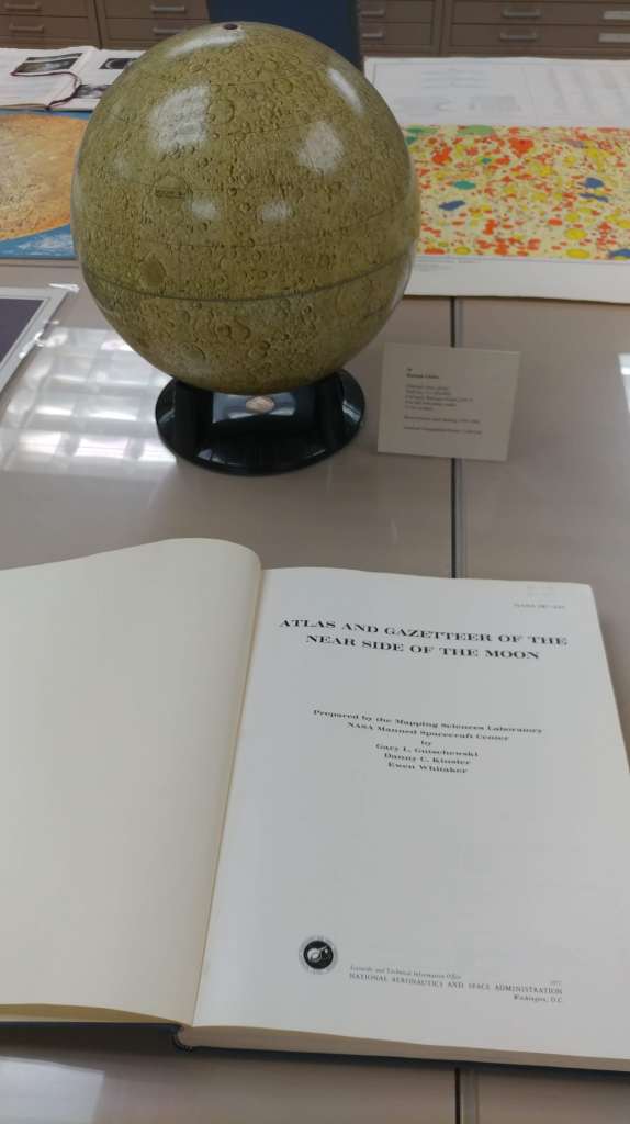
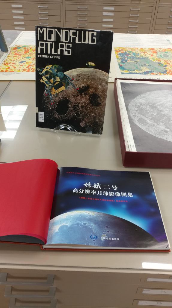
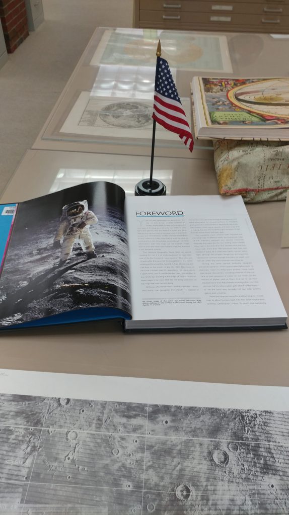
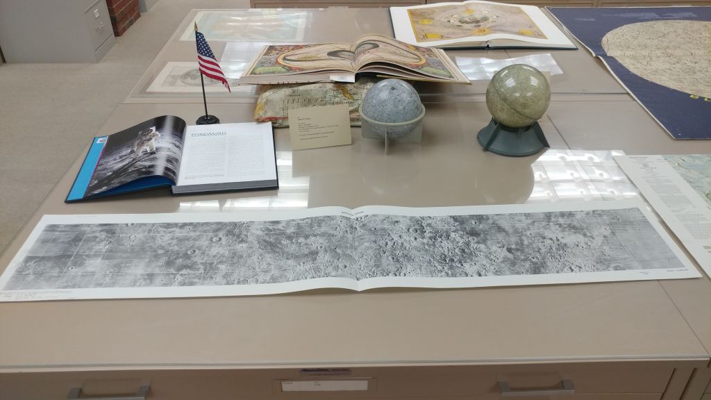
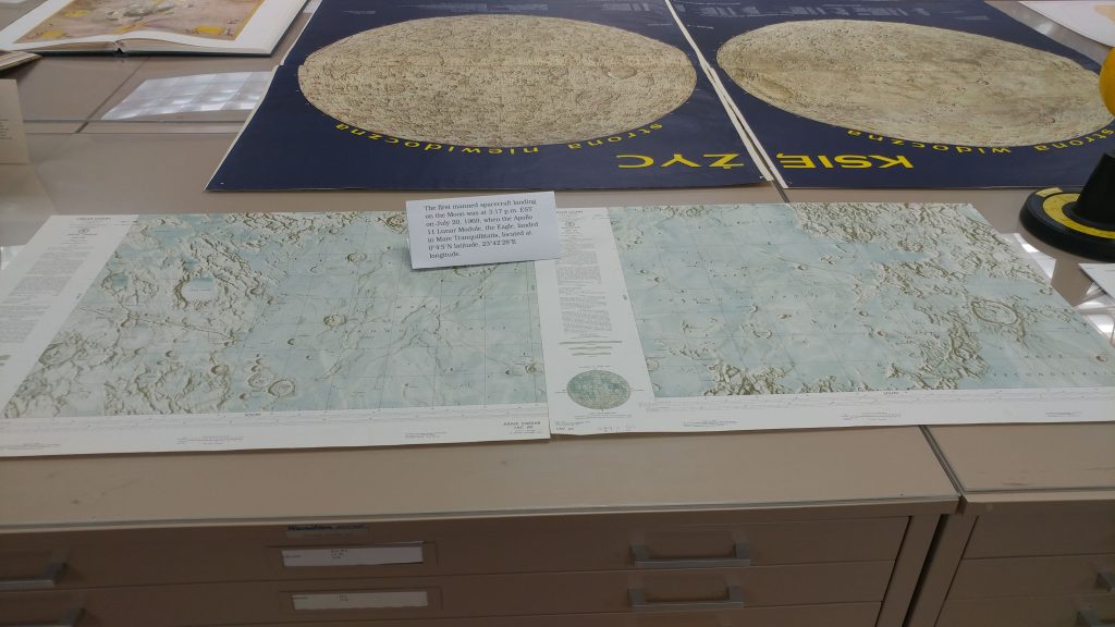
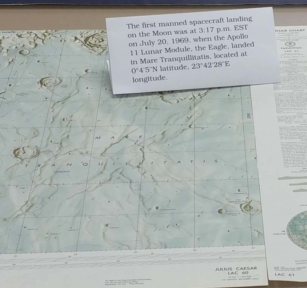
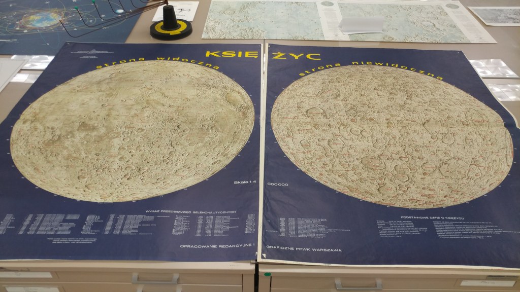
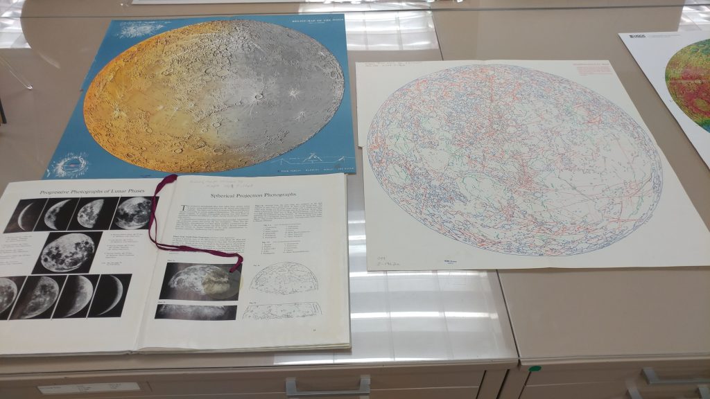
50th Anniversary of the Apollo 11 Moon Landing pop-up exhibit in the AGSL
by Angie Cope
The exhibit will be up from July 16 – July 26 during regular hours (M-F 8am-4:30pm).
Many of our maps have been scanned and are viewable in the AGS Library Digital Map Collection. https://collections.lib.uwm.edu/digital/collection/agdm/search/searchterm/moon

The AGSL Guided Tour: An Interview with Georgia Brown
Interview conducted by Lauren Maddox
This week, I sat down with Graduate Student Intern Georgia Brown to discuss one of her recent projects for the AGSL. Georgia is part of the School of Information Studies coordinated degree program working to receive her Master’s in both Library and Information Science and History. She has been a key member of the AGSL staff since 2018, contributing to many projects for the library. Recently, she designed a guided tour of the AGSL to make our collections more accessible to visitors exploring the library. To learn more about the tour and how you can take it, read on:
So, we’ve started giving visitors your Self-Guided Tour of the AGSL to help them navigate the library—could you talk a little about what the Guided Tour is and your process for creating it?
The guided tour helps people get into the space of the AGSL and really see more of the collection than is just out by the display cases. The process actually took a few months–I made a lesson plan last semester that had middle schoolers exploring the AGSL while also learning about the parts of a map. The lesson itself is a map of the library that the students use to figure out a different part of a map at each stop. After I made this, I realized that this would be an awesome way to have people just come visit the AGSL.
How would a visitor go about a Guided tour? Could you describe the process of getting a Guided Tour and what visitors see on it?
As soon as you walk into the AGSL, on the table to your right will be a stack of the guided tours. Someone on the library staff will ask if you need any help and if you are just there to look around, we’ll offer you the guided tour as a way to check out the library.
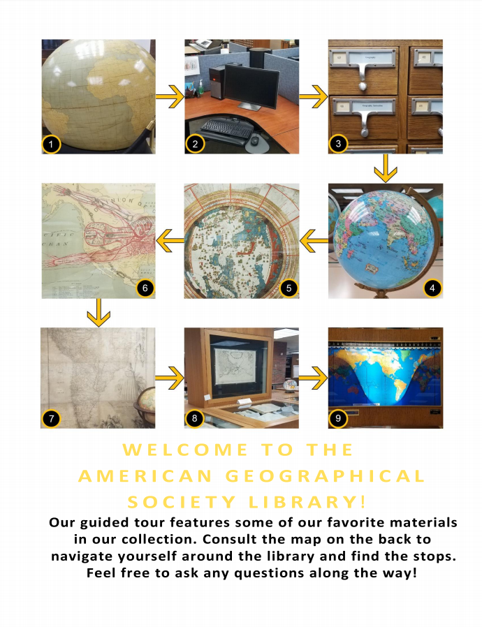
The Guided Tour, available at the front table in the AGSL 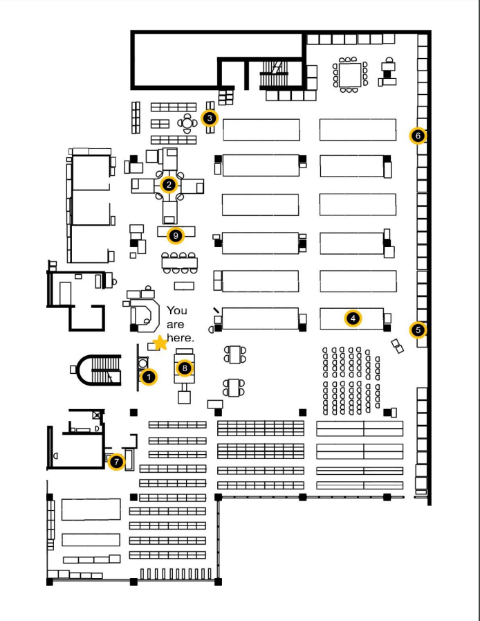
Map of the Library
Why was this a necessary project? Has it made the AGSL more accessible to visitors?
Lots of people come in to see the AGSL, and some will take the time to walk around and see everything. But one of my biggest frustrations is seeing visitors come in, spin once in a circle, and then leave. I realized there was probably more they wanted to see, but something about the space made it seem scary or hard to approach. Now that the guided tour is being handed to patrons and visitors, I feel like they are seeing more of what is on display.
What patrons benefit the most? What impact has this had on visitors’ experiences in the library?
In the two weeks that I have been handing out the guided tour, I feel like only a third of the people who start it actually finish it in its entirety. The other two thirds, however, keep getting distracted by all of our other awesome materials on display. My goal with the tour was to get people into our space, and in just a short time, I have seen people just as interested in globes and maps that aren’t on the tour as the ones that are on the tour.
Did working on this project teach you anything about the AGS Library or about libraries in general?
One cool thing about putting this together was the amount of collaboration that went into it. After I made the first version, I gave a copy to five staff members and interns, and they each gave me their notes on the project.
Thank you Georgia for joining me for this interview. To take the tour yourself and see our amazing collection in person, visit the AGSL and take the guided tour! You can find us on the third floor of UWM’s Golda Meir Library, Monday through Friday, 8:00 a.m. to 4:30 p.m. We look forward to seeing you!
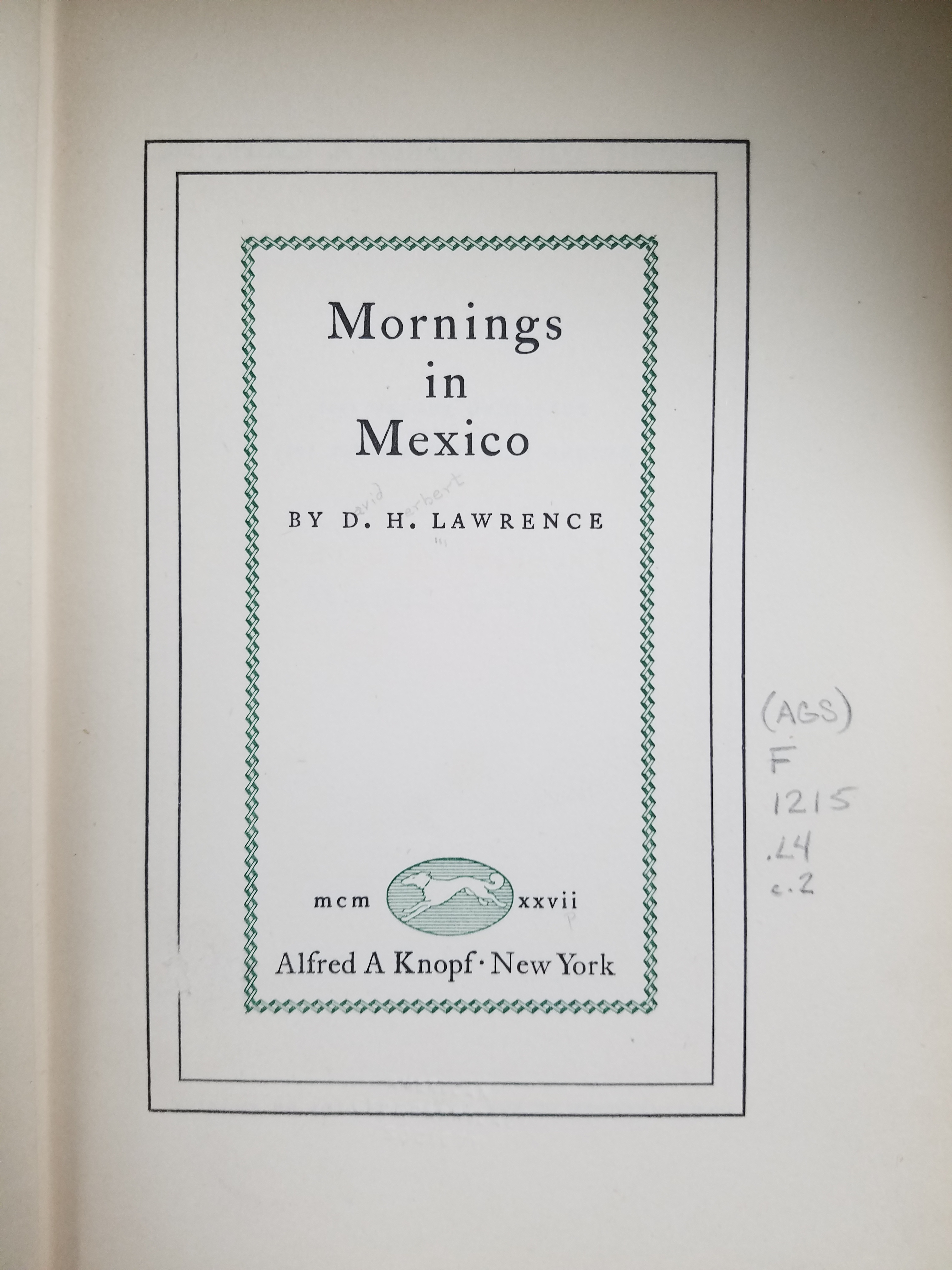
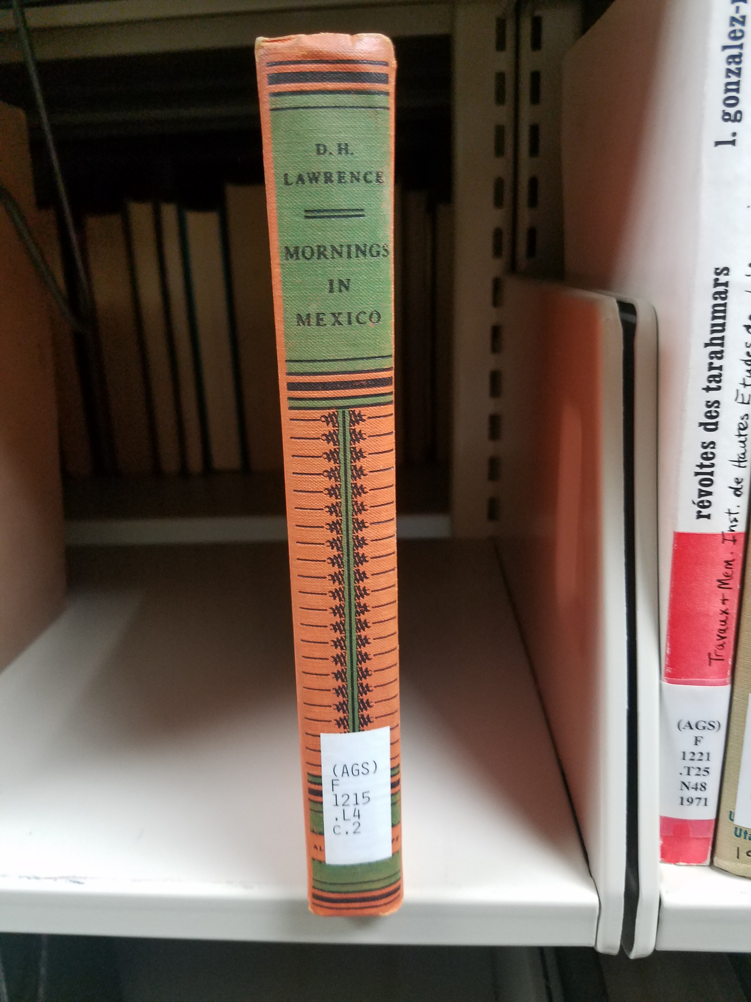
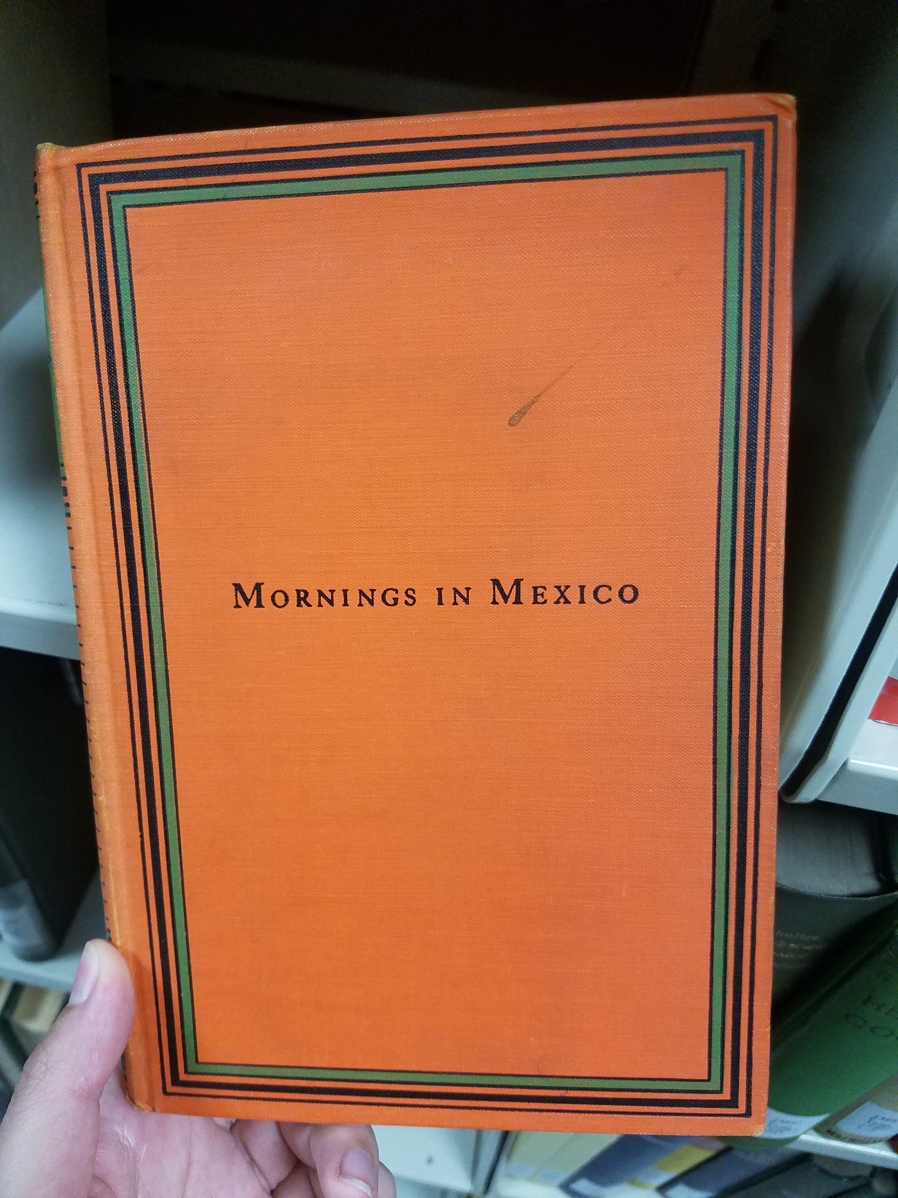
Mornings in Mexico: A Short History of Travel Literature
By Lauren Maddox
In 1919, still recovering from a nearly fatal bout of influenza, D.H. Lawrence fled England. He had been staying in Derbyshire with his wife Freida, finishing “The Wintry Peacock” and hiding from authorities. The couple was destitute; his most famous novel The Rainbow had been banned on obscenity charges and the government was using the Defence of the Realm Act to openly, and often violently, harass Lawrence for his anti-militarism and Freida’s German heritage. Sick, and barred from publishing, Lawrence resolved to undertake his “savage pilgrimage.” His self-exile from England was funded by an ancient, and very British, literary tradition: travel literature.
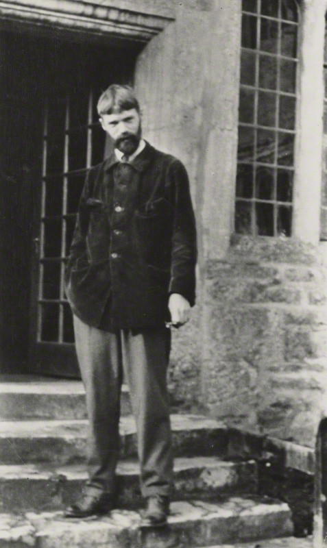
Photo of Lawrence by Lady Ottoline Morrell 29 November 1915
Despite these dire beginnings, Lawrence produced several gems during his travels: Twilight in Italy, Sea and Sardinia, Etruscan Places, and in 1927 Mornings in Mexico. The AGSL has a 1927 edition of Mornings in Mexico as well as a collection of travel writings from across time time and space, including dozens of travel books exploring Mexico and Latin America.
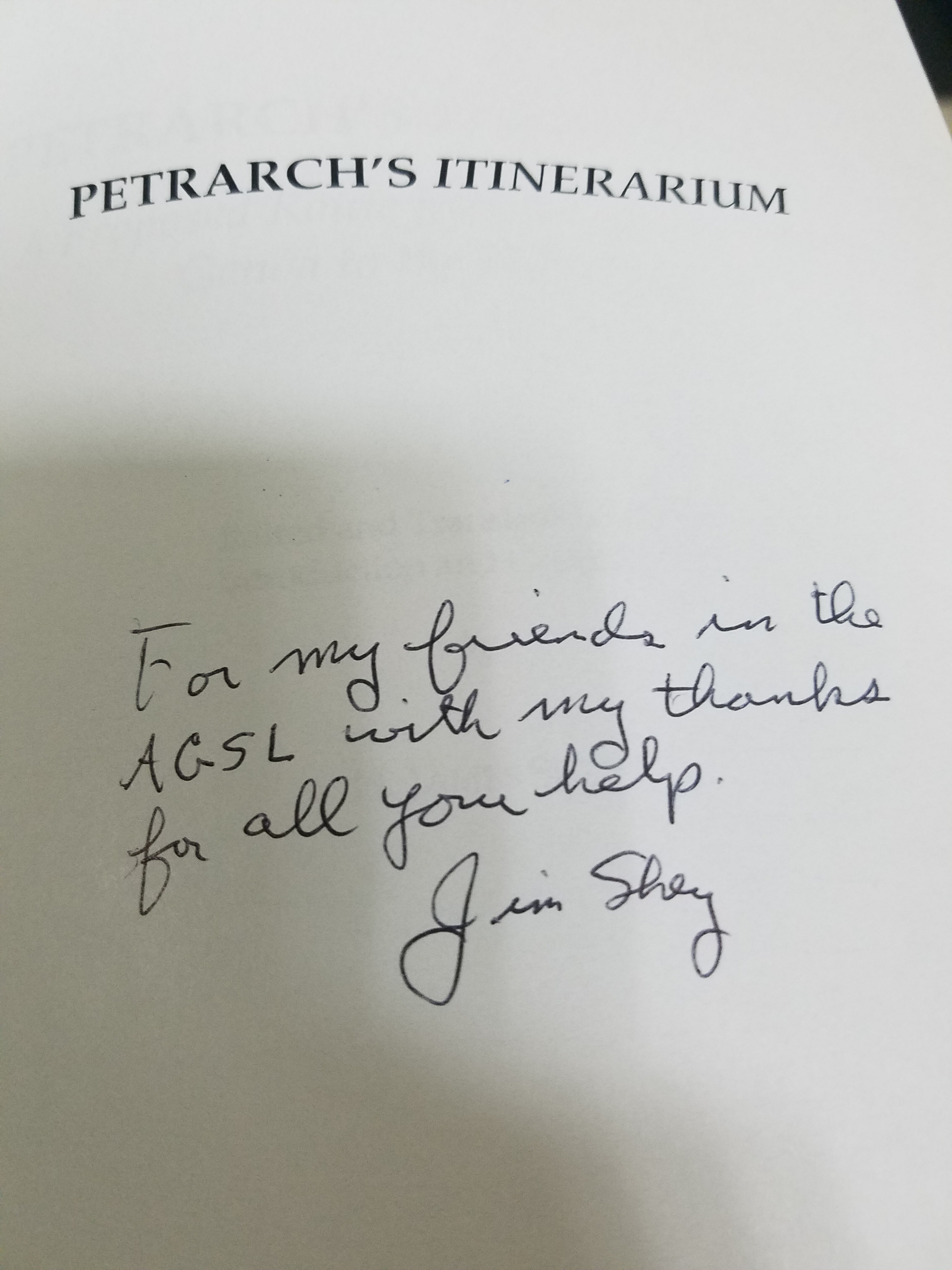
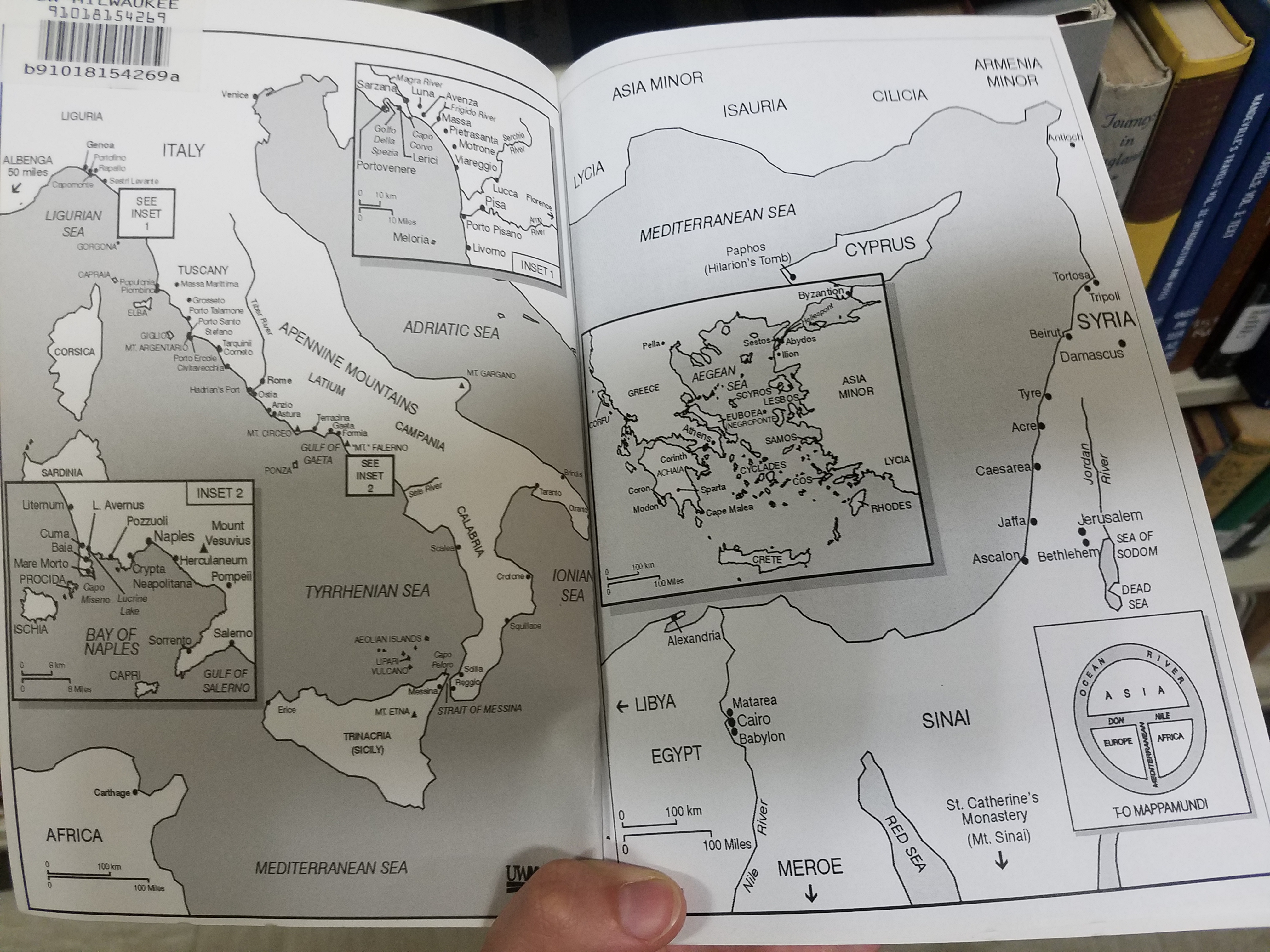
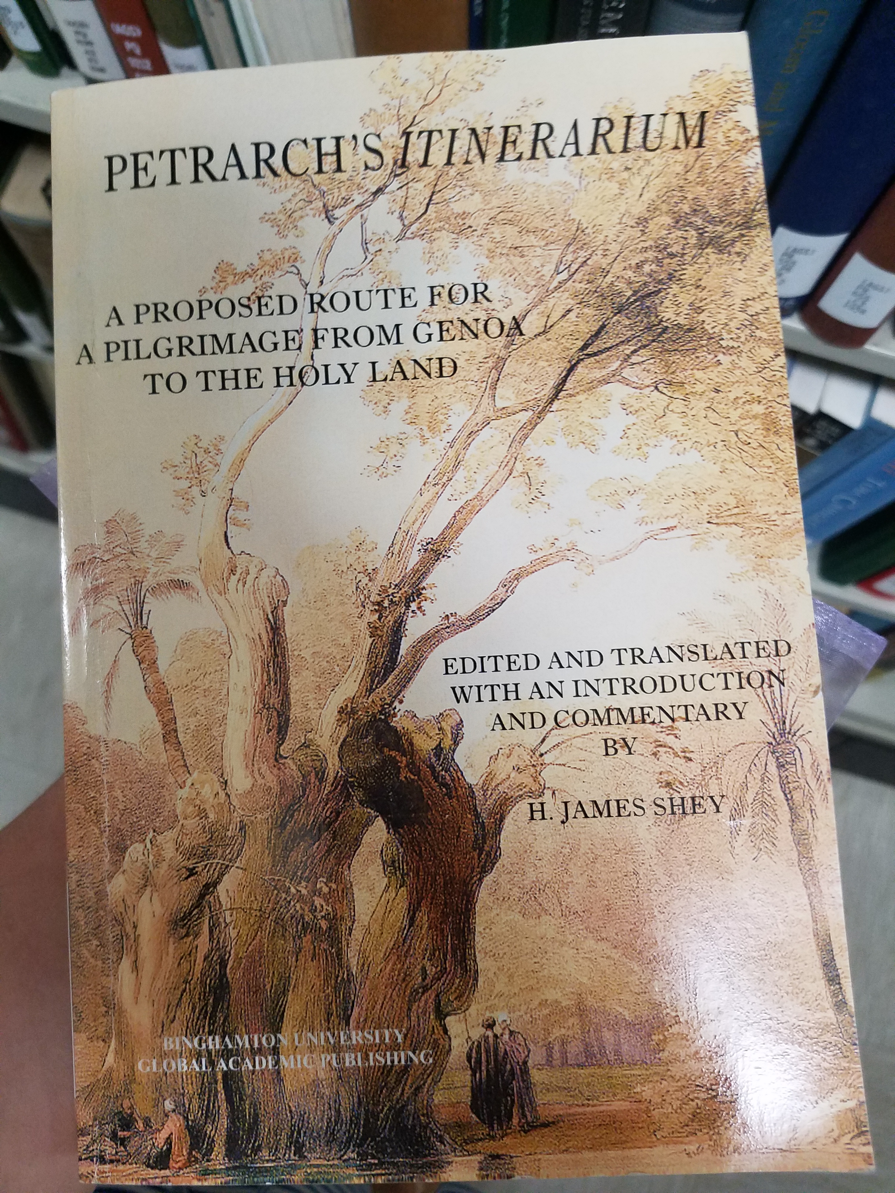
But the tradition of travel literature has existed as long as we have been traveling. Petrarch, climbing Mount Ventoux in 1336, accused his traveling companions of being frigida incuriositas–men with cold curiosity. The climb became a metaphor for Petrarch’s life, and he used his physical and visual experience of the landscape as a way to meditate on his own moral climb. UWM professor emeritus H. James Shey translated Petrarch’s Itinerarium, which outlines Petrarch’s proposed route for Giovanni Mandelli’s pilgrimage to the Holy Land in 1358. The Itinerarium focused primarily on the geography and path Mandelli would travel, but also included references to local history and Petrarch’s own spiritual experience as a pilgrim. The AGSL has a signed copy of Shey’s translation (which includes his own commentary on the Itinerarium) in the collection.
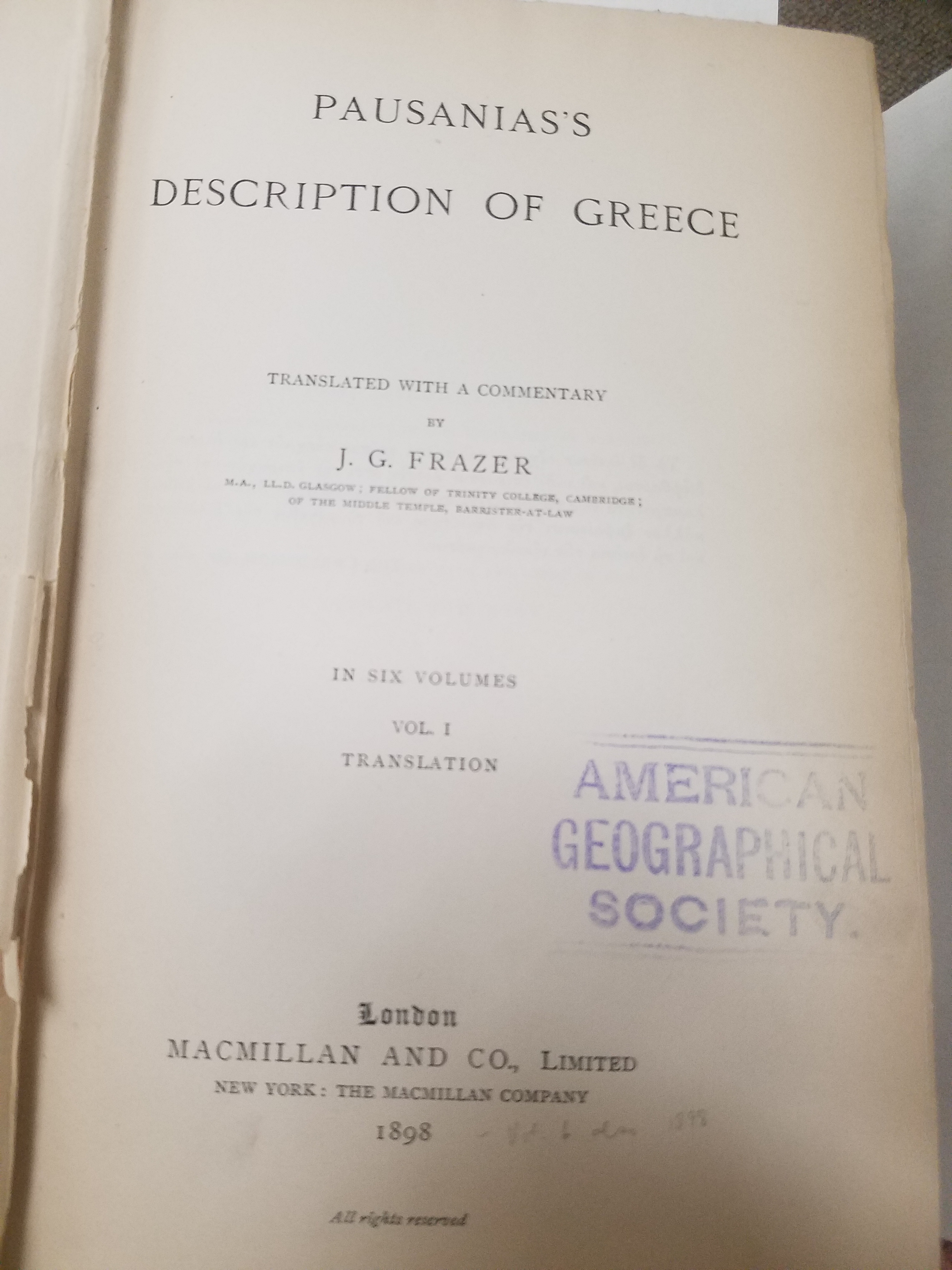
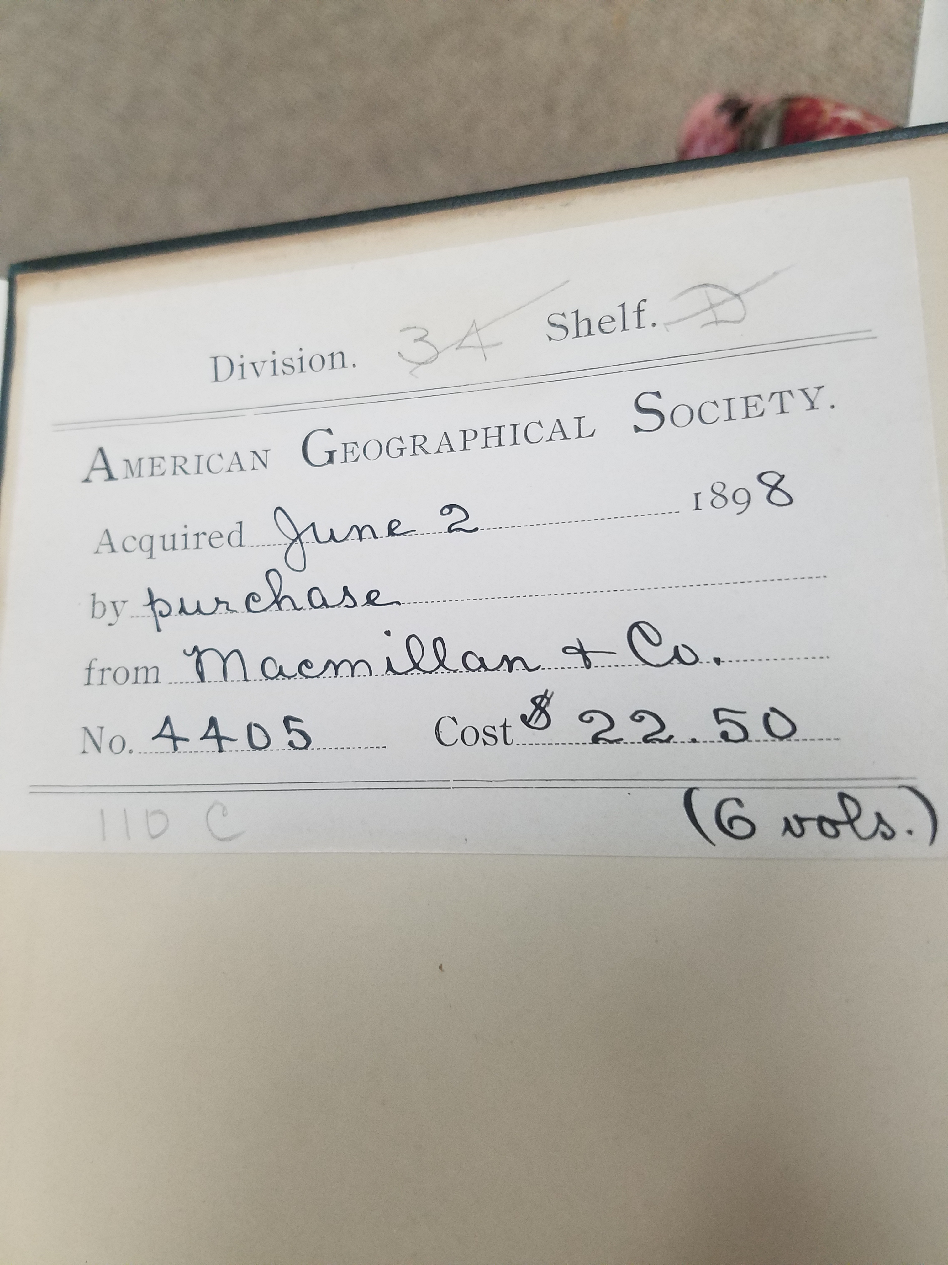
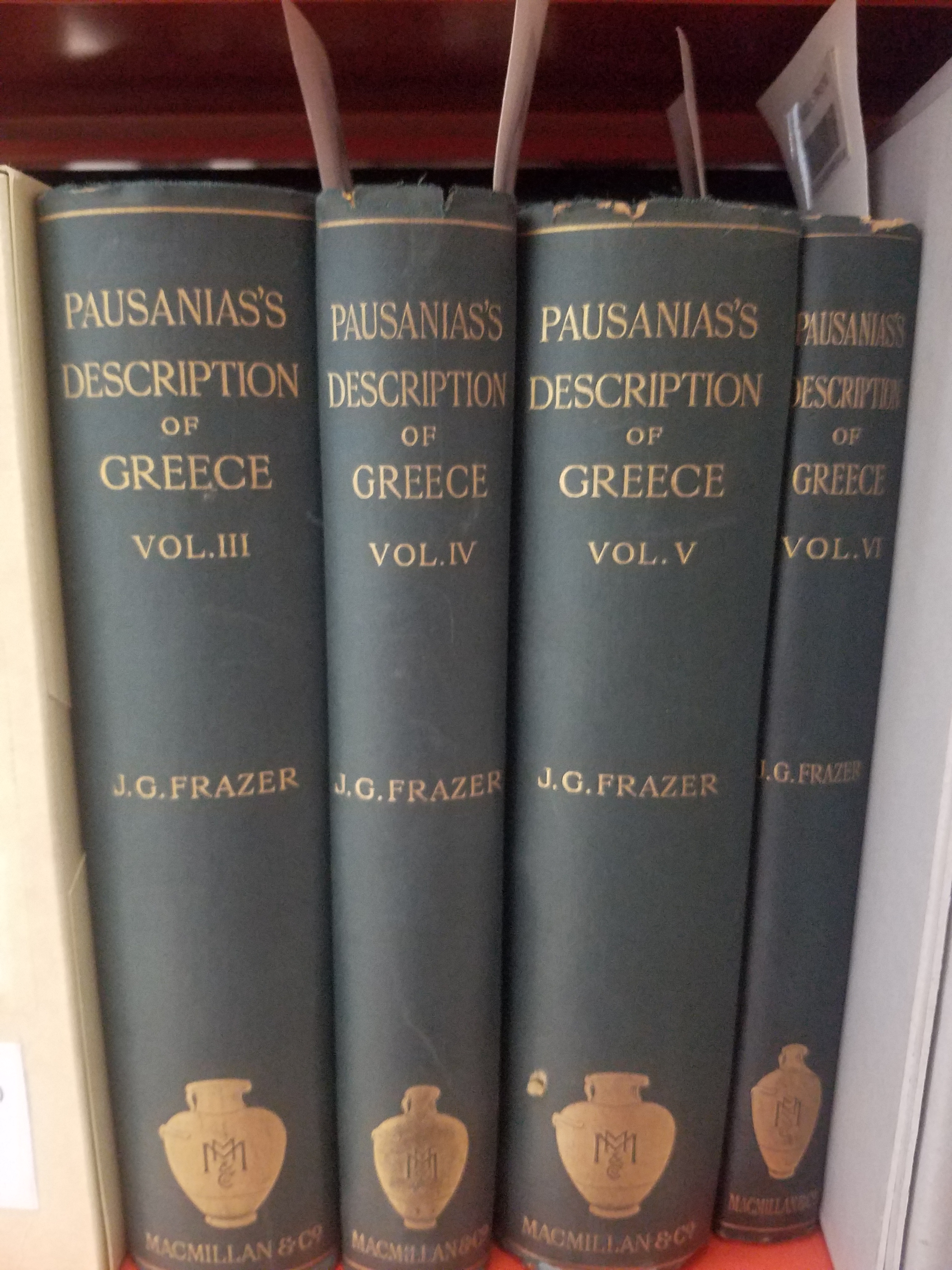
Travel literature was a well-loved genre before tourism took hold as a social standard; travel literature became a way for people to explore new places that they would never travel to themselves. Travel writing has taken many different forms over the years– in the 2nd century, Pausanias wrote his Description of Greece as Greece was being incorporated into the Roman Empire. The books attempt to capture the glories of Greek culture even as it began to shift into obsolescence by dedicating entire books to describing specific cities and regions, their geography, architecture, and religion. This multi-volume 1898 edition was translated by J.G. Frazer— the AGS purchased it as first edition from Macmillan & Co. the year it was published.
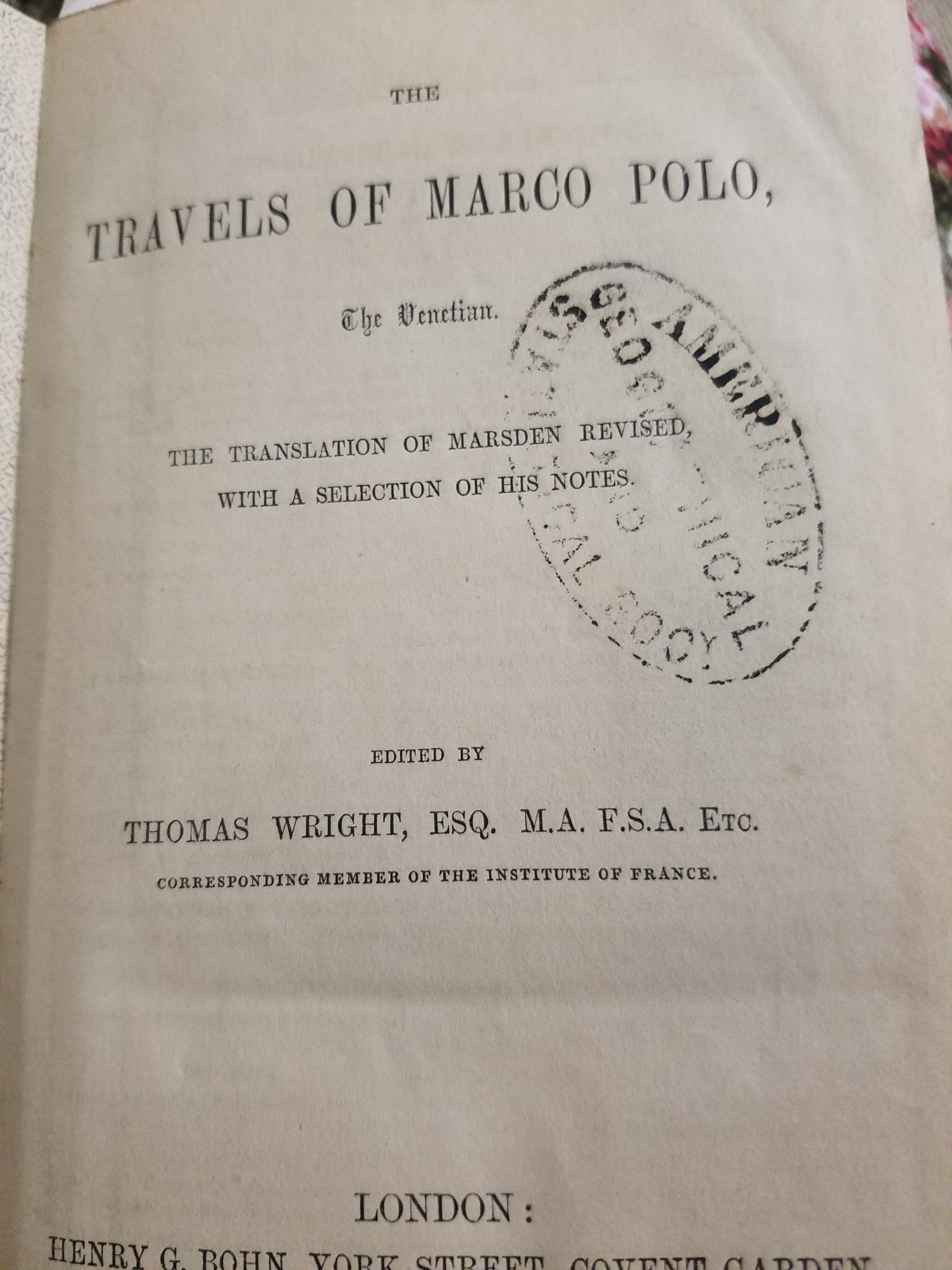
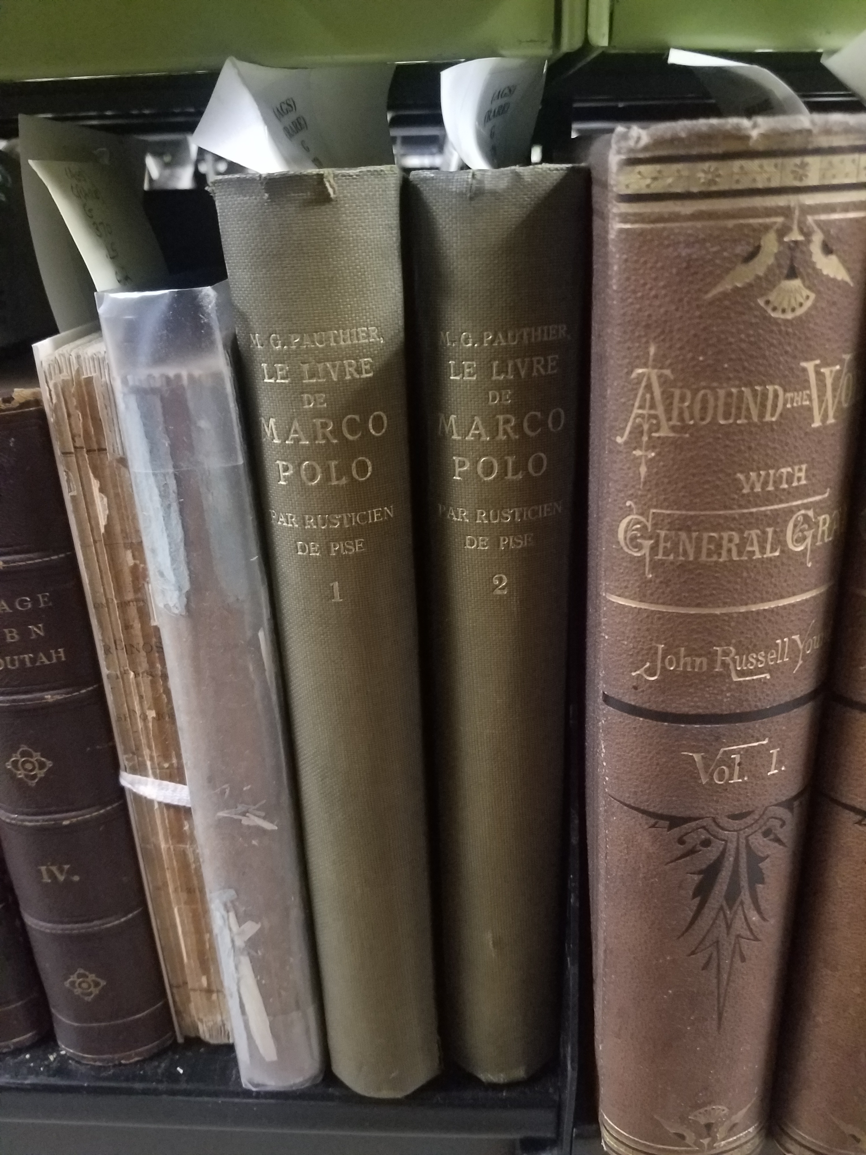
Travel writing continued to develop– travel diaries became popular during the Song Dynasty in China and Medieval Arabic literature. In the West, the genre became increasingly popular as exploration became a cultural priority; The Travels of Marco Polo transported readers to a great unknown East, Christopher Columbus’s journals became fascinating narratives of discovery, and maritime travelogues expanded the imaginations of the general population. But the tradition, especially in Europe, became steeped in colonialism.
In Mary Louise Pratt’s Imperial Eyes: Travel Writing and Transculturation, she asks “how travel books written by Europeans about non-European parts of the world created the imperial order for Europeans “at home” and gave them their place in it.” Europe’s economic and political growth in the 18th century opened the door to imperialist ideals, and in time the colonization and exploitation of countries by Europe. Travel literature written by European authors became a way for Europeans at home to imagine their place in the Empire and imbued them with a sense of “ownership, entitlement and familiarity” that allowed them to idealize European expansion as a moral quest to spread civilization to “uncivilized” hinterlands beyond their own borders. Travel writers became the eyes through which Europeans viewed the rest of the world, complicating the role of travel writing in literature and the colonial to post-colonial world. The act of viewing and recording became a way for colonizing countries to express ownership over the “domestic subjects” being viewed and recorded.
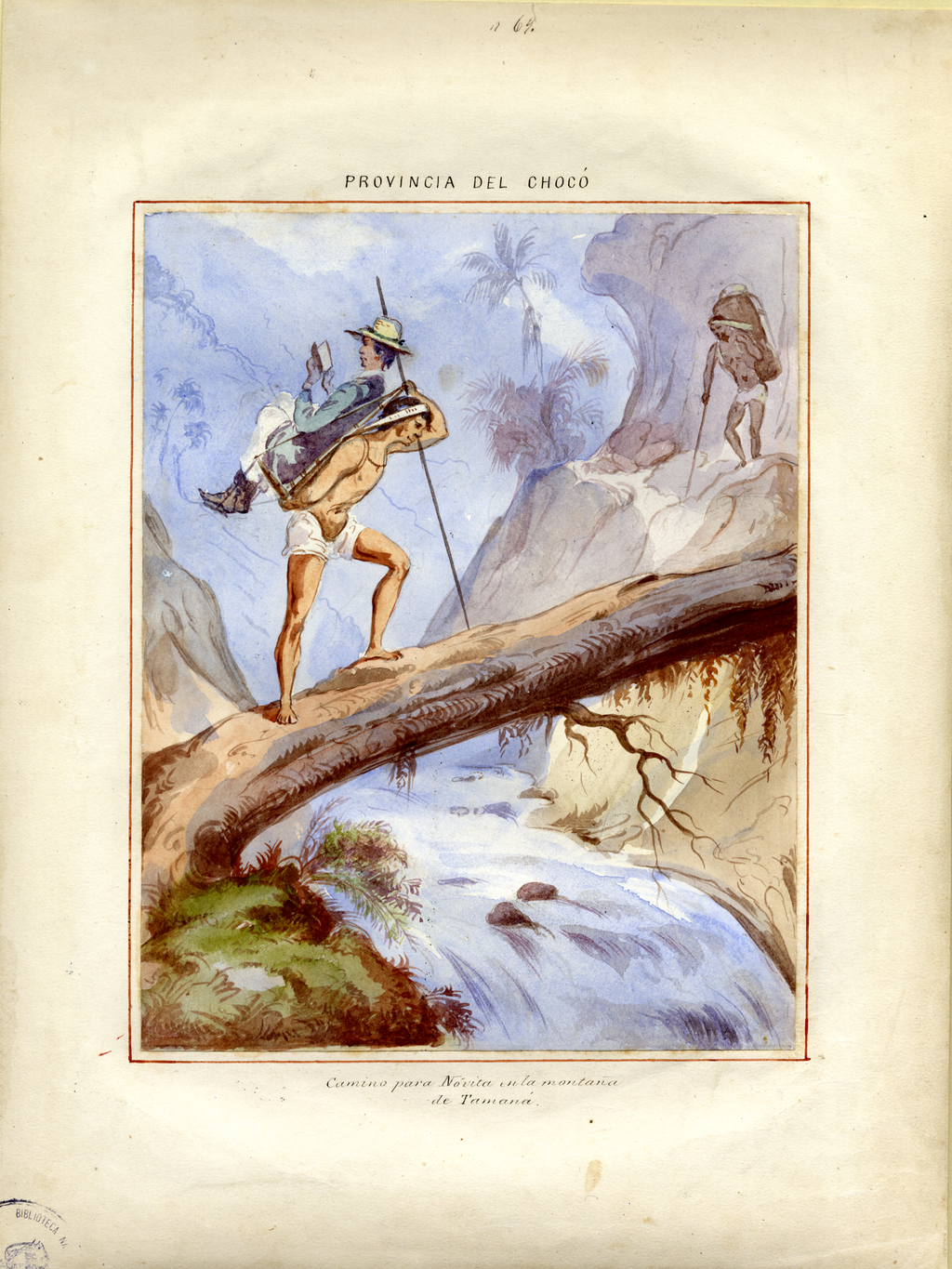
Provincia del Chocó. Interior de las habitaciones de los Indios, circa 1853 from Nancy Applebaum’s Mapping the Country of Regions: The Chorographic Commission of Nineteenth Century Columbia Click the link for a better view
So, when Lawrence left England and wrote about his travels to feed himself during his “savage pilgrimage” and long exile, he joined a long tradition of Europeans who, voyeuristically, observed and recorded the countries beyond their own borders as a way to stake their claim. Even Lawrence, rejected by his England and forced to wander, couldn’t separate himself from a long tradition of literary Imperialism. But travel writing continues to thrive: travel guides, tourism blogs, journals and memoirs connect people to places they might be going or have never been. We still use travel literature as a way to reflect on our own lives, like Petrarch, to see beyond ourselves, and experience new places. Travel literature has a long, and sometimes detrimental, history– but, Lawrence assures us, “still, it is morning, and it is Mexico. The sun shines.”
The Island of California
By Lauren Maddox
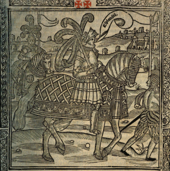
Illustration from La sergas de Esplandián
“Know that, on the right hand of the Indies, there is an island called California, very near to the Terrestrial Paradise;” this description, found in Chapter 157 of Las sergas de Esplandián, names a California at least sixteen years before Cortez spotted the coast of the land he would name California. The Spanish romance, which was a sequel to Garci Rodríguez de Montalvo’s better-known and better-received Amadis de Gaula, was largely forgotten despite being the first mention of a place named California. Esplandián was considered an inferior sequel and faded into insignificance; it’s greatest claim to fame is its brief appearance in Don Quixote’s library in Cervantes’s comical romance. And even that reference was unflattering. The curate chose to burn Esplandián instead of Amadis de Gaula because, he said, we should not “spare the son for the virtues of the father.”
So, Las sergas de Esplandián was a failed romance that was quickly forgotten. But, as the first recorded use of California, it stands to reason that this forgettable Spanish romance could have inspired Cortez when he encountered the lowest tip of the Baja California Peninsula, 775 miles from where the peninsula joins the mainland. As far as Coretz could tell from his ship, he had found an island on the right hand of the Indies, very near to the Terrestrial Paradise.
The misconception that California was an island would persist throughout the 16th century, and resurface with new, incorrect maps released in the 17th and 18th century. In 1539, Cortez’s navigator Francisco de Ullou ventured northward into California and discovered it was a peninsula, debunking the theory that California was an island just six years after the first sighting of the peninsula. Somehow, the legend persisted despite fairly correct representations of the peninsula being published as early as 1569.
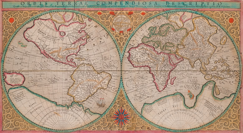
Mercator’s 1569 edition of Orbis terrae compendiosa descriptio from Envisioning the World: The First Printed Maps 1472-1700 Click the link to see this map in our Digital Collections
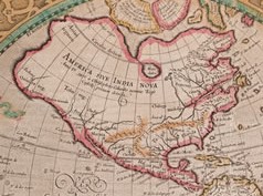
America in the Mercator Map
Many cartographers incorporated Ullou’s discovery of the peninsula into their maps, including this 1569 world map by Gerard Mercator. If you look closely at America, you can see the Baja California Peninsula clearly and correctly attached to the mainland. This representation wouldn’t stick–the Baja California Peninsula would be confused for an island again after Juan de Fuca’s voyage at the turn of the century. In 1592, de Fuca claimed to have found a strait he thought could be the Northwest Passage with a large island at its mouth. Only one account of this discovery survived, and the location of de Fuca’s strait was confused with California, reviving the representation of California as an Island.
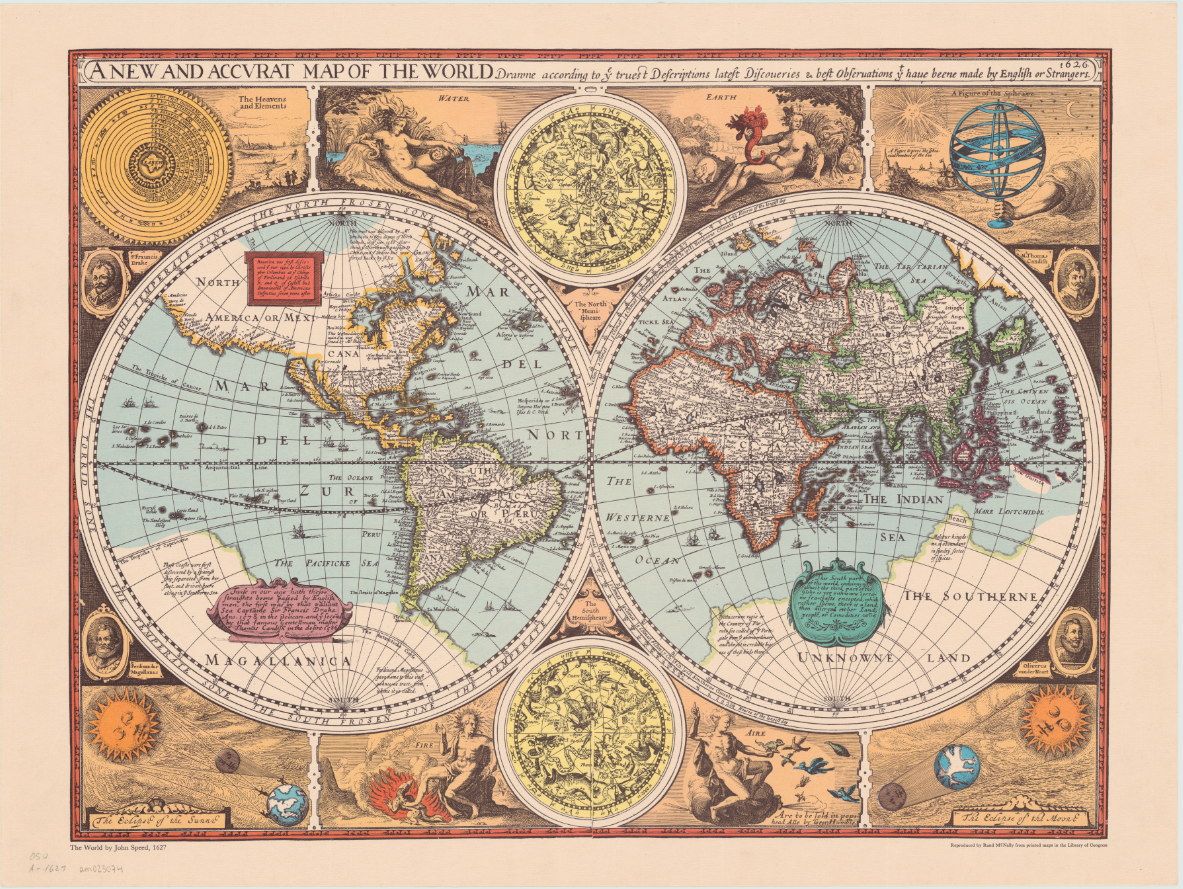
An overland expedition in 1602-1604 should have disproved de Fuca’s claim to have found a Northwest Passage, or at least cleared up any confusion about whether the Baja California Peninsula was the island he had claimed to see at the mouth of the strait. Despite Juan de Onate’s reports, the northern terminus of the Gulf of California was left vague on maps by the Spanish so that Cortez’s claim to the territory in 1533 could invalidate Drake’s later claim in 1579. Several maps released after Mercator’s map and de Onate’s reports show the peninsula detached from the mainland. One of the first atlas maps to depict California as an island was English mapmaker and historian John Speed’s America with those Known Parts in that Unknowne World both People and Manner of Building from 1626 or 27. This representation of America, seen again his A new and accurat map of the world reproduced by Randy McNally in 1966, also includes a fairly accurate mapping of the United States’ East Coast.
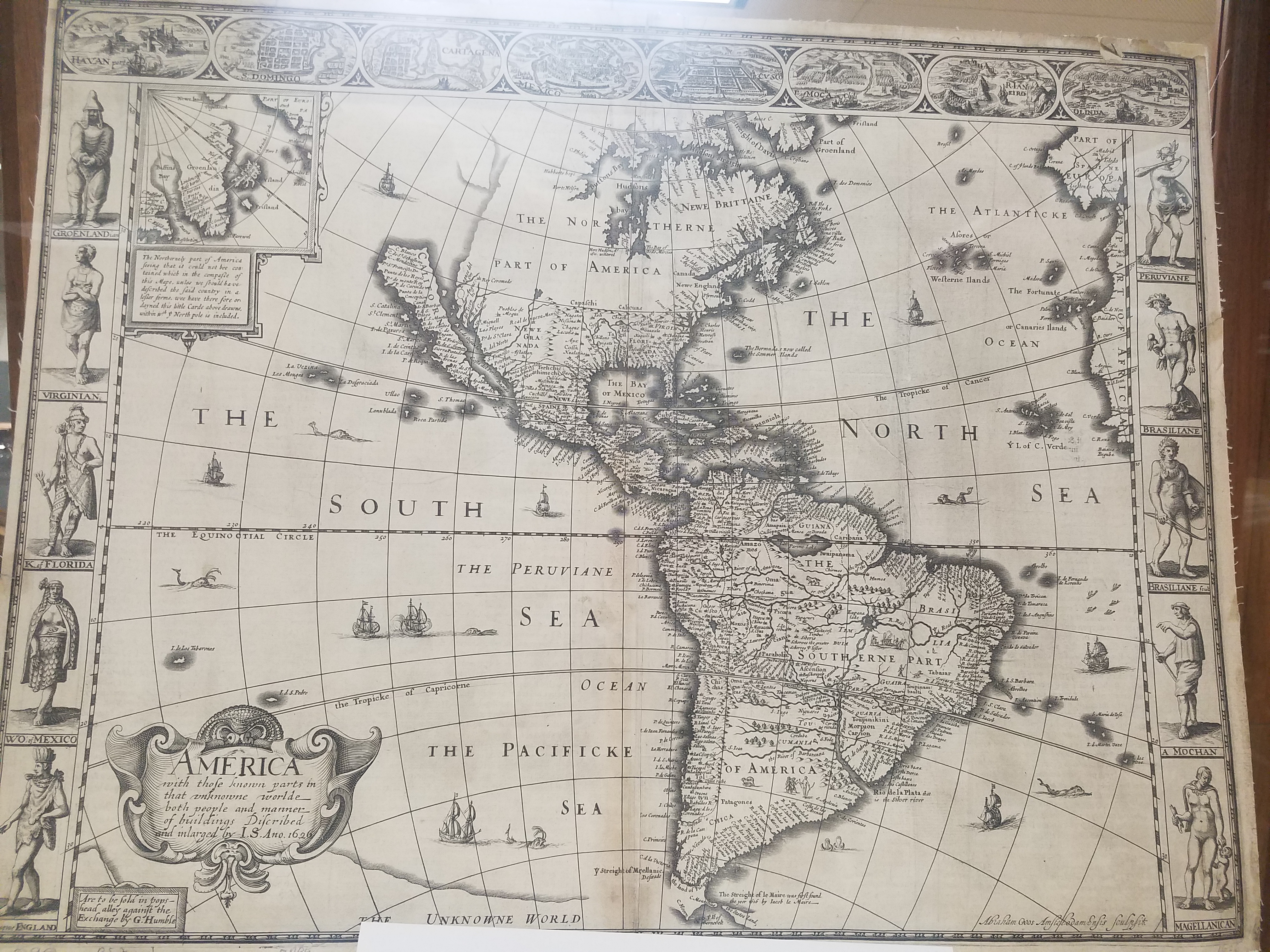
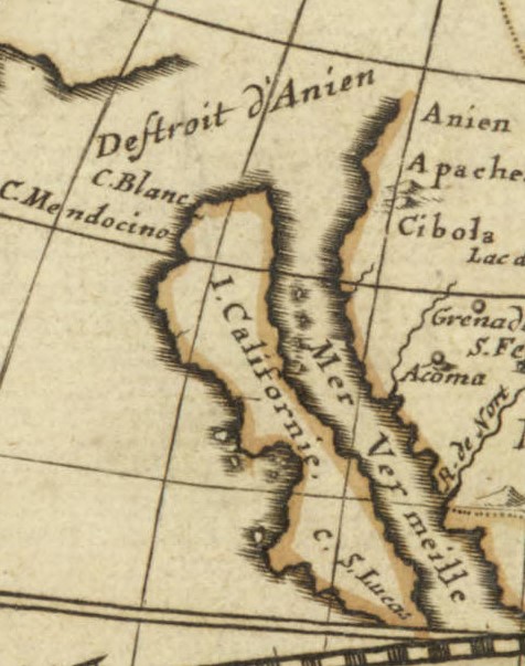
William Trevethen’s 1666 Americ descriptio nova depicts the Island of California once again. The Trevethen map also places Sir Francis Drake’s Nova Albion on the island; Nova Albion was actually a part of continental Mexico, and the English claim to Nova Albion was their foothold into claiming further continental territory, which is why the Spanish worked so hard to invalidate that claim. Nova Albion is now Point Reyes, which is just Northwest of the San Francisco area. The region North of the Island of California is marked “terra incognita” with a sea monster lurking in the waters to indicate the unknown and unexplored continent.
Click the link to see the Americ descriptio nova 1666, published in 1670 edition of Peter Heylyn’s Cosmography in our Digital Collections
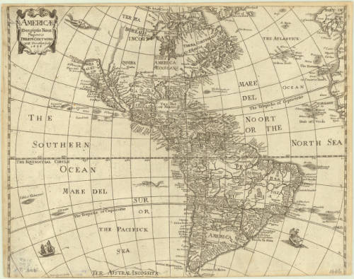
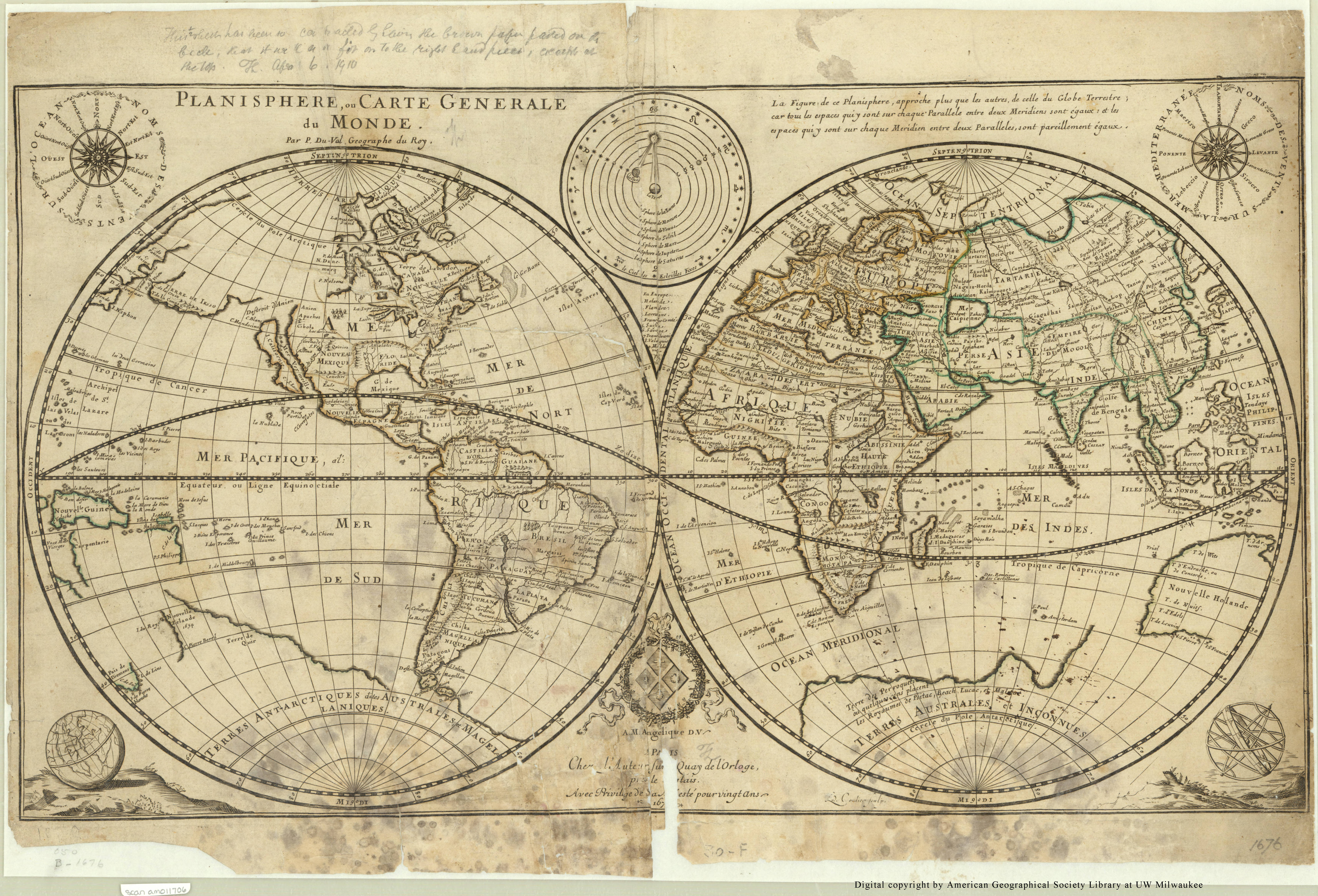
A 1677 world map in the AGSL collection by Pierre Duval includes the Island of California at the mouth of an approximately placed strait. This map also includes a vague coast line marked “terre de Iaso” just Northwest of California. The “terre de Iaso” was thought to be a region where Japan connected to North America.
L’America Settentrionale, another 1677 map by Guillaume Sanson, leaves the unexplored areas of North America blank to indicate the unknown, but clearly includes the island of California. Remarkably, the French maps do not include Nova Albion.
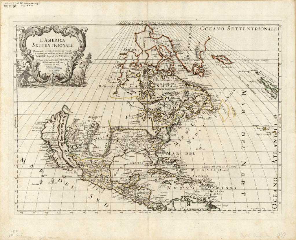
Click the link to see Guillaume Sanson’s 1677 Map of America in our Digital Collections
At the end of the 16th century, Dutch cartographers Gerard and Leonard Valck produced another map depicting California as an island. The Valck map, like the 1677 Duval map, includes a reference to an area connecting North America and Asia. On the Valck map, it is referred to as the “Terra Esonis.” The Valcks only include the vague coastline of the fabled connection, leaving a blank space– perhaps to leave room for future discoveries. The map includes detailed records of place names and waterways, as well as an illustrated cartouche depicting a pair of “Americans” surrounded by bountiful crops and exotic animals.
Click the link to see the Valcks’ 1690 Map of America in our Digital Collections
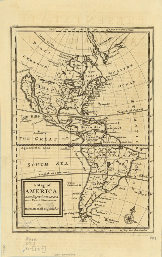
This map was produced just eight years before Eusebio Francisco Kino’s series of overland expeditions, which would finally confirm that the Baja California Peninsula was indeed a peninsula. Kino, a Jesuit missionary and cartographer, believed that California was an island until he began to explore deeper into the continent. He initially intended to establish a route between Jesuit missions in Sonoran and Baja California on his expeditions from 1698-1706, but also reported and confirmed the land connection and reestablished the existence of the Baja California Peninsula. The Jesuit order generally accepted his claims, but Europeans were slow to incorporate the peninsula into their own maps because of conflicting reports from Juan Mateo Manje, who joined Kino on several expeditions. Maps created into the 18th century by Europeans still recorded the Island of California’s existence; these two English maps were created just a few years after Kino’s final confirmation of the peninsula’s land connection. The first map, Michael Burgher’s 1714 A New Map of North America, depicts the topography of the area, as well as records of new discoveries, settlements, and claimed and unclaimed territory. The 1717 Map of America by Herman Moll has a similar focus, but includes South America.
The latest map in the AGSL collection depicting California as an island is Matthaeus Seutter’s 1740 map. The hand-colored map is filled with notes and ship routes, as well as two detailed cartouches depicting local peoples and their conversion to Christianity. Seutter’s map also references an Ocean of California surrounding the island and several sketches of aquatic plants.
Click the link to see the 1740 Seutter Map in our Digital Collections
Montalvo’s lost romance tells stories of a bountiful and fertile island ruled by women adorned in gold and jewels, and the Queen Calafia who fell in love with a Spanish man and forfeited her power, treasures, and land to their king for the chance to marry him. In Las sergas de Esplandián, the island of California is full of potential coveted by conquering Europeans. In many ways, this fiction became reality– California became an island, first by misconception, and then deception as the Spanish maneuvered to maintain their claim on the land and prevent English settlement. And in our collections, we have 200 years of maps recording one of cartography’s longest-lived errors.
The Love-Life of Dr. Kane
By Lauren Maddox
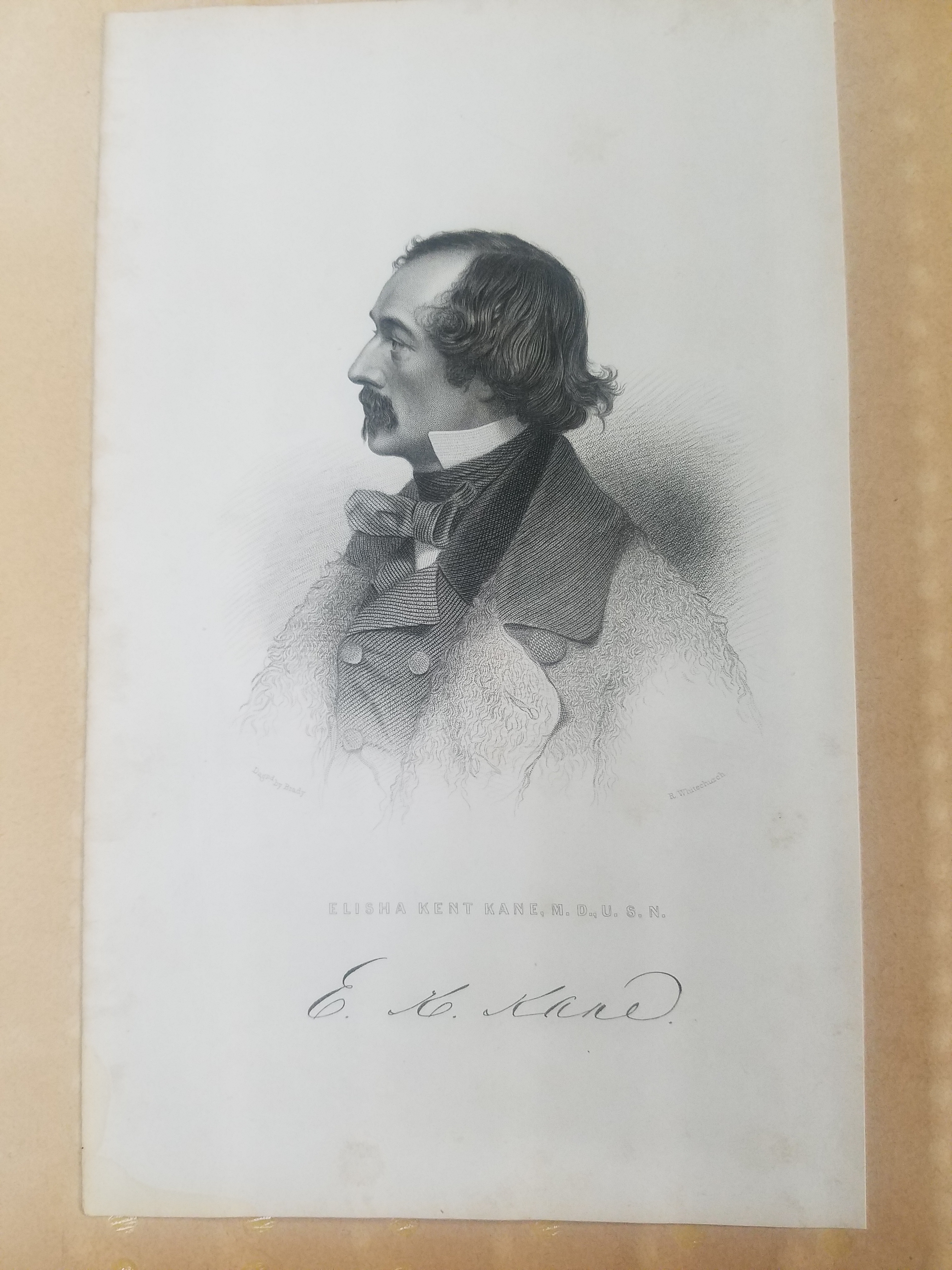
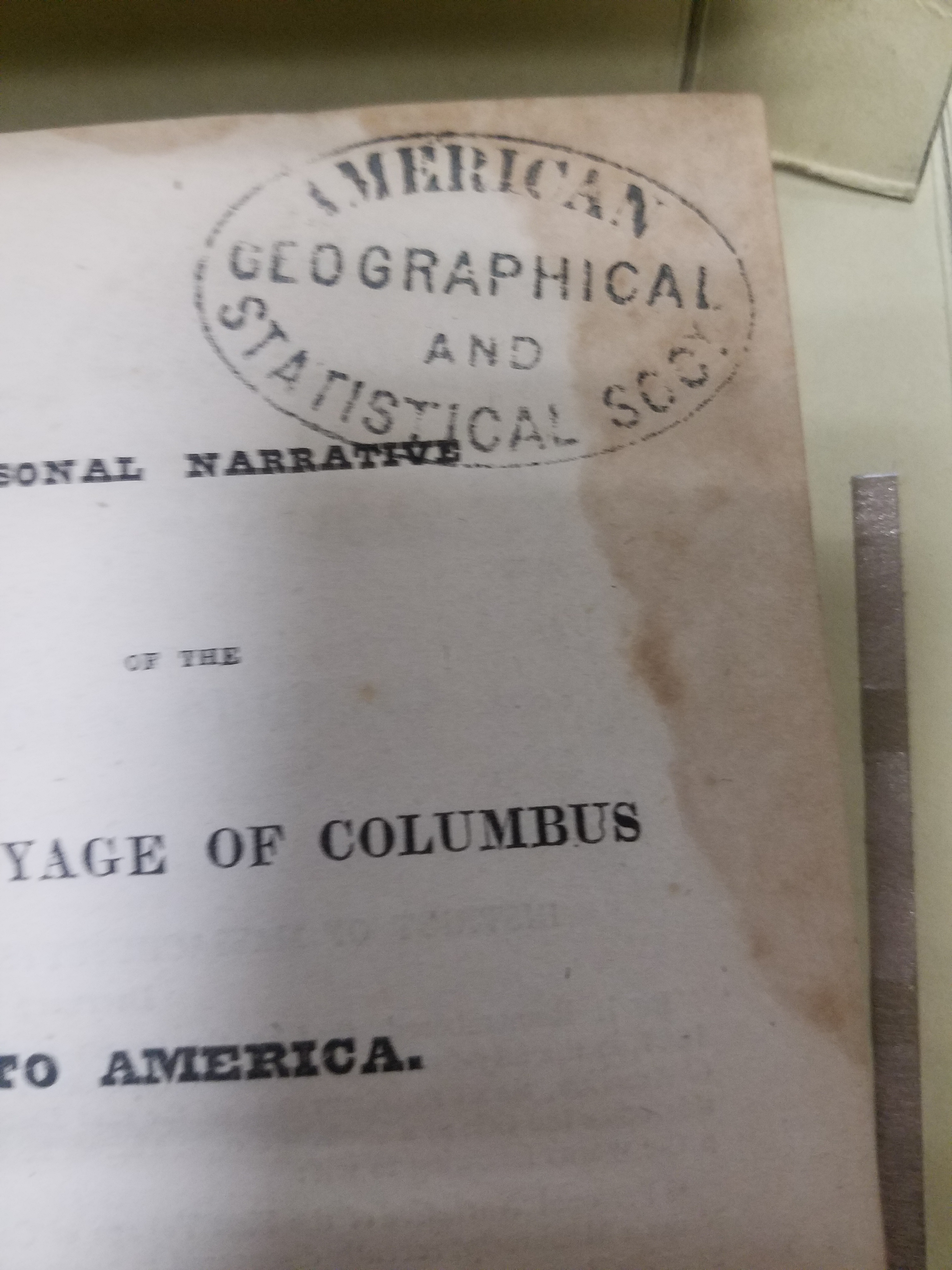
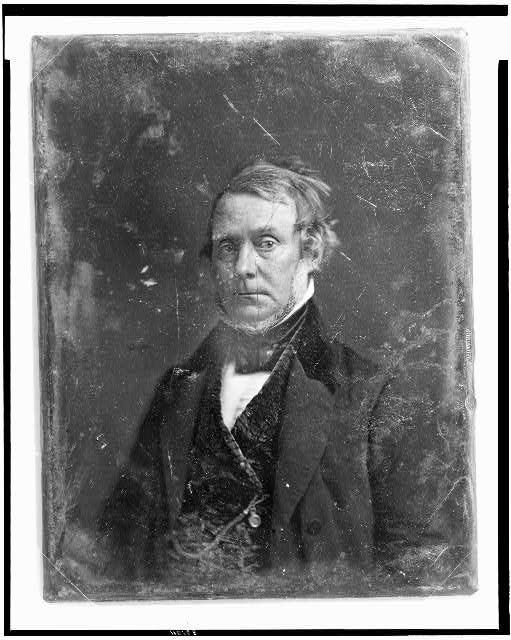
Click the link to see this Portrait of Kane from the Edmund Mills Scrapbooks in the AGSL Archives
Elisha Kent Kane, who appeared in last week’s post about the lost Franklin expedition, lived a life of adventure, and his harrowing escape from the arctic became an iconic expedition in the era of romance and arctic exploration. The accomplished explorer died tragically after his return from the second Grinnell expedition; extreme climate and malnutrition had wreaked havoc on his health. He died just two years later in Havana, Cuba, where he had traveled with his family in the hopes of recovering in the warmer climate. His life of intrigue and excitement didn’t end in the arctic, however; apparently Kane also had a titillating love life. After his death in 1857, a rather scandalous legal dispute began: Margaret Fox, claiming to be Kane’s secret wife, took Kane’s family to court for withholding her inheritance.
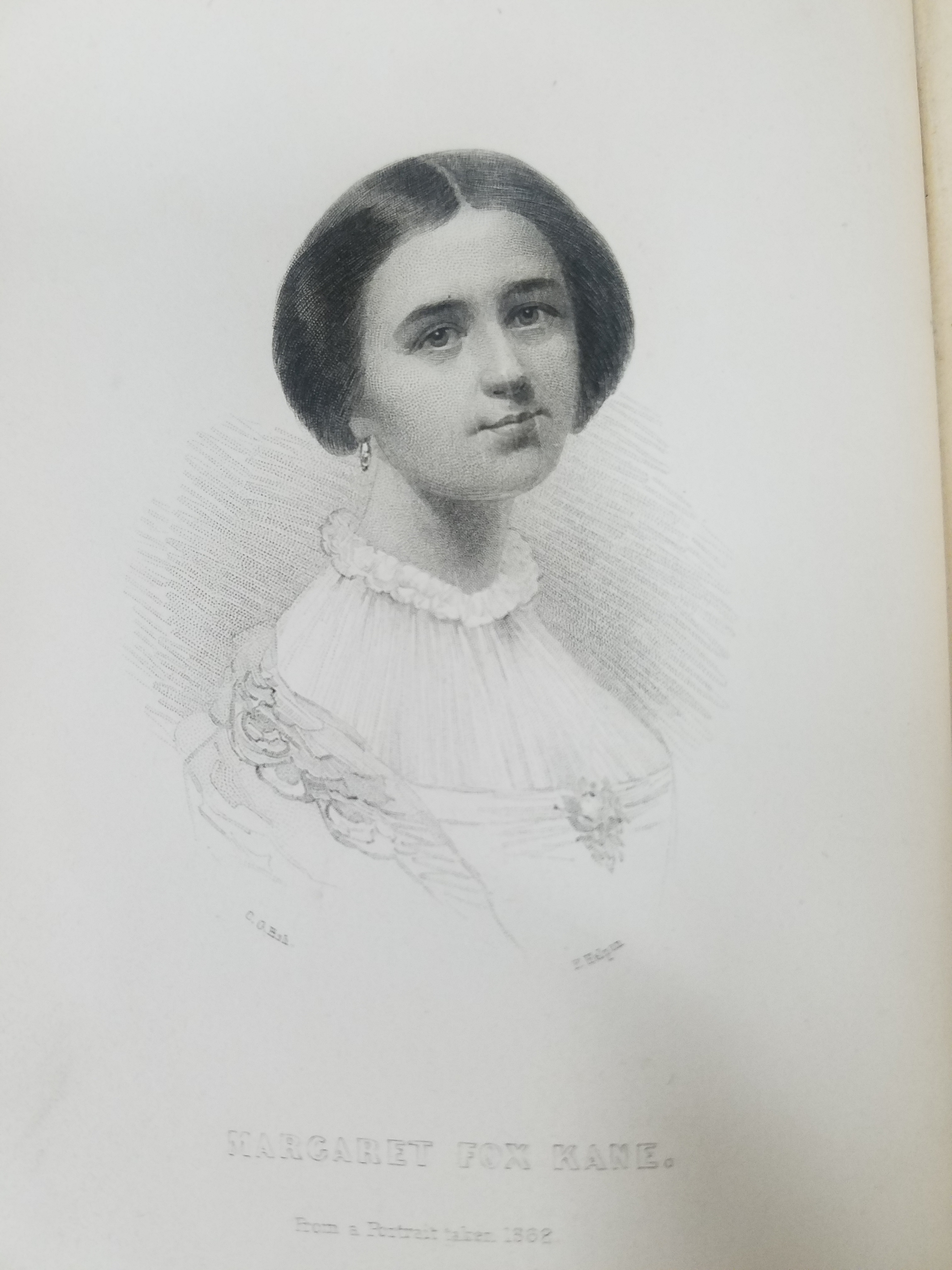
Click the link to see the Portrait of Margaret from The Love-Life of Dr. Kane
Margaret Fox was the middlest of the famous spiritualist Fox sisters. Margaret and her younger sister became famous in 1848 for supposedly communing with the entity that haunted their house in Hydesville, New York. The girls rocketed to fame and began giving demonstrations of their spiritual powers the next year. By 1850, the girls were holding public seances in New York. She and her younger sister continued their journey to spiritualist stardom under the management of their oldest sister Leah; the trio would spend years enjoying success as the centerpieces of seances attended by the well-to-do and famous.
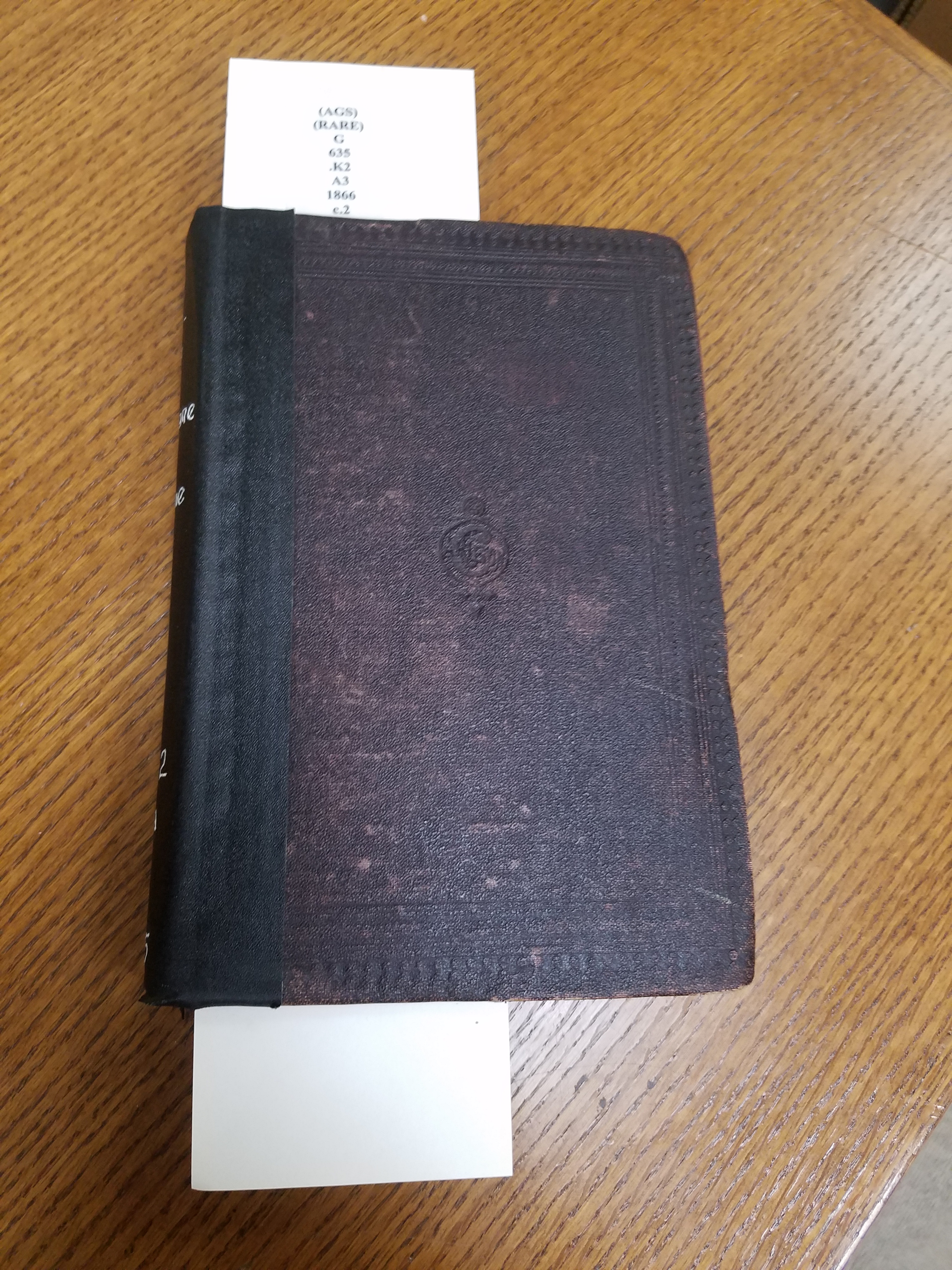
The AGS Library has in its rare collections a first edition copy of Margaret’s tell-all book The Love-Life of Dr. Kane, in which she claims to have secretly married Kane and publishes their personal correspondence to prove it. The book was gifted to the AGSL in 1922 by Edmund Mills from his collection of arctic books. The book, published in 1866, is prefaced and introduced by an unnamed author sympathetic to Margaret’s position in her legal battle with the Kane family and includes a memoir giving a narrative telling of the illicit love-match.
The preface first apologizes for the indecency of publishing love letters and “that which was never intended to meet the public eye,” but goes on to explain that the publication of these private letters, considered too “sacred” by Margaret to publish previously, will save her reputation from the slander she suffered by keeping them private. According to the preface, Kane had left a small inheritance to Margaret as his wife. Their marriage was vehemently denied by the surviving Kane family, and any mention of it in the press was quickly disparaged. Margaret, widowed and without an income, was forced confront the Kane family about the sum left to her by her late husband. After several disputes, several of which involved Elisha Kane’s brother breaking financial agreements, Margaret decided to publish the letters.
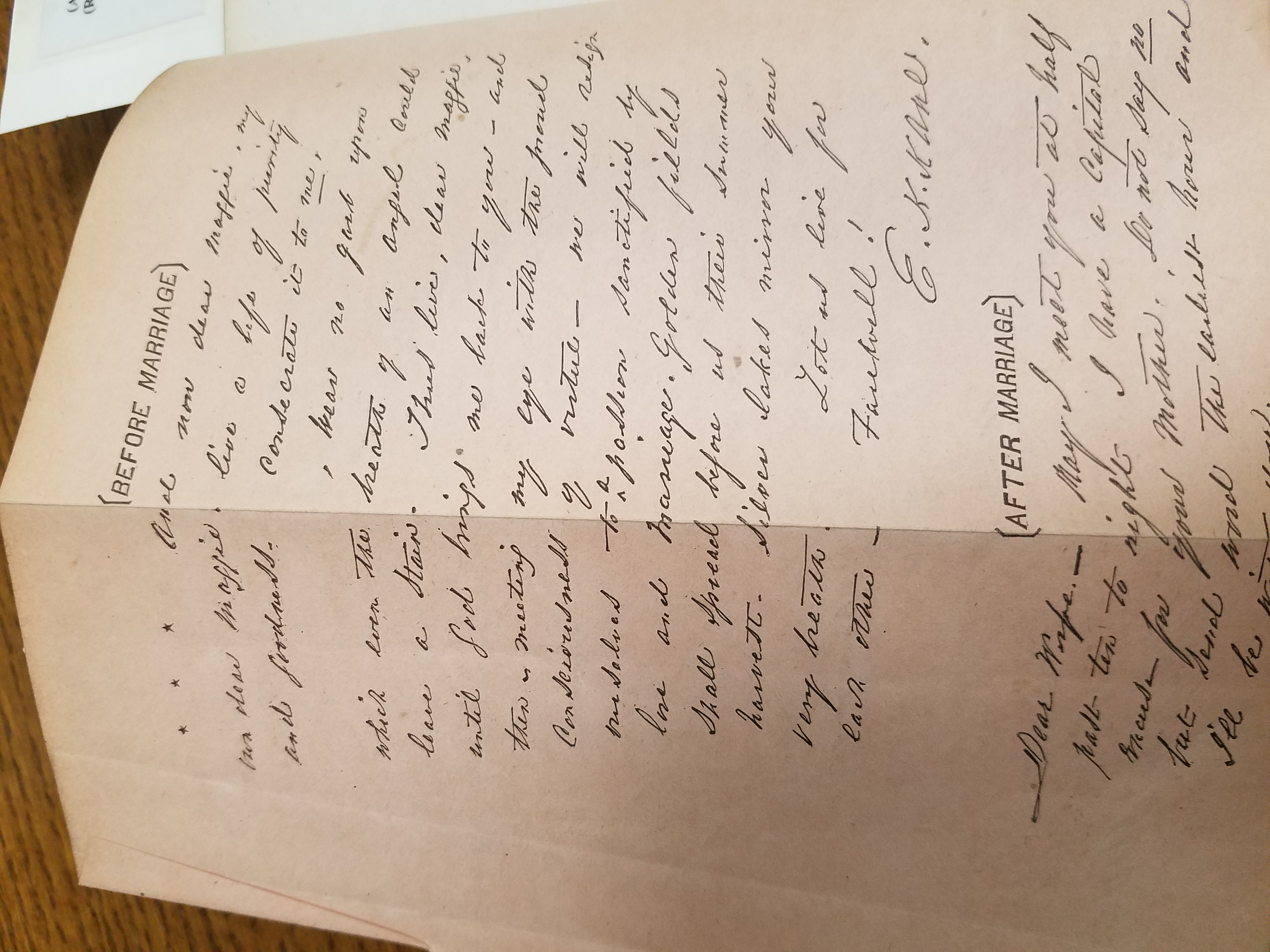
Fold out copy of letters in Kane’s handwriting tucked between the preface and introduction 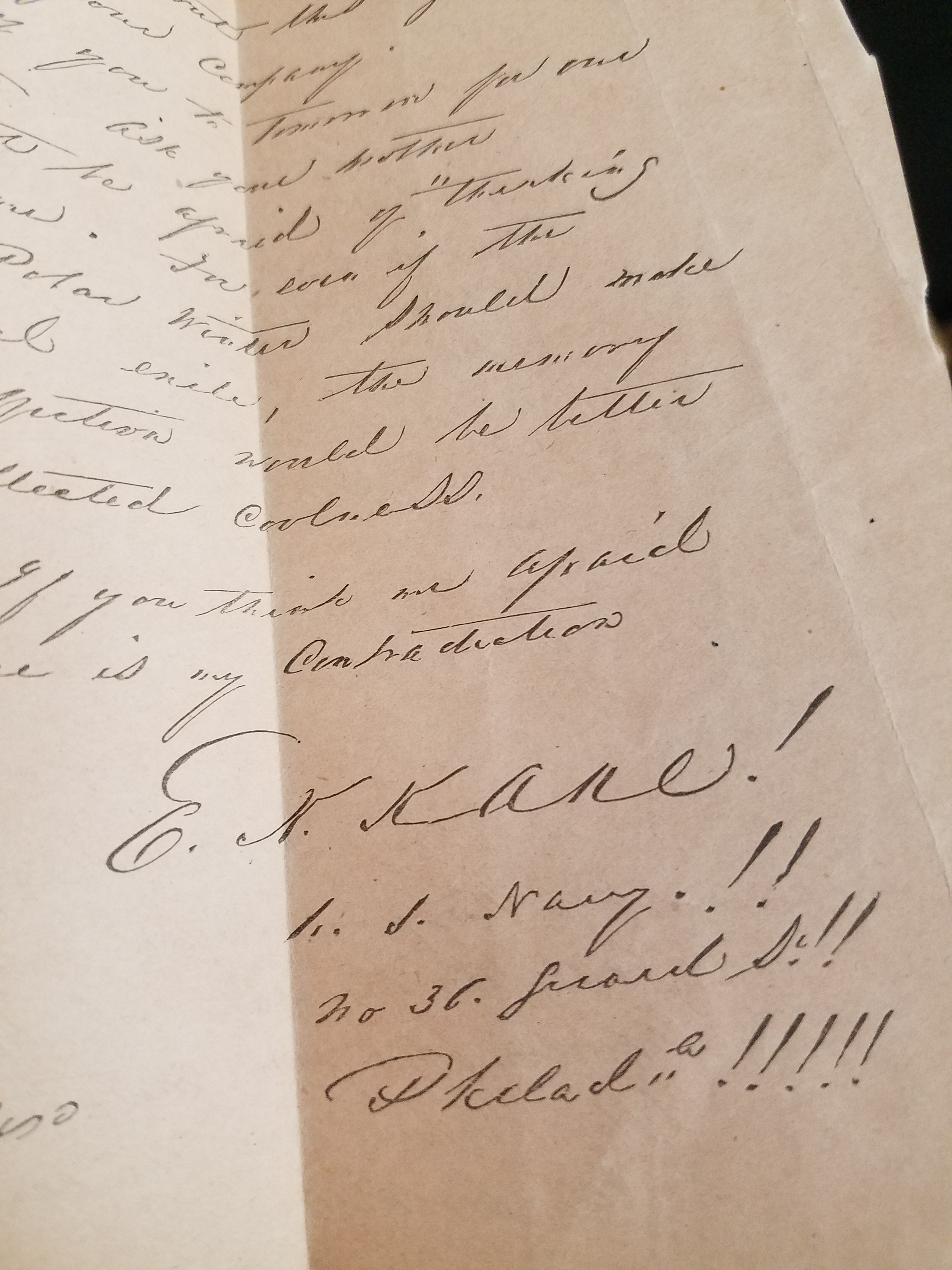
Kane’s signature
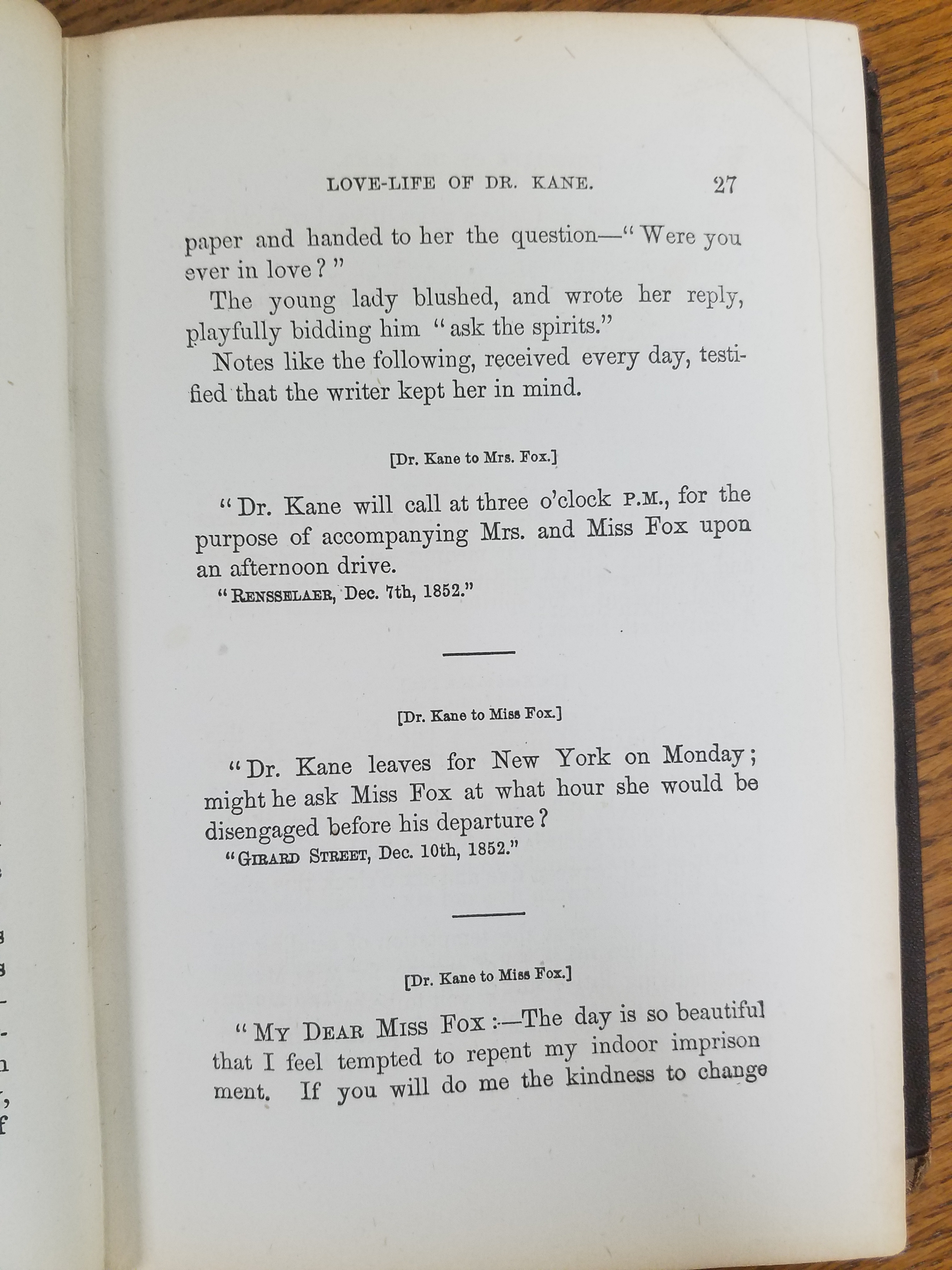
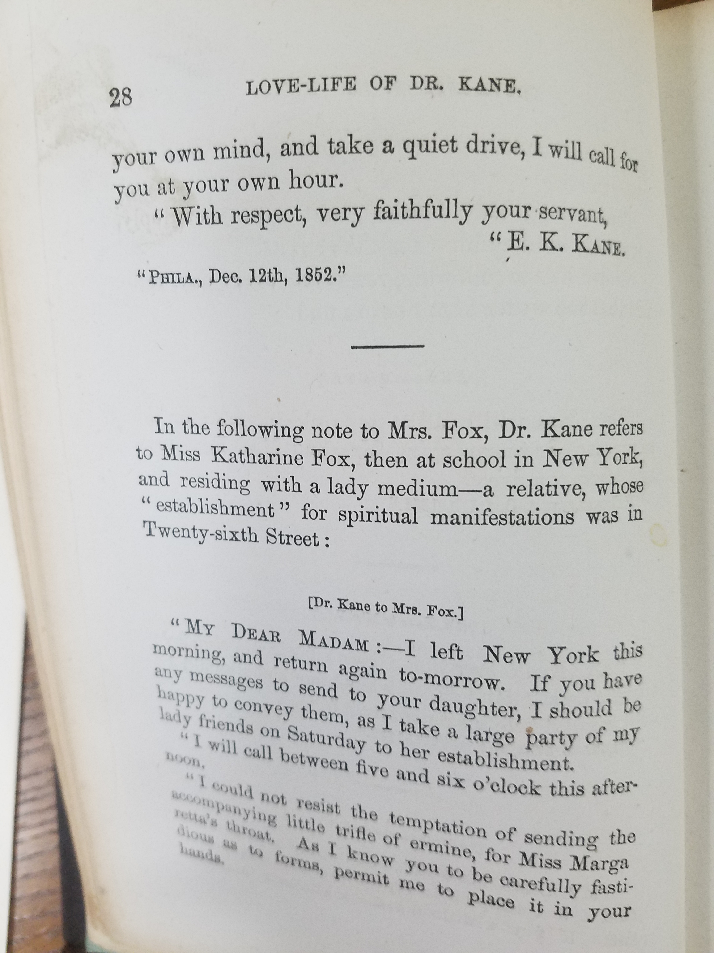
The introduction casts Kane and Margaret as star-crossed lovers kept apart by her occupation as a spiritualist, lack of social position, and his own family’s objections to her reputation. The anonymous author, rather romantically, declares, “How deep and strong that love must have been, to come off victorious from such a conflict!” Then finally, the Memoir chapter begins with the story of how the two met and the letters that they exchanged over the course their courtship. The author describes Kane’s falling in love with Margaret at first sight when he found her in Webb’s Union Hotel bridal parlor the autumn of 1852, preparing for a seance. Their epistolary romance began just days later when Kane slipped Margaret a note asking, “Were you ever in love?” And Margaret replied, “Ask the spirits.”
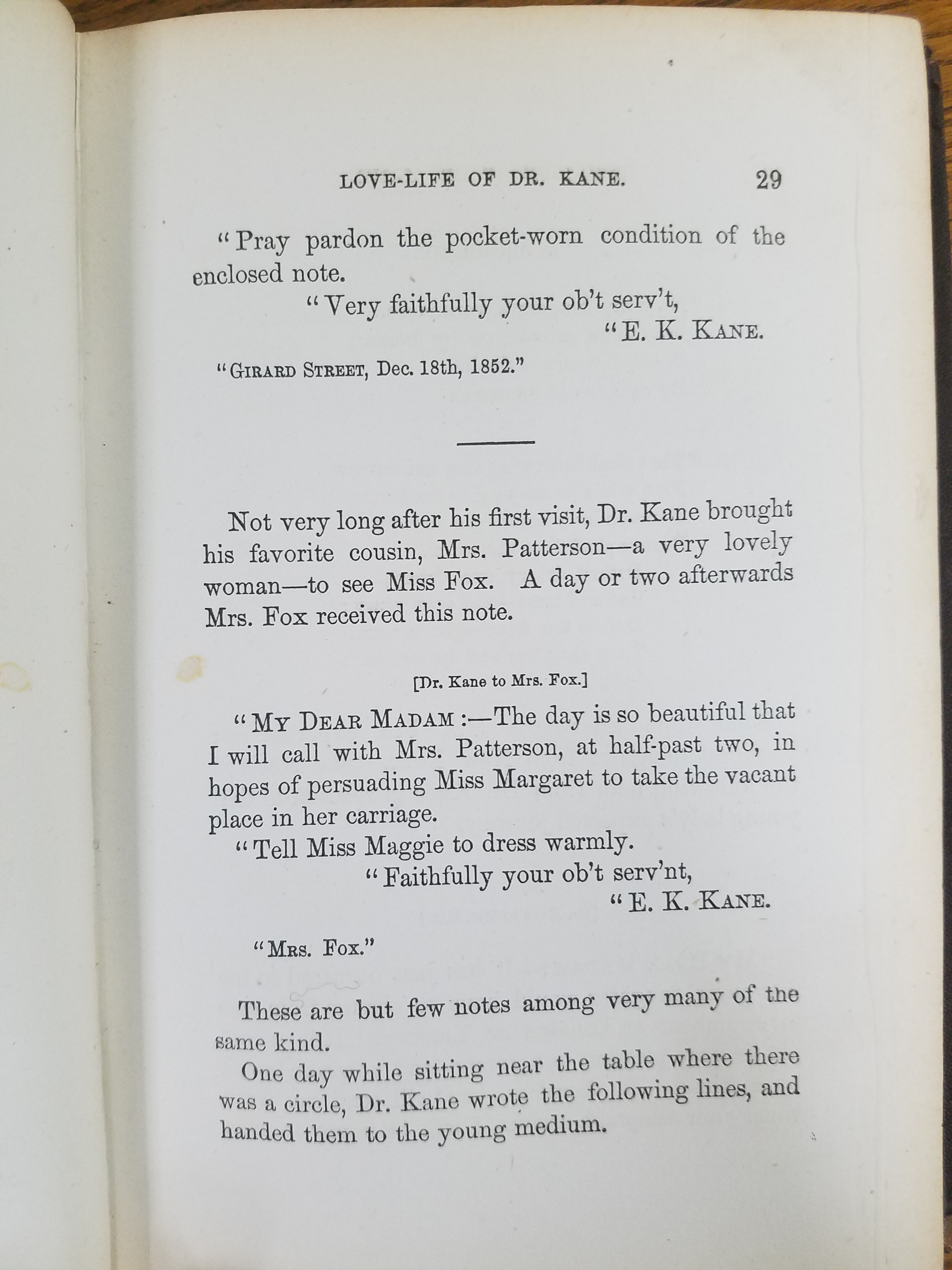
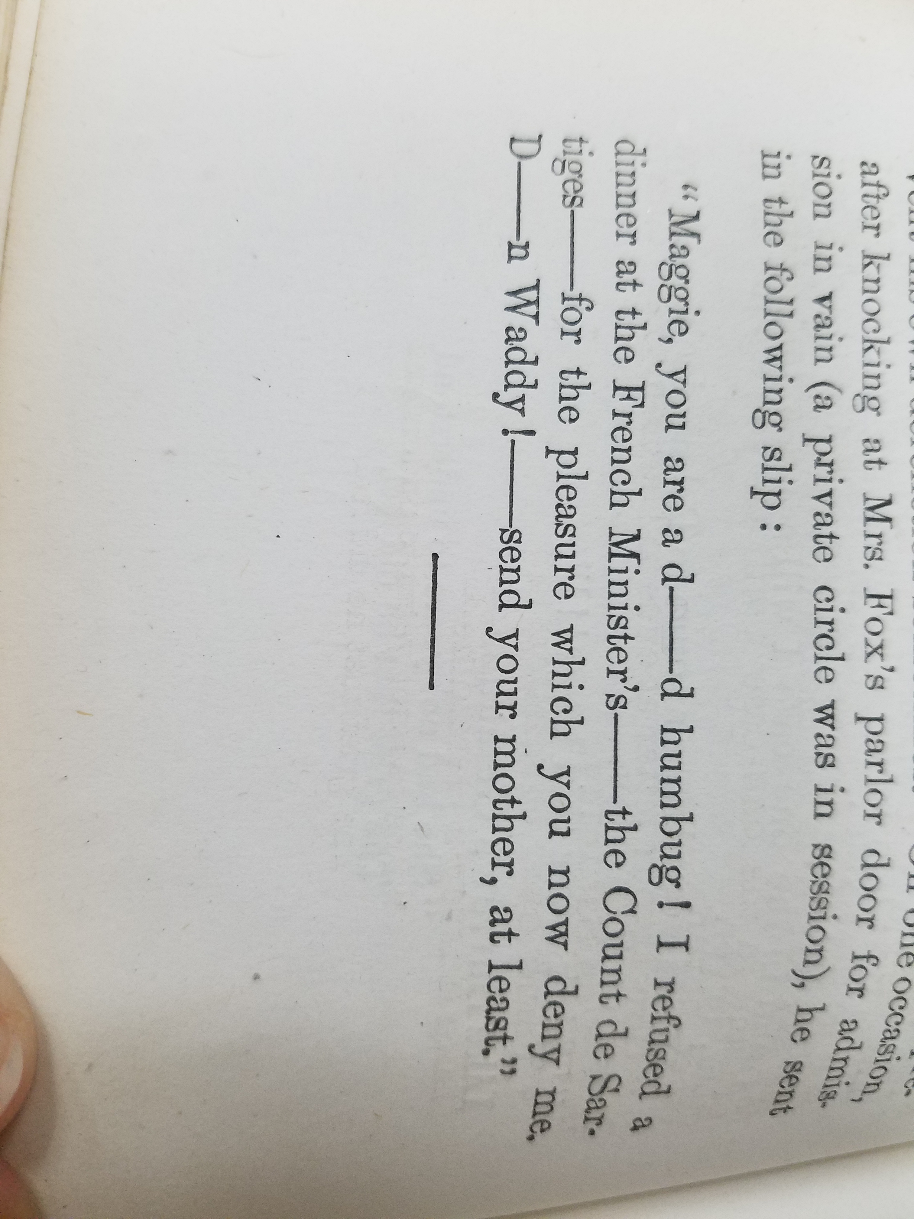
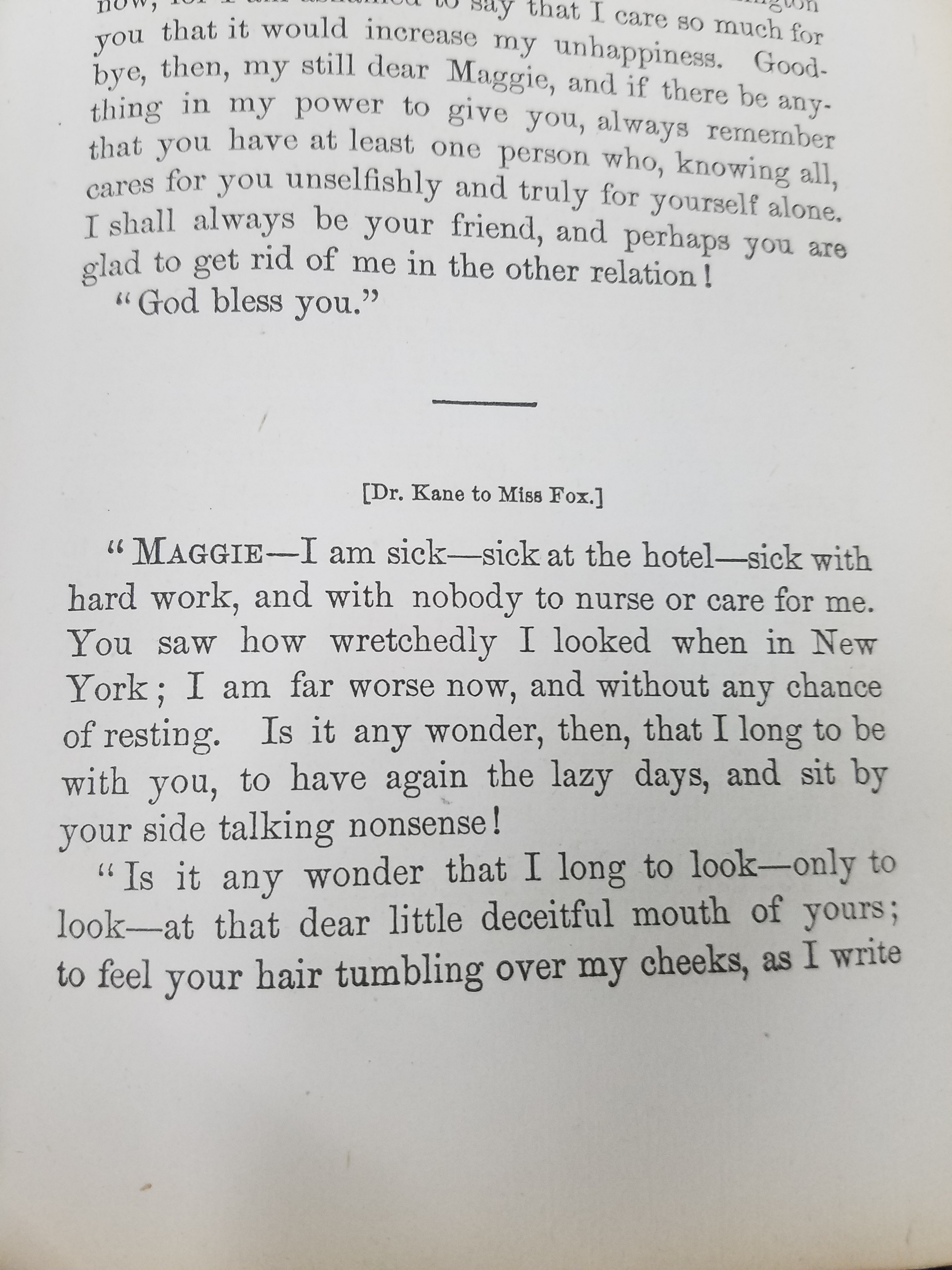
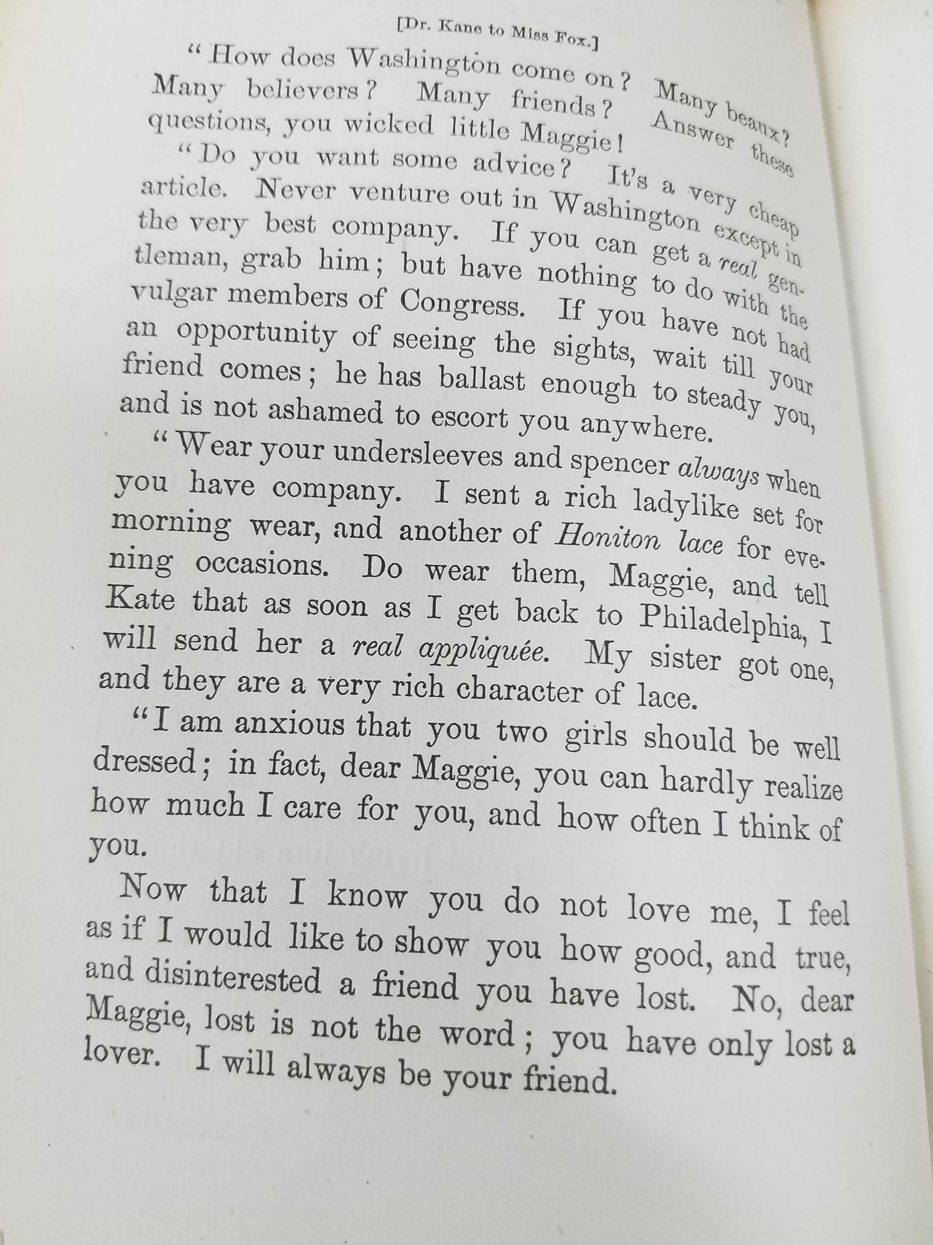
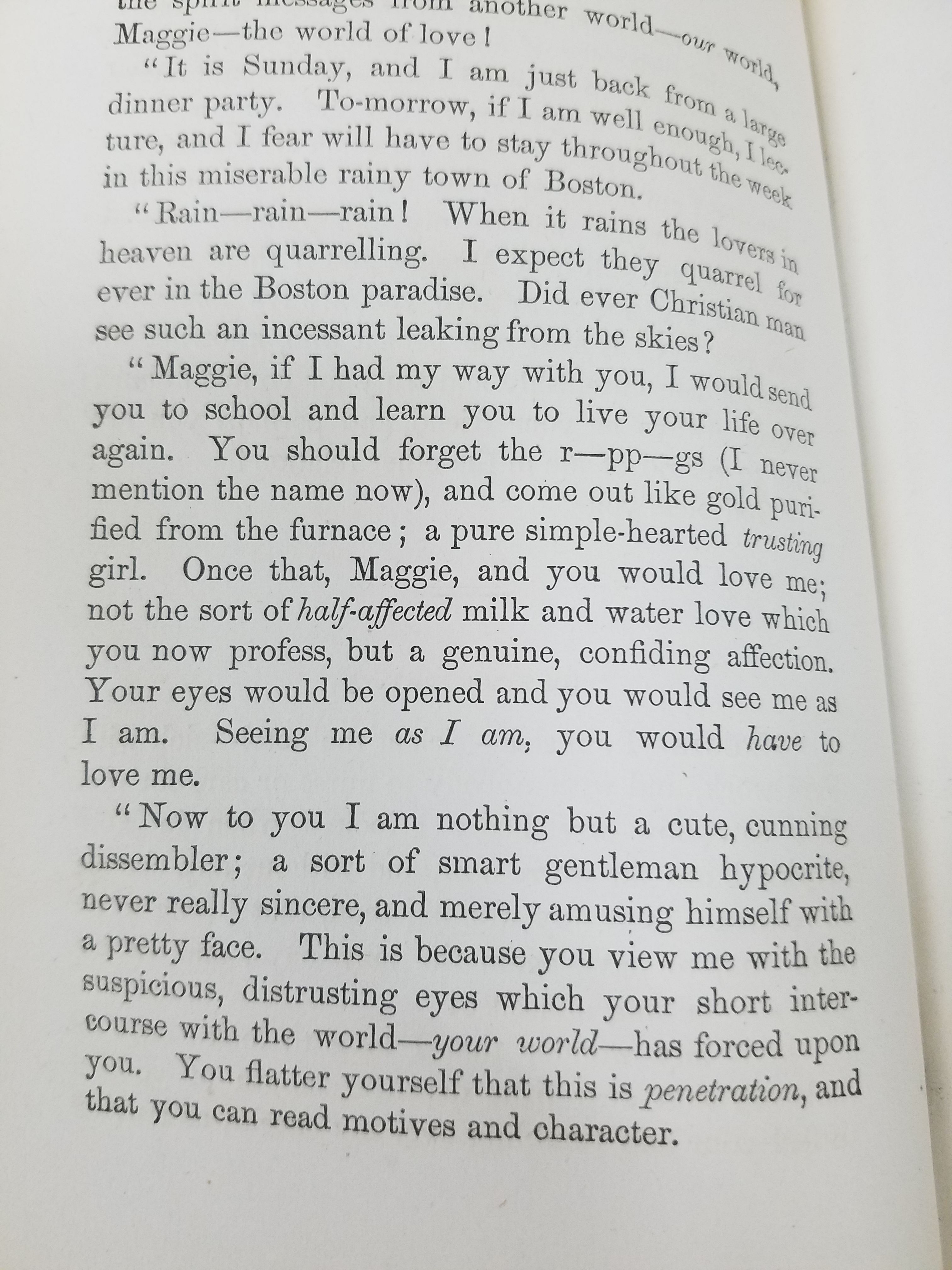
The romance, as told by the collection of letters, was tumultuous. Kane often denounced Margaret for not being affectionate enough, for continuing her work as a medium, or any number of sundry offenses. And his long absences, during which he sent Margaret to school to be educated until his return, were also a struggle. Though Henry Grinnell often wrote to Margaret to update her about Kane’s progress, the long separations created even more tension between the two. His family rejected Margaret so vehemently that her mother was forced to bar Kane from seeing her for fear of Margaret’s feelings or reputation being injured. Kane continued to seek Margaret out, and even asked her to marry him when he saw her on the street. She refused, but the press caught wind of their so-called engagement and maligned her in the papers. Kane never officially denied their engagement, which helped the gossip continue. Years passed, but in 1856, after Kane’s return from the second Grinnell expedition and the death of one of his close friends, Kane proposed to Margaret again. This time, more officially. But the two would not actually be married until days before he left for Cuba to recover his health– in the Fox’s parlor, Kane declared, in front of Margaret’s mother as their witness, that they were husband and wife. The book cites several legal precedents for this kind of common law marriage, assuring readers that the two were rightfully, if not publicly, married that night. The tone of Kane’s letters changes after this; he begins calling Margaret his beloved wife, but is filled with dread by his continually declining health. He tells Margaret that his greatest fear is dying away from her– which is, of course, what happens. And their marriage, which they had both vowed to keep secret until his return from Cuba, was never officially acknowledged by the Kane family. Margaret converted to Catholicism after Kane’s death and spent her days disavowing her own family’s legacy as mediums.
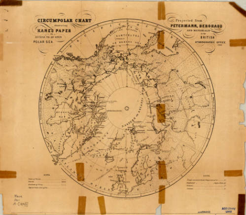
The introduction of The Love-Life of Dr. Kane claims that a man’s love letters “[reveal his] inner life and soul.” Elisha Kent Kane was a larger-than-life man who gave his life to the pursuit of discovering the unknown. The correspondence collected and published by Margaret Fox show us that Kane was also just a man, with a life and love beyond what we know. The AGSL has several maps by Kane in its collection, reminding us of his many contributions to the American Geographical Society. Below are just some of the items in the AGSL archives: his 1853 circumpolar charts and his surveys of the arctic during the Grinnell expeditions.
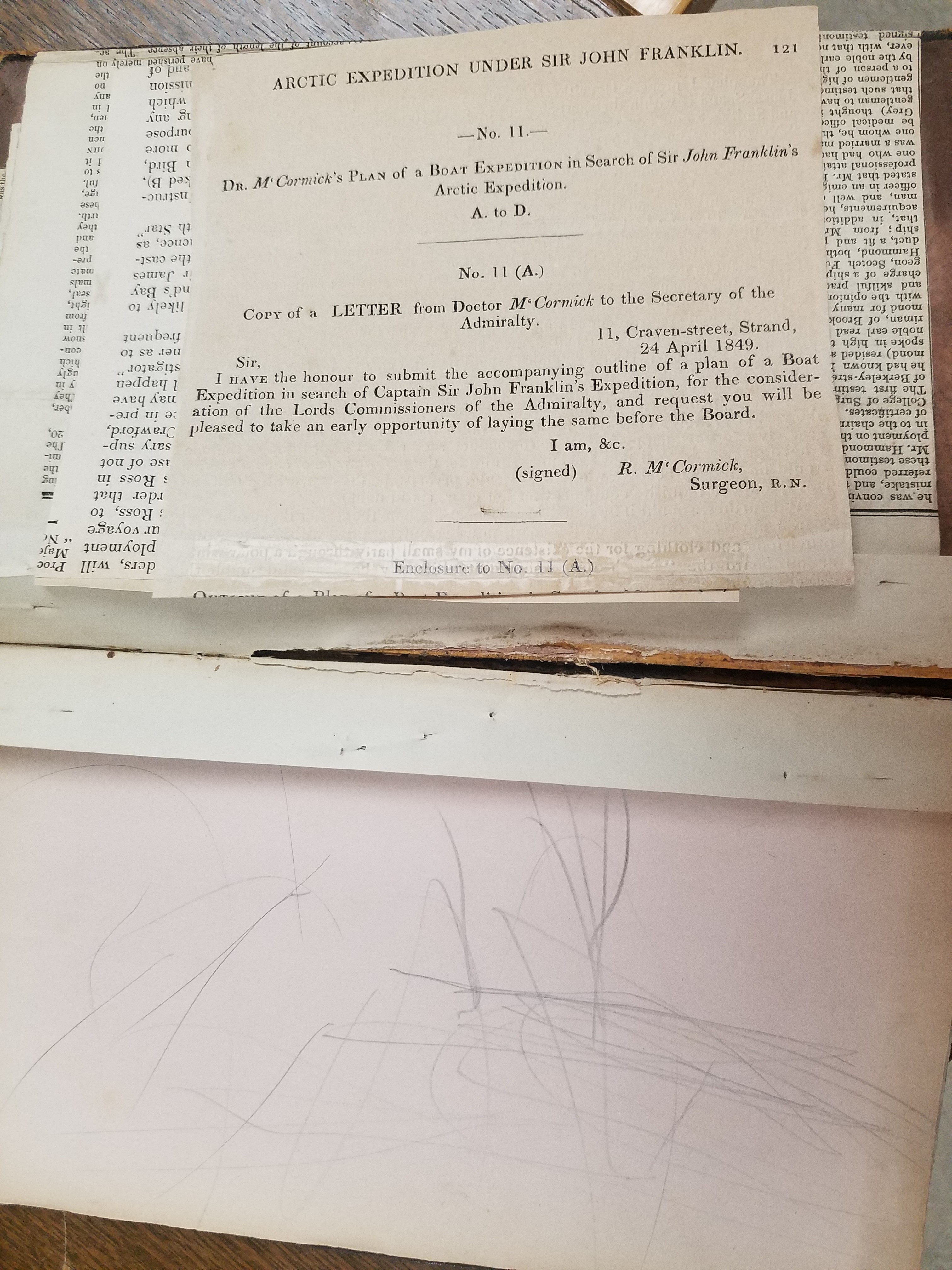
The Lost Franklin Expedition and the Early Years of the AGS
By Lauren Maddox
On May 19th, 1845, John Franklin, Francis Crozier, and the crews of the HMS Terror and HMS Erebus set out from Greenhithe, England on an expedition intended to explore previously unexplored areas of the Canadian Arctic and to complete the Northwest Passage. Lady Jane Franklin, with no word from Franklin and concerned for the welfare of her husband, began petitioning the British Admiralty to begin searching for the lost expedition as soon as 1847.
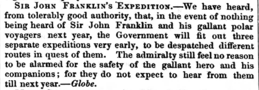
Click the link to see this excerpt From the November 13, 1847 Edition of Sheffield and Rotherham Independent
The Franklin expedition had been supplied with three years worth of canned goods to supplement the men’s hunting efforts; the British Admiralty assumed that the crew could comfortably survive another year before needing rescue. Unfortunately, the food provisioning contract had been awarded to Stephen Goldner just weeks before the Terror and Erebus set out. In his rush to fulfill the order of 8,000 cans of food, Goldner failed to check the quality of lead soldering on the tins. The food spoiled quickly, leaving the crew without proper provisions on their journey and unable to hunt once the ship was trapped in ice.
Official preparations for the rescue effort began in 1847– the Admiralty chose the three most likely routes that the Franklin expedition might have taken. The ships were likely icebound, so an overland rescue expedition would have to be arranged. Sir John Richardson, a seasoned arctic explorer who had traveled with Franklin on previous expeditions, chose a route along the Mackenzie River and the shores of Victoria Land and Wollaston Land, now Victoria Island and Wollaston Peninsula, which seemed most consistent with Franklin’s original travel plans. John Rae, another arctic explorer well-known for his prowess at safe and efficient overland travel, as well as his rapport with local indigenous peoples, was included in the rescue plans.

Click the link to see these Tracings of Dr. Rae’s Discoveries in the Arctic, 1851 from the AGS-NY Archives 
Flip Side
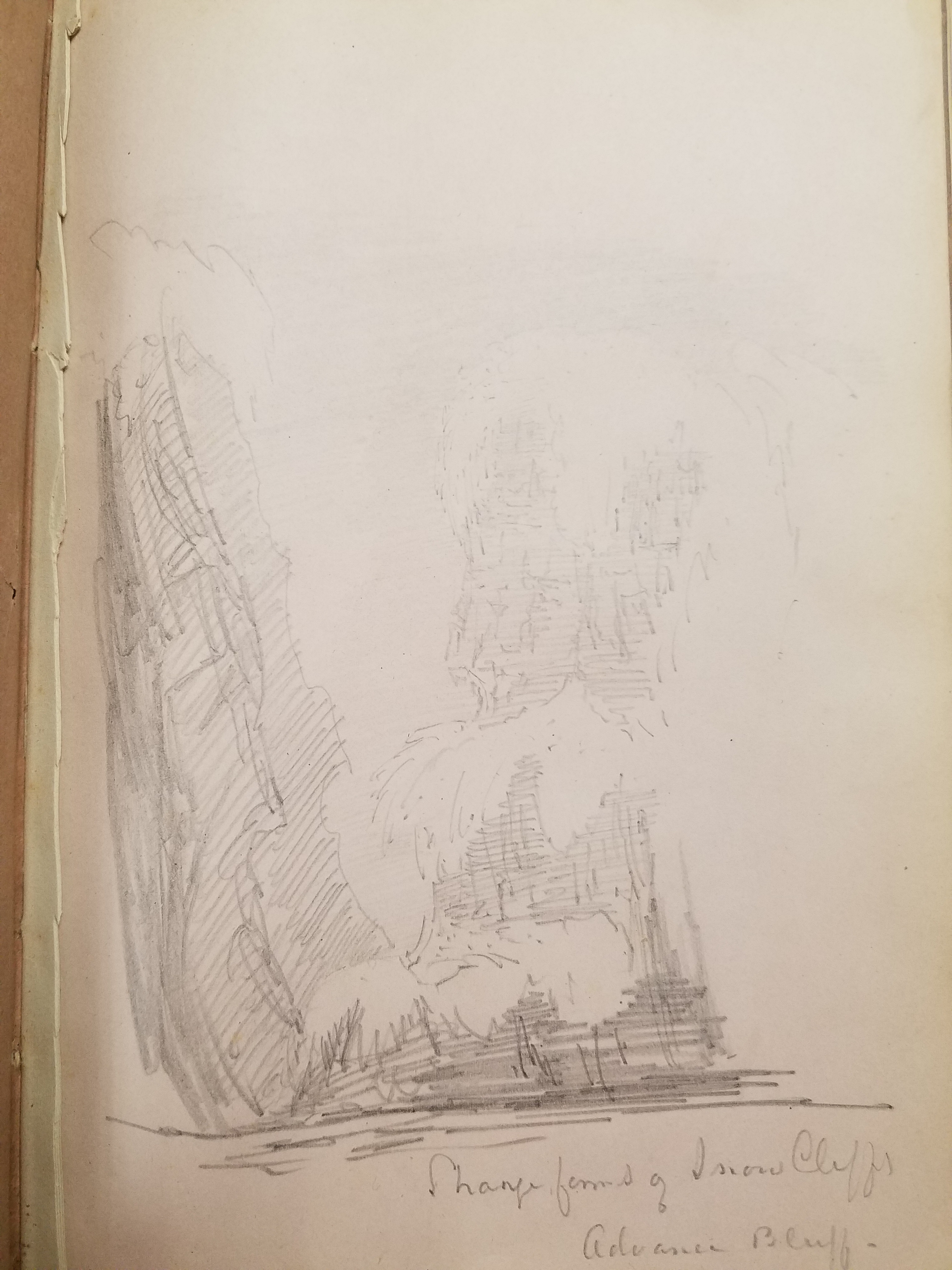
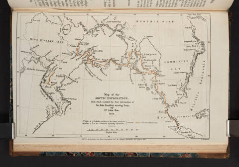
After travelling together overland and gathering information from locals, the men wintered in Fort Confidence; using the fort as a base of operations, Rae continued his search around the areas between the Mackenzie and Coppermine Rivers. In 1849, the two men decided that Rae would take the single boat and continue the journey on their intended route with a smaller crew of six men. Richardson returned to Liverpool on November 6, 1849. The above tracings of John Rae’s sketch maps outline his discoveries in 1851. Rae would continue charting the area and searching for signs Franklin’s lost expedition into 1854, but during this time, several other search expeditions were launched, including Henry Grinnell’s.
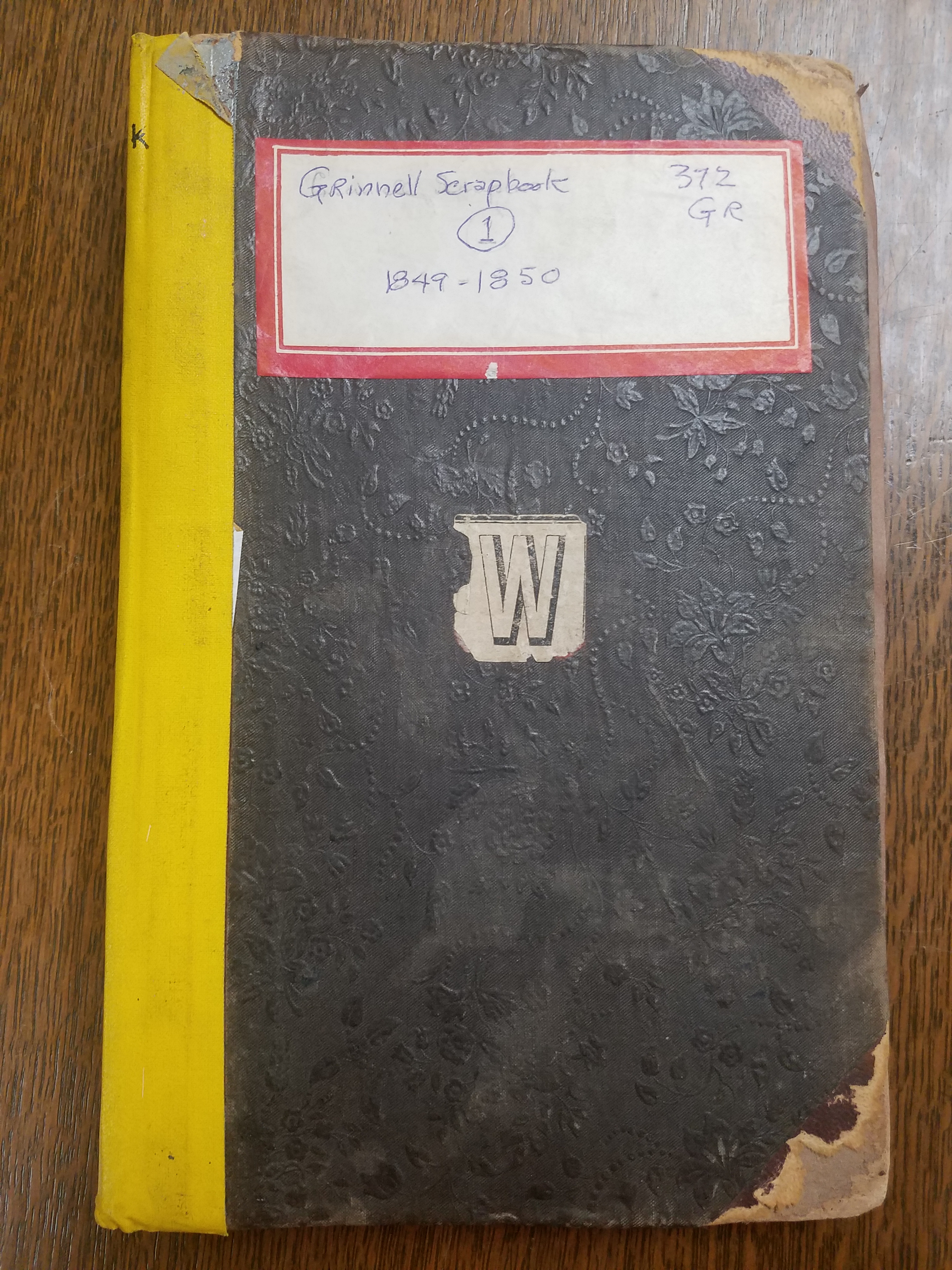
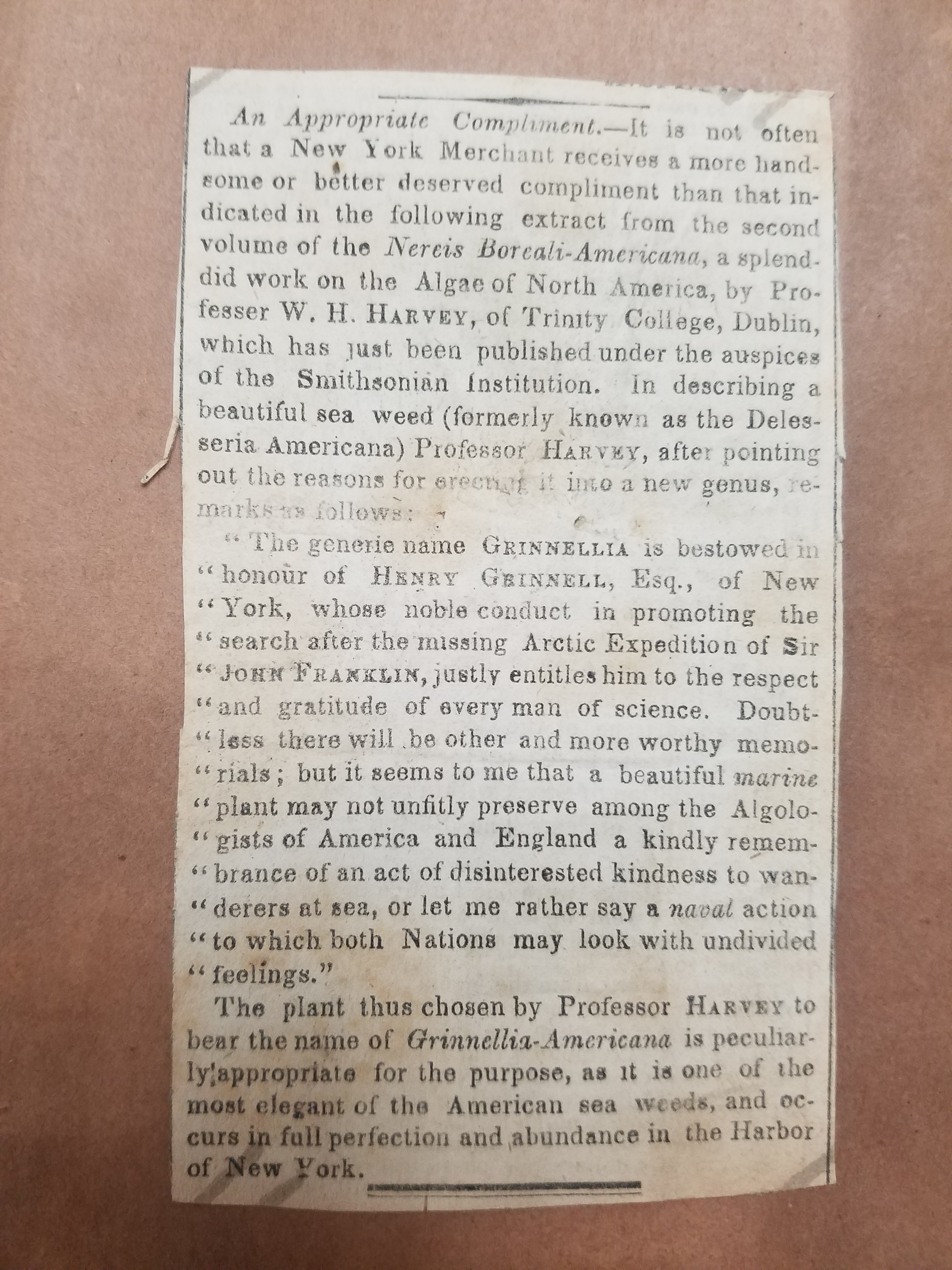
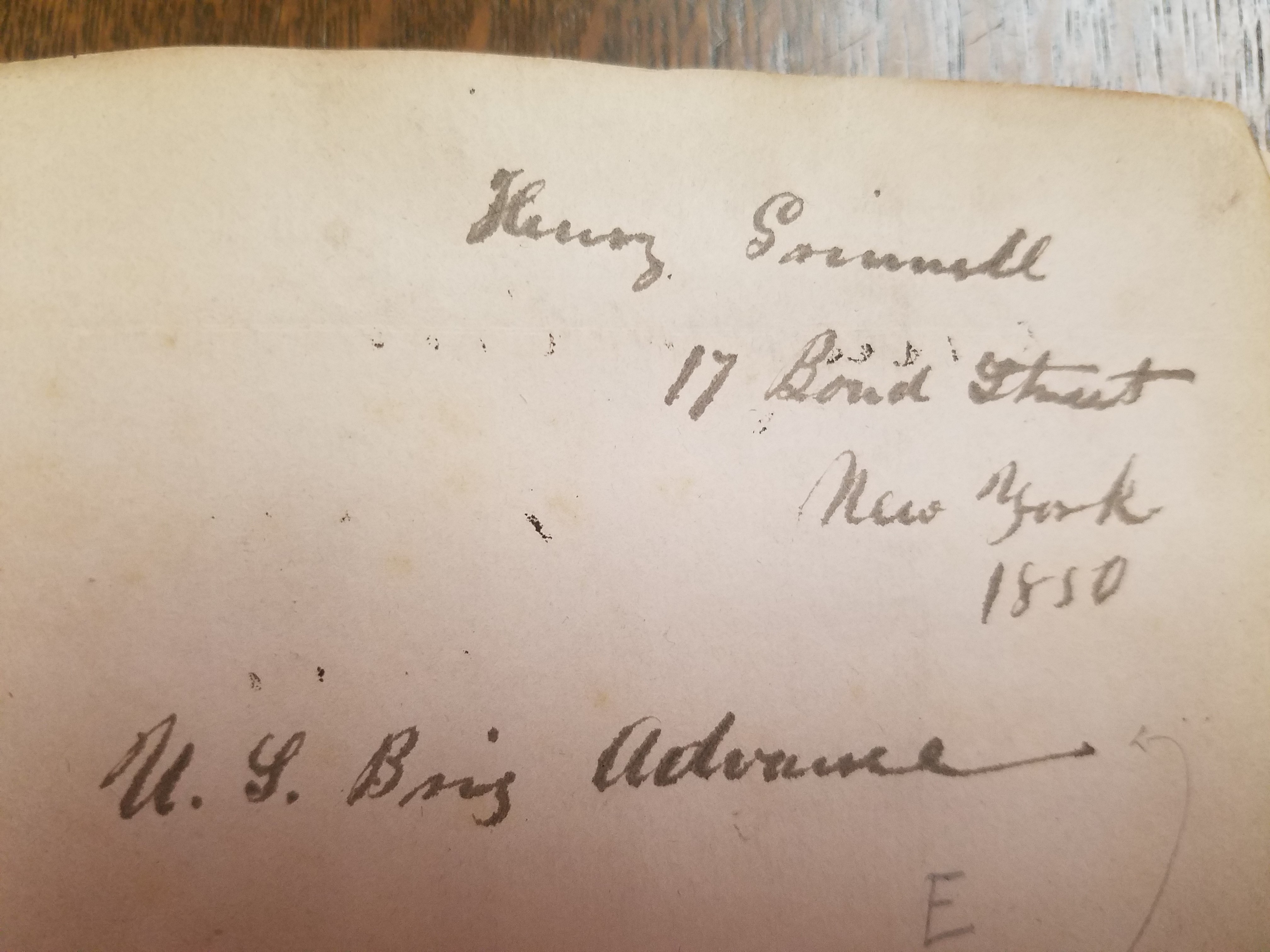
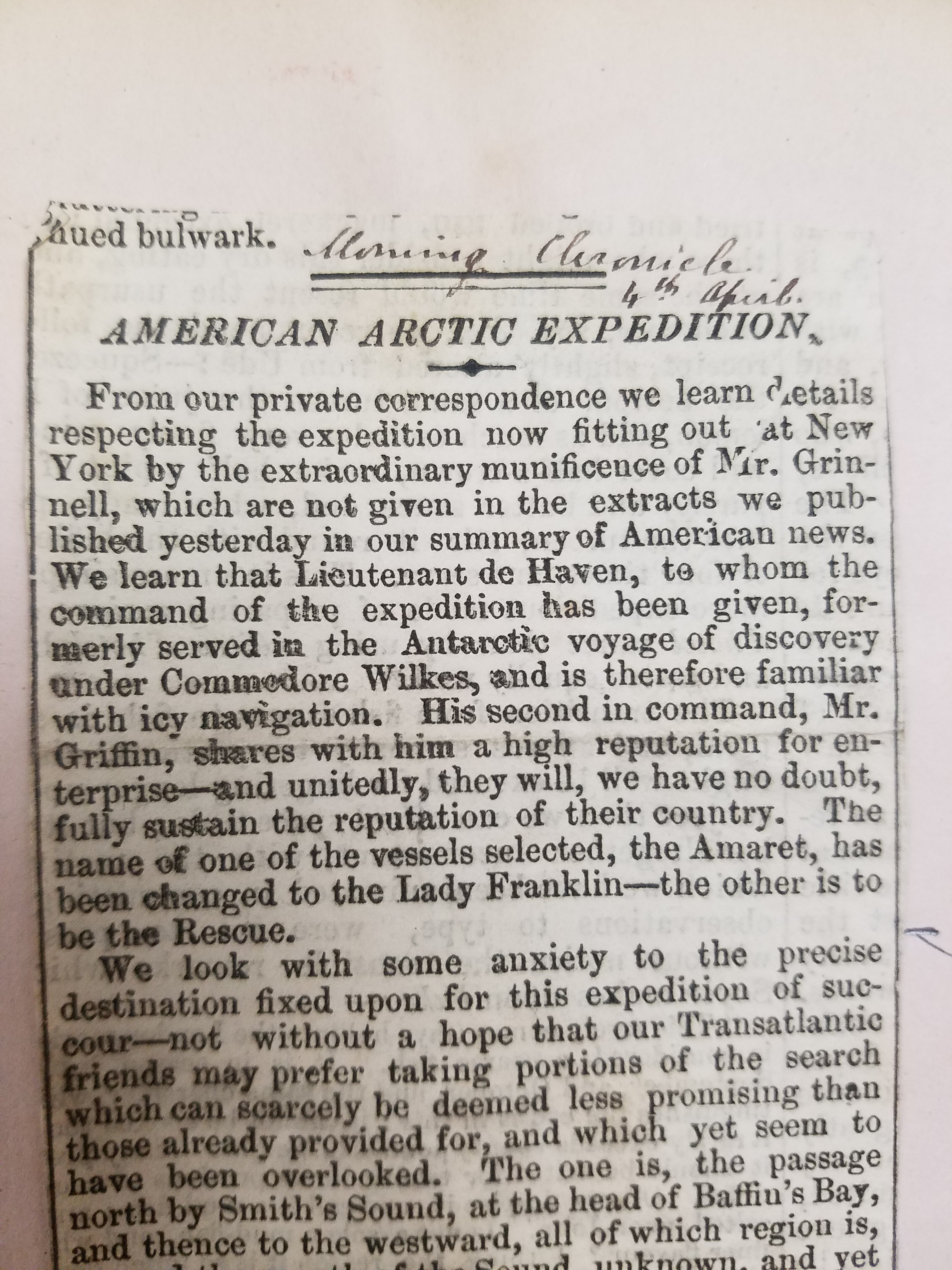
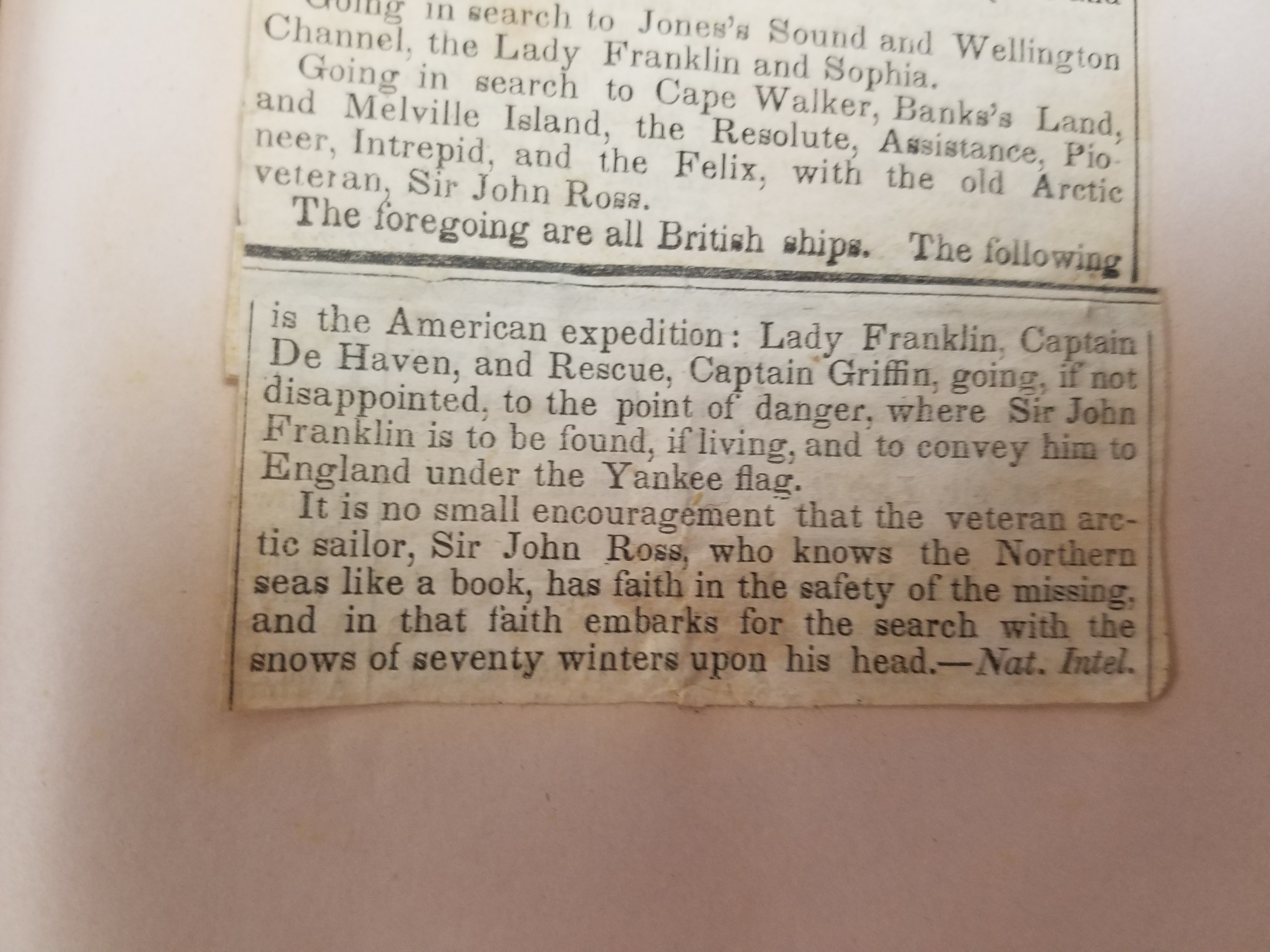
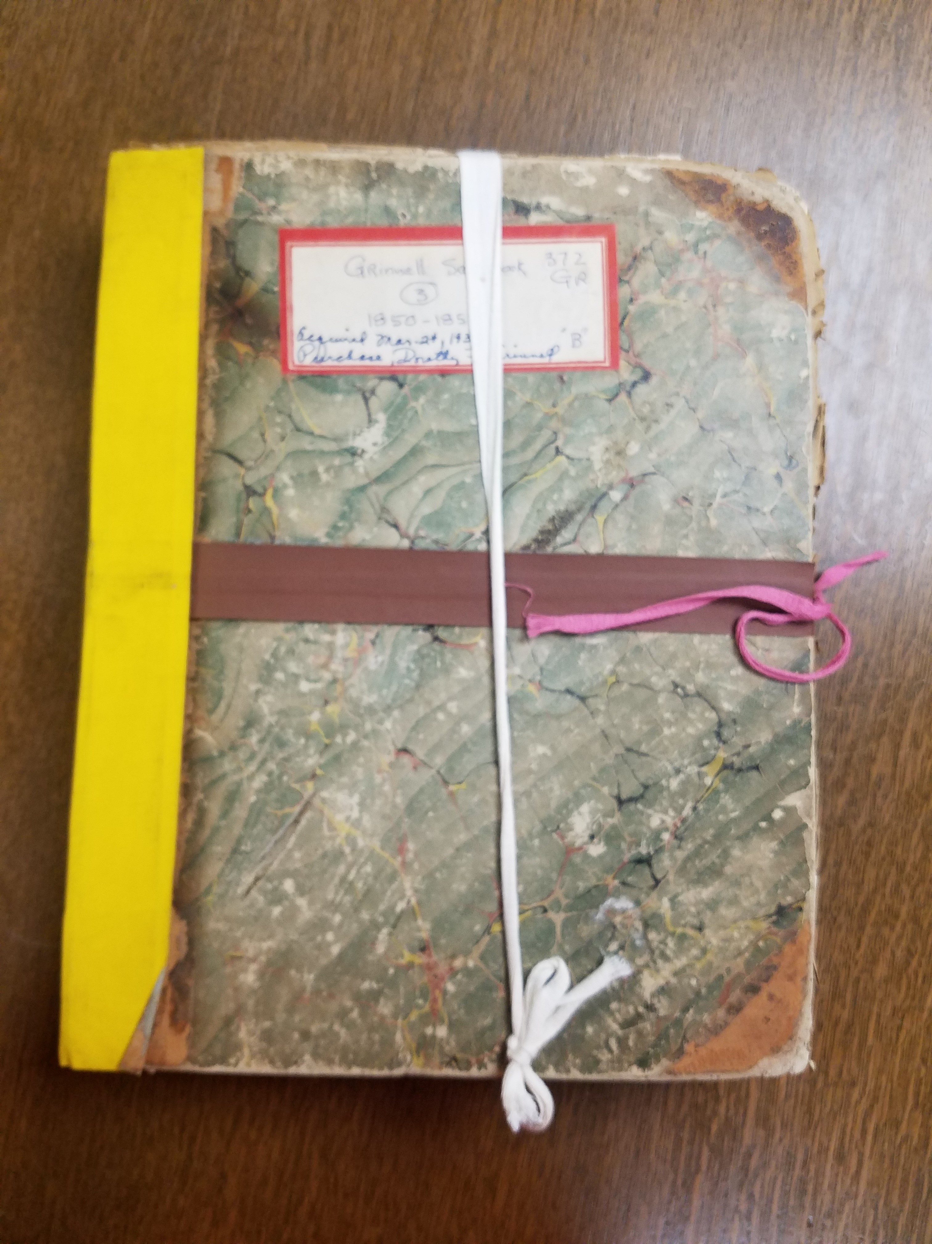
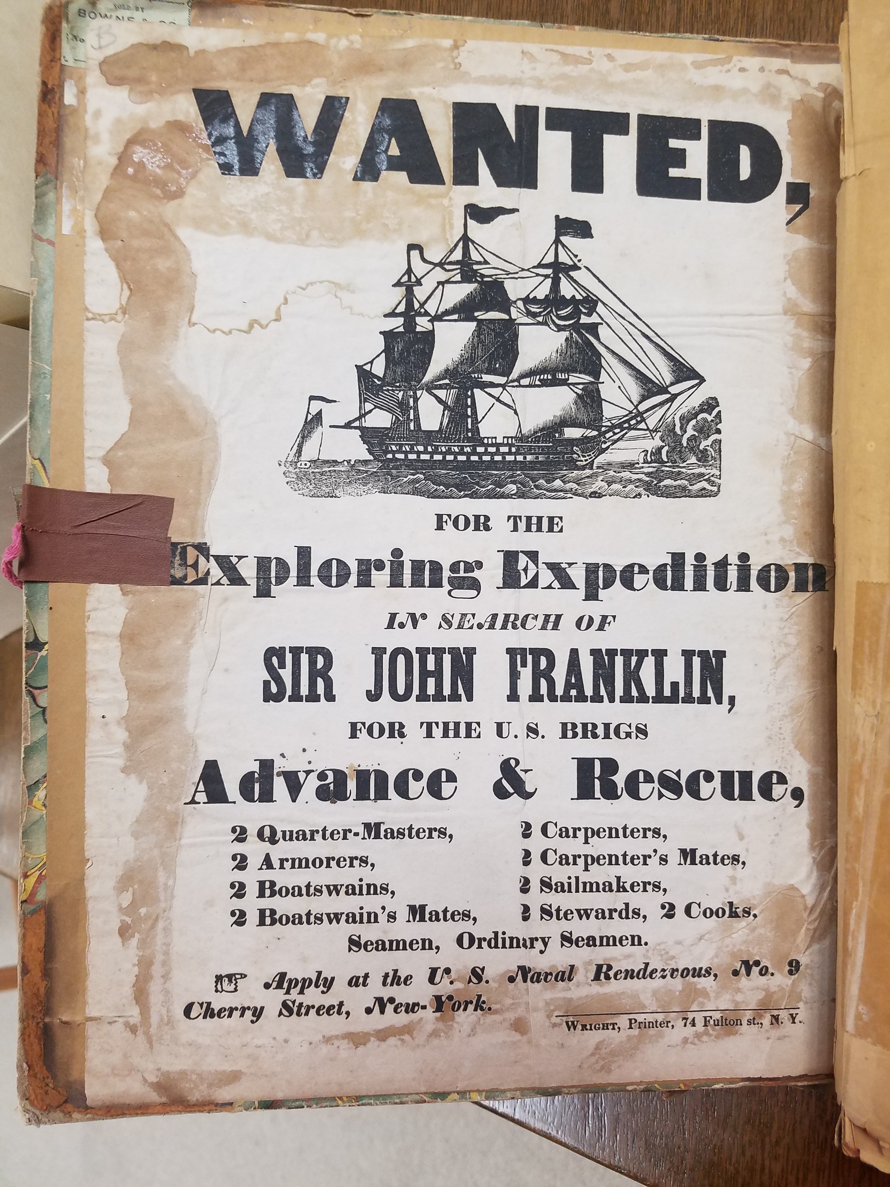
The Lost Franklin expedition would turn out to be instrumental in the foundation of the American Geographical Society. Henry Grinnell, wealthy merchant and the first elected president of the AGS, retired in 1850 to dedicate his life to philanthropy. Grinnell was a passionate follower of the search for John Franklin; in its collection, the AGSL has several scrapbooks of newspaper clippings following the story collected by Grinnell himself. The scrapbooks contain materials on previous expeditions as well as Grinnell’s own. He was particularly moved by Lady Jane Franklin’s continued appeals to American President Zachary Taylor for help finding her lost husband; when Congress hesitated to provide the aid required for a rescue expedition, Grinnell himself bought and refitted two brigs for arctic travel. He loaned these ships to the US Navy for use in an arctic exploration expedition in the hopes that John Franklin, or some trace of what happened to him, could be found.
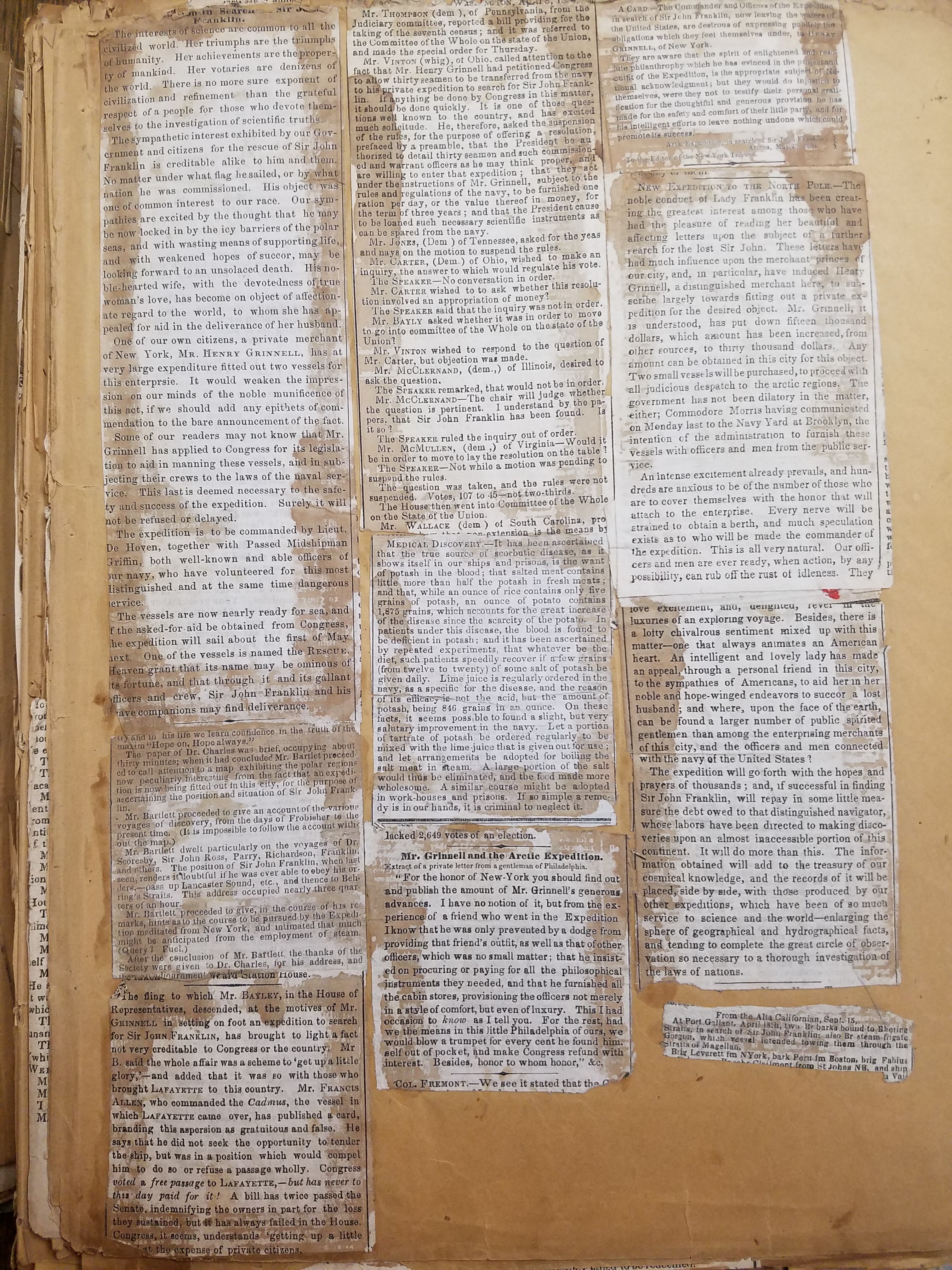
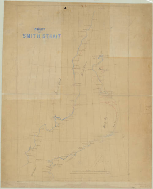
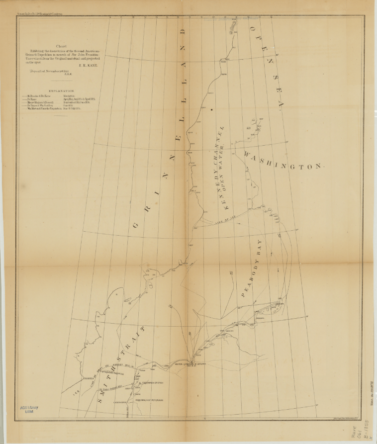
Click the link to see Chart Exhibiting Discoveries of the First Grinnell Expedition submitted by Kane in our Digital Archives
Click to see this Unidentified Notebook, 1854 found aboard the HMS Resolute after it was abandoned in the search for Franklin in our Digital Collections
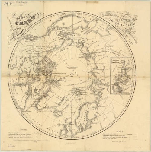
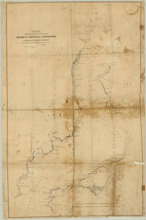
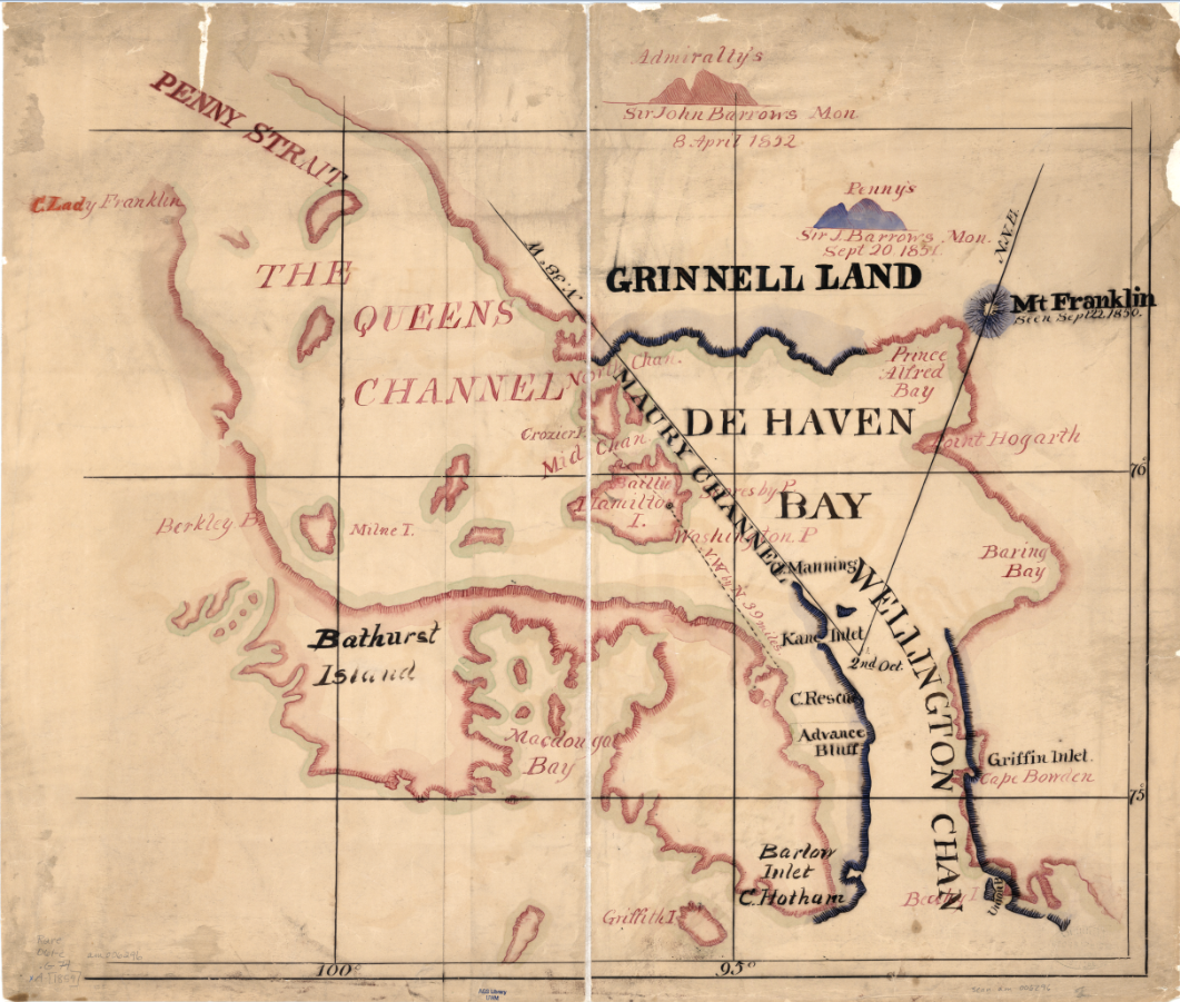
The First Grinnell expedition set out in the summer of 1850– the same year preliminary talks about founding an American geographical society began. Geography in the Making: The American Geographical Society 1851-1951 intimates in a single sentence that, though there is no “positive evidence” that Grinnell’s polar interests influence the foundation of the Society, the timing of his arctic expeditions and his election as president seem to suggest it. The expedition, lead by Edwin de Haven and including Elisha Kent Kane, set out in May and would continue their search through ice and bad weather for a year. They met with British search parties, including the first expedition on the HMS Resolute lead by, and joined forces to comb the area thoroughly– during the winter, however, the Advance and the Rescue were separated and icebound. Elisha Kane submitted a chart with a revised survey of the coast of Greenland and the party’s escape route south. This chart also shows the newly christened Grinnell Land, which De Haven named in honor of the expedition’s patron. After being forced to winter over in the ice, it was decided that the two ships should return with what news they had, though it was not very much: all the expedition had discovered about the lost Franklin party was their first camp, abandoned, and three graves on Beechy Island.
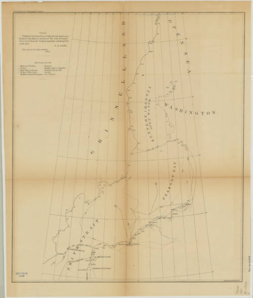
Click the link to see this Chart Exhibiting Discoveries of the Second Grinnell Expedition by Kane in our Digital Collections
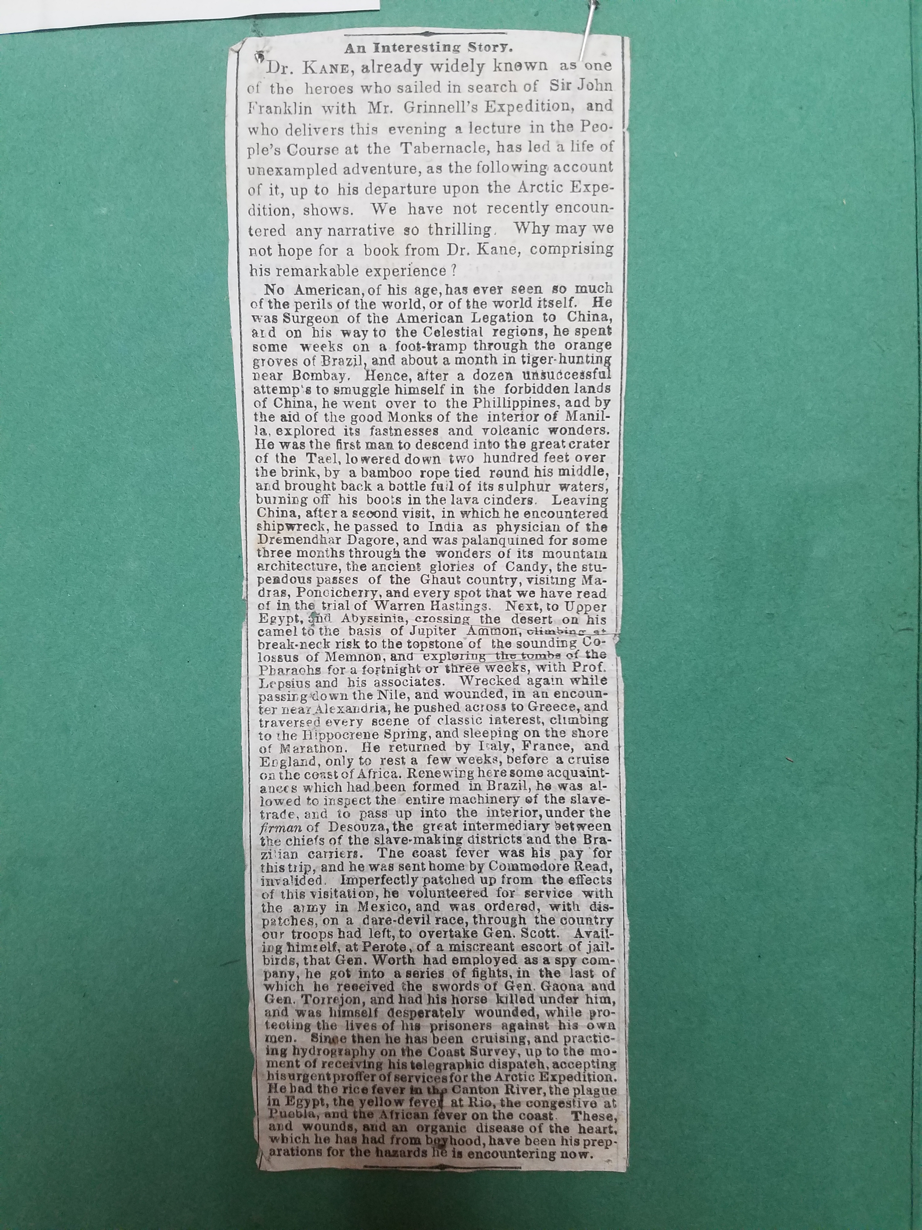
Unsatisfied with the results of the first expedition, Grinnell began planning a second search for Franklin. Elisha Kane would lead the expedition north of Beechy Island where Franklin’s first camp was found and into the open summer polar sea. The search plan was approved by the American Geographical Society in New York and financially supported by Grinnell and other philanthropists. Isaac Israel Hayes, another well-known name in the AGSL archives, signed onto the expedition as surgeon. The small crew set out on the Advance on May 30th, 1853 with meager provisions and research instruments. This expedition would shed no new light of the disappearance of Franklin’s expedition, but it would go farther north than any expedition before it, setting a new record, and allow Kane to gather useful geographical, climate, and magnetic observations. The journey was harrowing and the men, trapped for two winters in the ice, running low on supplies, and afflicted with scurvy, would be forced to abandon the Advance in search of rescue. Three men were lost during the expedition and Kane’s health would continue to deteriorate. He died in 1857, just two years after the expedition returned– the same year as his account of the journey was published.
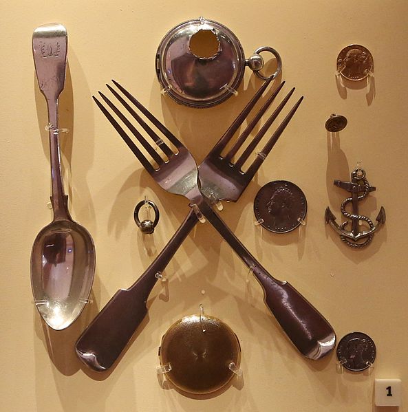
Click the link to see these Items Recovered by Rae, currently housed in the National Maritime Museum in Greenwich, London
The Grinnell Expeditions were unsuccessful in discovering the fate of the lost Franklin expedition. But during this time, John Rae’s own expedition was still on-going. In 1853, he encountered a group of Inuit who had several artifacts from Franklin’s crew in their possession. This included several pieces of monogrammed silverware, coins, and a pocket watch. Rae purchased these items from the Inuit and began interviewing locals. This was how he eventually discovered the sad fate of the Franklin expedition. While completing his survey of West Boothia, Rae heard about a group of white men who had starved four years earlier in a camp nearby. Rae continued his search until he discovered the final camp of the Franklin expedition. In his letter to the Admiralty, he described the state of the camp and the signs of cannibalism he found there. But, “any tidings, however meager and unexpectedly obtained” were better than none in Rae’s opinion.
Click the link to see “Arctic Exploration, With Information Respecting Sir John Franklin’s Missing Party.” 1855
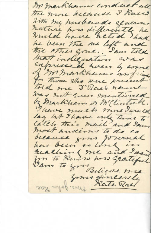
The British Admiralty published John Rae’s letter without his knowledge before his return to England in 1854. The public was outraged by his claims; Charles Dickens maligned him in the press and his findings were mostly ignored by Lady Jane Franklin who continued her search into the 1880s. However, later expeditions would only confirm what Rae had discovered, and the British Admiralty officially presumed the entire crew of the Franklin expedition dead. Rae’s crew collected the reward, but his reputation never recovered. Other explorers who had joined in the search for Franklin were knighted, but Rae, for implying that officers of the Royal Navy would stoop to cannibalism, was mostly kept out of the picture.
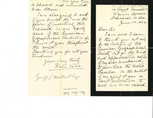
Rae published several articles in the Journal of the American Geographical Society of New York after his days of Arctic exploration were behind him. He shared his discoveries and practical advice with other explorers in the spirit of the AGS’s organizational purpose: “furthering the understanding of the role of geography in our lives.” After his death in 1893, the AGS published his obituary in their journal, honoring John Rae for his 35 years as a Corresponding Member of the AGS and his important contributions to geography. The Society had this to say about Dr. John Rae: “He wrote with simplicity and force, but he was more concerned to do things worthy of record than to record them. He had the gifts of the born explorer, the habit of exact observation, courage and fertility of resource, untiring energy, activity and strength; and with these a firmness and generosity of character that won the respect and the affection of men.”
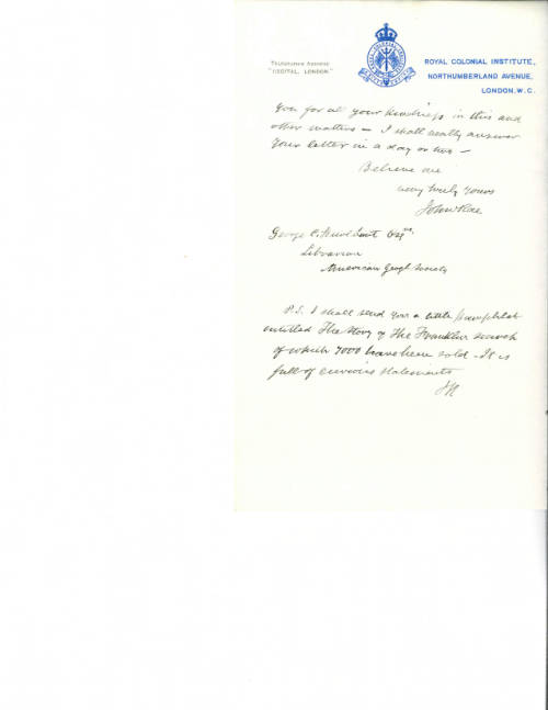
And in the AGSL archives, relics of a longstanding friendship between the Society and Rae: a collection of years of correspondence from Rae and his wife Kate to the AGS.


The young beginnings of the American Geographical Society were tied to those first Arctic expeditions to find Franklin, and this legacy of Arctic exploration continued into the 20th century. Luckily, records from these early years remain in the AGSL collection as a reminder of these tragic and exciting origins.
