Lauren’s blog
GIS Day 2019
By Lauren Maddox
It’s that time of year again– happy GIS Day 2019! Well, actually, GIS Day will be tomorrow, Wednesday November 20th. UWM will be celebrating the global event with their own GIS Day program. GIS Day is an opportunity for those of us who are interested in learning about geography and GIS technology to come together with a community of other GIS learners and explore GIS. Anyone interested is encouraged to register for the day’s program and the workshops they would like to attend for GIS Day 2019! Workshops and tours of the AGSL will be offered throughout the day from 9 a.m.-4 p.m. Keynote speaker Dr. Ryan Covington will be giving a talk about “Navigating Geospatial Technology in 2020 and Beyond” over lunch. A complete program of events is available at GIS Day’s UWM webpage. We hope you will join us in celebrating GIS Day this year!
20th Nebenzahl Lectures: The AGSL Goes to Chicago
By Lauren Maddox
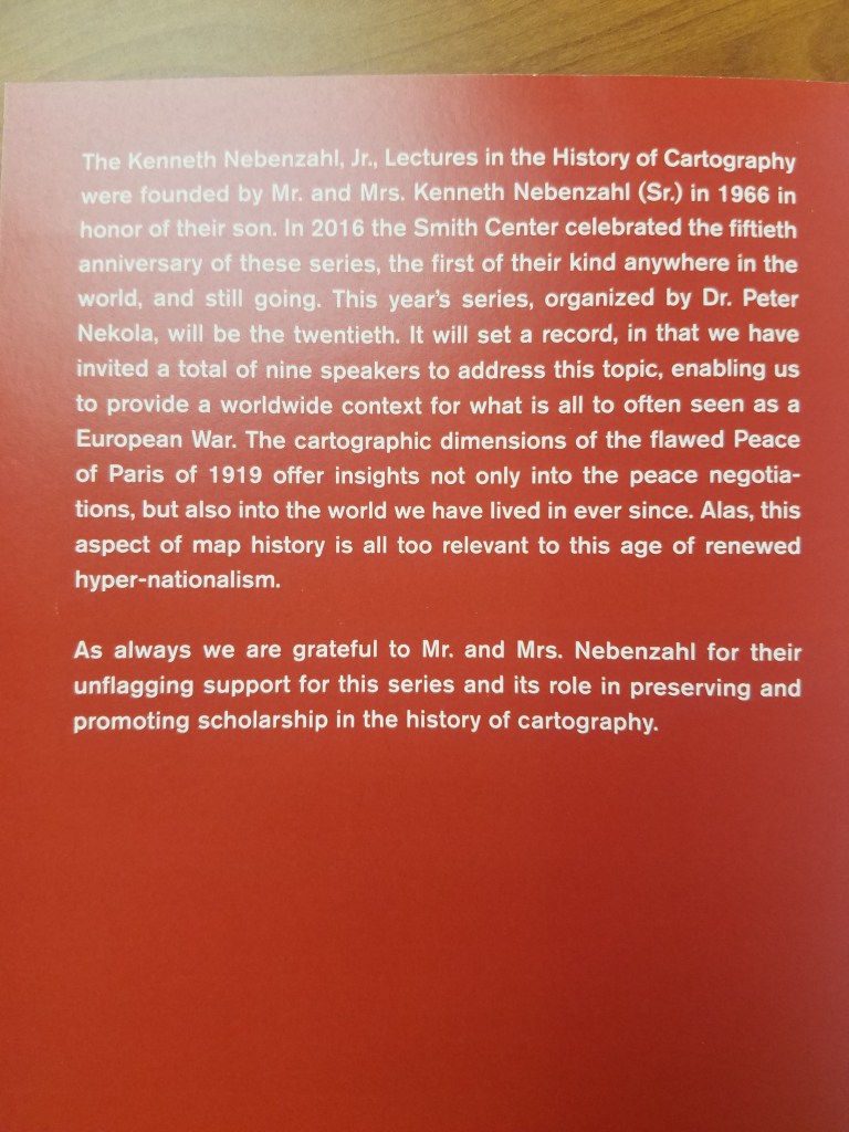
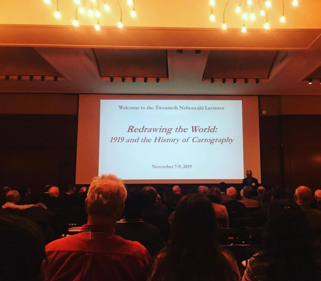
Last weekend was the 20th Nebenzahl Lectures that are held every few years at the Newberry Library in Chicago. The 2019 year’s theme was “Redrawing the World: 1919 and the History of Cartography”– which, as you can imagine, was a very exciting topic for staff at the AGSL. The lectures were held over three days and featured 9 different scholars including organizer Dr. Peter Nekola.
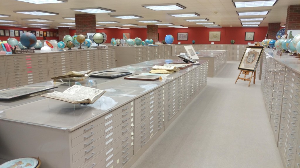
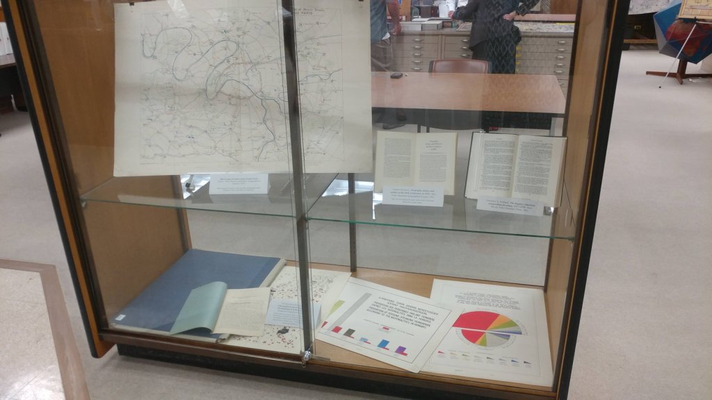
On Thursday, attendees visited the AGS Library and enjoyed a presentation by Curator, Marcy Bidney and viewing an exhibit highlighting the role of the AGS at the Paris Peace Conference following WWI. Besides providing thousands of maps, atlases, books and nautical charts from the AGS Library, which were shipped to France for use by the American delegation, the AGS building and its staff were involved in the work of the so-called “Inquiry” which preceded the actual Conference. Starting in November 1917, a team of geographers, historians, regional experts and cartographers worked in secret at the AGS headquarters building, drawing on the library’s vast resources to produce reports and maps for the American negotiators to use at the Peace Conference.
Many of the presenters at the conference, referenced resources held at the AGS Library and used in their research.
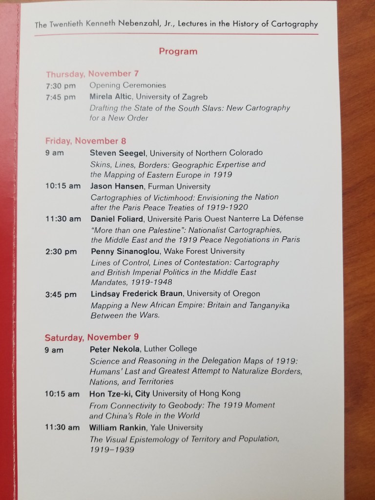
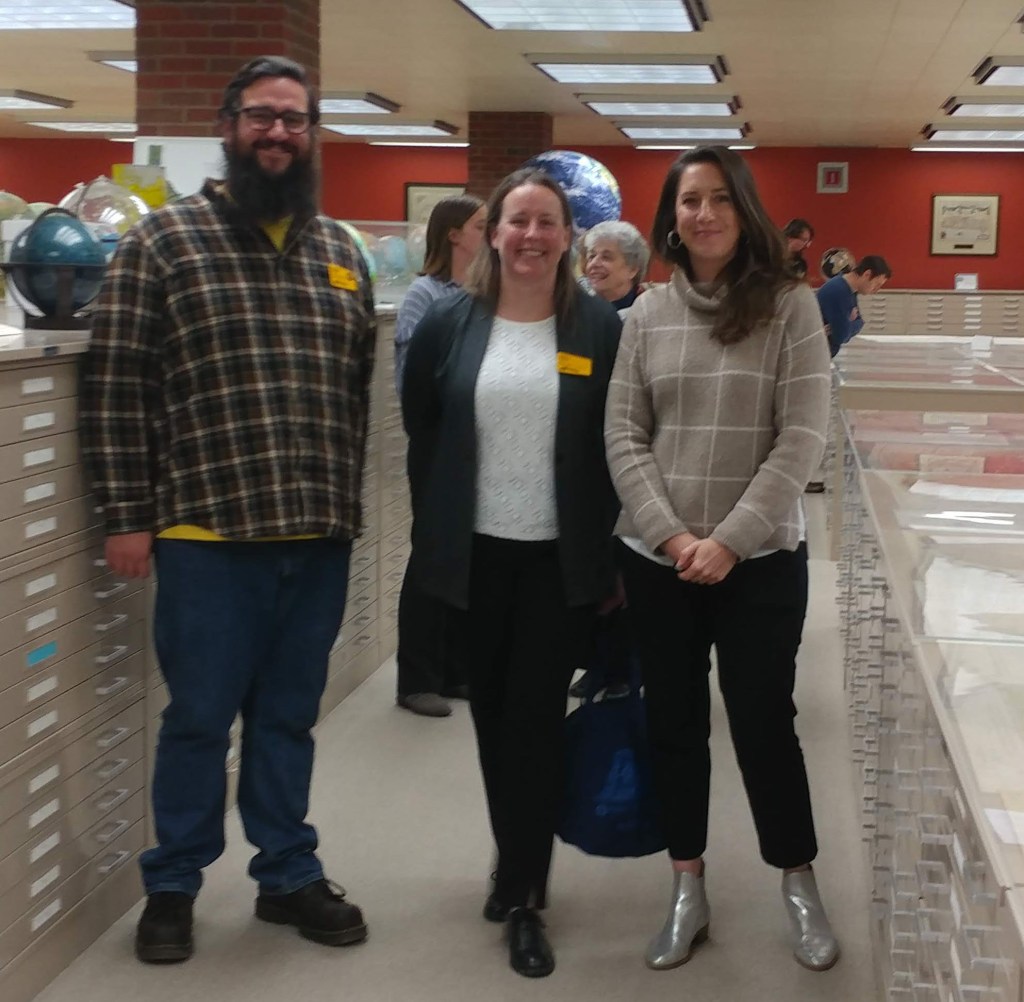
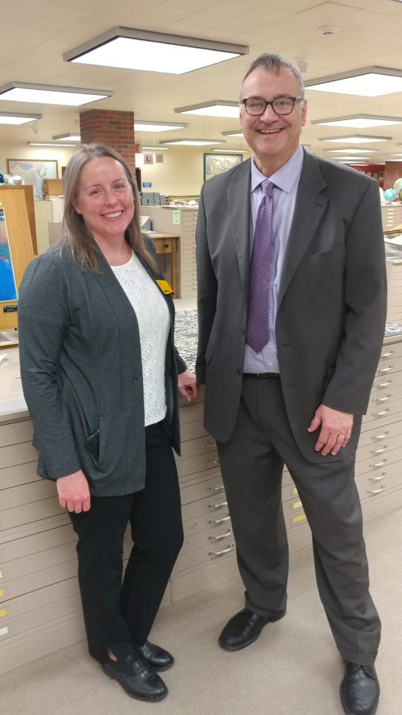
AGSL staff: Marcy Bidney, Curator ; Jovanka Ristic, Reference Librarian ; and student interns Georgia Brown and Katie Bischof attended the Lectures in Chicago. The Lectures focused on the 1919 map production boom and how cartographers helped forge the uneasy peace at the Paris Peace Treaties. Particular topics included “Mapping a New African Empire: Britain and Tanganyika Between the Wars” presented by Lindsay Frederick Braun and “Cartographies of Victimhood: Envisioning the Nation after the Paris Peace Treaties of 1919-1920” presented by Jason Hansen. The Lectures were an exciting reason to visit Chicago and the AGSL was proud to participate.
How Does Your Garden Grow? Imagining the Cemetery
By Lauren Maddox
As Halloween comes and goes, our minds drift to the dark and the macabre–we can’t help but think about spooky skeletons, werewolves, witches, ghosts, and vampires or about what those figures really represent to us: death. Death isn’t something people like to think about very much. America, in particular, has always held death at arms length with only squeamish acknowledgement.
The Church began to regulate burials around the 7th century across Europe–rituals for the dead and dying became increasingly Christian, and burying bodies in consecrated ground became an important tenant for dealing with the dead. In these early days of Christian burial, bodies were buried in mass graves so that the bones could be exhumed and stored in ossuaries in the walls of the church. But, due to lack of space, eventually bodies began to be buried in the church yard. Graves would be marked with simple stones, or is some cases, wooden crosses, unless the family was able to afford a more complicated memorial for their loved ones.
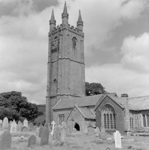
St. Pancras Church in Widecombe-in-the-Moor, England from the Clarence W. Sorenson Collection. Click the link to see this photo in our Digital Collections!
The churchyard grave was thought to be a place under the protection of the Church– it was a safe place where loved ones could be guaranteed to pass into an easy afterlife. But as populations boomed and the Industrial Revolution’s dangerous growth and unadulterated industry began to accumulate a body count, the ideation of the churchyard began to change. Instead of being a place where one might visit their loved ones and feel comforted by their presence, they became places in which disease festered and spread. Floods would unearth the recently buried and rain that passed through the churchyard might become contaminated. The proximity of the churchyard burial ceased to be a comfort and became a source of anxiety too-close-to-home.
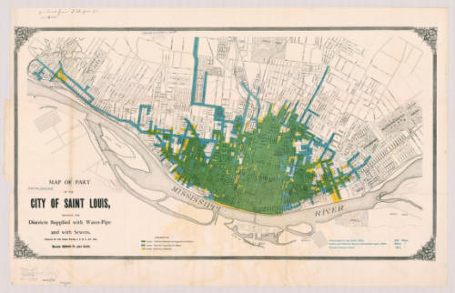
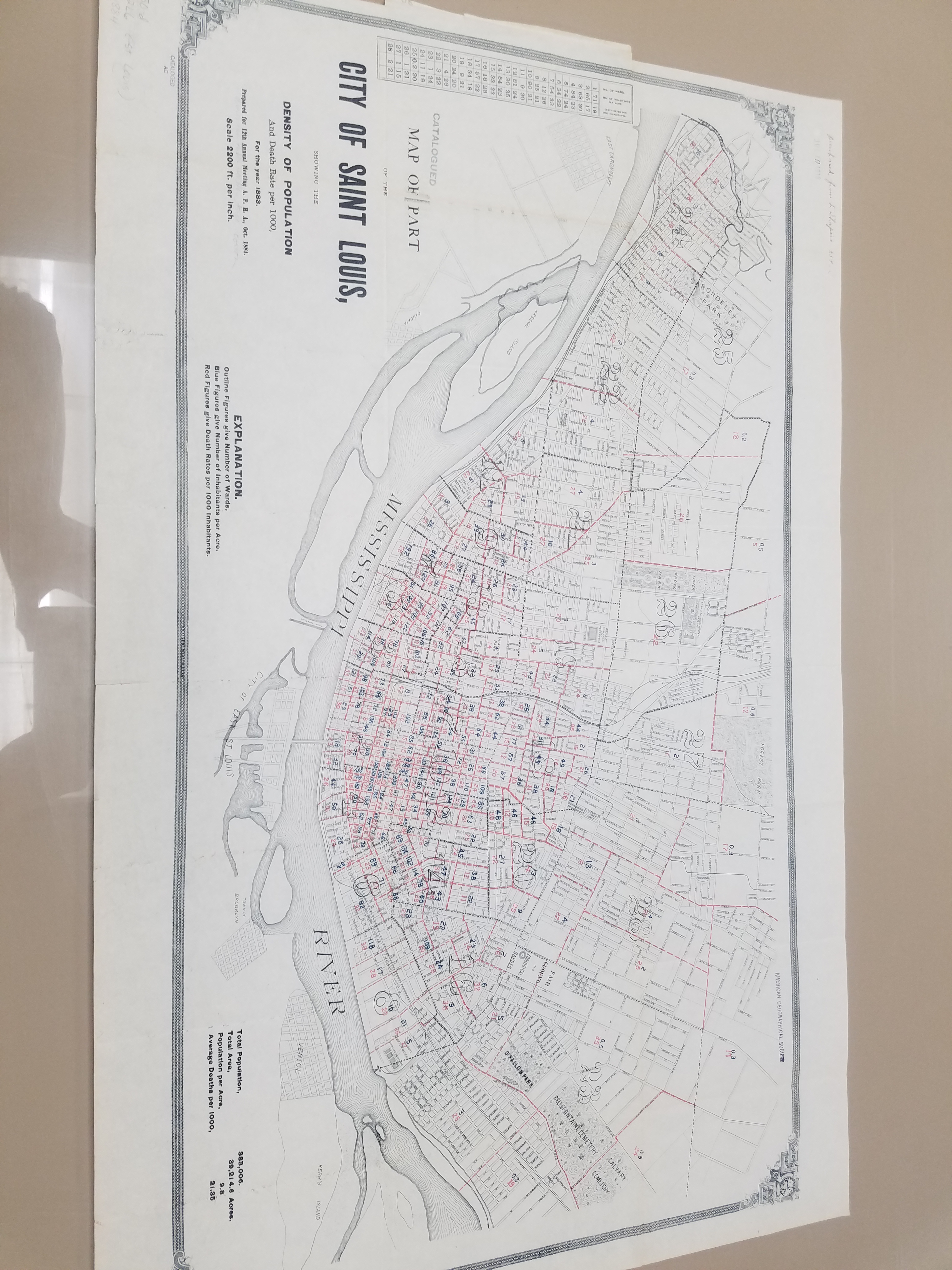
Map of St. Louis, MI in 1884. Click the link to see this map in our Digital Collections! 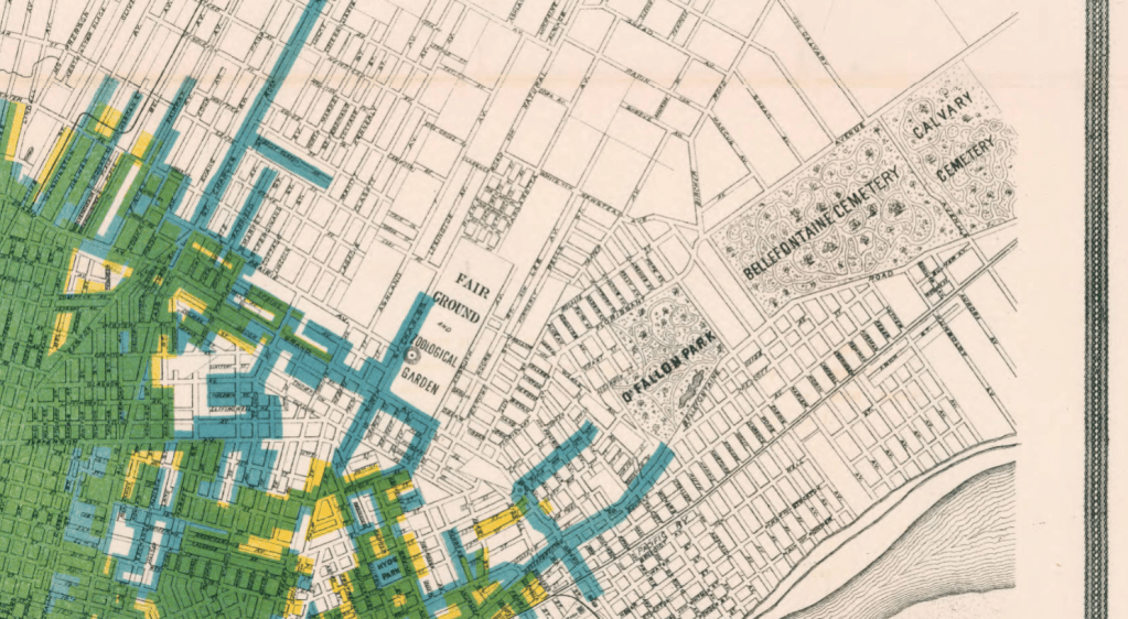
Detail from 1884 Map of St. Louis featuring the Bellefontaine Cemetery and the Calvary Cemetery.
Because of this, in the 19th century, the cemetery moved out of town. Death was an upsetting reality to have in your backyard for Americans, so cemeteries were moved away from the populated areas of the city and from the water supplies for the city. And, in a final symbolic gesture, cemeteries were gated to show that they were no longer part of the world of the living. Looking at these two late 19th century maps of St. Louis and Philadelphia, you can see how far out of town the cemeteries were moved for the safety and peace of mind of the living.
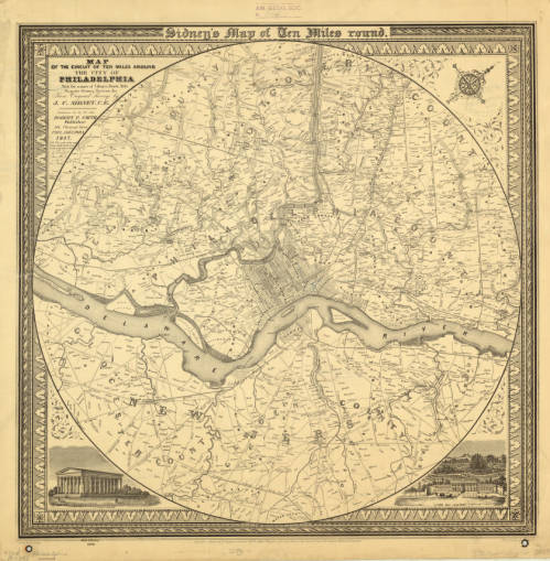
1847 Map of Philadelphia including multiple cemeteries. Click the link to see this map in our Digital Collections!
But, ironically, the cemetery also became like a public park. According to Keith Eggener, author of Cemeteries, cemeteries were free oases where people could escape the hustle and bustle of their city lives. People would bring picnics, bicycles, take strolls, and use the cemetery as a brief respite from daily life. They became immensely beautified– the cemetery was not only important as a place that separated the dead from the living, but also as a place that the living could visit at their leisure and leave again when they were satisfied.
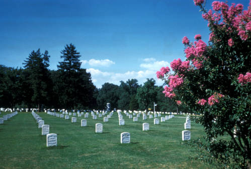
Arlington National Cemetery from the Harrison Forman Collection. Click the link to see this photo in our Digital Collections!
We might be a little more comfortable with our cemeteries these days, but they’re still not going to be our ideal afternoon spot. But during Halloween season, when death is on our minds, it’s important to remember our relationship to the place where spooky skeletons and vampires reside. And maybe accept that those scary figures are pretty harmless– Savannah’s Bonaventure Cemetery is a beloved tourist destination, where people go to see the beautiful parks. But, remember– always “keep your distance, remain quiet and show respect for the dead.”
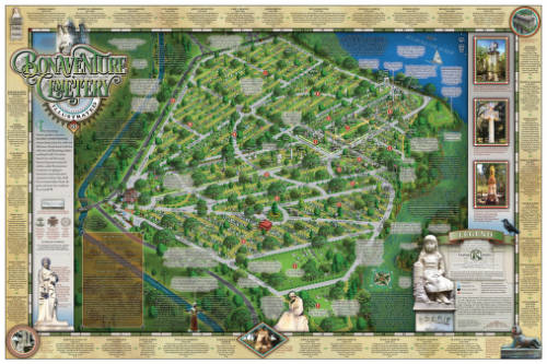
Illustrated Map of Bonaventure Cemetery in Savannah Georgia, 2016. Click the link to see this map in our Digital Collections! 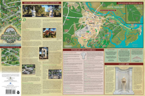
History of Bonaventure and Additional Information.
October Pop-up Exhibit
By Lauren Maddox
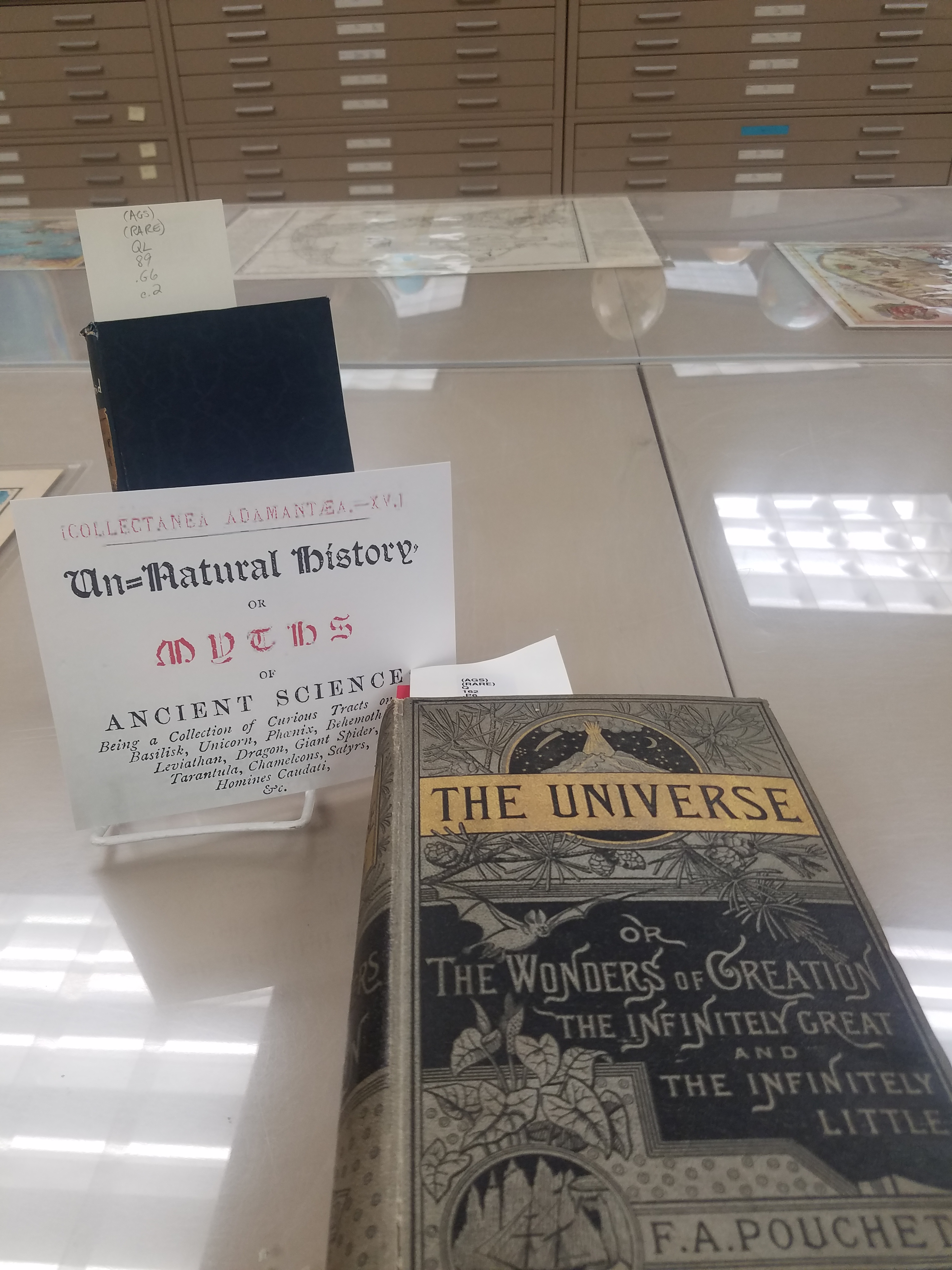
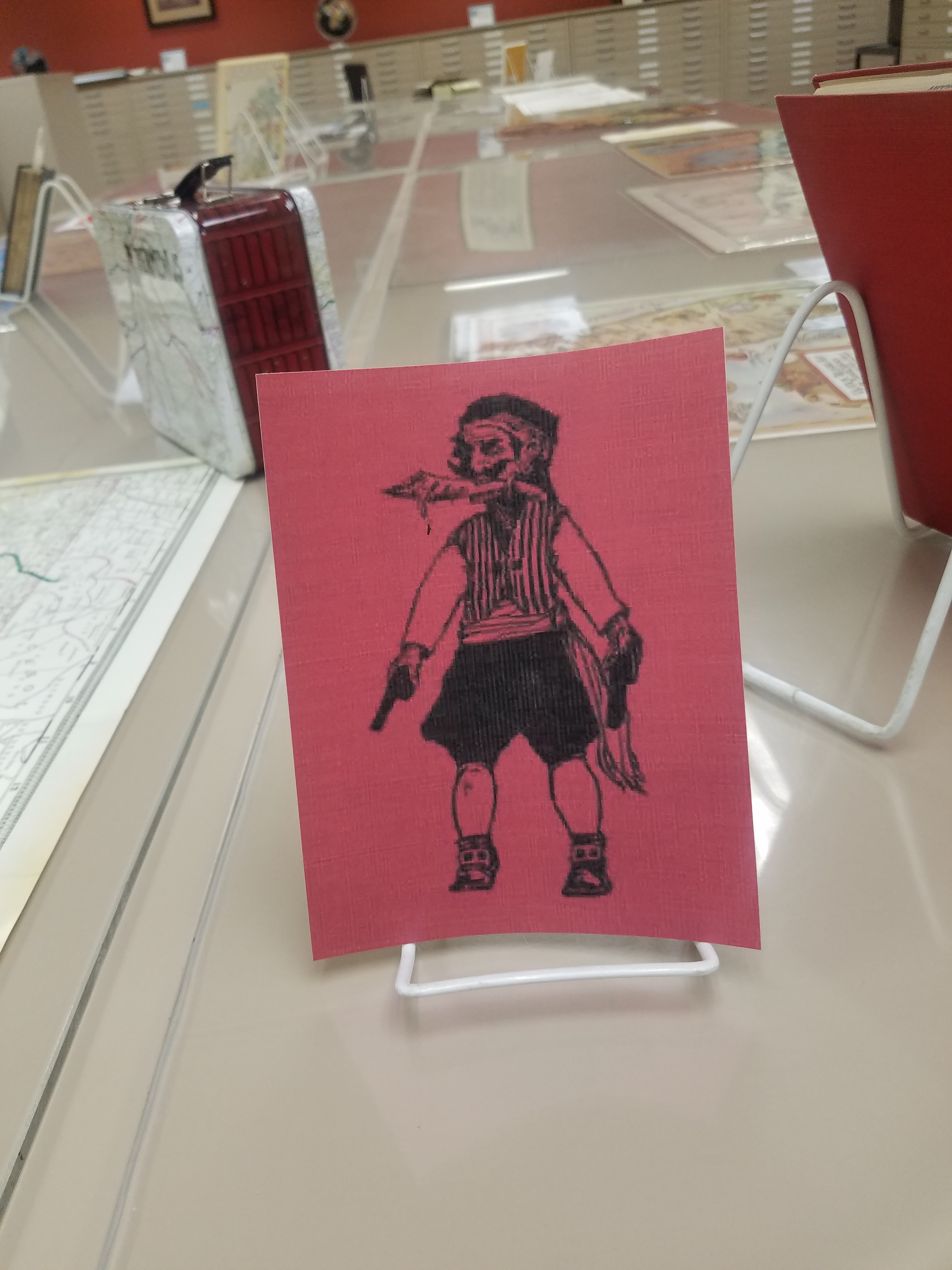
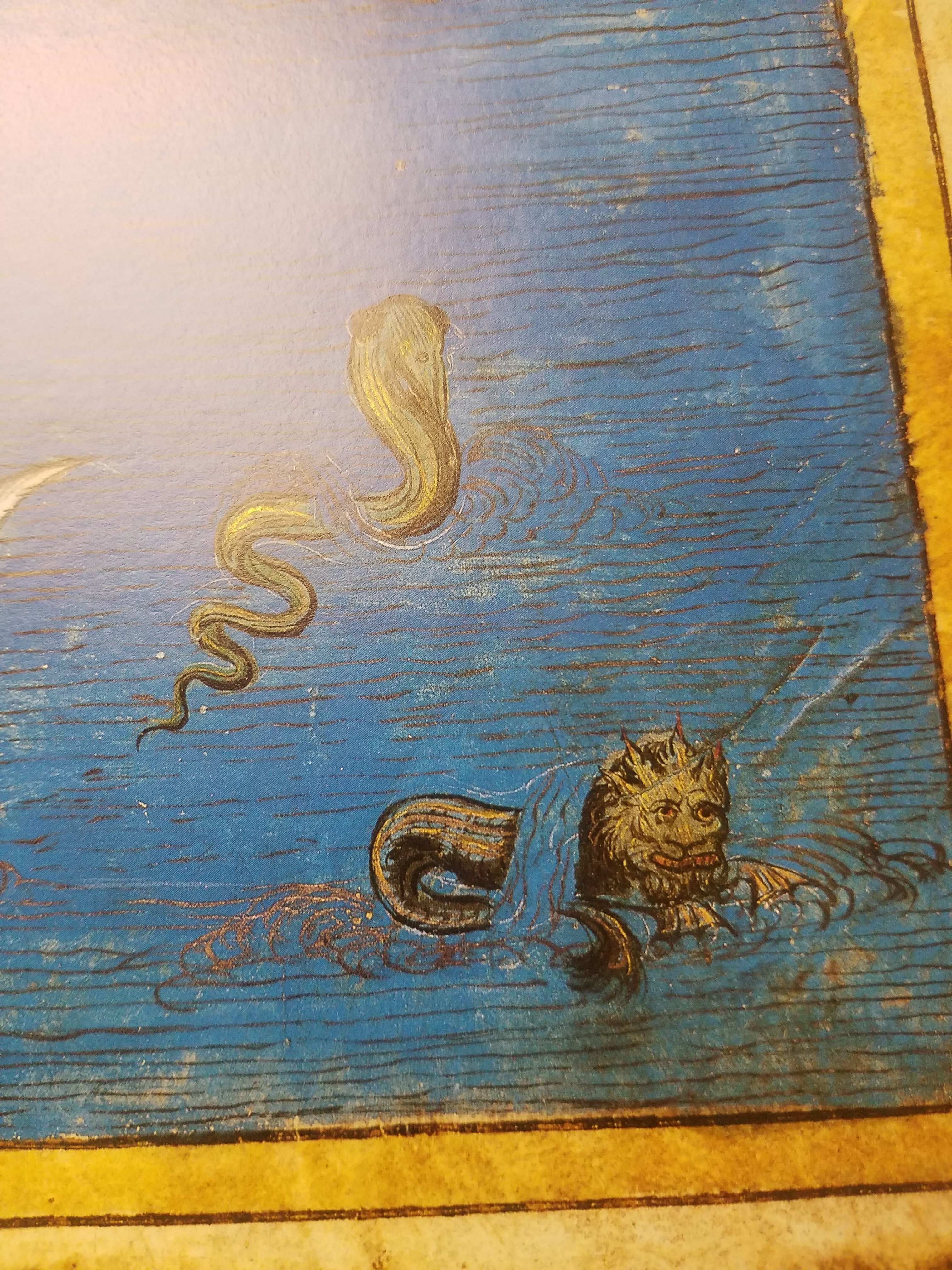
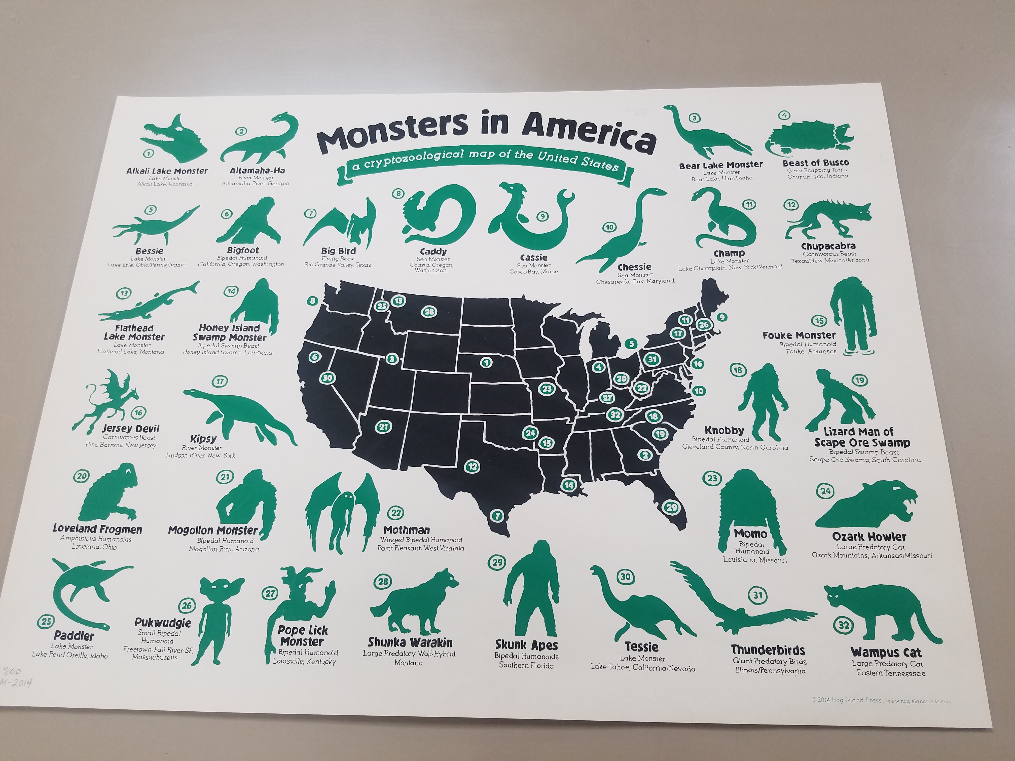
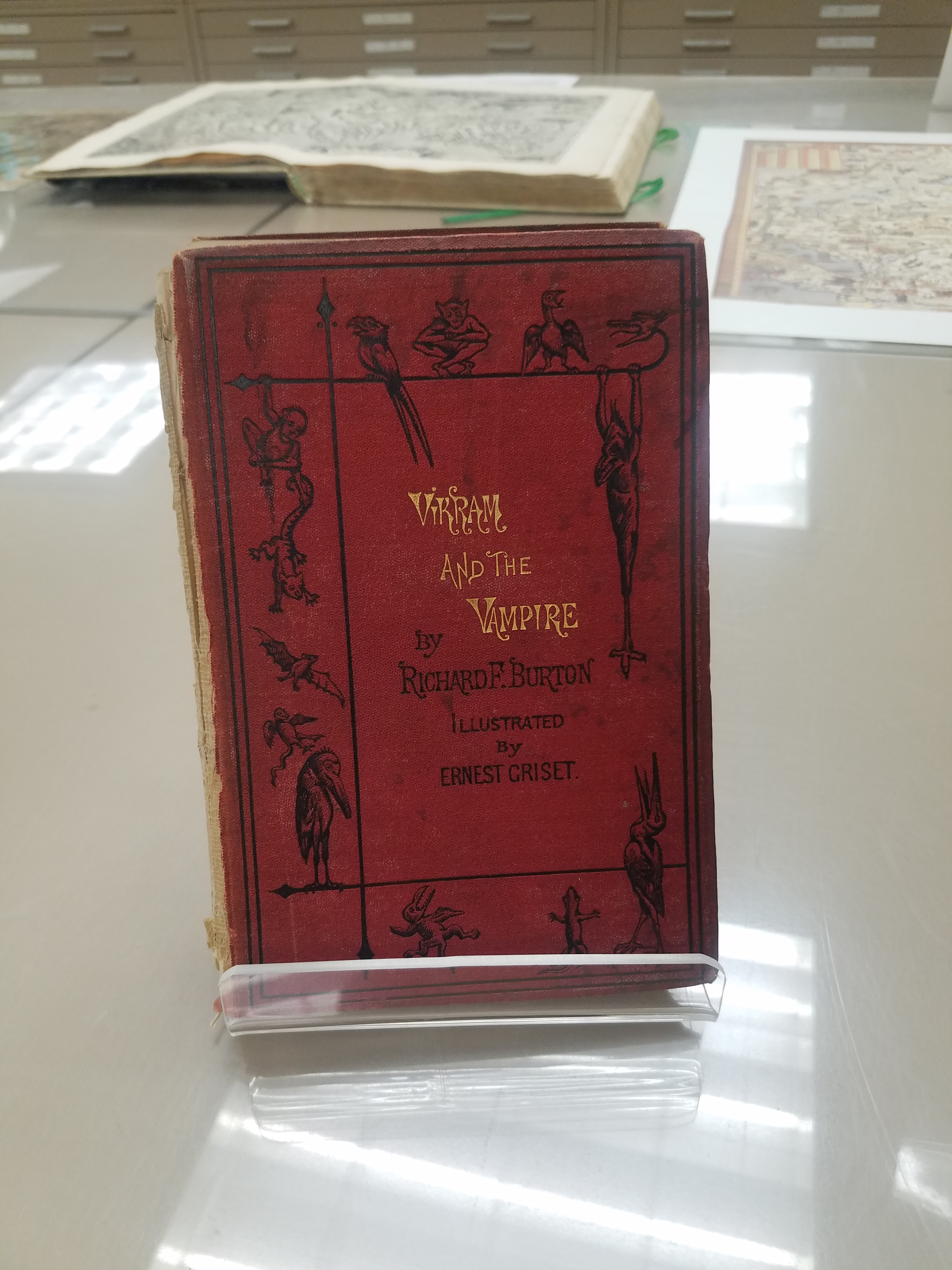
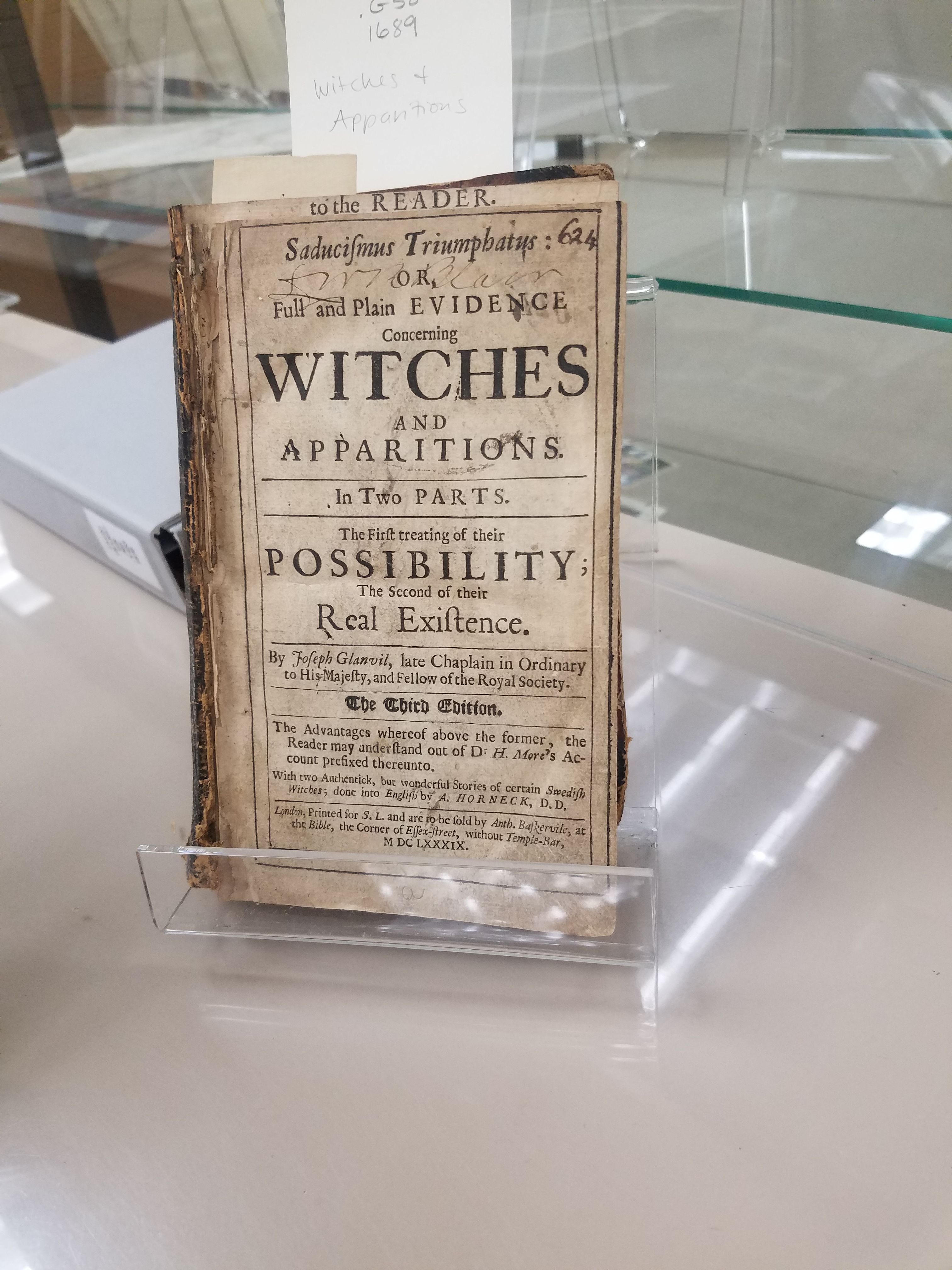
Happy Halloween! This month, the AGSL, UWM Archives, and Special Collections collaborated on another Pop-Up Exhibit! The official exhibit ran from October 23rd-25th and included specially curated pieces such as wood engravings of Mary Shelley’s Frankenstein by Barry Moser and many more spooky, scary artifacts! Well, you may have missed the full Pop-up Exhibit but don’t despair! There’s still time to see the hair-raising picks put out by the AGSL for the pop-up– our exhibition materials will stay on display until after Halloween! Peruse our collection; you may find sea monsters, witches, and haunted cemeteries– and if that doesn’t scare you, stay tuned for next week’s post which will feature some of the most spine-chilling, blood-curdling maps from this month’s Pop-Up!
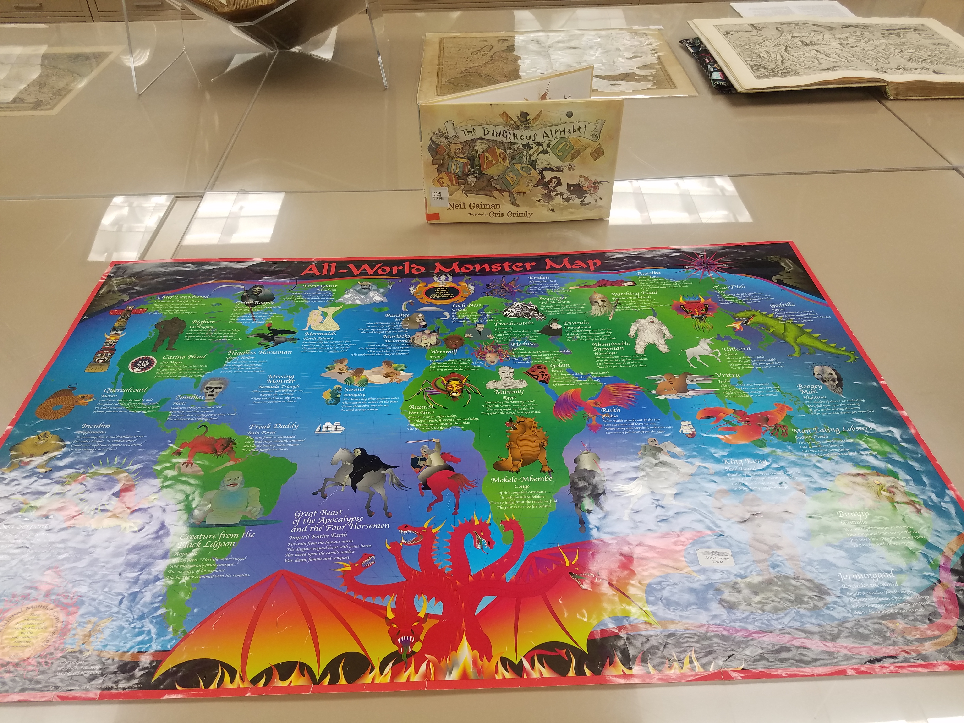
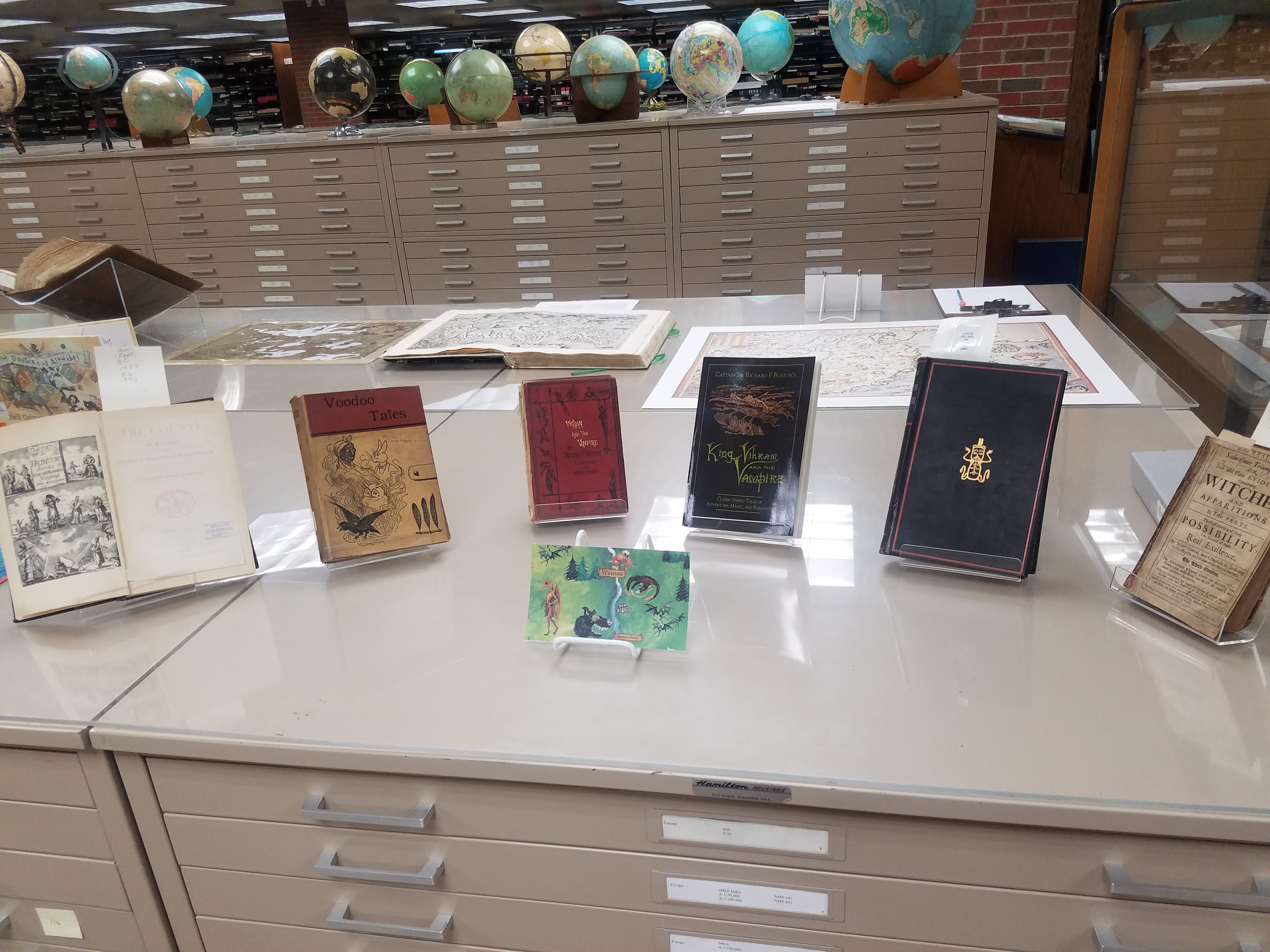
The AGSL is open to the public Monday through Friday, 8 a.m. to 4:30 p.m. Come see us and the Halloween Pop-up Exhibit while you still can!
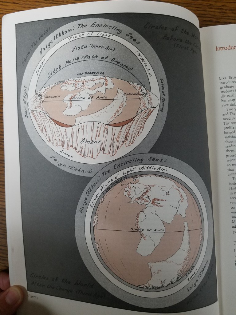
Mapping Fantasy Land: Karen Wynn Fonstad
By Lauren Maddox
J.R.R. Tolkien’s stories pushed fantasy into the mainstream and have passed through the hands of generations of eager fantasy readers. The genre was forever different after The Lord of the Rings— and people still love Tolkein’s works!
Part of the allure of fantasy for many readers is the chance to escape to another, fully-formed world. This is one of the reasons that speculative fiction has become such a thriving genre and why games like Dungeons and Dragons are now more popular than ever– not just because of Stranger Things.
But when you construct an immersive world that people want to become a part of, you have to answer a lot of practical questions about the layout of your world. You are tasked with mapping a place that doesn’t physically exist.
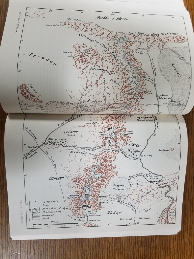
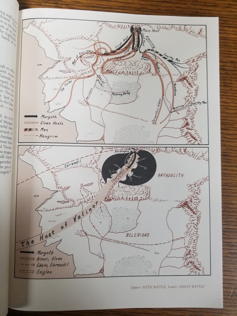
Worry not, fantasy fan! It’s not an impossible job to map fantasy land– and it was job beautifully done by one of the University of Wisconsin’s own: Karen Wynn Fonstad.
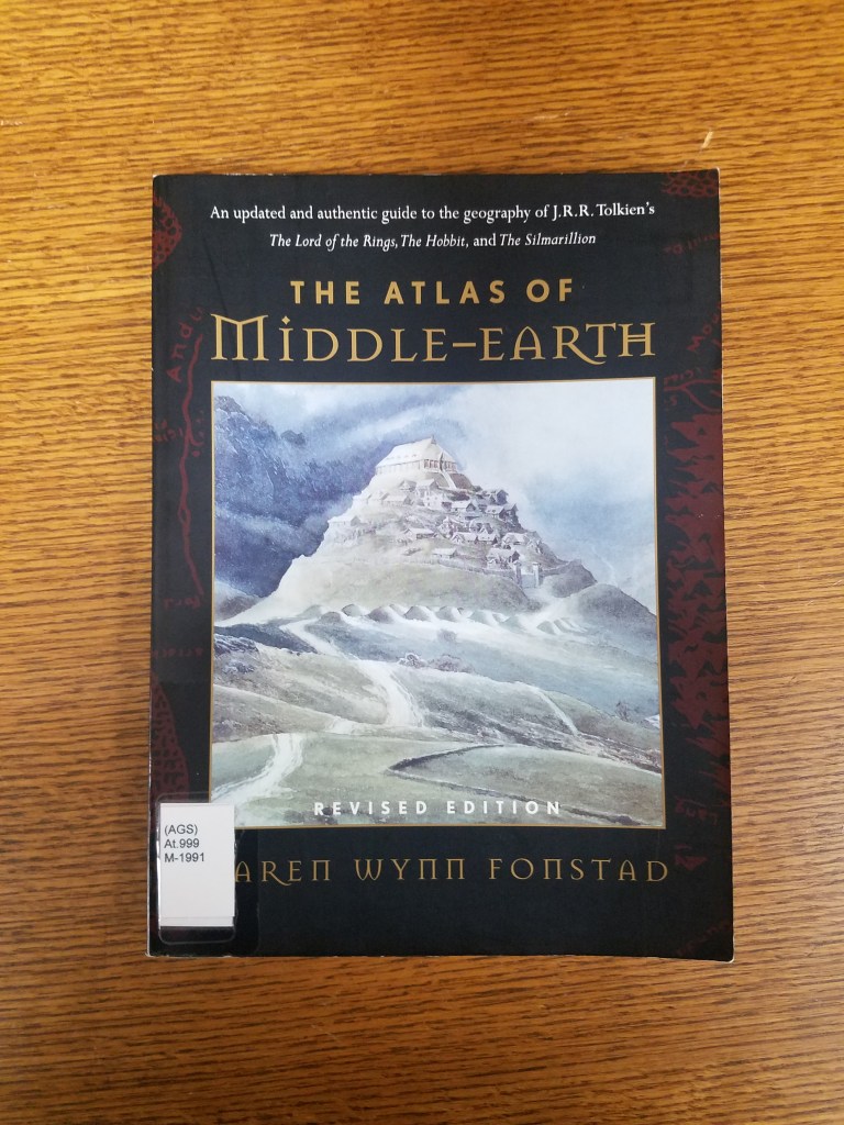
Fonstad received her MA in Geography with a specialization in Cartography from the University of Oklahoma. She went on to become the Director of Cartographic Services at UW-Oshkosh and was heavily involved with Oshkosh’s city planning. In 1970, she stepped down from her position as Director in order to raise her two children. But during this time she worked on several exciting fantasy atlases: The Atlas of Middle Earth, The Atlas of Pern, The Atlas of the Land, The Atlas of the Forgotten Realms, and The Atlas of the Dragonlance World. Fans might recognize some of those names from Tolkien, D&D, Anne McCaffrey’s science fiction and others. Fonstad’s work meant a lot to fans of those worlds, who felt like the atlases were a way to connect to the worlds they loved so much.
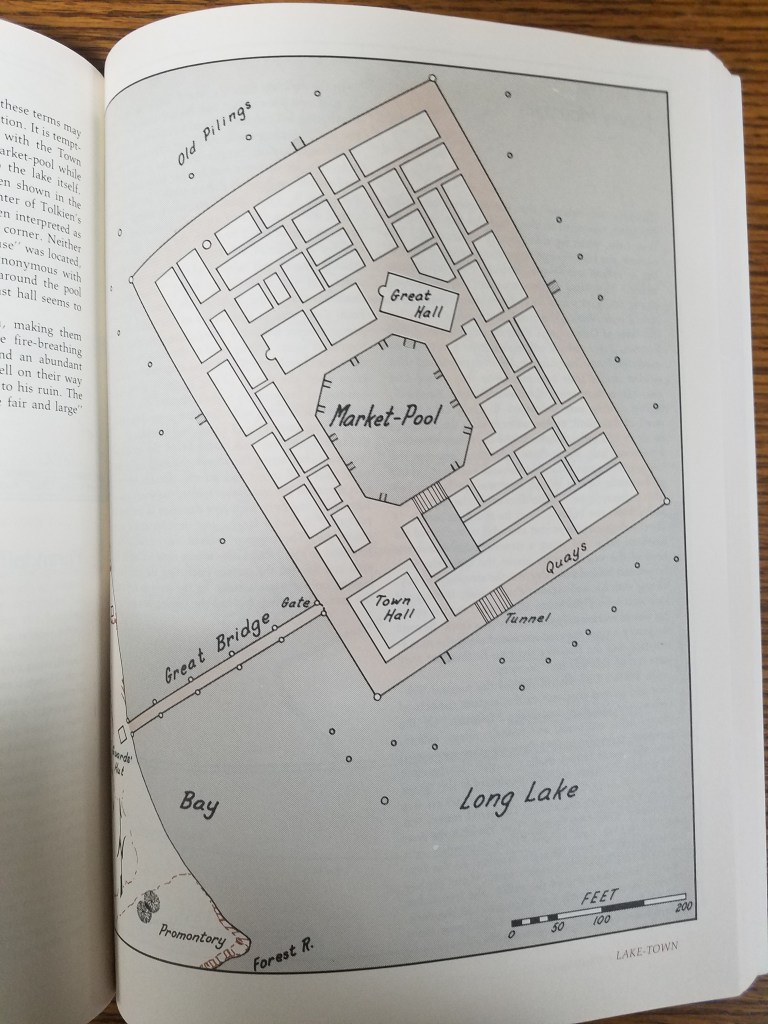
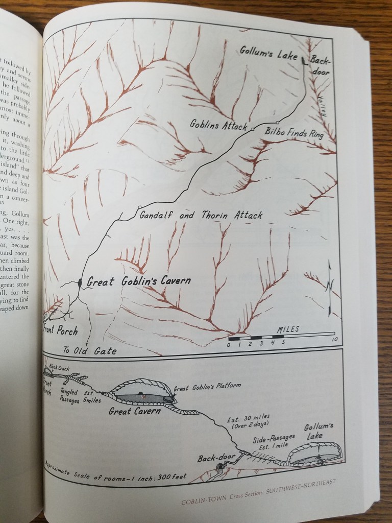
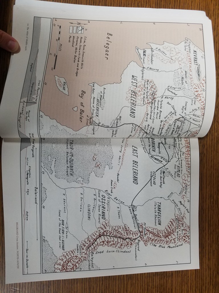
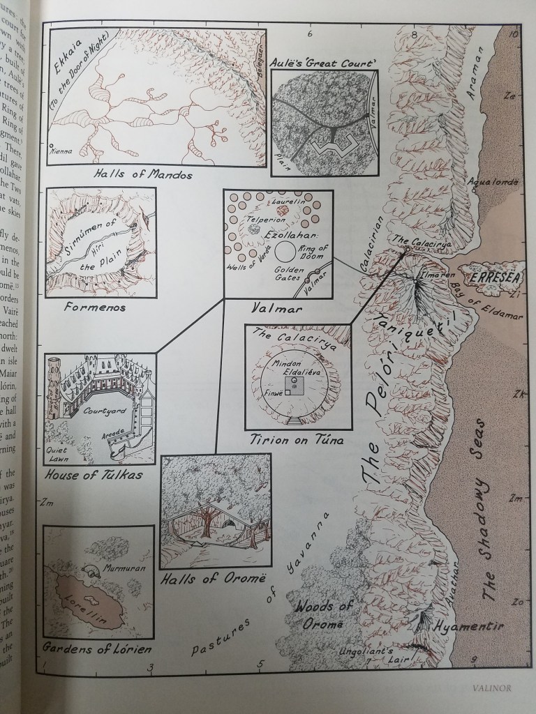
Fonstad passed away in 2005, but her work continues on in the hearts of those who were touched by her dedication to mapping fantasy lands. In the AGSL there are multiple atlases by Fonstad including her revised Atlas of Middle Earth, from which selections throughout this post were taken.
In Case You Missed Us: The National Hispanic Heritage Month Pop-Up Exhibit
By Lauren Maddox
Last month, I wrote about our then-upcoming Pop-Up Exhibit in celebration of National Hispanic Heritage Month. The exhibit was a collaborative project in conjunction with the UWM Archives to showcase some of our collections and honor this very special month. As we move into October, we will be putting up another exciting exhibit (stay tuned for more on that later!), but in case you missed this pop-up, here are some of the digital versions of pieces we featured in the exhibit:
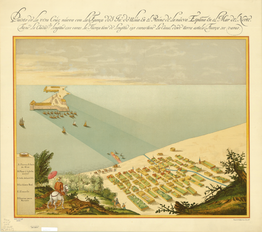
Map of San Juan Ulua Island in 1628. 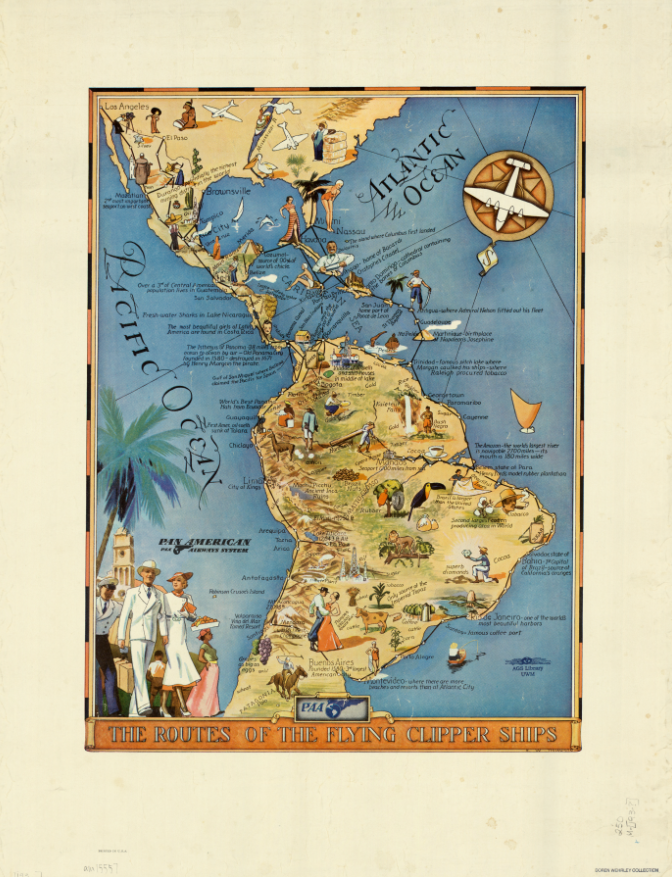
“The Routes of the Flying Clipper Ships,” 1930s. Click the links to see these maps in our Digital Collections! 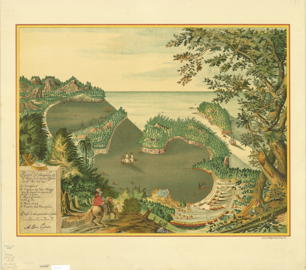
Map of San Juan Ulua Island in 1628. 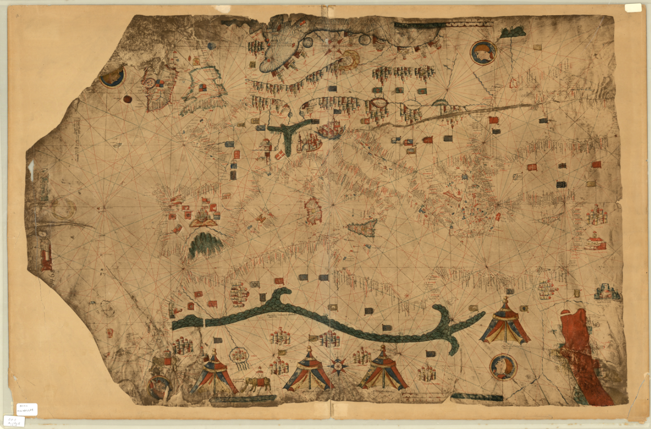
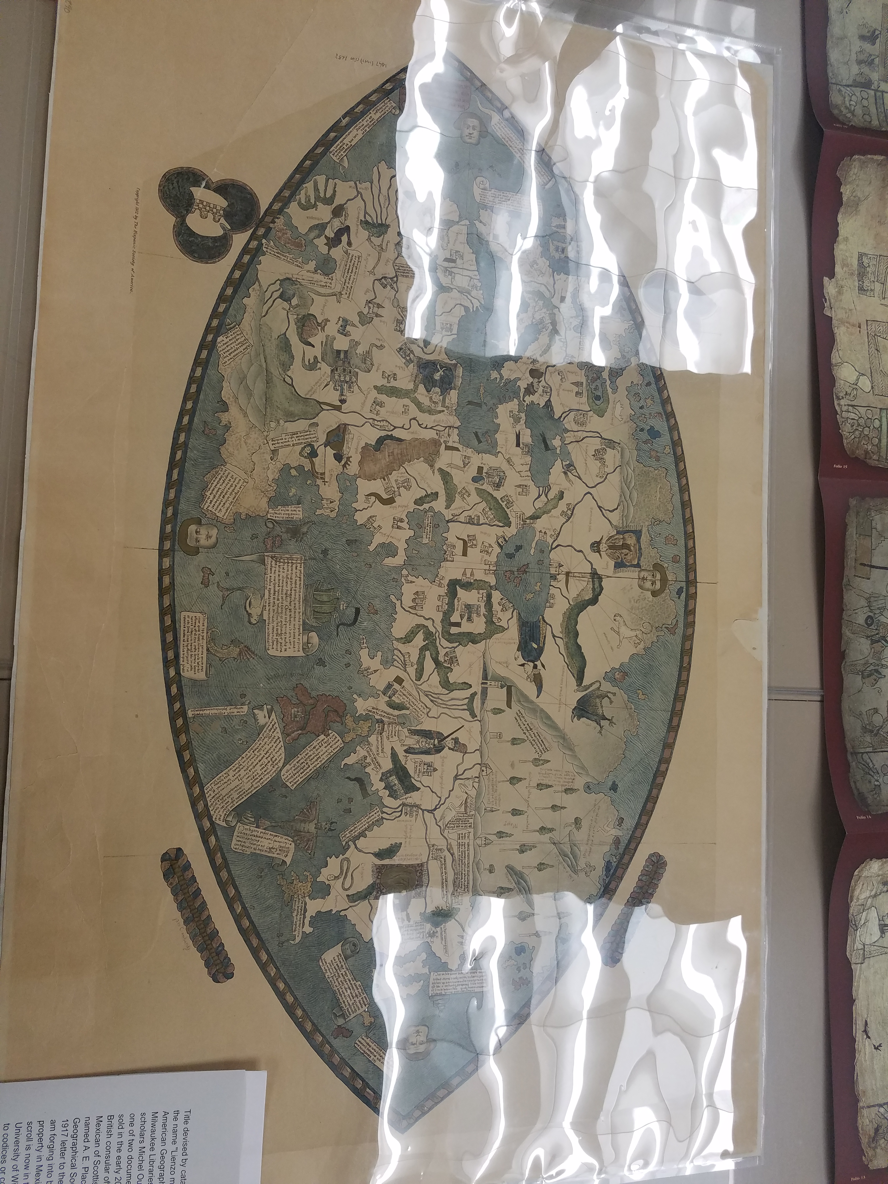
Fascimile of 1468 World Map, previously owned by the Hispanic Society of America.
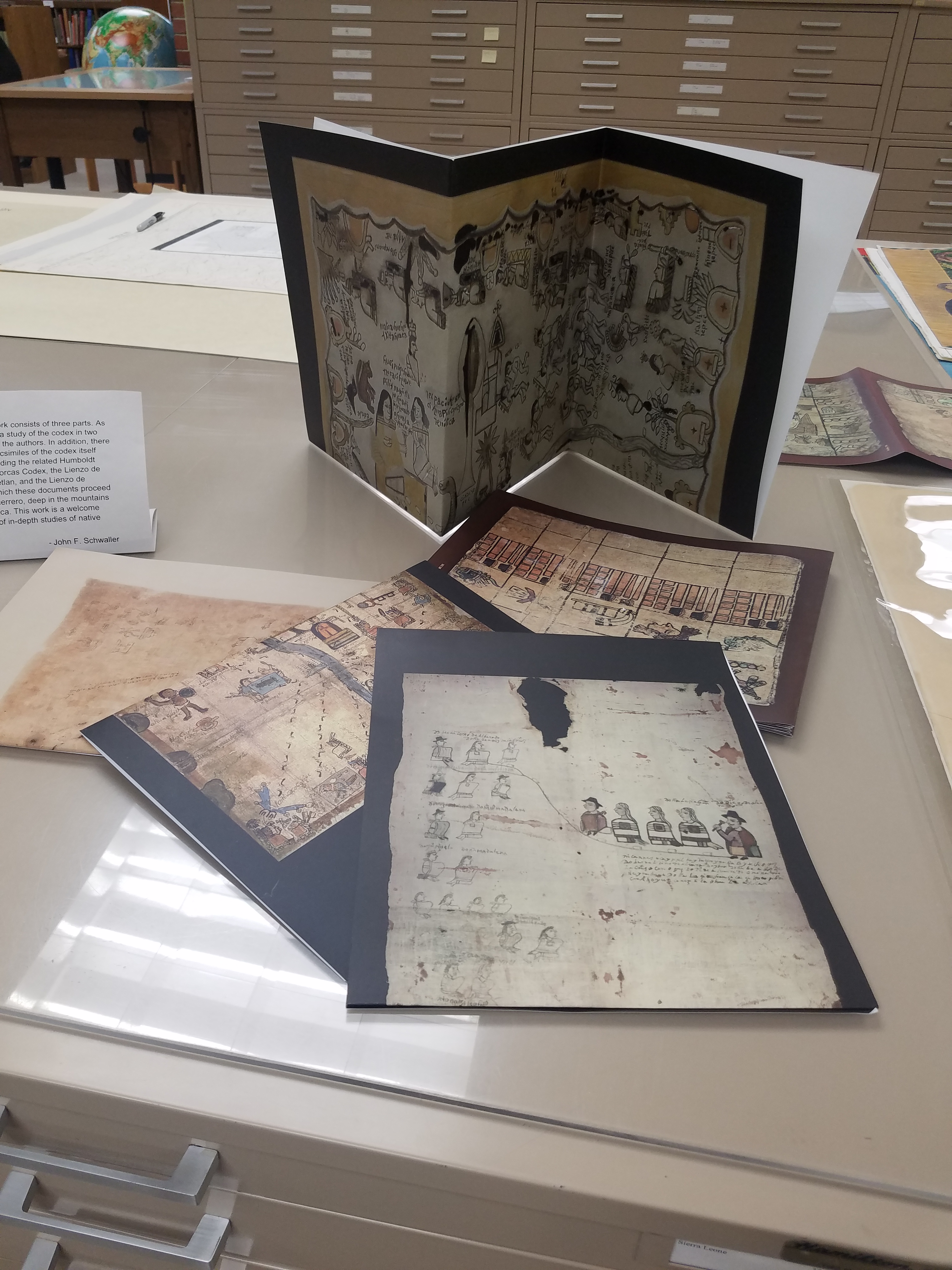
And some photos of the exhibit live and in-person:
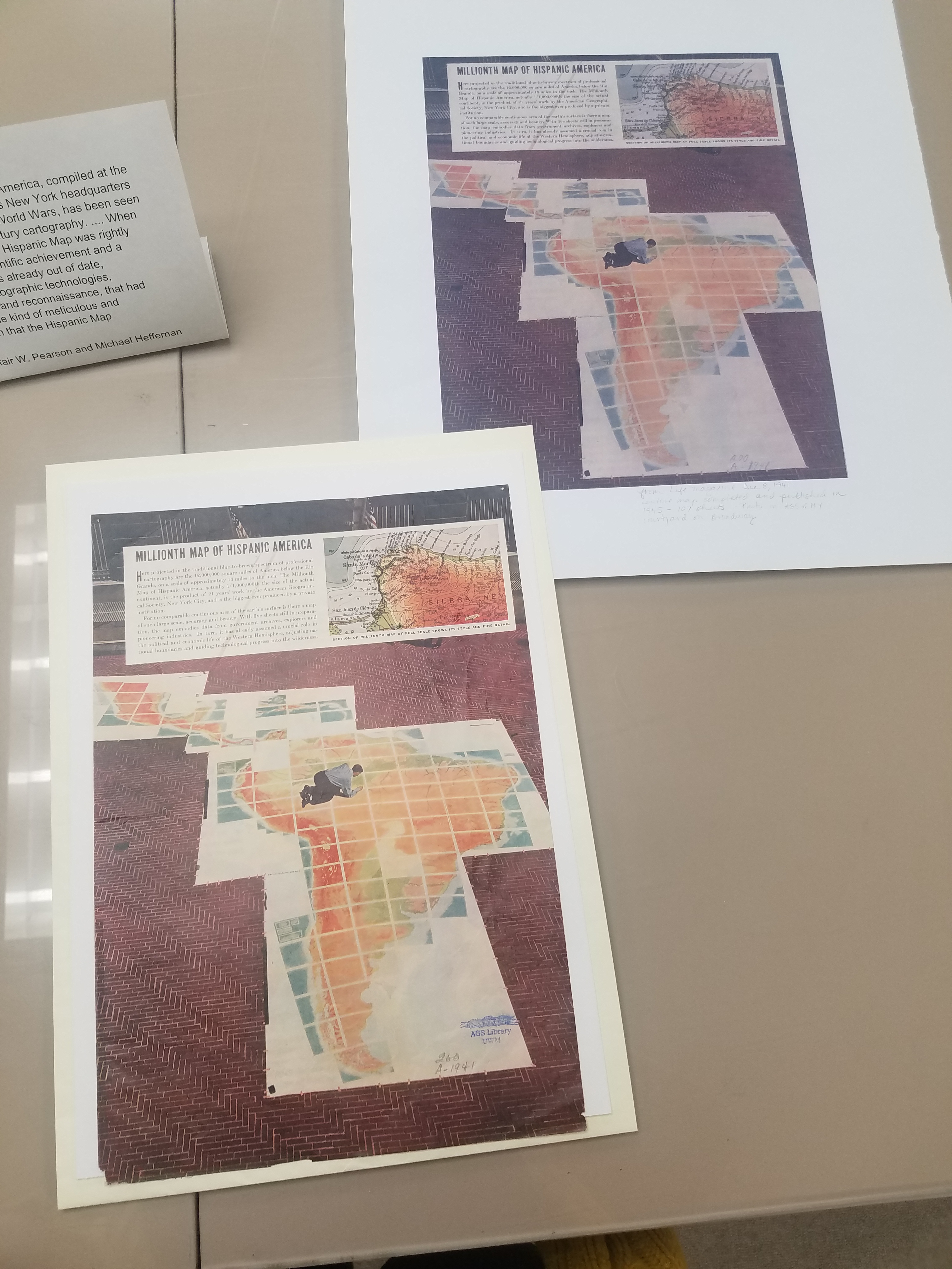
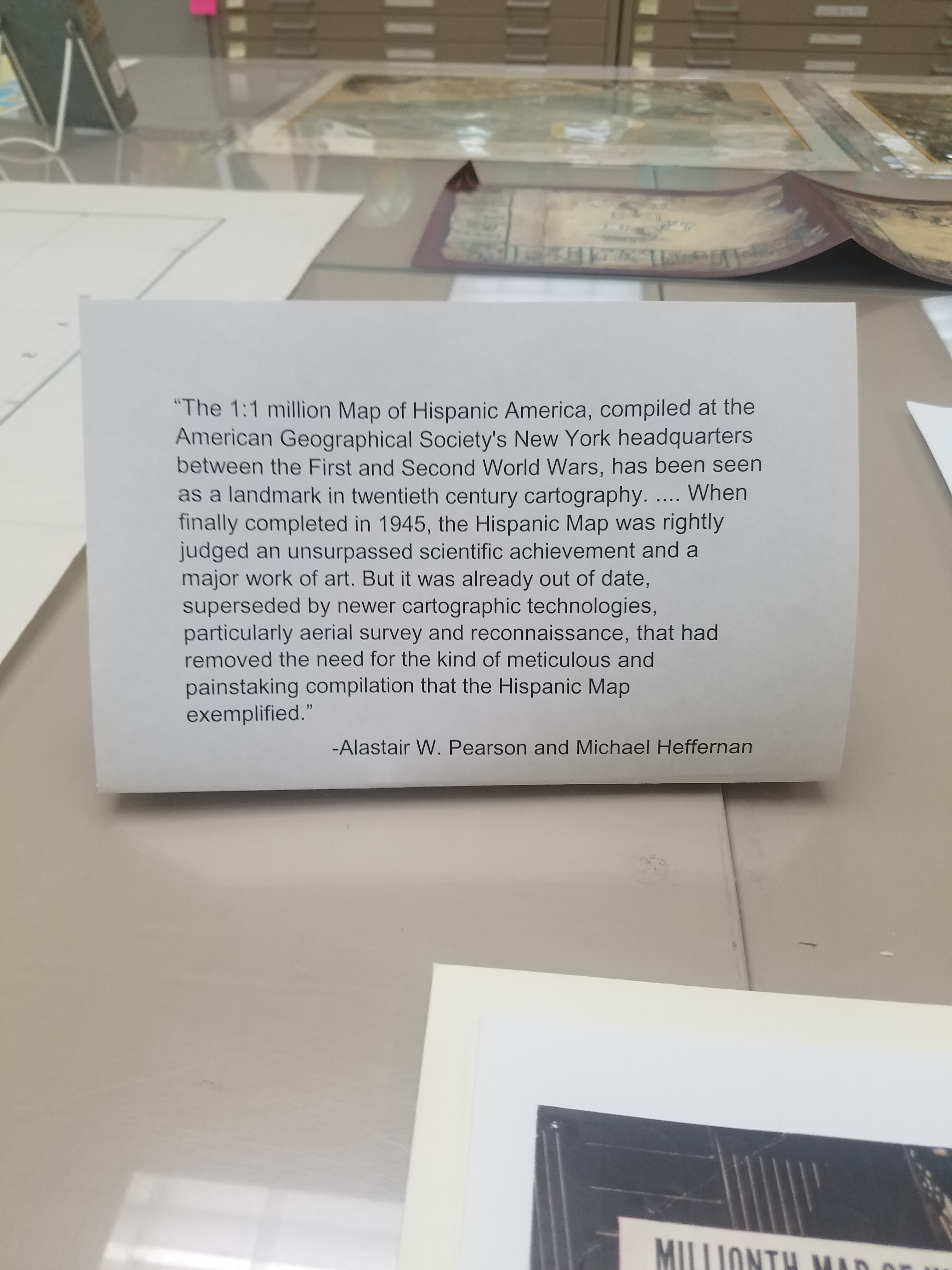
Stay tuned for more updates about future exhibits!
Fair and Square: A Short History of World’s Fairs
By Lauren Maddox
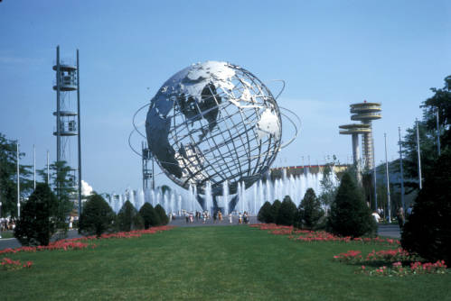
Unisphere Sculpture from 1964 New York World’s Fair, Taken by Harold Mayer. Click the link to see this photo in our Digital Collections!
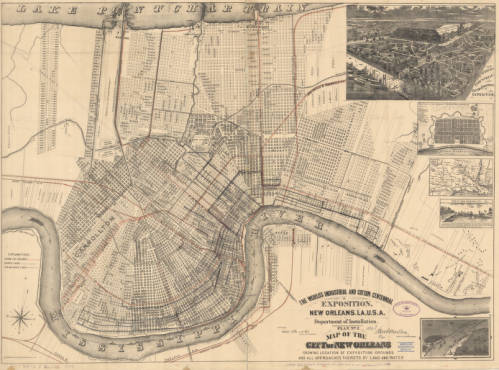
1884 Map of New Orleans’ Exposition Grounds. Click the link to see this map in our Digital Collections!
In 1984, Louisiana hosted a World’s Fair celebrating “The World of Rivers.” It was the last World’s Fair in the U.S. And it was the most financially disastrous fair in the history of World’s Fairs. To be fair, the point of hosting World’s Fairs and Expositions was never to make money– most host countries had to shell out exorbitant amounts of money to finance their fairs. But the point of the World’s Fair was never to make money; instead, these fairs were celebrations of progress and a chance to impress the international community. Host countries never expect to make a profit off of the Fair, but the 1984 Fair was particularly draining– it was the only Fair to ever go bankrupt.
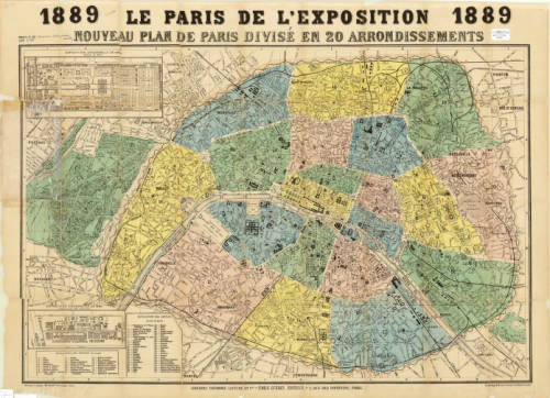
Map of Paris for the 1889 Exposition. Click the link to see this map in our Digital Collections!
But before the 1984 fair, the U.S. had a rich history as a member of the International Bureau of Exhibitions– they’ve hosted 30 World’s Fairs since their first in 1829. And before that?
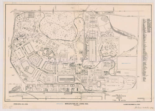
Ground Plan of Louisiana Purchase Exposition, 1904. Click the link to see this map in our Digital Collections!
The tradition of the World’s Fair is based heavily on French national expositions– but the first was actually hosted in Prague in 1791. This exposition was before World’s Fairs were standardized and regulated by the Bureau of International Expositions. These early expositions had their roots in Medieval festivals, and quickly became a way for post-revolution France to unite their new republic. The industry-focused expos continued under Napoleon but still focused on French products.
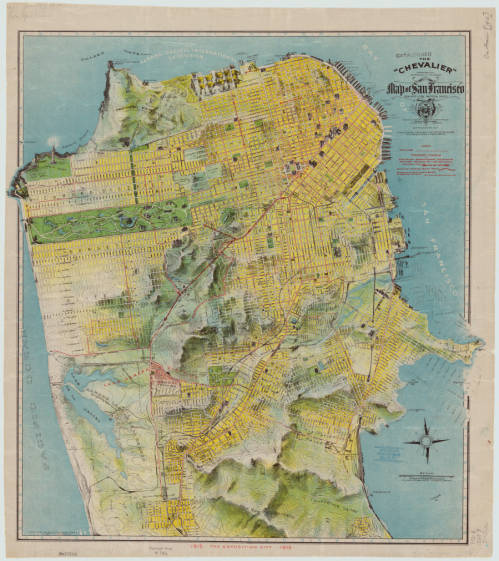
1912 Chevalier Map of San Francisco featuring the Panama-Pacific International Exposition grounds. Click the link to see this map in our Digital Collections!
The exposition most commonly cited as the first international affair is London’s Great Exposition in 1851. This World’s Fair was iconic– its great Crystal Palace became the symbol of World’s Fairs for years to come and continues to be one of the most quintessential Victorian structures.
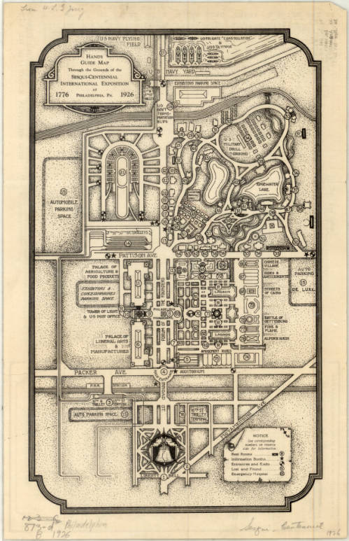
Complimentary Map of the Sesqui-Centennial International Exposition at Philadelphia, PA, 1926. Click the link to see this map in our Digital Collections! 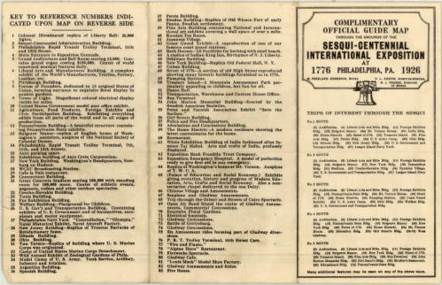
Points of Interest at the Sesqui-Centennial International Exposition at Philadelphia. Click the link to see this map in our Digital Collections!
In 1928, the Bureau of International Expositions (Bureau international des expositions) was established in order to oversee and approve of expo arrangements internationally and to set standards for expositions across nations. 170 countries are currently members of the BIE– including the United States. The BIE has remained in charge of international expositions ever since.
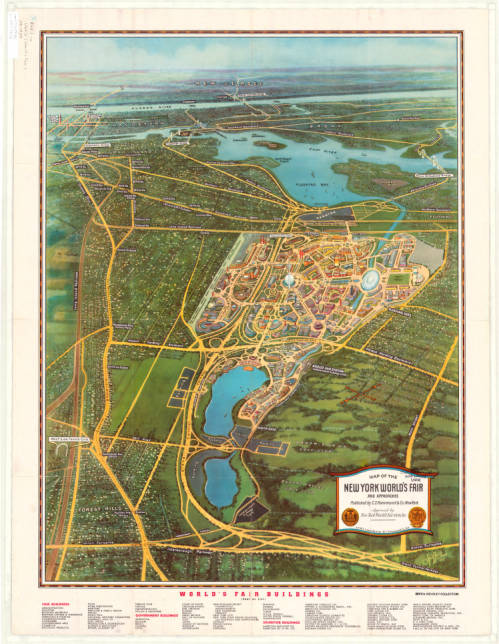
Map of the New York World’s Fair with Map of Greater New York’s Transit, 1939. Click the link to see this map in our Digital Collections! 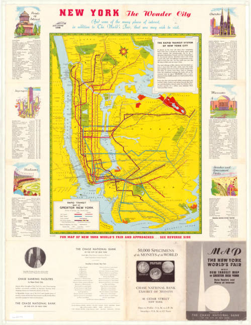
Map of New York Transit System with Points of Interest in the City, 1939. Click the link to see this map in our Digital Collections!
The nature of World’s Fairs have changed drastically since their Medieval beginnings– these fairs began as a way to unite communities, national and international, and then became an opportunity for countries to showcase their industrial prowess and establish themselves on the global stage.
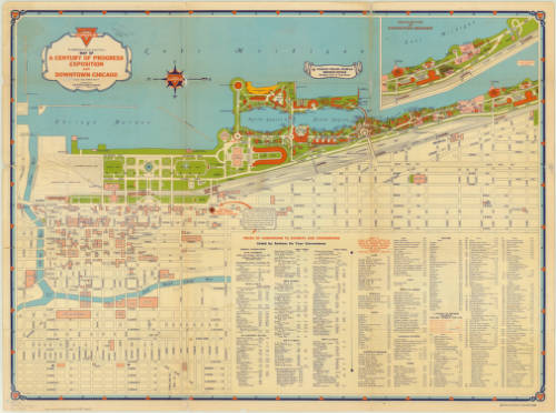
Map of Chicago’s 1933 World’s Fair. Click the link to see this map in our Digital Collections! 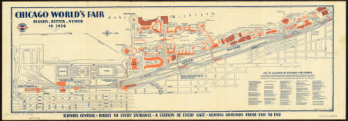
Map of Chicago’s 1934 World’s Fair. Click the link to see this map in our Digital Collections!
The 1984 exposition signaled the end of an era for World’s Fairs. It wasn’t just the last Fair to be hosted on American soil– it was also one of the first environmentally focused specialized expos. No longer are World’s Fairs an opportunity to flex wealth and status; instead, new expos are interested in environmentalism, building a sustainable future, and the building of a more united global community.
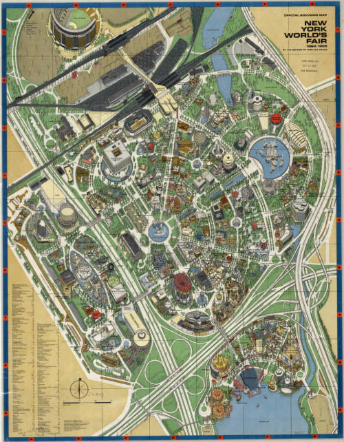
Map of New York’s 1964 World’s Fair. Click the link to see this map in our Digital Collections!
The United States withdrew membership from the BIE in 2002, but in 2017 rejoined. And maybe, in the near future, we can expect another Fair, as part of America’s long legacy of World’s Fairs, looking forward into a bright future.
Hispanic Heritage Month: A Special Pop-Up Exhibit
By Lauren Maddox
This past Sunday marked the beginning of National Hispanic Heritage Month. This month is a celebration of Hispanic Americans who, according to the National Hispanic Heritage Month website, “have positively influenced and enriched our nation and society.” The tradition of a National Hispanic Heritage Month began in 1968, when Representative Edward R. Roybal sponsored legislation that would establish a National Hispanic Heritage Week. The holiday week was signed into effect under Lyndon B. Johnson and then expanded to a month-long period during Reagan’s presidency in 1988. The original start date, September 15th, was chosen to celebrate the official independence days of Costa Rica, El Salvador, Guatemala, Honduras, and Nicaragua declared in 1821. The original week also encompassed Mexico, Belize, and Chile’s independence days. Now the month-long observance, celebrated from September 15th-October 15th, includes all of these days as well as Dia de la Raza.
In honor of National Hispanic Heritage Month, many organizations including the Library of Congress, the National Gallery of Art, the Smithsonian, and the National Park Service are hosting events throughout September and October. Throughout the month, there will be a Community Day, a Hispanic Heritage Month Concert with Inca Son, a book talk with Haitian-American writer Edwidge Danticat, and a Wikipedia Edit-a-thon and more. And in addition to the live events, many digital archive collections are being made public this month– the National Hispanic Heritage Month website includes a list of all related exhibits and collections here. Some highlights from this list: the Library of Congress’s Archive of Hispanic Literature on Tape, Documents of 20th Century Latin American and Latino Art supported and hosted by the National Endowment for the Humanities, and many, many others.
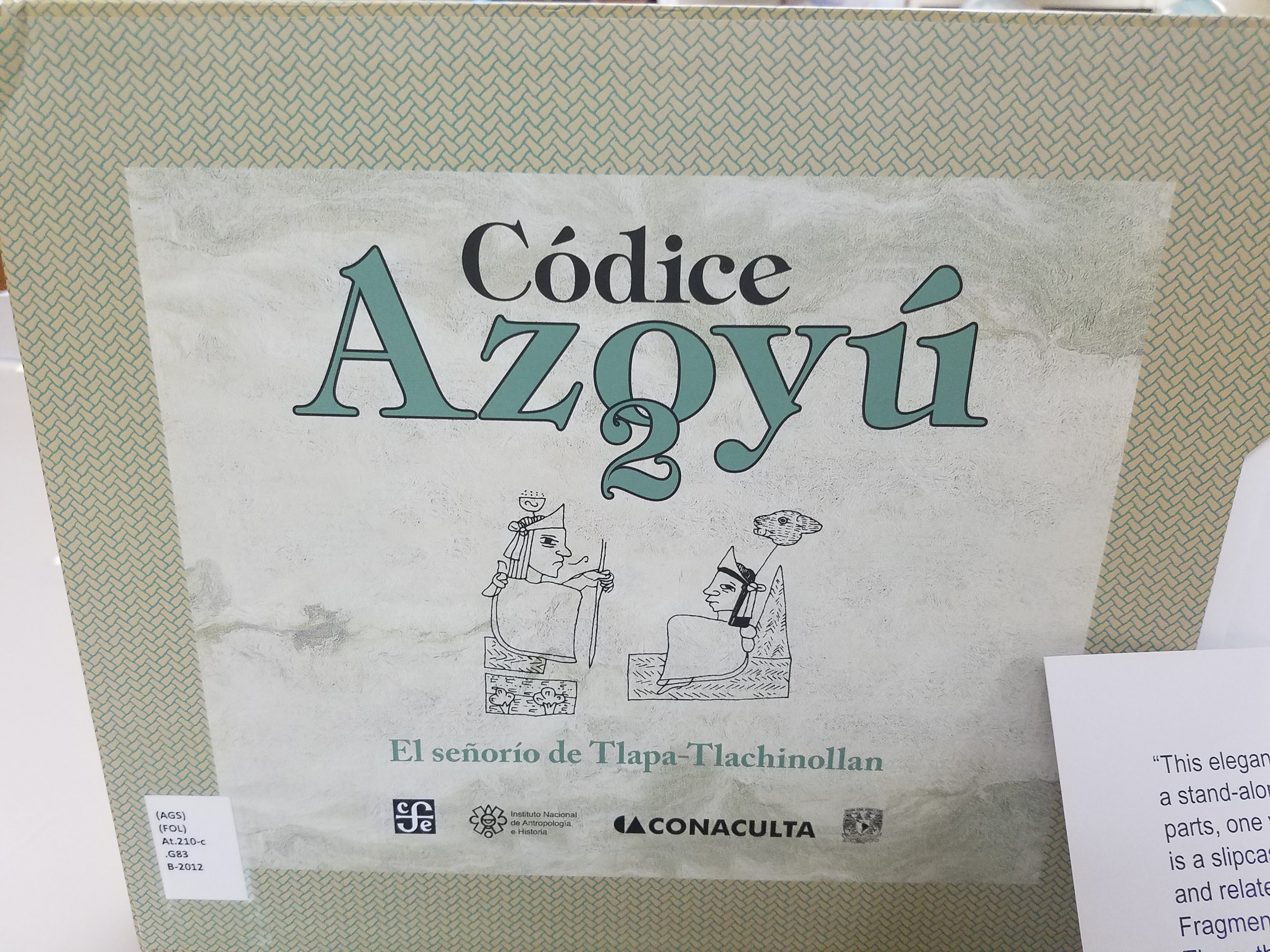
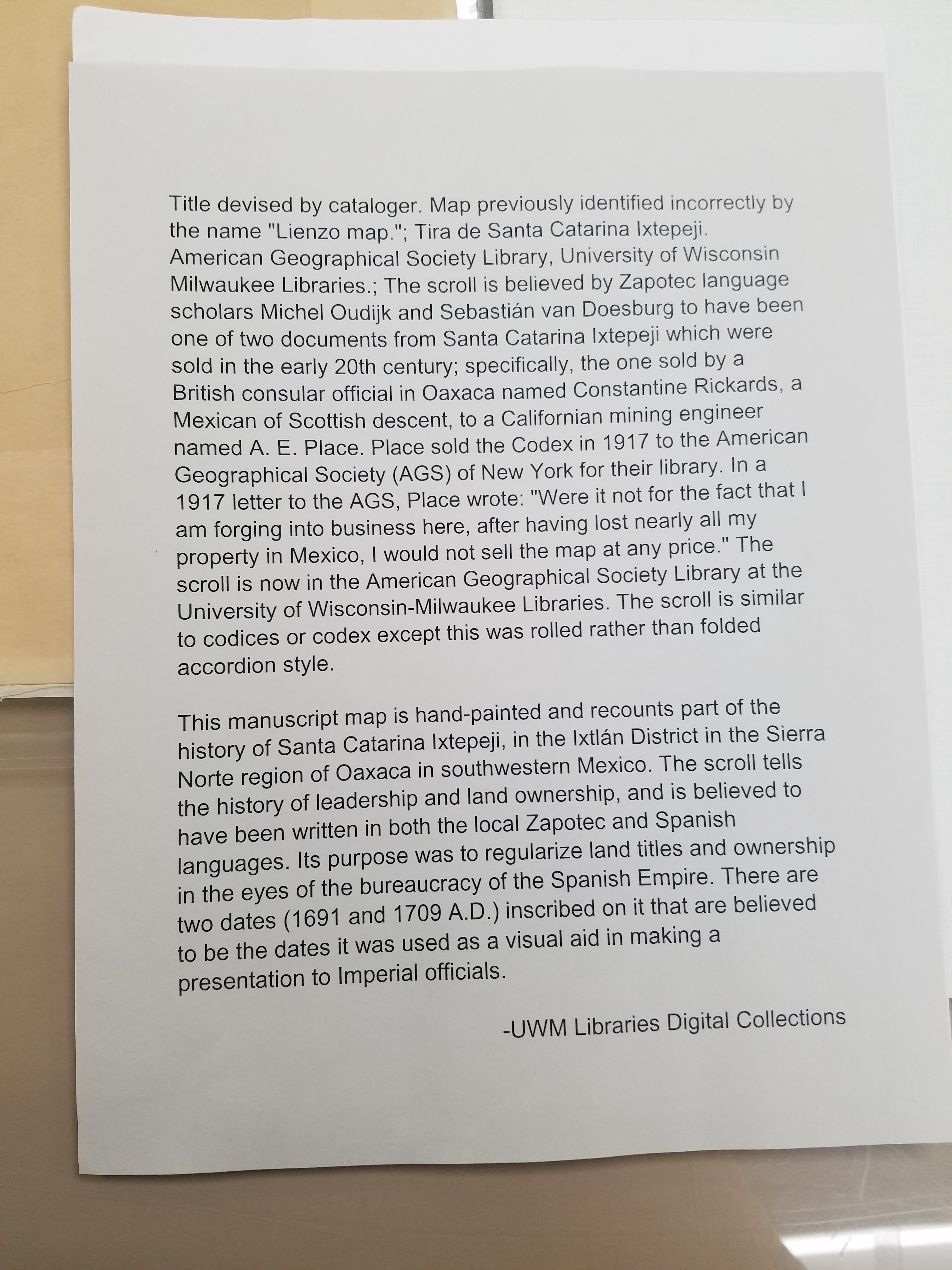
But these aren’t the only ways to celebrate National Hispanic Heritage Month! This week from September 25-27th, the AGSL and UWM Archives are collaborating on a pop-up exhibit featuring curated pieces from both libraries’ collections. The exhibit will span both of our libraries: materials from the Archives will be on display on the second floor and maps from our collections will be exhibited in the AGSL. We are especially excited to showcase the Tira de Santa Catarina Ixtepeji scroll. Please, come celebrate this historic month with us! And enjoy a preview of some of the maps included in the exhibit:
Map of San Juan Ulua Island in 1628. Fascimile of 1468 World Map, previously owned by the Hispanic Society of America. Map of Acapulco in 1628. “The Routes of the Flying Clipper Ships,” 1930s. Click the links to see these maps in our Digital Collections!
The AGSL is open from 8:30-4:30 Monday-Friday! We will also be participating in Milwaukee Open Doors this weekend on September 28th from 10-5! Please stop by and see us!
The New Northwest Passage: Tourism through the Arctic
By Lauren Maddox
At the beginning of the summer, I did a series of posts discussing some of the AGSL’s connections to Arctic exploration and the famous explorers of that age (or, more accurately, the scandalous love lives of those explorers). But the Northwest Passage is still a part of the public’s romantic imagination– it’s a largely untraversable and unexplored wild full of cold beauty. And the fact that a Northwest Passage has been a geographical mystery for so many generations of Western explorers doesn’t hurt. As shrinking sea ice opens new routes through the storied Northwest Passage, more and more ships are passing through. Shipping freights are taking advantage of the new possible alternative to the Panama Canal for pan-oceanic travel– but in 2016, the first cruise ship passed through the Northwest Passage on a 28-day cruise through the Arctic.
The Northwest Passage has been the subject of years of conjecture and speculation for European travelers–there is even some evidence that Vikings traveled to the Arctic and traded with indigenous peoples before the Little Ice Age. Early attempts to discover a true Northwest Passage were spearheaded the English; Henry VII sent John Cabot on a search for a direct route to Asia that could be used for more open trading in 1497. Several later explorers followed suit: Estaban Gomez in 1524, Martin Frobisher in 1576, Humphrey Gilbert in 1583, and on and on into the next two centuries.
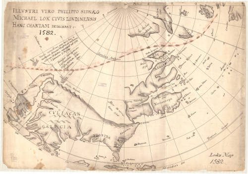
Explorers were also interested in finding alternative entry routes into the Passage– if they couldn’t traverse the Northwest Passage in its entirety, then maybe they could find another way onto the path. In 1539, Francisco De Ulloa embarked on an expedition to sail around the Baja California Peninsula– you might remember this from my July post about the island of California. Besides confirming the fact that California is indeed an island (just kidding), Ulloa also believed that the strait between California and the mainland would lead to an accessible Northwest Passage.
1776 Illustrative Map of the a proposed Northwest Passage through the Hudson Bay. Click the link to see this map in our digital collections! 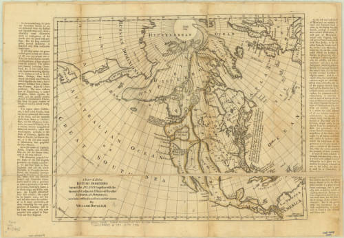
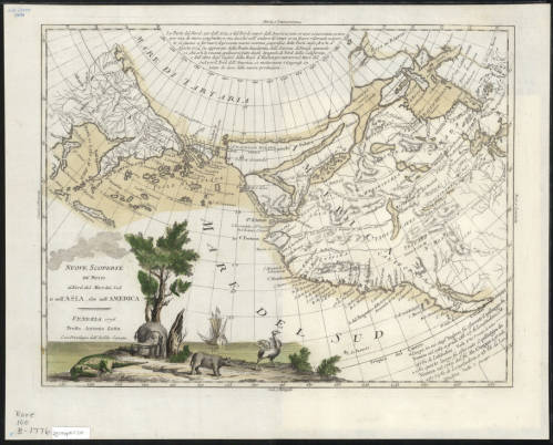
1770 Map of the Arctic, including a possible Northwest Passage. Click the link to see this map in our digital collections!
Many of these expeditions ended in tragedy– the truth was, at the time, there was no reliable pathway through the ice for ships to take. Routes that might be clear in one season would be completely frozen in another. Ships would often become stuck in the ice and forced to winter over where they were or abandon ship. In the 19th century, another rush of Arctic exploration swept Europe and the United States. In an earlier post, I go into some detail about the lost Franklin expedition and the scramble to discover their fate. This was one tragic ending of many expeditions– even Elisha Kent Kane’s rescue expedition in search of Franklin ended in a narrow escape from the deadly winter after which Kane’s health never recovered. Many thought that a purely ship-based expedition would never be possible; John Rae, the man who discovered the true fate of Franklin and his men, made many overland expeditions exploring the continent by using techniques already honed by native peoples who had managed to live there since, well, before the Vikings came to trade with them.
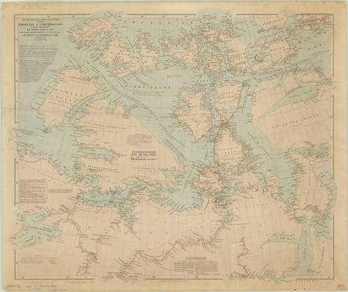
1860 Map of the Arctic Region. Click the link to see this map in our digital collection!
The Northwest Passage would prove impenetrable by ship until 1906, when Roald Amundsen and his six-person crew made a three-year journey through the icy waters in a tiny herring boat. His route through the Rae Strait was full of fairly young ice that was navigable and breakable, but the waters were shallow and only a small boat like the Gjøa could have made the trip.
As time passed and our climate has changed, the sea ice that prevented so many travelers from passing through the Northwest Passage has been shrinking. The Earth’s poles are more susceptible to the effects of climate change, and so the Arctic is warming at a faster rate than the rest of the world. The sea ice normally freezes and melts throughout the year, but the maximum coverage of the ice in winter has been shrinking at an alarming rate. This has some pretty huge implications for the state of our world, but has also led to an uptick in arctic tourism.
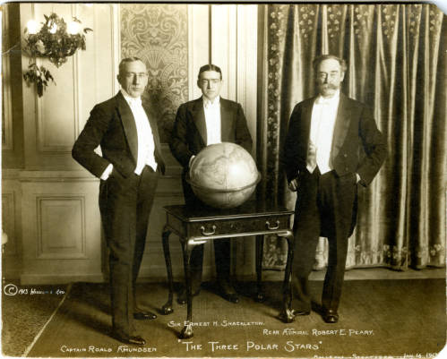
“The Three Polar Stars”: Photo of Amundsen, Shackleton, and Peary. Click the link to see this photo in our digital collection! 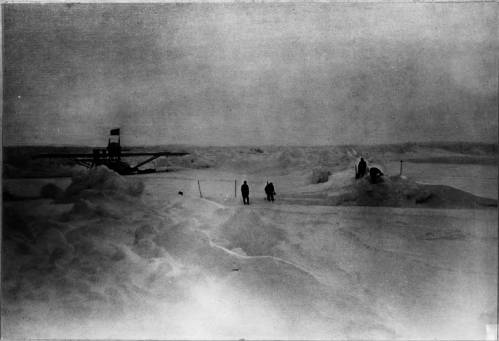
Amundsen’s 1925 Expedition with Ellsworth. Click the link to see this photo in our digital collections!
Because of the melting sea ice, larger boats can pass through the Northwest Passage. During the most recent Arthur Holzeimer Lecture at the AGSL, speaker Lauren Beck commented that, for the first time in history, the Northwest Passage of European imagination has become reality. Only because of the quickly degrading sea ice is the Northwest Passage actually a traversable ship passage.
Amundsen’s successful trip through the Northwest Passage did not turn it into an icy thoroughfare– the ice was still too much of a problem for large cargo ships and the water often dangerously shallow. In 2012, two astonishing events happened: arctic sea ice hit record lows, and ship passage through the Northwest Passage hit record highs. The Panama-Canal was still the better, more consistent choice for trans-ocean shipments, but the new open waterways inspired a different kind of ship-traffic.
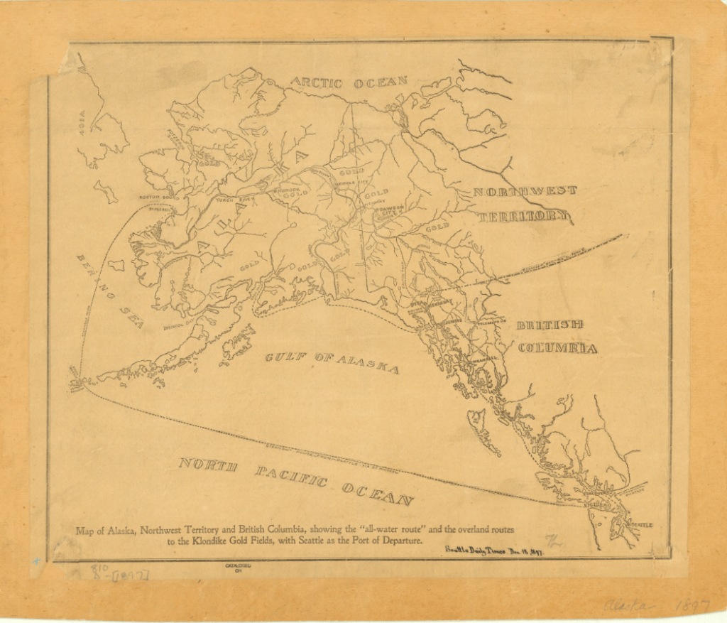
1897 Map of Alaska, Northwest Territory and British Columbia. Click the link to see this in our digital collections!
In 2016, the Crystal Serenity made an unprecedented voyage through the Northwest Passage; though not the first, it was the largest cruise ship to ever pass through the Northwest Passage. The cruise ship had to be escorted by a Polar-Grade ship that could break the ice for the cruise ship to pass though– or perform a rescue. While Crystal Cruises proudly took the Serenity through the Northwest Passage on multiple voyages for “true explore[s]” and is expecting the delivery of a Polar-Grade ship for more cruises, there is some concern about what tourism in the Arctic really means.
For one thing, the communities living there don’t have the infrastructure to deal with the influx of people and garbage. Townships are overwhelmed even by limited groups of tourists visiting. And the effect that human interference has on local flora and fauna– never mind the impending catastrophic oil or fuel spill that seems inevitable with increased traffic– can have deadly consequences for local indigenous communities.
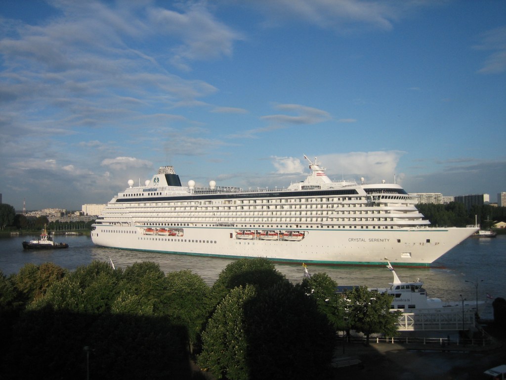
Photo of the Crystal Serenity in Antwerp
For many people, Arctic tourism is a “last-chance” to see an environment that might be on the brink of destruction. And while it is true that experiencing the Arctic has inspired many to defend it from climate destruction, the increased number of ships creates an increased risk of disaster for the environment, the people who live there, and even the tourists themselves. But ignoring the real possibility of climate disaster (or a shipwreck stranding hundreds of tourists on the Arctic Ocean), Arctic tourism also has a troubling philosophical component. Last-chance tourism forces us to think about the destruction of our natural world and how we want to face it. Do we want to put it at potential risk for the chance that tourists become potential activists? Or do we protect it from commercial interference as long as possible?
The answers to these questions are unclear, but as the Arctic tourism industry grows, the search for answers becomes more urgent.
Shelf Read Week
By Lauren Maddox
Thank you all for your patience during our brief hiatus last month! The AGSL has been preparing for the start of the new school year, which included a collection-wide shelf read. The shelf read will actually be an on-going project; each staff member will spend an hour a week continuing to read their section. But last week we came together as a staff to try and tackle the bulk of the work before students came back to campus for the Fall semester.
Most of my time at the AGSL this summer has been spent at my desk. Before I started writing for the AGSL, I had pretty much no experience working in libraries. Well, I was technically a library assistant at my high school, but that just meant I spent every morning reading in the library. So, I was pretty excited to get on board with the rest of the staff and do some real down-and-dirty library work.
Conclusions: I escaped with 0 paper cuts and the knowledge that it’s very hard for me to count past 64. But I thought that this would be a great opportunity for our readers to get an inside look at some of the behind the scenes work our staff does to make sure our library is as accessible and useful to our patrons as possible!
I was assigned sections 050-b and 200-b through c, which included the entire Carta Topagraphia. This was the point at which I realized I couldn’t count past 64, by the way– almost every map folder in this collection had close to 100 maps in it.
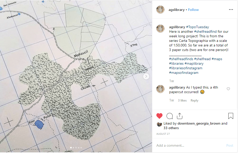
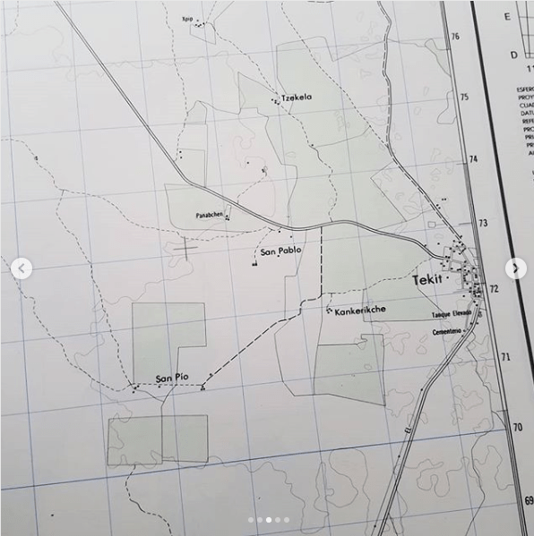
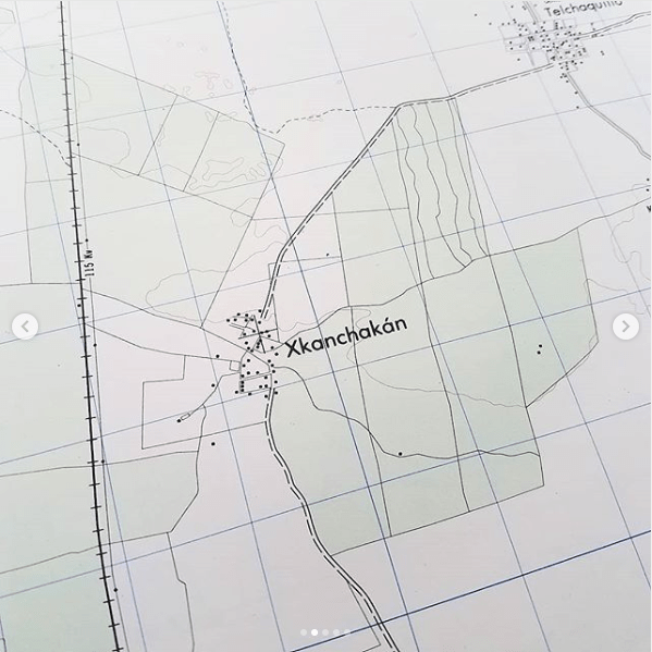
For this shelf-read, there were a few specific tasks we wanted to take care of specifically. First, we counted the maps in each folder; those individual counts were combined into a cumulative total. The shelf-read put into perspective just how many items are in the AGSL’s collections– I counted a couple thousand all by myself! Which was not the highest score. Our cumulative total of maps counted that week was 46, 709. And we’ve only just begun! Then, it was important to make sure that the maps that were in each folder were supposed to be there and in the right order. And we also worked on relabeling folders for ease-of-access for the future. And we stayed on the lookout for interesting maps that hadn’t been scanned yet to add to our digital collection or maps that hadn’t been cataloged officially. To keep spirits bright (because, no matter how necessary, counting map sheets is never going to be anyone’s favorite pastime) we also had a game of Shelf-Read Bingo going all week. I came in second place.
If, when you visit us during the semester, you notice that someone is shelf-reading, know that you’re witnessing a large-scale, on-going project that our whole staff is working on! And maybe let them finish counting– or else they might get stuck at 64 and have to start over.
- ← Previous
- 1
- 2
- 3
- Next →
