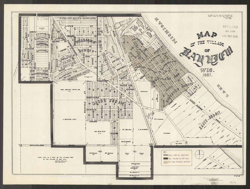
Western Photograph Digital Collection featuring Timothy H. O’Sullivan
The American Geographical Society Library has an extensive collection of western photographs by the photographers of the four great western surveys: William Henry Jackson, John K. Hillers, William Bell, Timothy O’Sullivan, Eadweard J. Muybridge and Carleton E. Watkins.
The Western Photograph Digital Collection presents 250 images from the American Geographical Society Library. The images selected are those of Timothy H. O’Sullivan (1840-1882) and were taken during the Geological Exploration of the Fortieth Parallel, 1867 – 1872 and the Surveys West of the 100th Meridian Expedition, 1874 and other explorations of the early Western territories of the United States.
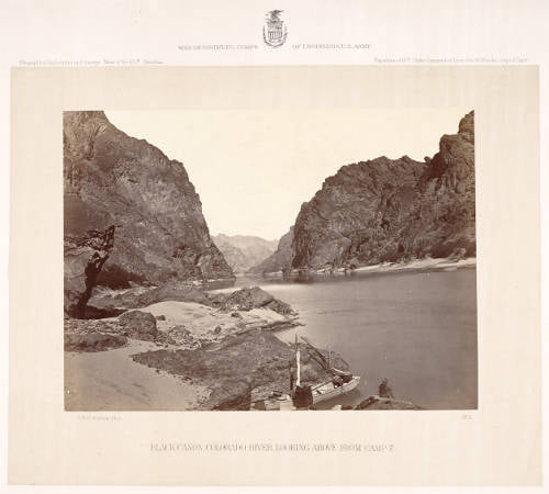
View the digital collection here: https://uwm.edu/lib-collections/western-photos/?fbclid=IwAR3_6YbX7Qrot_ljWp905P-mSlR7mkdrCKYI2LgoVFGNWDhWK07yq6IU9Dg
From Hip-Hop to Hope
By Brendan Dooley
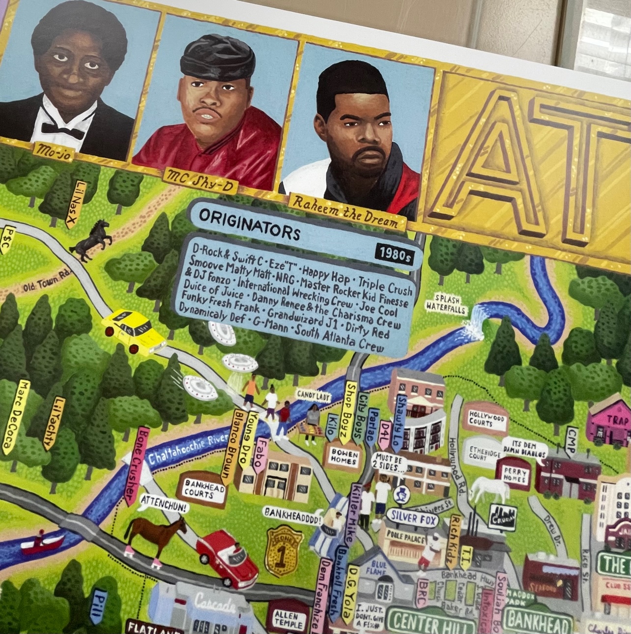
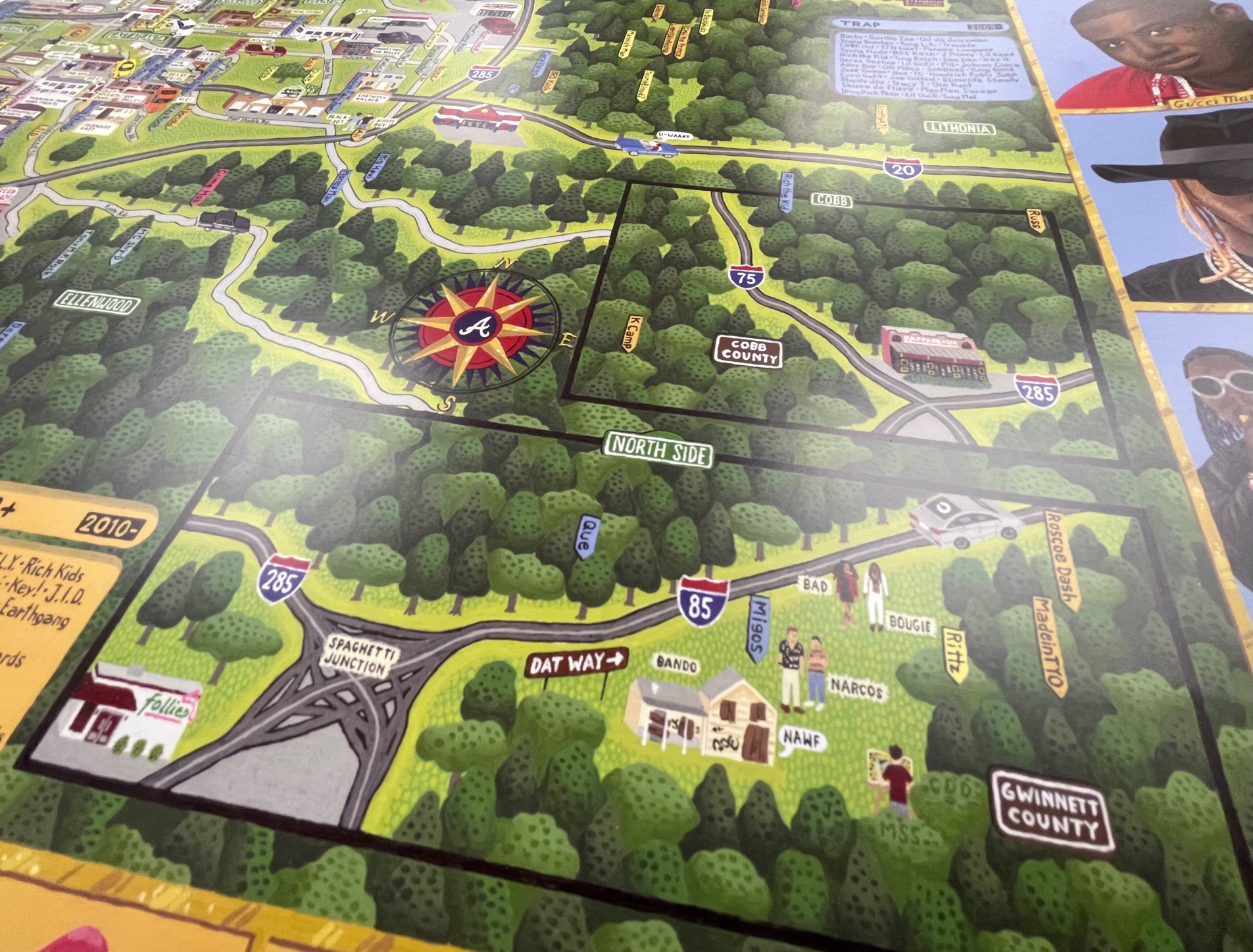
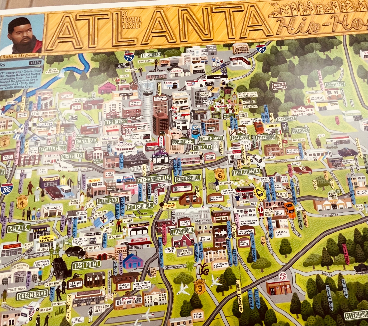
Recently arriving in the American Geographical Society Library, the “Atlanta Rap Map” is a tribute to the hip-hop influences of, in and around Atlanta, Ga., that documents the region’s artists and their works. The map shows artist locales as well as lyrical influences within, and lists major and minor performers and their works throughout with a border of painted face images.
Compiled, created and sold by Veazey Studio, the company said the 24” x 36” map was painted by hand in acrylics and includes anything “literally ‘put on the map’ by being mentioned in a hit song (from classic underground staples, to local hits, to worldwide chart toppers) or an influential album. The research took over a year, as older artists were uncovered, and hundreds of albums were listened to in their entirety.” (Now that’s my kind of research …)
Veazey Studio said proceeds from its sales of the Atlanta Rap Map will benefit HOPE Atlanta, a charity striving “to help Georgians avoid homelessness and hunger.”
You can come up to view the Atlanta Rap Map in the AGSL Monday-Friday, 9 a.m. to 4:30 p.m.

Reading list for how to use maps in research
Recently, a faculty member in History at the University of California at Riverside asked for book recommendations that he could use for readings in an upcoming graduate seminar on “Nature, Space and Place in Historical Research.” Janet Reyes, Geospatial Information Librarian at UC Riverside, asked for suggestions via the Map Librarian discussion list, Maps-L. Here is a list of titles that were shared via that discussion that may be of interest to readers of the AGS Library Blog. These titles will teach and/or demonstrate how to focus on maps and cartography, helping students think about maps as sources, problems in their construction, how maps lie, etc., and how to bring historic maps into a GIS.
Books
Anthamatten, Peter. 2020. How to Make Maps: An Introduction to Theory and Practice of Cartography. ISBN-13: 978-1138067806, ISBN-10: 1138067806
Crampton, Jeremy. 2010. Mapping: A Critical Introduction to Cartography and GIS. ISBN-13: 978-1405121736, ISBN-10: 1405121734
Field, Kenneth. 2018. Cartography. ISBN-13: 978-1589484399, ISBN-10: 1589484398
Gurney, Alan. 2004. Compass: A Story of Exploration and Innovation. ISBN-10: 0393050734, ISBN-13: 978-0393050738
Krygier, J, and D Wood. 2016. Making Maps: A Visual Guide for Map Design for GIS. Third ed. ISBN-13: 978-1462509980, ISBN-10: 9781462509980
Monmonier, Mark. Several books to choose from. https://www.goodreads.com/author/list/6040304.Mark_Monmonier
Tyner, Judith. 2014. The World of Maps: Map Reading and Interpretation for the 21st Century. ISBN-13: 978-1462516483, ISBN-10: 1462516483
Winchester, Simon. 2021. Land: How the Hunger for Ownership Shaped the Modern World. ISBN-10: 0062938339, ISBN-13: 978-0062938336
Digital Materials
Open textbook – Mapping, Society, and Technology / Manson (2017)
World Historical Gazetteer: https://www.whgazetteer.org/teaching/
From Joseph Kerski, Esri Education Manager: Course in modern web GIS: https://community.esri.com/t5/education-blog/a-complete-first-course-in-modern-web-based-gis/ba-p/1020548
Spatial Reserves: https://spatialreserves.wordpress.com
All the News that’s Fit to Map
By Brendan Dooley
In order to keep troops around the world up to date on each week’s advances during World War II, the U.S. military developed Newsmaps, poster-sized weekly publications of geographically focused battle updates. This was a time, of course, before emails, Tweets and Instagram posts (let alone personal cellphones in every pocket), so for the sailor at sea or soldier in the woods, jungle or desert, posted Newsmaps (often literally attached to posts) might be the only regular news they would see.
The American Geographical Society Library collection recently added 30-plus Newsmap editions, growing its collection of them to 142.
Most of the Newsmaps featured news briefs on the front, keyed to either large maps or smaller insets and/or photos from the relevant theater of operations, and the backs often featured large instructional or propaganada-ish illustrations or large-scale maps detailing particular battle hot zones.
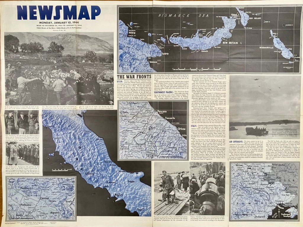
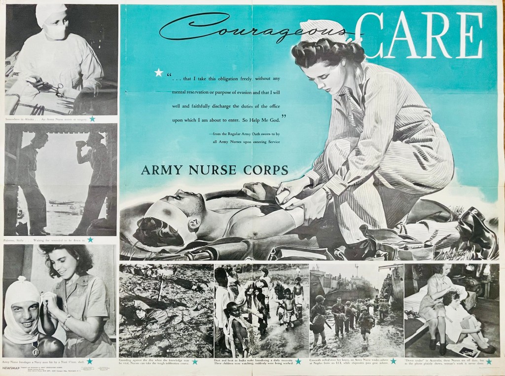

For instance, on the front of the Monday, Jan. 10, 1944, Newsmap (Vol. II, No. 38) are a collection of maps and images to go along with news briefs. The briefs that week covered the Soviet advance against Nazis in Crimea and Poland, U.S. movements against Japan on New Guinea in the Southwest Pacific, U.S. troop gains in central Italy and combined U.S. and R.A.F. bombing raids against Nazi-controlled munitions, plants and materiel in Northern Germany, Berlin and Paris (though no graphics with this last snippet). On the reverse of this Newsmap was a combined illustration and images detailing some ins and outs of the Army Nurse Corps.
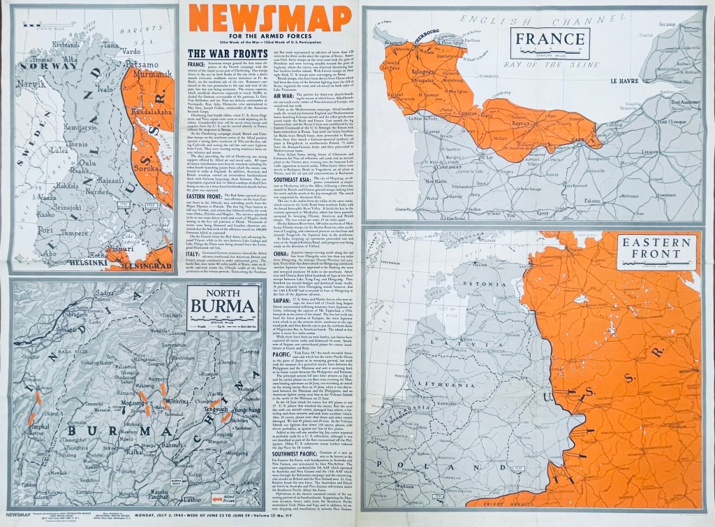
In another example six months later, the front of the Monday, July 3, 1944, Newsmap (Vol. III, No. 11F) includes briefs on the Allied seizure of the port at Cherbourg, France, Soviet advances in Finland, the Allied march north through Italy (now 120-some miles past Rome), bombing raids across Germany, Poland, Italy and Yugoslavia, Chinese and British troops taking Mogaung in Burma, U.S. Marine movements on Saipan, the new “Task Force 58” maneuvers near the Philippines and air operations in the Southwest Pacific. The back of this edition (Vol. III, No. 11B) detailed the importance of Teamwork, whether by army and naval forces in combined attacks or various Allied contingents in joint planning efforts and operations.
While blue was a dominant color of the Jan. 10 Newsmap, July 3 (on the front side) uses orange to highlight interest; from week to week, Newsmaps tended to feature one main color. Of note, the Newsmaps starting within Vol. II began denoting front “F” and back “B” sides to the editions. Additionally, there were Industrial editions of the Newsmaps—sent to U.S.-based munitions plants and military factories—that were usually similar in their news and layout on the front, but did not contain B sides. (More on these Industrial editions in a future post.)
The AGSL physical collection now includes 114 military editions of the Newsmaps across Volumes 1-5 (which ran from 1942-1946), as well as 28 of the Industrial versions from Volumes 2-4. Roughly two dozen of the new military editions and 15 of the Industrial versions were added after a donation from the Milwaukee County Historical Society.
You can come up to view them Monday-Friday, 9 a.m. to 4:30 p.m. in the AGSL on the third floor of the Golda Meir Library; which is open to the public as well as UWM students. (The extent of 212 Newsmaps is also available online at the University of North Texas here.
MILWAUKEE MUNICIPAL RESEARCH CENTER MAP COLLECTION
Beginning in 2020, the American Geographical Society Library partnered with the Milwaukee Municipal Research Center (MRC) to provide online access to over 250 maps. This online map collection features maps created by city departments and includes subject areas of the city’s historic geographical boundaries and annexations, current and former aldermanic districts (known as wards prior to 1972), Census tracts, neighborhoods, land use, redevelopment planning, transportation and population. The collection has both historical maps dating back to early 1800s as well as more modern maps dating into the 2000s. The technical work was done by two UWM SOIS students, Samantha Dickson and Lillian Pachner, who uploaded the files and created ContentDM metadata.
In addition to finding these 250+ maps in the American Geographical Society Library Digital Map Collection online, all of them can be used on site at the Milwaukee Municipal Research Center (MRC), located in the basement level of the Zeidler Municipal Building, 841 N. Broadway. Their hours are 8:00 am – 4:45 pm, Monday-Friday.
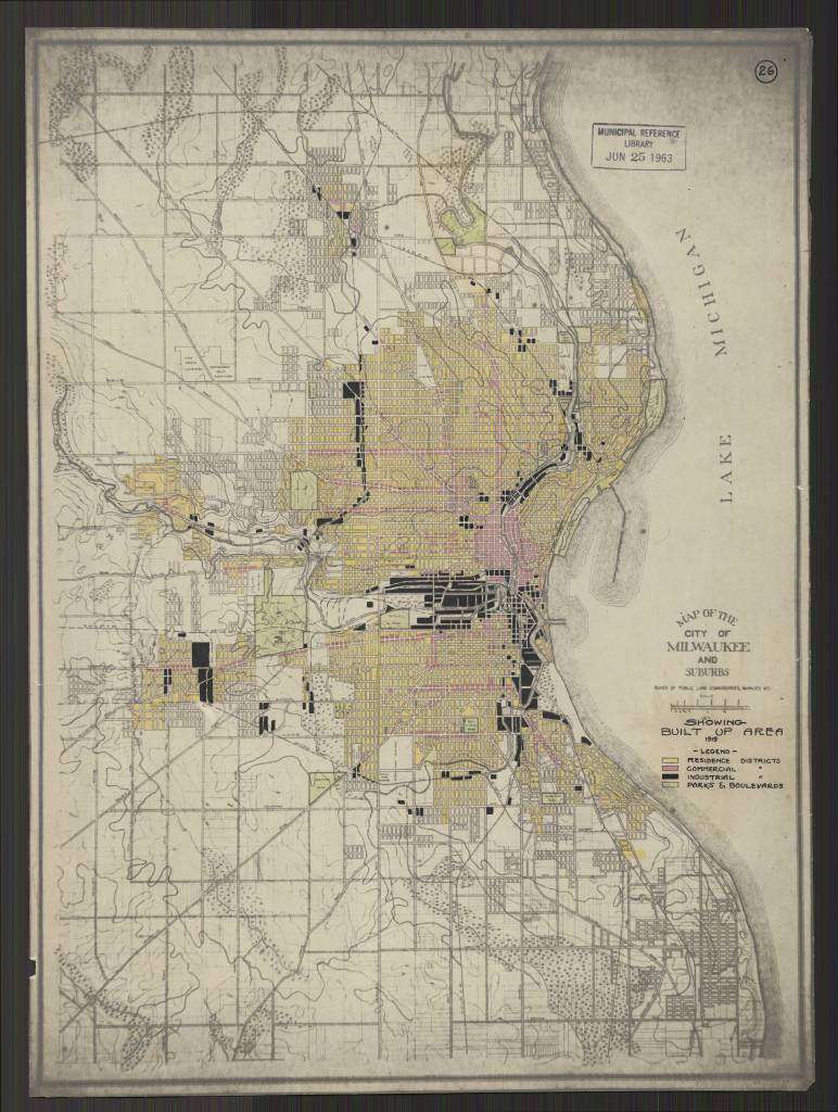
Milwaukee Wis. Annotated title: Showing Built Up Area 1919
https://collections.lib.uwm.edu/digital/collection/agdm/id/25616/rec/130
https://collections.lib.uwm.edu/digital/collection/agdm/id/25578/rec/150
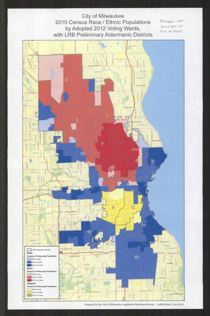
by Adopted 2012 Voting Wards, with LRB Preliminary Aldermanic Districts /
Prepared by the City of Milwaukee Legislative Reference Bureau
https://collections.lib.uwm.edu/digital/collection/agdm/id/25684/rec/135
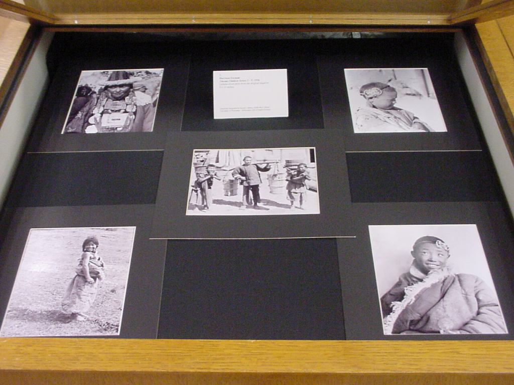
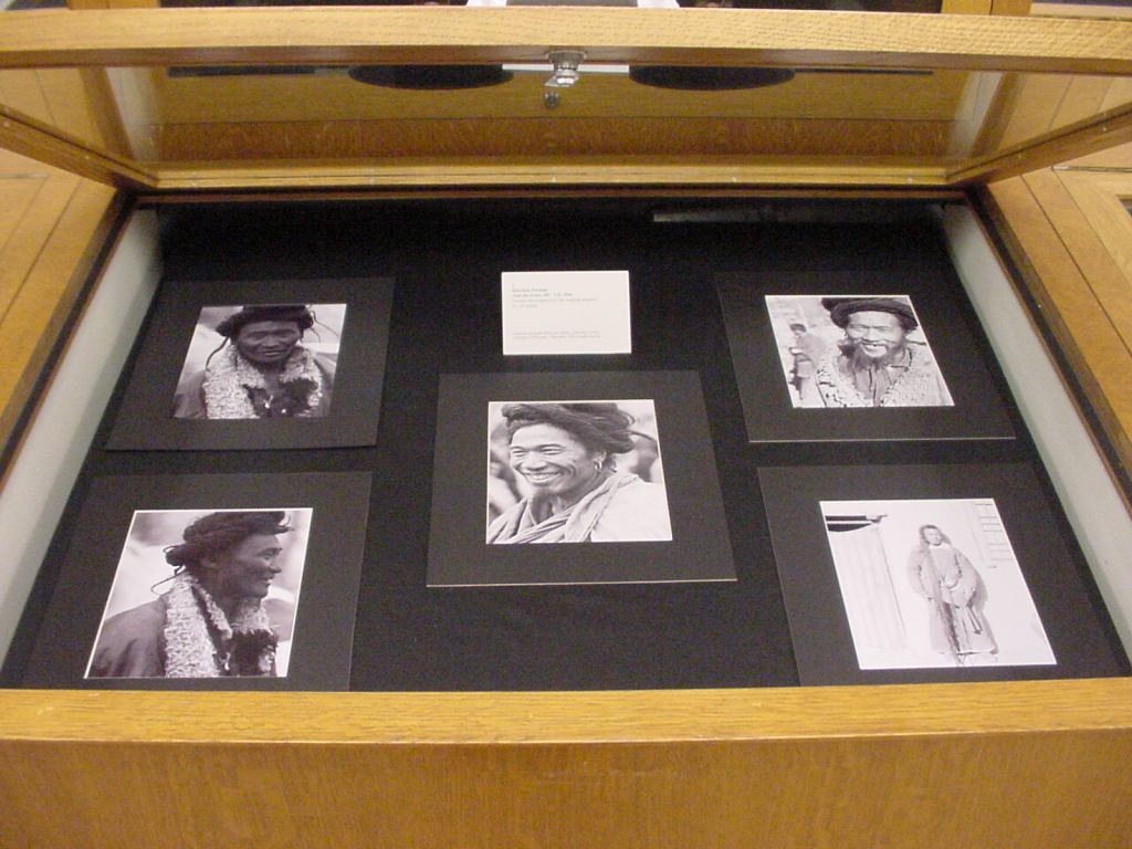
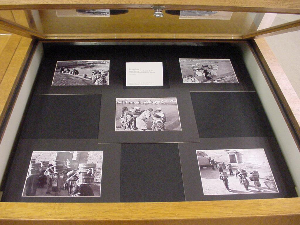
AROUND THE WORLD IN 34 YEARS – IMAGES FROM THE HARRISON FORMAN COLLECTION NOW ONLINE
Thirty-four years after the American Geographical Society Library received the Harrison Forman Collection, work to make the images in the collection accessible online was completed in May 2021. Donated by his wife Sandra Carlyle Forman in 1987, the photographic collection consists of print photographs, nitrate and safety negatives, 35 mm color slides, Ektachrome color slides, and motion picture films.
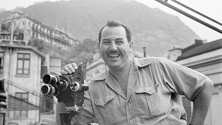
Harrison Forman (1904-1978) was a prominent photojournalist, explorer, author, and fellow of the American Geographical Society. As a foreign correspondent, Form n’s images and articles appeared in the New York Times, Times of London, Life, Look, Collier’s, Harpers, and Reader’s Digest. He was a native of Wisconsin and UW alumnus with a degree in Oriental Philosophy. Forman’s collection was a tremendous gift to the AGSL and subsequently became one of the most popular and most utilized of AGSL’s photography collections among researchers around the world.
This historically and geographically significant collection covers Forman’s travels from the late 1920s to the mid-1970s. Forman travelled the world with the eye of an anthropologist. He was fascinated by the lives, culture, economies, governments and infrastructure of each place he visited. Known in his heyday as the “Modern Day Marco Polo,” Forman was often the first Westerner to have access to the people and places he visited and seemed to always be in the right place at the right time, witnessing significant moments in history and documenting them with his photography. The content of the Forman Collection is a gold mine of historical information and beautiful photography. Forman’s images can be accessed online in the following collections on the UWM Digital Collections website:
Afghanistan: Images from the Harrison Forman Collection documents the life and culture of Afghanistan in the 1950s and 1960s.
Transportation Around the World focuses on the ways people all over the world get from point A to point B.
Cities Around the World highlights the architecture, city life, people, transportation, neighborhoods, commercial streets, and business districts of metropolitan areas.
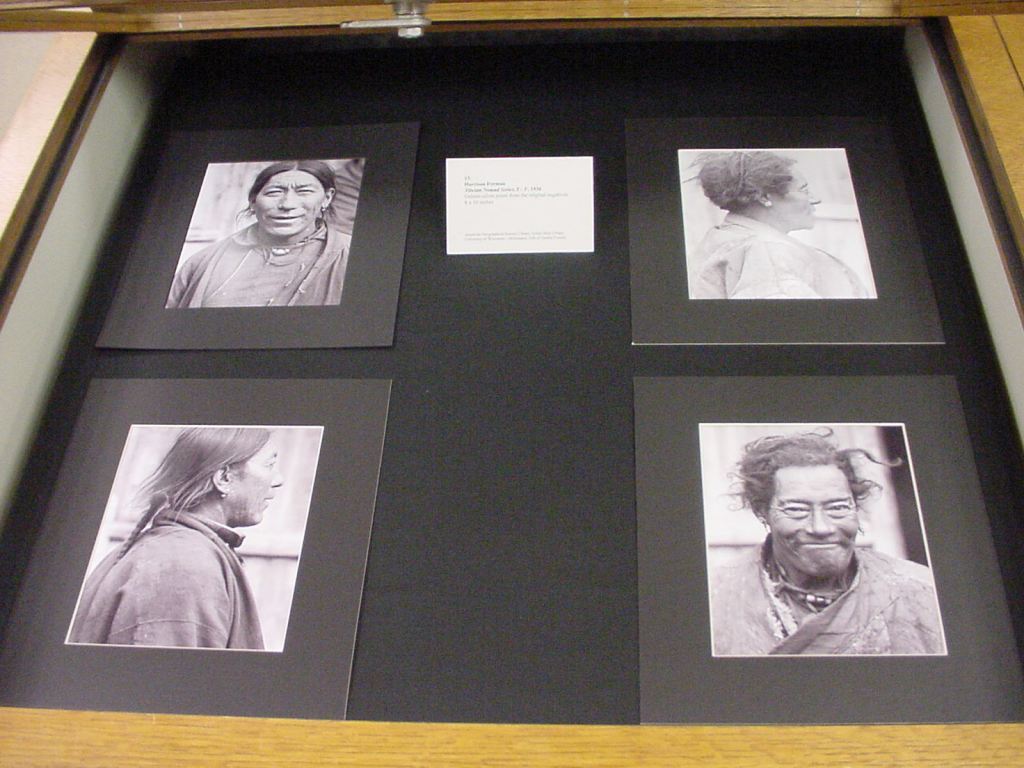
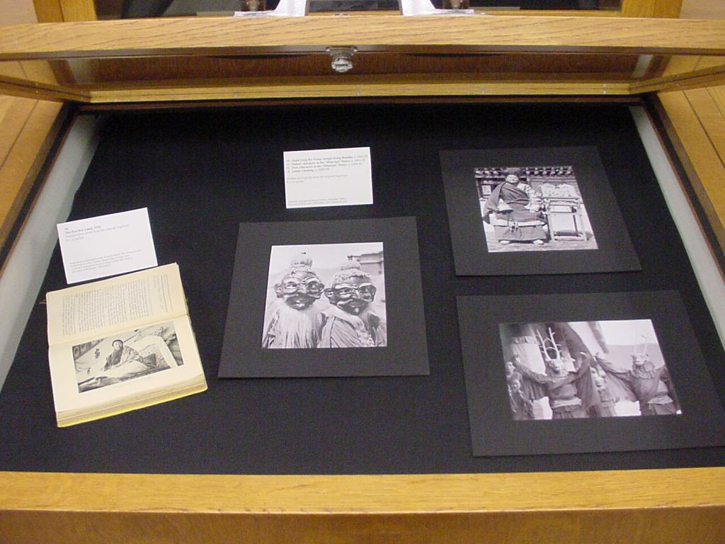
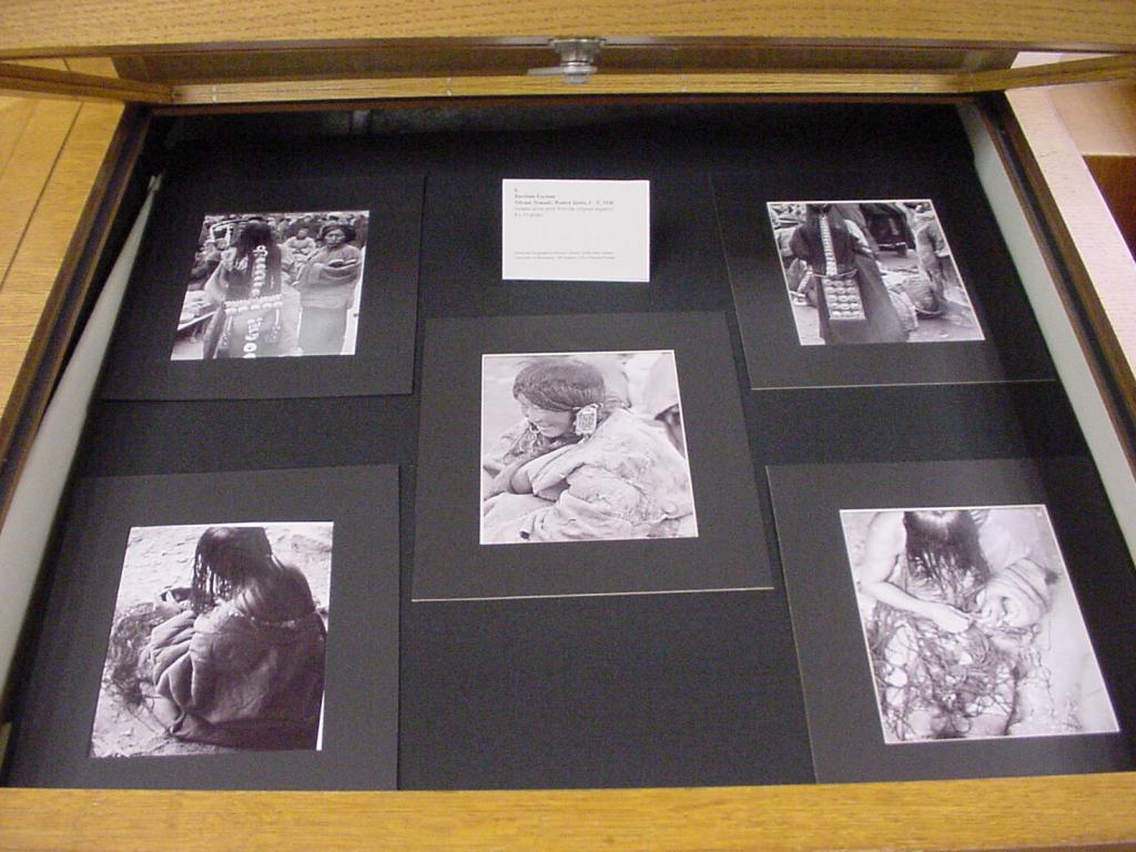
Tibet from the AGSL Collection includes Forman’s images he took while visiting Tibet in the 1930s – one of the few Westerners to visit the region at the time.
Nazi Invasion of Poland documents the beginning of WWII through images Forman took during the Blitzkrieg in Poland.
Travel Diaries and Scrapbooks of Harrison Forman 1932 – 1973 presents 62 of Forman’s diaries he kept while in the field, spanning his professional career.
Forman’s images can also be found in the UWM Digital Collections geographically organized collections: Asia and Middle East, Africa, Europe, North and Central America, South America and Oceania.
For further information about the collection, please contact Susan Peschel, Visual Resources Librarian, American Geographical Society Library.
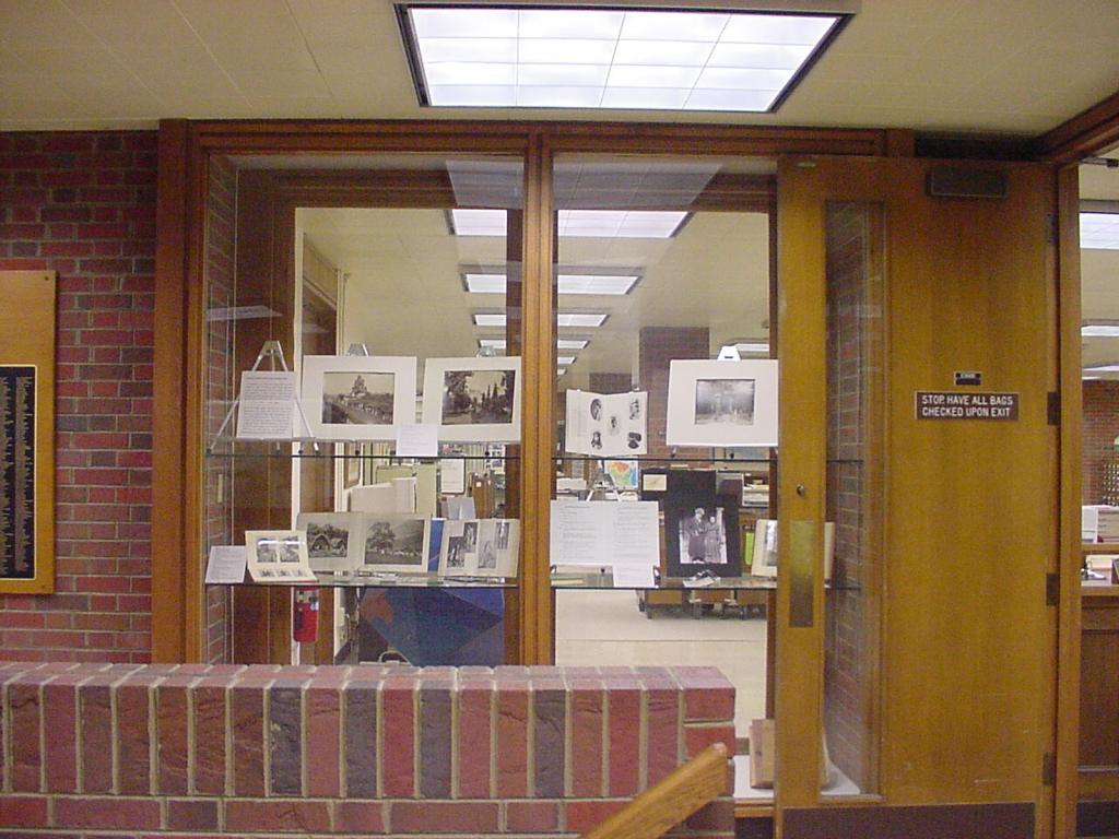
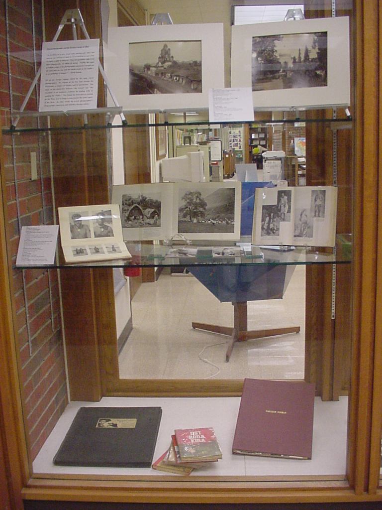
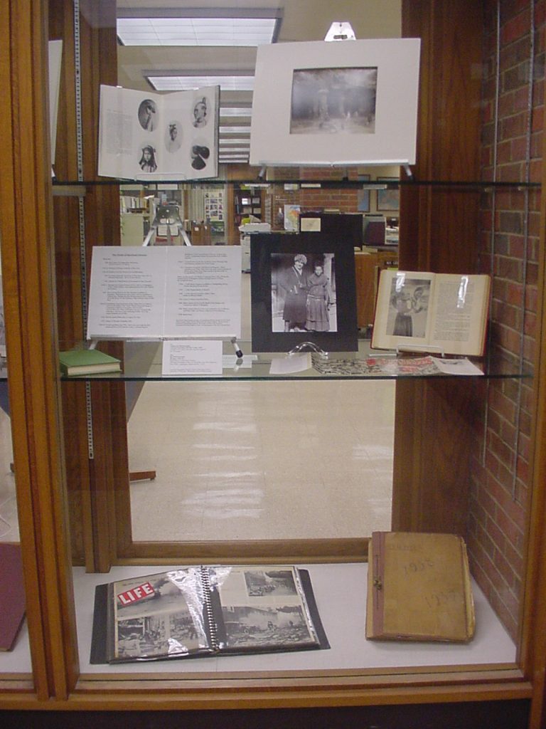
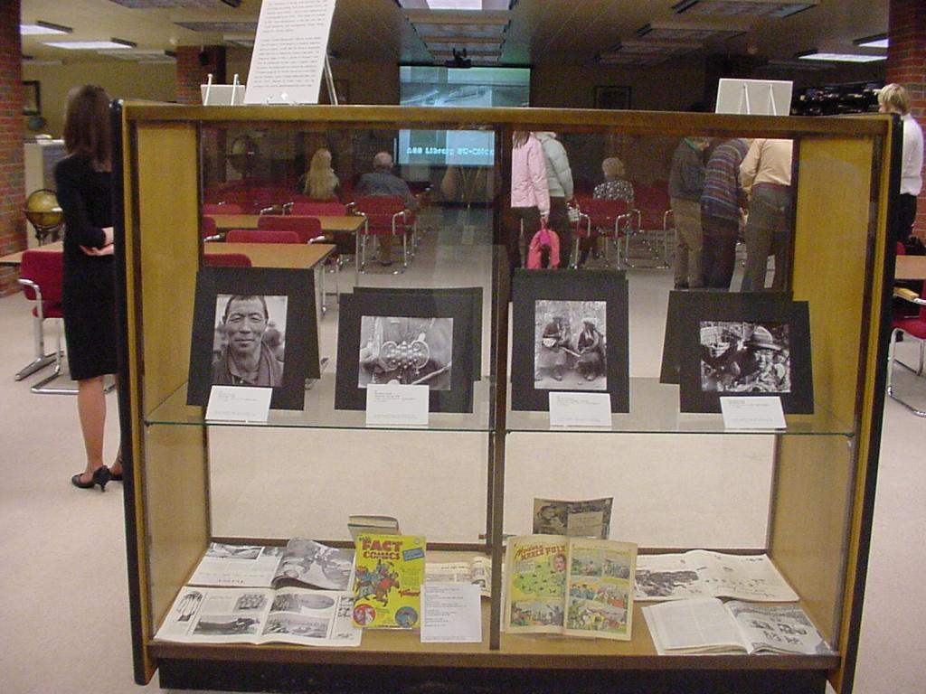
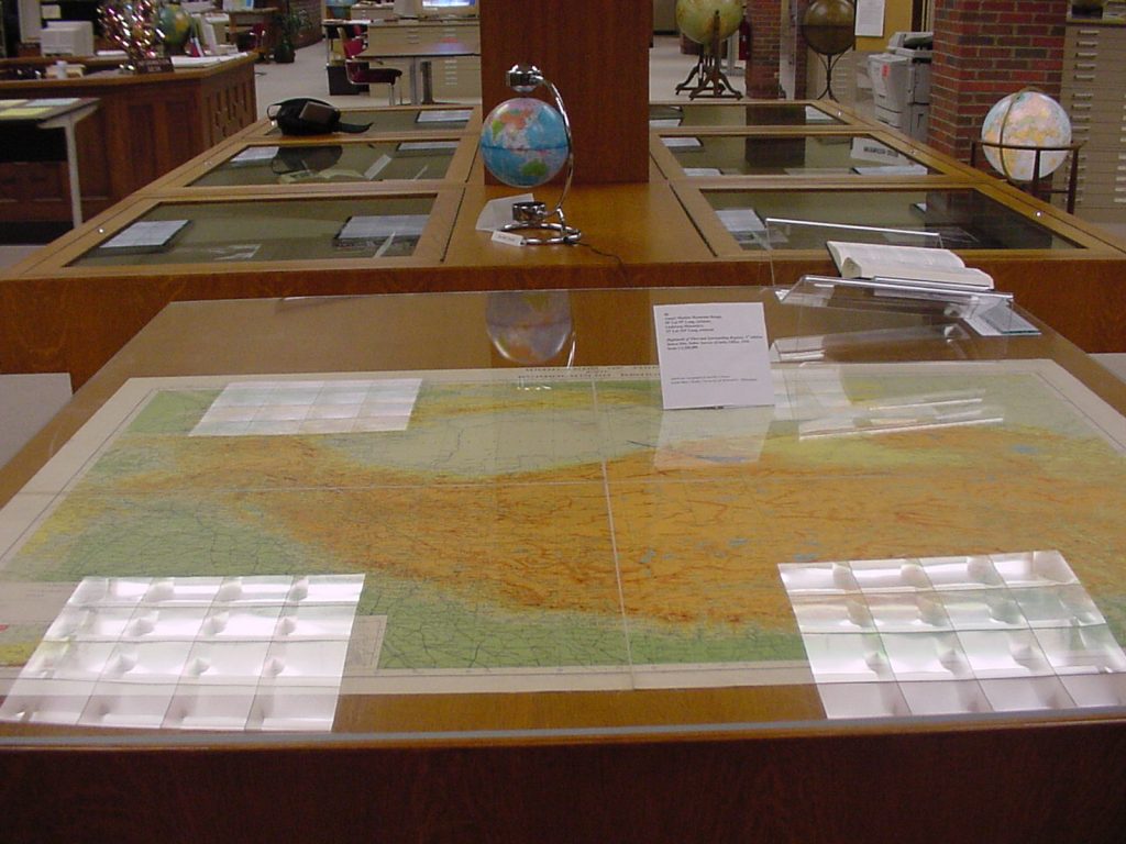
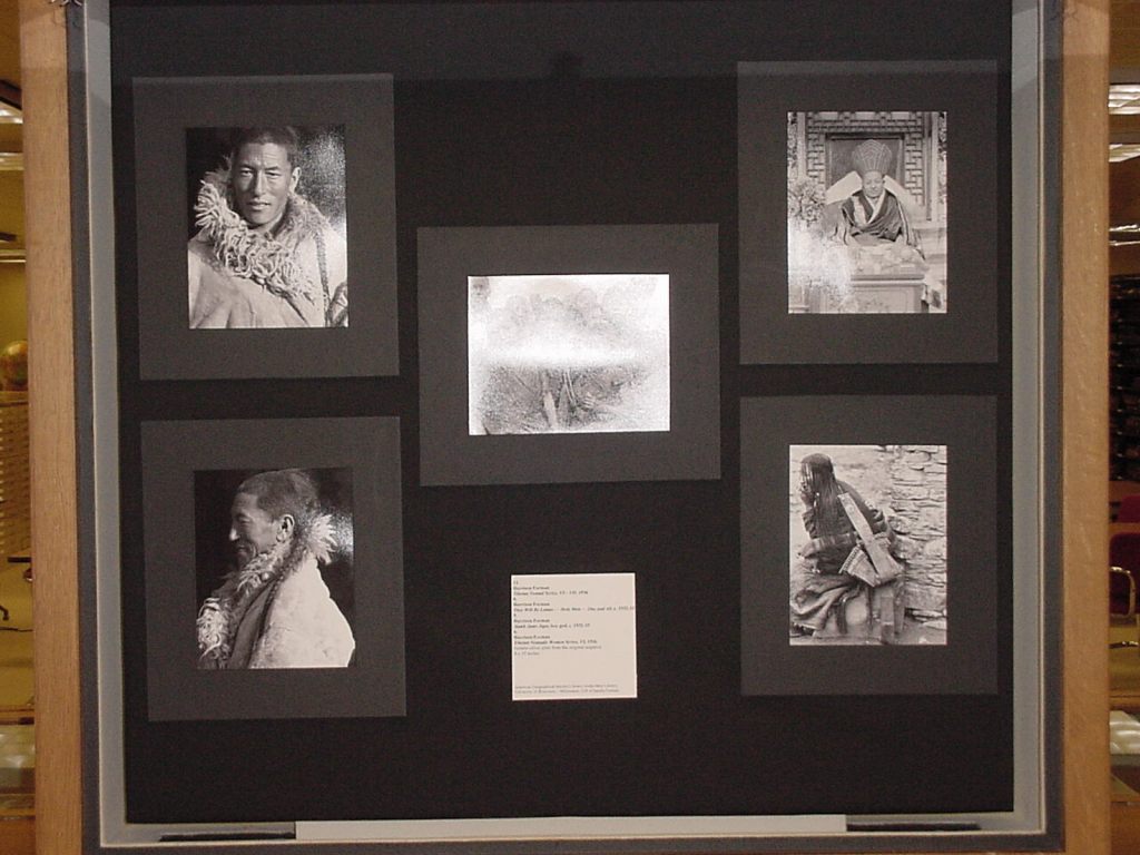
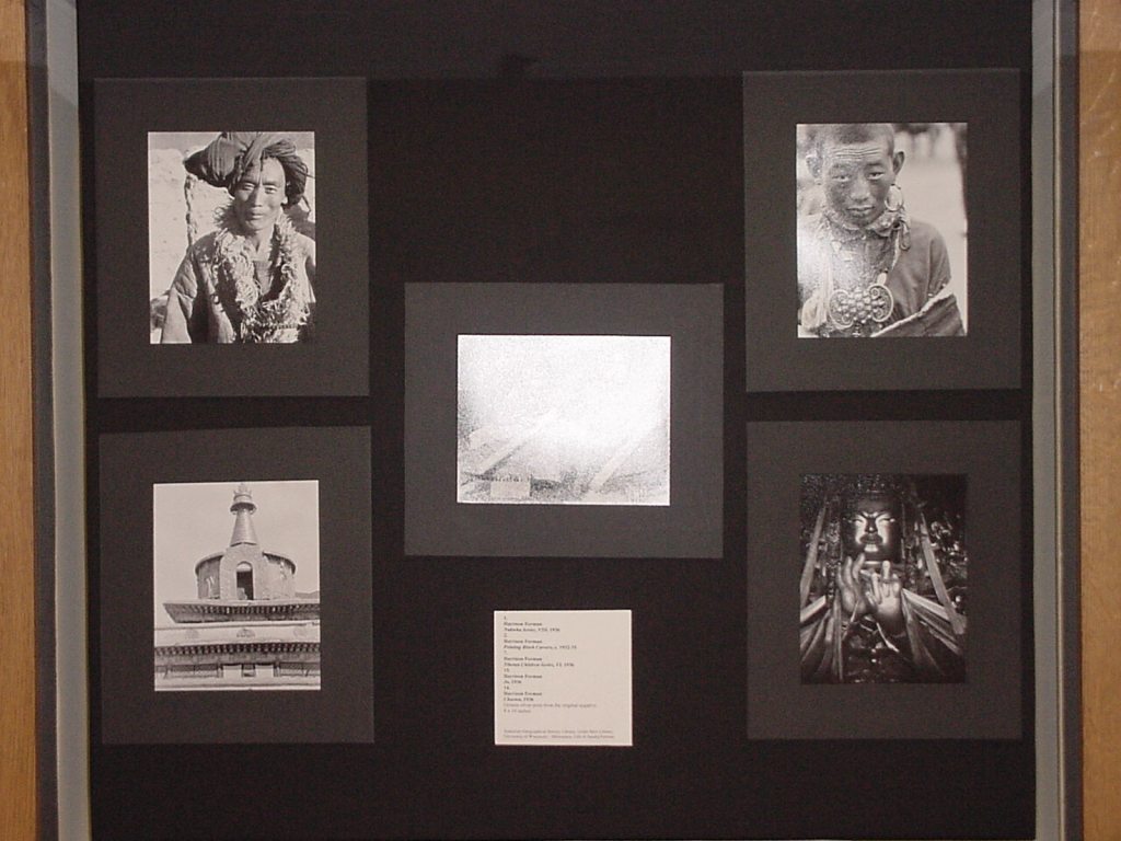
Looking back: Graduate Student Thesis Exhibition held in the AGS Library 2004
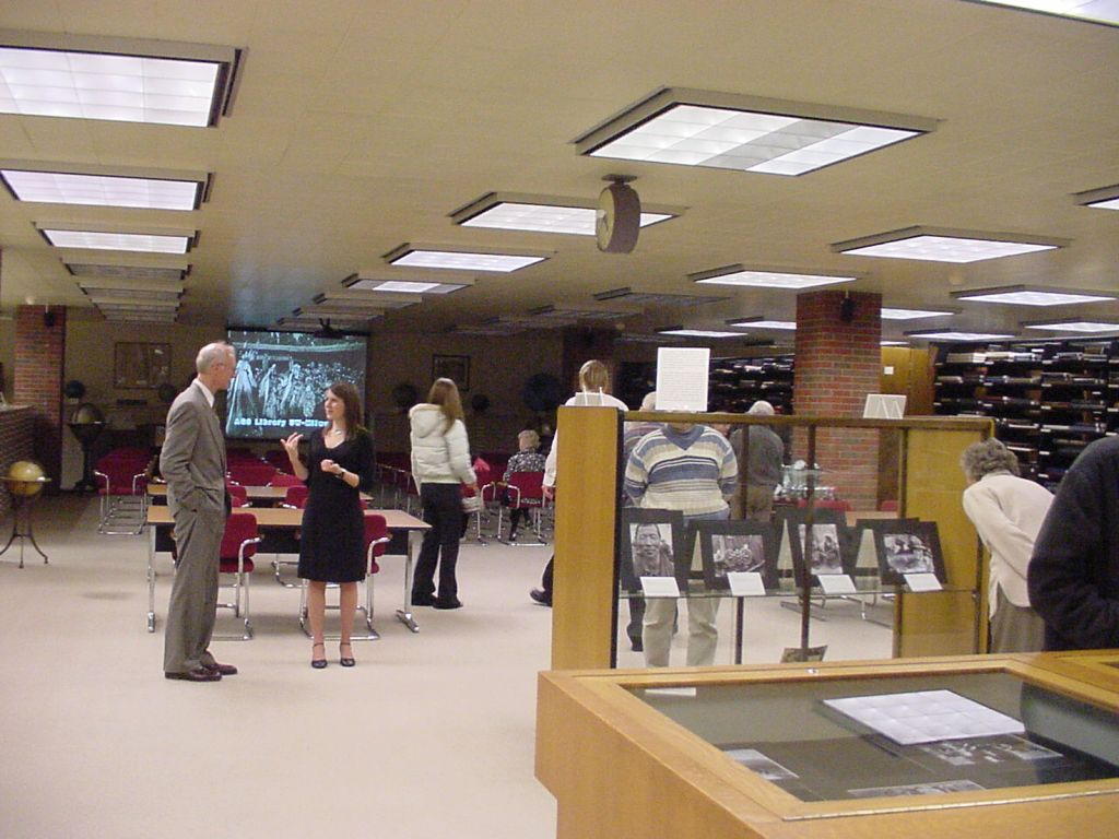
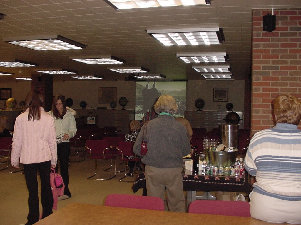
The AGS Library had the honor of providing space for a graduate student to host her senior art exhibit on the 3rd floor of the east wing of the Gold Meir Library.
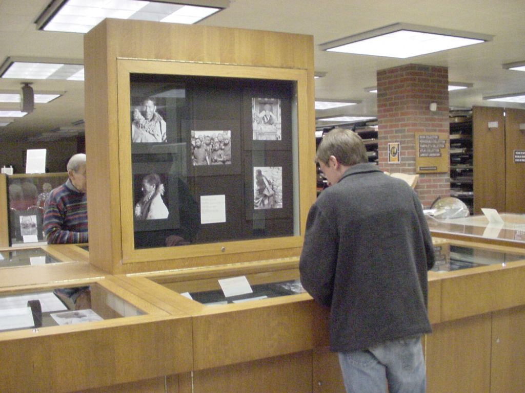
In December of 2004, UWM graduate student Beth Carlson hosted an exhibit of photographs at the AGS Library. Her exhibit, titled: “Travel Photography and the Western Image of Tibet: The Work of Harrison Forman” featured prints and negatives preserved at the AGS Library by Harrison Forman, often described by his peers as the Modern Day Marco Polo.
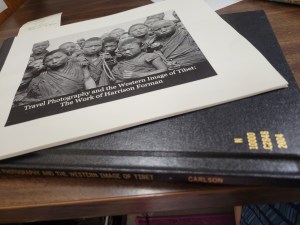
The exhibit was part of Carlson’s Masters of Arts in Art History degree at the University of Wisconsin Milwaukee. Her exhibit catalog, and thesis analyzed 40 of Forman’s 1930s travel photographs of Tibet and compared them to other images of the Far East by Western photographers. The AGS Library proved to be a lovely space to host Carlson’s exhibit that included a reception, a slide show and a brief lecture.
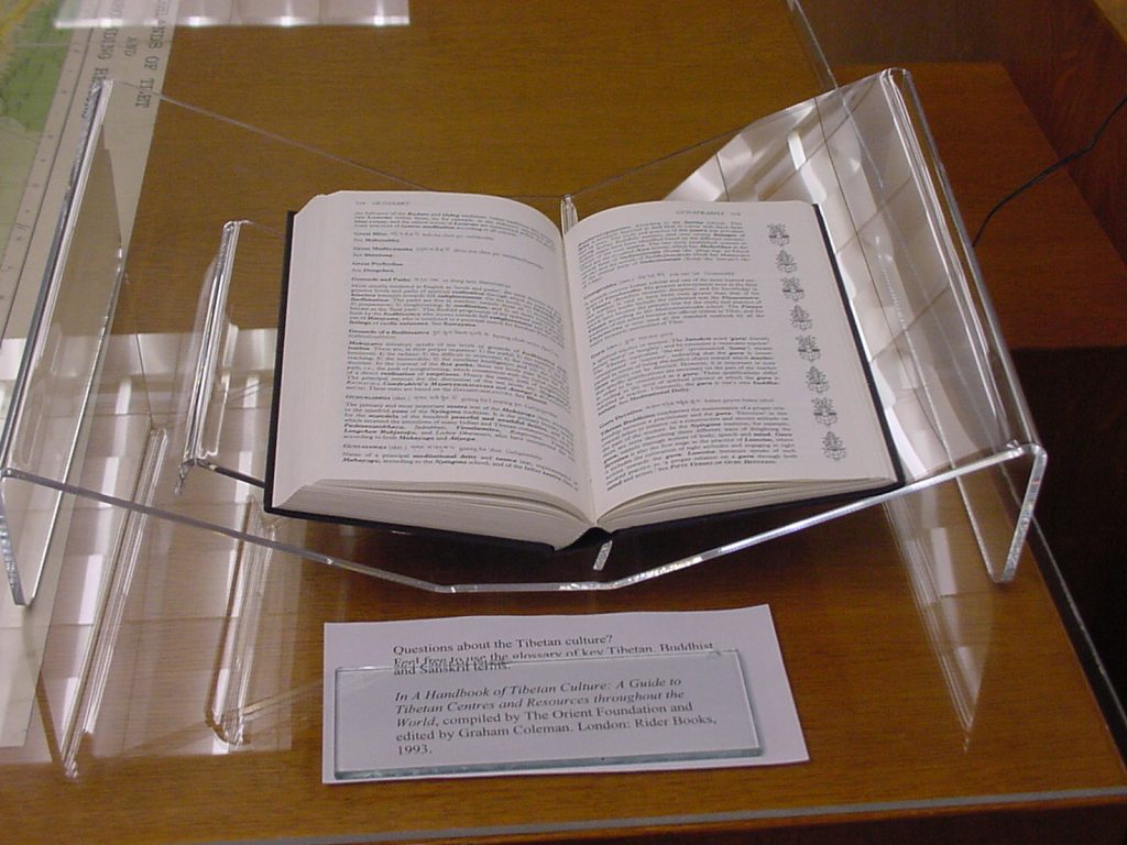
The exhibit included photographs, books, maps, scrapbooks, and graphic novels featuring Harrison Forman.
Harrison Forman was a Milwaukee native who graduated from the University of Wisconsin in 1929. He later worked as a foreign correspondent in the Far East for the New York Times, London Times and the National Broadcasting Company. Forman was an avid lecturer on international relations and became a Fellow of the American Geographical Society, Explorers Club, Circumnavigators Club and the Overseas Press. Forman died in 1978 and his photos were donated to the AGS Library by his wife, Sandra Carlyle Forman in 1987.

At the time of Beth Carlson’s senior exhibition, the AGS Library didn’t have a full time librarian dedicated the photograph collections. In 2006, Susan Peschel was promoted to the role of Visual Resources Librarian. The Forman collection has since been process and described and is available through the UWM Libraries digital collections.
Harrison Forman in the Asia Middle East Collection
While in the field, Forman maintained diaries containing information directly relevant to his photography. Those diaries are online here: Harrison Forman diaries
The inspiration for this post came up when Map Librarian, Angie Cope, met a library employee studying Art History at UWM. Angie wanted to show the student the beautiful exhibit that was held in the AGSL. However, the timing couldn’t be better to recognize this exhibit NOW because this year also represents the actual completion of organizing a collection. The entire Harrison Forman collection has been processed, scanned and put online in the UW Milwaukee digital collections! That’s amazing! You can read about it here: https://uwm.edu/lib-collections/harrison-forman/?fbclid=IwAR0-1ORMMHoowf276YPLEm5lcYyCclxFyEgLwc98wpWsrk_O6pSbz_g67DI
May 30, Day of the Canary Islands
by Angie Cope
The Day of the Canary Islands (Spanish: Día de Canarias) is celebrated annually on 30 May. It is a public holiday in the Spanish autonomous community of the Canary Islands chosen as the anniversary of the first session of the Parliament of the Canary Islands, held on 30 May 1983.
At present, the Canary Islands is the only autonomous community in Spain that has two capitals: Santa Cruz de Tenerife and Las Palmas de Gran Canaria, since the Statute of Autonomy of the Canary Islands was created in 1983.
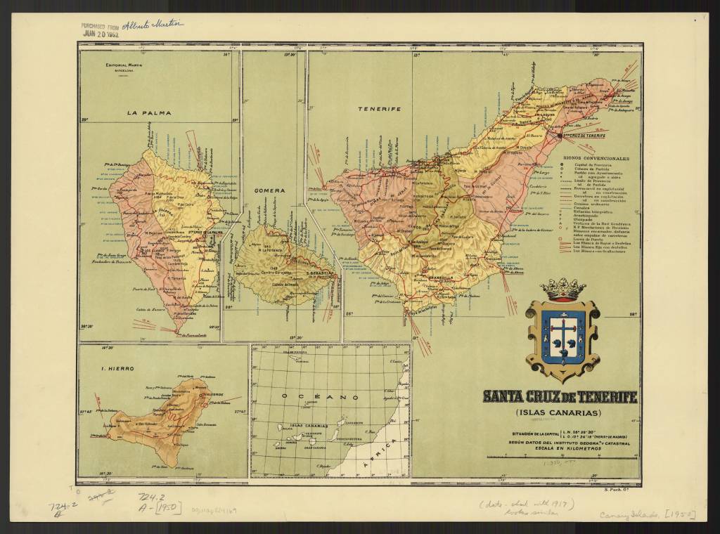
Santa Cruz de Tenerife (Islas Canarias) / by Alberto Martín, 1916
https://collections.lib.uwm.edu/digital/collection/agdm/id/15485/rec/10
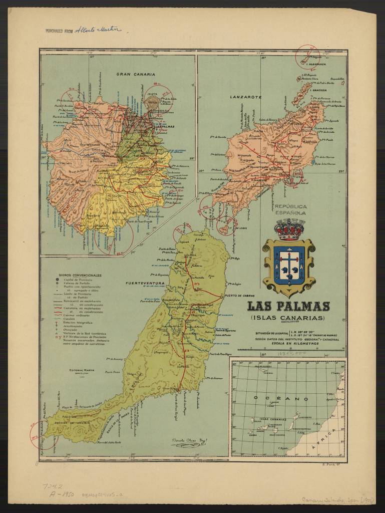
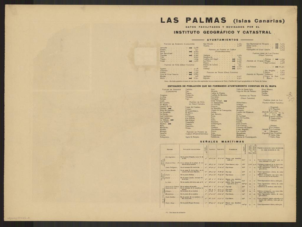
Las Palmas (Islas Canarias) / By Alberto Martin, 1922
https://collections.lib.uwm.edu/digital/collection/agdm/id/15570/rec/4
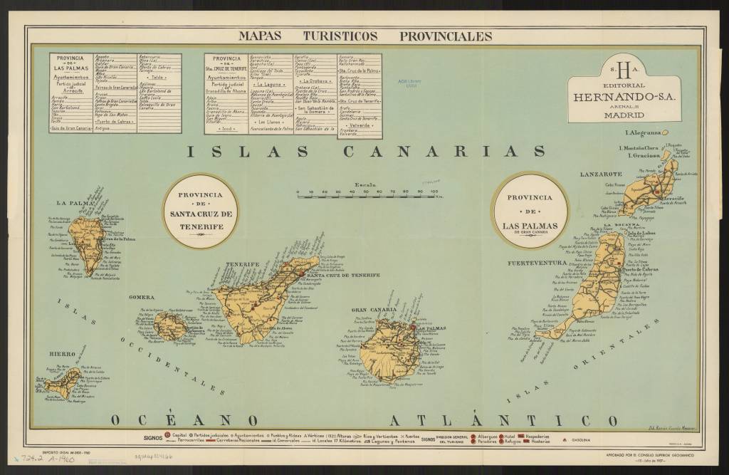
Mapas turisticos provinciales Canarias / aprobados por el Consejo Superior Geografico ; dib. Ramón Vicente Mesoner / Canarias (Islas) Mapas turísticos 1960
https://collections.lib.uwm.edu/digital/collection/agdm/id/15479/rec/5
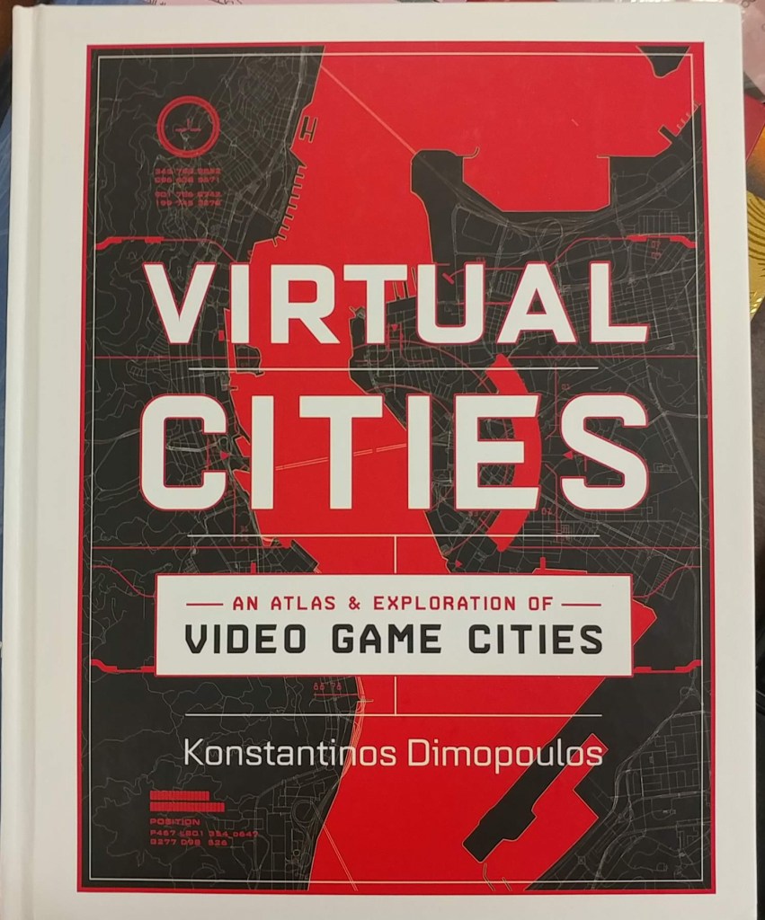
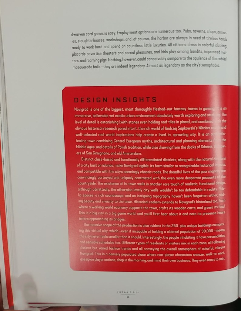
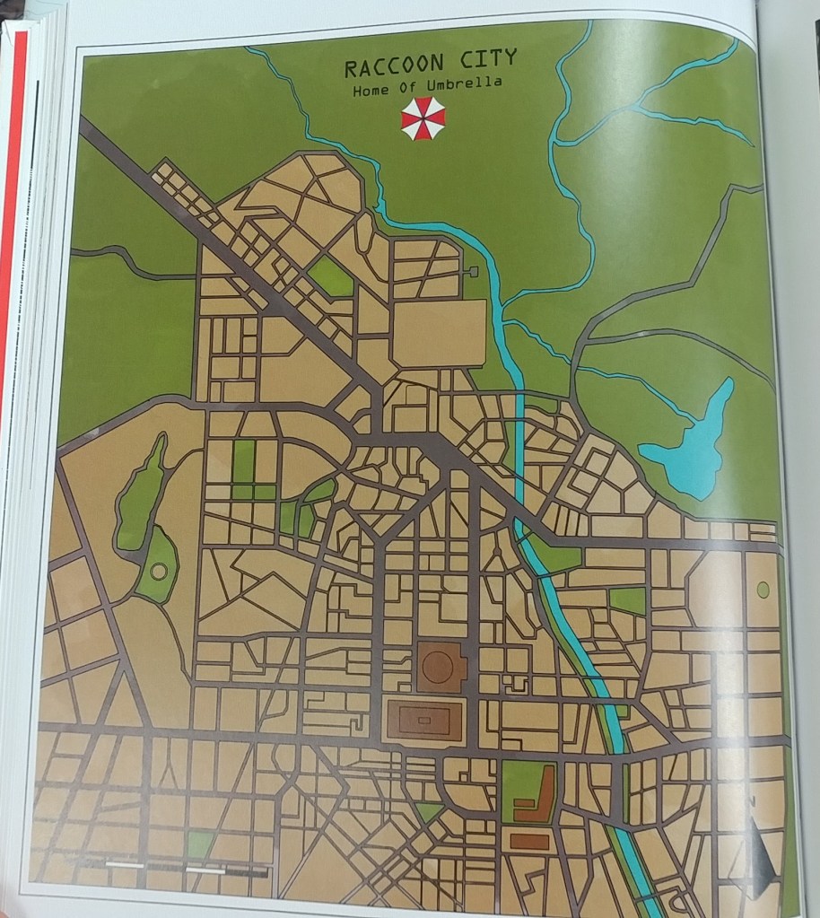
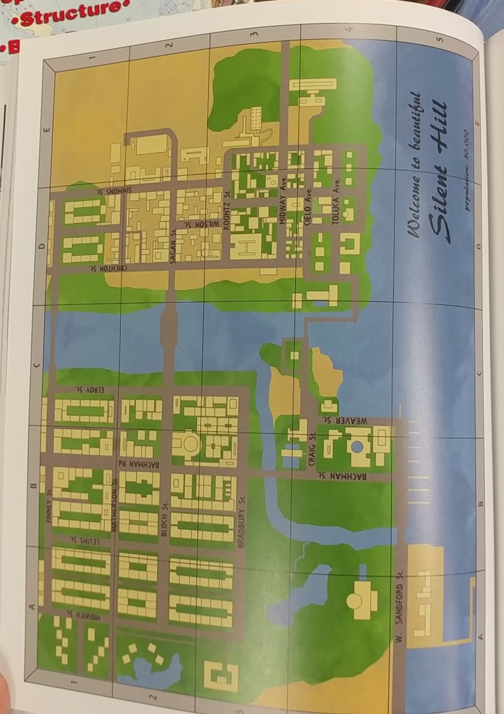
Virtual cities : an atlas of exploration of video game cities
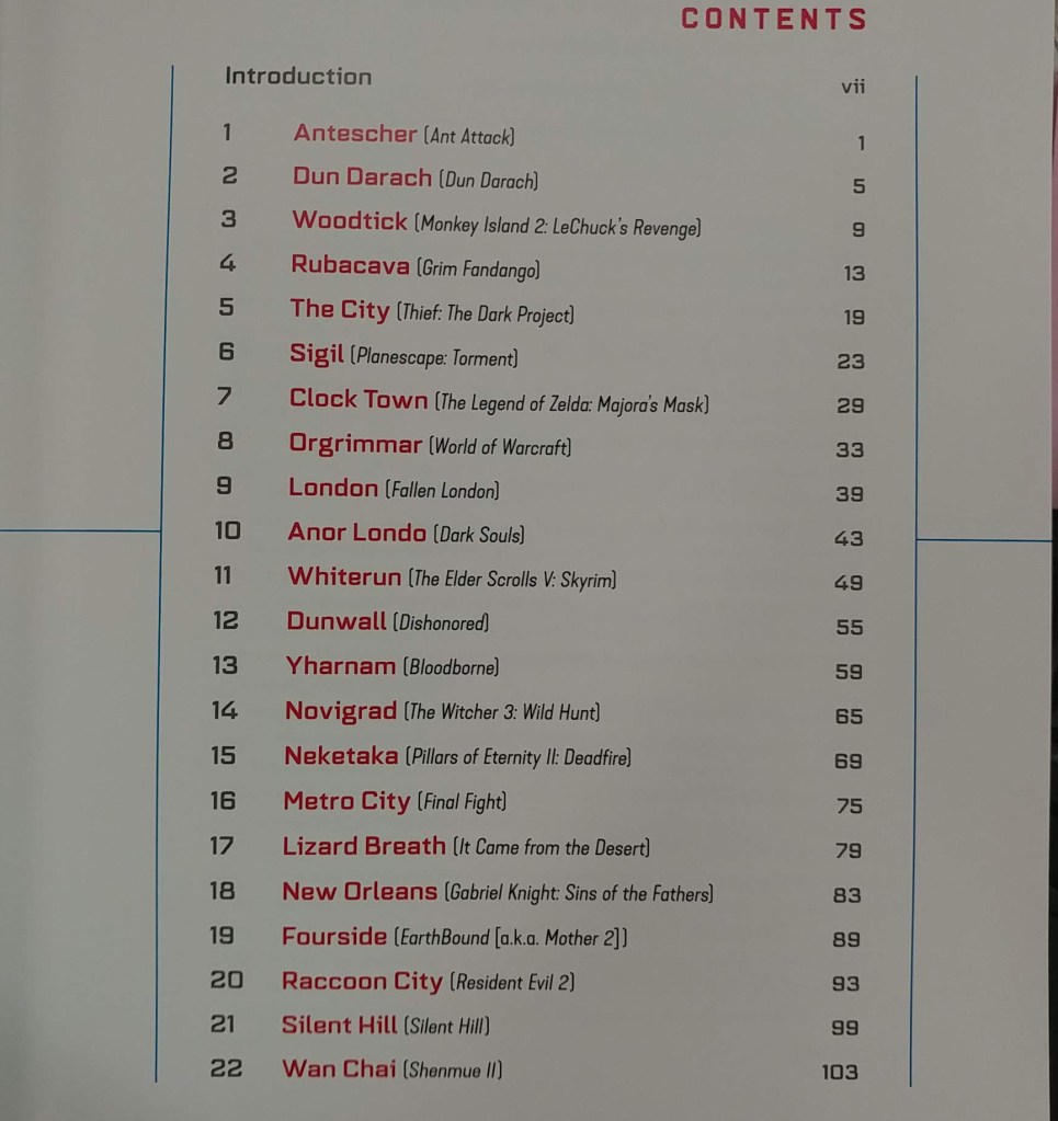
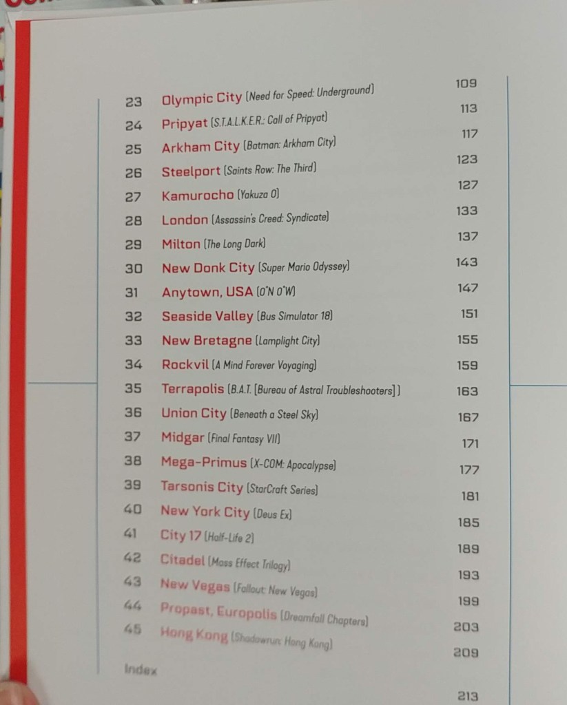
The AGS Library added a new atlas to the collection. Virtual Cities: An Atlas & Exploration of Video Game Cities by Konstantinos Dimopoulos. 224 pages, ISBN 1682686094 by Countryman Press, 2020.
“Spanning decades of digital history, this is the ultimate travel guide and atlas of the gamer imagination. Dimopoulos invites readers to share his vision of dozens of different gaming franchises like never before: discover Dimopoulos’s Half-Life 2’s City 17, Yakuza 0’s Kamurocho, Fallout’s New Vegas, Super Mario Odyssey’s New Donk City, and many more. Each chapter of this virtual travel guide consists of deep dives into the history and lore of these cities from an in-universe perspective. Illustrated with original color ink drawings and―of course―gorgeous and detailed maps, readers can explore the nostalgic games of their youth as well as modern hits. Sidebars based on the author’s research tell behind-the-scenes anecdotes and reveal the real-world stories that inspired these iconic virtual settings. With a combination of stylish original maps, illustrations, and insightful commentary and analysis, this is a must-have for video game devotees, world-building fans, and game design experts. 100 color illustrations.” — amazon.com

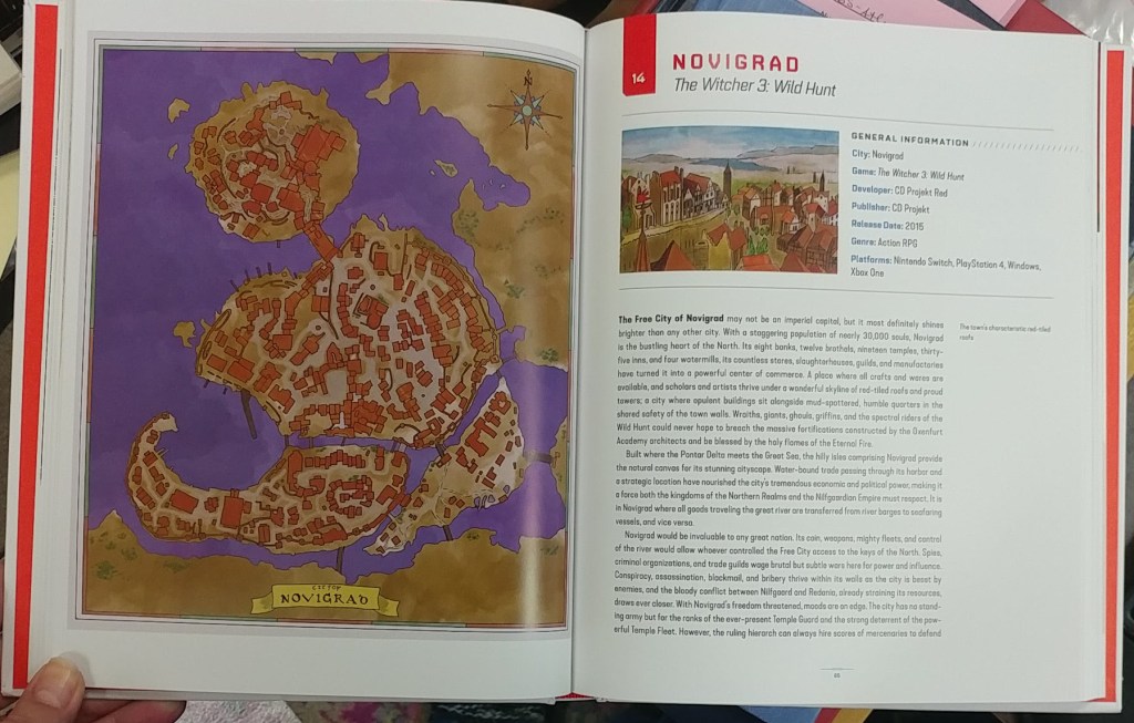
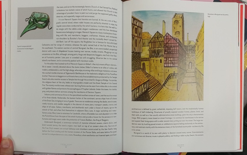
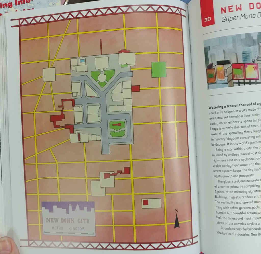
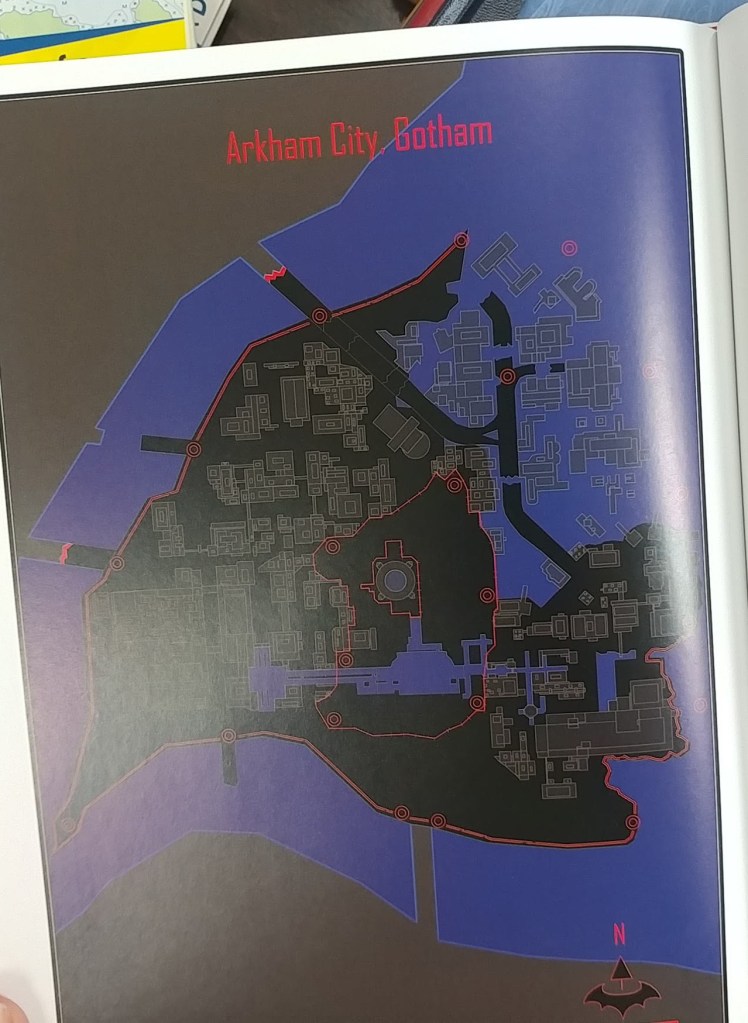
Konstantinos Dimopoulos studied urban planning and city geography for 10 years and holds a PhD. He has worked on the cities, settlements, and maps of several games including MMO Seed, The Sinking City, and more. He lives in Athens, Greece.
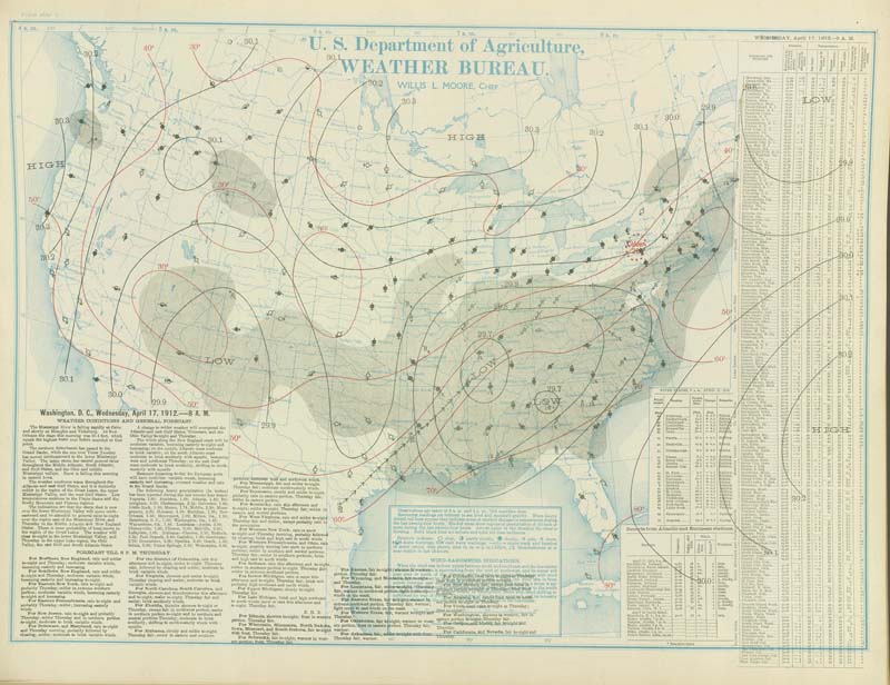
Wisconsin’s Tornado and Severe Weather Awareness Week is April 12-16
by Angie Cope
Modern day storm tracking relies on Doppler radar data and computer algorithms to forecast and identify dangerous weather.
In the past, The Department of Commerce produced daily weather maps … in print. Many libraries across the country have stacks of these maps.
Daily weather maps continue to aid researchers but are prepared in digital format by the National Centers for Environmental Prediction, Weather Prediction Center.
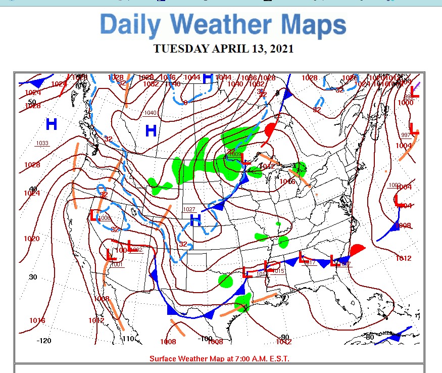
The AGS Library has many weather maps, photographs and data sets. Here are a few maps from the American Geographical Society Library Digital Map Collection.
Call number: 800-c .E2C4 I-1974 1975
https://collections.lib.uwm.edu/digital/collection/agdm/id/16471
Call number: 800 I-1976
https://collections.lib.uwm.edu/digital/collection/agdm/id/24523
For more information on data or maps from the AGS Library, contact us via email at: agsl@uwm.edu
