maps
Polar Exploration and the Hollow Earth
by Sam Balistreri-Daum
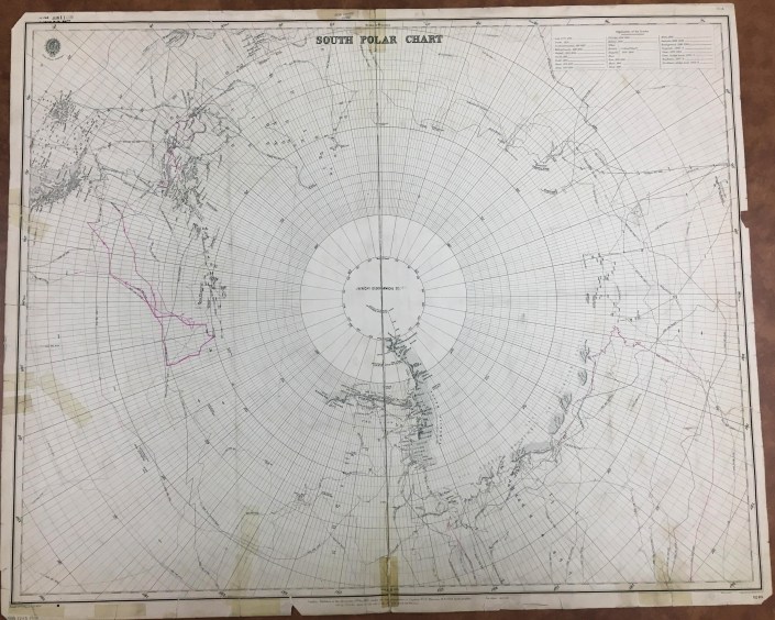
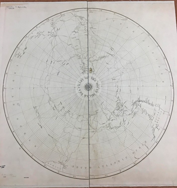
As I continued to catalog the British Admiralty charts this fall I was impressed by the way the AGS Library Nautical Chart collection in many ways shows the progress of exploration, especially in those last frontiers of the planet Earth, the Arctic and Antarctic Polar Regions. In today’s age of Google Maps and satellite imagery it becomes hard for us to imagine a time when every corner of the Earth was not known or explored. It still isn’t! Just think of the deepest parts of the oceans. So I decided I needed to learn more about what it was like in a time when polar exploration was at its most fervent if not urgent and theories, however crazy, were numerous as to what could be discovered at the poles.
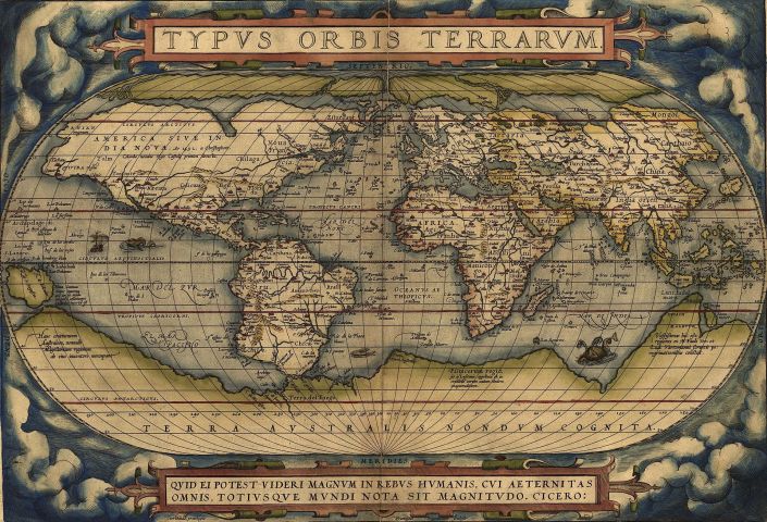
John Blake, in The Sea Chart: The Illustrated History of Nautical Maps and Navigational Charts (2016) gives a concise summary of the attempts to explore and reasons for the exploration of both poles. Exploration of the northern Polar Regions has a longer history than that of the South Polar Region, which is due to the “discovery” of America and the obsession of European explorers to find a Northwest Passage to Asia and India. Although a Northwest Passage does technically exist (during certain seasons), it is not a viable and profitable trade route. Interestingly, much of the exploration of both Arctic and Antarctic regions was made possible by an increased availability of British Naval vessels in the period following the Napoleonic Wars. Many of the names of ships and personnel responsible for these voyages such as William Parry, Commodore John Ross, Captains George Lyon and Frederick Beechey and His Majesty’s Ships Victory, Investigator and Enterprise to name a few can be found on the British Admiralty charts in the AGS Library collection. The Antarctic region around the South Pole, though explored much later, inspired much anticipation and excitement among explorers and colonizers as many European nations had far-flung colonial empires. Many early world maps and atlases, including Ortelius’ Theatrum Orbis Terrarum (1570) depicted large continents at the poles, especially the massive “Terra Incognita Australis” in the South Polar Region. There was even speculation that this large southern continent would have a temperate climate and would be populated with indigenous plants, animals and people. Imagine that! Realistic attempts at coastal exploration of what is today Antarctica did not occur until the Mid-19th Century and was often a byproduct of whaling and seal hunting expeditions.
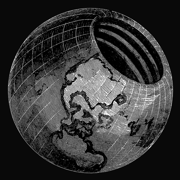
Remember how I said there were many theories about unexplored regions of Earth “however crazy”? Enter John Cleves Symmes (1780-1829), a military captain and veteran of the War of 1812. A timely listen to an episode of American history / comedy podcast The Dollop introduced me to Symmes and his theory. Symmes even spoke to the AGS in New York about his theory! Here at the AGSL we actually have a copy of The Symmes Theory of Concentric Spheres: Demonstrating That the Earth is Hollow, Habitable Within, and Widely Open about the Poles (1878) compiled by Symmes’ son Americus Symmes. They sure didn’t skimp on the title. The theory posits that the Earth is “globular, hollow, and open at the poles”, with a northern opening 2,000 miles in diameter and a southern opening that is “somewhat larger” (because why not, right?). The elder Symmes took his theory on the road, beginning in 1818 with an open letter calling for the exploration of the Arctic Polar Region to look for an opening, touring and lecturing until his death in 1829. Much like the speculation that a southern continent would have a temperate climate and be teeming with plant and animal life, the supposed hollow interior of the Earth according to Symmes would have a moderate climate and an abundance of flora and fauna. To Symmes and those convinced of his theory, the hollow Earth and its openings explained several phenomena including climate variation among various regions occupying the same latitude (for example temperate Europe vs. cold U.S. and Canada in winter), the Auroras (Borealis and Australis) and the counterintuitive migration patterns of various fish, bird and mammal species and groups of people. Want proof? Symmes claimed that looking at the example of Saturn’s Rings (discovered in 1610) proves that concentricity can exist. He also advanced the notion that not only Earth, but the rest of the planets in the solar system were probably hollow too. Including the sun! Needless to say Hollow Earth Theory doesn’t have much traction these days, except on the fringe where theories such as flat earth and the hollow moon (Aliens stole our moon and replaced it with a hollow one to spy on us?! Makes sense…) among others are alive and well.


The AGS Library is home not only to maps like the nautical charts that I have been working on cataloging during my time here, but a multitude of books, atlases and print materials that can be just as surprising as discovering the Earth is hollow.
Sources:
Blake, John. The Sea Chart: The Illustrated History of Nautical Maps and Navigational Charts. Conway/Bloomsbury, 2016.
Symmes, John Cleves. The Symmes Theory of Concentric Spheres: Demonstrating that the Earth is Hollow, Habitable Within, and Widely Open about the Poles/ compiled by Americus Symmes from the writings of his father, Capt. John Cleves Symmes. Bradley & Gilbert, 1878.
“Hollow Earth.” The Dollop from SoundCloud, 14 May 2015, https://soundcloud.com/the-dollop/80-the-hollow-earth
Century of Progress Maps
by Judy Aulik
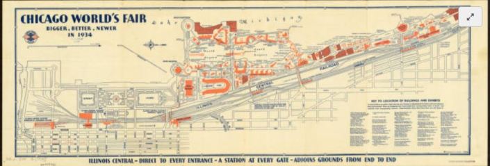
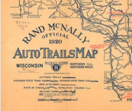
Chicago, celebrating an ill-defined centennial, hit the 40th anniversary of its 1892-1893 World’s Columbian Exposition with the Century of Progress fair of 1933-1934. Map publishers went into overdrive to commemorate the first large World’s Fair of the auto tourism era. Oil companies which commissioned these road maps for their gasoline brands include Barnsdall, Conoco, Deep-Rock, Diamond, Gulf, Lubrite, Pennzoil, Pure, Shell, Standard (Indiana), and Vacuum Oil. Both H.H. Gousha and Rand McNally produced many road maps for the occasion: some were essentially Chicago vicinity maps with an inset of the lakefront fair grounds. Some bore specially designed covers, such as those from Barnsdall and Pure. Others showed routes with a symbol celebrating each exhibit hall. Even post card manufacturer Curt Teich published a commemorative road map for its hometown!
But not every attendee drove. Many used the railroads instead. The Chicago & Northwestern Railroad was an obvious choice for those west of the city. However, five electric line stations plus the Illinois Central’s Central Station served the Century of Progress and the museums.
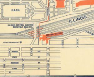
Although Chicago is a well-planned city, a city map and exhibit map would be welcomed by the tourist. In 1934, Illinois Central Railroad issued a Rand McNally map for this purpose.
Oddly, this is oriented east-west as opposed to a road map. By this time, the convention of using the top edge of the sheet being north was nearly universal. Lake Michigan comprises its top edge.
The Century of Progress Deco exhibit buildings do not survive, with the exception of a House of Tomorrow, on Beverly Shores, Indiana. Since 1997, the IC rail yards are greatly reduced, and Millennium Park occupies some of the area shown on this map. IC’s Central Station is demolished, but Chicago’s lakefront was returned to the people.
Click here to view the AGS Library copy in the Digital Map Collection
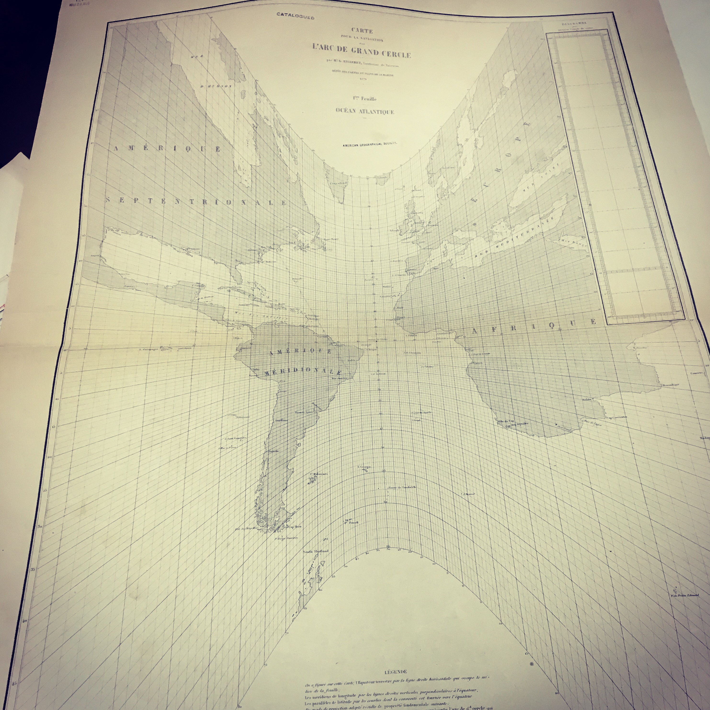
Planisphere physique by Philippe Buache, 1756
by Angie Cope
The AGS Library recently acquired a map of the world on a north polar projection. The map was made by French geographer Philippe Buache (1700-1770) who was one of the first to recognize the importance of watersheds. Buache trained under the geographer Guillaume Delisle and was married to Delisle’s daughter.
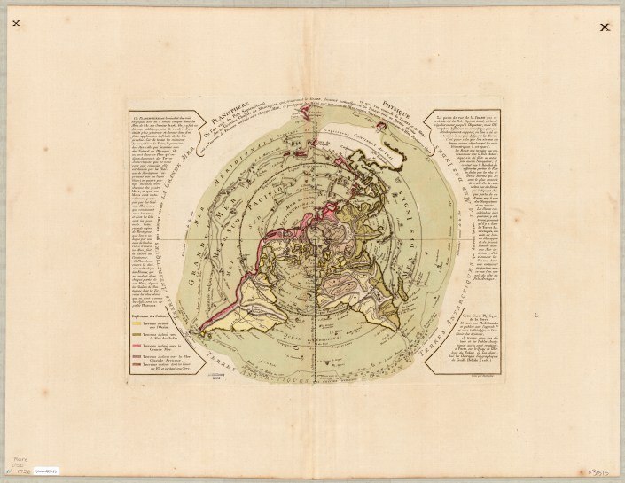
This map shows mountains and how each flows via rivers to the seas. Buache correctly identified the existence of Alaska and the Bering Strait, years before they were officially discovered.
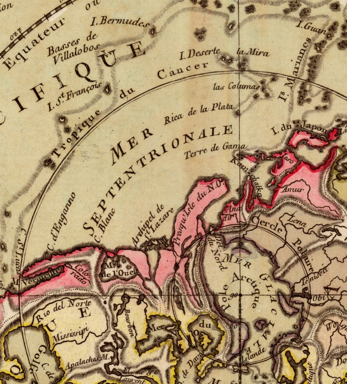
On the map he depicts an Antarctic Sea which turned out to be inaccurate.
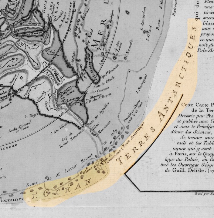
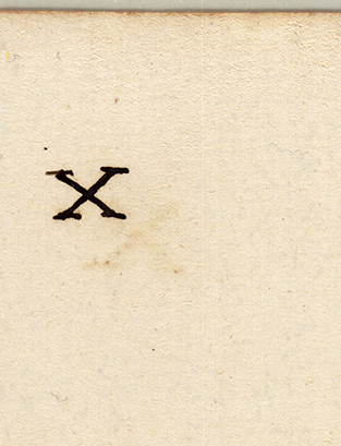
The AGS Library copy of this map is larger than other known copies at 56 x 74 cm in size (compared to 34 x 46 cm of other maps). The AGS Library map also has “Xs” in the top right and left corners on both the front and back of the map.
The text along the edges describes various expeditions and includes mention of Bouvet de Lozier’s 1738-1739 discovery of icebergs between 200-300 feet high and half a league to 2 or 3 leagues in circumference.
The AGSL copy of this map is available at the UWM Digital Map Collection. Click here to view it in more detail including zoom, pan, etc.
Library of Congress copy can be viewed in more detail here.

Cartographic Craftsmanship
by Sam Balistreri-Daum
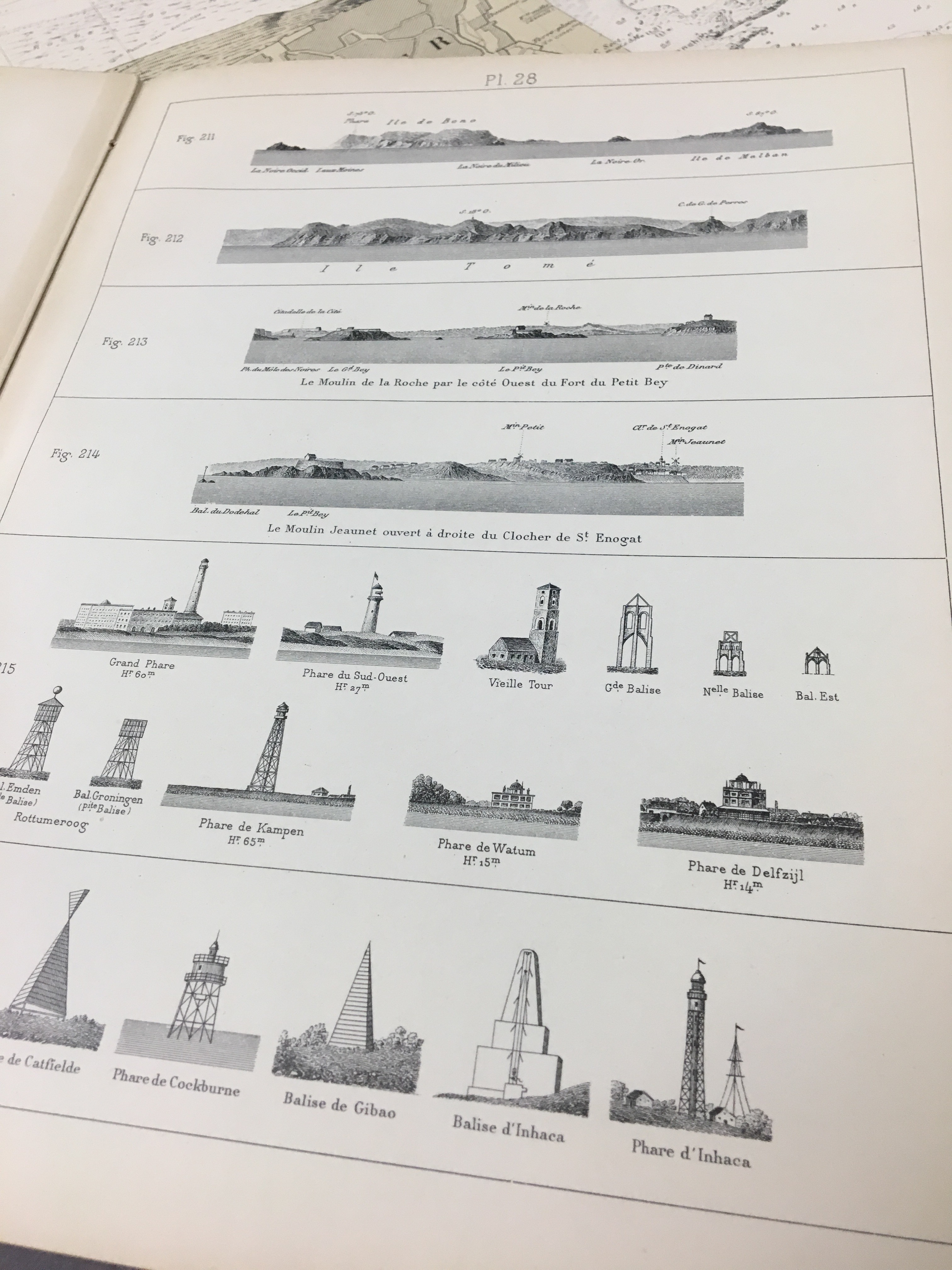
One aspect of the 19th and 20th Century nautical charts that continues to amaze me is the craftsmanship. I am currently working on the AGS Library’s set of Argentinian charts. Working with charts in a variety of languages means learning the various nuances of how the language is used in cartography, especially abbreviations. One abbreviation that had us scratching our heads for a little while was “dib.”, which we would see in the bottom right margin of the sheet accompanied by a name. I later found that this stood for dubujado or drawn and was again impressed by the level of craftsmanship and precision that is involved in cartography, especially in the days before computers.

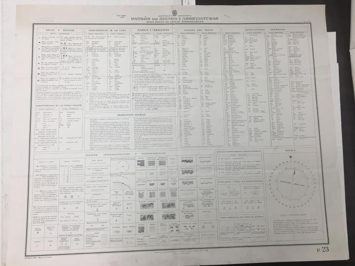
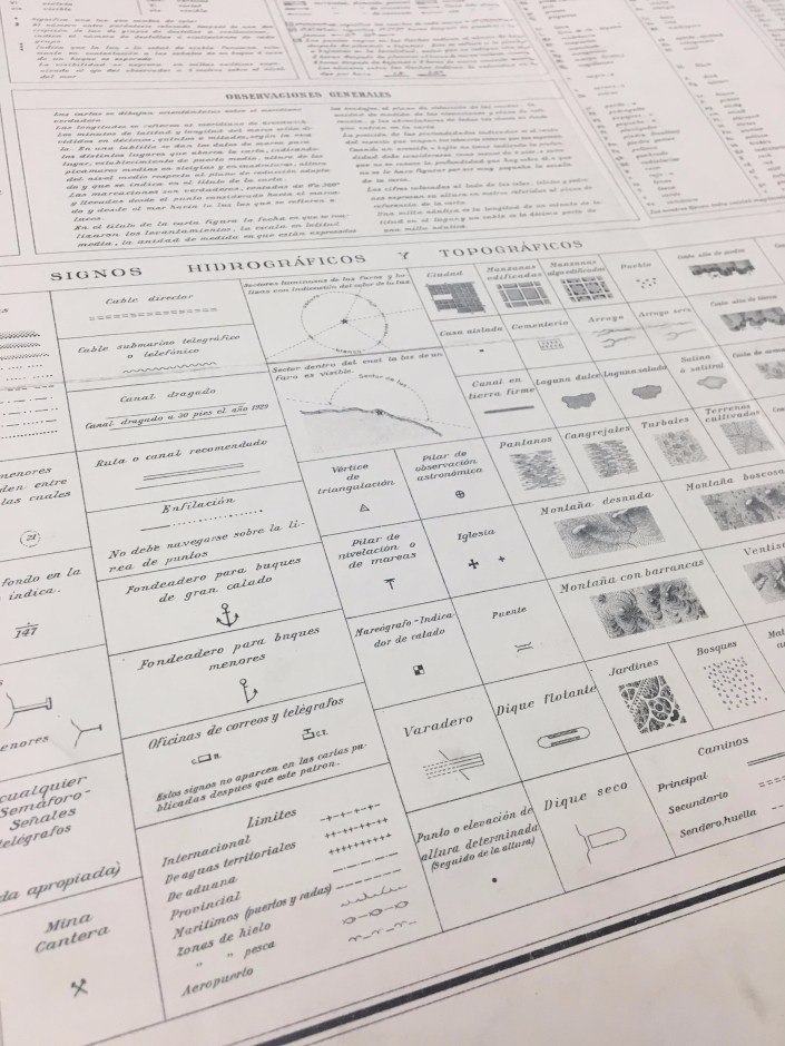
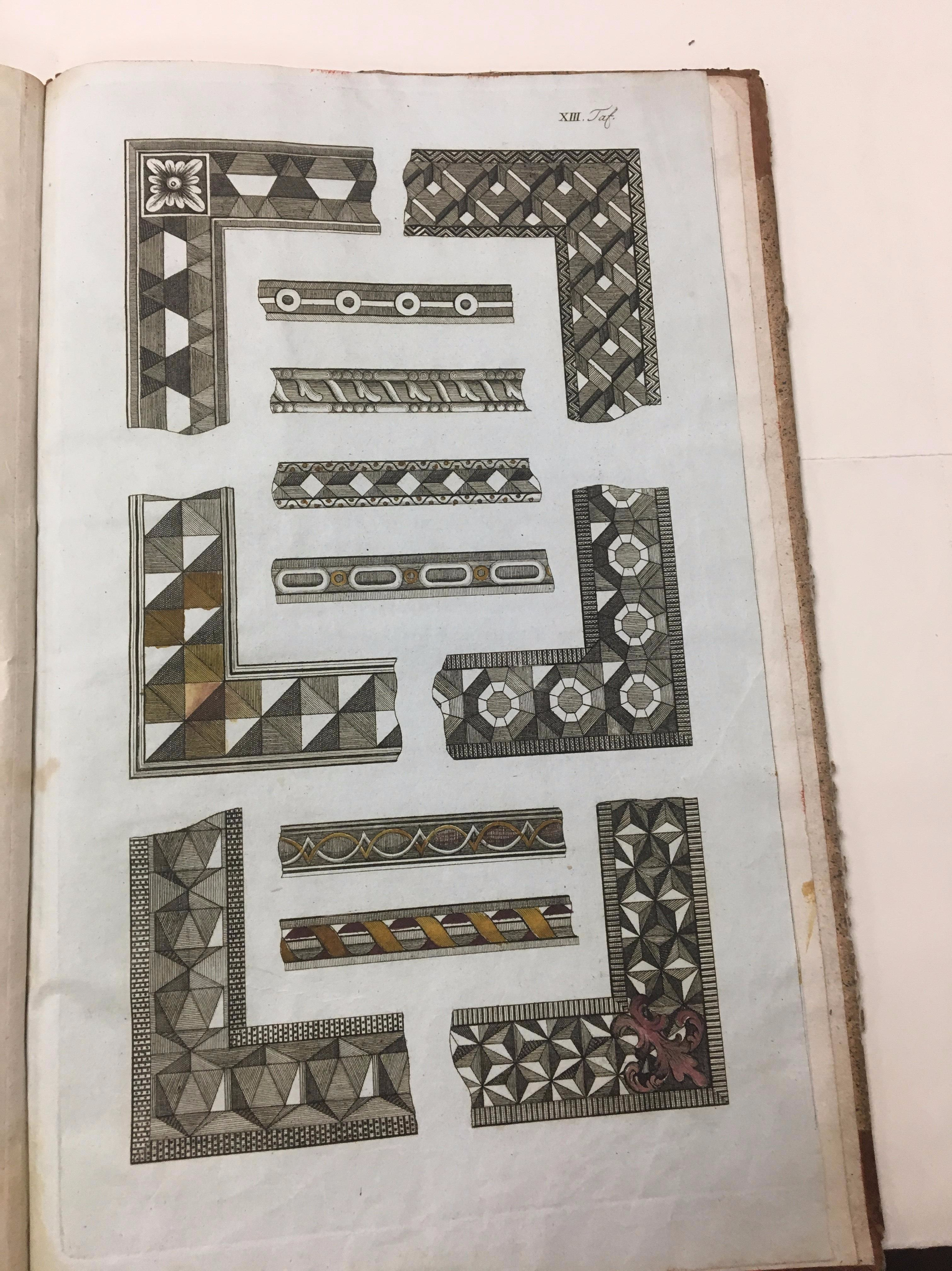
While cataloging the Argentinian charts I came across a chart containing keys for abbreviations, signals and topographic and hydrographic symbols used in the drawing of the charts in the series. This is a reference guide for those who would use the charts. Note the variety of styles that were done by hand before maps were engraved and then printed (click the image for an enlarged view).

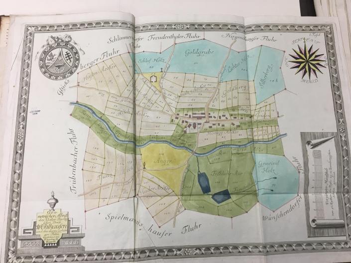
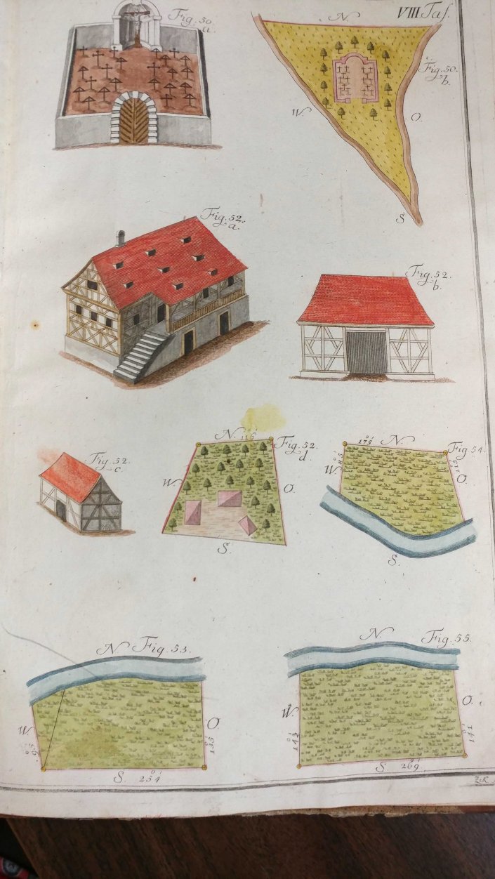
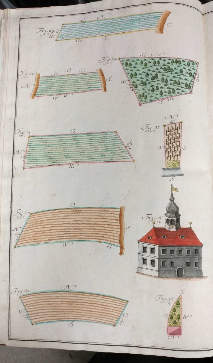
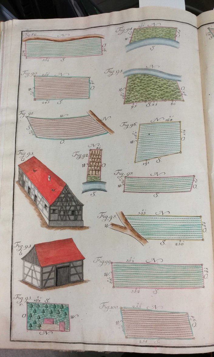
…And now for something different but related. How did a cartographer learn the skills necessary to draw maps? For an example of this we turn to the Practischer Entwurf eines neu zuerrichtenden Urbariums (1792). The book contains practical illustrations of (fictional) maps meant as a “how to” guide for cartographic drawing. This volume contains beautiful colored examples of cartography, but perhaps the most fun are the fictional places depicted on the maps. One map features such locations as Schmaltz Aecker (lard lands), Hader Aecker (discord lands) and a section labeled Anger that despite translating to “green” is actually colored in yellow.

Milwaukee’s First Brownie–William Wallace Rowland Part Three
by Judy Aulik
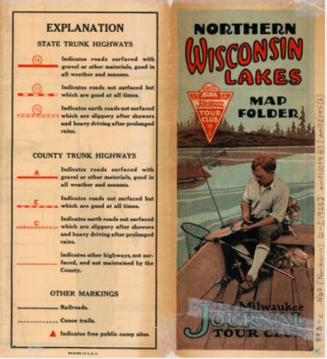
Beginning ca. 1924, state official maps had improved dramatically. The distractions of the Poole Bros. base map were gone. Improved highways were noted, which had always been a staple of the “Brownie” columns. The Milwaukee Journal Tour Club began to publish more specialized maps, such as Northern Wisconsin Lakes and their stand-alone Wisconsin maps, printed on heavy stock, in addition to their Call of the Open Road books.
The first blow to the Tour Club came when Wisconsin changed from the large detour maps, installed on large wooden signs at intersections by highway contractors, to the overprinted detour maps issued regularly. Each week, the Tour Club’s Information Station had updated detour information to go with the maps which membership conferred. Another Milwaukee Journal Tour Club function was superseded, although years before, AAA had begun to offer similar service.
After the Great Depression hit, The Milwaukee Journal tried to advertise its Tour Club more prominently in other newspapers. It offered more atlases and transcontinental maps as other states developed their state highway systems, and as the Federal Highway system, introduced in 1926, made cross-country travel more common.
In the same era, W. W. Rowland assumed more responsibility with the Journal. Map offerings by the Tour Club began to dwindle, and by 1933 the Milwaukee Journal Tour Club ceased to exist. Perhaps coincidentally, oil company advertising, especially road maps, reached their artistic peak. Milwaukee local Wadham’s Oil, in conjunction with Langwith, distributed beautiful maps before and after its merger with Socony-Mobil. National companies used either H. H. Gousha or Rand McNally to produce their maps, and Shell and Sinclair are especially noted for their advertising maps of the early ’30s, distributed free, of course. You can only guess what went through Brownie’s mind when the decision to terminate the Tour Club had to be made. Was it nostalgia for the earliest highway trips with his mother? Was there wistfulness for the days he coupled automotive trials and road reviews with his faithful “Poor Cuss?” Or did he merely say to his staff, “Job well done!”?
Eleven more years passed. His sister continued a woman’s column as he reached the vice-presidency at the Journal. In 1944, William Wallace Rowland passed, but “Brownie” lived on in the hearts of Milwaukeeans.

-End of series-
Part 2
Portions of these blog entries came from research for the Road Map Collectors Association’s publication, The Legend, and an April 23rd, 2017 presentation at the American Geographical Society Library.
Special thanks to the AGSL guest blogger, Judy Aulik. With an extensive road map collection of her own, Judy Aulik has served as past President of the Road Map Collectors Association, an organization founded in 1996. Now boasting a membership of several hundred in the US, Canada, and Europe, the club publishes a quarterly newsletter, has a website, Facebook page, and hosts an annual “Road Map Expo.” Judy is a retired Adult Services Librarian with a PhD from UW-Madison. She recently spoke to the Wisconsin Map Society about the history of the Milwaukee Journal Tour Club, and its influence on highway signage and mapping.
Milwaukee’s First Brownie–William Wallace Rowland Part Two
by Judy Aulik
In a strange burst of synchronicity a century ago, two numbered highway systems arose: that of commercial map publisher Rand McNally, and that of the State of Wisconsin. One interpreted the national blazed trails, the other rejected it entirely. W.W. Rowland catalyzed the latter.
 Rand McNally cartographer John Brink understood that a road map with written trail names along its roads was confusingly cluttered. His $100 idea was to place a legend on the Auto Trails (and Junior Auto Trails) maps with a number, the trail marking, and the trail name. Routes were tagged with the number in white in a dark rectangle. Although Rand McNally did attempt to sign these roads, the waterproofed cardboard signs were unlikely to survive the way Goodrich’s Guide Posts would. The clutter Brink removed, however, reappeared in advertising of area hotels and restaurants in certain road maps.
Consider using a highway map to navigate. The maps of the last 90 years had alphanumeric symbols printed on each highway, and road quality was designated by the type or color of line used. Try navigating through a major city if these signs are absent from the road! Navigating the state had the same trouble prior to 1918. Before the State Highway Trunk System, you were lucky to have a map. The Journal map insets, and accompanying text, plus The Call of the Open Road showed you if, for instance, a road was unimproved and likely to be muddy, but unless a trailblazer had marked the route, you wouldn’t know if you were on the correct road unless it followed a railroad or river.
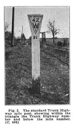
After Wisconsin State Highway Commission employees A.D. Hirst and W.O. Hotchkiss developed the system, numbering the highways from 10-99 according to the length of each, in one mad week in May, 1918, county highway departments erected numbered road signs. The first major style was a wooden post with a flared top. The cut yielded triangular sign, with the route number above WIS in the tapered point was painted on the face. It was also used as a milepost, with the mile number painted on the round post beneath the route sign.
Although the state official 1917 map was not intended for the tourist, it bore some resemblance to the modern road map. By 1918, it was improved. Blazed trails were deemed illegal in the state, although only the Yellowstone Trail was truly affected. However, the map still looked a bit makeshift, with the state trunk highways in red, overlaid on the Poole Bros. map base. Mileages between cities or intersections were still unlabeled, and highway surfacing unmarked. In use, until the mid-’20s, Wisconsin official maps, although free and accurate, fell short of the nearly streamlined maps The Milwaukee Journal and its Tour Club provided at low cost for the auto tourist.
-End Part Two-
Special thanks to the AGSL guest blogger, Judy Aulik. With an extensive road map collection of her own, Judy Aulik has served as past President of the Road Map Collectors Association, an organization founded in 1996. Now boasting a membership of several hundred in the US, Canada, and Europe, the club publishes a quarterly newsletter, has a website, Facebook page, and hosts an annual “Road Map Expo.” Judy is a retired Adult Services Librarian with a PhD from UW-Madison. She recently spoke to the Wisconsin Map Society about the history of the Milwaukee Journal Tour Club, and its influence on highway signage and mapping.
Milwaukee’s First Brownie–William Wallace Rowland Part 1 of 3
By Judy Aulik
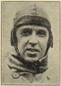 The Milwaukee Journal has a unique role in the history of Wisconsin’s State Trunk Highway system, thanks to one man: “Brownie” Rowland. Born in 1878, he worked his way up from office boy “Wallie” to becoming the Journal’s vice-president. But in the meantime, he was known to millions as “Brownie,” accompanied by his sidekick on the Wisconsin roadways, “The Poor Cuss.”
Early on, Rowland realized that two things were needed to improve the lives of auto tourists: good maps and good trailblazing. Nationally, beginning in 1912, the few good roads were known as “Blazed Trails,” and the best known of these was the Lincoln Highway. Predating the more well-known route, however, was the Yellowstone Trail, the only transcontinental blazed (named) trail to pass through Wisconsin.
In true Wisconsin spirit, he set out–at first with his mother as navigator–to 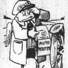 mark the better highways of the state as Journal Roads. These mapped routes were printed in the Sunday Journal. Parallel to this effort was that by the Wisconsin Advancement Association, which blazed convenient roadside objects with geometric blazes in red, white, or yellow; considerably more primitive than the Journal markings.
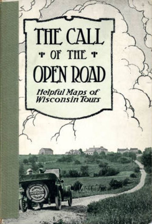
By early 1916, an ad in the Journal urged people to keep a scrapbook of maps clipped from the columns found in the sport section. Maps could come from other sources, such as B.F. Goodrich Company promotions. But something was brewing which lasted to the end of Prohibition: The Call of the Open Road.
 The 1916 edition wasn’t revolutionary. The maps were the insets previously seen, plus a state map of Tentative Main Travelled Roads of Wisconsin, from late 1915. Some of the WAA trails were shown. However, the narrative style of previous guidebooks and the concept of navigating by landmarks were to be replaced with maps.

Final two image credits: Rowland, William W. The Call of the Open Road: Helpful Maps of Wisconsin Tours (Milwaukee, Wis.: Milwaukee Journal, 1916). Online facsimile at http://www.wisconsinhistory.org/turningpoints/search.asp?id=1680
-End part one-
Part 3
Special thanks to the AGSL guest blogger, Judy Aulik. With an extensive road map collection of her own, Judy Aulik has served as past President of the Road Map Collectors Association, an organization founded in 1996. Now boasting a membership of several hundred in the US, Canada, and Europe, the club publishes a quarterly newsletter, has a website, Facebook page, and hosts an annual “Road Map Expo.” Judy is a retired Adult Services Librarian with a PhD from UW-Madison. She recently spoke to the Wisconsin Map Society about the history of the Milwaukee Journal Tour Club, and its influence on highway signage and mapping.
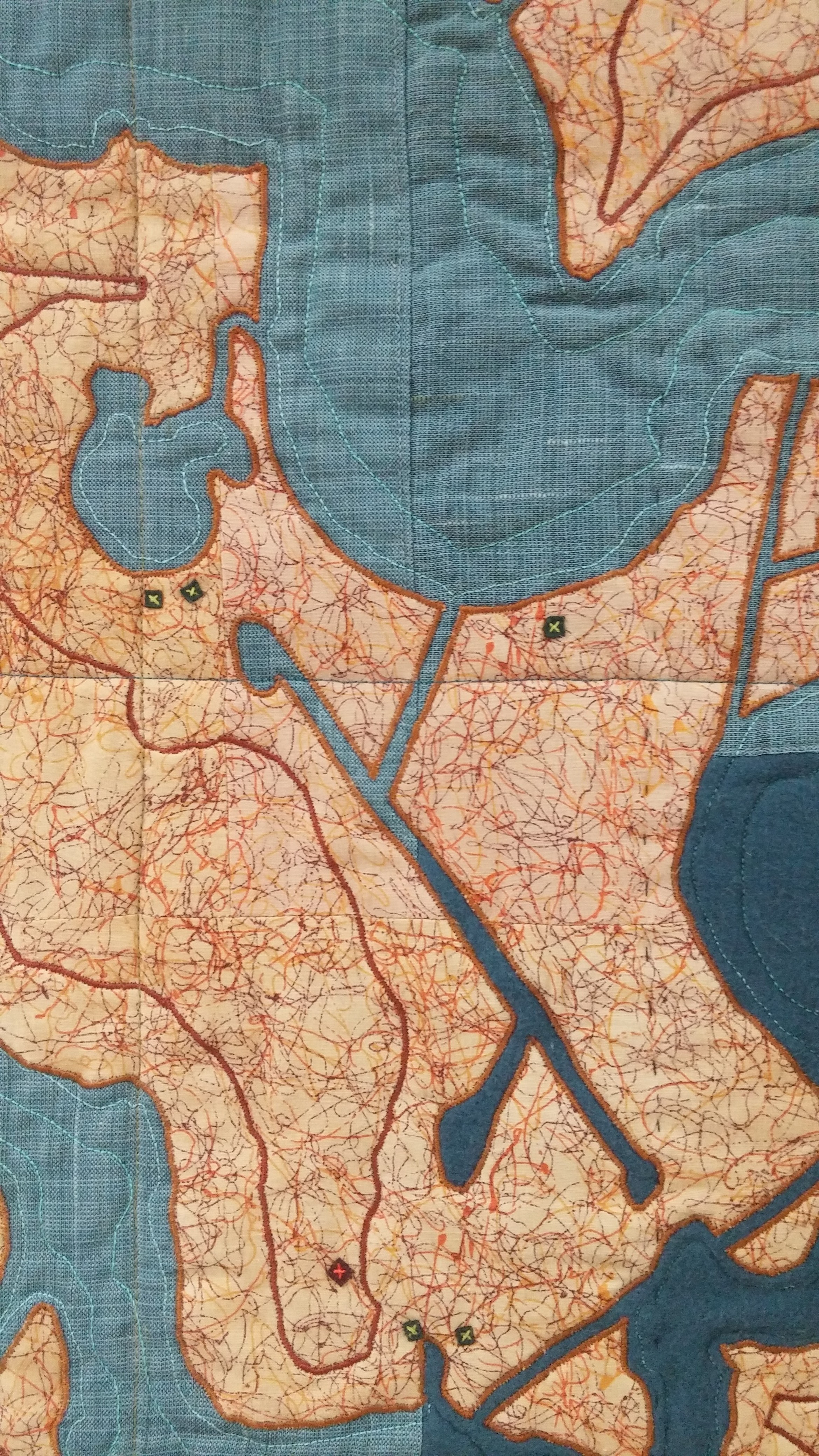
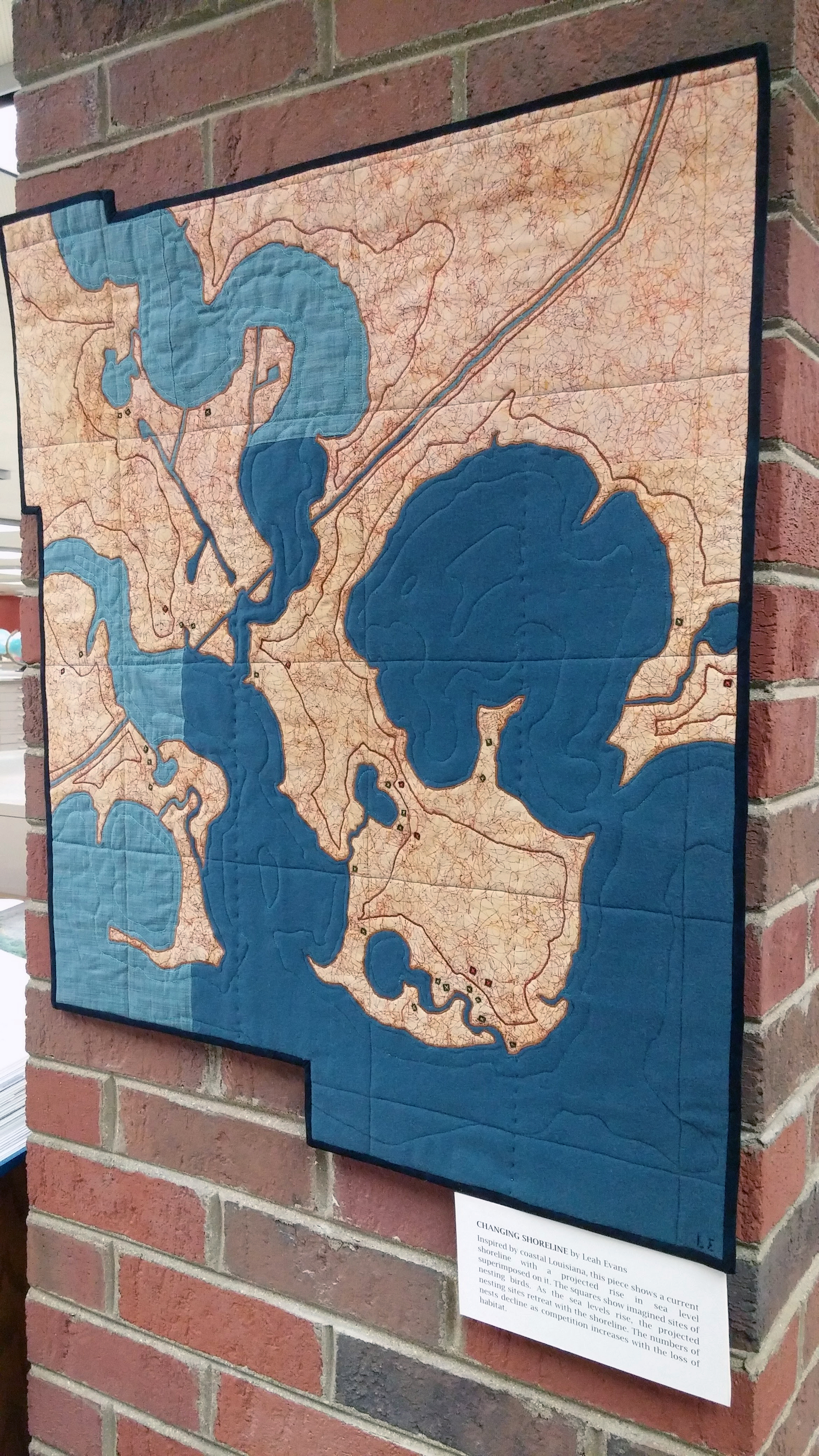
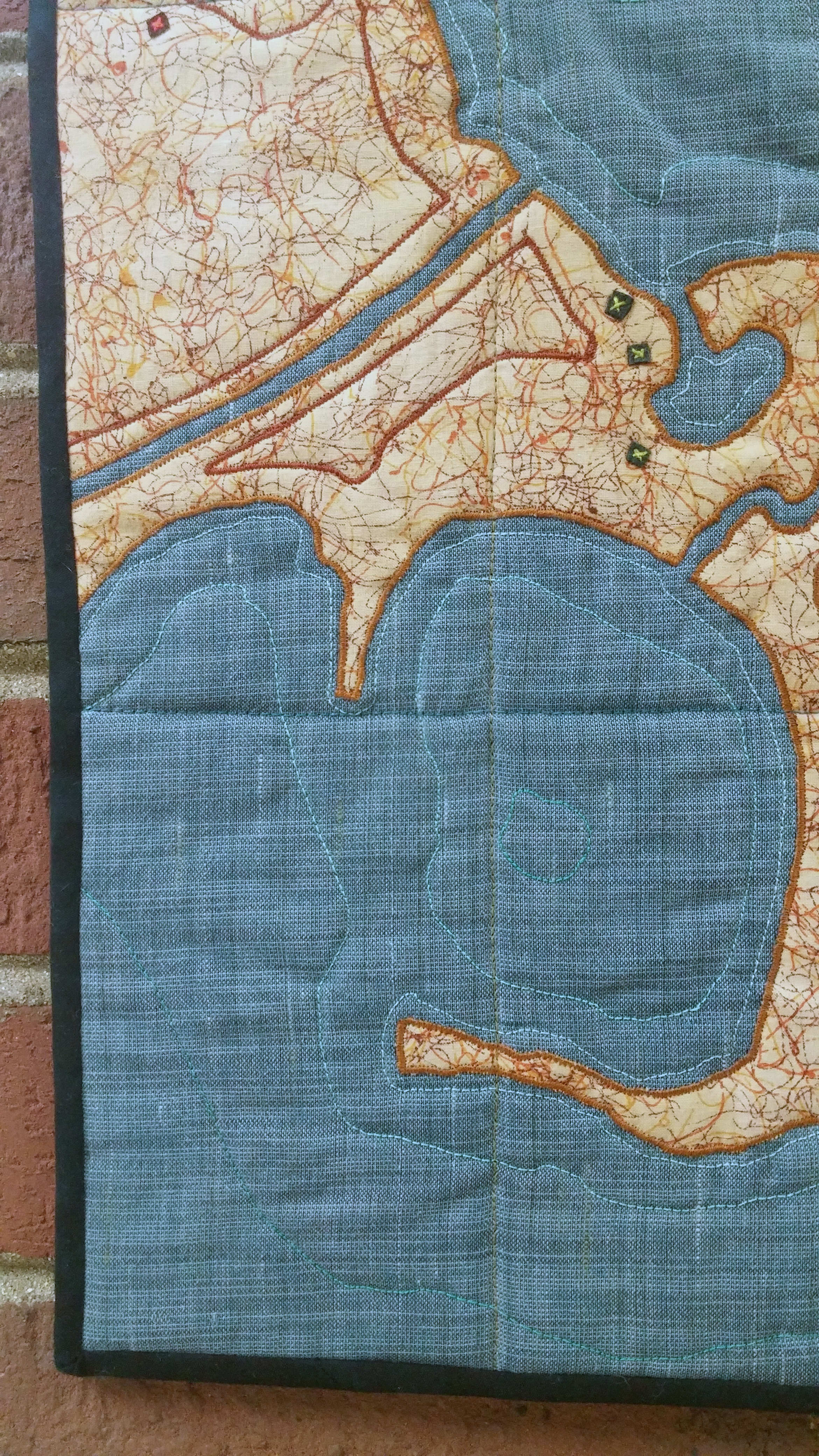
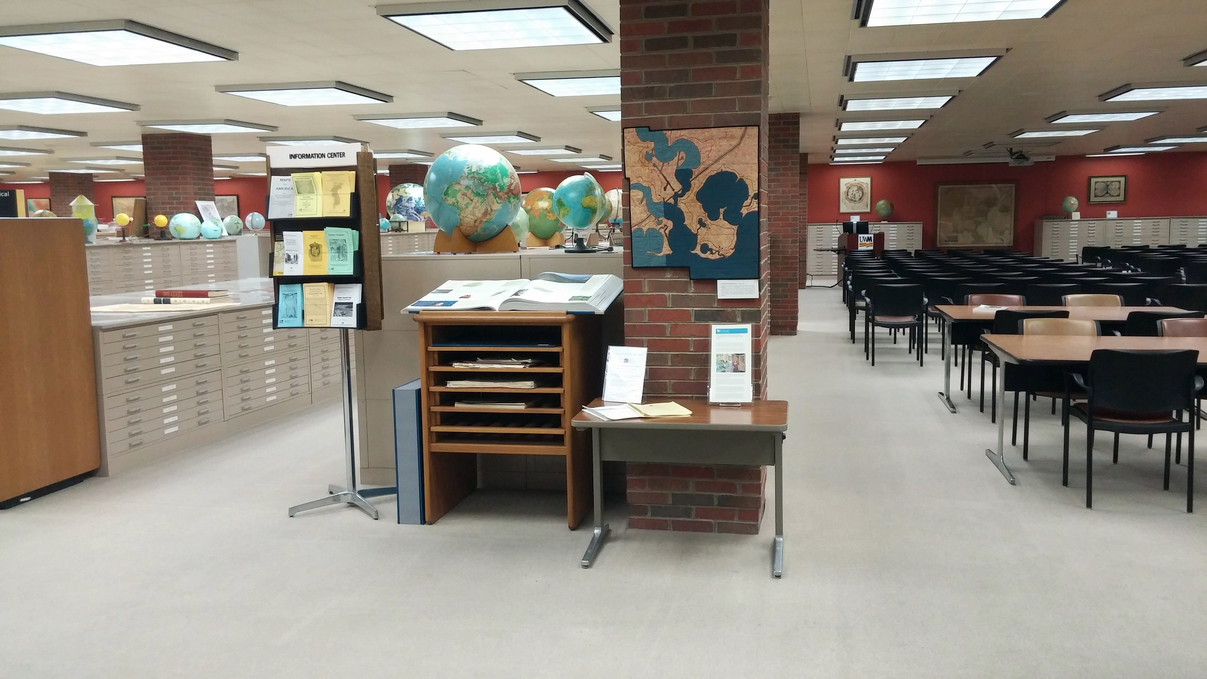
AGSL Acquired “Shoreline” by Leah Evans
by Susan Peschel
Recently the AGS Library acquired a “map” entitled, Shoreline, from Wisconsin fiber artist, Leah Evans.
Leah was one of 21 artists to participate in the prestigious 2015 Smithsonian Craft Show held in Washington, D.C. and was chosen to receive the first “Honoring the Future Sustainability Award” for this piece. The award “recognizes an artist whose work educates the public about climate change or inspires or models a sustainable response to climate change.” ( click here for more information )
Leah’s description of this piece provided for the show’s application sums up a recurring theme in her designs:
“An overarching theme in my work is human impact on the environment. Effects of climate change addressed in my current work include species loss and displacement, changes in shorelines and subsequent effects on human and wildlife communities, and water conservation. Through handwork and a majority of re-purposed materials, I create subtle reminders of how our actions can create both destruction and opportunity.”
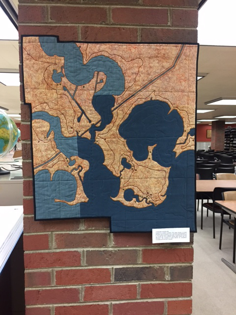
This beautiful work is on permanent display at the AGS Library in the UWM Golda Meir Library.
French nautical charts at the AGSL
by Sam Balistreri-Daum
I have been working as an intern here at the American Geographical Society Library for the past few months, and my work is focused on indexing and cataloging 19th and 20th Century nautical charts. These charts originate in various countries consisting of hydrographic surveys from around the globe. This has been an amazing project to be involved with and I would like to share my progress on the French nautical charts created by the Service hydrographique de la Marine and its predecessor, the Dépôt des cartes et plans de la Marine.
The Service hydrographique de la Marine (today the Service hydrographique et océanographique de la Marine or SHOM) is an office of the French Ministry of Defense, established in 1720. While there are obvious military and strategic implications for the creation of detailed nautical charts, the Service Hydrographique also provided a public service by making accurate charts available to navigators sailing for business and recreation. (Wikipedia) The collection of French nautical charts at the AGSL features charts from around the world including South and Central America, Southeast Asia, Africa, the Polar Regions, the Pacific Islands and Europe as well as world maps and various tidal and atmospheric charts.
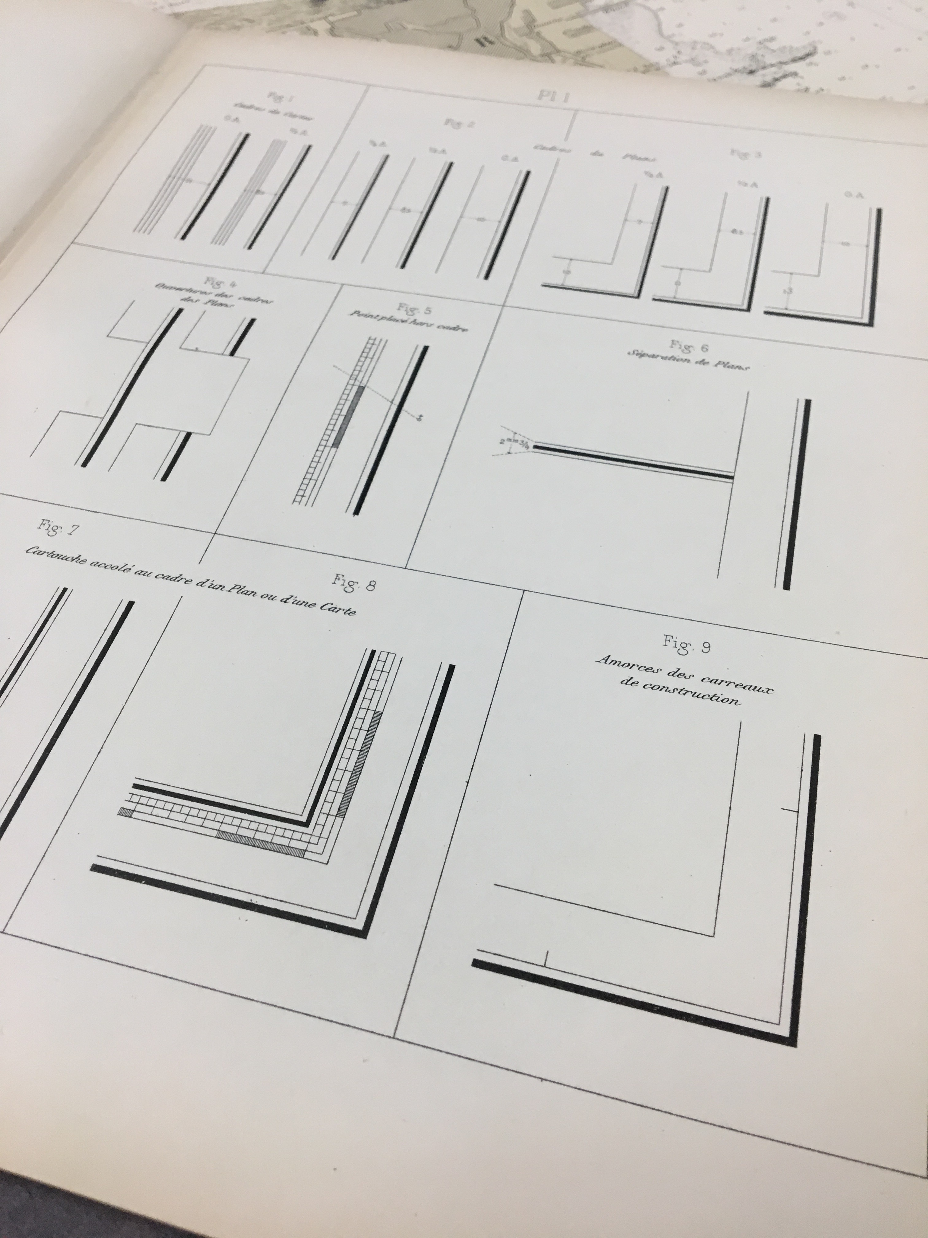
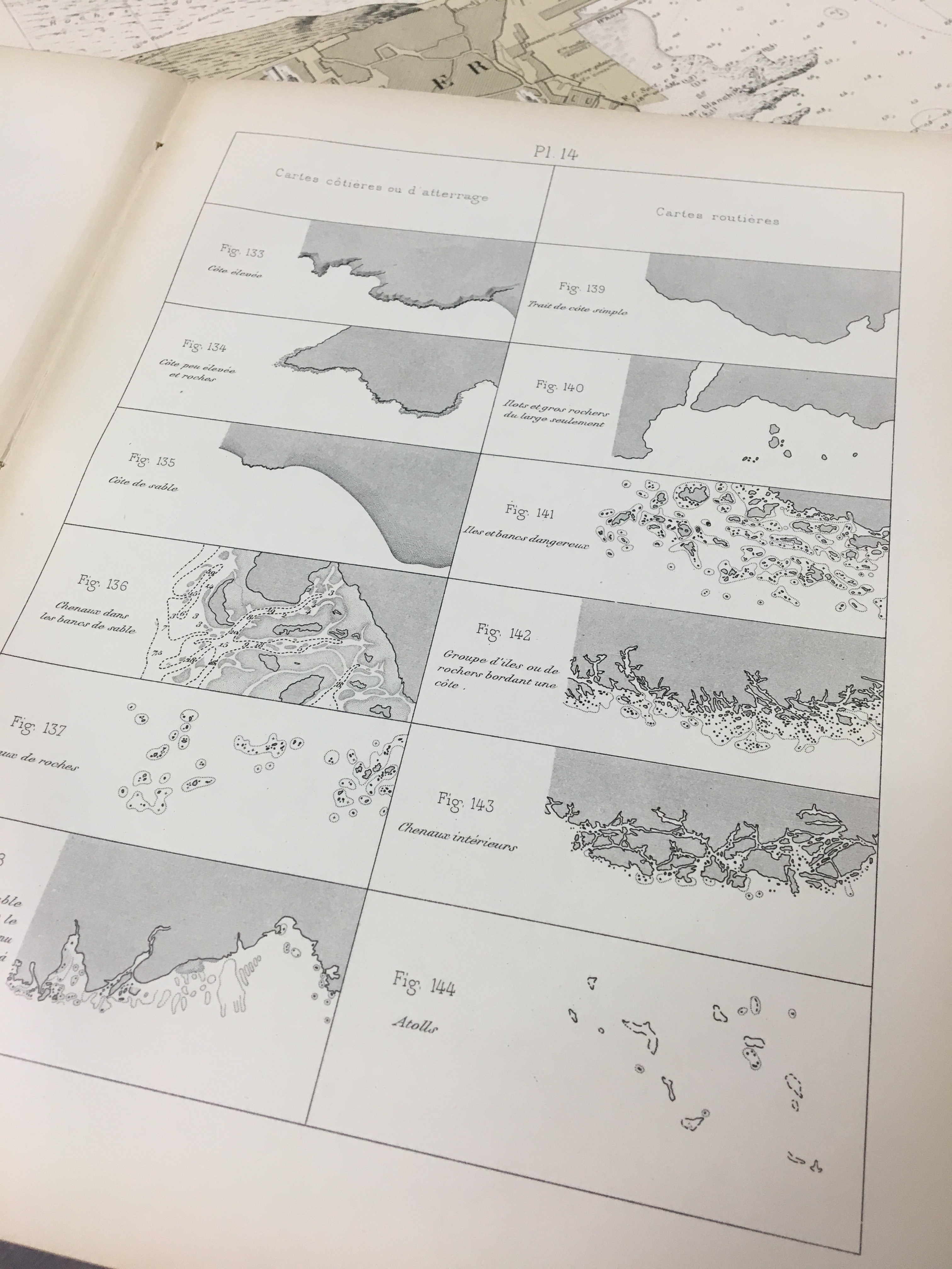
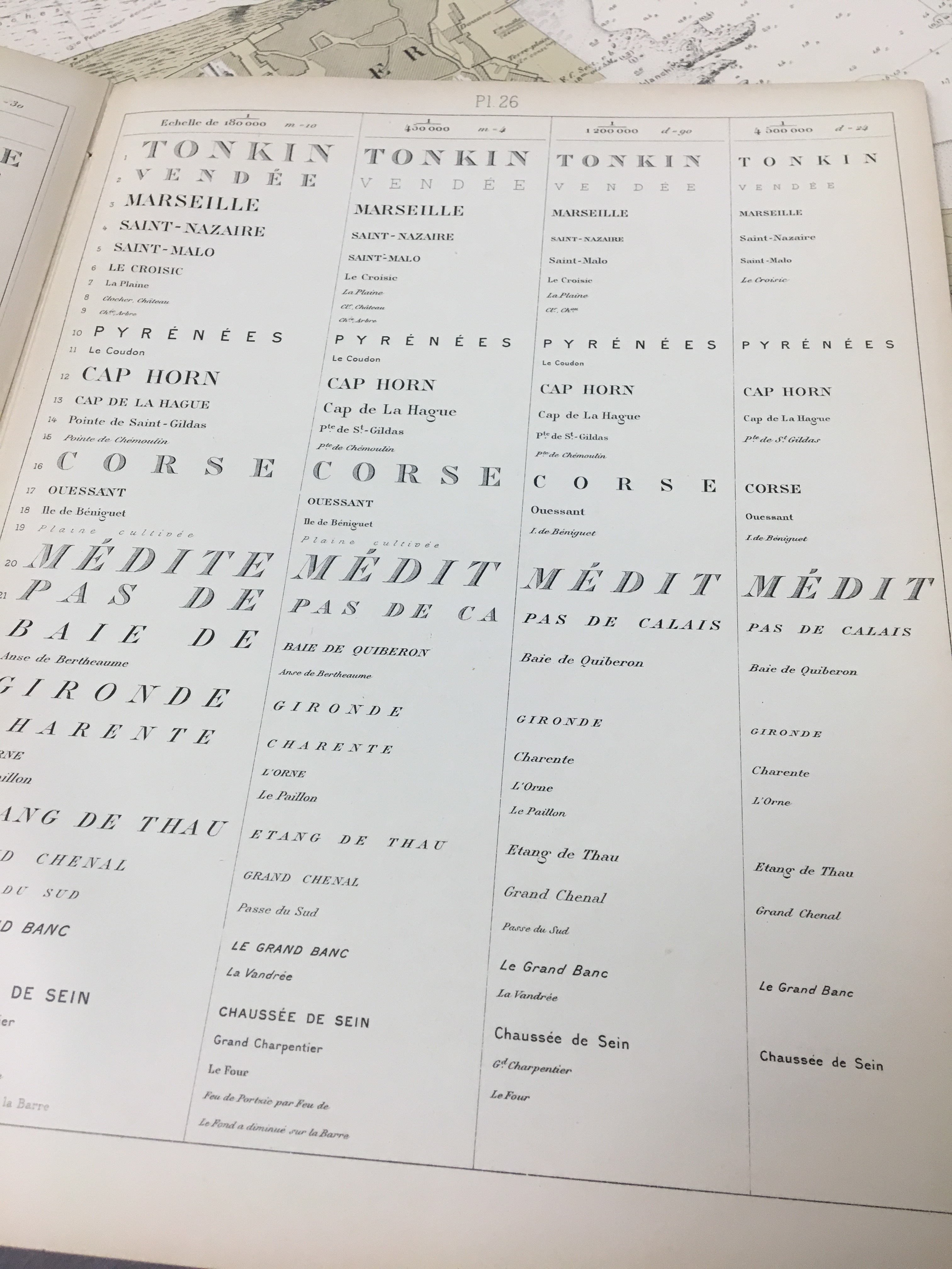
The charts themselves are remarkable not only in their accuracy but in the standards employed in their presentation. The charts are printed using a method called intaglio printing, where the detail of the map itself is etched on a hard surface, such as copper, inked, and then pressed to paper. The AGSL collections also features a guide to the design and creation of these charts entitled Dispositions Générales Relatives aux Cartes et Plans (1914).
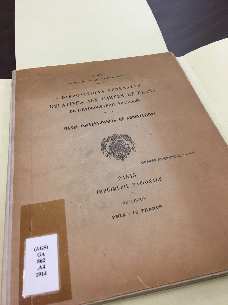
Dispositions Générales Relatives aux Cartes et Plans (1914).
This guide was helpful in understanding the structure and format of nautical charts from the presentation of scale, terminology and printing methods. Here are a few formatting examples from among the many that are included in this great resource.
- ← Previous
- 1
- …
- 5
- 6
