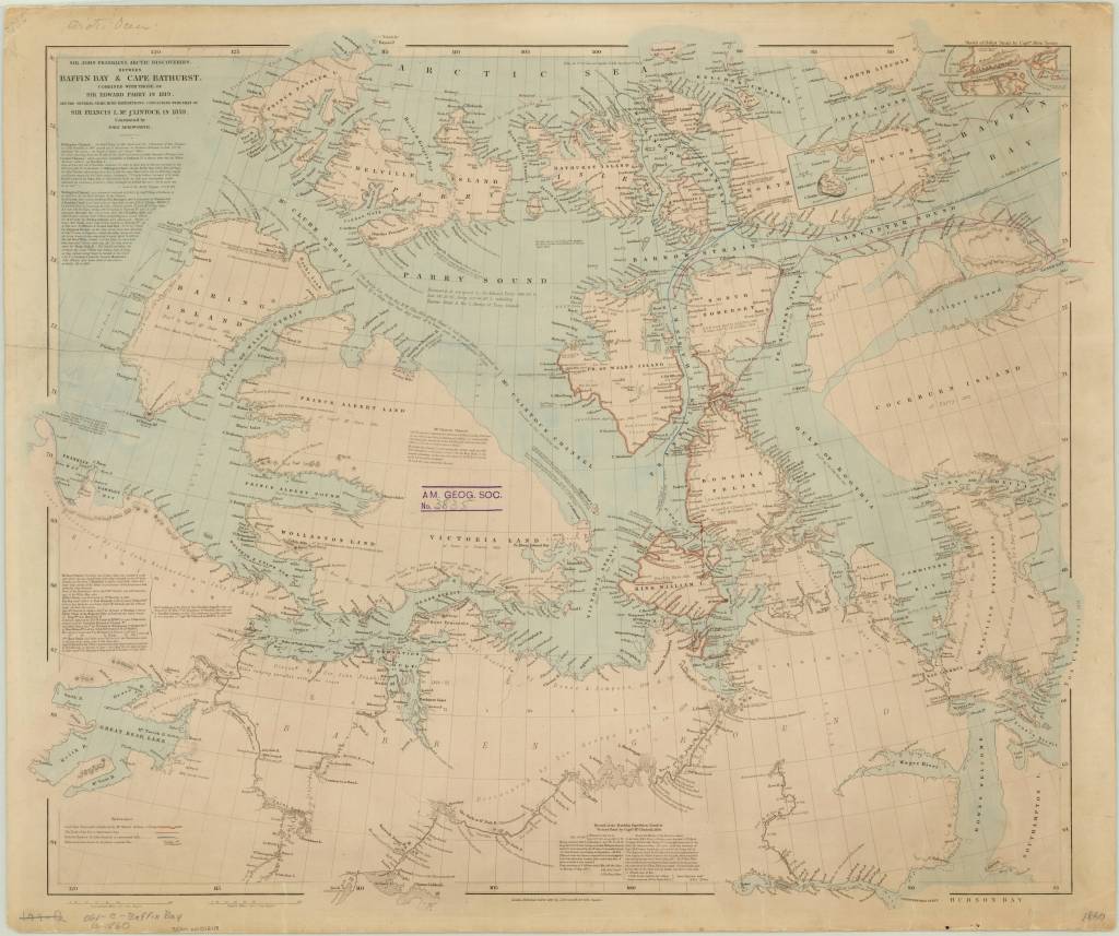
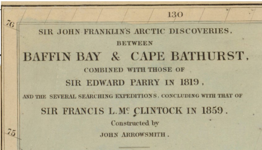
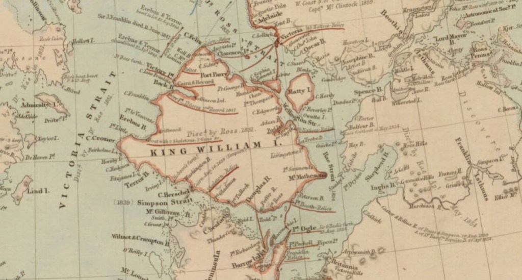
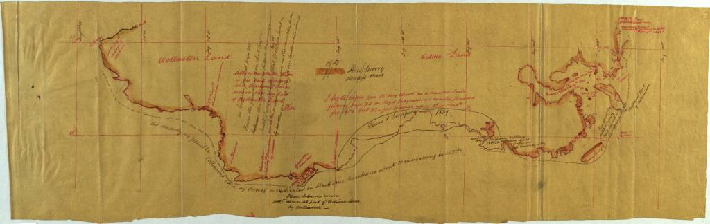
John Arrowsmith’s 1860 Arctic discoveries map
by Angie Cope
If you’re watching the AMC series “The Terror” you’ve experienced the dramatization of Sir John Franklin’s final voyage in 1845 in HMS Erebus and HMS Terror. The journey ended in tragedy for him and all his men, becoming the worst disaster in the history of British polar exploration.
Sir John Franklin’s Arctic discoveries, between Baffin Bay & Cape Bathurst, combined with those of Sir Edward Parry in 1819, and the several searching expeditions, concluding with that of Sir Francis L. McClintock in 1859 / constructed by John Arrowsmith, 1860
https://collections.lib.uwm.edu/…/colle…/agdm/id/21392/rec/4
From Royal Museums Greenwich:
Franklin’s two naval vessels sailed up the Wellington Channel before turning south toward Beechey Island, where they would spend the winter. In the spring, they sailed south down Peel Sound but, off the northernmost point of King William Island, were trapped by the ice flow down the McClintock Channel.
In the spring of 1847, a party from the expedition travelled across the ice to Point Victory on shore and deposited a written record of their progress. It is thought they reached Cape Herschel on the south coast of the island, filling in the unexplored part of the North-West Passage. Sir John Franklin died in June that year.
Still trapped in the ice, Erebus and Terror drifted south until Captain Crozier ordered their abandonment in April 1848. Weakened by starvation and scurvy, the 105 surviving men headed south for the Great Fish River. Most died on the march along the west coast of King William Island.
To read the entire article. https://www.rmg.co.uk/…/john-franklin-final-north-west-pass….
Moravia 1741 by Georges-Louis le Rouge
by Angie Cope
Carte particulière de la Moravie Divisée en six Cercles avec les Principaux Postes de ce Marquisat / pour l’intelligence de la Guerre presente a Paris par et chez le Sr. Le Rouge Ingr. Geographe du Roy … 1741
This map was created a year after the unsuccessful invasion by Prussian forces under Frederick the Great in 1740. Moravia and Bohemia formed a powerful kingdom of the Holy Roman Empire from the 16th Century to the early 20th Century. After the First World War, Moravia was integrated into the new state of Czechoslovakia.
Symbols used for cities and topography; title detail ; detail of Olmutz (Olomouc)
This map is attributed to Georges-Louis le Rouge who was a Paris based map publisher. He was born in Hanover, Germany as Georg Ludwig where he was educated and employed as a military engineer, hydrographer and cartographer. This map of Moravia was made a year after Le Rouge moved to Paris and Francophied his name. He set up shop on the Rue Des Grands Augustins and produced thousands of maps and diagrams ranging from city and town plans, to atlases, plans of military campaigns and sea charts. He received the title “Geographe du Roi” to King Louis XV. Le Rouge also worked with Benjamin Franklin to produce the important 1769 Franklin/Folger Map of the Gulf Stream. Franklin, who met Le Rouge in Paris, writes that “He [Le Rouge] is, I believe, a proper person.” *
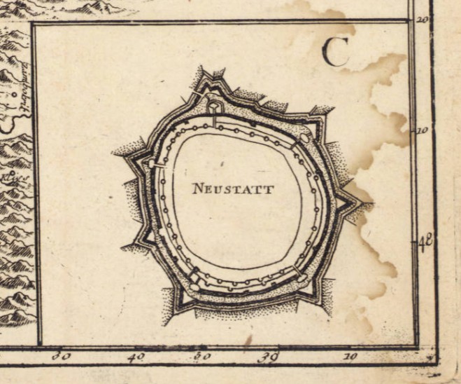
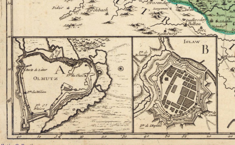
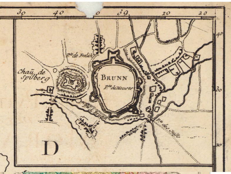
Includes 4 inset maps: A. Olmutz — B. Iglaw — C. Neustatt — D. Brunn.
The copy of the map held at the AGS Library is from the personal collection of Albert Gallatin (1761-1849) who served as the Secretary of the Treasury under both Presidents Thomas Jefferson and James Madison between 1801 and 1814. The maps were given to the American Geographical Society of New York in 1919 by Gallatin’s great grandson, Albert Eugene Gallatin (1882-1952) who served on the AGS Council in 1913. The maps, spanning the years 1700 to 1842, were originally bound as an atlas factice entitled “Atlas generale,” but have been disbound and conserved by the AGS Library at UW Milwaukee Libraries.
*Le Rouge Cohn, Ellen R., Benjamin Franklin, Georges-Louis Le Rouge and the Franklin/Folger Chart of the Gulf Stream, Imago Mundi, Vol. 52, (2000), pp. 124-142.
Remembering Dr. John Rae
By Lauren Maddox
When I first began working for the AGSL and contributing to this blog, I spent a lot of time time with our polar explorers– I wrote about the Lost Franklin Expedition and the hunt to find the ship, and Dr. Elisha Kane’s affair with Margaret Fox, and about the history of the Northwest Passage. Now, as I am graduating from UWM, it seems only appropriate that I should go back to where I started: polar explorers. More specifically, I think its time to spotlight my favorite polar explorer, who has appeared in many of my posts: Dr. John Rae.
Dr. John Rae was the unsung hero in the search for the Lost Franklin Expedition– he was the first to discover what had happened in the tragic wreck that stranded Franklin and his men and report back to the British Admiralty. The discovery ruined his career; the mere suggestion that Franklin and his crew had been forced to turn to cannibalism was offensive to many, and they did not appreciate Rae’s report. It took him years to secure the reward for his crew, and they, unlike the many explorers who went searching for Franklin, were never knighted for their efforts to recover Franklin and his crew.
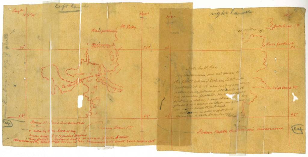
But Rae’s contributions to exploration and cartography went beyond his doomed discovery of the Franklin expedition; he was one of the greatest overland explorers of the 19th century, and has been credited with the true discovery of the Northwest Passage. More than all that, he was a great friend to the American Geographical Society.
Rae’s professional career began at the University of Edinburgh, where he studied medicine. Upon graduating, he was licensed to practice by the Royal College of Surgeons of Edinburgh, after which he signed on with the Hudson Bay Company. While posted in Moose Factory, Ontario, Rae developed many of the qualities that he would become known for as an explorer later in his career: he worked closely with his indigenous colleagues, during a time when many European explorers refused to do so, to learn survival skills and to craft his famous snow shoes. With the knowledge he gained at Moose Factory, he was able to go on long overland expeditions without being slowed down by extra supplies or crew members.
After the Moose Factory post, Rae went on a series of overland expeditions for the Hudson Bay Company. He charted miles of arctic coast, discovering unmapped terrain and recording it for map makers. Many locations were named after him, including the Rae River and the Rae Strait along the Arctic coast.
After discovering the fate of the Lost Franklin Expedition, Rae struggled for years to secure the reward money for himself and his crew. Once they had finally been paid, if not recognized or honored, for their discovery, Rae commissioned the construction of a polar exploration vessel; unfortunately, during its brief career as a cargo vessel on the Great Lakes, the Iceberg was lost on Lake Ontario and never found again– like so many other ships lost on the Great Lakes.
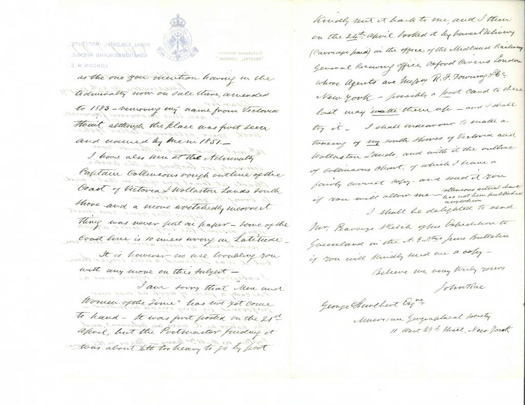
Rae continued to work for the Hudson Bay Company well into his 70s, exploring the Red River area to devise locations for a telegraph line from North America to Russia. At the age of 79, he passed away from an aneurysm and was buried at the St. Magnus Cathedral, where a memorial statue was erected in his honor.
John Rae lived a full and fascinating life. Though he was never honored in his lifetime for his role in discovering the Lost Franklin Expedition, historians remember him for his many other achievements: his extensive exploration of the Arctic and the Northwest Passage; his respect for native communities and their knowledge; and his many, many contributions to the field of cartography. And personally, I will always hold an affection for John Rae, who has been my longest research-interest during my time with the AGSL.
Thank you all for reading!
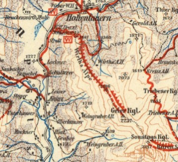
Beautiful countryside makes beautiful maps : The Alps in Austria
By Angie Cope
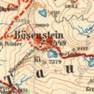
There is a beautiful set of maps dating from 1913 by map great G. Freytag. The American Geographical Society Library has 7 from this 1:100,000 series and they’re packed full of information. From a distance, the maps appear to be basic topographic maps, but if you look closely and think about all the detail you can imagine the complexity of human and natural interactions. Viewing the maps along with photos from the AGS Library photo collections, you begin to understand that this is both a snap shot in time and a reference for the present.
G. Freytags Skirouten-Karte des Ennstales und der Rottenmanner Tauern (G. Freytag’s ski route map of the Enns Valley and the Rottenmanner Tauern)
1913
https://collections.lib.uwm.edu/digital/collection/agdm/id/12013/rec/1
Liezen Torfstich or peat bogs.
The above-ground extraction of peat is referred to as peat cutting. This organic material, which is created in bogs from the carbon from dead plants, serves as a low-energy fuel, to improve soil ventilation in horticulture and to a small extent also for the production of textile fibers and for medicinal purposes.
Interesting map symbology for avalanche warnings. (click on any image to see a larger view)
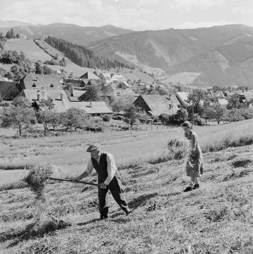
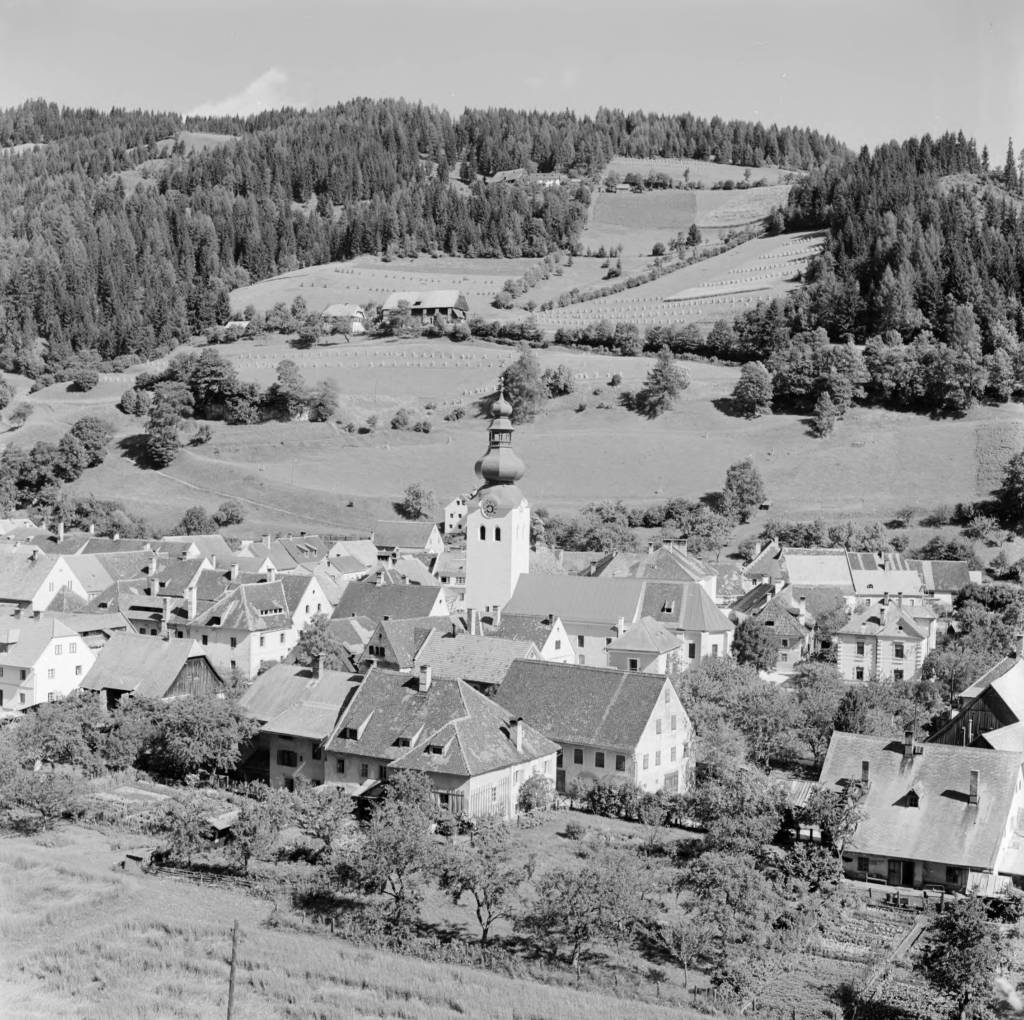
Photos from from the Eugene V. Harris collection between 1937 and 1969 showing the beauty of the region. (click on any image to see a larger view)
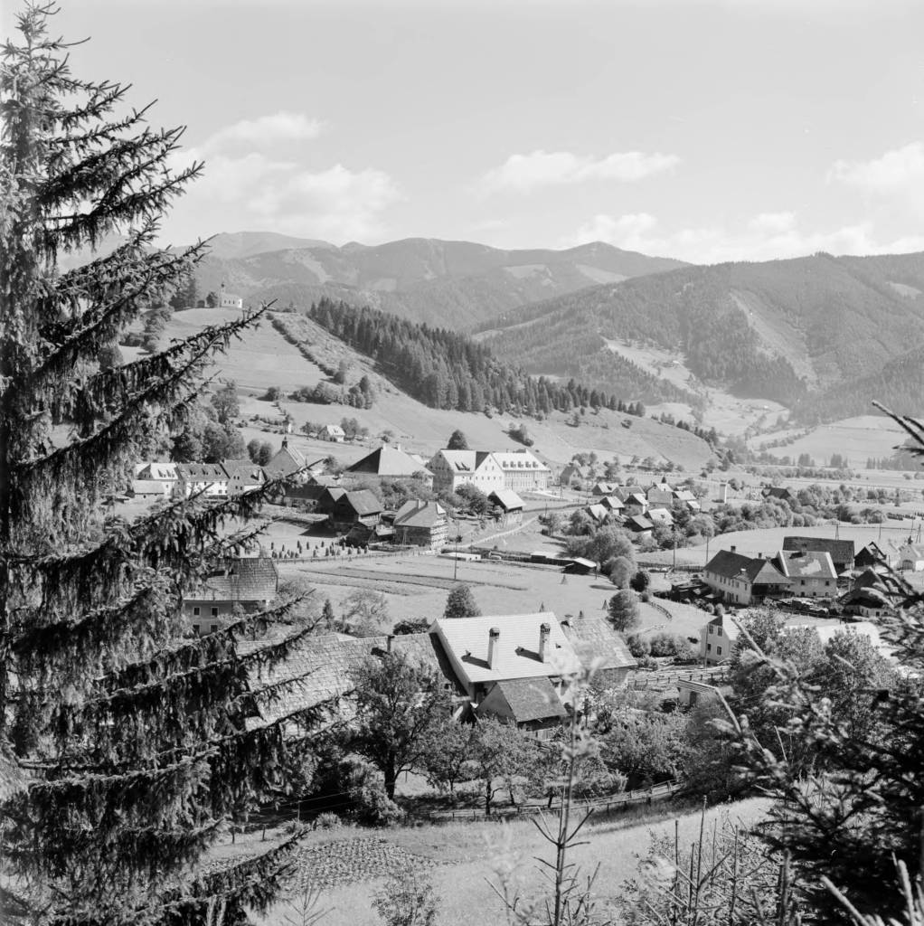
Austria, view of town of Oberzeiring from hill
https://collections.lib.uwm.edu/digital/collection/agseurope/id/1508/rec/1
Austria, view of Oberzeiring and hillside with St. Nicholas Church tower
https://collections.lib.uwm.edu/digital/collection/agseurope/id/1250/rec/13
Austria, people raking hay in field in Oberzeiring
https://collections.lib.uwm.edu/digital/collection/agseurope/id/1690/rec/17
Splendid China was abandoned, looted, turned to rubble and transformed into Margaritaville
by Angie Cope
I’ve been working from home cataloging maps that were donated to the AGS Library. I thought I’d be able perform this task very quickly but, every other map I encounter seems more interesting than the last and distracts me. Today I ran across one called “Splendid China.”
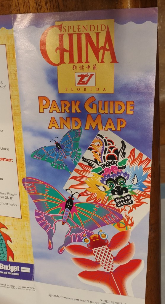
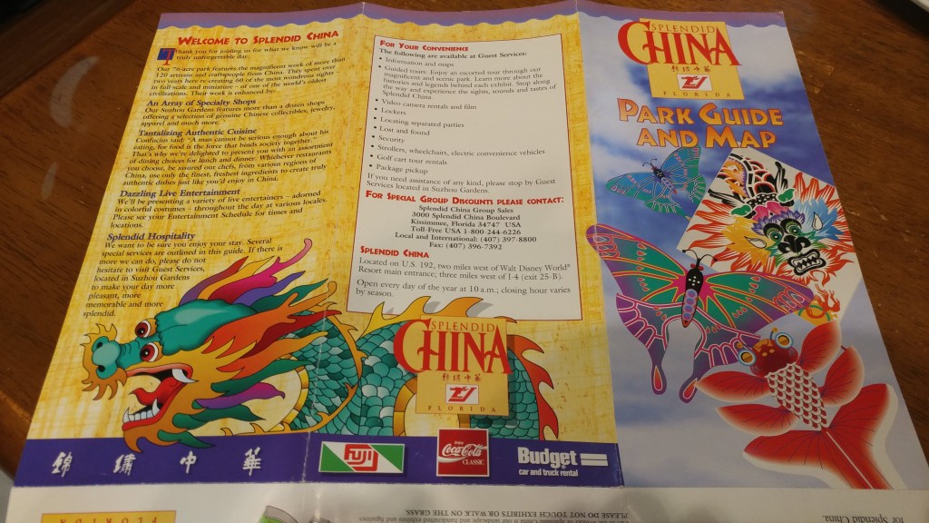
Splendid China was a theme park in Florida near Walt Disney World. The park opened in 1993, and closed on December 31, 2003. Splendid China, Florida had a sister park in Shenzhen, China which remains open today.

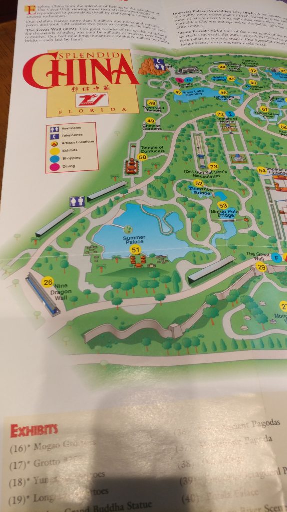
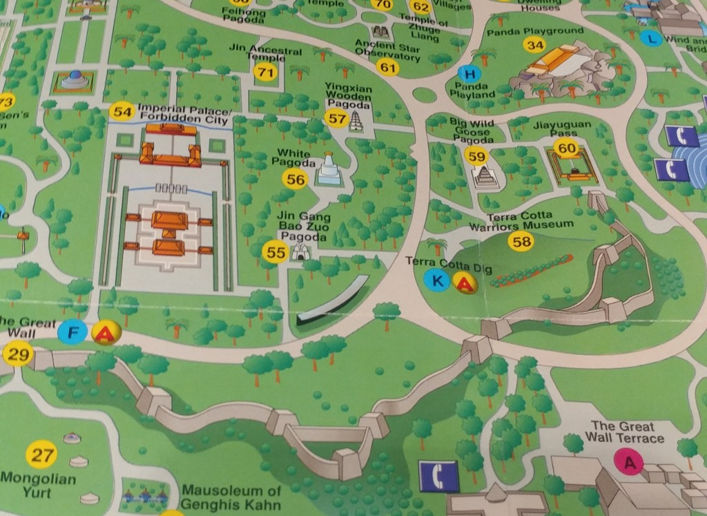
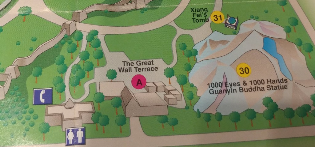
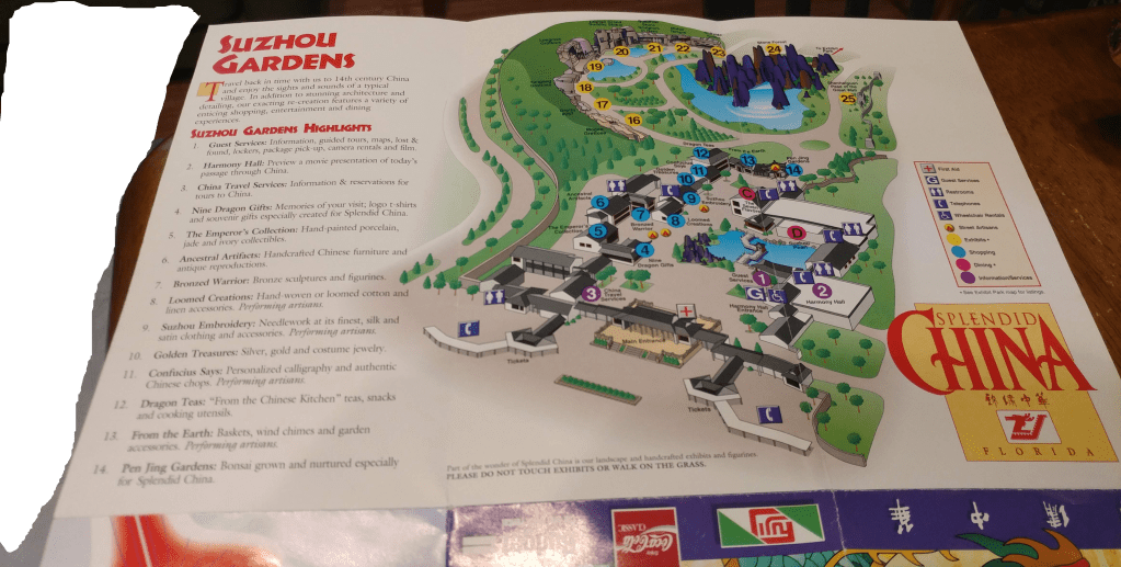
The Florida park contained over 60 one tenth scale detailed replicas of China’s most famous landmarks such as the Great Wall, Forbidden City, and the Terra Cotta Warriors. After years of controversy and protests, the park closed in 2003, vandals looted what wasn’t nailed down and the park was reduced to rubble.
In 2018 the site was officially cleared, making way for the American resort Margaritaville that opened in 2018.
Read more about Splendid China, Florida
Atlas Obscura: https://www.atlasobscura.com/places/splendid-china-orlando
Wikipedia: https://en.wikipedia.org/wiki/Splendid_China_(Florida)
Roadside America: https://www.roadsideamerica.com/story/2057
Get Wrecked: Shipwrecks on the Great Lakes
By Lauren Maddox
As the weather warms up here in Milwaukee (slowly but surely) we start fantasizing about our coming summer on Lake Michigan; soon we’ll be able to walk along the beach without our coats on, go out on the water, maybe even swim if the water isn’t too cold. It’s time for swimsuits and sunscreen again! But underneath the surface and the veneer of summer fun, Lake Michigan is hiding something.
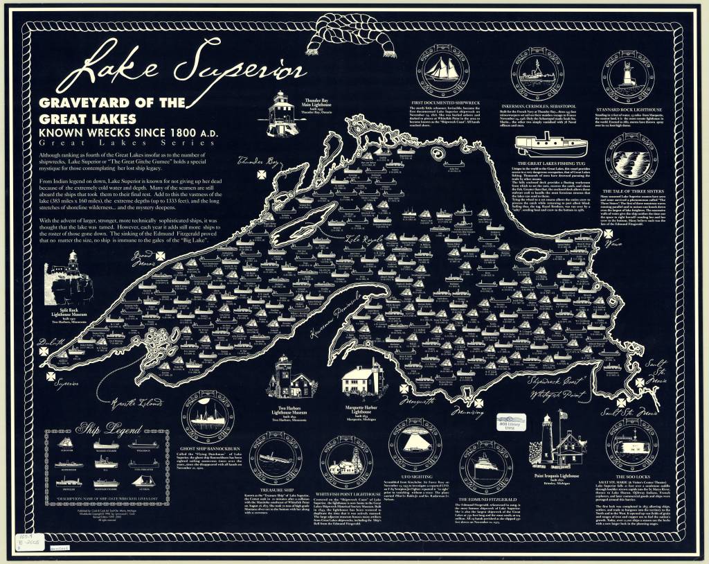
2005 Map of Lake Superior’s Known Wrecks Since 1800. Click the link to see this map in our Digital Collections!
The Great Lakes Shipwreck Museum is north of Paradise, Michigan at the Whitefish Point Light. The Whitefish Point Light, first lit in 1849, is the oldest operational lighthouse on Lake Superior. Lake Superior, the most infamous of all the Great Lakes for its rocky, hard to navigate shoreline, is the final resting place for more than 550 shipwrecks– 200 of which happened in Whitefish Bay. The museum, which was founded in 1978, memorialized the tragic loss of the SS Edmund Fitzgerald, which was capsized by gale force winds in November, 1975. Since it was founded, the Museum has been a place where visitors can learn about the maritime history of the Lakes and the many shipwrecks that have occurred there.
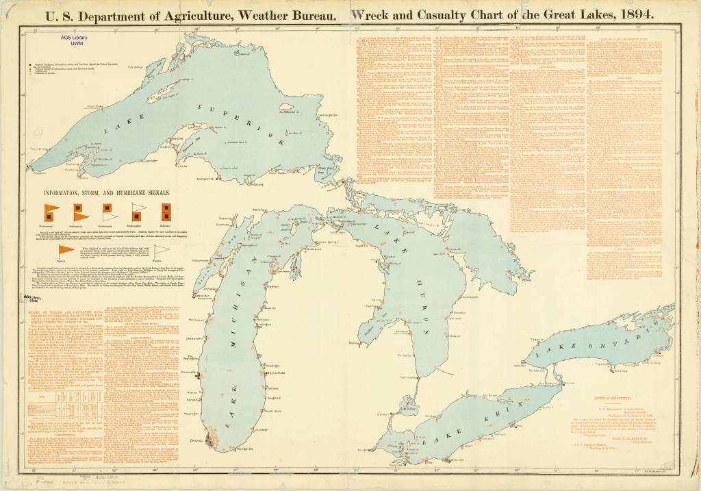
Wreck and Casualty Chart of the Great Lakes, 1894. Click the link to see this map in our Digital Collections!
Thanks to the organizations like the Great Lakes Shipwreck Museum and the Great Lakes Shipwreck Historical Society, shipwrecks in Lake Superior are still being recovered. These shipwrecks were tragic events, but the debris left behind is part of our water-faring history that many organizations hope to safe keep for future generations.
The James McBride, sunk in 1857. The first ship to carry cargo from the Atlantic to port on Lake Michigan. Click the link to learn more! 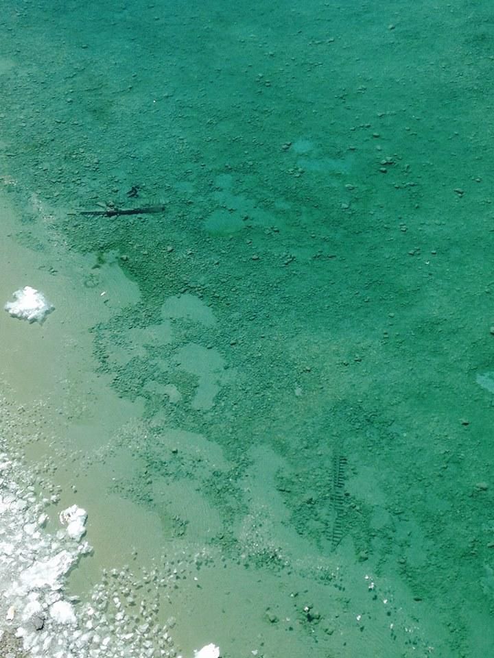
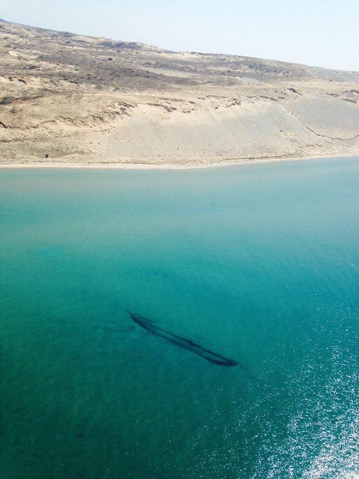
Unidentified Shipwrecks on Lake Michigan. Click the link to learn more! 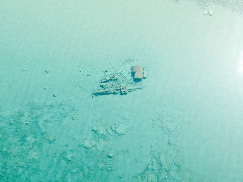
The Rising Sun, sunk in 1917. All passengers and crew rescued. Click the link to see this photo on the Smithsonian Magazine website!
The Great Lakes, due to their cold, fresh waters, preserve shipwrecks remarkably well; if left undisturbed, ships can survive for centuries at the bottom of the Lakes. On a particularly clear day in 2015, the US Coast Guard Air Station in Traverse City was able to photograph shipwrecks in Lake Michigan from the air. Generally, water conditions in the Great Lakes are not clear because algae, fed by agricultural run-off, clouds the water and obscures the shipwrecks below.
Unfortunately, despite the Lakes’ ability to preserve old ships in its waters, invasive species like the zebra mussels, will infest otherwise stable wrecks, rendering them unrecognizable and unfit for study.
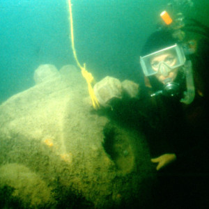
The Conemaugh before it was infested by zebra mussels. Click the link to see this image on the GLSM Research Page! 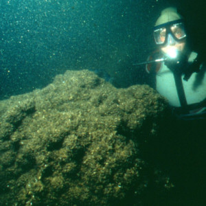
The Conemaugh after it was infested by zebra mussels. Click the link to see this image on the GLSM Research Page!
The AGSL has shipwreck charts that span decades, recording the many wrecks that have happened on the Great Lakes. Ships have been carrying goods across the Great Lakes since at least 1679, when the French vessel Griffon carried supplies to settlements along the north shore of Lake Eerie. And as long as ships have been traversing the Lakes, ships have been sinking there. The Griffon, after unloading the much-needed supplies it was carrying, was loaded up with furs and other commercial goods, only to be caught in a storm on its return trip and never seen again.
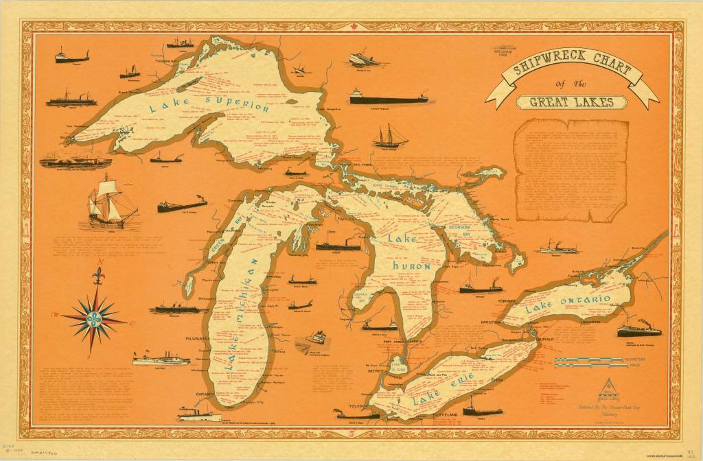
1977 Shipwreck Chart of the Great Lakes. Click the link to see this map in our Digital Collections!
Technology improved exponentially, and by the 1800s, the Great Lakes were a vital route for the shipping of goods in the Midwest; Chicago’s steel industry kick-started maritime shipping across Lake Michigan. But, of course, more ships on the water meant more potential accidents. Many of the shipwrecks you can see on these maps are from this era, before we had highways that connected our country for the easy movement of goods. Even modern ships, like the Edmund Fitzgerald, fall prey to the unpredictable conditions of the Lakes.
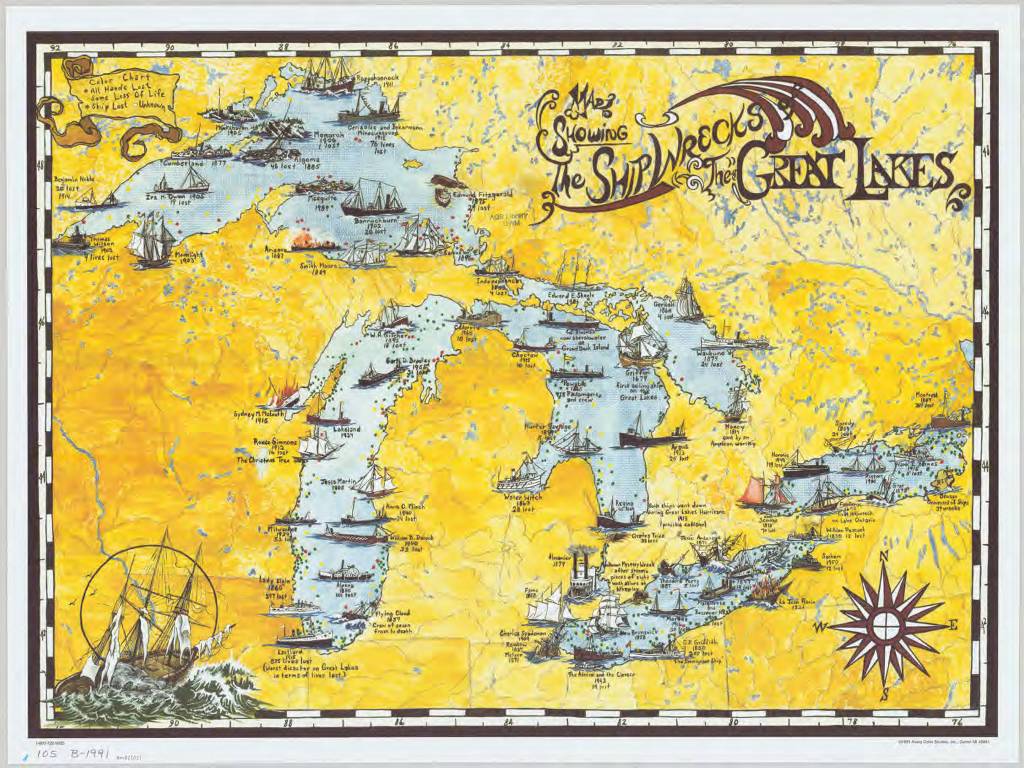
1991 Map Showing the Shipwrecks of the Great Lakes. Click the link to see this map in our Digital Collections!
So, this year, as we’re all getting ready to enjoy our summer by the lake, remember that there is often something else waiting to be discovered just beneath the surface.
The Phantom Ship on Crater Lake
By Lauren Maddox
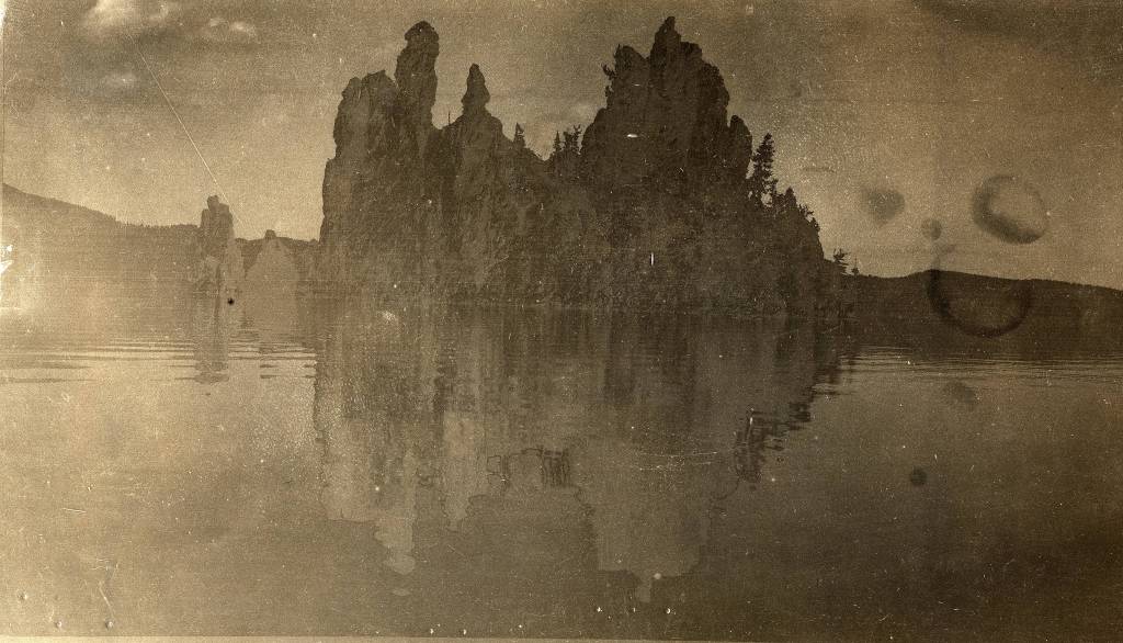
Photo of Phantom Ship Island from the AGS’s 1912 Transcontinental Excursion. Click the link to see this photo in our Digital Collections!
The Klamath people have lived near Mount Mazama for over 10,000 years. According to their histories, Llao, the Chief of the Below World, attacked the community living by the volcano when a human woman refused to become his lover. Skell, the Chief of the Above World, defended the Klamath people from Llao’s rage; he chased Llao back into the mountain and smashed the mountain peak over his head, collapsing Mount Mazama and forming a huge crater. The crater filled with rain water so blue, it turned the grey mountain birds bright blue, too.

Young Mountain Bluebird from Aubudon’s Field Guide. Click the link to learn more about Mountain Bluebirds!
Lalek, a 19th century Klamath leader, interpreted this oral history before white geologists even understood the volcanic nature of Mount Mazama: 7,700 years ago, Mount Mazama violently erupted and collapsed in on itself, forming a huge crater lake. The crater was fed with snow melt and rain instead of a running water source, so its waters remain clear and shockingly blue.
Crater Lake in Oregon is the deepest lake in the United States. It has two famous islands: Wizard Island, which is a a volcanic cinder cone formed after the massive eruption of Mount Mazama, and Phantom Ship Island. Phantom Ship Island, as its name suggest, appears to be a ship when seen from a distance. Mysteriously, when the lake is foggy, the island appears to disappear, adding to the impression that it is a phantom ship. The island is made of ancient andecite rock formations, which were shaped by the hydrothermal activity of Crater Lake.
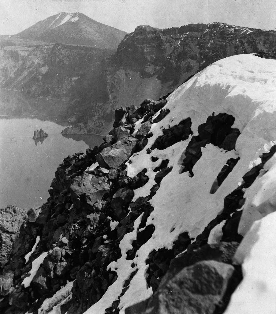
Phantom Ship Island from a distance, 1912. Click the link to see this photo in our Digital Collections!
In 1912, the American Geographical Society organized a Transcontinental Excursion to, as supposed by Geography in the Making: The American Geographical Society 1851-1951, “increase the knowledge of American geography by Europeans” and to “promote the acquaintance of European Geographers with Americans.”
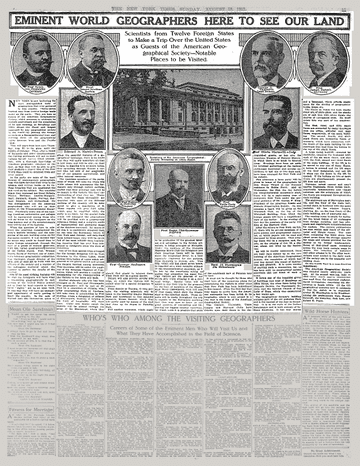
1912 Article in the New York Times. Click the link to see this article on the NY Times website! 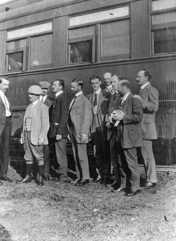
Passengers posing by AGS Transcontinental Train. Click the link to see this photo in our Digital Collections!
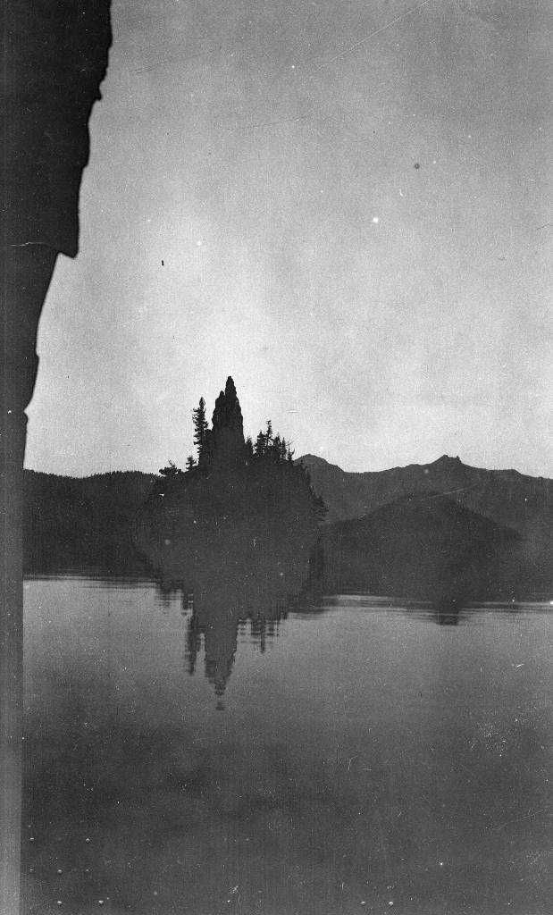
One of the stops on the Transcontinental Excursion’s route was Crater Lake, where several passengers took photos of Phantom Ship Lake.
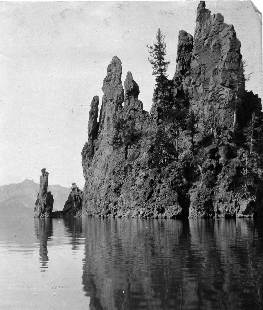
Closeup of Phantom Ship Island. Click the link to see this photo in our Digital Collections! 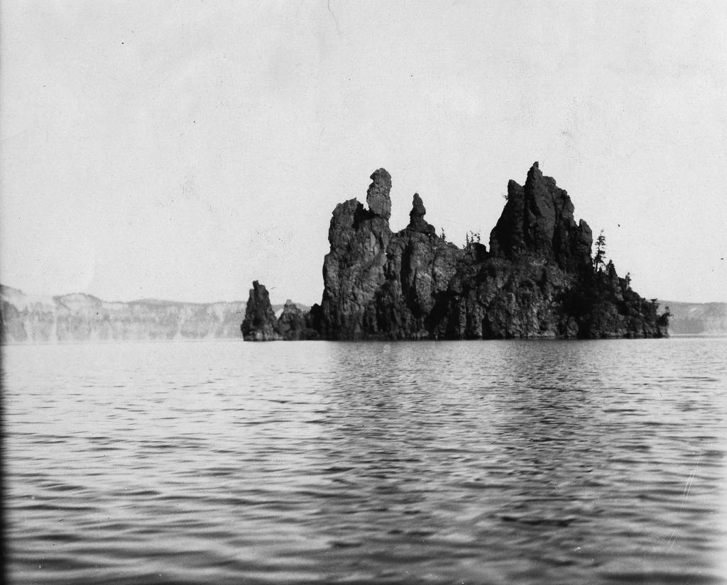
Photo of Phantom Ship Island. Click the link to see this photo in our Digital Collections!
While Phantom Ship Island may resemble a ghost ship, it is not the most mysterious phenomenon on Crater Lake. Some visitors to the park report seeing campfire on the uninhabited islands, and eerie sounds plague tourists who choose to stay in the Crater Lake Lodge. But by far, the most inexplicable occurrence on the lake.
The first account of the Old Man of the lake was written in 1902; Joseph S. Diller reported a stump floating upright in the lake. The Old Man is a more than 100 year old hemlock tree that floats, as reported, completely upright in Crater Lake. The Old Man travels by floating across the lake, sometimes over 60 miles, never upending. The Old Man is allowed to float freely now, because once, when scientists tied the Old Man to the shore to prevent him from disrupting navigation of the lake, he called a storm that didn’t subside until he was released.
Though Crater Lake has a strange and magical history, somehow Phantom Ship Island through the fog is not the most unusual sight visitors might encounter. But that doesn’t mean it isn’t eerie!
Phantom Ship Island. Click the link to see this photo in our Digital Collections!
Cancelled Maps and March Mapness
By Lauren Maddox
As schools prepare to move online and sport’s seasons are postponed, cancellation is on everyone’s minds. While looking through the drawer of Madagascar maps, a graduate student intern found a map with
“CANCELLED” printed on the verso:
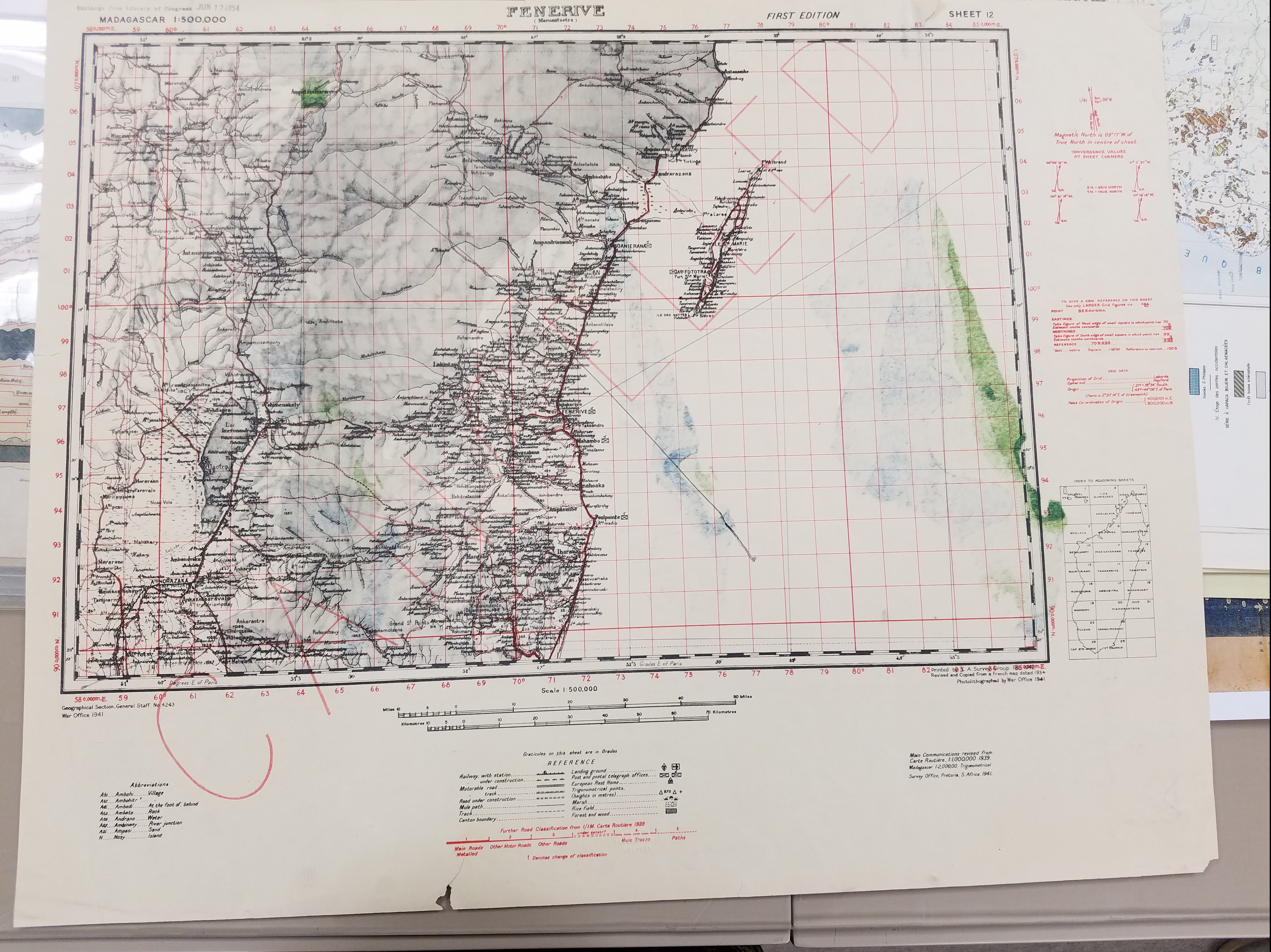
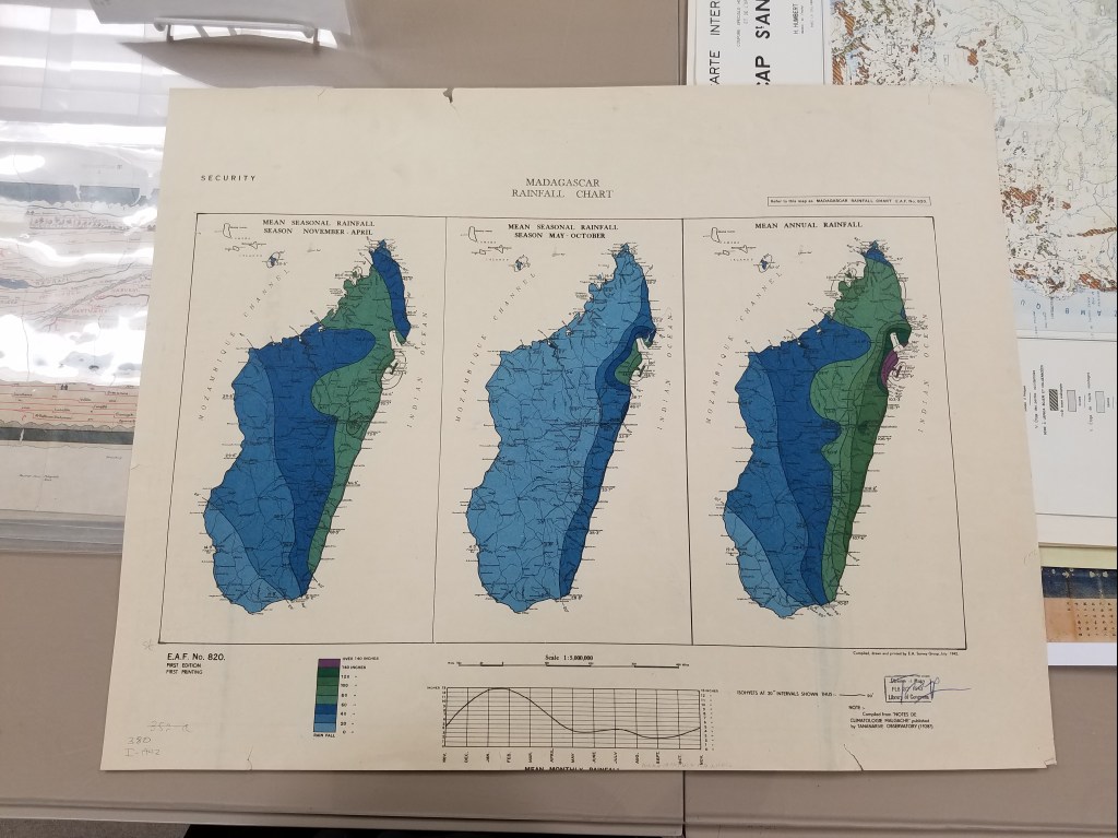
The main map “Madagascar rainfall chart” from the Great Britian Eastern African Army from 1942 stands as a historical record of the key role recycling and material conservation played during war time. Obsolete maps or extra printings would have been re-used such as this Madagascar map.
Another great example of reusing paper can be seen on this map of Martinique also from 1942. The map is also printed on verso of an obsolete chart with a more detailed cancellation pattern overprinted to obscure that chart’s details.
This has been a hard week for many people, sports fans included. We understand that without basketball, hockey, and baseball games, March just won’t be the same. But we hope that we can lift your spirits and give you something to cheer for! While you’re at home practicing responsible social distancing over the extended Spring Break, the AGSL invites you to participate in March Mapness! We will be voting on our Instagram story to decide which map in our collections is the best! The first round will be March 16th, and then we’ll vote on the last two maps standing on March 30th. Please join us on Instagram to celebrate March Mapness!
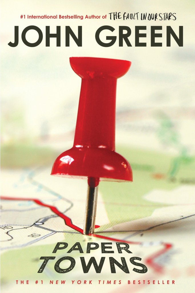
On the Road to Algoe: Revisiting the Paper Town
By Lauren Maddox
John Green’s Paper Towns posed a question that stumped many of its readers: how can spaces be simultaneously fictitious and real?
The novel was received by an excited public in 2008; the book won the Edgar Award, was Editor’s Choice for book of the year at Booklist and Voya, and was top of the list for Best Book at the Chicago and New York public libraries. In 2014 and 2015 interest in the novel and its faux-setting peaked– Paper Towns was being adapted into a film starring Nat Wolff and Cara Delevingne. Excitement for the move inspired a plethora of articles by news outlets like NPR, MNN, and Gizmodo describing the paper town that the book is centered around: Algoe, New York.
Check this book out from the UWM library! Click the link to learn more.
Algoe was unique in that it wasn’t and then was and then wasn’t a real place. Mapmakers would sometimes include fictitious entries as a way to subtly sign their work. It’s almost impossible to prove that a representation of reality has been copied, but copyright traps were a way to prove that a work had been stolen. If the copycat included the fictional place names from the original map in their version, the original mapmaker could prove that it was their intellectual property. Algoe was one of these copyright traps. It appeared to be a small hamlet in upstate New York, nestled between interstate routes. In reality, “Algoe” was just an anagram of mapmakers Otto G. Lindberg’s and Ernest Alpers’s initials.
Esso bought the map from Lindberg and Alpers and began distributing it. A few years later, Algoe appeared on another map by Randy McNally. Lindberg accused McNally of having stolen the map because, of course, Algoe wasn’t a real place. But McNally protested. His company had gotten the records of Algoe completely legally. A general store owner had seen the town name Algoe on the Esso map years earlier and decided to name his general store after it. Just like that, Algoe had become a real place. After a few years, the store shut down, and Algoe ceased to exist again. You can still find it, though, if you search for Algoe on Google Maps.
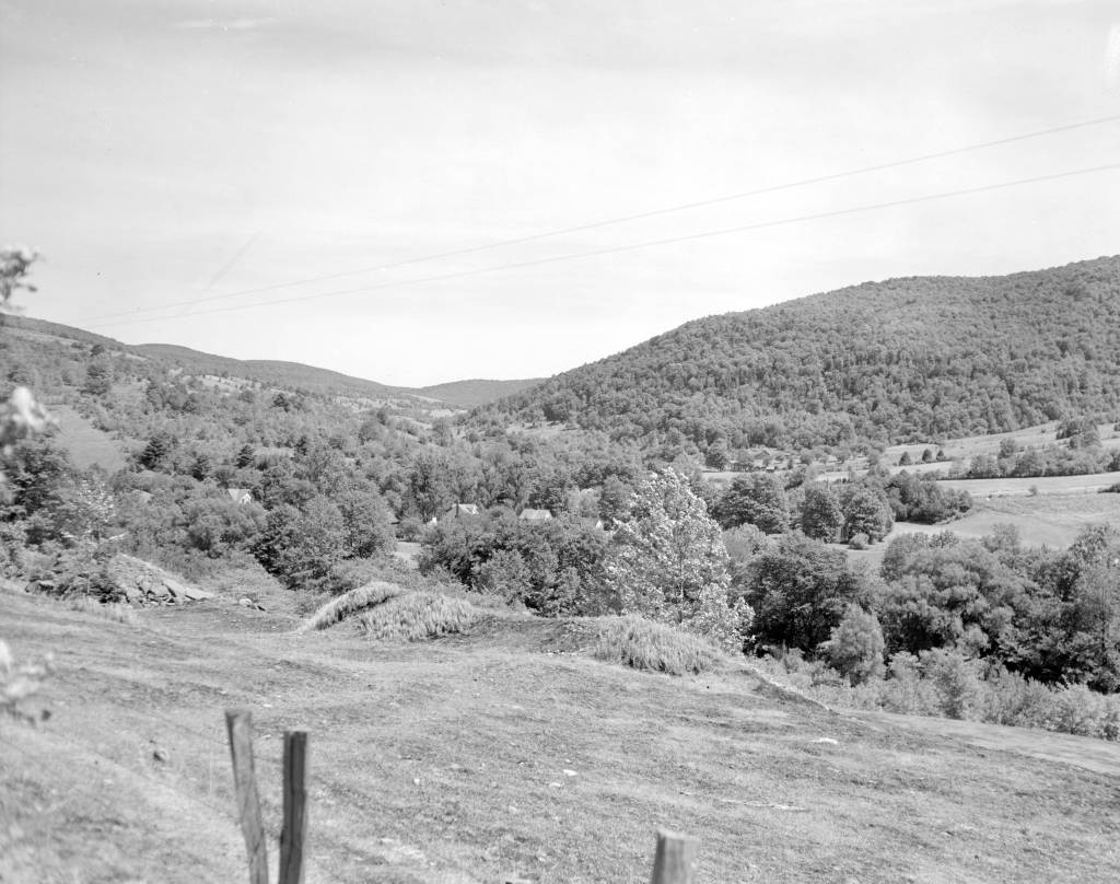
Photo of Delaware County, New York, where Algoe was supposed to be. Click this link to see this photo in our Digital Collections!
Trap streets and paper towns were just one way that a mapmaker might mark their work– the map sheets below, which are part of a survey of the Gold Coast (now Ghana), depict a hidden elephant in the elevation chart. Frank Jacobs’s “How to Hide an Elephant in a Map” tells the story of a hot, uncomfortable British surveying expedition who, upon discovering a particularly inaccessible stretch of land, decided to just doodle an elephant and call it a day.
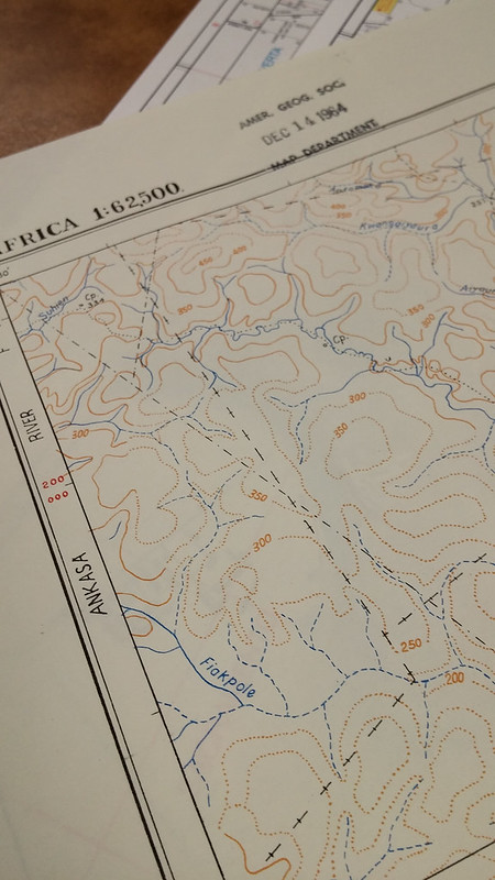
1964 Edition of the Gold Coast Survey Maps. Click the link to check out our Flickr! 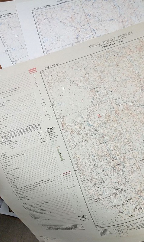
Three editions featuring the elephant. Click the link to check out out Flickr!
In this case, the hidden mark on the map wasn’t to protect intellectual property; apparently, the expedition decided to fill the blank space in their survey so that they could pack up and go home. But the result was the same– the creator’s left a unique stamp on their work that was copied in later editions over and over again. Just in the AGSL archives, there are three editions of this map sheet with the elephant from 1924, 1951, and 1964.
We expect maps to tell the truth– they appear, on the surface, to be objective representations of reality. But the truth is, they often aren’t; mapmakers and the people who finance them have an agenda. In Algoe’s case, it was a white lie designed to protect the intellectual property of mapmakers who wouldn’t otherwise be able to prove that their work had been stolen. And the tired British expedition’s elephant was a way for them to avoid traversing any deeper into an inaccessible landscape. These are the innocent lies that maps sometimes tell us– but other times, a map could be lying to us for other, more nefarious reasons.
Monmonier’s How to Lie with Maps. Click the link to see this book in our Digital Collections!
Mark Monmonier’s How to Lie with Maps outlines the many lies, harmless or not, that maps sometimes tell us. According to Monmonier, “map users…need to appreciate the perils and limitations” of maps because they are “rhetorical tools fully capable of ‘lying'” to us, accidentally and purposefully. These lies can be fairly small– a fake hamlet in upstate New York or an elephant masquerading as a hill. Algoe isn’t a threat to our perceptions of reality. However, it does remind us that maybe our maps aren’t as truthful as we like to believe.
In 1993, a series of cases against the board game company behind Trivial Pursuit ended the use of copyright traps. The courts found that, in the same way you can’t copyright a real place, you can’t copyright a lie. No one looks for these copyright traps anymore, since they aren’t functional protections against copycat map makers– which means there might be even more hidden places on our maps, waiting to be discovered.
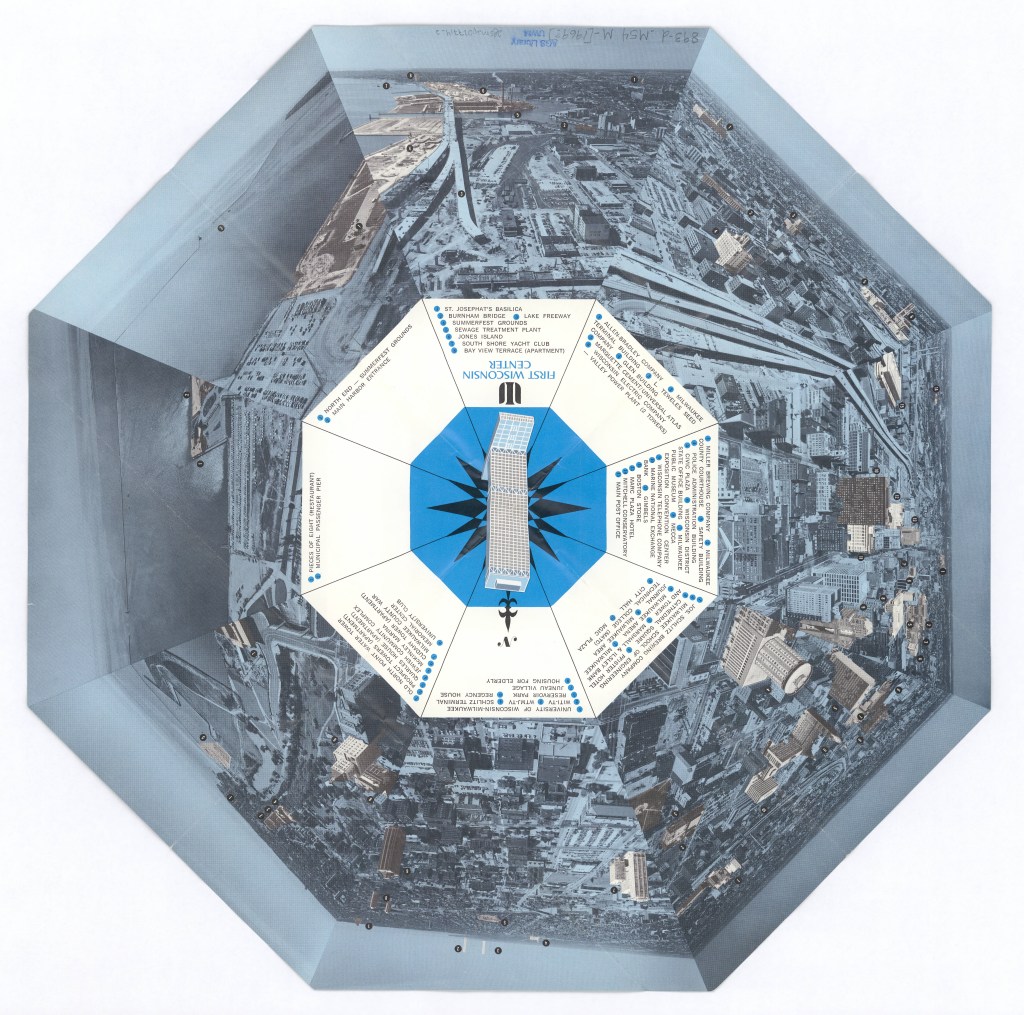
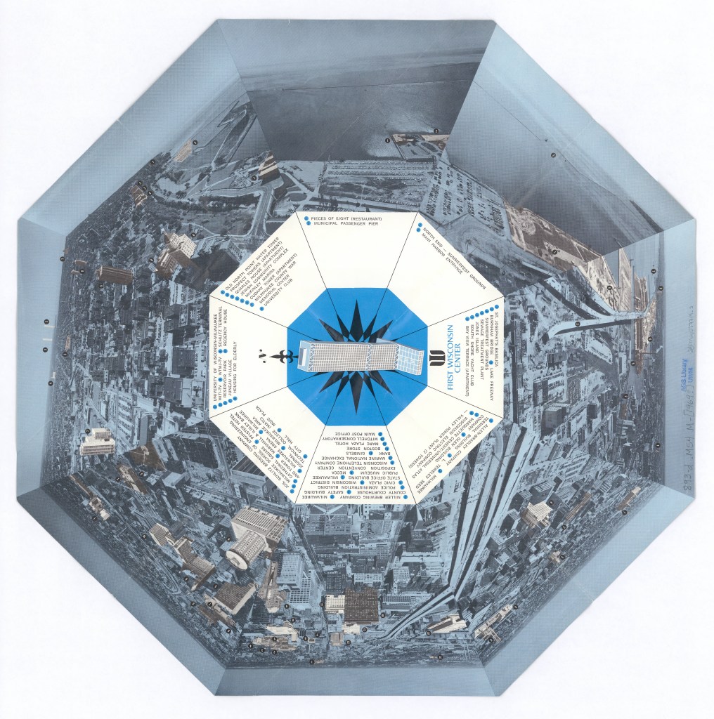
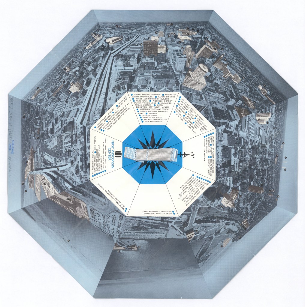
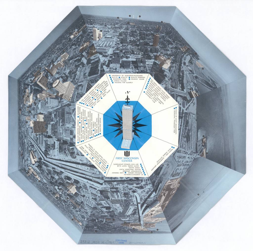
View of Milwaukee, Wisconsin 1972
by Angie Cope
Milwaukee as seen from atop the First Wisconsin Center in 1972.

The First Wisconsin Center located at 777 Wisconsin Avenue is the original name of a skyscraper located in downtown Milwaukee. It is noted for being the tallest building in the state standing 601 feet tall with 42 stories. Construction of the building was announced in 1969 and completed in 1972. Today the building is named the U.S. Bank Center and continues to offer a spectacular view of the city.
An observation deck on the 41st floor is open to the public during the “Doors Open Milwaukee” event usually held in September each year. Visit their website for more information: https://historicmilwaukee.org/doors-open/
In July 1987, a hacking box was installed outside the 41st floor to allow peregrine falcons to nest as part of the Wisconsin Department of Natural Resources (DNR) Peregrine Falcon Recovery Plan.Since the launch of the program in 1987, 67 falcons have fledged from the hacking box atop the tower.
Visit “Encyclopedia of Milwaukee” to learn more about the US Bank Center: https://emke.uwm.edu/entry/us-bank-center/
View this item in the American Geographical Society Library Digital Map Collection here:
