Historical County Atlases
by Angie Cope
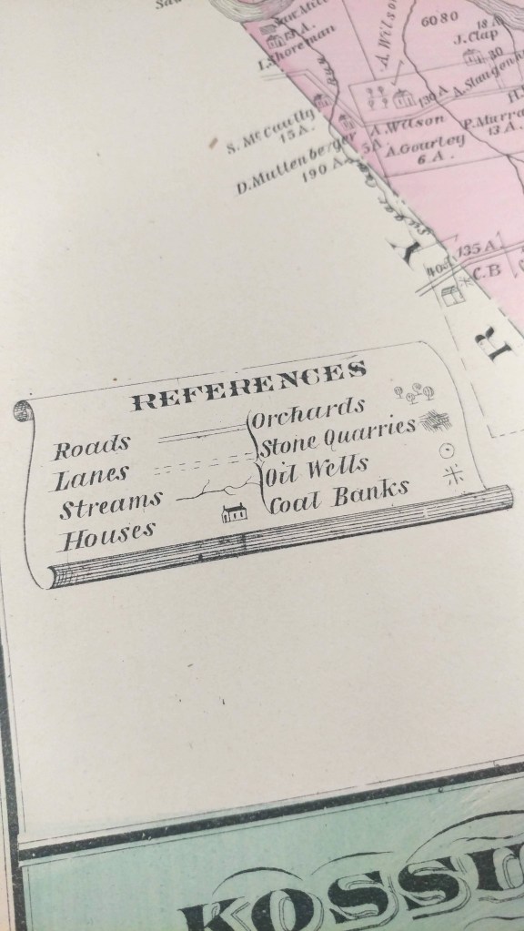
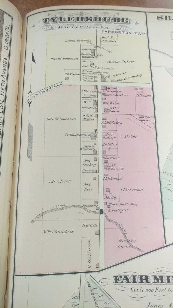
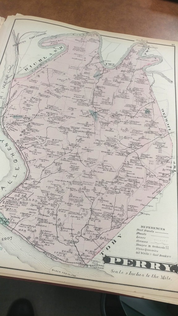
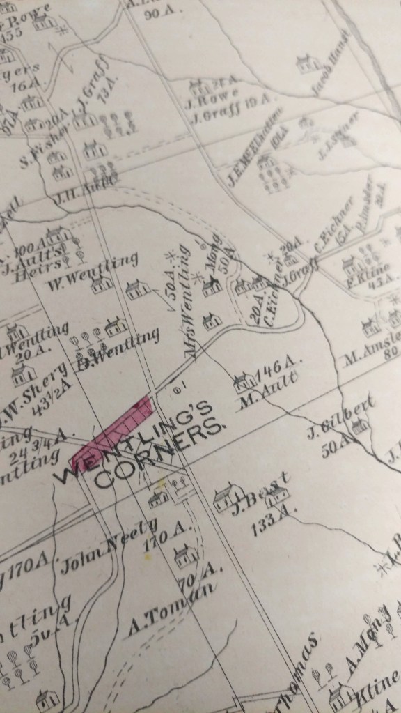
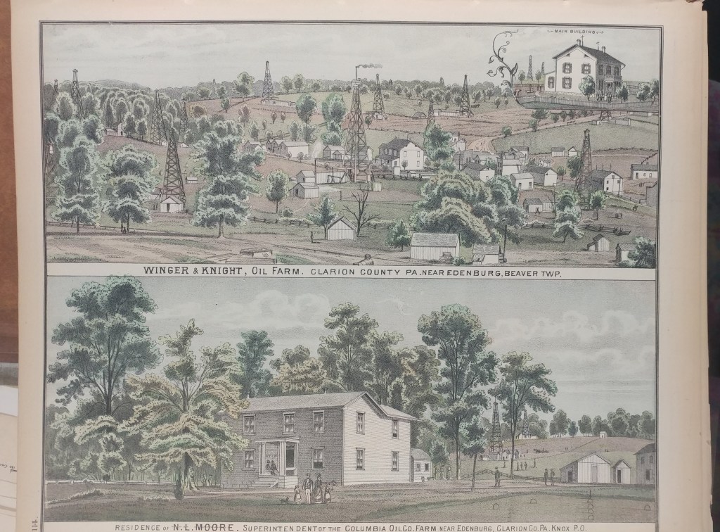
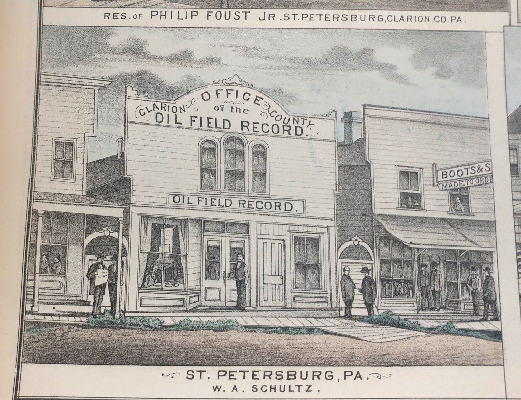
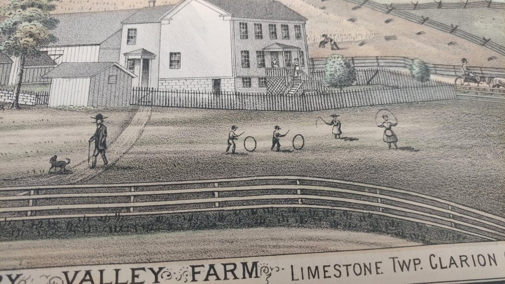
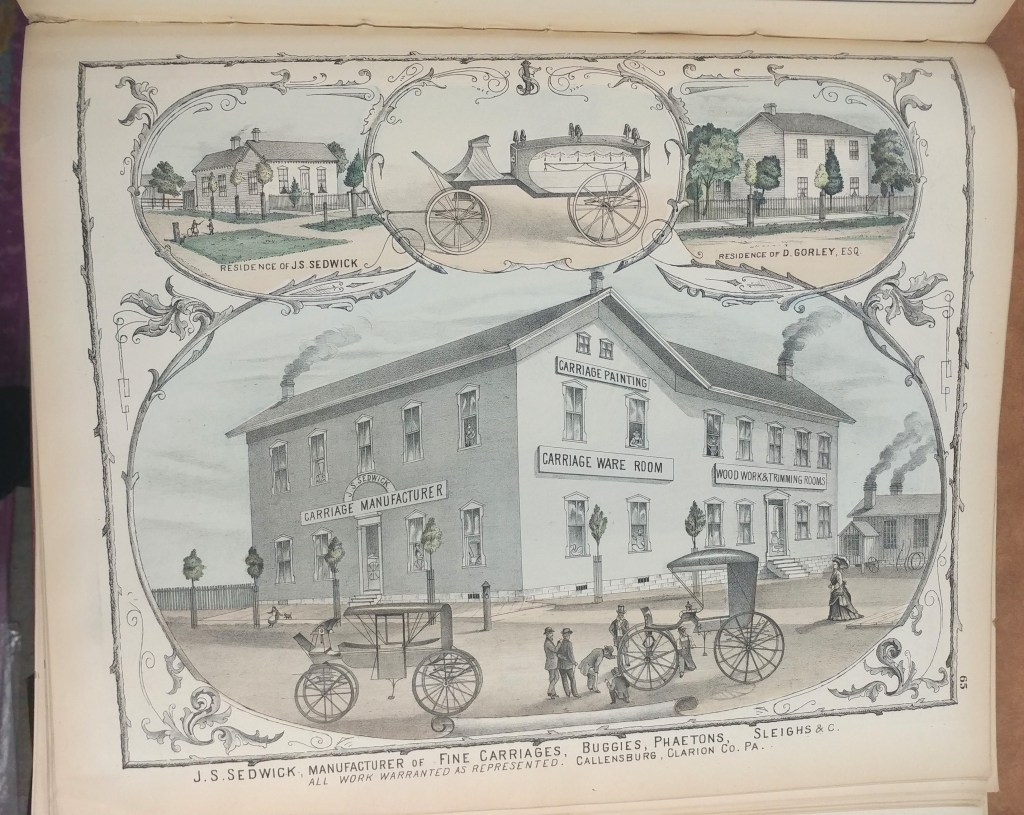
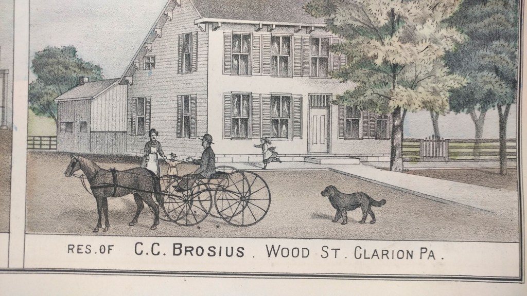
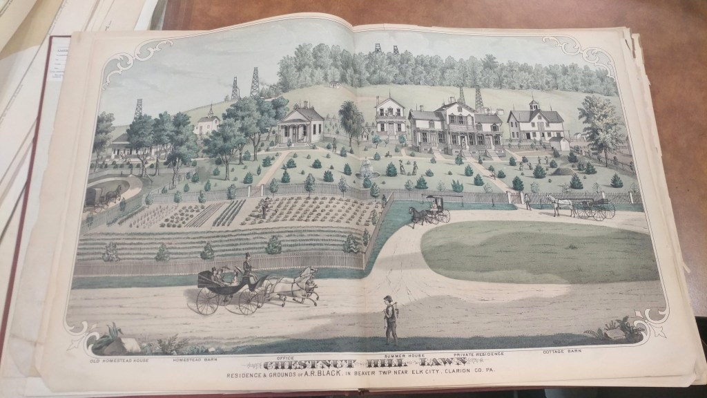
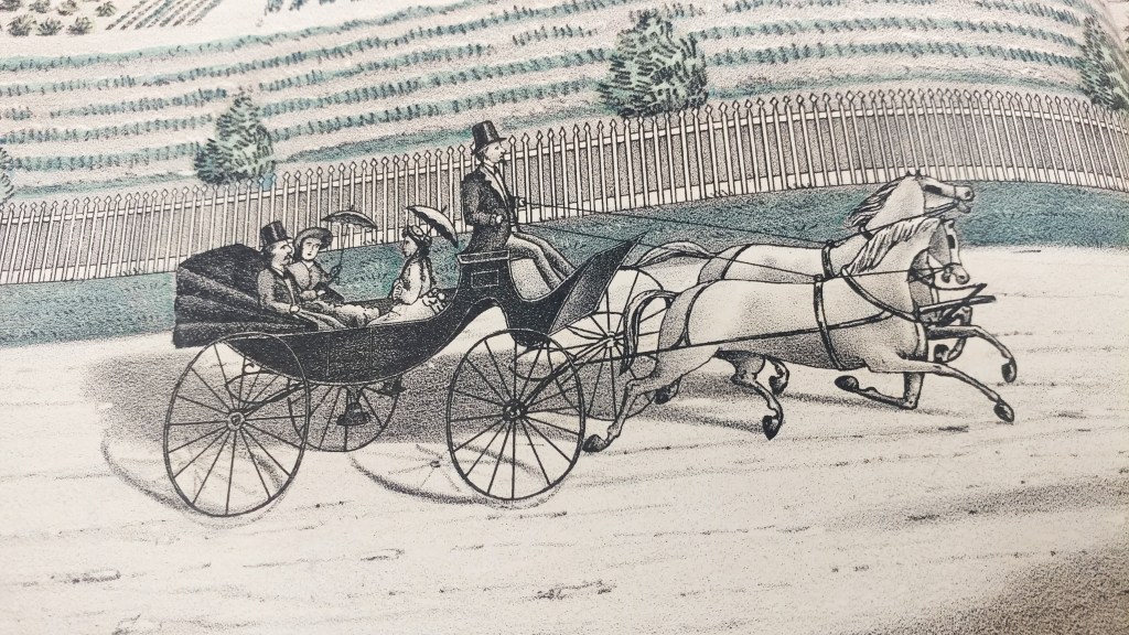
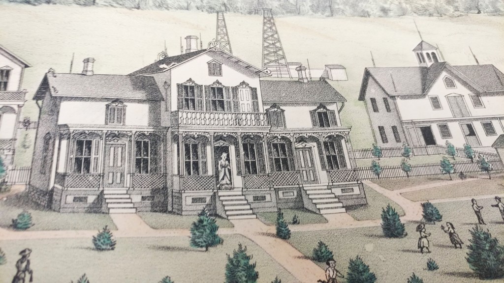
Historical county atlases show property boundaries and land ownership for every parcel of land in a county. In addition to rivers, hills and roads, these maps showed churches, cemeteries, schools, administrative boundaries, railways and roads. Each region had unique features such as Clarion County, Pennsylvania’s orchards, oil wells and coal banks.

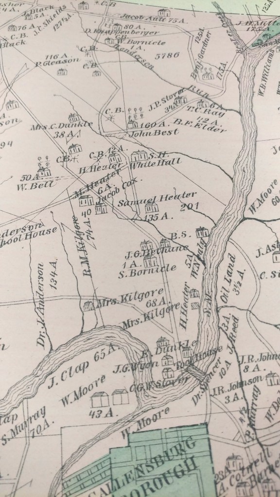
These historical county atlases provide a detailed snapshot of much of the United States during periods of great population expansion of the 19th and early 20th Century.
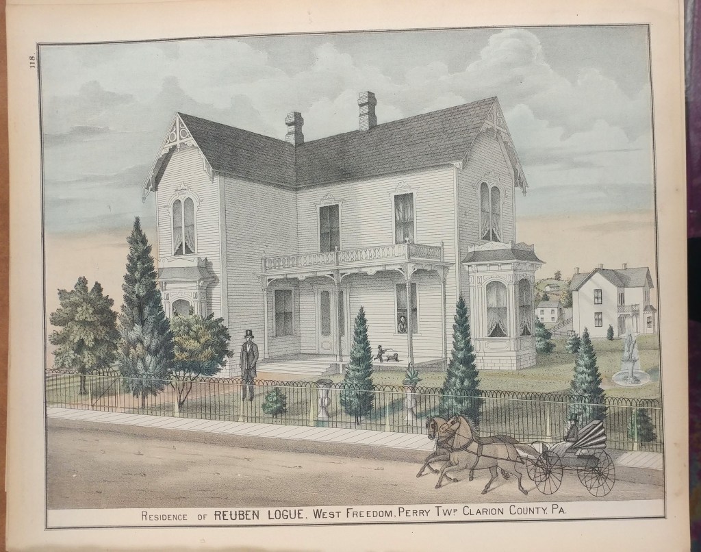
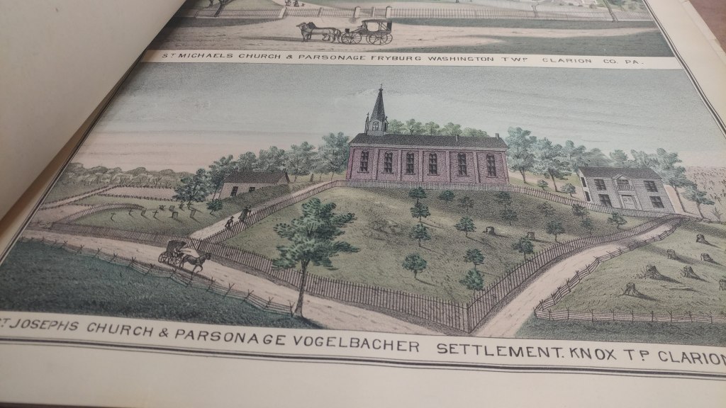
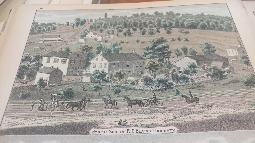
Preparation was often financed through support of local patrons who paid a fee to door-to-door salesmen. The atlases would then include patron directories and biographies, giving credit to this financial support. Many atlases include detailed illustrations of patrons and their homes, businesses and families. As in the example of this Clarion County, Pennsylvania atlas, the illustrations are numerous and beautiful.
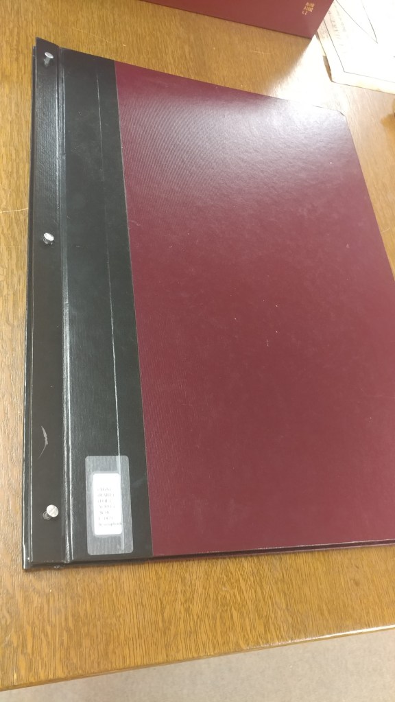
These atlases can be found in libraries across the country but the paper used wasn’t always the best quality. At the AGS Library even re-binding didn’t guarantee use of acid-free materials.
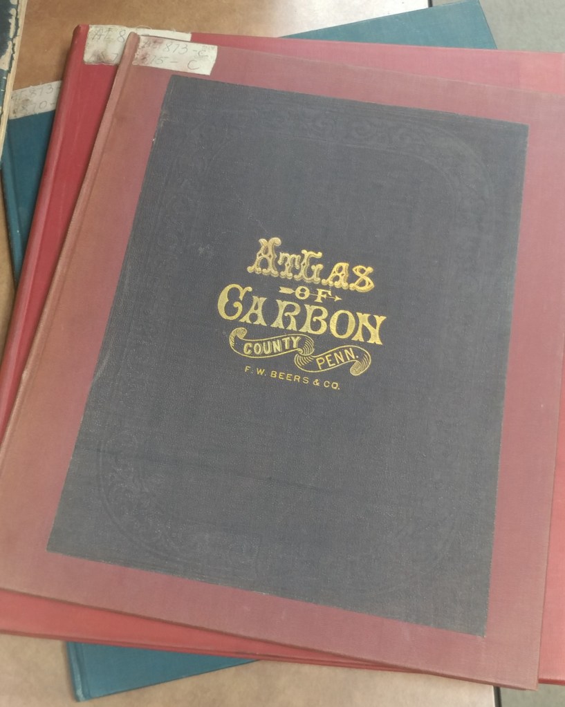
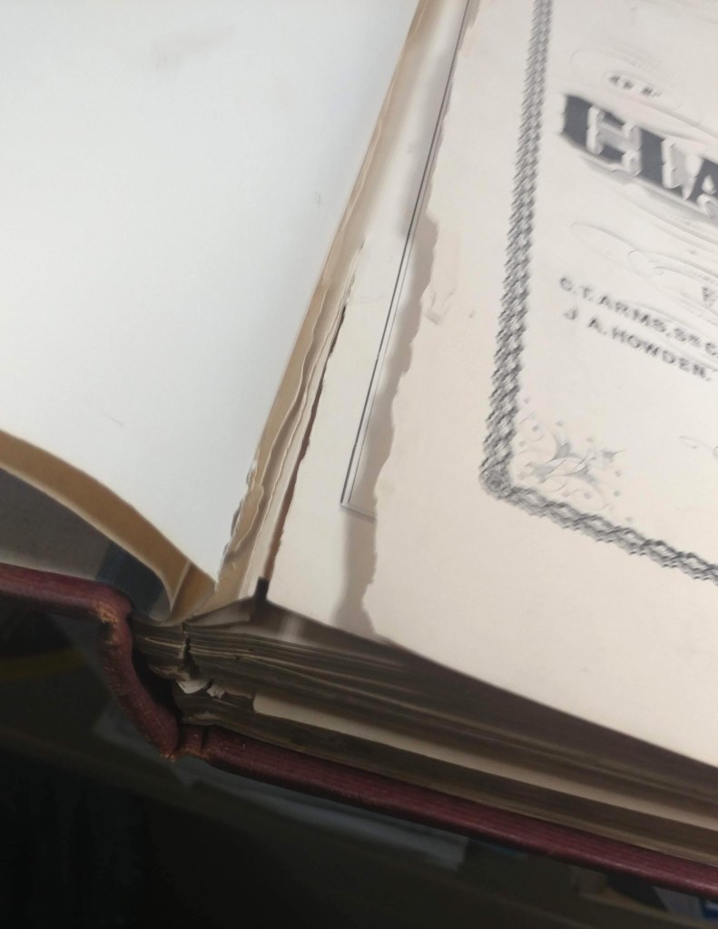
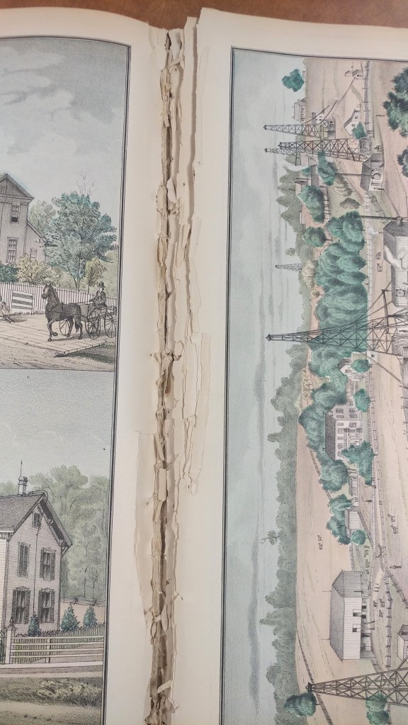
Scanning atlases is a way to provide increased access, preserve information and limit handling to avoid additional damage. At the AGS Library we have nearly 1,000 atlases of this type. Other libraries are also scanning their atlases and making them available to researchers.
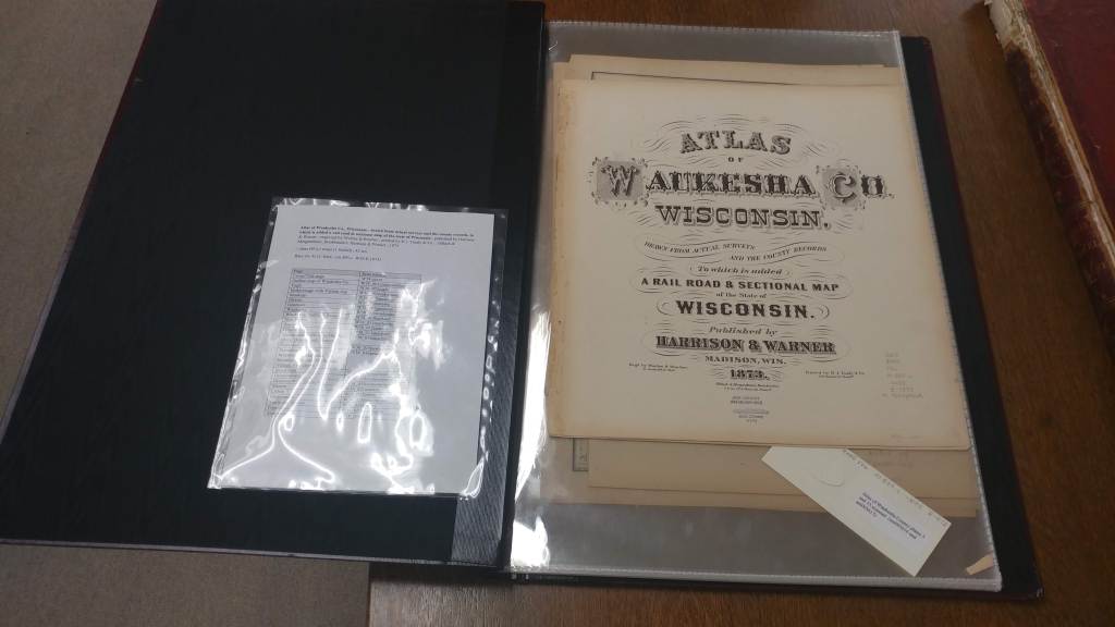
Atlas of Waukesha Co., Wisconsin : drawn from actual surveys and the county records, to which is added a rail road & sectional map of the state of Wisconsin / published by Harrison & Warner ; engraved by Worley & Bracher ; printed by H.J. Toudy & Co. ; Oldach & Mergenthaler, Bookbinders, 1873.
https://collections.lib.uwm.edu/digital/collection/agdm/id/3626/rec/2
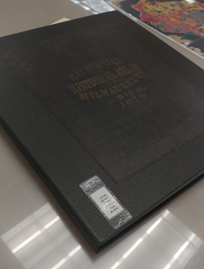
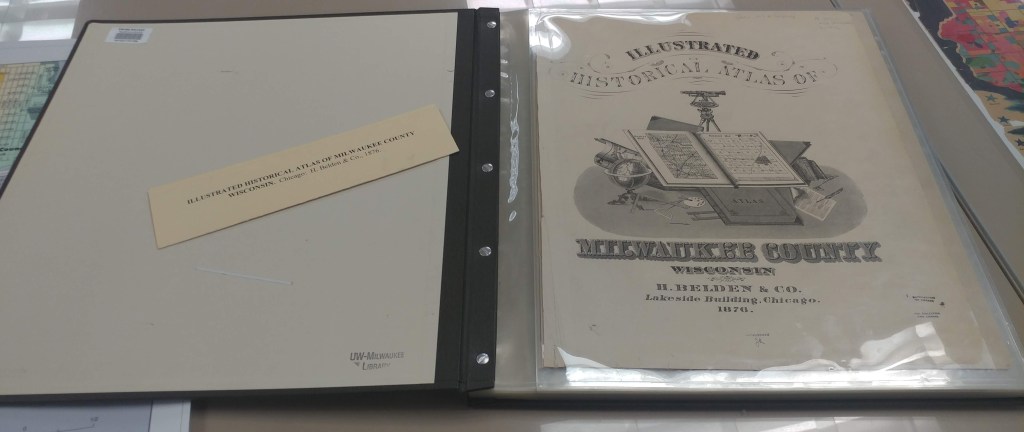
Illustrated historical atlas of Milwaukee County, Wisconsin / by H. Belden & Co., 1876.
https://collections.lib.uwm.edu/digital/collection/agdm/id/3746/rec/4
Disney’s Darkest Day
By Lauren Maddox
July 17th is celebrated at Disneyland as the park’s official opening day. This year marks the 65th anniversary– Disney hasn’t announced any official celebration plans yet, but fans can most likely expect a birthday bash to remember. The park’s anniversary wasn’t always celebrated on July 17th, however; during Walt Disney’s life, the official date was July 18th, one day after what we consider to be the opening day now.
Walt Disney was adamant that the July 17th opening not be acknowledged as the official opening– and with good reason. July 17th, 1955 was such a disaster that Disney sometimes called it “Black Sunday.”
Expectations for the July 17th preview day were high. Disney had been planning his amusement park since at least 1948, when he sent the first memo to Dick Kelsey describing his plans for a Mickey Mouse theme-park. But the original idea pre-dated even this first draft of the park concept; Disney’s own father worked at the World’s Columbia Exposition in 1893.

Map of the Chicago World’s Fair in 1893. Click the link to see this map in our Digital Collections! 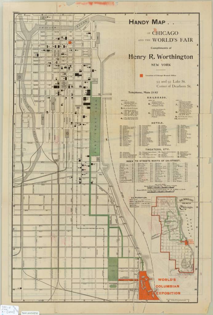
Map of the Chicago World’s Fair in 1893. Click the link to see this map in our Digital Collections!
The World’s Columbia Exposition was a Chicago’s World’s Fair held in 1893 to celebrate the 400th anniversary of Christopher Columbus’s first arrival in North America. The Fair was supposed to be a symbol of the burgeoning ideas of American exceptionalism and Chicago’s recovery from 1871 fire. The Fair was a monumental undertaking; the grounds covered more than 650 acres, and nearly 26 million visitors passed through. More important to Disney’s story than the grandiosity of the fair: the 1893 World’s Fair was the first to host a dedicated amusement park area.
His father’s memories of that Fair and its amusement rides stayed with Disney until his own fatherhood. Disney cited watching his children on a merry-go-round as the final inspiration that lead him to Disneyland.
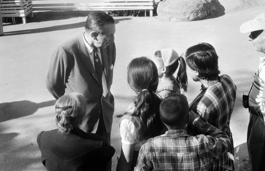
Disney talking to a group of children at Disneyland in 1957. Click the link to see this photo in our Digital Archives!
Besides his tender family memories, Disney also had a practical reason to build an amusement park. He was, after all, a businessman first. As Disney’s animation studio in Burbank gained more success, more and more fans wanted to come visit. The inside of an animation studio isn’t actually that interesting, and it would be hard to get any work done with crowds of tourists peeking in on the animators who worked there.
The original plans for Disneyland put the amusement park right next door to the Burbank studio. After realizing how much of an undertaking (and how many more acres) the amusement park was going to be, Disney moved the location to the Anaheim site.
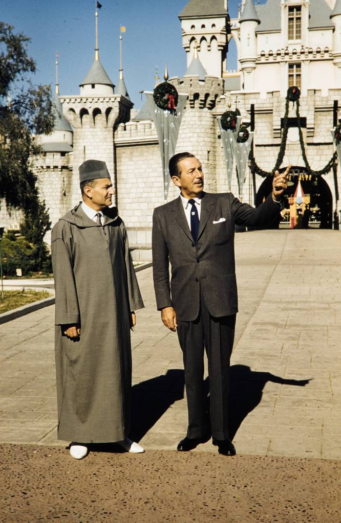
Disney entertaining King Muhammad V at Disneyland, 1957. Click the link to see this photo in our Digital Archives!
For the preview day, Disney invited a select group of 14,000 guests. This included the press as well as friends and families. This was the first thing to go wrong that day. Around twice as many guests actually showed up to the park– many had purchased counterfeit tickets to gain entry to the preview day opening, but many more simply climbed over the walls and broke into the park. Disneyland, for the day, was only prepared to serve the 14,000 intended guests; vendors ran out of food, half of the water fountains weren’t functioning because the plumbers working on the park went on strike (and offered the ultimatum “bathrooms or water fountains”). The event was sponsored by Pepsi, so many park-goers accused Disney of forcing them to buy drinks by sabotaging the water fountains. It was an unseasonably warm day for Anaheim, and the freshly poured asphalt was so soft that women’s high heels would sink into it.
Besides these critical logistical failures, the media coverage of the event was a circus. Disney himself missed the cue to read his dedication, and said, to the camera live and on air, that he’d thought he’d been given the signal to start. Bob Cummings was caught on camera flirting with the dancers and even kissing one girl. Other commentators lost their mics and had to cover for themselves while the tapes ran on.
In summary, the whole day was deeply embarrassing to Disney. He never acknowledged the July 17th preview as the opening day of Disneyland, and it was only after his death that it was adopted as the official anniversary.
Disney’s legacy lives on, for all the good and ills that entails. But perhaps his greatest contribution to the amusement park circuit, besides Disneyland itself, is the impact his choices made on amusement park cartography.
When Disney was first pitching the park idea to investors, he used maps created by Herbert Ryman to help draw the picture of the park that he was imagining and struggling to put into words. Ryman’s version of the park didn’t make it to brochures, partially because his maps were of an imaginary park that wasn’t quite the same as the real Disneyland.
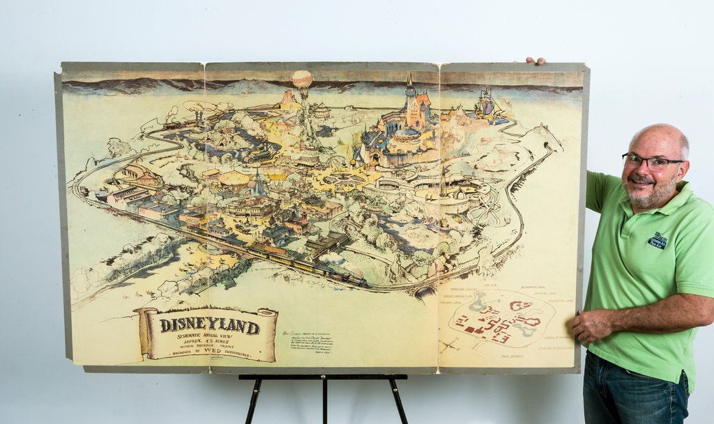
The 1953 Ryman Map of Disneyland from the New York Times. Click the link to see the rest of this article!
Due to budgeting issues, the official map of Disneyland took another three years after opening day to create. Sam McKim was the artist behind the first official park maps in 1958. The maps, at this point, still had some aspirations for parts of Disneyland not yet built, but mostly functioned as tools for park-goers to use to find their way around and as free souvenirs they could take home. Sam McKim’s maps ran, with some slight adjustments over the years, until 1964. For his contributions to the Disney brand, he was named “Map Maker to the Kingdom” and a tribute to his work can still be found at Disneyland.
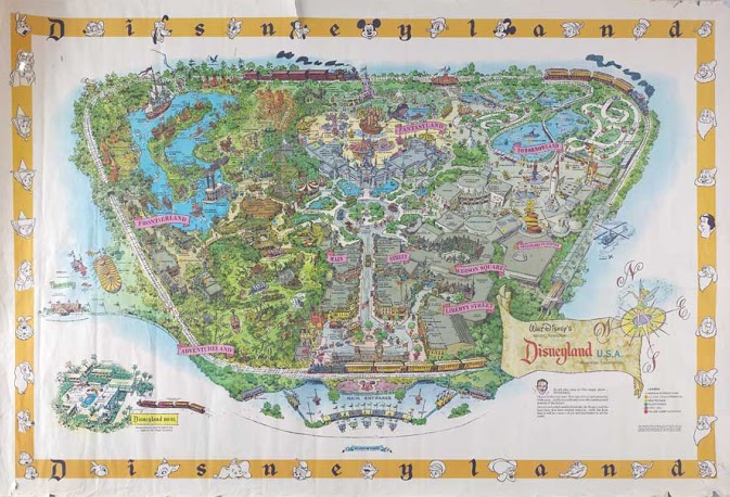
McKim’s 1958 Map of Disneyland. Click the link to see this map on Mouse Maps!
Maps as souvenirs was not a new concept; many World’s Fairs gave out artful brochure maps for visitors to remember their day at the Fair. But McKim’s willingness to push the boundaries of realistic map making in order to appeal to the imaginative and exciting nature of Disneyland revolutionized the amusement park map. After McKim, the artists behind the brochure maps became anonymous, but his impact on the work remains clear.
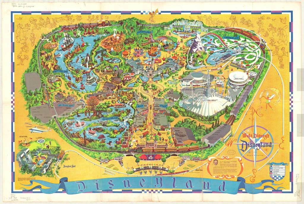
1968 Map of Disneyland. This version removed Edison Square and Liberty Park, which were not built but still included on the previous generation of maps. Click the link to see this map in our Digital Collections!
Cartography was a key tool in Disneyland’s creation. And it continues to be an important part of the Disneyland brand an experience– but more than that, the maps at Disneyland give us a way to take the park home. That first day may have been a disaster, but many, many Disney fans have experienced and loved the park since then. Happy 65th anniversary! Remember to take a map before you go–they help us find our way.
American Geographical Society Councilman Roosevelt and his Geographer
By Lauren Maddox
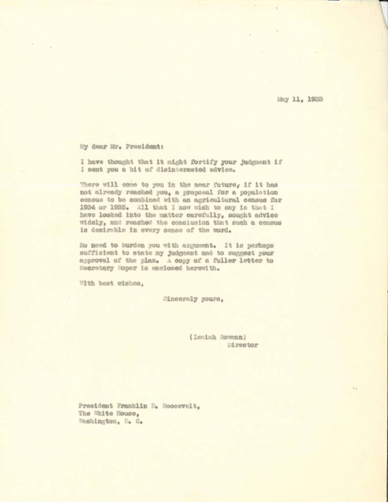
The American Geographical Society’s council has been host to some famous and interesting members– Rockefellers and Tiffanys, even. But even with a cast of fascinating characters, it’s hard to outshine Franklin D. Roosevelt.
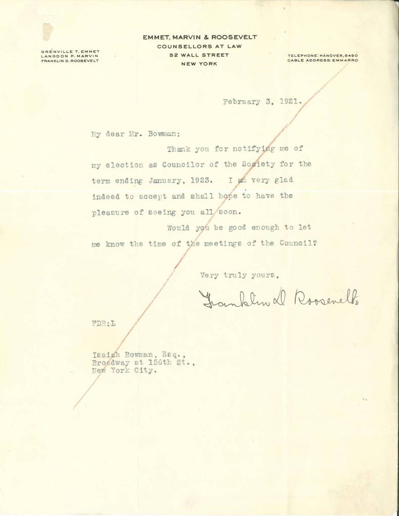
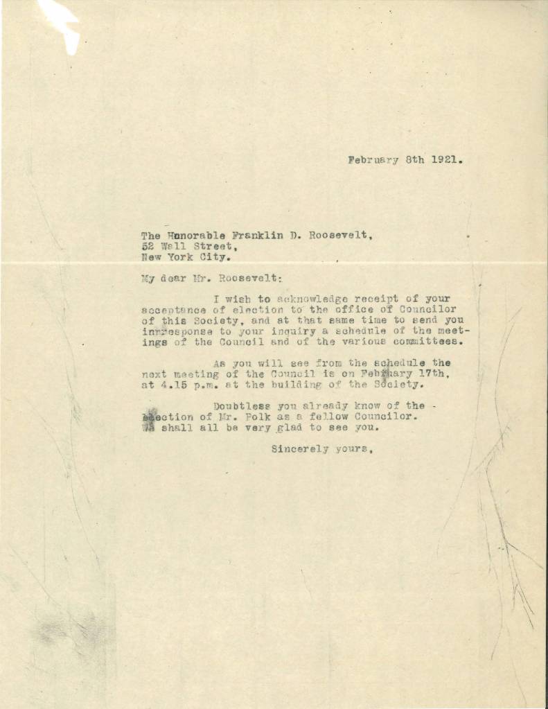
Through Roosevelt and Bowman’s letters, we can track the progression of Roosevelt’s health and his political career. Roosevelt often sent letters apologizing for his absence from AGS Council meetings, due to travel and health problems both.
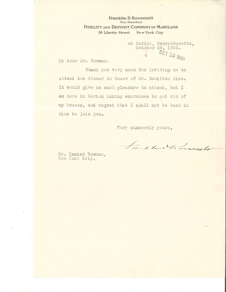
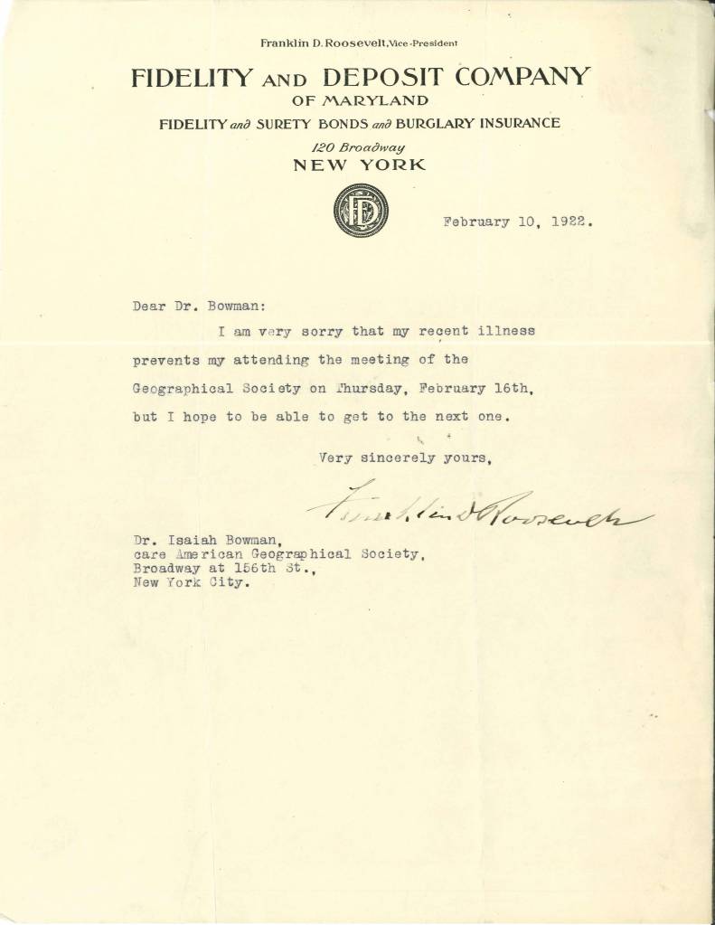
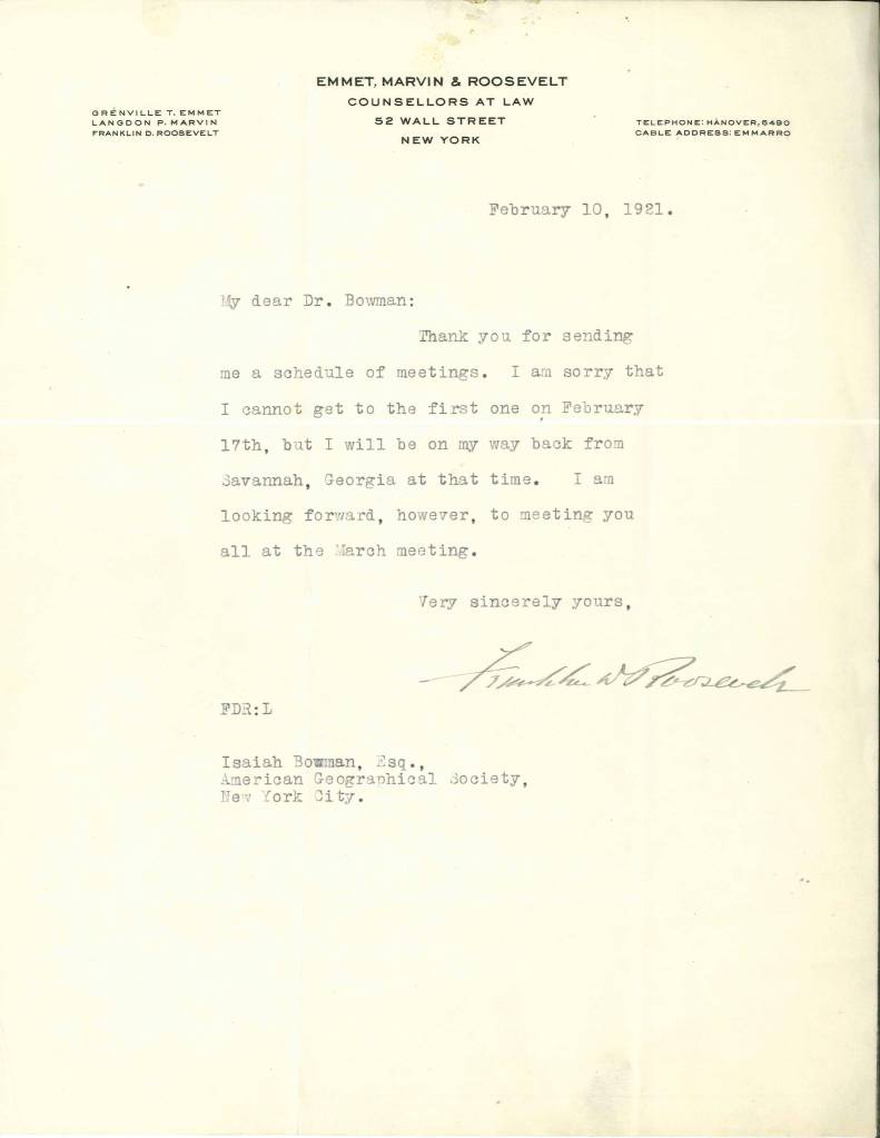
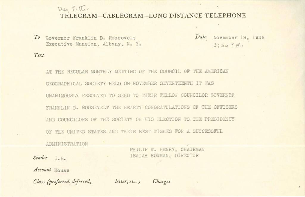
As Roosevelt’s political career progressed, his ability to attend council meetings and participate in Society work was greatly hampered. He was elected governor and then president during his tenure on the council! In 1932, he was forced to resign from his position as council member in light of his impending Presidency. Roosevelt served on the American Geographical Society’s council for more than 10 years– he was a busy man but always believed in the Society’s mission and continued to think kindly of them after his obligations to his office prevented him from participating on the council.

Roosevelt’s relationship with the AGS of New York didn’t end with his resignation from the council, however. The two men continued to correspond, and Roosevelt made Isaiah Bowman a State Department adviser during World War II.
This wasn’t the first time Isaiah Bowman had gained the confidence of a President; in 1917, he offered the AGS’s resources to the government and became close to Woodrow Wilson. His insight played a key role in how territory was distributed as part of the Paris Peace Conference in 1919. It wasn’t surprising that FDR would keep Bowman and his geographical and cartographic resources in mind during World War II. As an adviser in the State Department, Bowman participated in the Dumbarton Oaks Conference and the San Francisco Conference, which established the United Nations. During this time, Bowman was still President of John Hopkins, and he established the Applied Physics Laboratory, where technologies like the Proximity Fuze were created. Bowman was a useful man for the president to rely on.
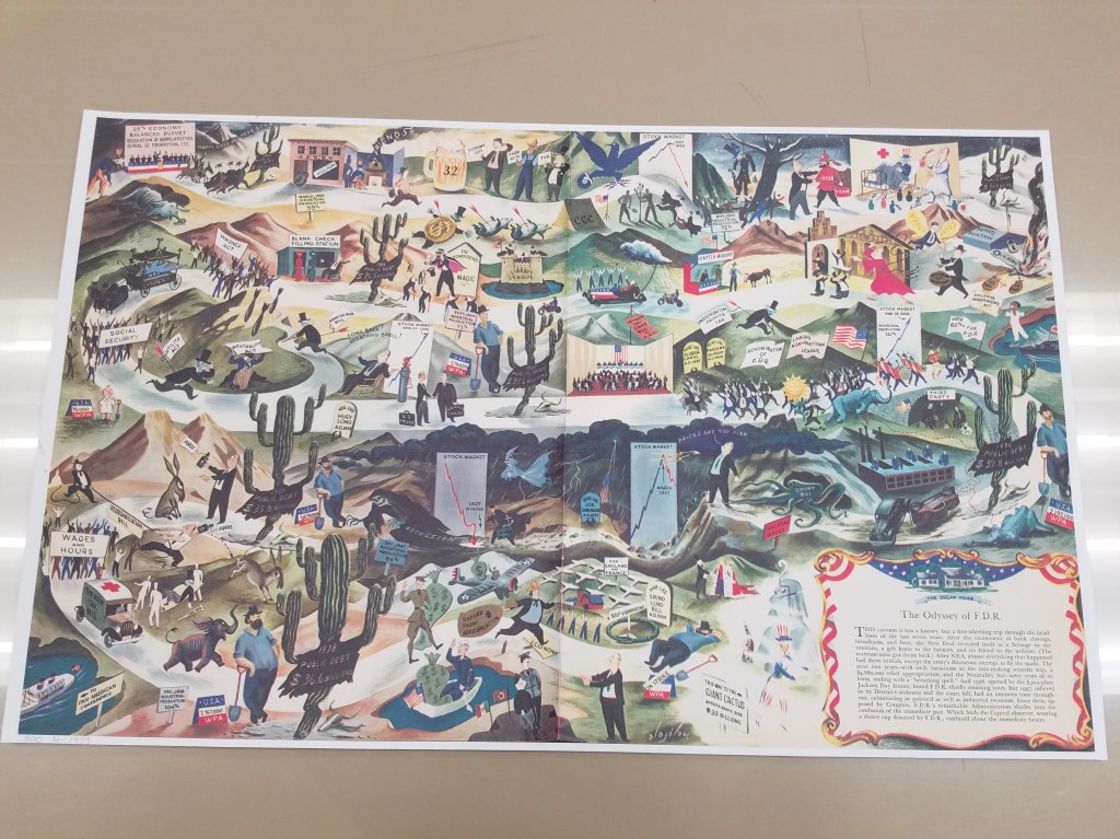
“The Odyssey of FDR” is an unflattering map of FDR’s political exploits up to 1939.
It was, however, surprising that Roosevelt enlisted Bowman to help find and establish refuge for Jewish emigrants displaced by the war. Bowman was a known antisemite who put policies into place at John Hopkins to limit the number of Jewish students admitted to the school. Neil Smith’s American Empire: Roosevelt’s Geographer and the Prelude to Globalization revealed Bowman’s prejudiced policies at John Hopkins and his treatment of Jewish students there. Unsurprisingly, Bowman’s search for refuge for Jewish emigrants lead him to five different countries, not one of which was the United States.
The collection of Roosevelt’s and Bowman’s letters in the AGSL collections help track the rise of Roosevelt to power, and the years-long relationship he maintained with the American Geographical Society and its leadership. Reading through their letters lets us watch as history unfolds before us all over again– and reminds us of the private lives that influence our public histories.
You can find more about Roosevelt and Bowman at the Archives of the American Geographical Society digital collection: https://uwm.edu/lib-collections/agsny/
The Mysterious Case of Ernest G. Lemcke
By Lauren Maddox
Sometimes I like to pull back the curtain a bit for you– show you some of the behind-the-scenes work that goes on unseen at the AGSL. I was given a special project a few months ago that I thought the readers of this blog would be interested in hearing about.
Some things about me you need to know: I love puzzles and I have never seen Mission Impossible. Most of the AGSL staff loves puzzles; we are currently working on a 4,000 piece puzzle (which you can see if you visit us!). Generally, my work at the AGSL has me at a desk writing– that’s my job. But sometimes someone gives me something different to work on.
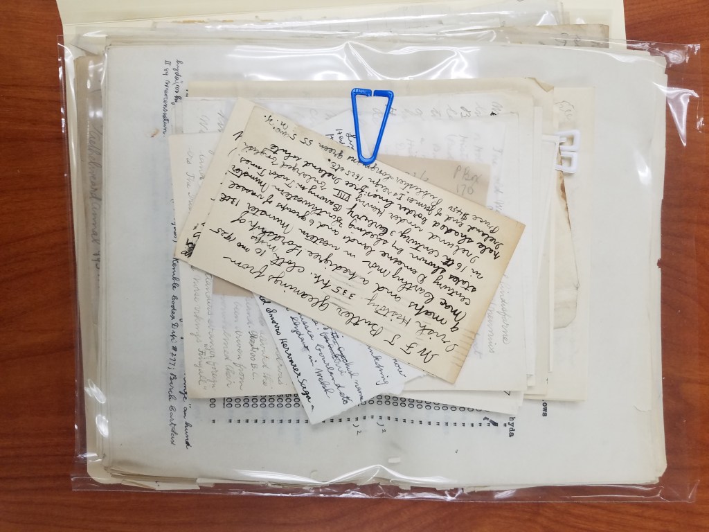
Susan Peschel stopped by my desk with a nondescript beige box.
“Your mission, should you choose to accept it–” she stopped to ask me if I remembered Mission Impossible. I didn’t, but I had at least heard the quote before. Susan told me that she had a puzzle for me (and that it might explode once she walked away).
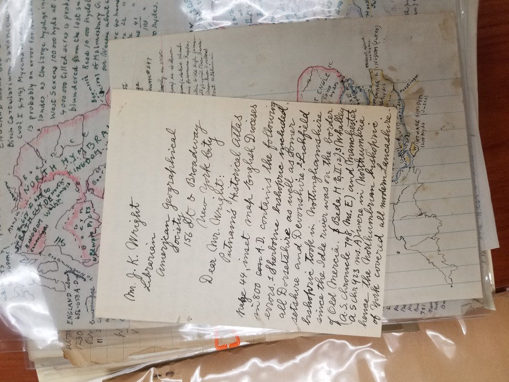
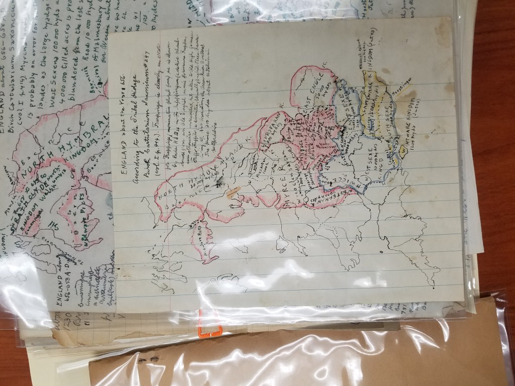
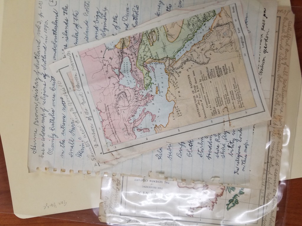
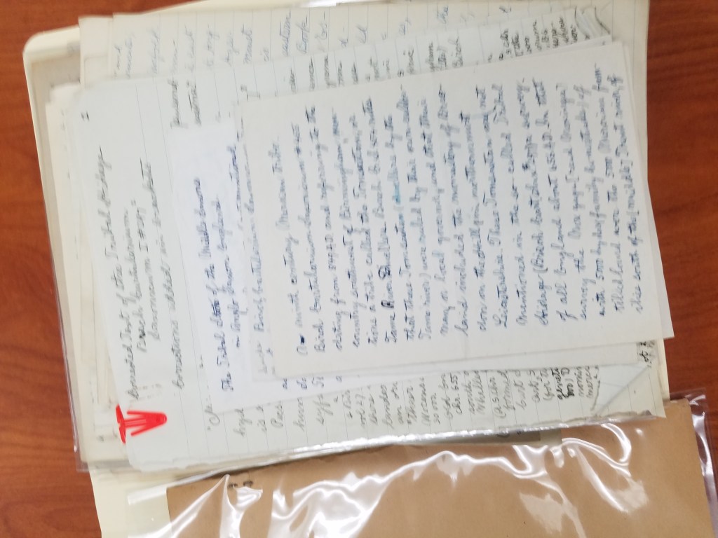
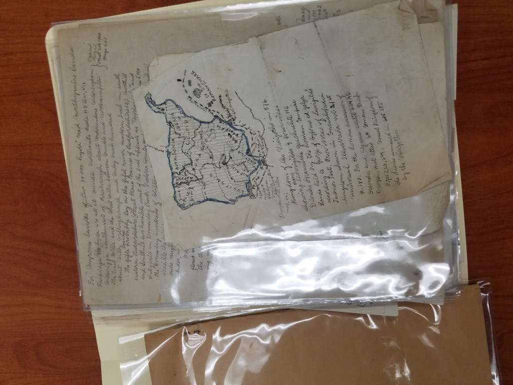
The problem with the box, which had traveled with the AGSL’s collection from New York to Milwaukee in the 70s, was that it had never been archived. The papers in the box were unsorted– no one even knew what they were. By all appearances, the collection of handwritten pages and letters seemed random. There were maps in the pile, but they were either hand-drawn or, stranger, road maps that had been drawn over. My mission (and I did accept it) was to figure out what we had and then to put it into some semblance of order.
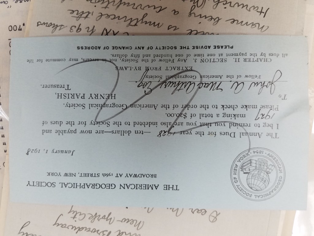
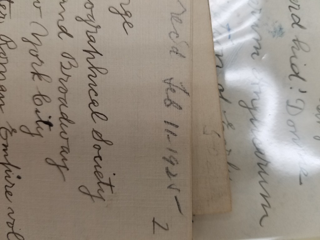
We didn’t know much, but we did know his name: Ernest G. Lemcke. We knew he was a card-carrying member of the American Geographical Society of New York because we have a record of his membership dues:
He wrote a trove of letters to Ena L. Yonge and John K. Wright. He bought a roadmap in 1926 and hand-drew a medieval military event in England from the 1300s. He was a book publisher in New York– which I discovered because some of his stationery had letterhead from Lemcke&Buechner, “Booksellers, publishers, importers.”
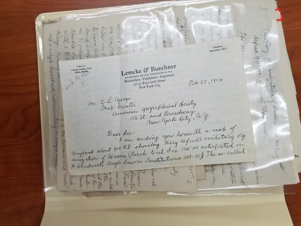
Part of the trouble with deciphering the box was figuring out what was meant for who. The maps were easy– Ena L. Yonge was map curator for the AGS of New York at the time, and his maps often came with a letter explaining what they were. But the partial manuscripts, many handwritten first drafts, and article corrections for the AGS’s periodical were mysterious and dense.
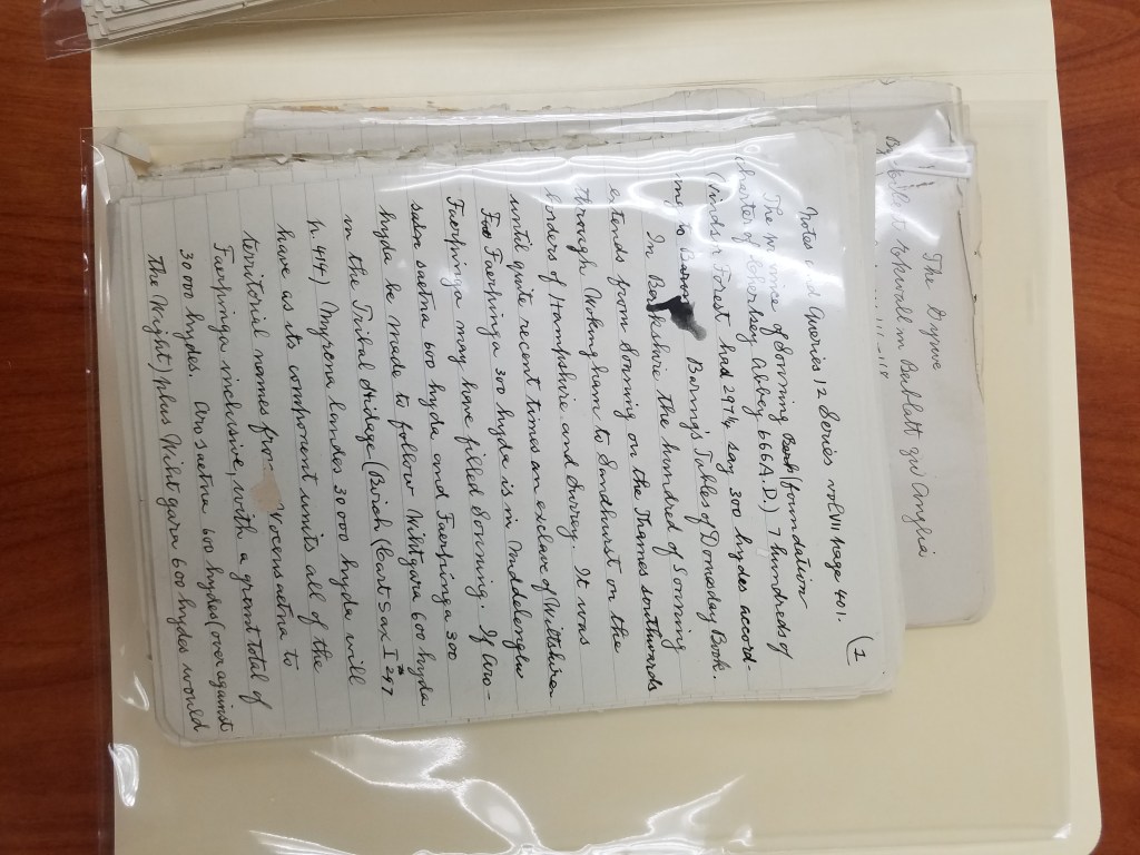
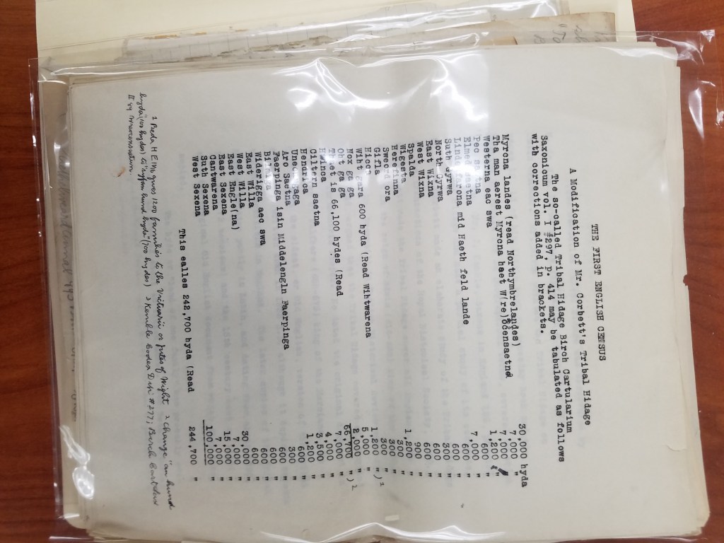
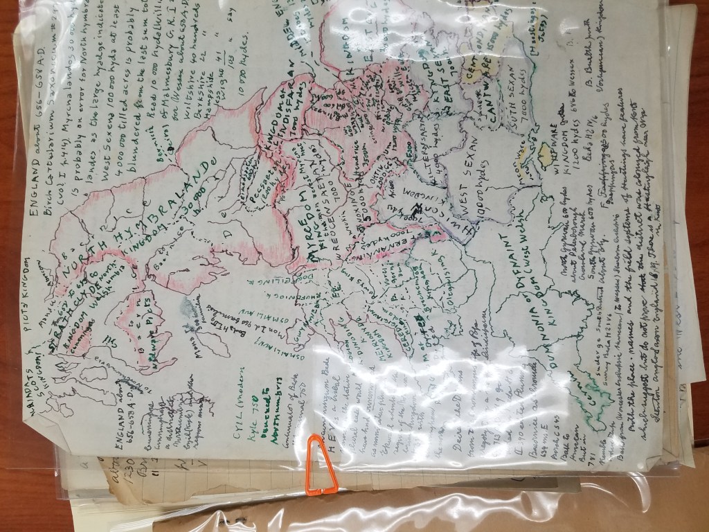
After many fruitless Google searches, I learned a few things about Lemcke: besides being a book publisher, he was also a historian with several books out, many specifically interested in the “Tribal Hidage” in Wessex. As it turns out, the University of New Hampshire also has a collection of Lemcke papers! Which was how I tracked down some of his publications and discovered that the many handwritten pages about a “tribal hidage” and the first English Census were partial drafts of his later, completed publications.
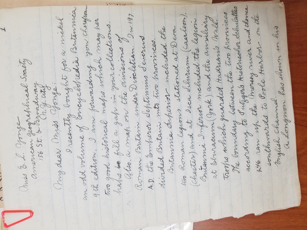
Now that I had a better idea of what we had, I came to the next part of the puzzle: putting it in order. I started with separating the things that were obviously addressed to Yonge or Wright. Maps were obviously meant for Yonge, and corresponded with letters that he had sent. John K. Wright was once director of the AGS of New York, but that didn’t help place many of Lemcke’s letters. But as it turned out, before he was director, Wright was the editor of the AGS’s regular publication from 1920-1956. This was exactly the period of time Lemcke was writing. The periodical corrections, then, seemed to be for the editor of the publication. And after reading Lemcke’s letters, I found him explaining corrections to his manuscript to Wright.
Once the letters were sorted by recipient, I started to put them in a chronological order. Some of the letters were dated– those were easy. But many of the letters weren’t dated. For several of them, I found a reference he made to an article he had just read, which helped me place it in the chronology. But many more had to be dated by their relationship to the other letters, which made for some puzzling work.
After finishing the work of putting the box in order, it was time to have it officially archived. This was definitely out of my expertise, so I reached out to fellow graduate intern Georgia Brown, who consulted our curator, Marcy Bidney, about what to do with the box.
Soon, the Lemcke papers will be officially archived! Since all of his correspondence was addressed to Ena L. Yonge and John K. Wright, the letters will be incorporated into their existing correspondence collections, cataloged, and made available for viewing! And now, with a little puzzling, we have put a years-old AGSL mystery to rest.
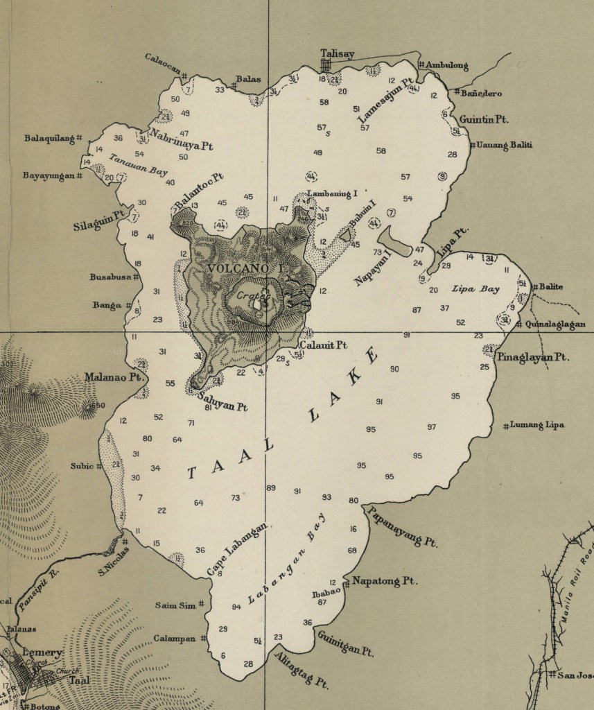
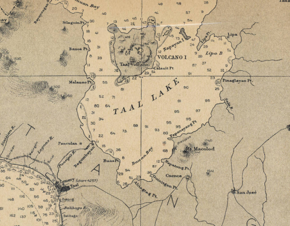
Taal Volcano, Philippines
by Angie Cope
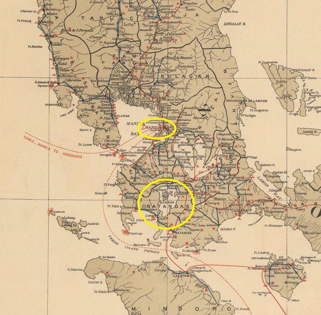
The Taal Volcano in the Philippines is about 37 miles (60 kilometers) south of the capital Manila on the island of Luzon. The volcano sent a plume of ash, steam and rock six to nine miles into the sky with a violent explosion on Sunday, January 12, 2020. The area remains on an alert level four out of five which means a “hazardous eruption” is immenent in a region which is heavily farmed and popular for tourism.
Scientists warned that new fissures were appearing in the ground, and about 50 earthquakes jolted the area in just eight hours on Tuesday, all signs that another, possibly larger eruption was coming.
Around 459,000 people reside within a danger zone with a 14-kilometer (8.7 miles) radius around the volcano, according to a map by the agency, while more than 930,000 people live in a wider 17-kilometer (10.5 miles) danger zone.
Taal has been spewing fountains of red hot lava half a mile high, sparking its own spectacular lightning storms and turning green, tropical vistas grey with ash.
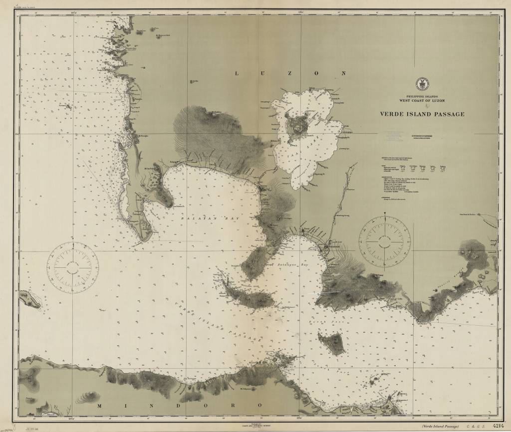
Philippine Islands, west coast of Luzon : Verde Island Passage / [U.S.] Coast and Geodetic Survey 1912
https://collections.lib.uwm.edu/digital/collection/agdm/id/6440/rec/30
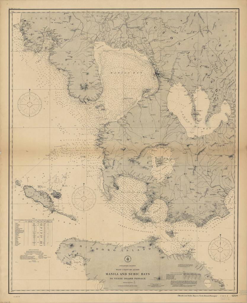
Philippine Islands, west coast of Luzon : Manila and Subic Bays to Verde Island Passage / published … by the Coast and Geodetic Survey, O.H. Tittmann, Superintendent ; compiled from surveys by the Coast and Geodetic Survey … and from Spanish and other sources 1907
https://collections.lib.uwm.edu/digital/collection/agdm/id/6373/rec/4
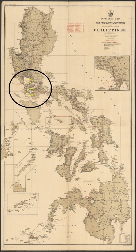
Progress map of Signal Corps telegraph lines and cables in the Military Division of the Philippines / prepared under the direction of Brigadier General A.W. Greely chief signal officer U.S. Army ; by Major R.E. Thompson Signal Corps, U.S. Army 1903
https://collections.lib.uwm.edu/digital/collection/agdm/id/25398/rec/23
City of St. Louis, Missouri
by Angie Cope
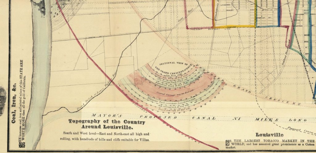
City of Lousiville and vicinity population 15,000 and 30,000 buildings, 1869
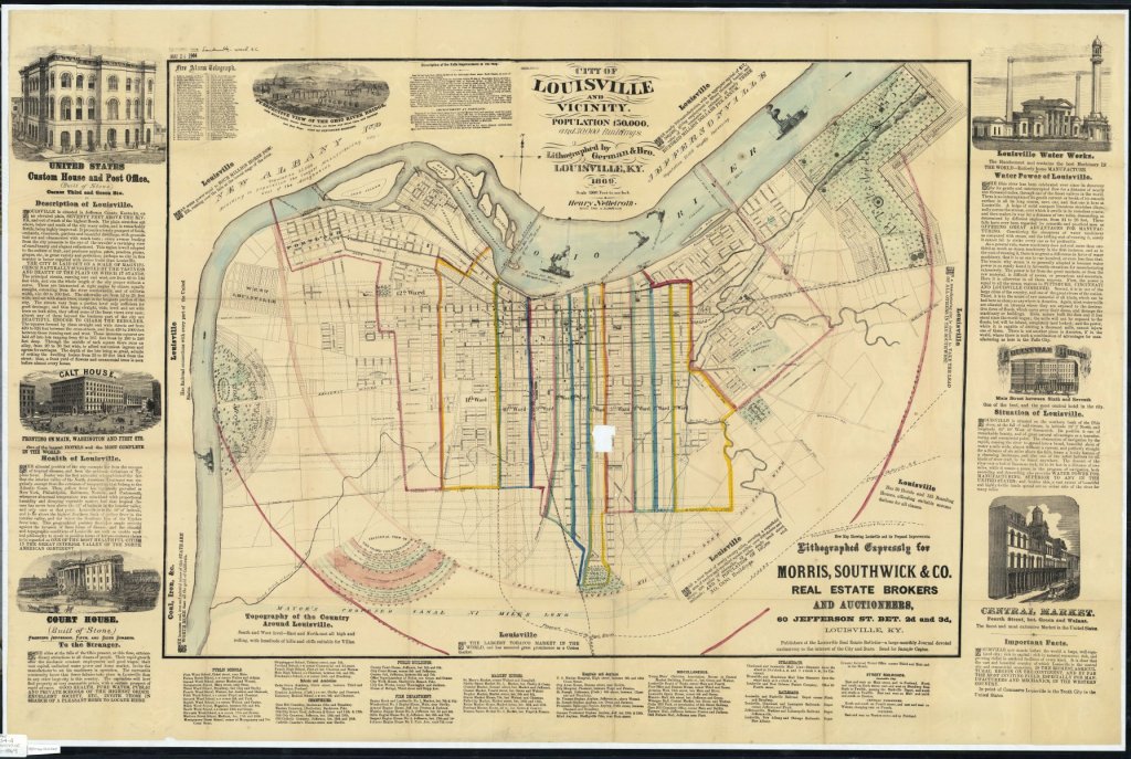
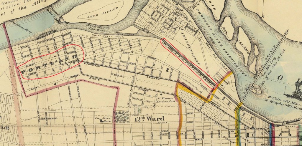
Louisville, Kentucky was founded in 1778 and named after King Louis XVI of France whose soldiers had assised Americans in the Revolutionary War. Louisville is one of the oldest cities west of the Appalachain Mountains and served historically as a portage city on the Ohio River. Building and maintenance of a canal began in 1826 with the first ship passing through in 1830. This map shows an ambitious new 11 mile canal proposed by the mayor of Louisville in 1869. The then mayor was Joseph H. Bunce who was a steamboat captain living in the Portland District near where the existing canal passed by.
The map promotes the economic prosperity of the city and was distributed by the Morris, Southwick & Co. Real Estate Brokers and Auctioneers. The map ws lithographed by German & Brother, a lithographic firm founded at Louisville in 1854 by Charles W. German (1837-1907) and Philip T. German which later became Falls City Lithographic Co. with Charles German as manager in 1881.
https://collections.lib.uwm.edu/…/coll…/agdm/id/21153/rec/15
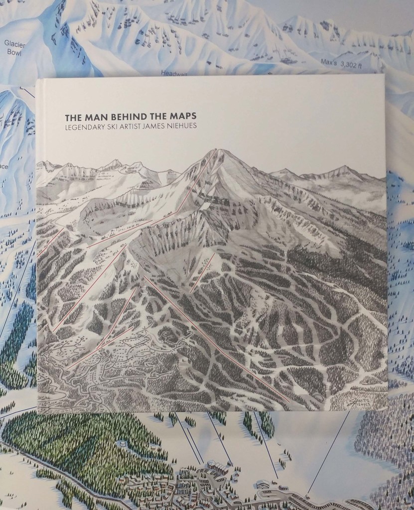
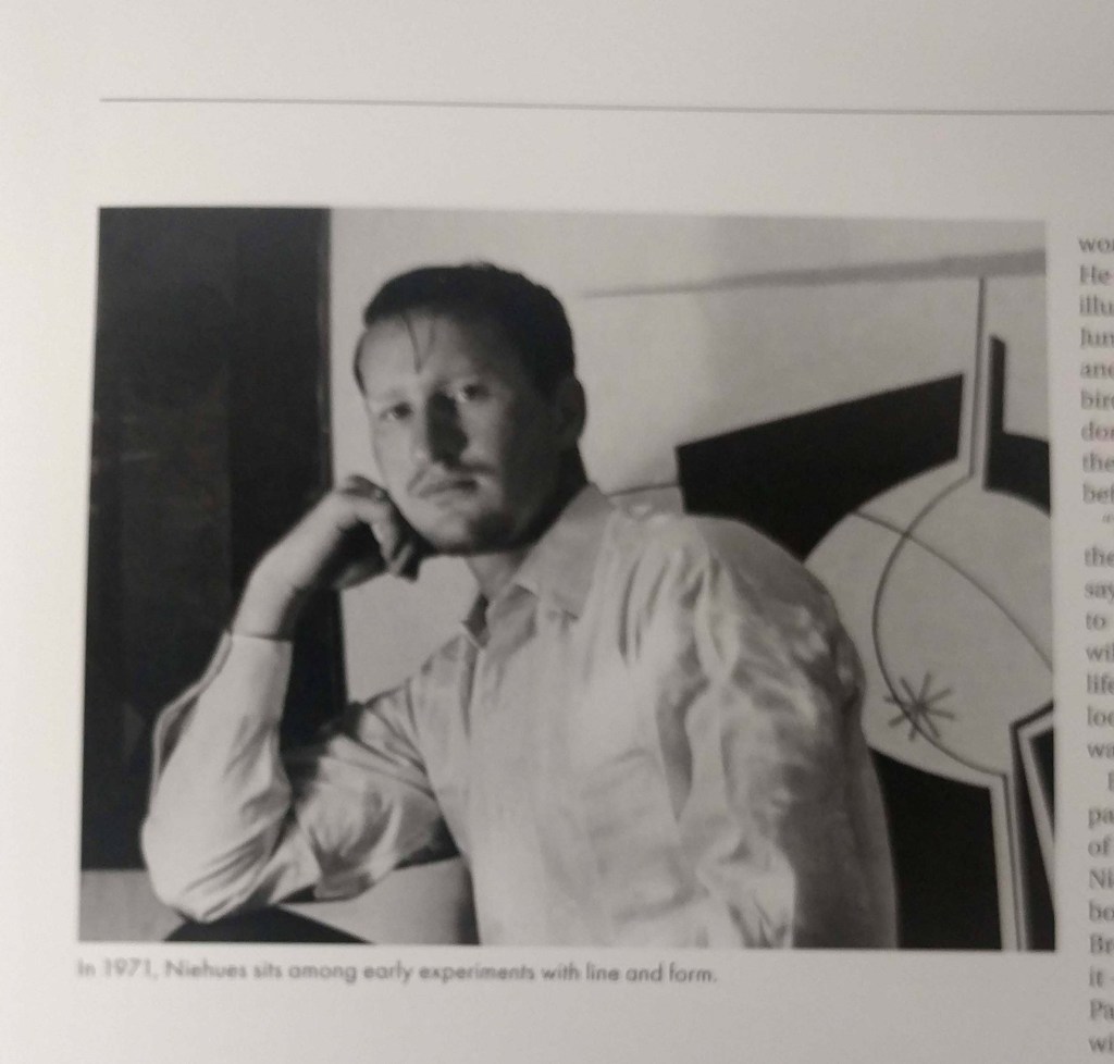
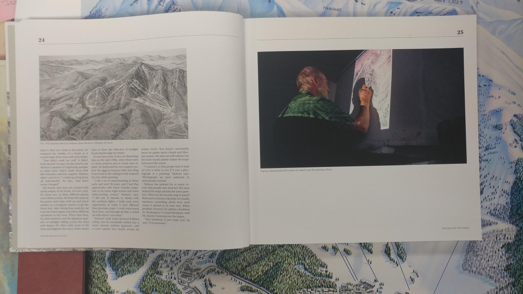
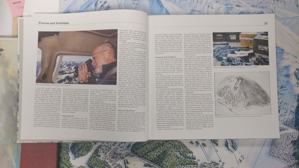
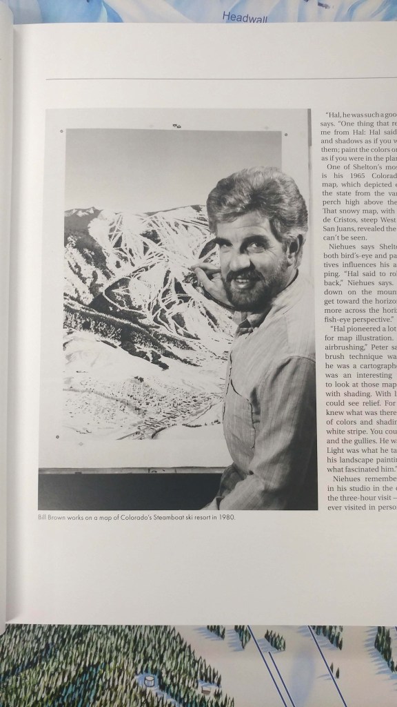
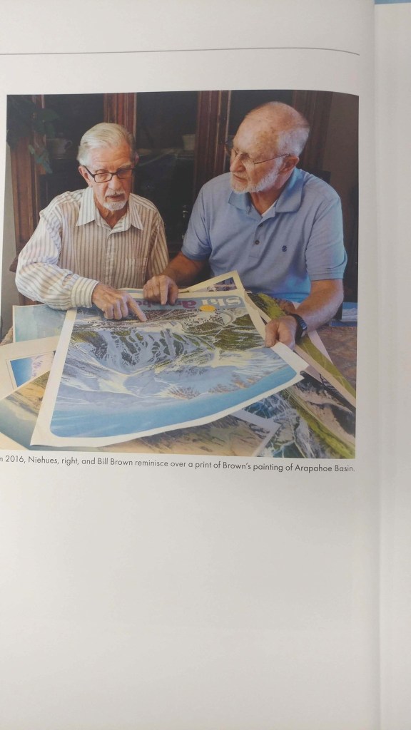
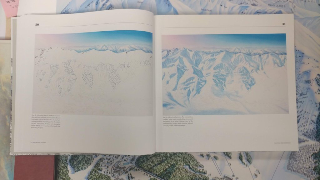
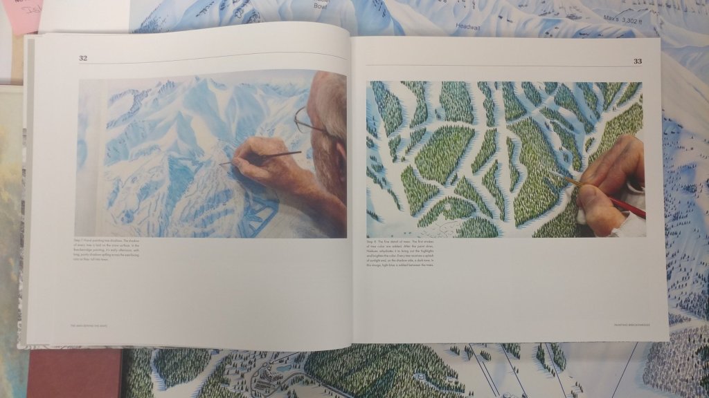
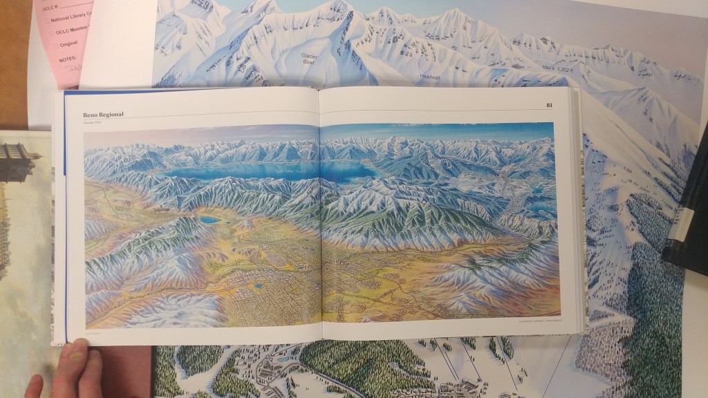
The man behind the maps : legendary ski artist James Niehues
by Angie Cope
The AGSL ordered a copy of “The man behind the maps : legendary ski artist James Niehues.” The introduction tells about Niehues, his inspirations including his mentor and friend, Bill Brown. The book details Niehues’s process and includes over 200 pages of color illustrations of Niehues’ mountain maps. Beautifully colored images of Niehues’s maps are included in the book from the United States, Canada, Australia, Chile, New Zealand and Serbia. This is a beautiful book, that, yes, smells great. It can be purchased here: https://jamesniehues.com/pages/the-man-behind-the-map
Mount Vesuvius, Italy
by Angie Cope
Vesuvius is a volcano located on the Gulf of Naples in Campania, Italy, about 5.6 miles east of Naples and a short distance from the shore. The height of the main cone has been constantly changed by eruptions but was 4,203 feet in 2010.
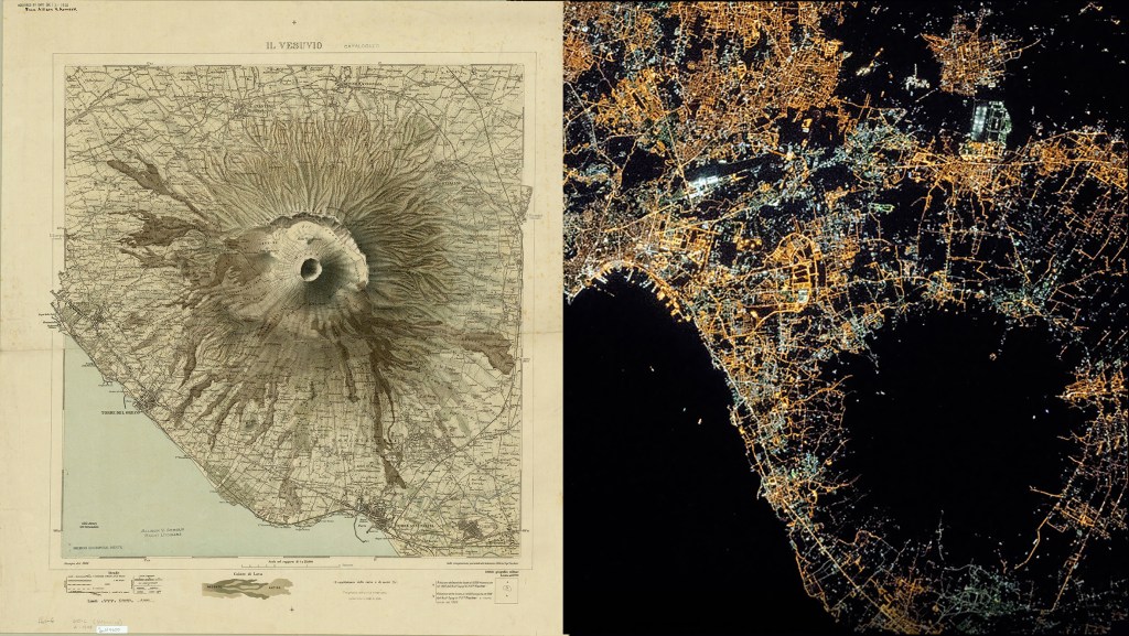
Vesuvius was formed as a result of the collision of the African and the Eurasian tectonic plates. The infamous eruption of Mount Vesuvius in AD 79 destroyed the Roman cities of Pompeii, Herculaneum, Oplontis and Stabiae, as well as several other settlements. The eruption ejected a cloud of stones, ashes and volcanic gases to a height of 21 miles, erupting molten rock and pulverized pumice at the rate of 7.8 × 10⁵ cubic yards per second.
Vesuvius has erupted many times since then and is the only volcano on the European mainland to have erupted within the last hundred years. Today, it is regarded as one of the most dangerous volcanoes in the world because of the population of 3,000,000 people living near enough to be affected, with 600,000 directly in the danger zone.
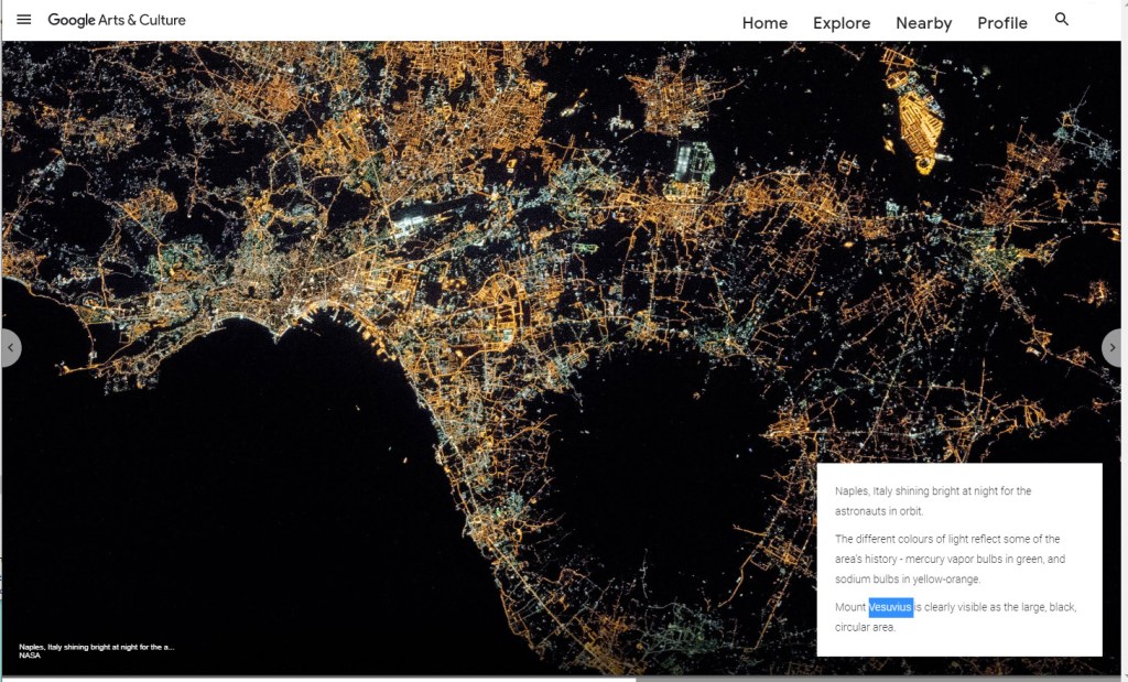
Here is an image shared by Google from the International Space Station showing Mount Vesuvius as the large, black, circular area. Naples, Italy shines bright at night and the different colors of light reflect some of the area’s history – mercury vapor bulbs in green, and sodium bulbs in yellow-orange.
Here is a map donated to the AGS of NY in 1918 from Allison Armour showing Mount Vesuvius in 1908. Il Vesuvio / Istituto Geografico Militare
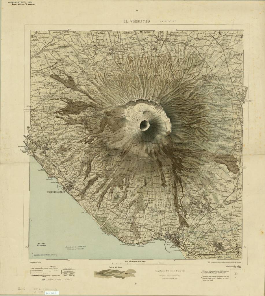
https://collections.lib.uwm.edu/digital/collection/agdm/id/3379/rec/1
Here is another view of Moutn Vesuvius on this 1913 map of Campania, Italy
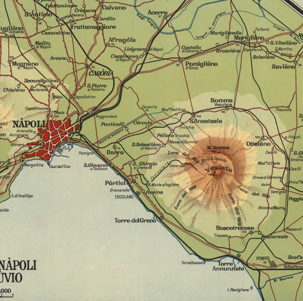
https://collections.lib.uwm.edu/digital/collection/agdm/id/15436/rec/69
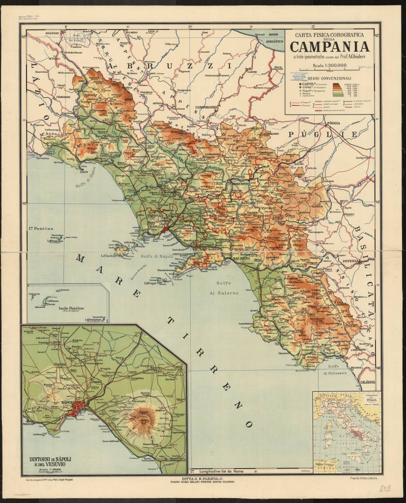
Carta fisica-corografica della Campania / a tinte ipsometriche, curata dal Prof. A. Ghisleri ; costrutta ed eseguita nell’Off. Cartogr. Nani & Longhi ; proprieta Artistico-Letteraria ; Ditta G.B. Paravia & C. ; lit. Bolis 1913
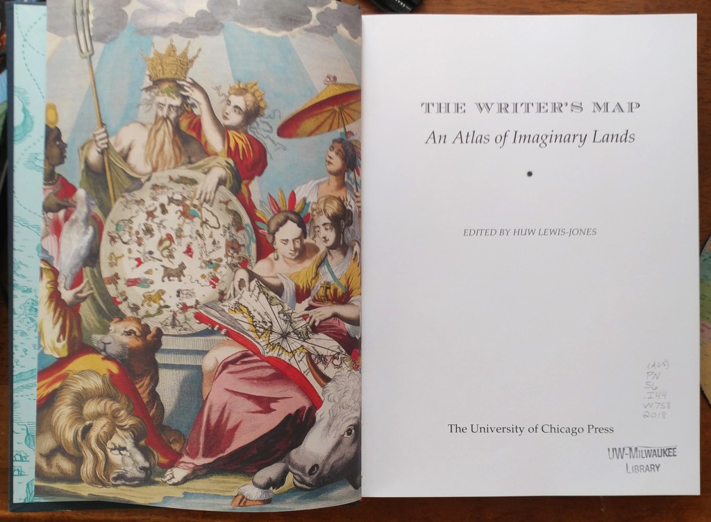
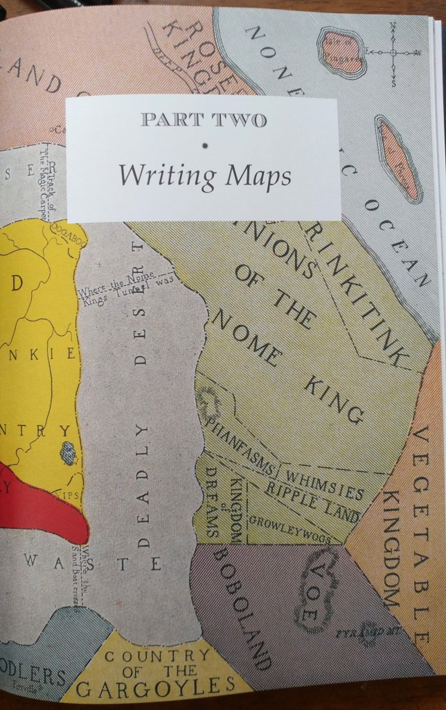
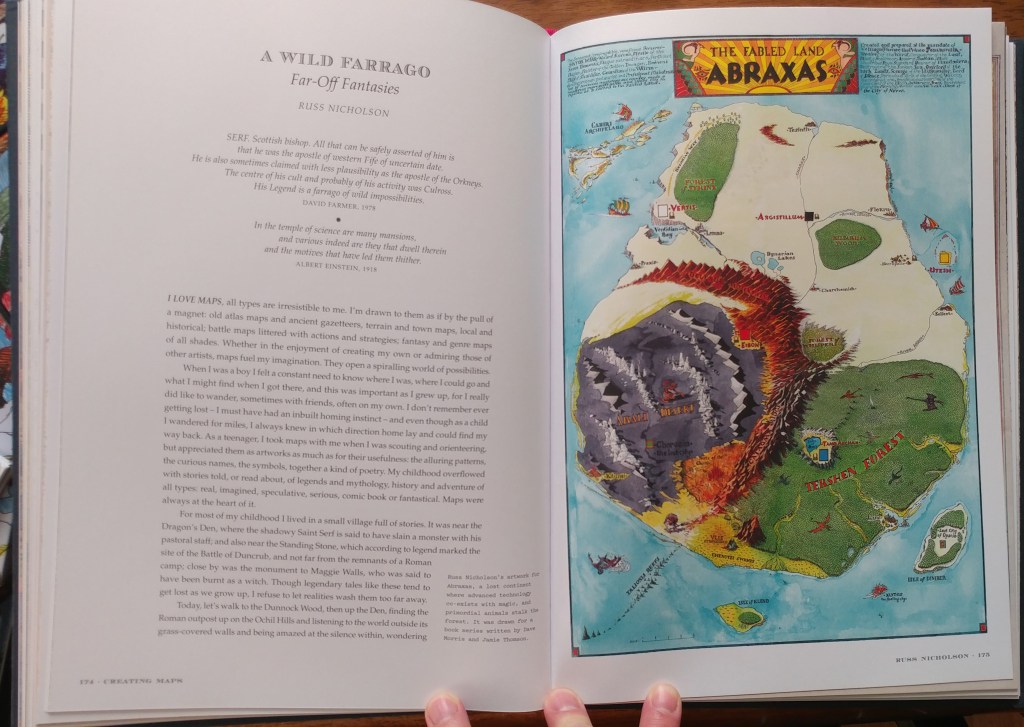
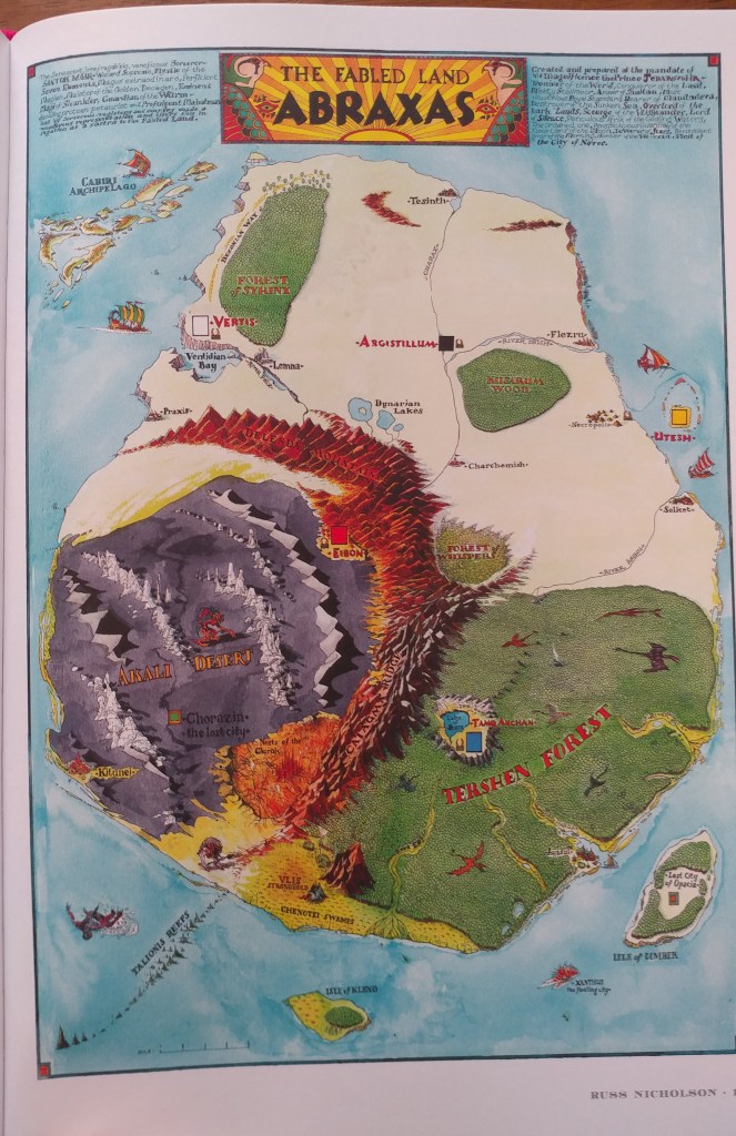
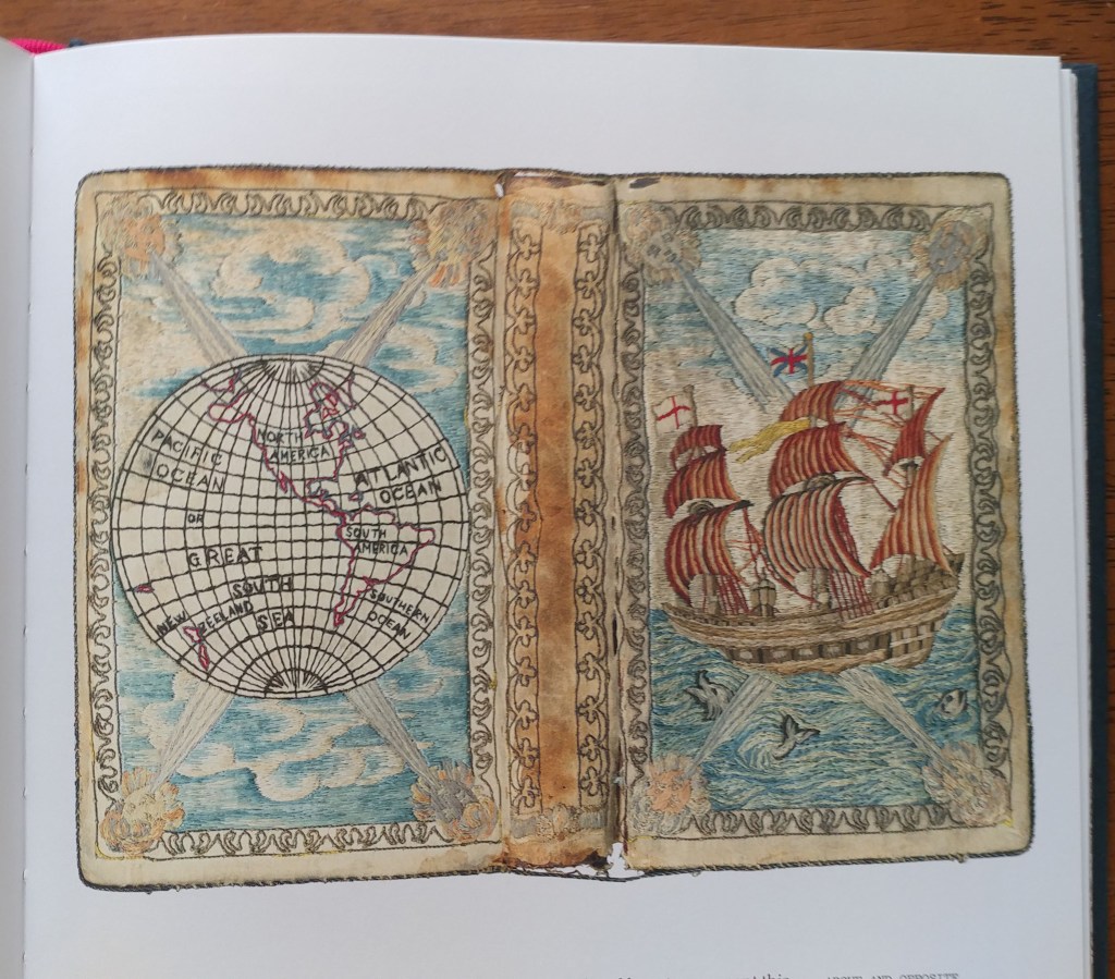
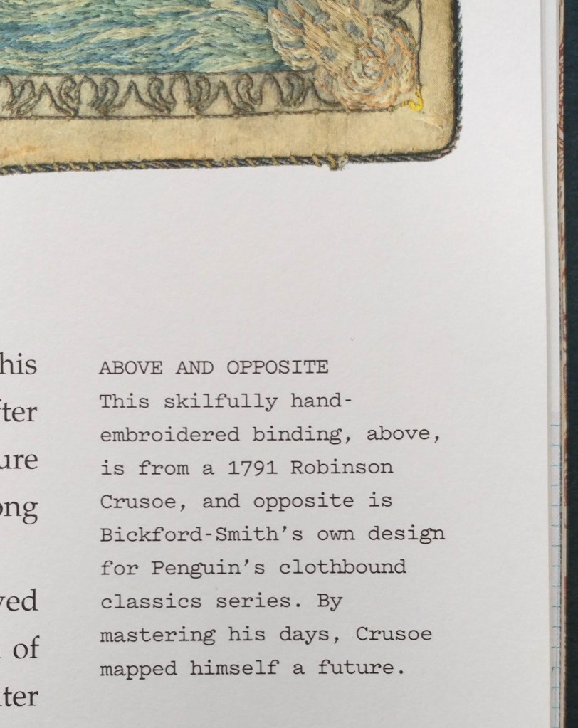
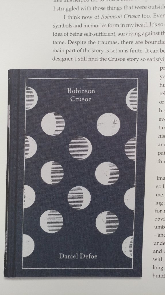
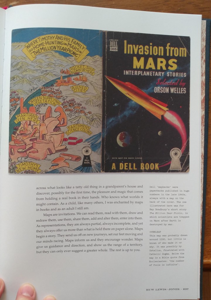
The Writer’s Map – an atlas for creative storytellers
by Angie Cope
The Writer’s Map is an atlas of the journeys that our most creative storytellers have made throughout their lives. This magnificent collection encompasses not only the maps that appear in their books but also the many maps that have inspired them, the sketches that they used while writing, and others that simply sparked their curiosity.
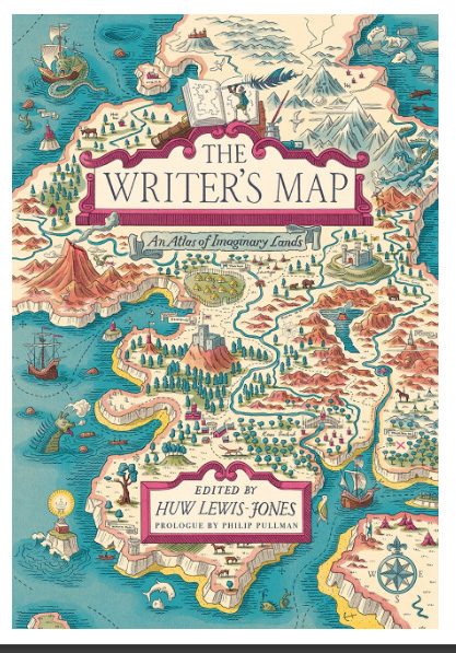
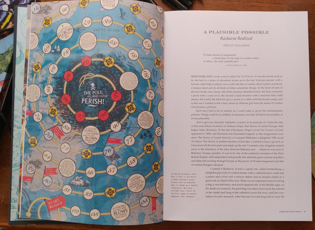
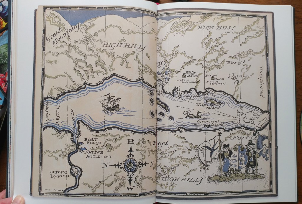
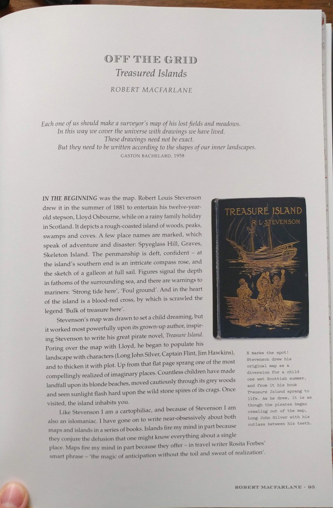
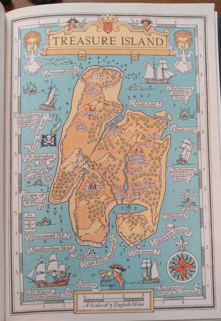
Philip Pullman recounts the experience of drawing a map as he set out on one of his early novels, The Tin Princess. Miraphora Mina recalls the creative challenge of drawing up ”The Marauder’s Map” for the Harry Potter films. David Mitchell leads us to the Mappa Mundi by way of Cloud Atlas and his own sketch maps. Robert Macfarlane reflects on the cartophilia that has informed his evocative nature writing, which was set off by Robert Louis Stevenson and his map of Treasure Island. Joanne Harris tells of her fascination with Norse maps of the universe. Reif Larsen writes about our dependence on GPS and the impulse to map our experience. Daniel Reeve describes drawing maps and charts for The Hobbit film trilogy. This exquisitely crafted and illustrated atlas explores these and so many more of the maps writers create and are inspired by—some real, some imagined—in both words and images.
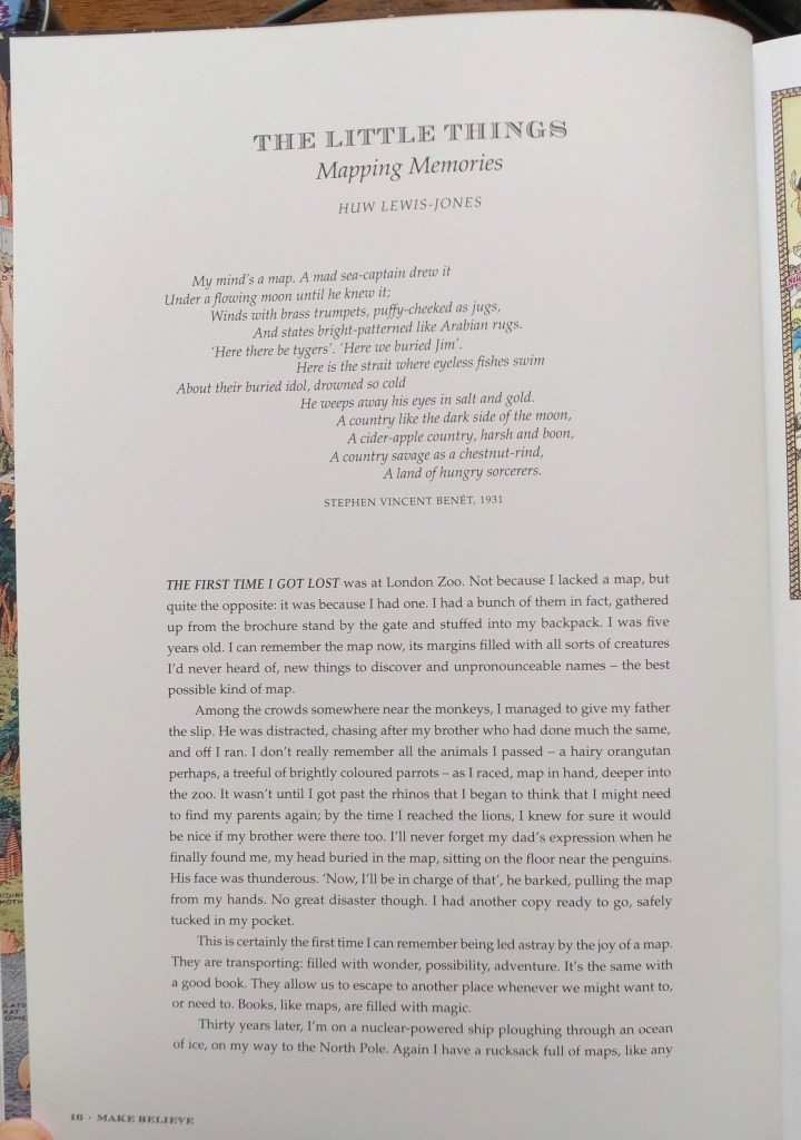
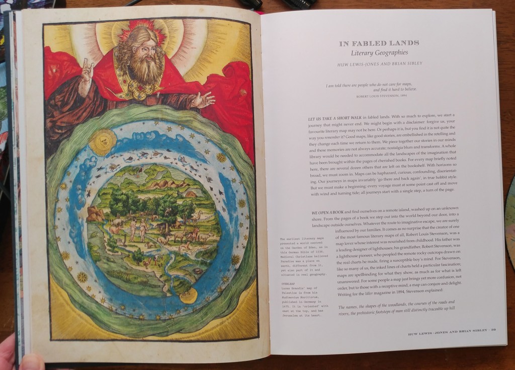
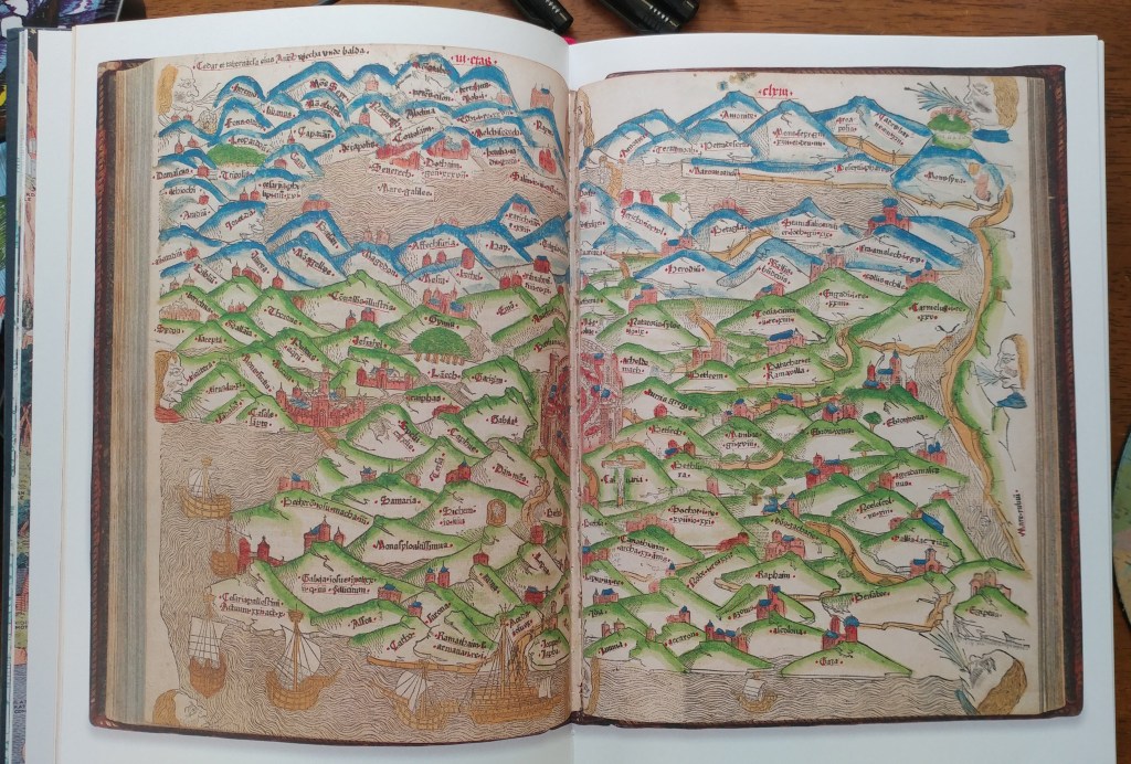
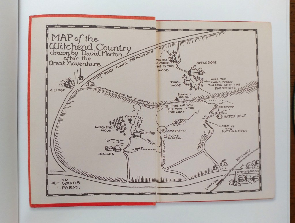
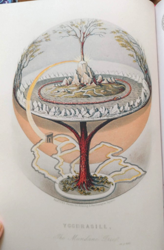
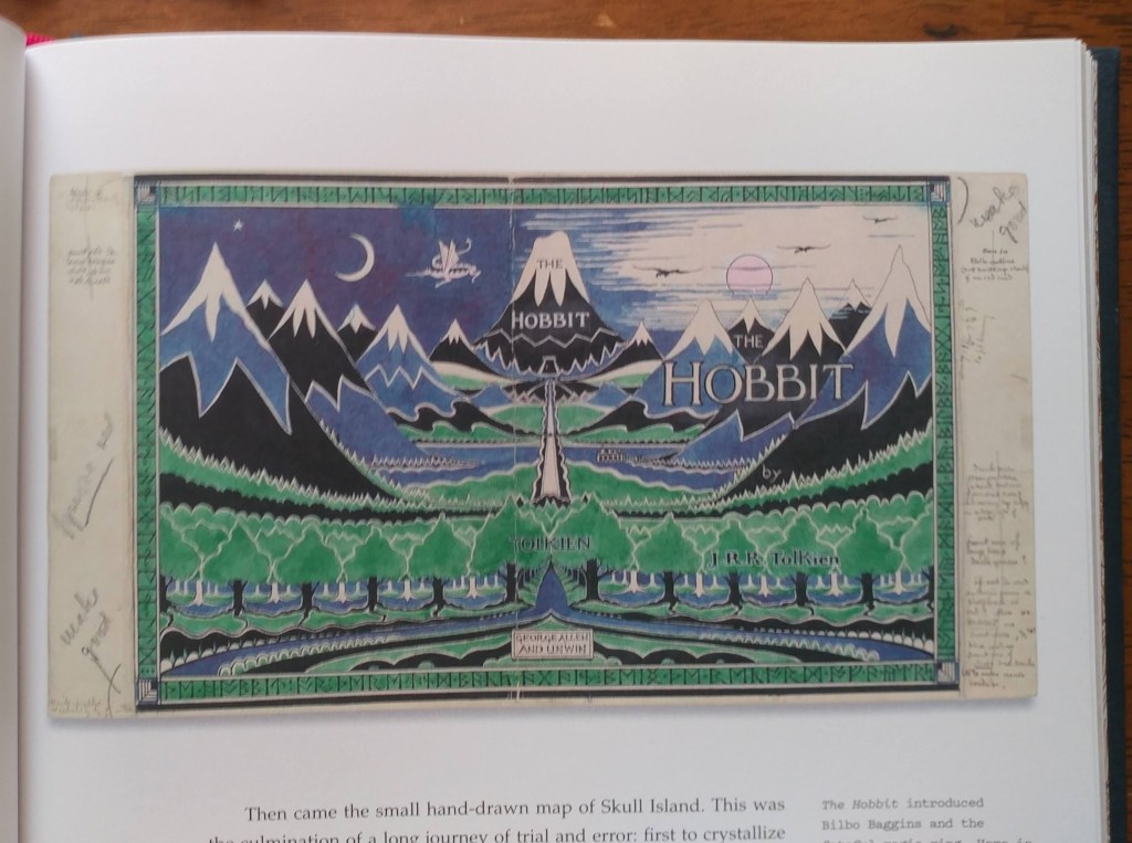
Amid a cornucopia of 167 full-color images, we find here maps of the world as envisaged in medieval times, as well as maps of adventure, sci-fi and fantasy, nursery rhymes, literary classics, and collectible comics. An enchanting visual and verbal journey, The Writer’s Map will be irresistible for lovers of maps, literature, and memories—and anyone prone to flights of the imagination.
Huw Lewis-Jones is a historian of exploration with a PhD from the University of Cambridge. He was formerly curator at the Scott Polar Research Institute, Cambridge, and the National Maritime Museum, London. His books include Arctic, Ocean Portraits, In Search of theSouth Pole, The Conquest of Everest, The Crossing of Antarctica, and Across the Arctic Ocean. Most recently, he is also coauthor of the internationally bestselling Explorers’ Sketchbooks.
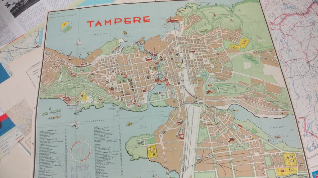
End of Semester Me Time
by Angie Cope
If you’re a frequent visitor to the AGS Library, you know that you can’t find all our materials by searching in the UWM Libraries online catalog. We have an old fashioned card catalog that does list everything acquired between 1851 and 1978. Most things acquired between 1980 and 2019 are cataloged, but staff are still hard at work getting all 500,000 maps and 12,000 atlases cataloged in the digital environment.
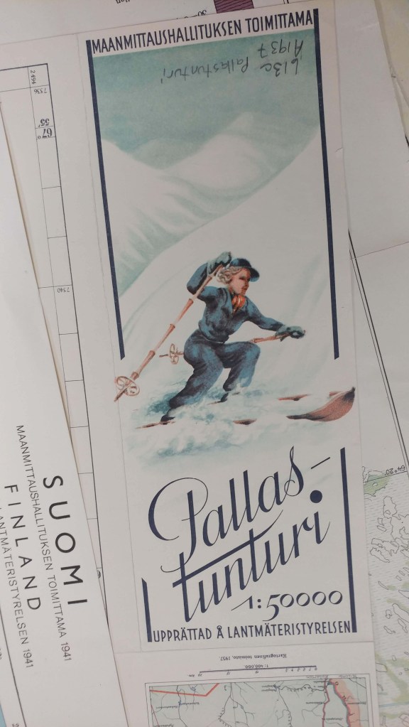
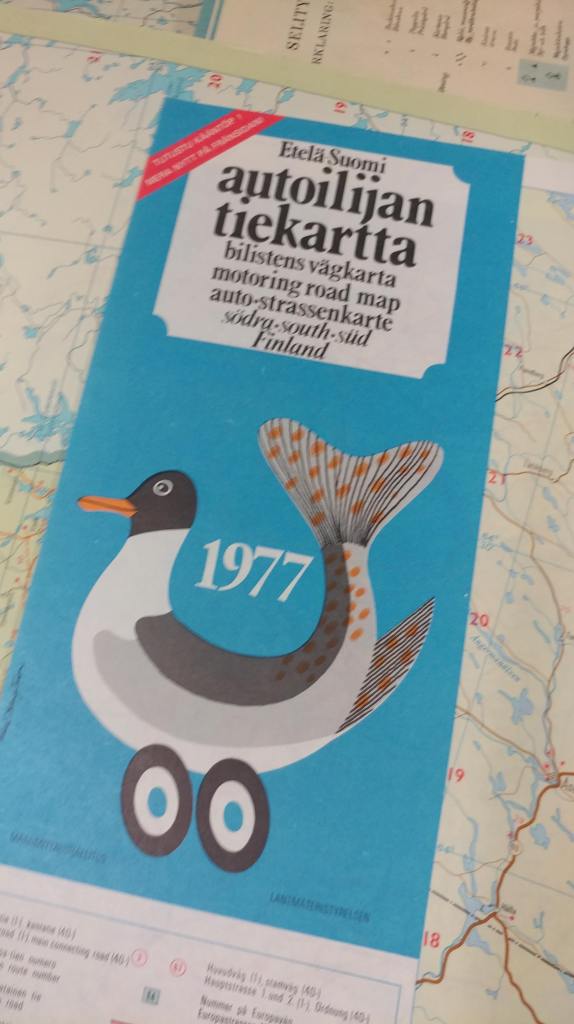
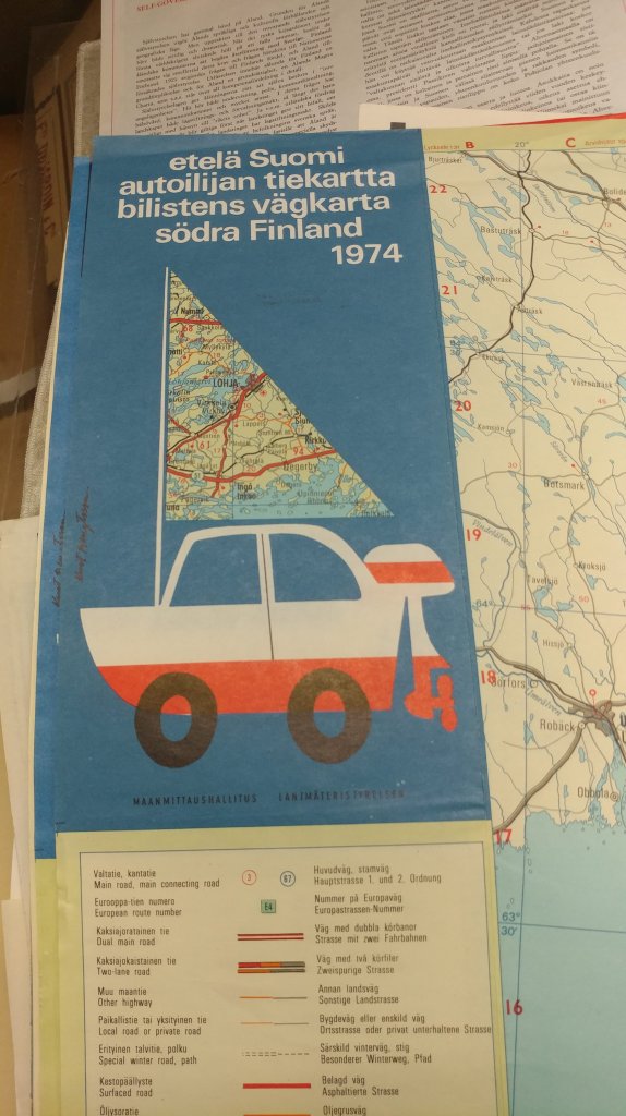
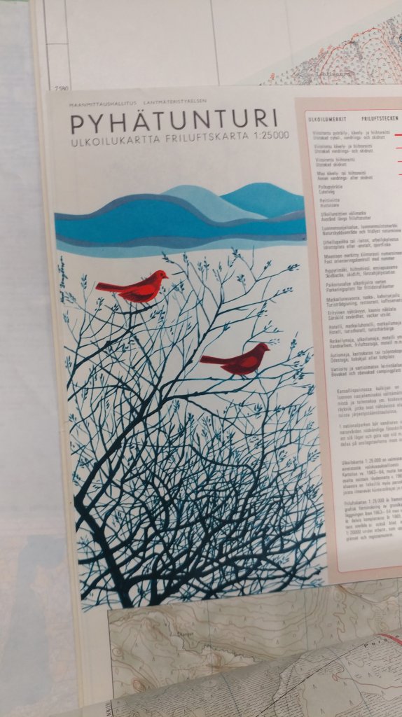
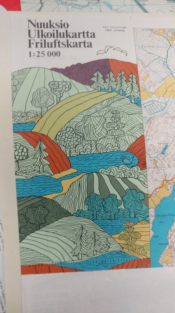
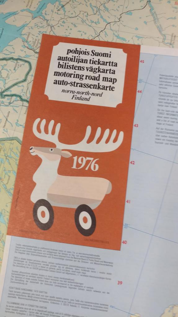
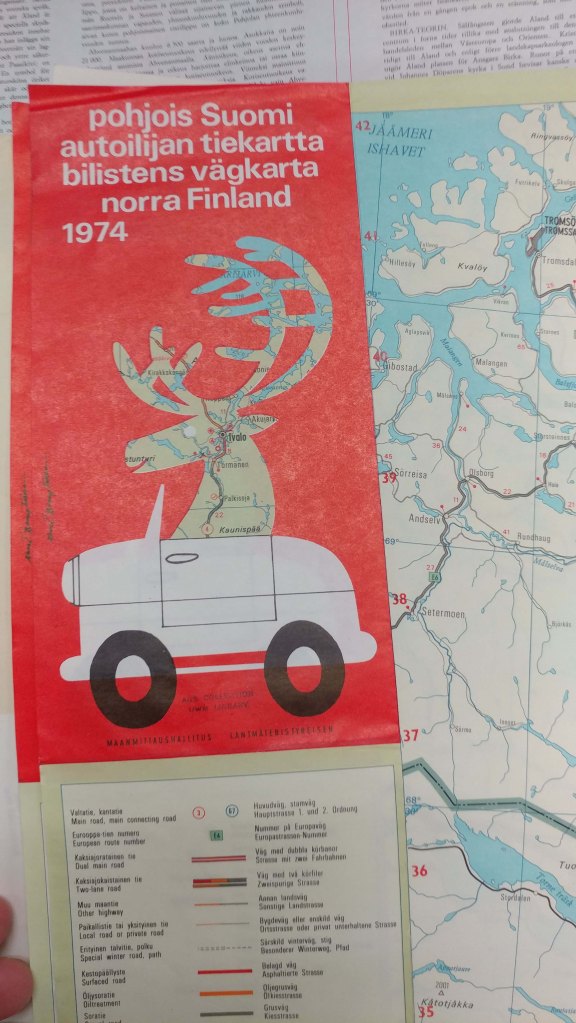
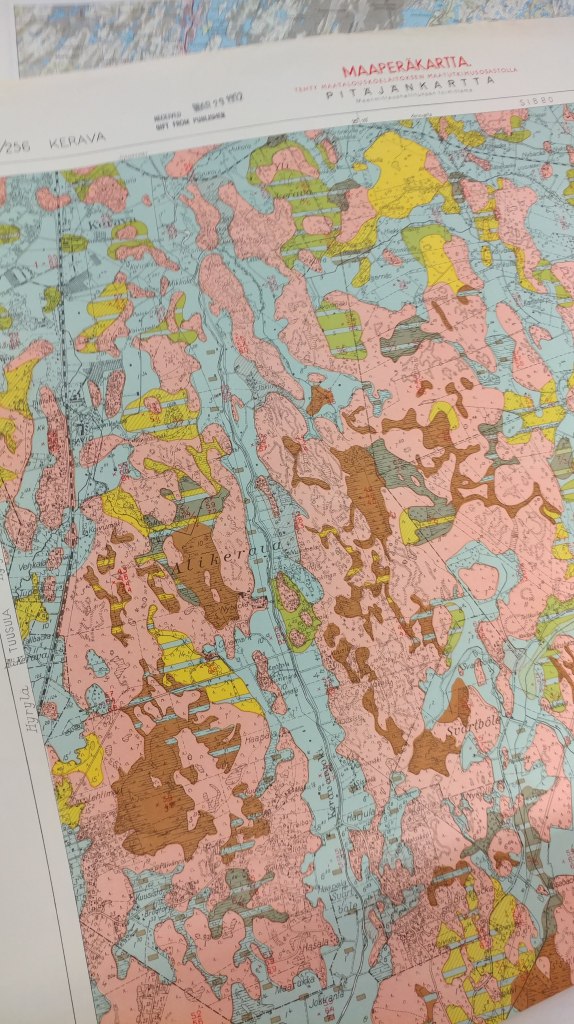
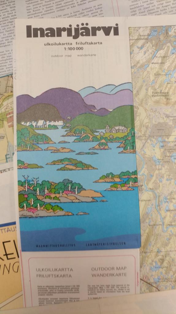
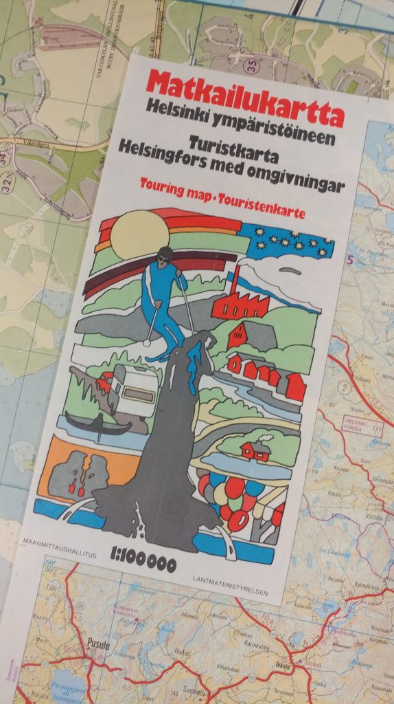
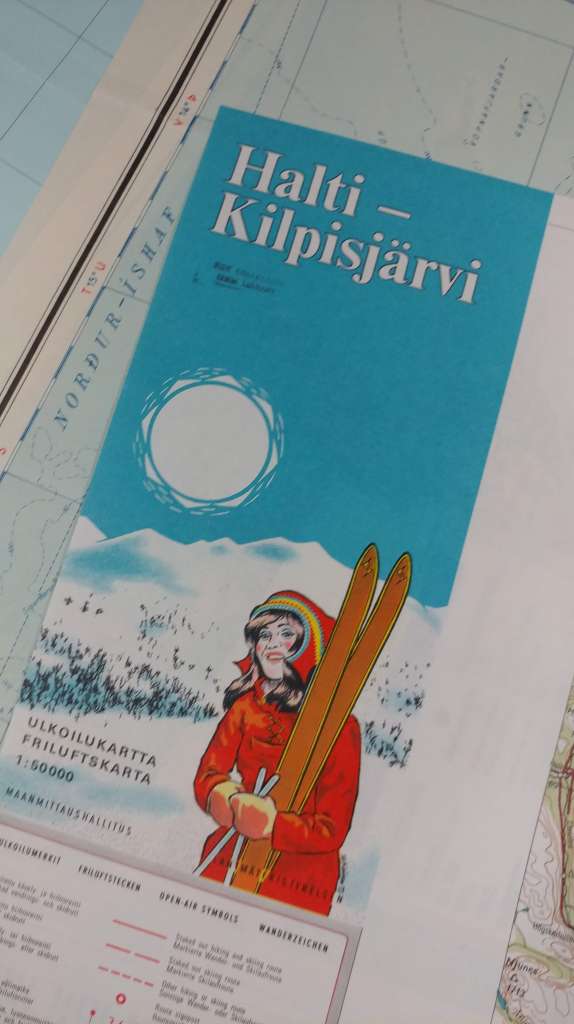
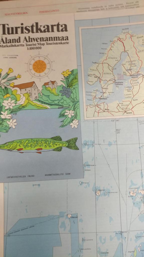
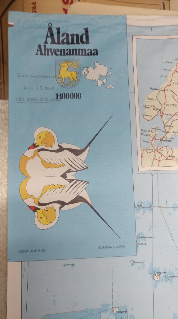
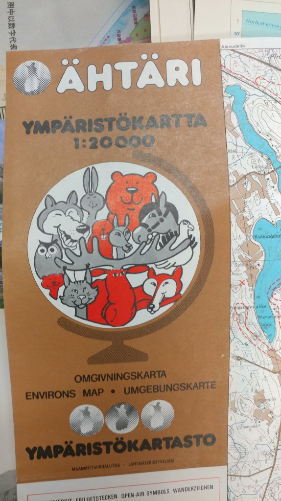
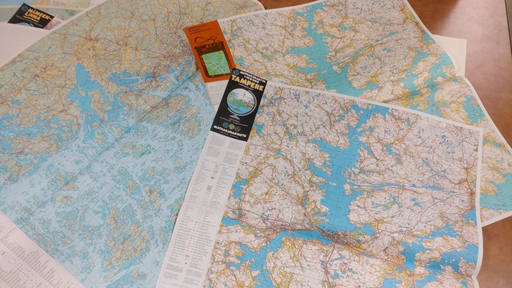
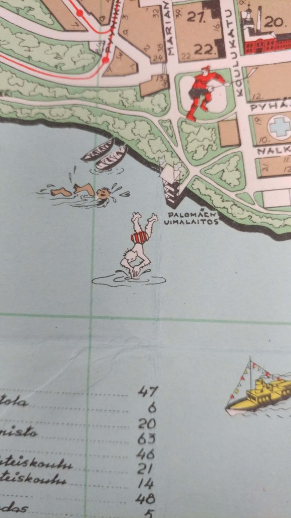
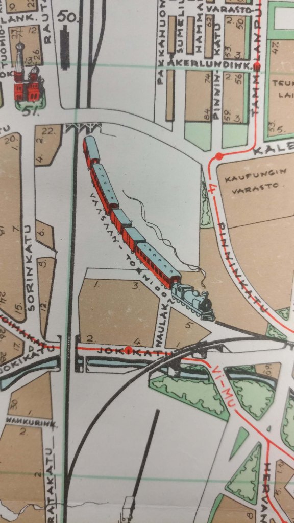
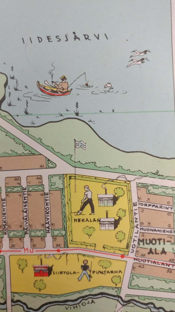
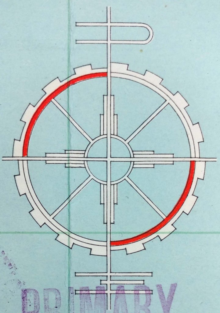
During each semester break, I like to tackle some of the cataloging of these older materials and this winter break I’m indulging in some me time and focusing on a region I adore: Scandinavia. Iceland got some attention:
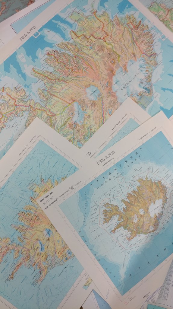
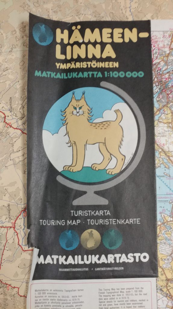
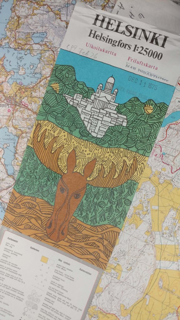
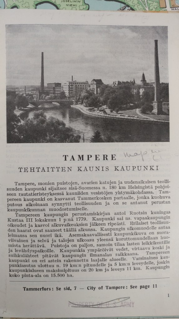
And next I’m traveling to Finland. I think the maps from these areas are simply amazing. Between the color choices and graphics used, I find them some of the most beautiful maps made. I’d like to share a few images with you from our collections in Finland.
__________________________________________
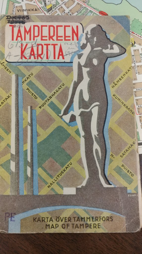
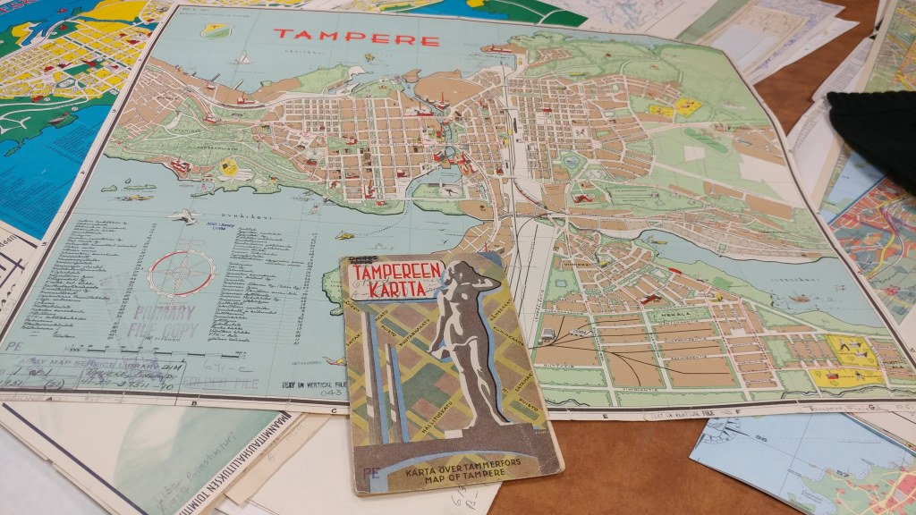
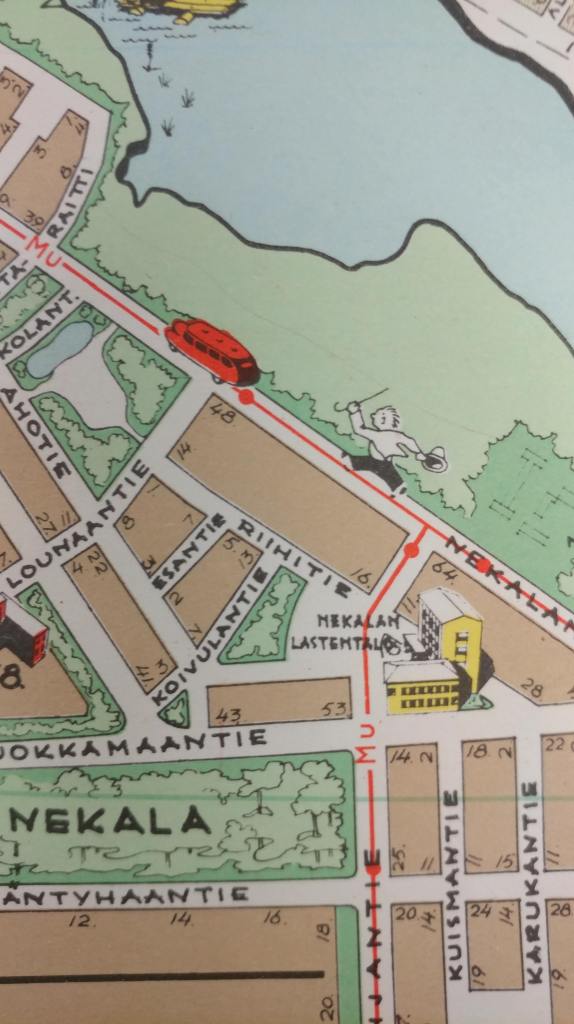
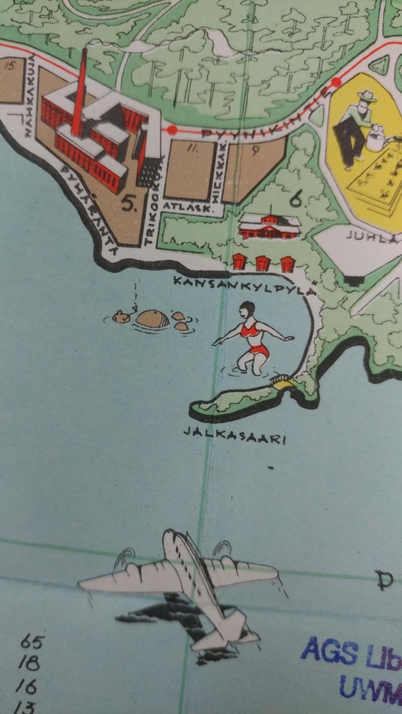
_________________________
In addition to trying to get everything searchable in an online catalog format, we are also working on getting more and more items scanned and viewable in our Digital Map Collection.
Click here to view the maps of Iceland in the digital collection so far.
Click here to view maps of Finland in the digital collection so far.
Click here to view maps of Norway in the digital collection so far (and my favorite, Vardo).
Click here to view maps of Sweden in the digital collection so far.
And, click here to view maps of Denmark in the digital collection so far.
